Downloaded 21 times
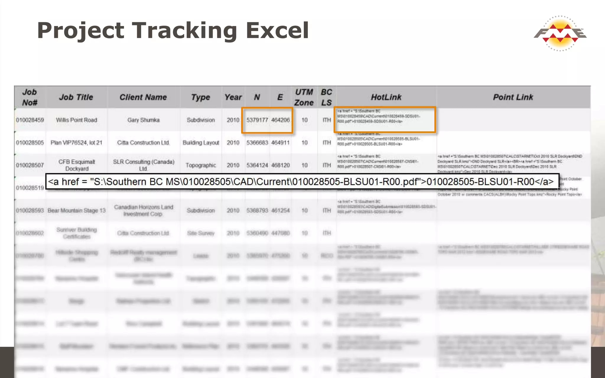
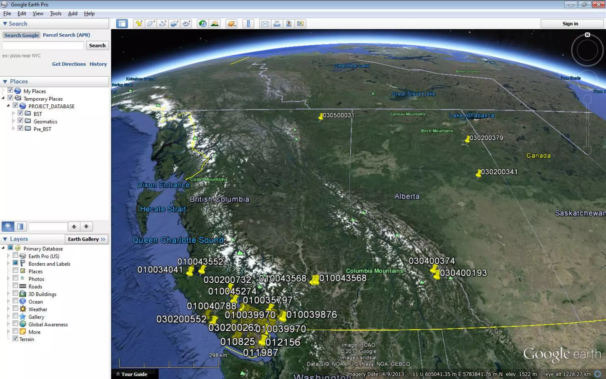
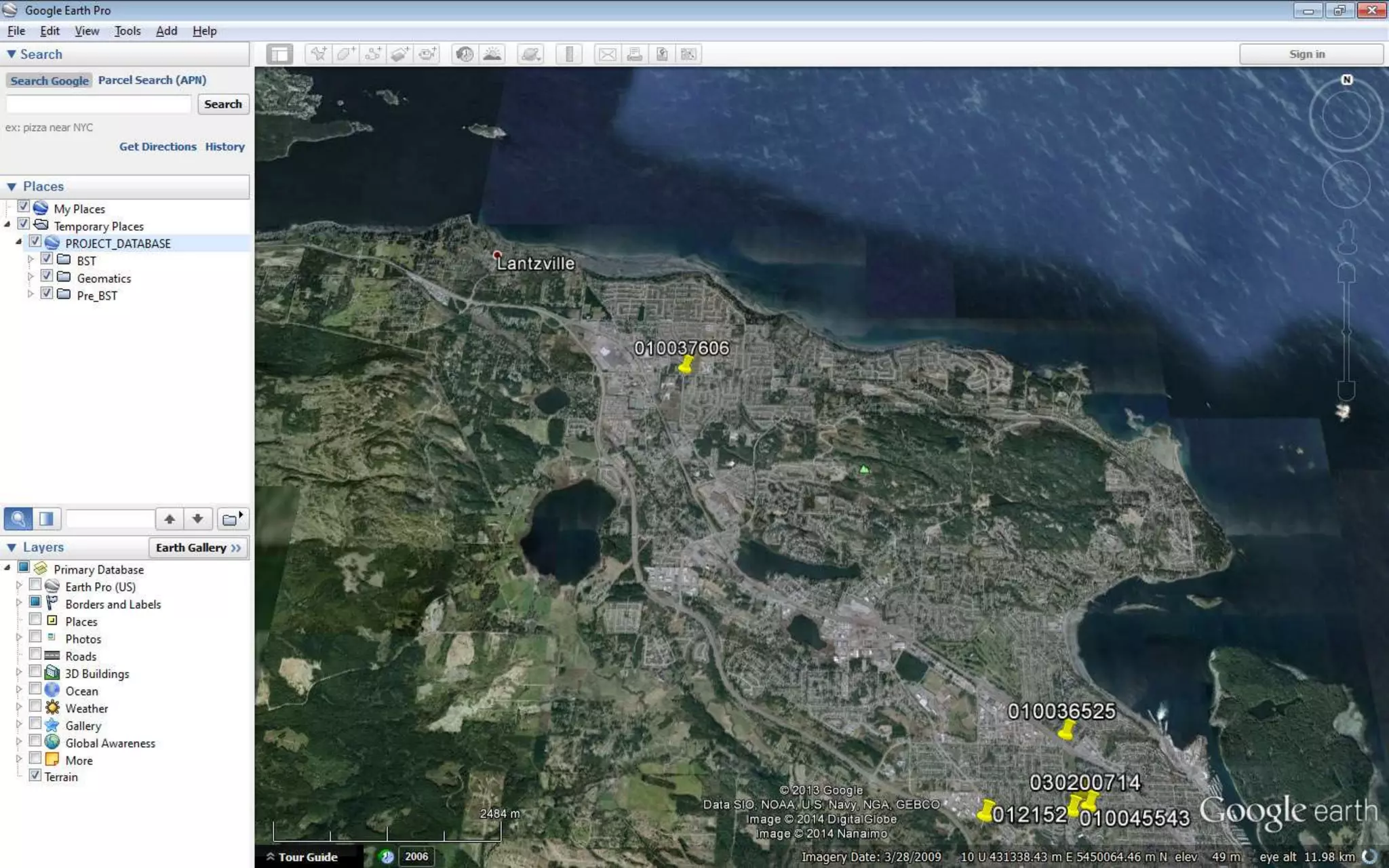
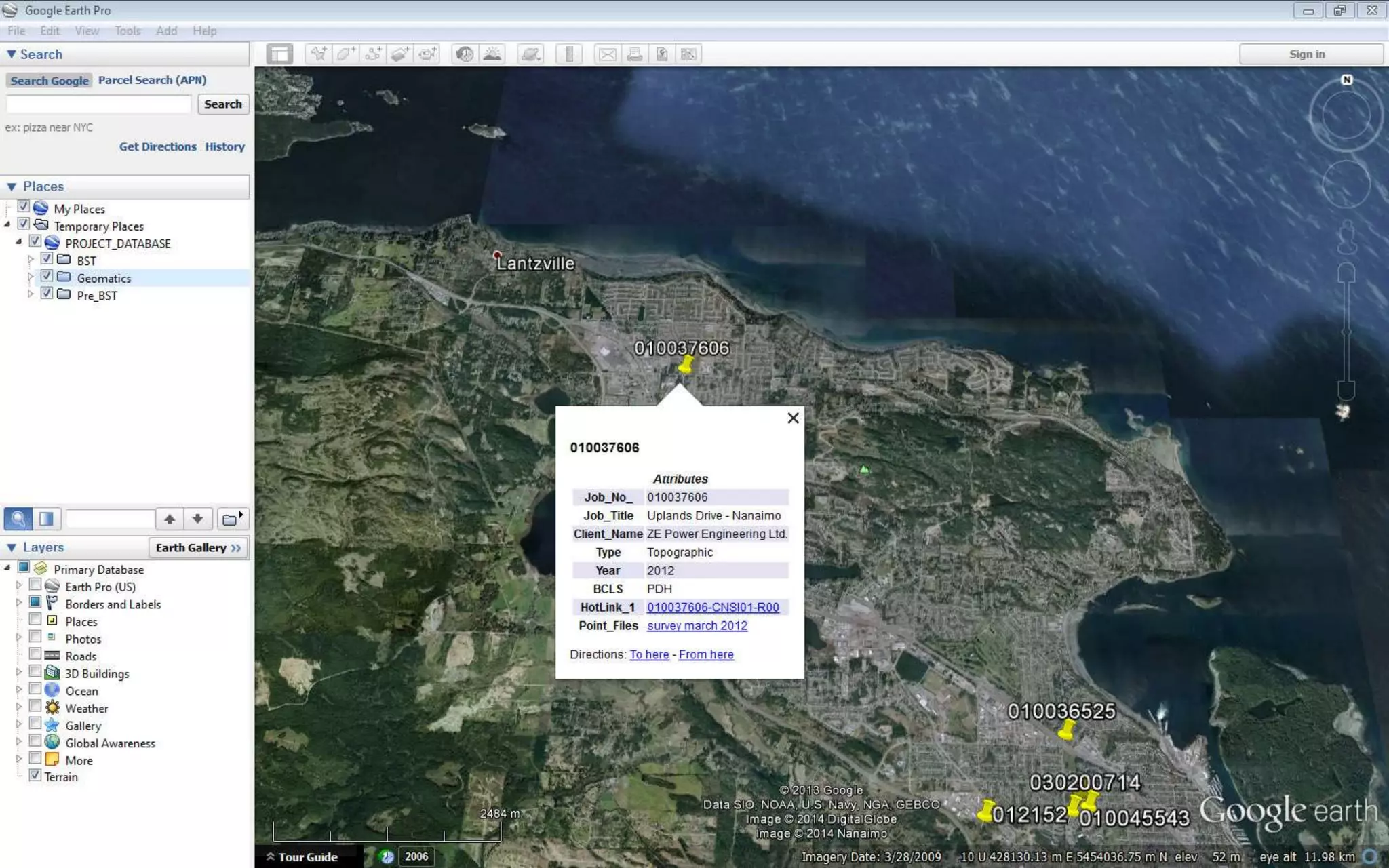
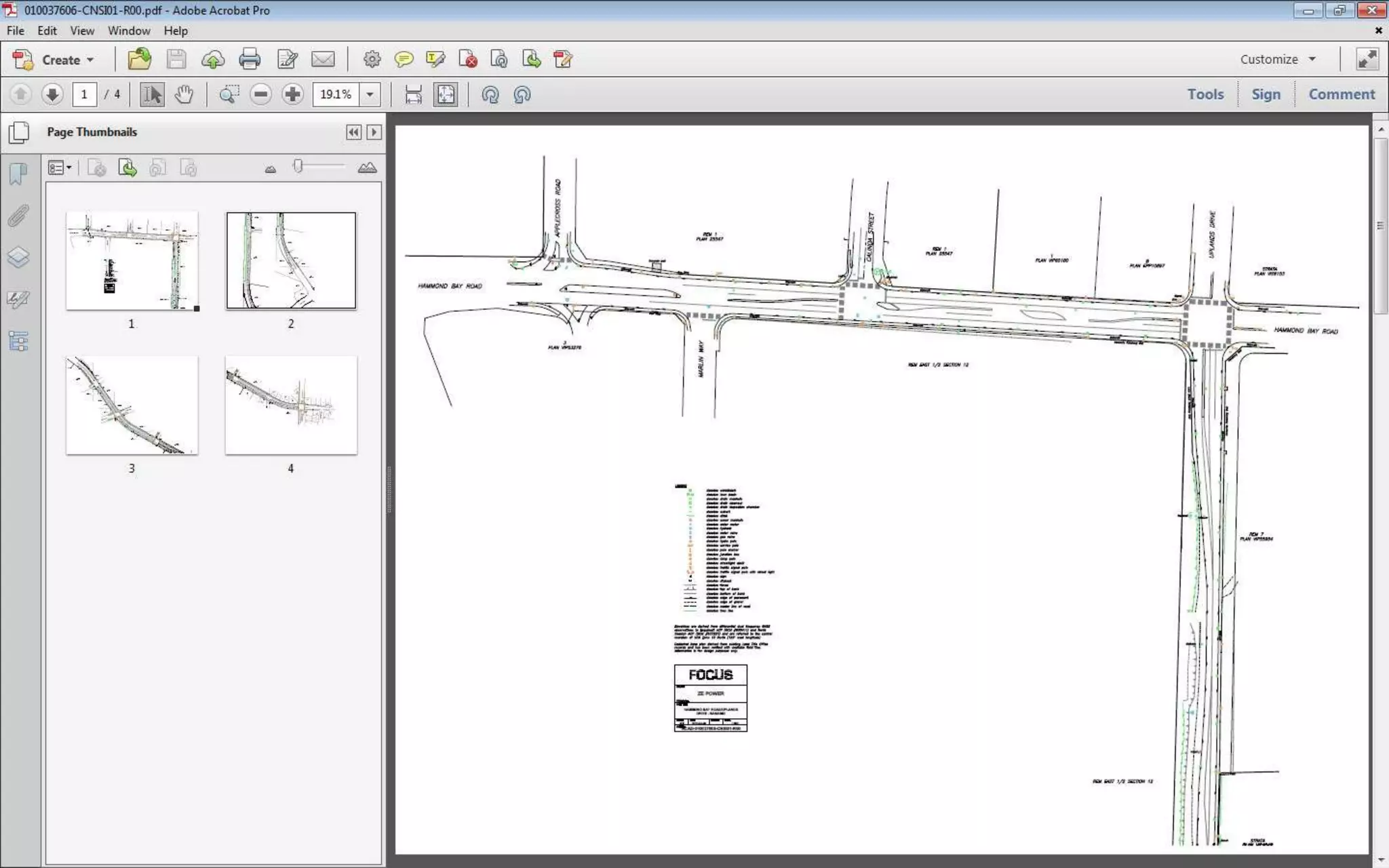
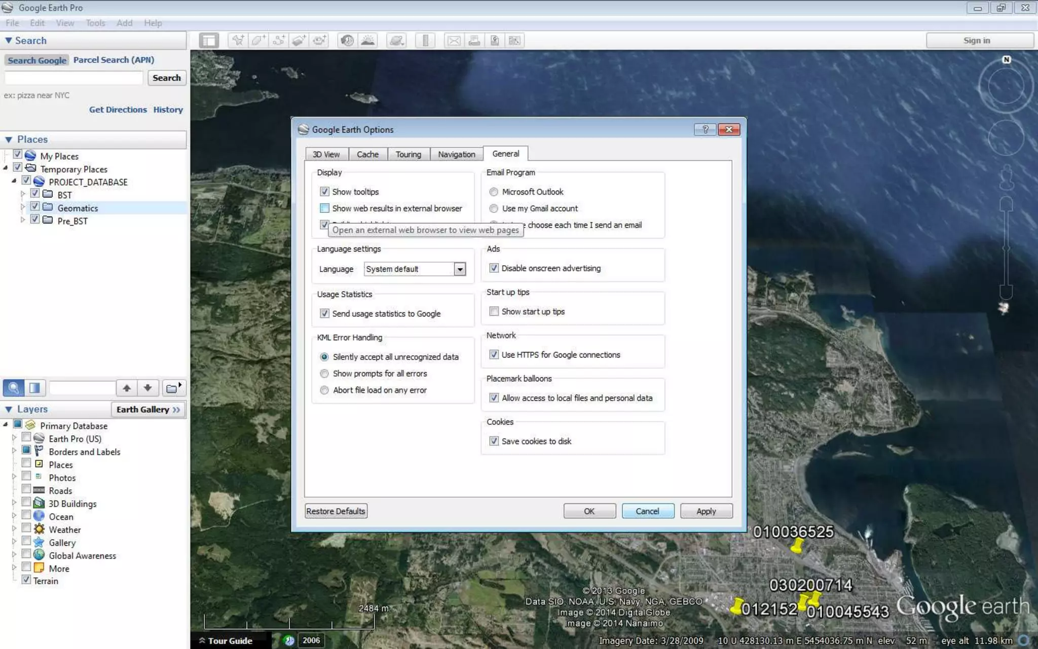

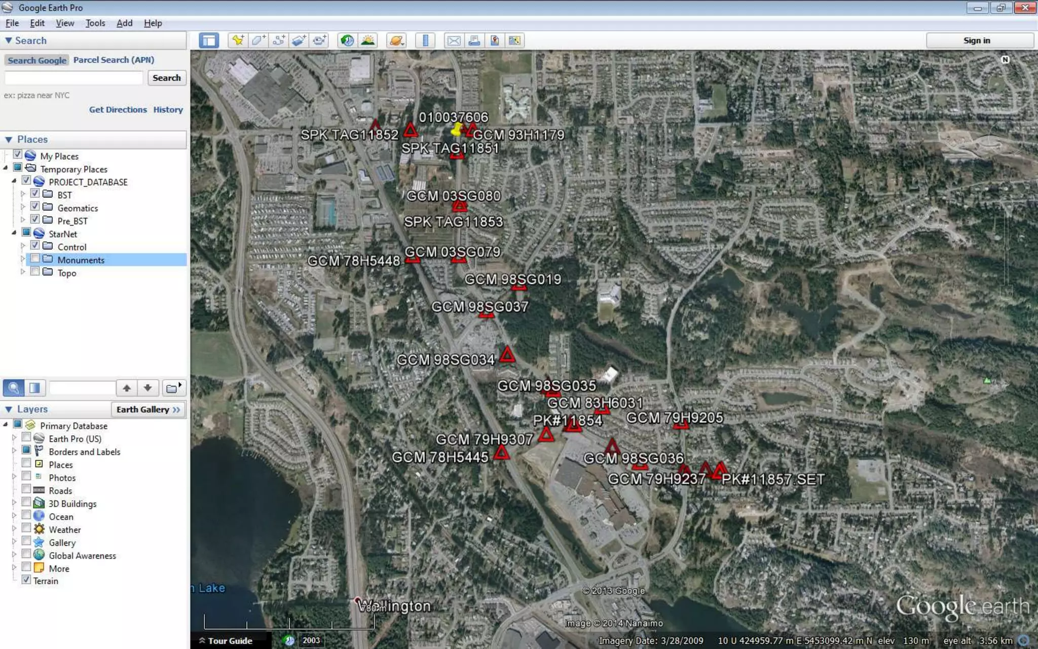
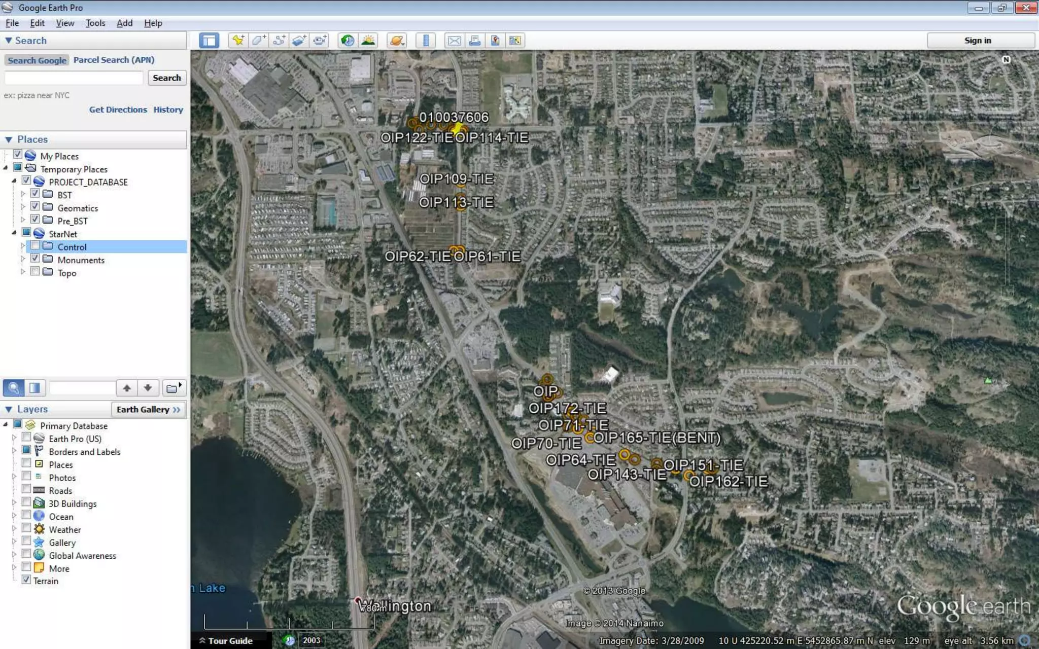
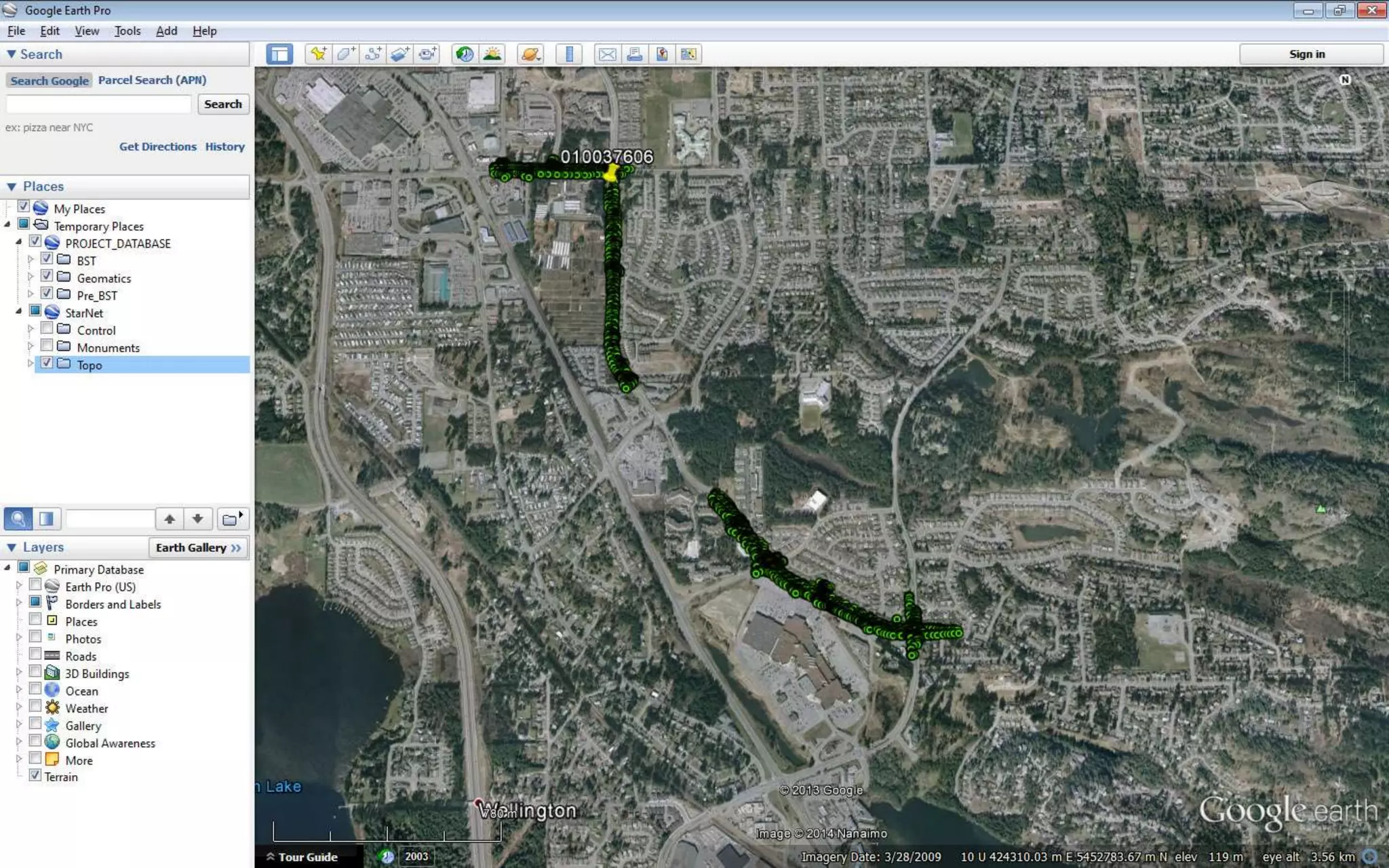
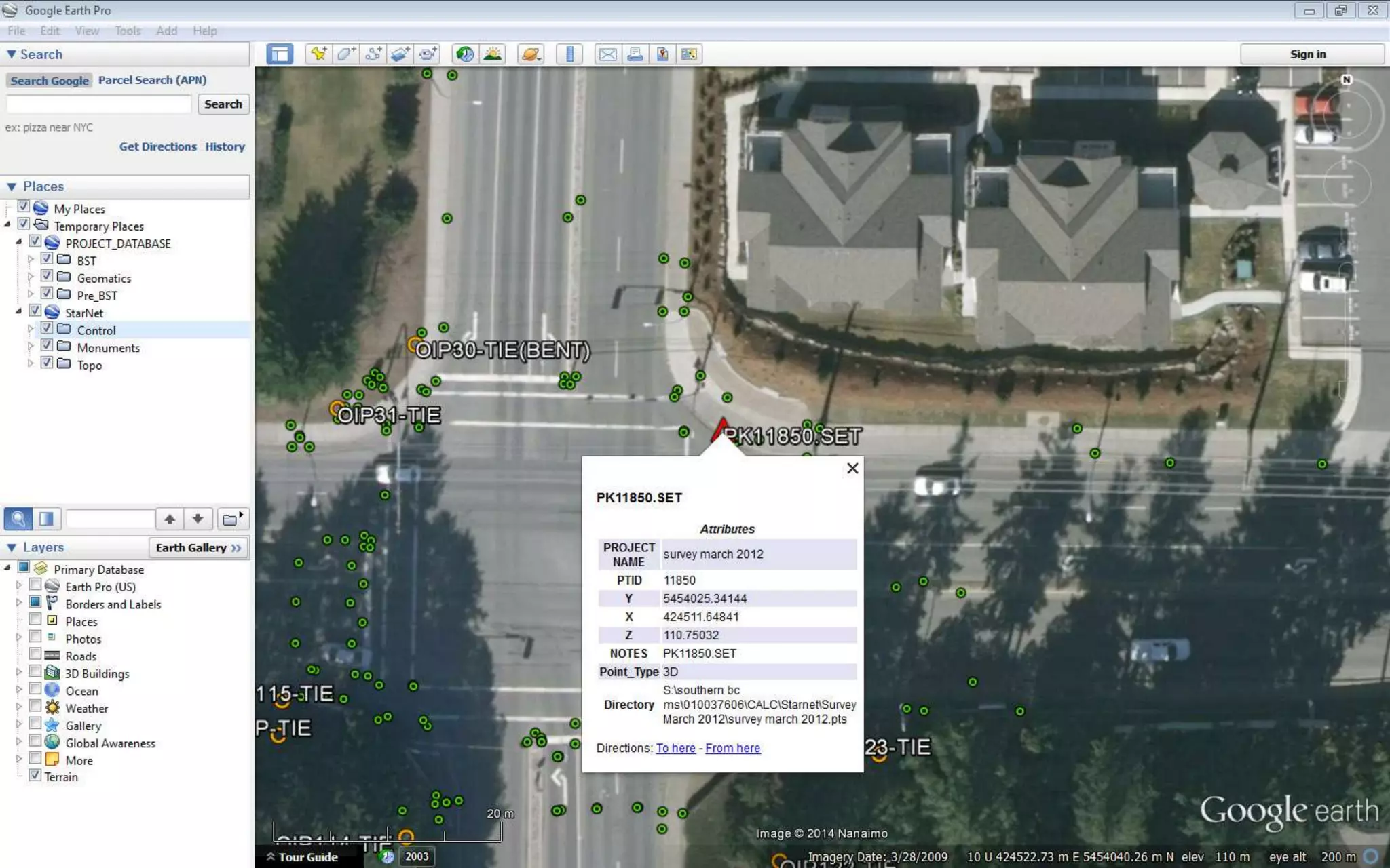
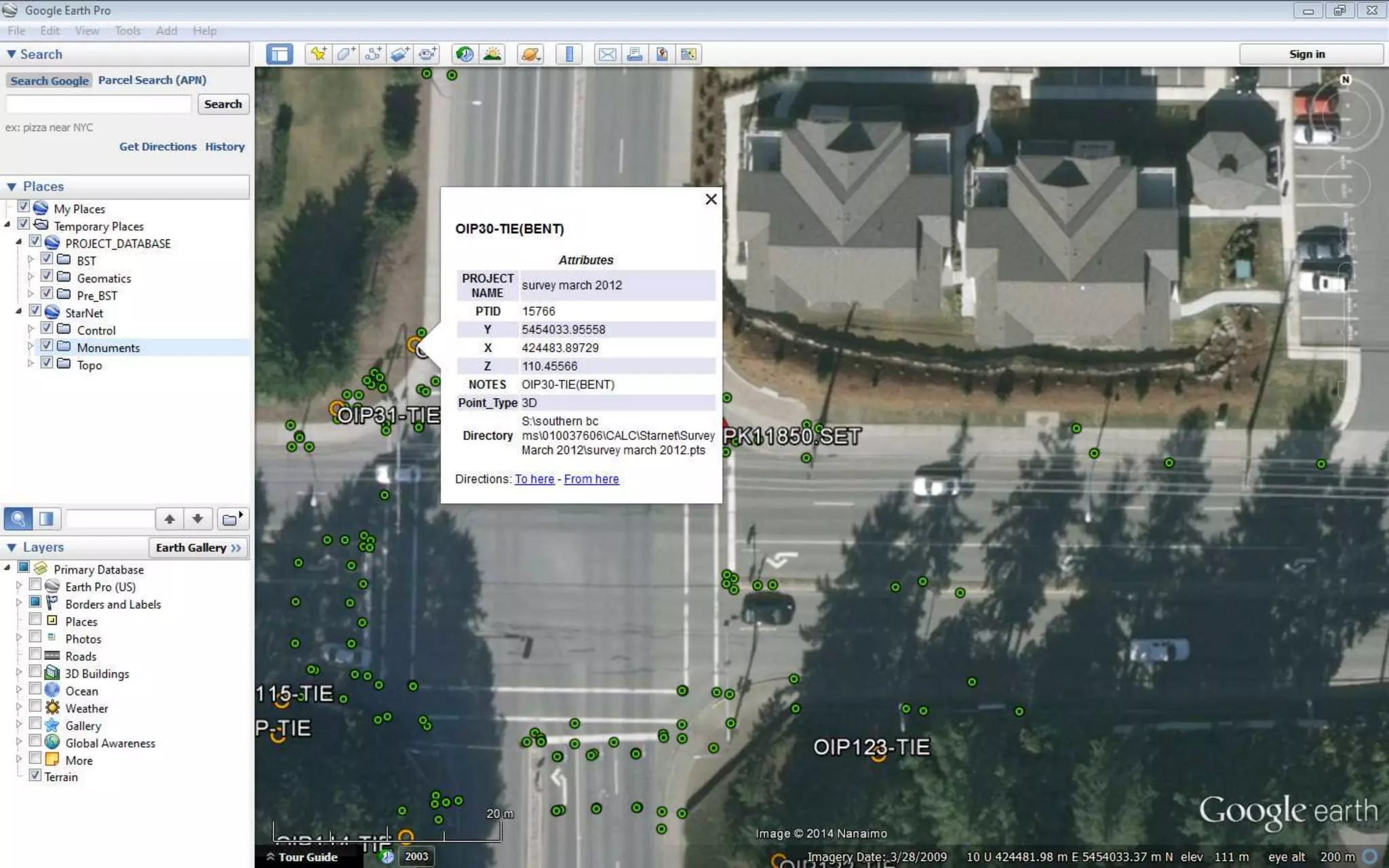
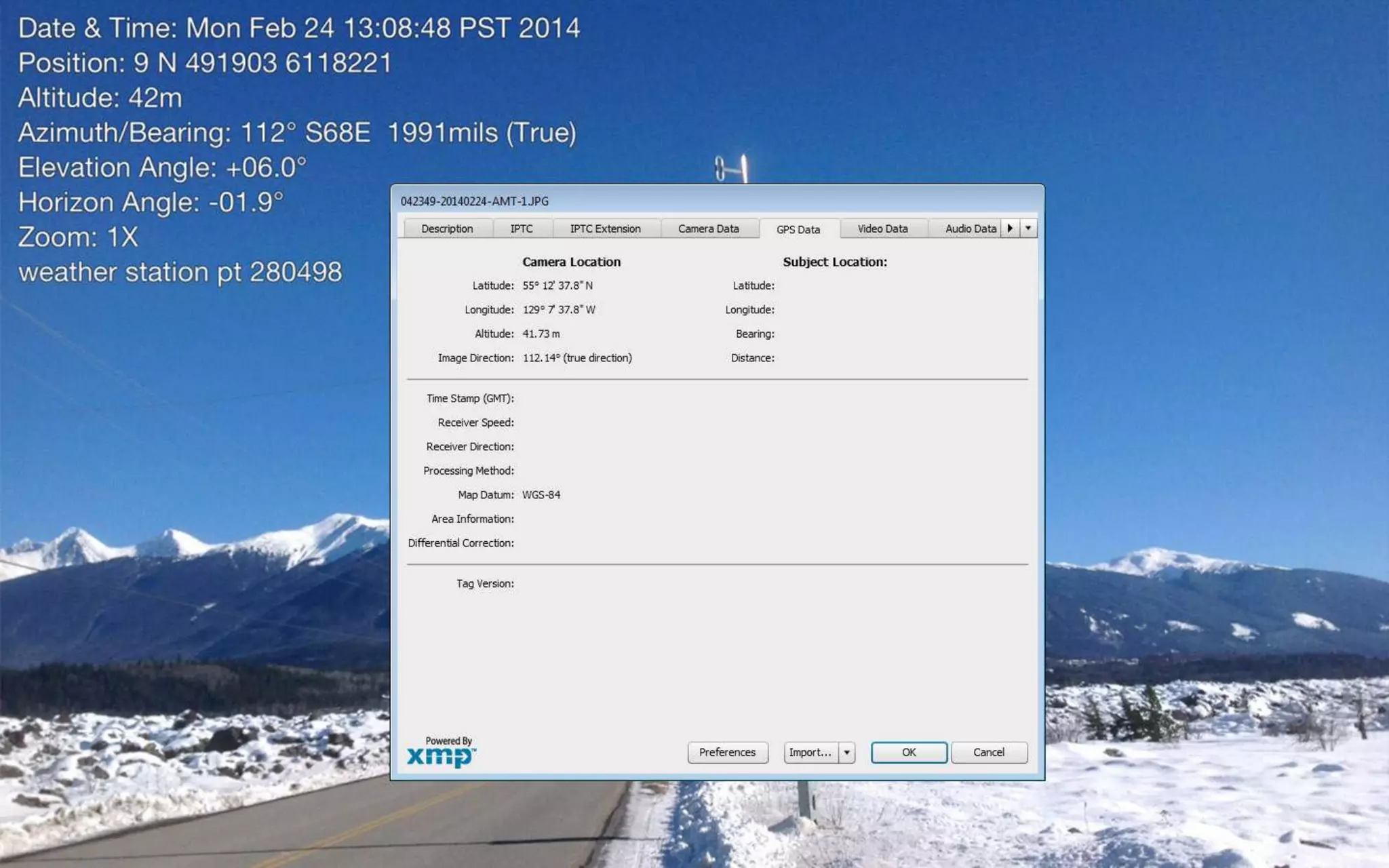
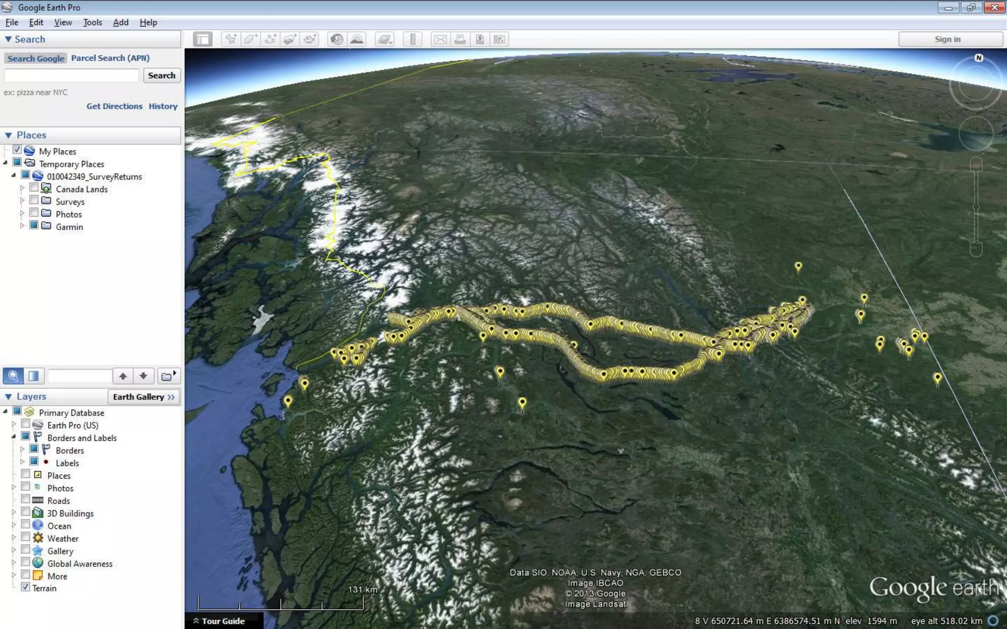
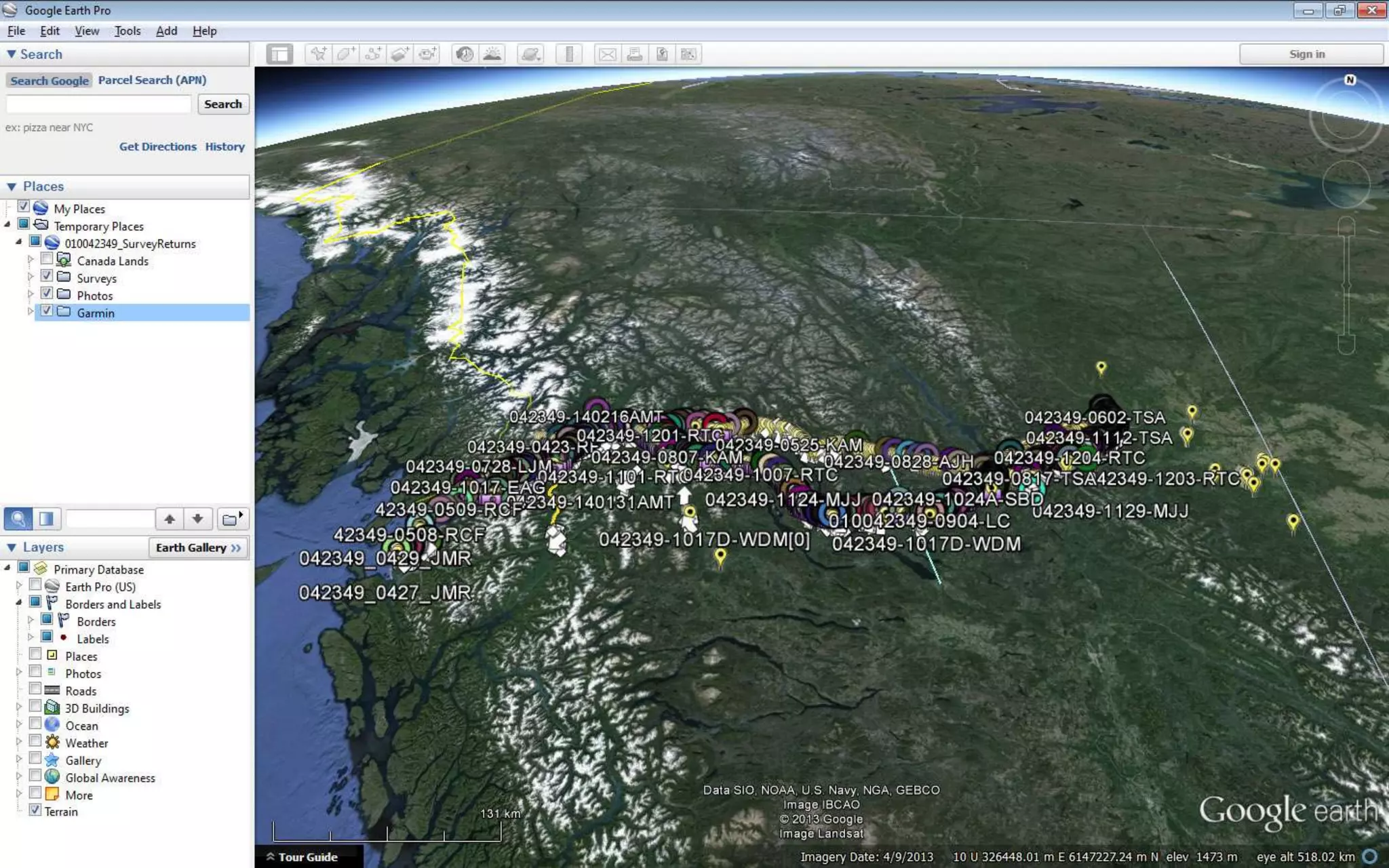
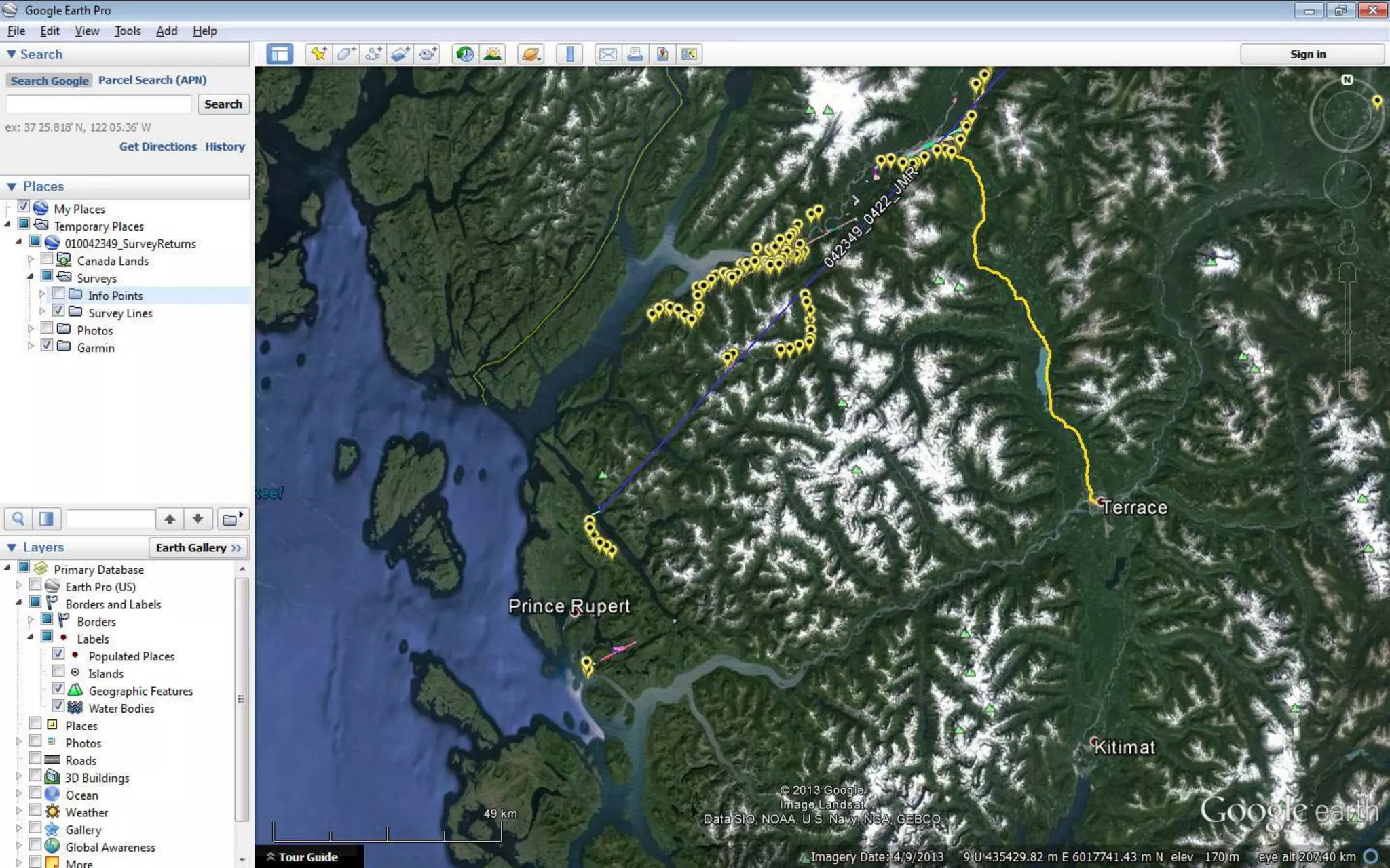
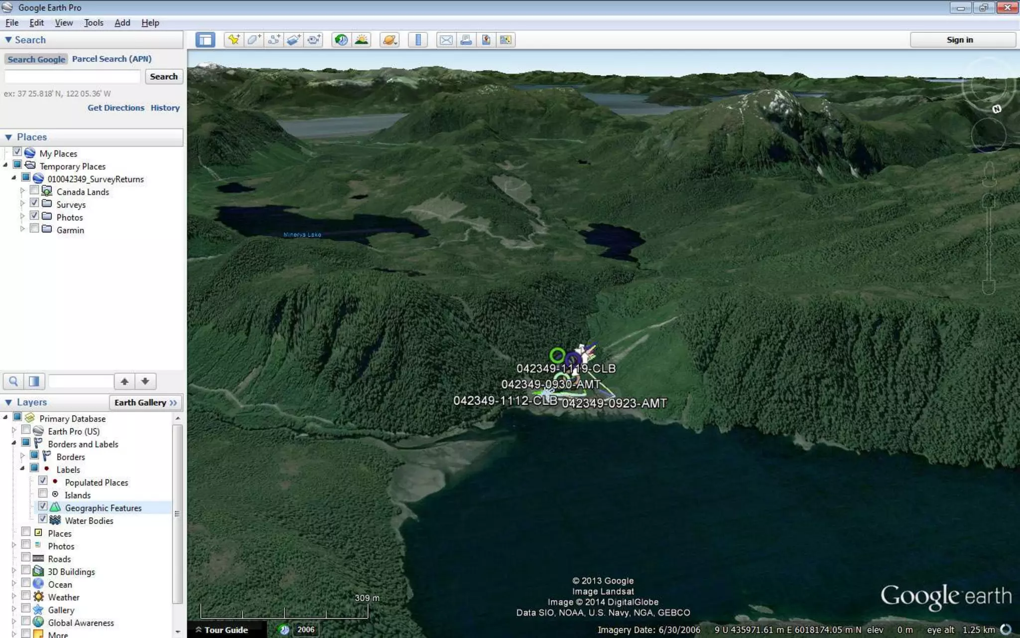
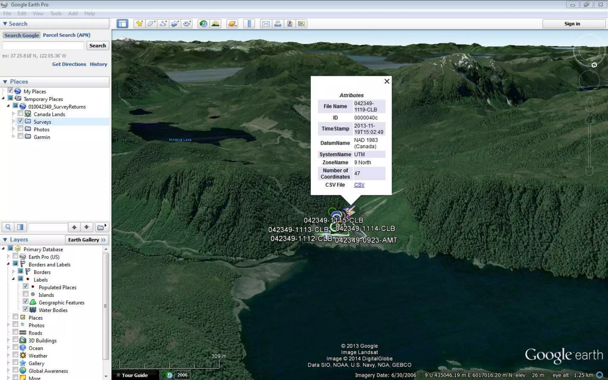
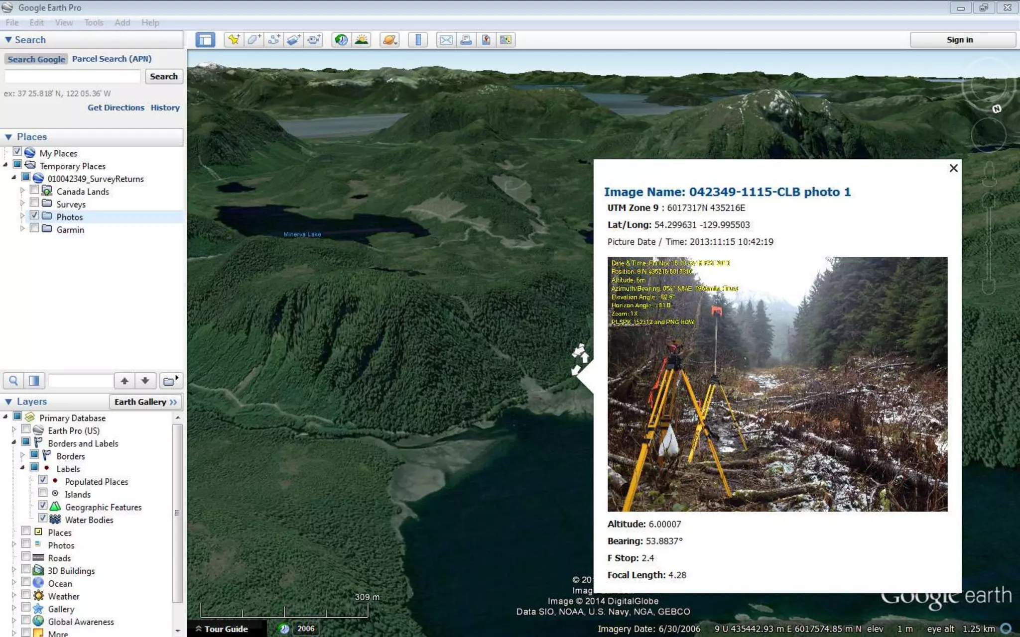
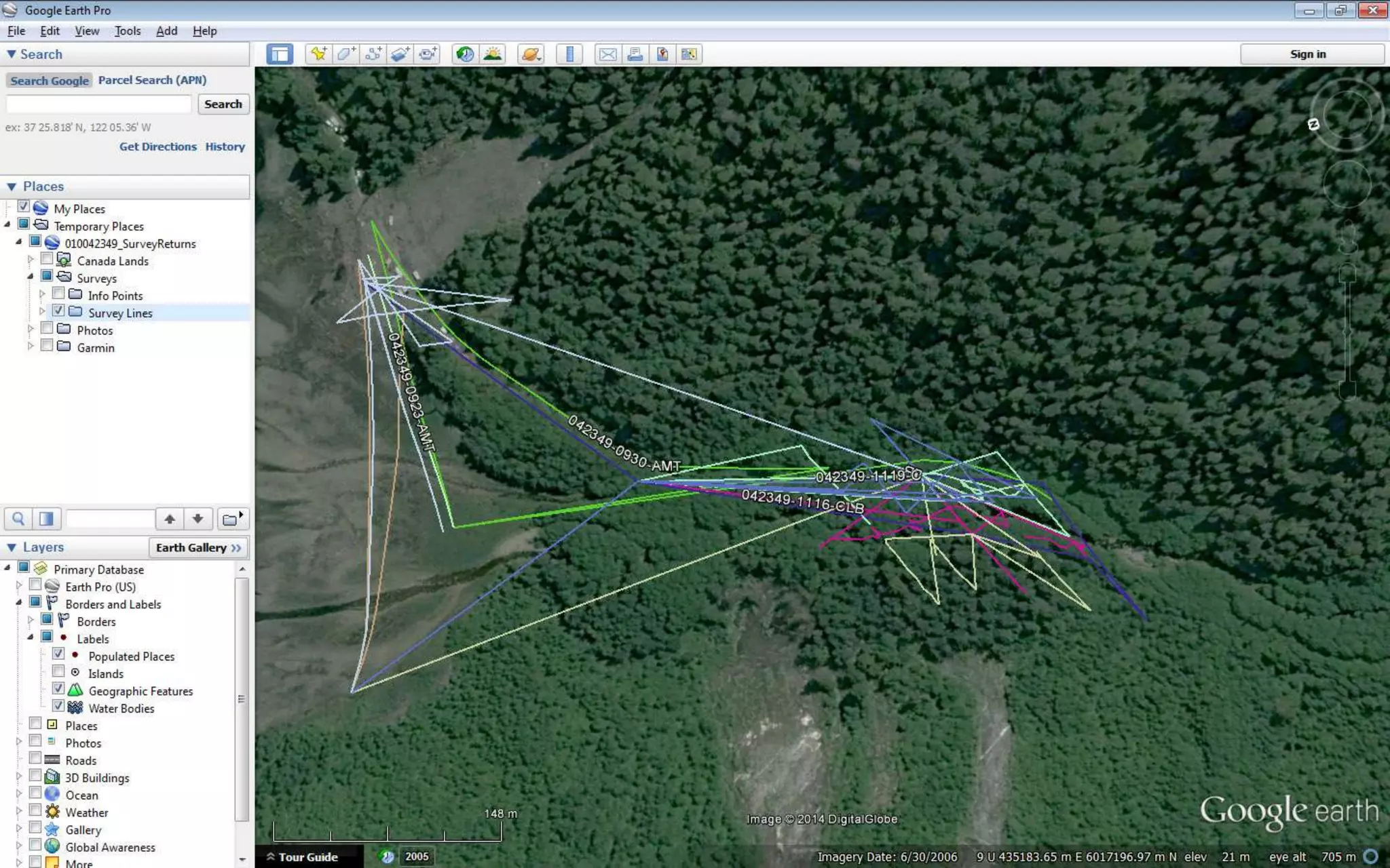
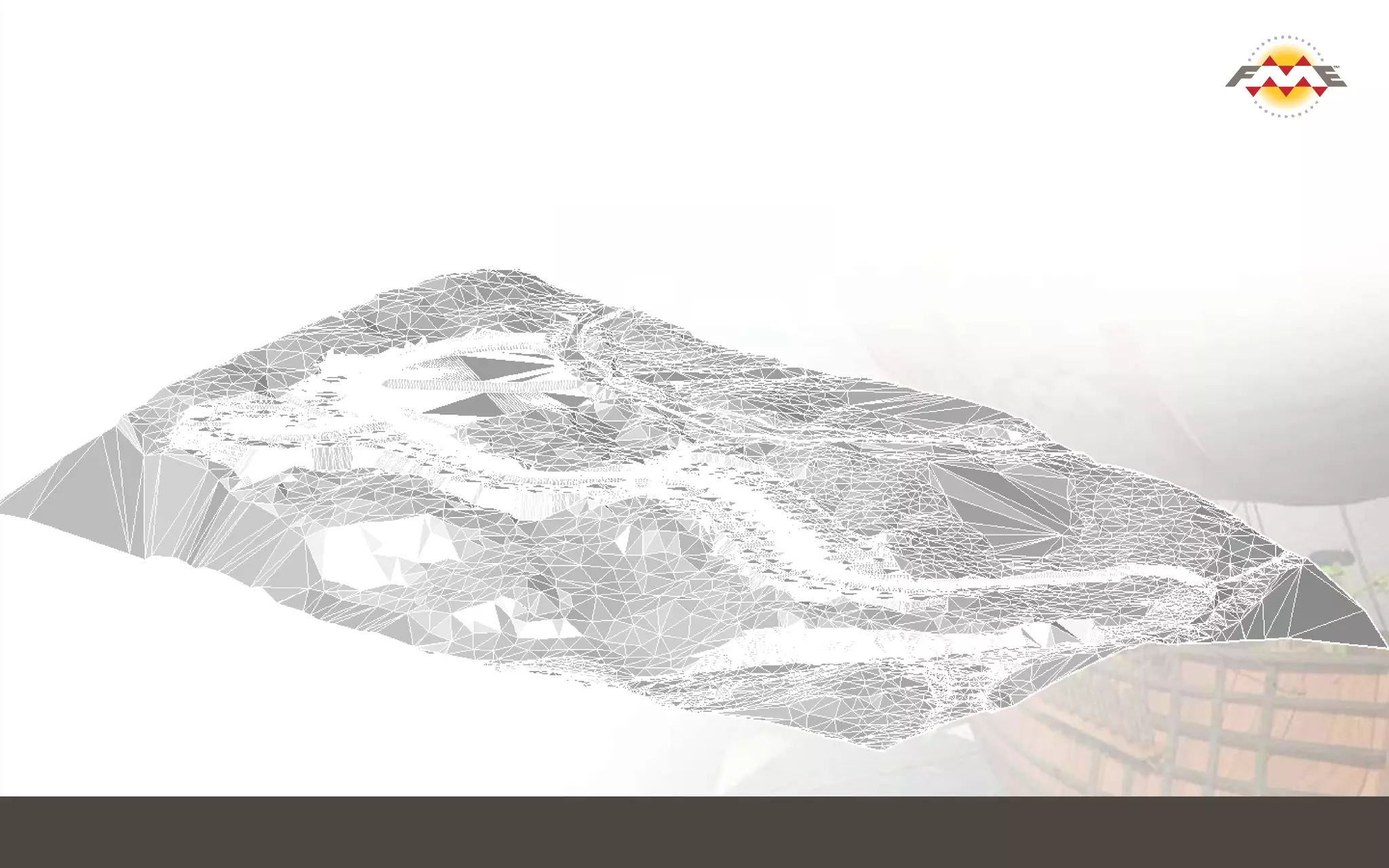
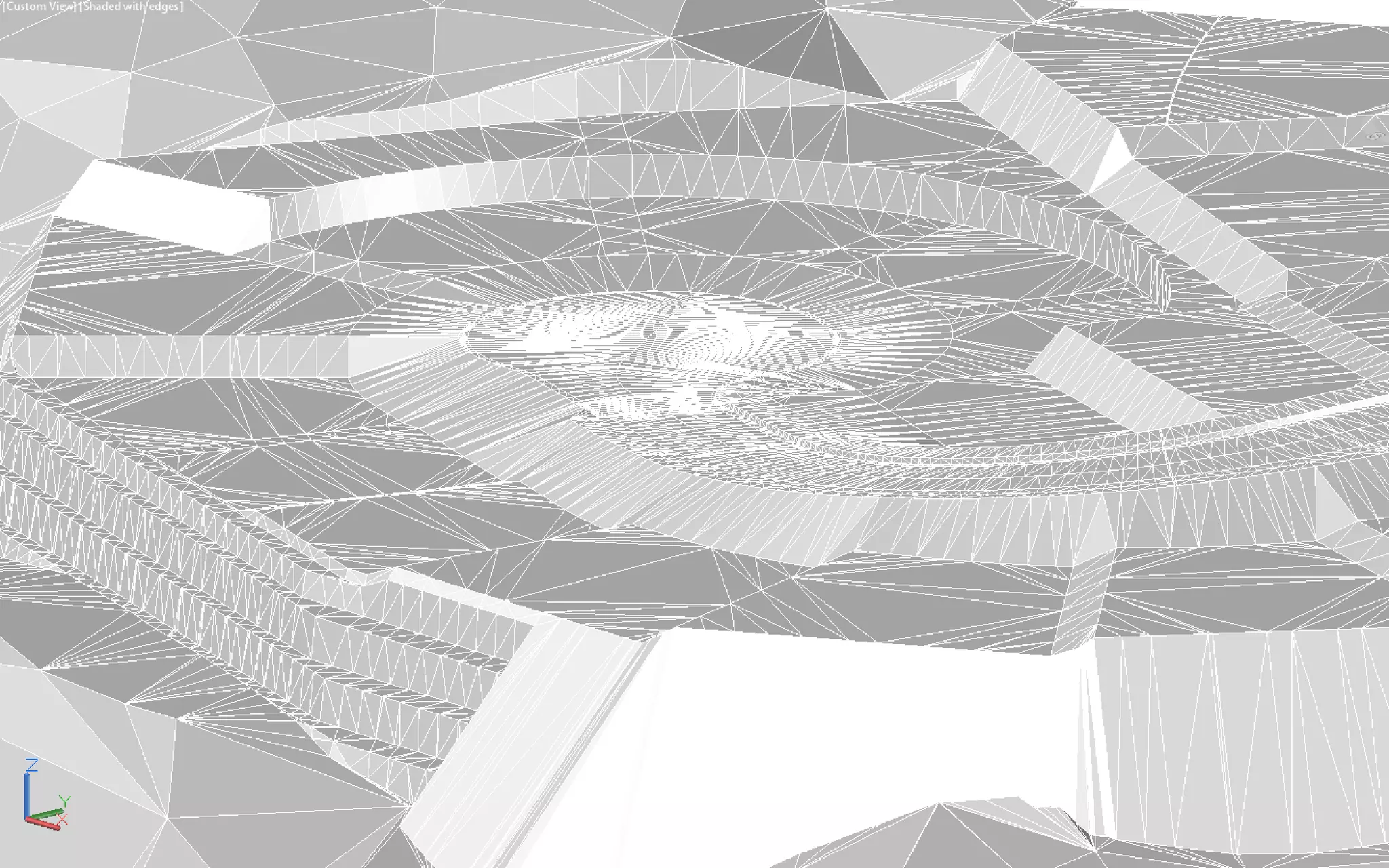
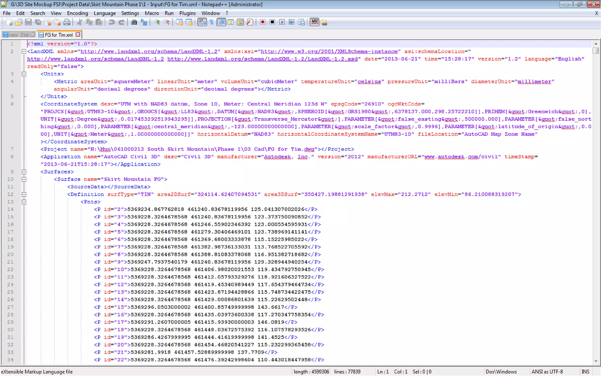
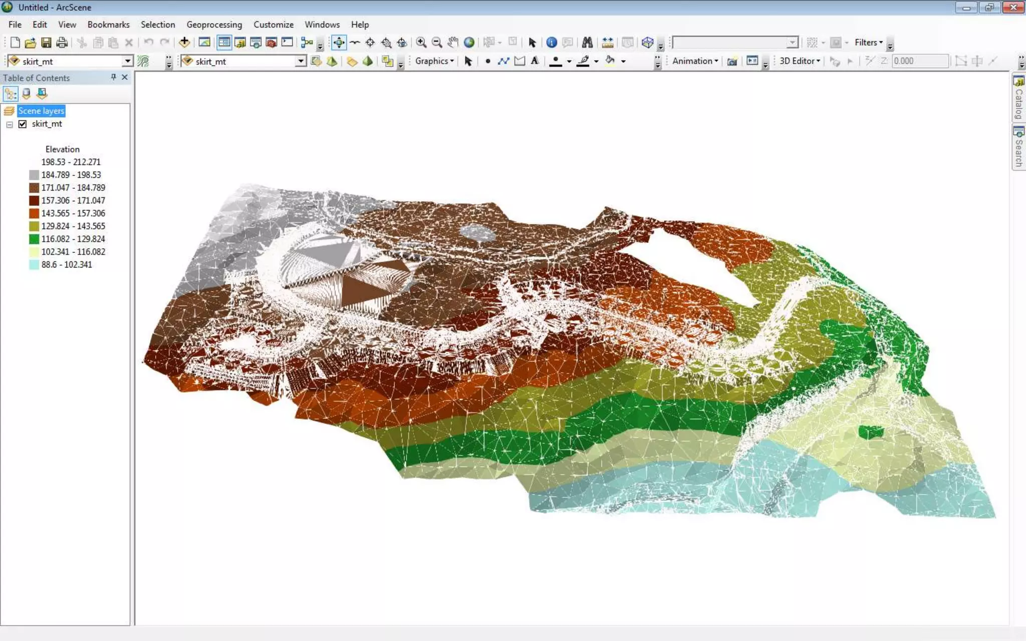
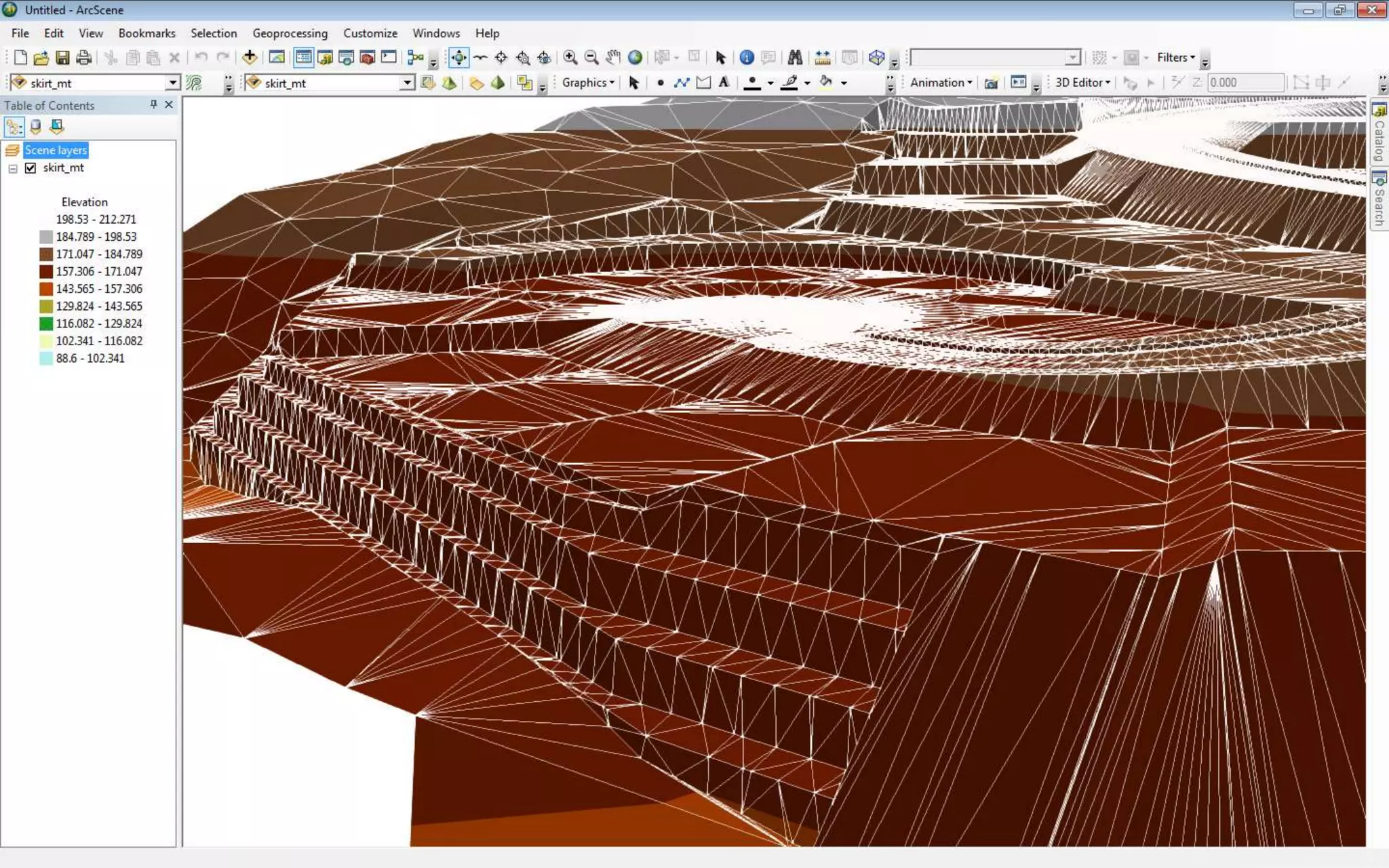
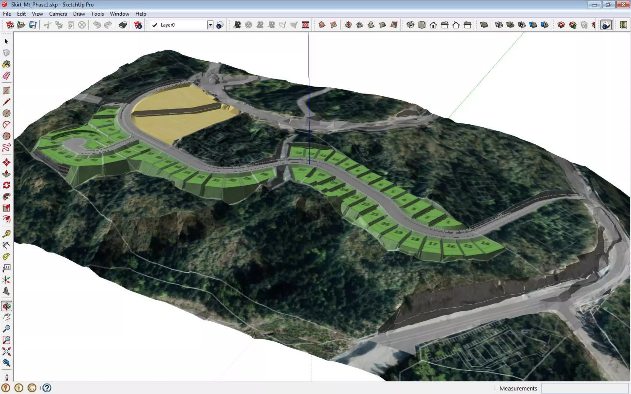
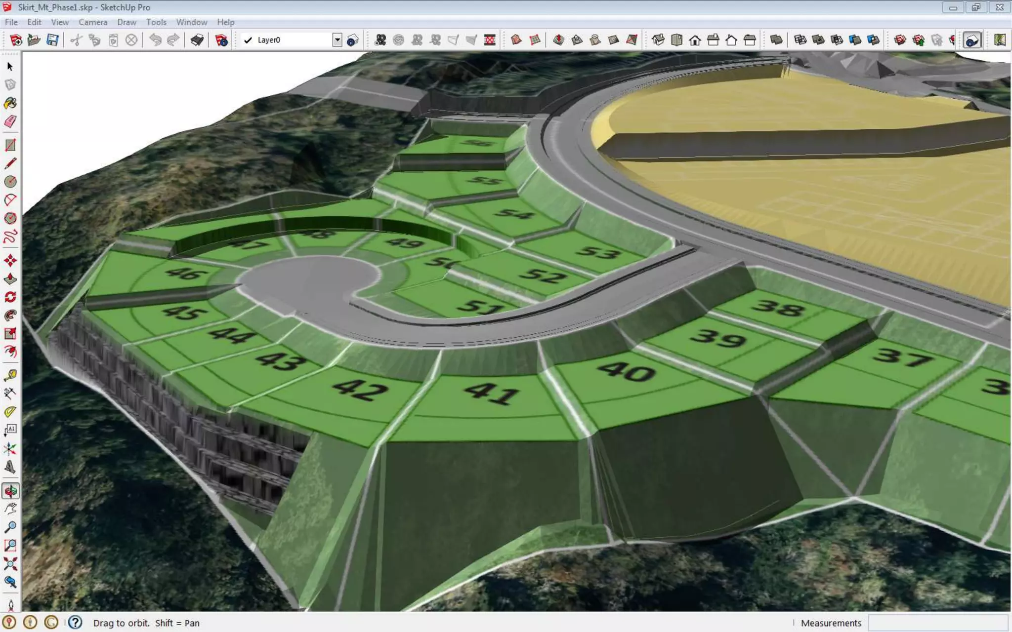
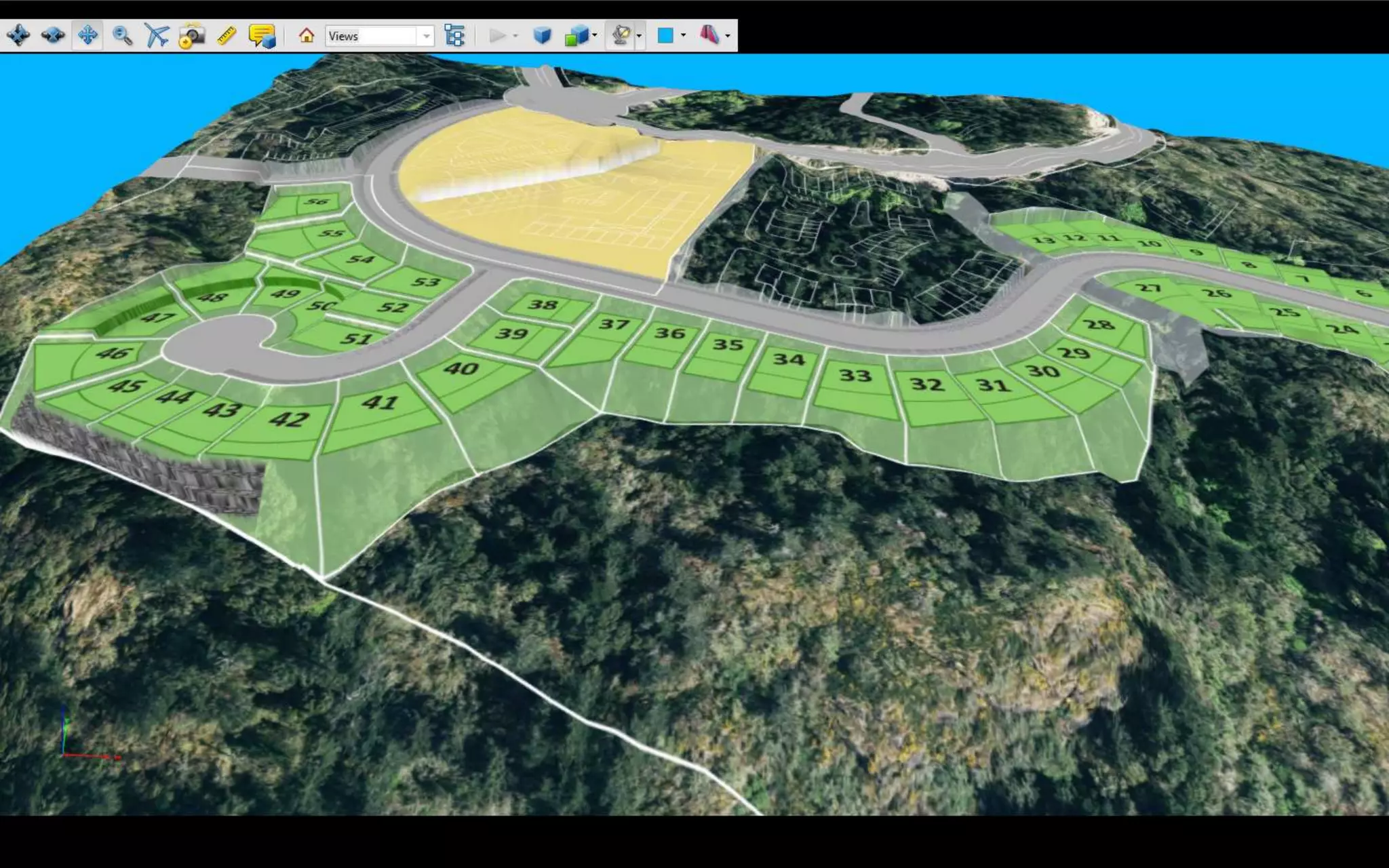
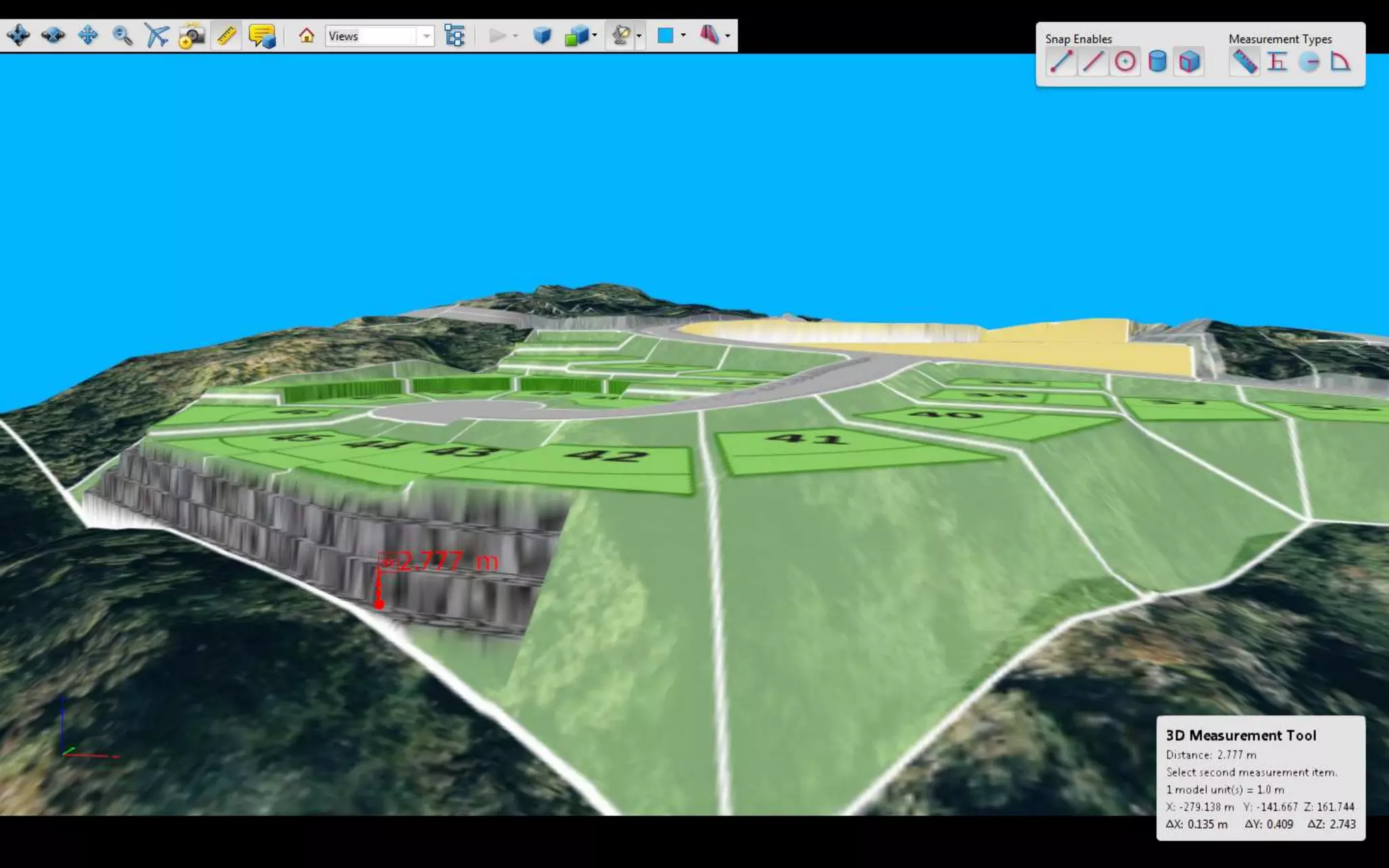

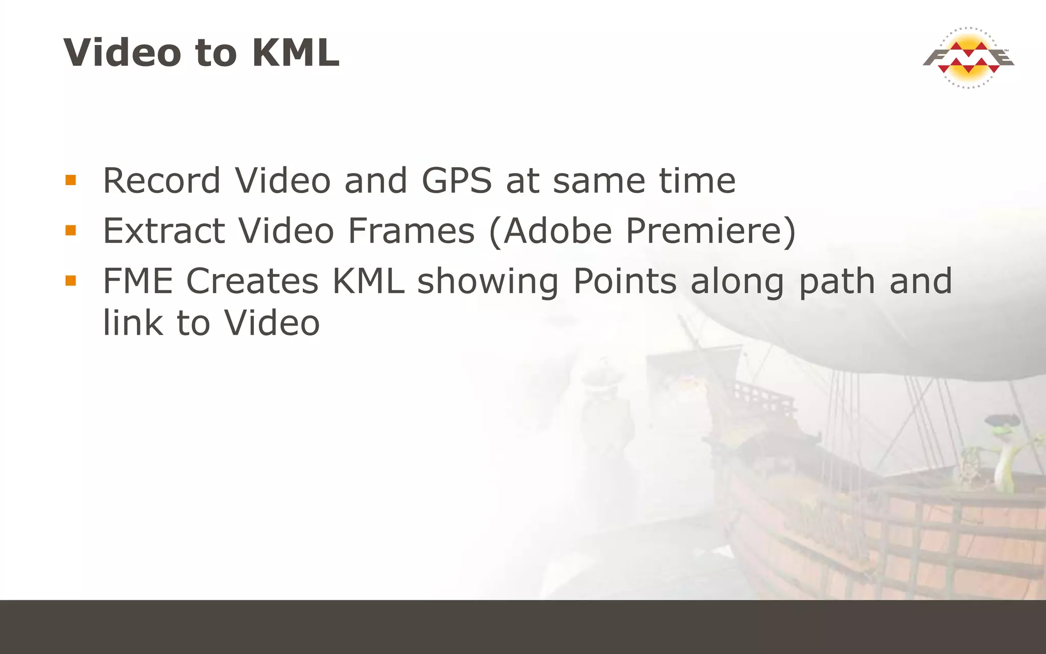
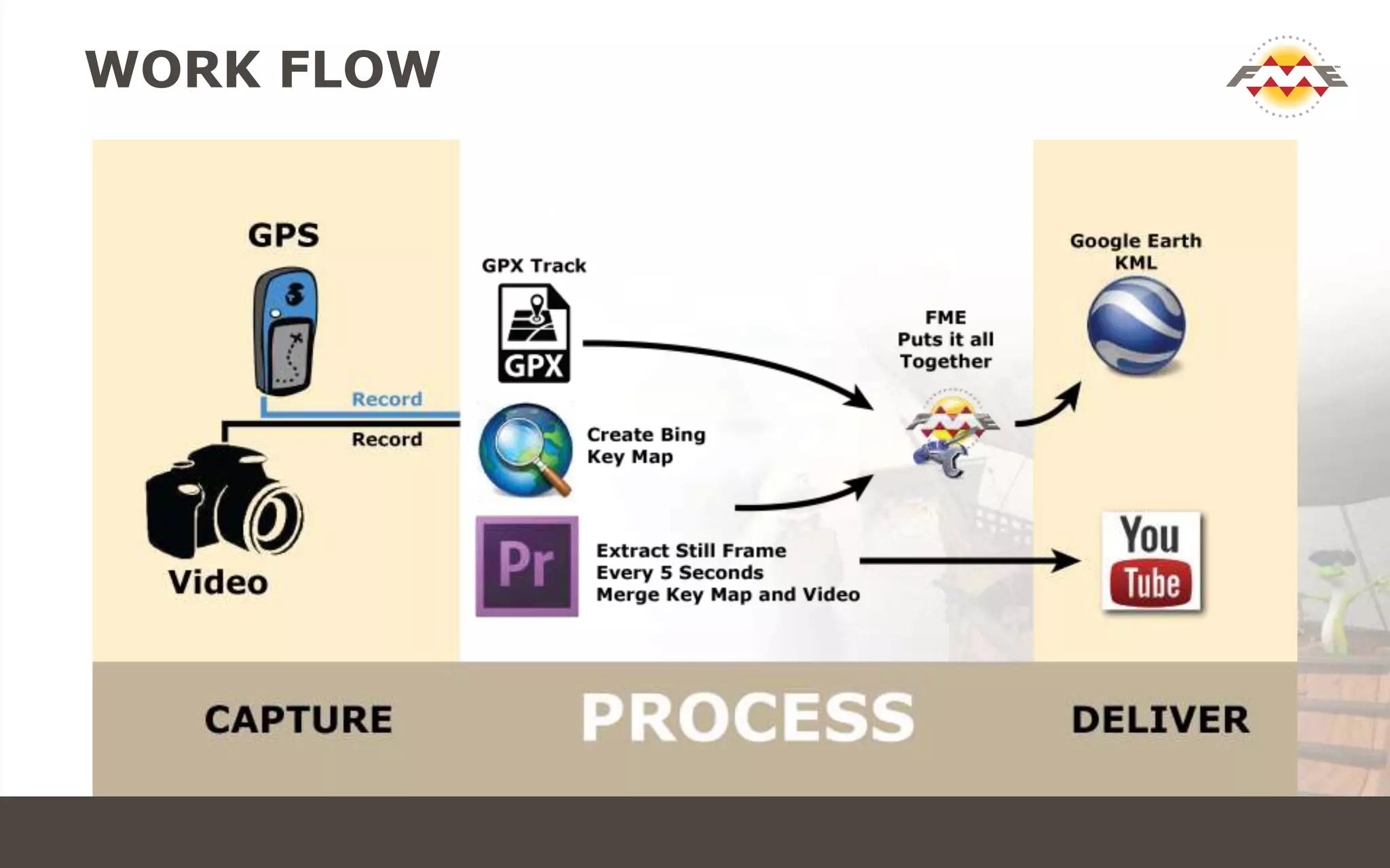
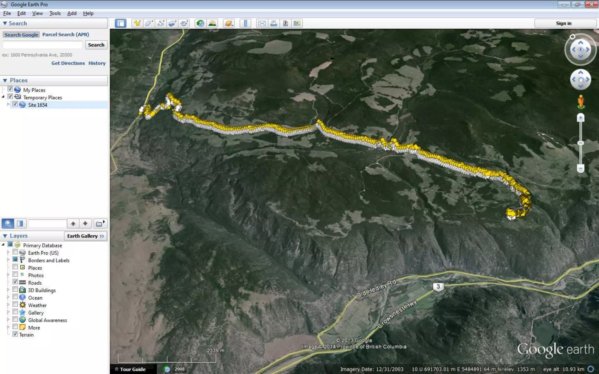
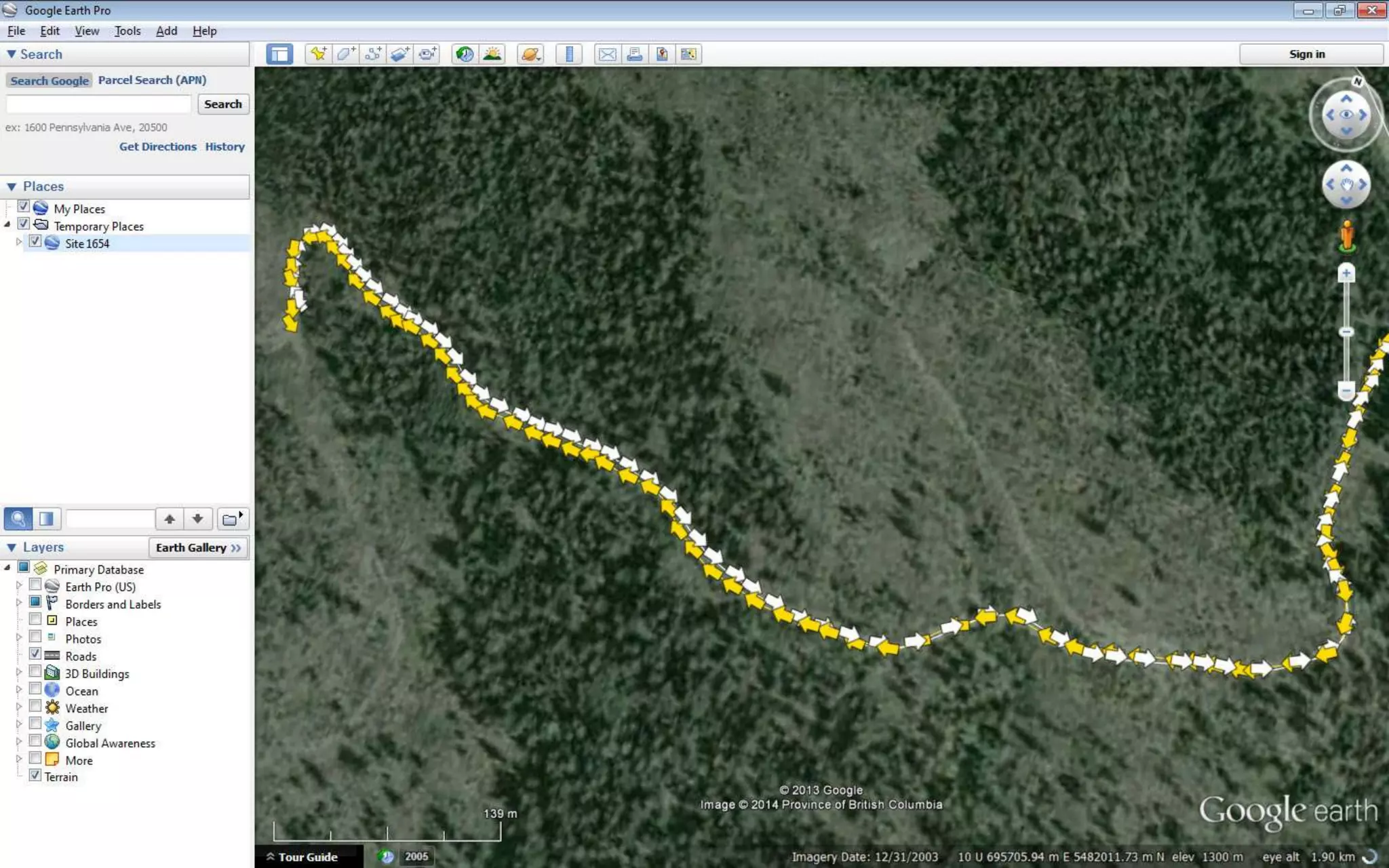
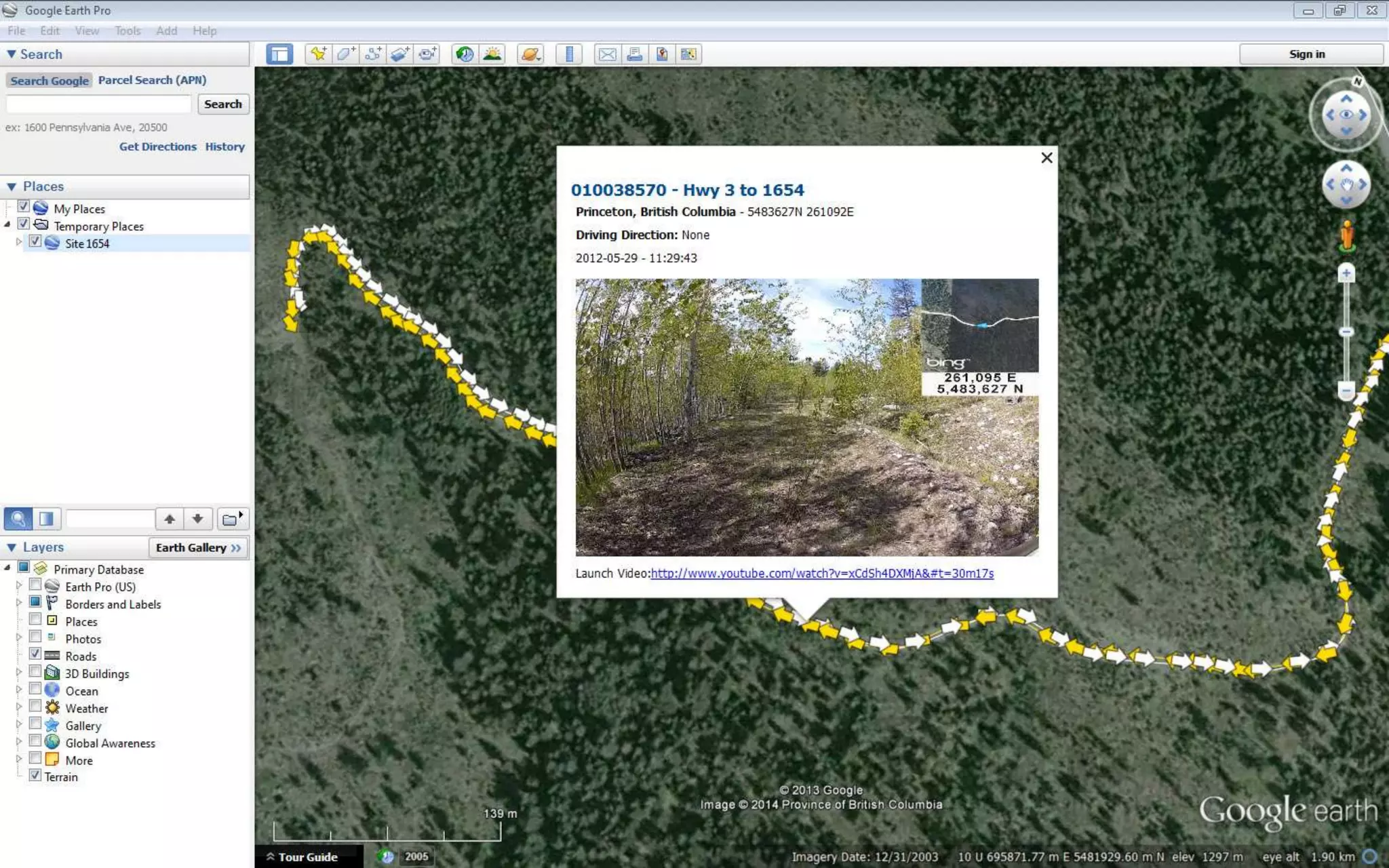
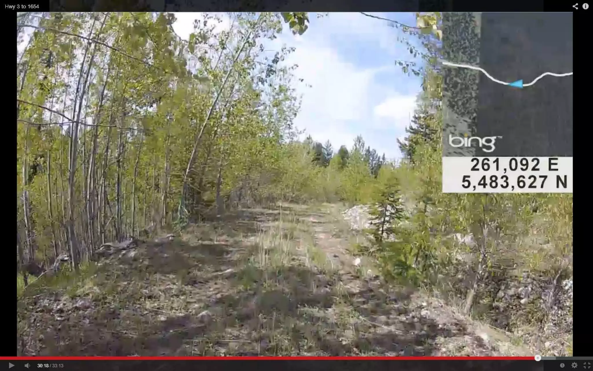
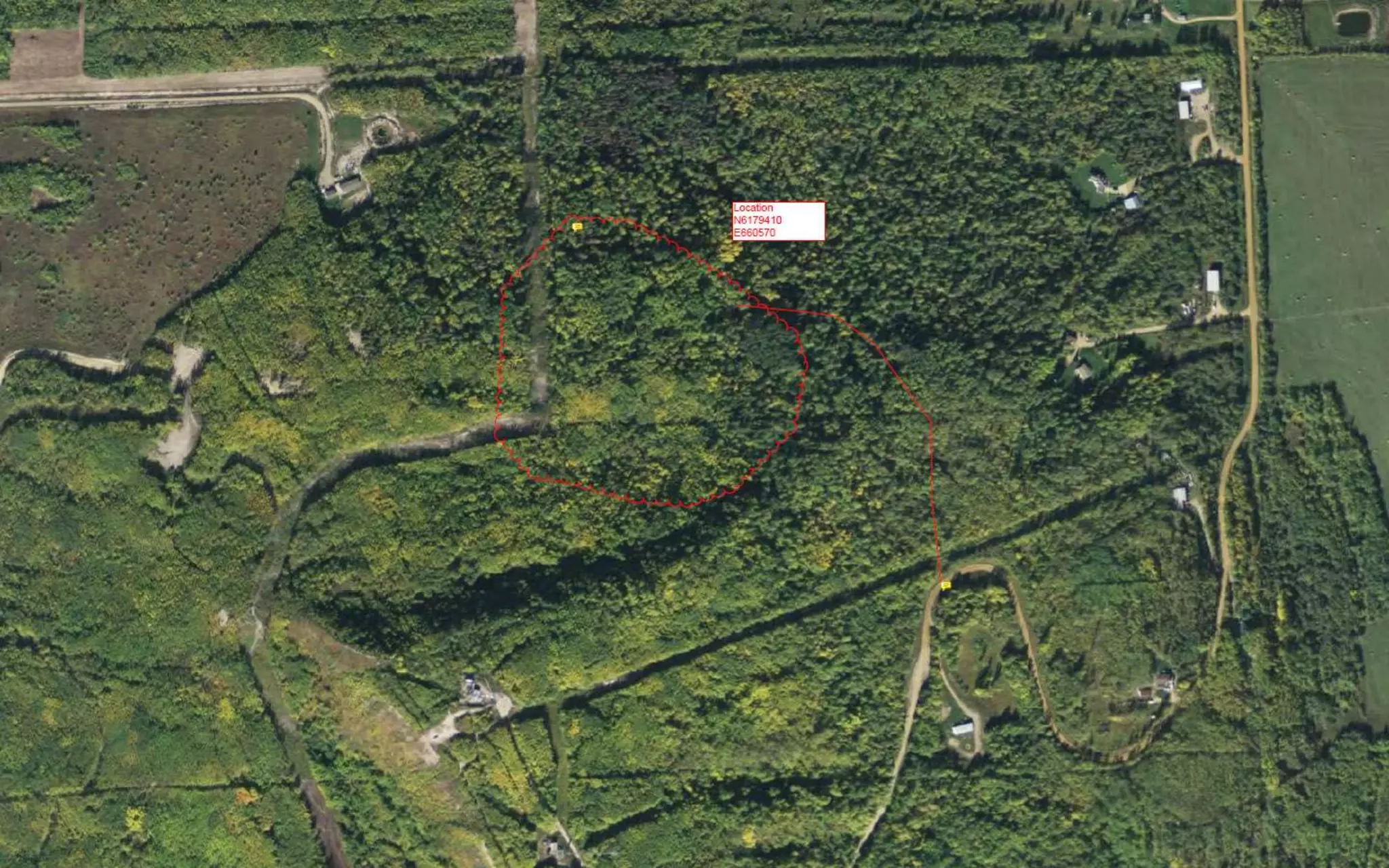
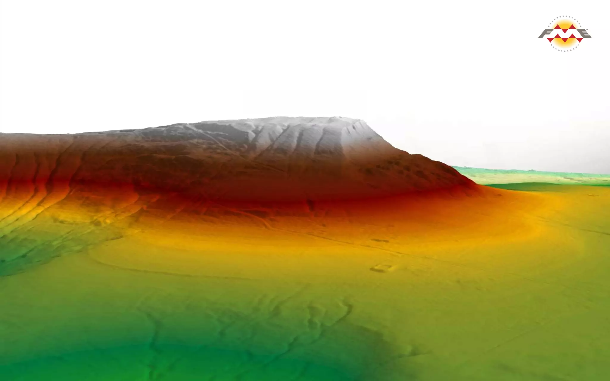
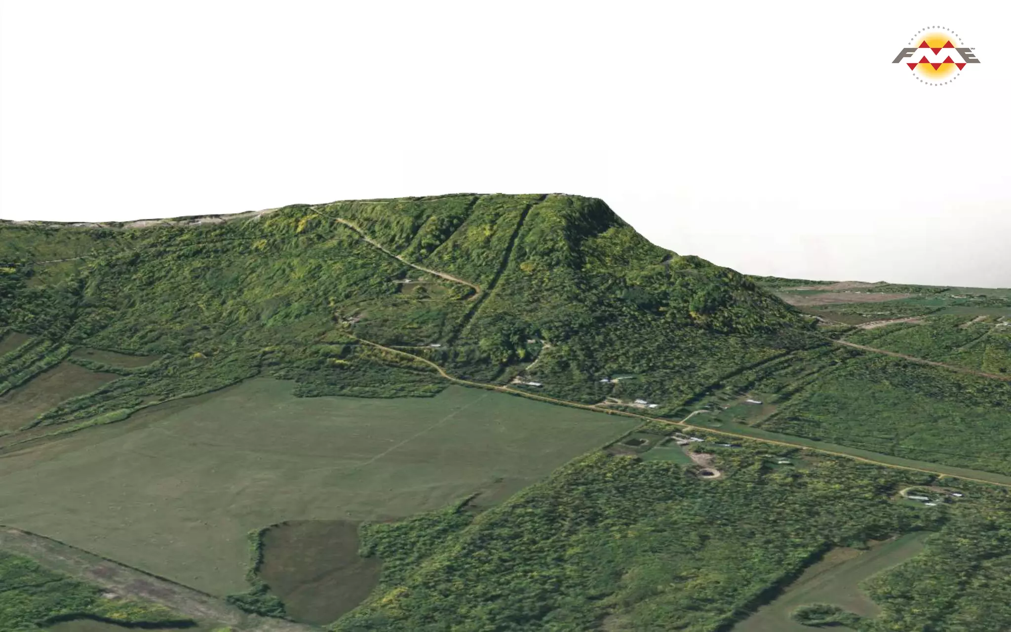

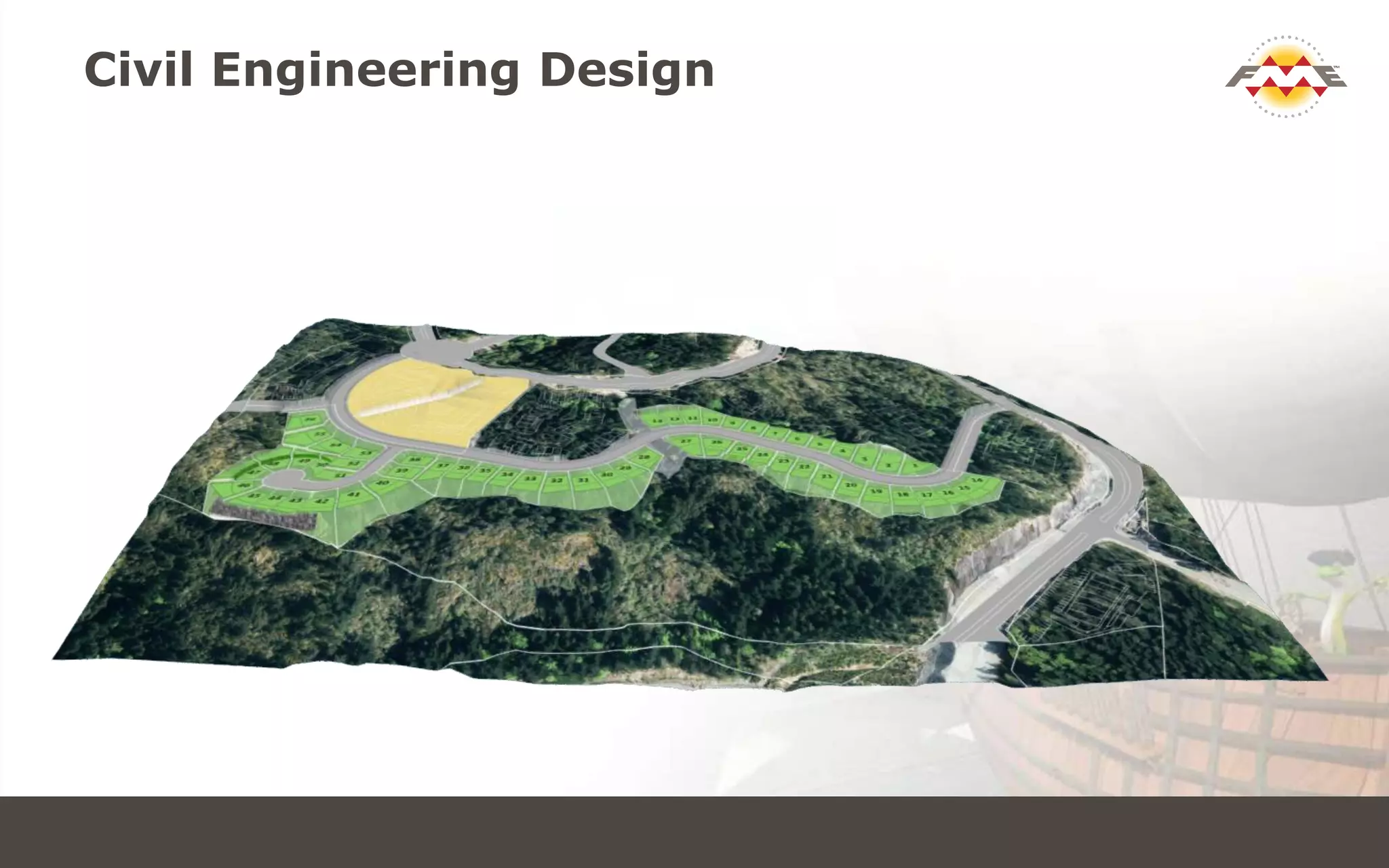
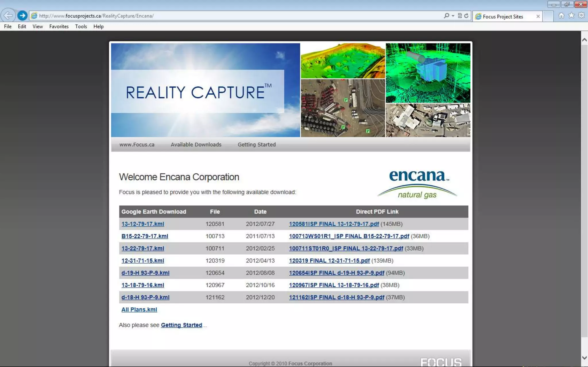

This document discusses Focus, a geomatics and engineering company that deals with various data formats and software tools. It outlines Focus's problem solving approach, which includes tracking projects with KML files, moving TIN models between software, and reprojecting LiDAR data between grids and ground coordinates. It also discusses Focus's product delivery methods, such as creating KML files from video, generating 3D models in various formats including LandXML and SketchUp, and creating Google Earth KML mashups and 3D PDFs. The document provides examples of Focus connecting, transforming, and automating data to solve problems and deliver products for survey, engineering, and planning projects.


![Vibe Coding vs. Spec-Driven Development [Free Meetup]](https://cdn.slidesharecdn.com/ss_thumbnails/vibecodingvsspecdrivendevelopment-251209105622-43f455e7-thumbnail.jpg?width=640&height=640&fit=bounds)


