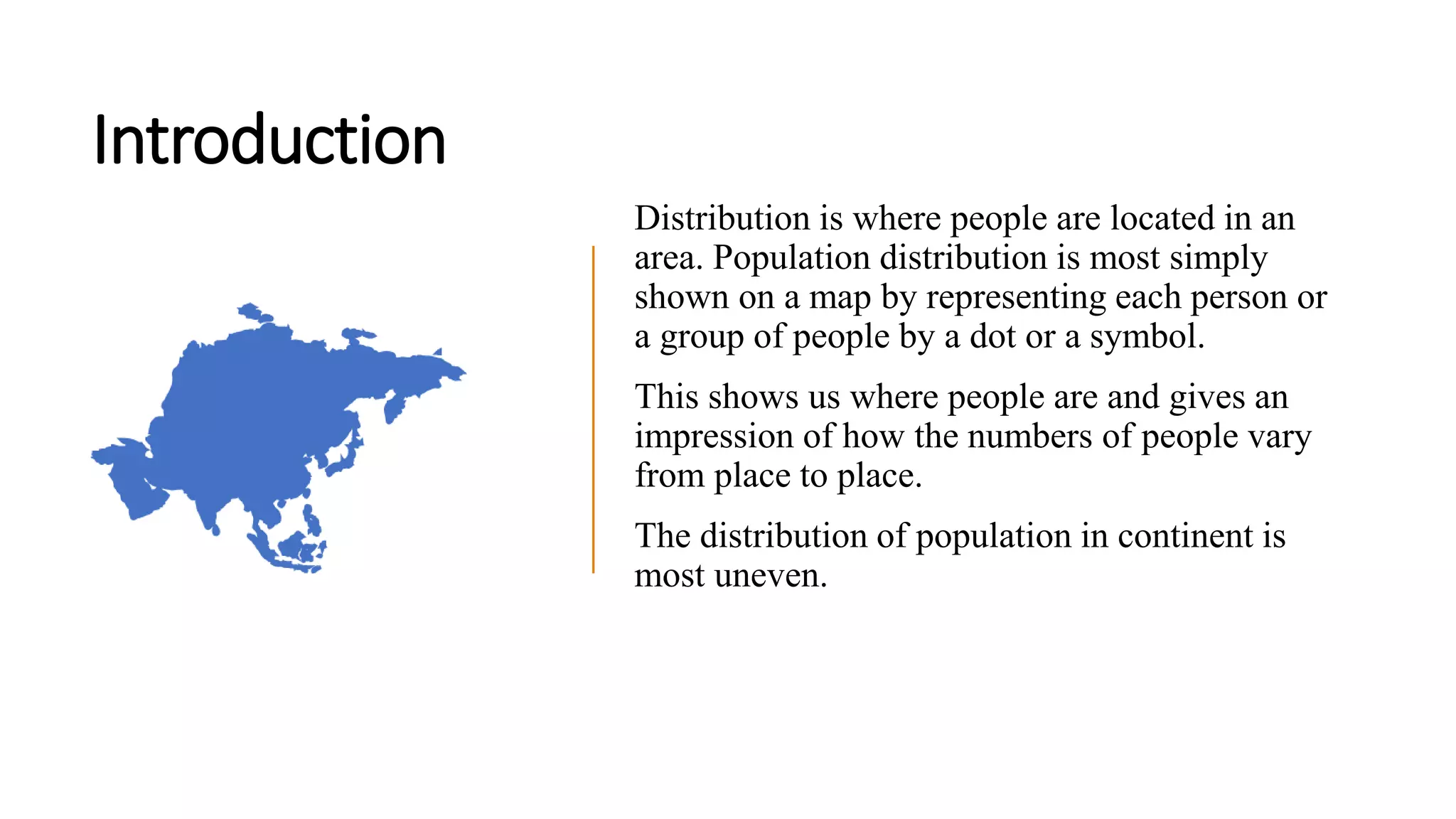
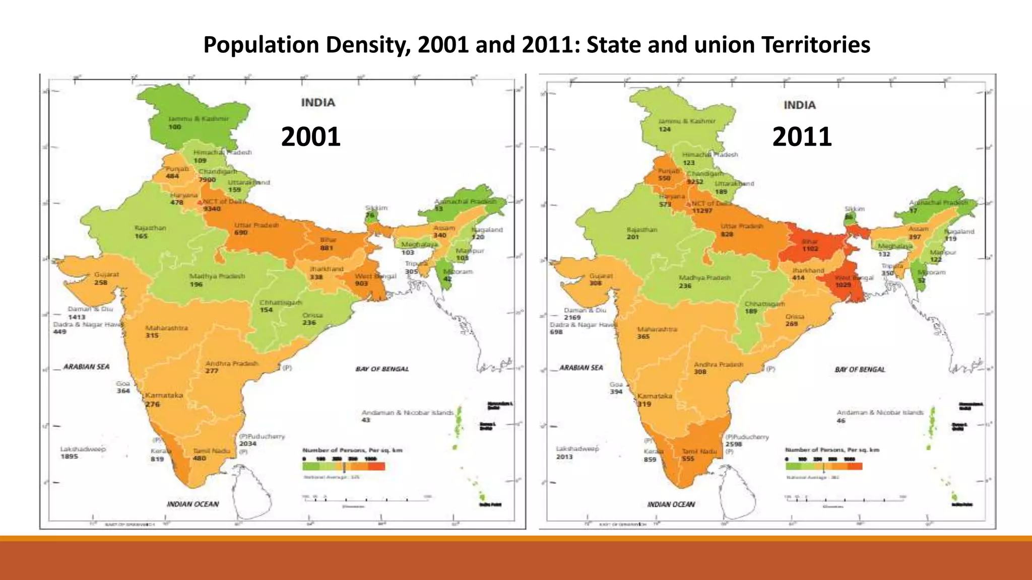
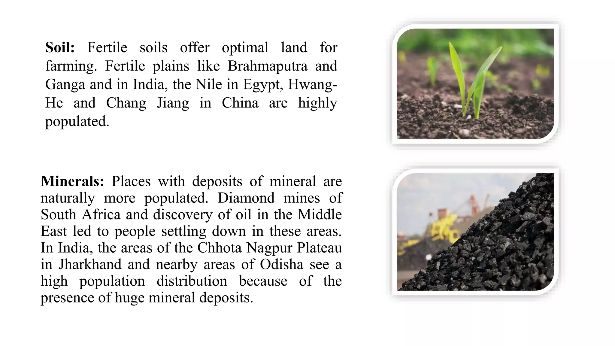
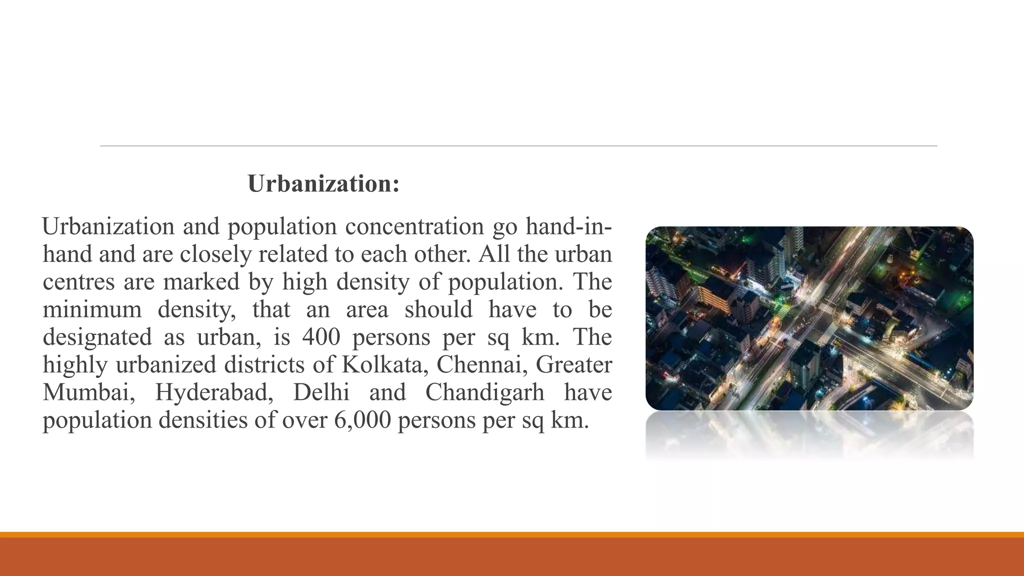
Population Distribution in India and Factors
affecting the distribution
MIHIR ADHIKARY
CONTENTS
1. Introduction
2. Density Wise Distribution
3. Percentage Wise Distribution
4. Factors Affecting Population distribution
Introduction
Distribution is where people are located in an
area. Population distribution is most simply
shown on a map by representing each person or
a group of people by a dot or a symbol.
This shows us where people are and gives an
impression of how the numbers of people vary
from place to place.
The distribution of population in continent is
most uneven.
Population Density
• Number of persons per square kilometers.
• Important index which shows
concentration of population in a specified
area.
• Different types of density.
• As per recent census data which show
density gone up to 382 persons per
square kilometers from 325 persons per
square kilometers in 2001.
• High increase puts immense pressure on
our natural resources and existing
infrastructural facility and adversely
affect the quality of life.
Chronological change in density
Spacial
Density
distribution
Trend and pattern of density
distribution
2001 2011
Population Density, 2001 and 2011: State and union Territories
Percentage
Distribution of
Population in
India
State wise share
of Population
India,2011
Ranking of states and union territories by population: 2001 and 2011
Population, 2001 and 2011: States and union territories
2001 2011
Factors
affecting the
distribution
Geographical factors:
Topography: people prefer living on plains
rather than plateaus and mountains since these
areas are suitable for agriculture, manufacturing
and also service activities. The ganga plains are
one of the most densely populated areas of the
world whereas mountains like alps, andes and
the himalayas are thinly populated.
Climate: people generally stay away from
extreme climates (very cold or very hot) like
the sahara desert, the russian polar regions,
canada and antarctica.
Water: people prefer to live in those places
where fresh water is easily available. So, the
river valleys are densely populated and the
deserts have less population.
Minerals: Places with deposits of mineral are
naturally more populated. Diamond mines of
South Africa and discovery of oil in the Middle
East led to people settling down in these areas.
In India, the areas of the Chhota Nagpur Plateau
in Jharkhand and nearby areas of Odisha see a
high population distribution because of the
presence of huge mineral deposits.
Soil: Fertile soils offer optimal land for
farming. Fertile plains like Brahmaputra and
Ganga and in India, the Nile in Egypt, Hwang-
He and Chang Jiang in China are highly
populated.
Social, Cultural, Economic and Historical Factors:
Social: Areas with better housing, health facilities and education are more
populated e.g., Pune. Better transport facilities also contribute to the increased
population of any region.
Cultural: Places with cultural or/and religious import attract people. Example:
Varanasi, Jerusalem and Vatican city.
Economic: Industrial areas offer employment opportunities. A large number of
people make their way into these areas. Examples: Mumbai in India and Osaka in
Japan.
Historical: Historical processes should also be taken into account while explaining
the pattern of population distribution.
Industrial Factors:
Industrial growth offers massive employment opportunities and acts as
a great magnet to attract people, particularly from the neighbouring
areas. This results in higher population density. Industrial areas are
almost invariably associated with areas of high population densities.
One hectare of industrial land is capable of supporting several
thousand persons, while the most fertile area devoted to agriculture
may not support more than a few hundred persons per hectare. One of
the major causes of high population density in West Bengal, Bihar,
Jharkhand, Orissa, Maharashtra and Gujarat is the phenomenal growth
of industries in these states.
Transport:
Growth of population is directly proportional to the development of
transport facilities. The northern plain of India has a dense network of
transport routes and is densely populated region. The peninsular
plateau has moderate network of transport route and is moderately
populated area. The Himalayan region badly lacks transport facilities
and is scarcely populated.
Urbanization:
Urbanization and population concentration go hand-in-
hand and are closely related to each other. All the urban
centres are marked by high density of population. The
minimum density, that an area should have to be
designated as urban, is 400 persons per sq km. The
highly urbanized districts of Kolkata, Chennai, Greater
Mumbai, Hyderabad, Delhi and Chandigarh have
population densities of over 6,000 persons per sq km.
Population distribution in India and Factors affecting the distribution

Population distribution in India and Factors affecting the distribution

  • 1.
    Population Distribution inIndia and Factors affecting the distribution MIHIR ADHIKARY
  • 2.
    CONTENTS 1. Introduction 2. DensityWise Distribution 3. Percentage Wise Distribution 4. Factors Affecting Population distribution
  • 3.
    Introduction Distribution is wherepeople are located in an area. Population distribution is most simply shown on a map by representing each person or a group of people by a dot or a symbol. This shows us where people are and gives an impression of how the numbers of people vary from place to place. The distribution of population in continent is most uneven.
  • 4.
    Population Density • Numberof persons per square kilometers. • Important index which shows concentration of population in a specified area. • Different types of density. • As per recent census data which show density gone up to 382 persons per square kilometers from 325 persons per square kilometers in 2001. • High increase puts immense pressure on our natural resources and existing infrastructural facility and adversely affect the quality of life.
  • 5.
    Chronological change indensity Spacial Density distribution Trend and pattern of density distribution
  • 6.
    2001 2011 Population Density,2001 and 2011: State and union Territories
  • 7.
  • 8.
    State wise share ofPopulation India,2011
  • 9.
    Ranking of statesand union territories by population: 2001 and 2011
  • 10.
    Population, 2001 and2011: States and union territories 2001 2011
  • 11.
    Factors affecting the distribution Geographical factors: Topography:people prefer living on plains rather than plateaus and mountains since these areas are suitable for agriculture, manufacturing and also service activities. The ganga plains are one of the most densely populated areas of the world whereas mountains like alps, andes and the himalayas are thinly populated. Climate: people generally stay away from extreme climates (very cold or very hot) like the sahara desert, the russian polar regions, canada and antarctica. Water: people prefer to live in those places where fresh water is easily available. So, the river valleys are densely populated and the deserts have less population.
  • 13.
    Minerals: Places withdeposits of mineral are naturally more populated. Diamond mines of South Africa and discovery of oil in the Middle East led to people settling down in these areas. In India, the areas of the Chhota Nagpur Plateau in Jharkhand and nearby areas of Odisha see a high population distribution because of the presence of huge mineral deposits. Soil: Fertile soils offer optimal land for farming. Fertile plains like Brahmaputra and Ganga and in India, the Nile in Egypt, Hwang- He and Chang Jiang in China are highly populated.
  • 14.
    Social, Cultural, Economicand Historical Factors: Social: Areas with better housing, health facilities and education are more populated e.g., Pune. Better transport facilities also contribute to the increased population of any region. Cultural: Places with cultural or/and religious import attract people. Example: Varanasi, Jerusalem and Vatican city. Economic: Industrial areas offer employment opportunities. A large number of people make their way into these areas. Examples: Mumbai in India and Osaka in Japan. Historical: Historical processes should also be taken into account while explaining the pattern of population distribution.
  • 15.
    Industrial Factors: Industrial growthoffers massive employment opportunities and acts as a great magnet to attract people, particularly from the neighbouring areas. This results in higher population density. Industrial areas are almost invariably associated with areas of high population densities. One hectare of industrial land is capable of supporting several thousand persons, while the most fertile area devoted to agriculture may not support more than a few hundred persons per hectare. One of the major causes of high population density in West Bengal, Bihar, Jharkhand, Orissa, Maharashtra and Gujarat is the phenomenal growth of industries in these states. Transport: Growth of population is directly proportional to the development of transport facilities. The northern plain of India has a dense network of transport routes and is densely populated region. The peninsular plateau has moderate network of transport route and is moderately populated area. The Himalayan region badly lacks transport facilities and is scarcely populated.
  • 16.
    Urbanization: Urbanization and populationconcentration go hand-in- hand and are closely related to each other. All the urban centres are marked by high density of population. The minimum density, that an area should have to be designated as urban, is 400 persons per sq km. The highly urbanized districts of Kolkata, Chennai, Greater Mumbai, Hyderabad, Delhi and Chandigarh have population densities of over 6,000 persons per sq km.