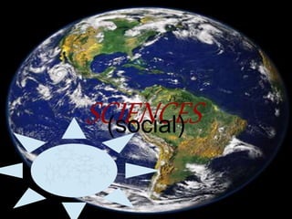
Planet earth teresa and marta
•Download as PPTX, PDF•
0 likes•556 views

This document discusses geographic coordinate systems. It explains that longitude and latitude grids allow every location on Earth to be identified by a set of numbers or letters. Parallels are lines of equal distance from the equator that run east to west, while meridians are lines of equal distance from the north and south poles that run north to south. The prime meridian at Greenwich, England is used as the base line for measuring longitude, with lines running 180 degrees east and west from it.
Report
Share
Report
Share

Recommended
Ch 2 latitude and longitude
This document discusses latitude and longitude lines. It explains that latitudes are horizontal lines that run east to west and encircle the Earth in parallel circles. Longitudes run north to south and are used to calculate time differences between locations. The prime meridian passes through Greenwich, England at 0 degrees. Locations are precisely located using their latitude and longitude coordinates where the lines intersect.
Meridians and-parallels
Meridians are semicircles running north to south that connect the poles and are used as reference lines for measuring longitude, while parallels are circles running east to west that are perpendicular to meridians and are used as reference lines for measuring latitude, with the most important being the equator and Arctic Circle. Together, lines of longitude and latitude provide a system to precisely locate any place on Earth.
Parallels and meridians (1)
Parallels and meridians are imaginary lines used to locate places on Earth. Parallels circle the Earth parallel to the equator and measure latitude, while meridians run from pole to pole, with the Greenwich meridian at 0 degrees measuring longitude. Together, the lines of latitude and longitude provide coordinates that uniquely identify locations worldwide.
P P T # 4 Earth
The document discusses the Earth's grid system of lines of longitude and latitude that are used to locate positions on the globe. It defines key terms like the prime meridian at 0° longitude which runs through Greenwich, England. Meridians run from the North to South Pole and are lines of longitude. The equator is at 0° latitude and divides the globe into northern and southern hemispheres. It describes how longitude is measured in degrees east and west of the prime meridian, and how latitude is measured in degrees from the equator to the poles. It also discusses the International Date Line and how time zones are used to standardize time zones based on longitude.
Latitude and longitude
Latitude lines run east-west and measure locations as degrees north or south of the equator, splitting the Earth into northern and southern hemispheres. Longitude lines begin at the prime meridian and measure degrees east or west. Together, a location's latitude and longitude coordinates precisely identify its position on Earth.
Geographic grid latitudes and longitudes made by Ravi Bharti
This powerpoint presentation contains the basic information of earth's geographic grids, their features, importance etc.
Prime Meridian,Equator, Latitude and longitude
This document defines and explains key concepts related to latitude, longitude, and their use in determining locations on Earth. It discusses the prime meridian, equator, latitude, longitude, north and south latitudes, east and west longitudes, and the international date line. Latitude lines run parallel around the globe, measuring angles north and south of the equator, while longitude lines converge at the poles, measuring angles east and west of the prime meridian. Together, latitude and longitude precisely locate positions worldwide.
Latitude & Longitude
This document discusses latitude and longitude and how they are used to locate positions on a globe. Latitude lines run north and south and are measured in degrees from the equator. Longitude lines run east and west and are measured in degrees from the prime meridian. Positions are specified using degrees, minutes, and N, S, E, or W to indicate location relative to the equator and prime meridian.
Latitude and Longitude
Lines of latitude and longitude form a grid system around the Earth, with the equator as the starting point for measuring latitude and the Prime Meridian as the starting point for measuring longitude. Latitude lines run parallel to the equator and measure degrees north and south, while longitude lines run from pole to pole and measure degrees east and west. The intersection of a latitude and longitude line provides an absolute location on Earth.
Lines of Latitude and Longitude
This document explains latitude and longitude and how they are used to locate places on a world map. Latitude lines run east-west and measure degrees north and south of the equator. Longitude lines run north-south and measure degrees east and west of the Prime Meridian in London. Examples of major latitude and longitude lines are provided, and the reader is tasked with marking these on a map, including the Tropics of Cancer and Capricorn, Equator, Arctic and Antarctic Circles, and Greenwich Meridian. The document also demonstrates how to write the latitude and longitude coordinates of a point on the map.
Longitude and latitude gr 10.pptx
1) Lines of latitude and longitude allow us to accurately describe locations on Earth. Lines of latitude run east-west and indicate how far north or south a place is from the equator, while lines of longitude run north-south and indicate how far east or west a place is from the prime meridian.
2) The prime meridian passes through Greenwich, England and is defined as 0° longitude. Longitude lines are numbered up to 180° east and west of the prime meridian.
3) To write the latitude and longitude coordinates of a location, write the latitude value first, followed by the longitude value. For example, the coordinates of Madrid are 40° 26' N 3° 42' W.
Chapter latitude and logitude
Locations on Earth are described by their latitude and longitude coordinates. Latitude is the distance north or south of the equator, measured in degrees from 0 degrees at the equator to 90 degrees at the poles. Lines connecting points of equal latitude are called parallels. Longitude is the distance east or west of the Prime Meridian, measured in degrees from 0 degrees at the Prime Meridian to 180 degrees east and west. The Prime Meridian passes through the Greenwich Observatory in England. The rotation of the Earth causes the sun to traverse 15 degrees of longitude per hour, causing time to change by 4 minutes when moving between meridians. The International Date Line approximates the 180th meridian, where the date changes when traveling east or
Latitude and Longitude
Latitude lines run horizontally around the Earth and measure positions north and south of the equator, ranging from 0 degrees at the equator to 90 degrees at the poles. Longitude lines run vertically and measure positions east and west of the Greenwich Meridian, ranging from 0 degrees at the prime meridian to 180 degrees east and west at the International Date Line. Together, latitude and longitude provide a system for precisely locating any position on Earth.
Latitude and longitude
Our mission is to track hurricanes using precise latitude and longitude coordinates. Latitude and longitude form a grid system that allows us to pinpoint exact locations on Earth. We can track the latest hurricanes by their latitude and longitude coordinates using Google Earth.
Finding Locations on Earth
The document discusses key concepts about determining locations on Earth using latitude and longitude.
Latitude is measured in degrees north and south of the equator, which divides the Earth into the Northern and Southern Hemispheres. Longitude is measured in degrees east and west of the Prime Meridian passing through Greenwich, England. Together, lines of latitude and longitude can be used to precisely identify any location on Earth.
Latitudeand longitude
Latitude and longitude are used to identify locations on Earth. Latitude runs parallel to the equator and measures positions as degrees north and south, from 0 degrees at the equator to 90 degrees at the poles. Longitude runs perpendicular to latitude, from the prime meridian at 0 degrees to 180 degrees east and west. The prime meridian passes through Greenwich, England. Latitude and longitude together provide an exact geographic coordinate for any location.
Latitude and longitude 1
Latitude lines run east-west and measure locations as degrees north or south of the equator, splitting the Earth into northern and southern hemispheres. Longitude lines begin at the Prime Meridian and measure degrees east or west, splitting the Earth into western and eastern hemispheres. Together, latitude and longitude coordinates provide a specific position anywhere on Earth.
Latitude & longitude class 2013 notes
This document includes notes on climate, time zones, and map projections. It discusses latitude and longitude lines and how they divide the Earth. Latitude lines run east to west and are used to measure degrees north and south of the equator. Important latitude lines include the Tropics of Cancer and Capricorn and Arctic and Antarctic Circles. Longitude lines run north to south and are used to establish time zones and the International Date Line. Time zones group regions that use the same standard time.
longitude latitude
This document provides information about latitude and longitude. It defines latitude as lines that run east-west and measure degrees north and south of the equator, splitting the Earth into northern and southern hemispheres. Longitude is defined as lines that begin at the Prime Meridian and are numbered east and west, splitting the Earth into western and eastern hemispheres. The document also discusses time zones and how there is a one hour difference for every 15 degrees of longitude, with time increasing to the east and decreasing to the west.
Lecture Latitude And Longitude
Latitude and longitude lines form a grid system that can be used to identify locations on Earth. Latitude lines run east-west and are parallel to the equator, ranging from 0 degrees at the equator to 90 degrees at the North and South Poles. Longitude lines run north-south and intersect at the poles, ranging from 0 degrees at the prime meridian to 180 degrees on the opposite side of the globe. To locate a position, the latitude is given first, followed by the longitude.
Latitude and longitude
The document explains how latitude and longitude are used to locate positions on Earth. The equator and prime meridian divide the globe into four quadrants, with latitude measuring distances north and south of the equator and longitude measuring distances east and west of the prime meridian. Together, a latitude and longitude coordinate precisely locates any point on the planet's surface. Examples show how to read latitude and longitude values and identify locations in different quadrants.
Latitude & Longitude
Latitude lines run horizontally around the Earth and are parallel lines of equal distance. Longitude lines run vertically and converge at the poles. Together, latitude and longitude can precisely locate any position on Earth within the grid system of degrees, minutes, and seconds.
Longitudes & latitudes
Longitudes are vertical lines that run from the North to South Pole. They are used along with latitude to give the exact position of places on Earth. Latitudes are horizontal lines parallel to the equator, with 0° at the equator. Latitudes are not all the same length, getting shorter closer to the poles. Together, latitude and longitude allow any location on Earth to be precisely identified.
Chapter 5 relationship between latitude, longitude, and climate section 2 geo...
1) Lines of latitude and longitude divide the Earth into locations and help identify places using their coordinates.
2) Latitude describes the position north or south of the equator, while longitude describes the position east or west of the prime meridian.
3) Generalizations can be made that regions near the equator (low latitudes) tend to be warmer, areas farther from the equator (middle latitudes) tend to be milder, and locations at the poles (high latitudes) tend to be colder due to differences in sunlight exposure.
Latitude And Longitude
Latitude and longitude lines form a grid system that can be used to identify locations on Earth. Latitude lines run east-west and are parallel to the equator, ranging from 0 degrees at the equator to 90 degrees at the North and South Poles. Longitude lines run north-south and intersect at the poles, ranging from 0 degrees at the prime meridian to 180 degrees on the opposite side of the globe. To locate a position, the latitude is given first, followed by the longitude.
Latitude and longitude
The document discusses lines of latitude and longitude that form a grid system around the Earth. Lines of latitude, also called parallels, circle the globe parallel to the equator and measure degrees north and south. Lines of longitude, also called meridians, circle the globe from pole to pole and measure degrees east and west of the Prime Meridian. Where these lines intersect provides an absolute location on Earth in degrees of latitude and longitude.
Latitude and Longitude
Latitude lines run east-west and measure locations as degrees north or south of the equator, splitting the Earth into northern and southern hemispheres. Longitude lines begin at the Prime Meridian and measure degrees east or west, splitting the Earth into western and eastern hemispheres. Together, latitude and longitude coordinates provide a specific position anywhere on Earth.
Latitude and longitude powerpoint
There are three methods for locating places on a map:
1. The alphanumeric grid system
2. The military grid system
3. Longitude and latitude
Longitude and latitude use imaginary lines - lines of latitude run east to west and are parallel, while lines of longitude run north to south and converge at the poles. Together they form a grid that can be used for navigation and locating features on a map.
Introduction
This document provides an overview of the various branches of social science. It begins by introducing the topic and then lists and briefly describes over 70 branches of social science, including anthropology, archaeology, economics, political science, psychology, and sociology. The branches cover a wide range of topics from cultural anthropology to transport economics to welfare economics. The document concludes by stating that social science is concerned with society and the relationships among individuals within a society.
More Related Content
What's hot
Latitude and Longitude
Lines of latitude and longitude form a grid system around the Earth, with the equator as the starting point for measuring latitude and the Prime Meridian as the starting point for measuring longitude. Latitude lines run parallel to the equator and measure degrees north and south, while longitude lines run from pole to pole and measure degrees east and west. The intersection of a latitude and longitude line provides an absolute location on Earth.
Lines of Latitude and Longitude
This document explains latitude and longitude and how they are used to locate places on a world map. Latitude lines run east-west and measure degrees north and south of the equator. Longitude lines run north-south and measure degrees east and west of the Prime Meridian in London. Examples of major latitude and longitude lines are provided, and the reader is tasked with marking these on a map, including the Tropics of Cancer and Capricorn, Equator, Arctic and Antarctic Circles, and Greenwich Meridian. The document also demonstrates how to write the latitude and longitude coordinates of a point on the map.
Longitude and latitude gr 10.pptx
1) Lines of latitude and longitude allow us to accurately describe locations on Earth. Lines of latitude run east-west and indicate how far north or south a place is from the equator, while lines of longitude run north-south and indicate how far east or west a place is from the prime meridian.
2) The prime meridian passes through Greenwich, England and is defined as 0° longitude. Longitude lines are numbered up to 180° east and west of the prime meridian.
3) To write the latitude and longitude coordinates of a location, write the latitude value first, followed by the longitude value. For example, the coordinates of Madrid are 40° 26' N 3° 42' W.
Chapter latitude and logitude
Locations on Earth are described by their latitude and longitude coordinates. Latitude is the distance north or south of the equator, measured in degrees from 0 degrees at the equator to 90 degrees at the poles. Lines connecting points of equal latitude are called parallels. Longitude is the distance east or west of the Prime Meridian, measured in degrees from 0 degrees at the Prime Meridian to 180 degrees east and west. The Prime Meridian passes through the Greenwich Observatory in England. The rotation of the Earth causes the sun to traverse 15 degrees of longitude per hour, causing time to change by 4 minutes when moving between meridians. The International Date Line approximates the 180th meridian, where the date changes when traveling east or
Latitude and Longitude
Latitude lines run horizontally around the Earth and measure positions north and south of the equator, ranging from 0 degrees at the equator to 90 degrees at the poles. Longitude lines run vertically and measure positions east and west of the Greenwich Meridian, ranging from 0 degrees at the prime meridian to 180 degrees east and west at the International Date Line. Together, latitude and longitude provide a system for precisely locating any position on Earth.
Latitude and longitude
Our mission is to track hurricanes using precise latitude and longitude coordinates. Latitude and longitude form a grid system that allows us to pinpoint exact locations on Earth. We can track the latest hurricanes by their latitude and longitude coordinates using Google Earth.
Finding Locations on Earth
The document discusses key concepts about determining locations on Earth using latitude and longitude.
Latitude is measured in degrees north and south of the equator, which divides the Earth into the Northern and Southern Hemispheres. Longitude is measured in degrees east and west of the Prime Meridian passing through Greenwich, England. Together, lines of latitude and longitude can be used to precisely identify any location on Earth.
Latitudeand longitude
Latitude and longitude are used to identify locations on Earth. Latitude runs parallel to the equator and measures positions as degrees north and south, from 0 degrees at the equator to 90 degrees at the poles. Longitude runs perpendicular to latitude, from the prime meridian at 0 degrees to 180 degrees east and west. The prime meridian passes through Greenwich, England. Latitude and longitude together provide an exact geographic coordinate for any location.
Latitude and longitude 1
Latitude lines run east-west and measure locations as degrees north or south of the equator, splitting the Earth into northern and southern hemispheres. Longitude lines begin at the Prime Meridian and measure degrees east or west, splitting the Earth into western and eastern hemispheres. Together, latitude and longitude coordinates provide a specific position anywhere on Earth.
Latitude & longitude class 2013 notes
This document includes notes on climate, time zones, and map projections. It discusses latitude and longitude lines and how they divide the Earth. Latitude lines run east to west and are used to measure degrees north and south of the equator. Important latitude lines include the Tropics of Cancer and Capricorn and Arctic and Antarctic Circles. Longitude lines run north to south and are used to establish time zones and the International Date Line. Time zones group regions that use the same standard time.
longitude latitude
This document provides information about latitude and longitude. It defines latitude as lines that run east-west and measure degrees north and south of the equator, splitting the Earth into northern and southern hemispheres. Longitude is defined as lines that begin at the Prime Meridian and are numbered east and west, splitting the Earth into western and eastern hemispheres. The document also discusses time zones and how there is a one hour difference for every 15 degrees of longitude, with time increasing to the east and decreasing to the west.
Lecture Latitude And Longitude
Latitude and longitude lines form a grid system that can be used to identify locations on Earth. Latitude lines run east-west and are parallel to the equator, ranging from 0 degrees at the equator to 90 degrees at the North and South Poles. Longitude lines run north-south and intersect at the poles, ranging from 0 degrees at the prime meridian to 180 degrees on the opposite side of the globe. To locate a position, the latitude is given first, followed by the longitude.
Latitude and longitude
The document explains how latitude and longitude are used to locate positions on Earth. The equator and prime meridian divide the globe into four quadrants, with latitude measuring distances north and south of the equator and longitude measuring distances east and west of the prime meridian. Together, a latitude and longitude coordinate precisely locates any point on the planet's surface. Examples show how to read latitude and longitude values and identify locations in different quadrants.
Latitude & Longitude
Latitude lines run horizontally around the Earth and are parallel lines of equal distance. Longitude lines run vertically and converge at the poles. Together, latitude and longitude can precisely locate any position on Earth within the grid system of degrees, minutes, and seconds.
Longitudes & latitudes
Longitudes are vertical lines that run from the North to South Pole. They are used along with latitude to give the exact position of places on Earth. Latitudes are horizontal lines parallel to the equator, with 0° at the equator. Latitudes are not all the same length, getting shorter closer to the poles. Together, latitude and longitude allow any location on Earth to be precisely identified.
Chapter 5 relationship between latitude, longitude, and climate section 2 geo...
1) Lines of latitude and longitude divide the Earth into locations and help identify places using their coordinates.
2) Latitude describes the position north or south of the equator, while longitude describes the position east or west of the prime meridian.
3) Generalizations can be made that regions near the equator (low latitudes) tend to be warmer, areas farther from the equator (middle latitudes) tend to be milder, and locations at the poles (high latitudes) tend to be colder due to differences in sunlight exposure.
Latitude And Longitude
Latitude and longitude lines form a grid system that can be used to identify locations on Earth. Latitude lines run east-west and are parallel to the equator, ranging from 0 degrees at the equator to 90 degrees at the North and South Poles. Longitude lines run north-south and intersect at the poles, ranging from 0 degrees at the prime meridian to 180 degrees on the opposite side of the globe. To locate a position, the latitude is given first, followed by the longitude.
Latitude and longitude
The document discusses lines of latitude and longitude that form a grid system around the Earth. Lines of latitude, also called parallels, circle the globe parallel to the equator and measure degrees north and south. Lines of longitude, also called meridians, circle the globe from pole to pole and measure degrees east and west of the Prime Meridian. Where these lines intersect provides an absolute location on Earth in degrees of latitude and longitude.
Latitude and Longitude
Latitude lines run east-west and measure locations as degrees north or south of the equator, splitting the Earth into northern and southern hemispheres. Longitude lines begin at the Prime Meridian and measure degrees east or west, splitting the Earth into western and eastern hemispheres. Together, latitude and longitude coordinates provide a specific position anywhere on Earth.
Latitude and longitude powerpoint
There are three methods for locating places on a map:
1. The alphanumeric grid system
2. The military grid system
3. Longitude and latitude
Longitude and latitude use imaginary lines - lines of latitude run east to west and are parallel, while lines of longitude run north to south and converge at the poles. Together they form a grid that can be used for navigation and locating features on a map.
What's hot (20)
Chapter 5 relationship between latitude, longitude, and climate section 2 geo...
Chapter 5 relationship between latitude, longitude, and climate section 2 geo...
Viewers also liked
Introduction
This document provides an overview of the various branches of social science. It begins by introducing the topic and then lists and briefly describes over 70 branches of social science, including anthropology, archaeology, economics, political science, psychology, and sociology. The branches cover a wide range of topics from cultural anthropology to transport economics to welfare economics. The document concludes by stating that social science is concerned with society and the relationships among individuals within a society.
The Business of Digital: Chapter 2 - The Age of Content - The Science Behind ...
This document discusses the science behind native advertising. It summarizes the findings of a neuroscience study conducted by Nielsen and Sharethrough. The study found that native ads are read, not just seen, as they receive direct visual focus on the text. Native ads also influence the brain more than banners by engaging both sides of the brain during processing. Specifically, native ads are uniquely suited to forming and strengthening brand associations in the brain.
Family Inclusive Practice in OOHC
The document outlines family inclusion strategies proposed by Family Inclusion Strategies in the Hunter (FISH) following a presentation to Life Without Barriers case managers. It discusses ideas in several areas: casework practice, carer recruitment/training, family relationships, and organizational issues. Many ideas can be implemented immediately and don't require new resources or policies. Some require redirecting current resources or support from LWB management, such as developing family inclusion policies and reducing caseloads to allow for relationship building. The overarching goal is to shift practice from a focus on managing contact to facilitating meaningful family relationships through respect and trust.
IAB Canada Metrics 2015 - Eyereturn - The Truth About Clicks - Ian Hewetson
Even after all of these years, more media is bought based on the cheapness of the click than any other KPI, even though the click has no correlation to real success. Using the latest measurement techniques across both mobile and desktop to examine this issue, Eyereturn will show the effects of the industry's long standing addiction to the click, and what we can all do to help break the habit.
Resultados Prueba IPP Grado 10º La Providencia
Los documentos proporcionan los resultados de pruebas de intereses profesionales (IPP) para varios estudiantes. Cada documento muestra los intereses y preferencias de un estudiante en diferentes campos profesionales como médico, empresarial, deportivo, entre otros.
Goldberg Action Plan
This report focuses on improving the Litigation Department at Goldberg & de Villiers law firm. It identifies objectives like continuing quality client services, increasing the client base, and strengthening the brand. Problems are identified such as needing clearer mission/vision statements, potential staffing issues if the client base expands, ensuring optimal resource and time utilization. Proposed actions include retaining valued clients while adding new ones through increased contact, implementing regular client feedback mechanisms, securing new clients on a quarterly basis, immediately addressing old files, and meeting with staff to share the mission and vision statements.
Investigacion sobre calculo numero y manejo de errores
Este documento trata sobre cálculo numérico y manejo de errores. Explica que el análisis numérico es una rama de las matemáticas que permite resolver problemas mediante operaciones aritméticas en una computadora. También describe la importancia de los métodos numéricos para resolver problemas matemáticos, científicos o de ingeniería en una computadora. Además, detalla dos tipos básicos de errores en cálculos numéricos: el error de redondeo debido a la representación finita de números, y el error de truncamiento
Romeo and Juliet: A Webinar
This document provides an overview of various productions and interpretations of Shakespeare's Romeo and Juliet. It includes quotes from critics and directors discussing aspects of the play such as its enduring popularity, the passionate love story between Romeo and Juliet, and different directorial approaches to famous scenes like the balcony scene. The document also lists directors of various productions from 1961 to 2010 and includes pictures from some film and theater adaptations of the play.
أشهر 4 كذبات وقع فيها المصريين على الفيس بوك
هناك 4 كذبات وقع فيها المصريين على الفيس بوك و غالبا ستكون انت احد الذين تعرضوا لها :)
معاصرون هوست لخدمات الويب و التسويق الالكترونى
Sabela II
El documento resume el reinado de Isabel II de España desde 1833 hasta 1868, un período turbulento marcado por conflictos entre facciones políticas moderadas y progresistas, la guerra carlista, y el ascenso y caída del poder de la monarquía borbónica. Se detalla la regencia de María Cristina y Espartero, el establecimiento de una constitución en 1837, el alternancia del poder entre moderados y progresistas, y la mayoría de edad de Isabel II, antes de concluir con los pactos de Ostende y Bruselas
Testimonials to Deborah Anderson's Skill Set in Educating
Deborah has been an instructor in many areas, computer, information technology, programming, advanced web design, Photoshop (and advanced Photoshop techniques) and the list goes on and on... Check out what her students and instructors say about her tips, strategies, and teaching skills...
Congratulations Page 2013
The document provides information about wedding planning services for a client holding their wedding at the Hilton Houston Westchase. It outlines the duties of the hotel's catering manager versus a professional wedding planner. It also lists preferred vendors within their wedding package and other recommended vendors in categories like cake, linens, floral arrangements, photography, music and more. The goal is to help clients identify reliable local vendors to assist with different aspects of their wedding at the Hilton Houston Westchase.
Viewers also liked (16)
The Business of Digital: Chapter 2 - The Age of Content - The Science Behind ...
The Business of Digital: Chapter 2 - The Age of Content - The Science Behind ...
IAB Canada Metrics 2015 - Eyereturn - The Truth About Clicks - Ian Hewetson
IAB Canada Metrics 2015 - Eyereturn - The Truth About Clicks - Ian Hewetson
Investigacion sobre calculo numero y manejo de errores
Investigacion sobre calculo numero y manejo de errores
130512 chi school of faith (part 2 - moses) by joseph gan
130512 chi school of faith (part 2 - moses) by joseph gan
Testimonials to Deborah Anderson's Skill Set in Educating
Testimonials to Deborah Anderson's Skill Set in Educating
Similar to Planet earth teresa and marta
Satellite Communication Lec4, Chat Rooms GupshupCorner.com Pakistan.
Satellite Communication Lecture 3 , by Chat Rooms | pakistani Chat Rooms http://www.gupshupcorner.com Chat Rooms Without Registration.
Globe: lattitudes and longitudes
This document discusses key concepts relating to latitude, longitude, and time zones on Earth. It explains that the equator divides the planet into northern and southern hemispheres. Parallels of latitude run parallel to the equator and are measured in degrees from 0 at the equator to 90 at the poles. Important parallels include the Tropic of Cancer, Tropic of Capricorn, and Arctic Circle. The planet is also divided into torrid, temperate, and frigid zones based on sunlight. Longitudes are measured in degrees east and west from the Prime Meridian at Greenwich, England. Time zones are based on longitude, with each zone being approximately 15 degrees and 1 hour apart. Standard time is used within countries
Science 4th
1. The International Date Line is an imaginary line that runs through the Pacific Ocean near 180° longitude, separating calendar dates.
2. It is not a perfectly straight line and bends in some areas, like near Kiribati, to keep countries and territories within the same date.
3. Crossing the date line from east to west adds a day to the calendar date, while crossing from west to east subtracts a day. This maintains a consistent calendar around the globe.
Parallelsandmeridians1 130218083301-phpapp01
The document discusses parallels and meridians, which are imaginary lines used to locate places on Earth. [1] Parallels circle the globe parallel to the equator and measure latitude, while meridians run between the poles and measure longitude. [2] The Greenwich meridian at 0° longitude is the prime meridian. [3] Together, a place's latitude and longitude coordinates provide its specific location.
Ppt of Class 6 ,ch 2, globe , Geography pdf
This ppt is Geography, classic 6 chapter-2, Globe : Latitudes and Longitude, ncert and CG board syllabus. Thus is useful for teachers and student's.
Earth as a sphere
The document discusses latitude and longitude, the coordinate system used to locate places on Earth, wherein latitude is measured in degrees north and south of the equator and longitude is measured in degrees east and west of the Prime Meridian. It provides details on how to calculate distances between locations using their latitudes and longitudes, including distances along meridians, along the equator, and along parallels of latitude.
Lines of Latitude and Longitude – PowerPoint
PowerPoint on Lines of Latitude, Lines of Longitude, Climate Zones, Equinoxes, Solstices, The Three Norths, Prime Meridian, International Date Line, Greenwich Mean Time, Coordinated Universal Time.
Lines of Latitude and Longitude – Worksheet at:
http://www.slideshare.net/yaryalitsa/lines-of-latitude-and-longitude-worksheet
WEEK1-Q4.pptx
This document discusses how coordinate systems using longitude and latitude can be used to locate places on Earth. Longitude lines run north-south and are used to locate west-east positions. Latitude lines run east-west and locate north-south positions. Key points include the Prime Meridian at 0 degrees longitude, the Equator at 0 degrees latitude, and the poles at 90 degrees latitude. Several activities are provided to practice identifying locations based on their longitude and latitude coordinates.
India size and location
This document discusses key geographic concepts including latitude, longitude, hemispheres, and time zones. It explains that latitude lines run east-west and measure degrees north and south of the equator, dividing the earth into northern and southern hemispheres. Longitude lines begin at the prime meridian and are numbered east and west. By using latitude and longitude coordinates, any location on earth can be precisely pinpointed. It also describes how the earth's rotation causes different time zones around the globe that are approximately 15 degrees apart.
Latitudes and Longitudes [Autosaved].pptx
latitude longitude, latitude longitude explanation, latitude longitude explained, latitude longitude ppt free download, latitude longitude definition, latitude longitude class 5 notes, latitude longitude social studies
Q4 Science 7 week 1.pptx
The document discusses coordinate systems used to describe locations on Earth. It explains that coordinate systems use imaginary lines of latitude, longitude, the equator, and prime meridian. Latitude lines run parallel east-west around the Earth, measuring angles north and south of the equator. Longitude lines run perpendicular north-south between the poles, measuring angles east and west of the prime meridian. The equator and prime meridian serve as reference points at 0 degrees for latitude and longitude, respectively.
Longitude and latitude
The document discusses how the Earth is divided into hemispheres and measured. The Northern and Southern Hemispheres are divided by the equator, with the Northern Hemisphere located north of the equator and the Southern Hemisphere south of it. Latitude lines measure degrees north and south of the equator, while longitude lines run parallel to the Prime Meridian and divide the Earth into Eastern and Western Hemispheres.
What is Latitude and Longhitude and How it affects the Weather.pptx
Latitude and Longhitude are invisible lines
Earth As a sphere 2.pptx
The document discusses latitude and longitude, which are used to locate places on Earth. Latitude is measured in degrees north and south of the equator, while longitude is measured in degrees east and west of the Prime Meridian in Greenwich, England. The document provides details on calculating distances between locations using their latitudes and longitudes, either along meridians of longitude or along the equator. It also discusses finding the shortest distance between two points, which follows a great circle route passing through the North and South Poles.
The Earth, the Geographic Coordinates
This document discusses geographic coordinates and how they are used to locate positions on Earth. It explains that parallels of latitude run parallel to the equator, dividing the planet into northern and southern hemispheres. Meridians of longitude run from the North Pole to the South Pole, dividing Earth into eastern and western hemispheres. To determine a point's precise location, its latitude (its distance north or south from the equator) and longitude (its distance east or west from the prime meridian) are identified. Where the line of latitude and longitude intersect is the absolute location on Earth's surface. Together, the grid of parallels and meridians forms coordinates that allow distances and positions to be precisely calculated globally.
_L-14 The Globe- Latitudes and Longitudes new.pptx
Here are the answers:
1. The local time of a place situated 60° W of London will be 6 pm if it is noon in London. Since each 15° of longitude represents a 1 hour time difference, and the place is 60° west of London, the time difference will be 60/15 = 4 hours. So if it is noon in London, the local time at the place 60° W will be noon + 4 hours = 6 pm.
2. The local time of a place situated 90° E of London will be 3 pm if it is 9 am in London. Since each 15° of longitude represents a 1 hour time difference, and the place is 90° east of London, the time difference will be
Pr 1
A geographic coordinate system uses numbers to specify every location on Earth. Common coordinates are latitude, longitude, and elevation. Latitude is the angle between the equatorial plane and a line drawn from the Earth's center to the point, measured in degrees north or south. Longitude is the angle between the prime meridian and a line drawn to the point, measured in degrees east or west around the Earth's equator. Together, latitude and longitude uniquely identify any location on Earth.
Latitudes and longitudes and india size and location
This presentation covers the following topics:
1. Geographic coordinate system, i.e, latitude and longitudes
2. Size and location of India
(because before understanding the size and location our country, Geographic coordinate system, i.e, latitude and longitudes are important)
which enables the students to locate all four hemispheres including
Northern Hemisphere
Southern Hemisphere
Eastern Hemisphere
Western Hemisphere
Students will be able to identify which line divides the earth into the correct hemispheres.
Students will be able to find locations on map using longitude and latitude.
Chapter Two_Earth, moon and sky.pptx
The document discusses concepts related to Earth's motion and how it causes seasons. It explains that Earth's tilted axis and yearly revolution around the sun, combined with the changing angle of sunlight, create the seasons in the Northern and Southern Hemispheres. Specifically, it notes that summer occurs in the Northern Hemisphere when it leans toward the sun in June, and winter occurs when it leans away in December. The equinoxes in March and September occur when neither hemisphere is tilted toward the sun.
Abbey chapter2 2012
This document provides information about how to read maps and globes. It discusses scale, different types of scales like ratio and bar scales, and using latitude and longitude to locate points. It explains that latitude lines run horizontally and longitude lines run vertically. The prime meridian and equator divide the globe into hemispheres and quadrants. Topographic maps use contour lines to indicate elevation and slope steepness. Satellite imagery and GPS are now used to create digital maps.
Similar to Planet earth teresa and marta (20)
Satellite Communication Lec4, Chat Rooms GupshupCorner.com Pakistan.
Satellite Communication Lec4, Chat Rooms GupshupCorner.com Pakistan.
What is Latitude and Longhitude and How it affects the Weather.pptx
What is Latitude and Longhitude and How it affects the Weather.pptx
_L-14 The Globe- Latitudes and Longitudes new.pptx
_L-14 The Globe- Latitudes and Longitudes new.pptx
Latitudes and longitudes and india size and location
Latitudes and longitudes and india size and location
More from Chema Jimeno Sabadú
Airports ppt
An airport is where people go to travel on planes, check in their luggage at the counter, and wait at the gate before boarding their flight, where a flight attendant will show them to their seat and the pilot will fly the plane to their destination.
Physical description (by Twinkle)
The document describes physical characteristics such as eye color, hair color, hair length, hair texture, and facial hair. It provides examples of how to say these characteristics in Spanish, including "I have green eyes" as "Tengo los ojos verdes". The document asks questions to prompt descriptions and provides answers such as "I have grey eyes", "I have ginger hair", and "I have curly hair".
Australian quiz
Australia is a large island country located in the southern hemisphere. It has a population of around 24 million people and has many unique landscapes including deserts, rainforests, and the Great Barrier Reef. While Australia has hot summers, its seasons are opposite to those in the United Kingdom. It is home to distinctive wildlife such as kangaroos and koalas, as well as dangerous creatures like venomous snakes and spiders.
Matter Unit.
This document appears to be about a 4th grade science unit on matter. The unit will likely introduce students to the basic concepts and properties of matter, such as the three states of matter (solid, liquid, gas) and their characteristics. Students may learn about physical and chemical changes to matter through hands-on activities and experiments.
Socialscience300ct 151029205856-lva1-app6892
This document discusses concepts around Earth science covered in a 4th grade social sciences unit. It describes imaginary lines like meridians and parallels that are used to measure longitude and latitude. It also outlines Earth's basic layers of the geosphere and atmosphere. The atmosphere is divided into layers including the troposphere, stratosphere, and ionosphere. The document defines weather occurring in the troposphere and lists common weather phenomena as well as tools used to measure aspects of weather like temperature, wind speed, air pressure, and precipitation.
Social sciences . The Earth.
The document discusses the Earth's imaginary lines, movements, and layers. It describes how the Earth is divided into vertical meridians and horizontal parallels used to measure longitude and latitude in degrees. It notes that the Earth's rotation takes 24 hours and revolution around the sun takes 365 days and 6 hours. Finally, it states that the geosphere, or solid part of the Earth, is divided into layers.
History timeline tercero
This document provides an overview of history from prehistory to the modern age. It describes key periods such as prehistory (beginning 5 million years ago), the Ancient World (starting with the invention of writing around 3500BC), the Middle Ages (476AD to 1492), the Early Modern Age (1492 to 1789 with discoveries and the printing press), and the Contemporary or Modern Age (beginning in 1789 with the Industrial Revolution and continuing to present). Each period is briefly characterized with some important developments and events. The document also provides links to learn more about each historical period.
Unit 4 disestion and excretion
This document discusses the human digestive and excretory systems. It describes the major parts of the digestive system including the mouth, esophagus, stomach, small intestine, and large intestine. It explains the basic functions of these organs in breaking down food and absorbing nutrients. The excretory system is also outlined, naming the kidneys, ureters, bladder, and urethra as key parts that remove waste from the blood and expel it from the body as urine. The document also lists the main nutrient groups found in foods like carbohydrates, proteins, fats, vitamins and minerals, and their roles in energy, growth, and health. Healthy eating and lifestyle habits are recommended.
Unit 4 systems
The document discusses the major body systems including the nervous system, locomotor system, circulatory system, respiratory system, and reproductive system. It explains that the nervous system is made up of the brain, spinal cord and nerves and controls everything in the body. It also notes that the locomotor system includes joints, muscles and bones and allows the body to move, while the respiratory system includes the nose, windpipe, bronchi and lungs.
Spain unit 4. Year 3. Primary Education.
Spain is located in southern Europe on the Iberian Peninsula. It borders France, Andorra and Portugal and is surrounded by seas including the Cantabrian Sea, Atlantic Ocean, and Mediterranean Sea. Spain has 17 autonomous communities and 2 autonomous cities, each with their own capital, flag, coat of arms, and anthem. Spain has various mountain ranges and plateaus, rivers that originate in the mountains and flow into the surrounding seas and oceans, and tributaries that feed into larger rivers.
Unit 3 plants
The document provides information about basic plant facts, including that plants are living things that are born, grow, reproduce, and die. They need water, minerals, soil, and sunlight to survive. The document discusses different plant parts like roots, stems, and leaves. It describes how plants reproduce through pollination and develop fruits containing seeds. Different types of plants are classified based on their stems and leaves. The document also outlines ways that plants are used by humans and how people can help care for and protect plants.
Europe
Europe is the second smallest continent located between the Arctic Ocean to the north, the Atlantic Ocean to the west, Asia to the east, and the Mediterranean Sea and Black Sea to the south. The longest mountain ranges are the Ural Mountains in Russia and the Alps spanning parts of France, Switzerland, Italy, Germany and Austria, with the highest peak being Mont Blanc in the Alps. Major rivers include the Volga in Russia, the Danube flowing into the Black Sea, and the Rhine originating in the Alps and emptying into the North Sea.
Social science year 3 review
The document provides a review of topics covered in the 3rd grade including Earth's movements like rotation and revolution, cardinal points, types of maps, continents, countries of the world, and Earth's layers. It mentions it takes 24 hours for Earth to complete one rotation and 365 days and 6 hours to complete one revolution around the Sun. It also lists the geosphere is divided into layers as one of the topics reviewed from the 1st unit on Earth.
4. review information para cuarto
The document covers several topics including:
1. The basic structures and systems of the human body like bones, muscles, digestive system and others.
2. The life cycle from a fertilized egg to birth.
3. The three main categories of animals based on their diets - herbivores, carnivores and omnivores.
4. The basic parts and life cycle of plants from seeds to flowers and fruit.
5. The three main types of landscapes - mountains, coastal, and flat landscapes.
Matemáticas 5º ppt ultimo tema
Este documento trata sobre la probabilidad y la estadística. Explica conceptos como la probabilidad de un suceso, sucesos seguros, posibles e imposibles, y cómo calcular la probabilidad de diferentes resultados. También describe cómo crear tablas, gráficos y diagramas de árbol para organizar datos y calcular la probabilidad de diferentes resultados. Ofrece enlaces interactivos para ejercicios que ayudan a comprender mejor estos conceptos.
Tema 15 de lengua
Este documento define los conceptos de refrán, sujeto y predicado de una oración, y párrafo. Explica que un refrán contiene una enseñanza, explicación o consejo. Define el sujeto como la persona, animal o cosa de lo que se habla en la oración, y puede ser léxico o gramatical. El predicado es lo que se dice del sujeto. Finalmente, un párrafo es una unidad de comunicación formada por oraciones relacionadas entre sí sobre un mismo tema.
Making an electric circuit
We need to buy components for a simple electric circuit including a battery as a power source, wires to connect the components, a light bulb as a resistor, and a switch to turn the circuit on and off.
Natural science heat and light
The document discusses heat and light. It defines heat as thermal energy and light as a form of radiation that travels in waves. It explains that thermal energy can be transferred in three ways: radiation, conduction, and convection. It also discusses how different materials are conductors or insulators of thermal energy. Finally, it explains how thermal energy can cause changes in state, including melting, evaporation, expansion, and chemical changes. It then defines light and discusses reflection, refraction, and how white light is composed of all colors. It explains how objects can absorb light and convert it to thermal energy.
Natural science energy
Energy appears in many forms and can produce movement or light. There are five main forms of energy: thermal, nuclear, chemical, light, and electrical. Thermal energy is used for heating in ovens and homes, nuclear energy powers plants, chemical energy fuels airplanes, light energy is used in computers, and electrical energy powers fans, drills, and televisions. Some forms of energy like wind, solar, hydroelectric, and biofuels are renewable, while other forms like coal, natural gas, uranium, and petroleum are limited.
Experiment ecosystems
This document outlines a student's experimental project about ecosystems conducted in February 2017. It includes sections for the student's name, group members, project title, materials used, their initial prediction of what would happen, the results of the experiment, and what they learned.
More from Chema Jimeno Sabadú (20)
Recently uploaded
Your Skill Boost Masterclass: Strategies for Effective Upskilling
Your Skill Boost Masterclass: Strategies for Effective UpskillingExcellence Foundation for South Sudan
Strategies for Effective Upskilling is a presentation by Chinwendu Peace in a Your Skill Boost Masterclass organisation by the Excellence Foundation for South Sudan on 08th and 09th June 2024 from 1 PM to 3 PM on each day.South African Journal of Science: Writing with integrity workshop (2024)
South African Journal of Science: Writing with integrity workshop (2024)Academy of Science of South Africa
A workshop hosted by the South African Journal of Science aimed at postgraduate students and early career researchers with little or no experience in writing and publishing journal articles.clinical examination of hip joint (1).pdf
described clinical examination all orthopeadic conditions .
How to Add Chatter in the odoo 17 ERP Module
In Odoo, the chatter is like a chat tool that helps you work together on records. You can leave notes and track things, making it easier to talk with your team and partners. Inside chatter, all communication history, activity, and changes will be displayed.
ISO/IEC 27001, ISO/IEC 42001, and GDPR: Best Practices for Implementation and...
Denis is a dynamic and results-driven Chief Information Officer (CIO) with a distinguished career spanning information systems analysis and technical project management. With a proven track record of spearheading the design and delivery of cutting-edge Information Management solutions, he has consistently elevated business operations, streamlined reporting functions, and maximized process efficiency.
Certified as an ISO/IEC 27001: Information Security Management Systems (ISMS) Lead Implementer, Data Protection Officer, and Cyber Risks Analyst, Denis brings a heightened focus on data security, privacy, and cyber resilience to every endeavor.
His expertise extends across a diverse spectrum of reporting, database, and web development applications, underpinned by an exceptional grasp of data storage and virtualization technologies. His proficiency in application testing, database administration, and data cleansing ensures seamless execution of complex projects.
What sets Denis apart is his comprehensive understanding of Business and Systems Analysis technologies, honed through involvement in all phases of the Software Development Lifecycle (SDLC). From meticulous requirements gathering to precise analysis, innovative design, rigorous development, thorough testing, and successful implementation, he has consistently delivered exceptional results.
Throughout his career, he has taken on multifaceted roles, from leading technical project management teams to owning solutions that drive operational excellence. His conscientious and proactive approach is unwavering, whether he is working independently or collaboratively within a team. His ability to connect with colleagues on a personal level underscores his commitment to fostering a harmonious and productive workplace environment.
Date: May 29, 2024
Tags: Information Security, ISO/IEC 27001, ISO/IEC 42001, Artificial Intelligence, GDPR
-------------------------------------------------------------------------------
Find out more about ISO training and certification services
Training: ISO/IEC 27001 Information Security Management System - EN | PECB
ISO/IEC 42001 Artificial Intelligence Management System - EN | PECB
General Data Protection Regulation (GDPR) - Training Courses - EN | PECB
Webinars: https://pecb.com/webinars
Article: https://pecb.com/article
-------------------------------------------------------------------------------
For more information about PECB:
Website: https://pecb.com/
LinkedIn: https://www.linkedin.com/company/pecb/
Facebook: https://www.facebook.com/PECBInternational/
Slideshare: http://www.slideshare.net/PECBCERTIFICATION
Advanced Java[Extra Concepts, Not Difficult].docx
This is part 2 of my Java Learning Journey. This contains Hashing, ArrayList, LinkedList, Date and Time Classes, Calendar Class and more.
Exploiting Artificial Intelligence for Empowering Researchers and Faculty, In...
Exploiting Artificial Intelligence for Empowering Researchers and Faculty, In...Dr. Vinod Kumar Kanvaria
Exploiting Artificial Intelligence for Empowering Researchers and Faculty,
International FDP on Fundamentals of Research in Social Sciences
at Integral University, Lucknow, 06.06.2024
By Dr. Vinod Kumar KanvariaLAND USE LAND COVER AND NDVI OF MIRZAPUR DISTRICT, UP
This Dissertation explores the particular circumstances of Mirzapur, a region located in the
core of India. Mirzapur, with its varied terrains and abundant biodiversity, offers an optimal
environment for investigating the changes in vegetation cover dynamics. Our study utilizes
advanced technologies such as GIS (Geographic Information Systems) and Remote sensing to
analyze the transformations that have taken place over the course of a decade.
The complex relationship between human activities and the environment has been the focus
of extensive research and worry. As the global community grapples with swift urbanization,
population expansion, and economic progress, the effects on natural ecosystems are becoming
more evident. A crucial element of this impact is the alteration of vegetation cover, which plays a
significant role in maintaining the ecological equilibrium of our planet.Land serves as the foundation for all human activities and provides the necessary materials for
these activities. As the most crucial natural resource, its utilization by humans results in different
'Land uses,' which are determined by both human activities and the physical characteristics of the
land.
The utilization of land is impacted by human needs and environmental factors. In countries
like India, rapid population growth and the emphasis on extensive resource exploitation can lead
to significant land degradation, adversely affecting the region's land cover.
Therefore, human intervention has significantly influenced land use patterns over many
centuries, evolving its structure over time and space. In the present era, these changes have
accelerated due to factors such as agriculture and urbanization. Information regarding land use and
cover is essential for various planning and management tasks related to the Earth's surface,
providing crucial environmental data for scientific, resource management, policy purposes, and
diverse human activities.
Accurate understanding of land use and cover is imperative for the development planning
of any area. Consequently, a wide range of professionals, including earth system scientists, land
and water managers, and urban planners, are interested in obtaining data on land use and cover
changes, conversion trends, and other related patterns. The spatial dimensions of land use and
cover support policymakers and scientists in making well-informed decisions, as alterations in
these patterns indicate shifts in economic and social conditions. Monitoring such changes with the
help of Advanced technologies like Remote Sensing and Geographic Information Systems is
crucial for coordinated efforts across different administrative levels. Advanced technologies like
Remote Sensing and Geographic Information Systems
9
Changes in vegetation cover refer to variations in the distribution, composition, and overall
structure of plant communities across different temporal and spatial scales. These changes can
occur natural.
Walmart Business+ and Spark Good for Nonprofits.pdf
"Learn about all the ways Walmart supports nonprofit organizations.
You will hear from Liz Willett, the Head of Nonprofits, and hear about what Walmart is doing to help nonprofits, including Walmart Business and Spark Good. Walmart Business+ is a new offer for nonprofits that offers discounts and also streamlines nonprofits order and expense tracking, saving time and money.
The webinar may also give some examples on how nonprofits can best leverage Walmart Business+.
The event will cover the following::
Walmart Business + (https://business.walmart.com/plus) is a new shopping experience for nonprofits, schools, and local business customers that connects an exclusive online shopping experience to stores. Benefits include free delivery and shipping, a 'Spend Analytics” feature, special discounts, deals and tax-exempt shopping.
Special TechSoup offer for a free 180 days membership, and up to $150 in discounts on eligible orders.
Spark Good (walmart.com/sparkgood) is a charitable platform that enables nonprofits to receive donations directly from customers and associates.
Answers about how you can do more with Walmart!"
Azure Interview Questions and Answers PDF By ScholarHat
Azure Interview Questions and Answers PDF By ScholarHat
Pengantar Penggunaan Flutter - Dart programming language1.pptx
Pengantar Penggunaan Flutter - Dart programming language1.pptx
What is Digital Literacy? A guest blog from Andy McLaughlin, University of Ab...
What is Digital Literacy? A guest blog from Andy McLaughlin, University of Aberdeen
Pollock and Snow "DEIA in the Scholarly Landscape, Session One: Setting Expec...
Pollock and Snow "DEIA in the Scholarly Landscape, Session One: Setting Expec...National Information Standards Organization (NISO)
This presentation was provided by Steph Pollock of The American Psychological Association’s Journals Program, and Damita Snow, of The American Society of Civil Engineers (ASCE), for the initial session of NISO's 2024 Training Series "DEIA in the Scholarly Landscape." Session One: 'Setting Expectations: a DEIA Primer,' was held June 6, 2024.Chapter 4 - Islamic Financial Institutions in Malaysia.pptx
Chapter 4 - Islamic Financial Institutions in Malaysia.pptxMohd Adib Abd Muin, Senior Lecturer at Universiti Utara Malaysia
This slide is special for master students (MIBS & MIFB) in UUM. Also useful for readers who are interested in the topic of contemporary Islamic banking.
How to Build a Module in Odoo 17 Using the Scaffold Method
Odoo provides an option for creating a module by using a single line command. By using this command the user can make a whole structure of a module. It is very easy for a beginner to make a module. There is no need to make each file manually. This slide will show how to create a module using the scaffold method.
Executive Directors Chat Leveraging AI for Diversity, Equity, and Inclusion
Let’s explore the intersection of technology and equity in the final session of our DEI series. Discover how AI tools, like ChatGPT, can be used to support and enhance your nonprofit's DEI initiatives. Participants will gain insights into practical AI applications and get tips for leveraging technology to advance their DEI goals.
Recently uploaded (20)
Your Skill Boost Masterclass: Strategies for Effective Upskilling
Your Skill Boost Masterclass: Strategies for Effective Upskilling
Digital Artefact 1 - Tiny Home Environmental Design
Digital Artefact 1 - Tiny Home Environmental Design
South African Journal of Science: Writing with integrity workshop (2024)
South African Journal of Science: Writing with integrity workshop (2024)
ISO/IEC 27001, ISO/IEC 42001, and GDPR: Best Practices for Implementation and...
ISO/IEC 27001, ISO/IEC 42001, and GDPR: Best Practices for Implementation and...
Exploiting Artificial Intelligence for Empowering Researchers and Faculty, In...
Exploiting Artificial Intelligence for Empowering Researchers and Faculty, In...
LAND USE LAND COVER AND NDVI OF MIRZAPUR DISTRICT, UP
LAND USE LAND COVER AND NDVI OF MIRZAPUR DISTRICT, UP
Walmart Business+ and Spark Good for Nonprofits.pdf
Walmart Business+ and Spark Good for Nonprofits.pdf
Azure Interview Questions and Answers PDF By ScholarHat
Azure Interview Questions and Answers PDF By ScholarHat
Pengantar Penggunaan Flutter - Dart programming language1.pptx
Pengantar Penggunaan Flutter - Dart programming language1.pptx
What is Digital Literacy? A guest blog from Andy McLaughlin, University of Ab...
What is Digital Literacy? A guest blog from Andy McLaughlin, University of Ab...
Pollock and Snow "DEIA in the Scholarly Landscape, Session One: Setting Expec...
Pollock and Snow "DEIA in the Scholarly Landscape, Session One: Setting Expec...
Chapter 4 - Islamic Financial Institutions in Malaysia.pptx
Chapter 4 - Islamic Financial Institutions in Malaysia.pptx
How to Build a Module in Odoo 17 Using the Scaffold Method
How to Build a Module in Odoo 17 Using the Scaffold Method
Executive Directors Chat Leveraging AI for Diversity, Equity, and Inclusion
Executive Directors Chat Leveraging AI for Diversity, Equity, and Inclusion
Planet earth teresa and marta
- 2. Longitude and latitude ●The girds of intersecting lives on a globe enables us to identify every location on Earth whith a set of numbers or leters . The symbol for degrees is º.Ptolemy wrote that the furtest point at the right or left side of a circle or a sphere is 90 degrees from the top .There are 180º between any two sides of a circle or sphere. ●This means that the north and south poles are 180º apart from one another , and both poles are 90º from the Equator ●
- 3. Parallels ● All east – west lines are equidistants from each other .Every point on a given east west line, therefore ,in the same distance from the equator , the same distance from the North Pole ,and the same distance from the South Pole. For this reason east west lines , or lines of latitude are comonly to as parallels of latitude , or simply parallels.
- 4. Meridians ● They are north – south lines,or lines of longitude .They are commonly refered to as meridians of longitude , or simply meridians . The zero , or base line for numbering the north – south lines , is called the prime meridian or Greenweech Meridian . Each meridian goes only halfway around the Earth from Pole to ● Pole . Each has a twin on the other side of the other side of the Earth.Like the Prime Meridian and the 180th Meridian , all such pairs of Meridians form circles that cut the Earth into
- 5. BY ….......... ● TERESA AND MARTA