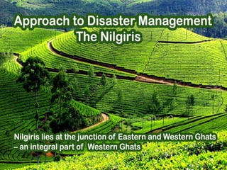
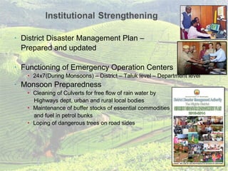
Nilgiris lies at the junction of Eastern and Western Ghats
– an integral part of Western Ghats
 At an altitude of 900 Meters- 2636 Meters
 Most habitations lie on the mountain range
 Multi hazard prone
 Disasters like earthquake (zone 3), Heavy downpour,
Landslide, Hailstorm, Flash flood
.
Landslide Zonation Map- Moderately High HazardLandslide Zonation Map- Moderately High Hazard
( Source. Geologic Survey of India (GSI).
.
Highly landslide prone area - Red dots indicate the places where landslides occurred
• 106 vulnerable locations identified by GSI in the Nilgiris
• Recorded history of landslides from 1891
 Last in 2009, loss of 46 lives
 Change in nature of disasters
 Hailstorm in 2012- 6 inch thick carpet
of hailstones at Doddabetta Thumanatty
• Shift in focus of the GOI – UNDP initiated Community Based
Programme from Disaster Risk Management Programme to
Disaster Risk Reduction Programme
• District Disaster Management Plan –
Prepared and updated
• Functioning of Emergency Operation Centers
• 24x7(During Monsoons) – District – Taluk level – Department level
• Monsoon Preparedness
• Cleaning of Culverts for free flow of rain water by
Highways dept, urban and rural local bodies
• Maintenance of buffer stocks of essential commodities
and fuel in petrol bunks
• Loping of dangerous trees on road sides
• Enabling the field level functionaries
• Supply of specialised vehicles ,emergency kits , wireless
power saw, etc – funds from State Govt, HADP.
• Safe Shelters
• Increased from 89 to 957 (with habitation wise coordinates)
• Village Level DM leaders
• Akin to booth level officers in election scenario-
volunteers training -tie up with IRCS
• Regular monitoring of IMD warnings
• Dissemination of warnings to lower level
• Simple Warning System
• Connecting the last Mile – New Approach
• Can be operated from Emergency Managers
end to the village through mobile phone
• Pilot Project in 35 Habitations under HADP funding
• Coordination/ Training/ Mock drill with Inter
departments, 6th
battalion, MRC, Cordite Factory ,
• District Level Training
For officials and NGOs
• Village Level Trainings
Certificates issued to Volunteers
• Training for all stake holders
• Observation of International
Day for Disaster Reduction (Oct 13th )
Competitions in Schools and Colleges
- extensive use of electronic media
• Mock drills
Village Level and School Level
• Identification of vulnerable locations
• Relocated 47 families
from places like Allanchi , Marapalam
• Hill Area Building rules followed
Master Plan, Geo-tech Rules
• Soil conservation measures
Retaining Wall, Geo mat (Jute), Gabion structures
• Controlling the usage of Earth movers & JCB (prior
permission of DC required , usage for Agri purpose
completely banned ), Mining (banned)
Loose boulder check
Cost effective terracing
using vegetative barrier
RR supporting wall protecting the road side
Achanacal - After treatmentAchanacal Landslide scar -
Approaches to Disaster Management in the Nilgiris, Tamil Nadu.

Approaches to Disaster Management in the Nilgiris, Tamil Nadu.

  • 1.
    Nilgiris lies atthe junction of Eastern and Western Ghats – an integral part of Western Ghats
  • 2.
     At analtitude of 900 Meters- 2636 Meters  Most habitations lie on the mountain range  Multi hazard prone  Disasters like earthquake (zone 3), Heavy downpour, Landslide, Hailstorm, Flash flood
  • 3.
    . Landslide Zonation Map-Moderately High HazardLandslide Zonation Map- Moderately High Hazard ( Source. Geologic Survey of India (GSI). . Highly landslide prone area - Red dots indicate the places where landslides occurred
  • 4.
    • 106 vulnerablelocations identified by GSI in the Nilgiris • Recorded history of landslides from 1891  Last in 2009, loss of 46 lives  Change in nature of disasters  Hailstorm in 2012- 6 inch thick carpet of hailstones at Doddabetta Thumanatty
  • 5.
    • Shift infocus of the GOI – UNDP initiated Community Based Programme from Disaster Risk Management Programme to Disaster Risk Reduction Programme
  • 6.
    • District DisasterManagement Plan – Prepared and updated • Functioning of Emergency Operation Centers • 24x7(During Monsoons) – District – Taluk level – Department level • Monsoon Preparedness • Cleaning of Culverts for free flow of rain water by Highways dept, urban and rural local bodies • Maintenance of buffer stocks of essential commodities and fuel in petrol bunks • Loping of dangerous trees on road sides
  • 7.
    • Enabling thefield level functionaries • Supply of specialised vehicles ,emergency kits , wireless power saw, etc – funds from State Govt, HADP. • Safe Shelters • Increased from 89 to 957 (with habitation wise coordinates) • Village Level DM leaders • Akin to booth level officers in election scenario- volunteers training -tie up with IRCS • Regular monitoring of IMD warnings • Dissemination of warnings to lower level • Simple Warning System • Connecting the last Mile – New Approach • Can be operated from Emergency Managers end to the village through mobile phone • Pilot Project in 35 Habitations under HADP funding • Coordination/ Training/ Mock drill with Inter departments, 6th battalion, MRC, Cordite Factory ,
  • 8.
    • District LevelTraining For officials and NGOs • Village Level Trainings Certificates issued to Volunteers • Training for all stake holders • Observation of International Day for Disaster Reduction (Oct 13th ) Competitions in Schools and Colleges - extensive use of electronic media • Mock drills Village Level and School Level
  • 9.
    • Identification ofvulnerable locations • Relocated 47 families from places like Allanchi , Marapalam • Hill Area Building rules followed Master Plan, Geo-tech Rules • Soil conservation measures Retaining Wall, Geo mat (Jute), Gabion structures • Controlling the usage of Earth movers & JCB (prior permission of DC required , usage for Agri purpose completely banned ), Mining (banned) Loose boulder check Cost effective terracing using vegetative barrier RR supporting wall protecting the road side Achanacal - After treatmentAchanacal Landslide scar -