NDGISUC2017 - Bringing Remote Sensing Data to your GIS Application
•
1 like•144 views

The document discusses how remote sensing data from satellites can be brought into GIS applications, noting that moderate resolution data from instruments like MODIS and VIIRS as well as higher resolution ASTER imagery are available from the Land Processes Distributed Active Archive Center. It describes GIS-friendly formats and services like web map services that allow this satellite imagery and derived data layers to be directly used in GIS software, and provides examples of applications like AppEEARS that allow users to extract and explore time series data.

Recommended
Recommended
More Related Content
What's hot
What's hot (18)
Similar to NDGISUC2017 - Bringing Remote Sensing Data to your GIS Application
Similar to NDGISUC2017 - Bringing Remote Sensing Data to your GIS Application (20)
More from North Dakota GIS Hub
More from North Dakota GIS Hub (20)
Recently uploaded
Recently uploaded (20)
NDGISUC2017 - Bringing Remote Sensing Data to your GIS Application
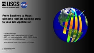
- 1. From Satellites to Maps: Bringing Remote Sensing Data to your GIS Application Lindsey Harriman NASA LP DAAC Science Integration Lead SGT, Inc., contractor to the USGS EROS Center lindsey.harriman.ctr@usgs.gov *Work performed under USGS contract G15PD00467
- 2. 2
- 4. So where can I get these data?
- 5. Land Processes Distributed Active Archive Center LP DAAC Surface Reflectance, Land Cover, Vegetation Indices Land Processes Distributed Active Archive Center
- 7. Moderate Resolution Imaging Spectroradiometer (MODIS)
- 8. Visible Infrared Imaging Radiometer Suite (VIIRS)
- 9. Advanced Spaceborne Thermal Emission and Reflection Radiometer (ASTER)
- 10. Bringing to Data to GIS • GIS Services •MODIS Web Map Service (WMS) •Ongoing development for Web Coverage Service (WCS) • GIS-Friendly Formats •Georeferenced, full resolution ASTER imagery (GeoTIFF) •Time series MODIS, SRTM, WELD, and Population data from the Application for Extracting and Exploring Analysis Ready Samples (AppEEARS) (GeoTIFF, NetCDF4)
- 11. Web Map Service (WMS) • Available for a selection of MODIS datasets • Expanding data offerings in future • Rolling one-year basis • Works in ArcGIS, QGIS, browser – or consume for your own application! • Access information: https://lpdaac.usgs.gov/data_access/web_map_ser vices_wms
- 18. ASTER L1T Full Resolution Browse Characteristics • 15 meter, visible browse image • 90 meter, thermal browse image • GeoTIFF in UTM projection • Terrain corrected Uses • Visual inspection of change or disaster event • Digitizing land features • Digitizing infrastructure • Base map Download from: NASA Earthdata Search: https://search.earthdata.nasa.gov/ USGS EarthExplorer: https://earthexplorer.usgs.gov/
- 19. Visible and Near Infrared (VNIR) Thermal Infrared (TIR)
- 20. AppEEARS (Application for Extracting and Exploring Analysis Ready Samples)
- 21. Data available in AppEEARS
- 22. AppEEARS Point Sampler User input: Coordinate pairs • Set temporal constraint • Select individual data layers • Automatically receive decoded quality information
- 24. AppEEARS Area Sampler User input: Polygons • Set temporal constraint • Select individual data layers • Reformat • Reproject • Automatically mosaic • Automatically receive decoded quality information
- 26. Questions? List serv: https://lists.nasa.gov/mailman/listinfo/lpdaac Website: https://lpdaac.usgs.gov