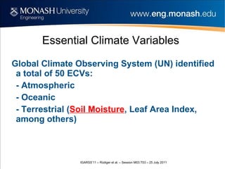
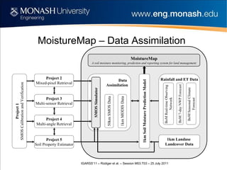
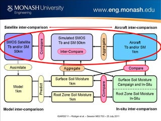
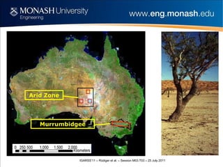
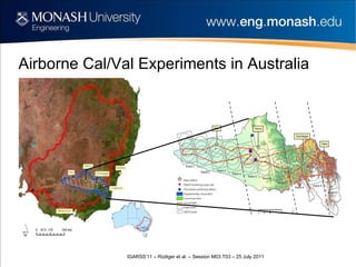
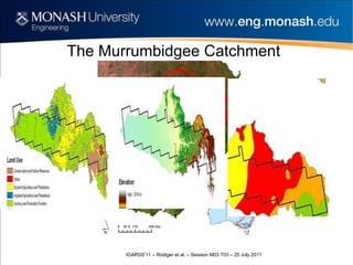
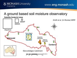
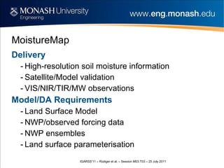
Christoph Rüdiger, Jeffrey Walker Dept of Civil Engineering, Monash University, Australia Yann Kerr, Arnaud Mialon, Olivier Merlin Centre d’Etudes Spatiales de la Biosphère (CESBIO), France Ed Kim NASA Goddard Space Flight Center, USA Validation of SMOS L1c and L2 Products with Airborne and In-situ Observations across Australia
Environmental conditions in Australia
Essential Climate Variables Global Climate Observing System (UN) identified a total of 50 ECVs: - Atmospheric - Oceanic - Terrestrial ( Soil Moisture , Leaf Area Index, among others)
General Motivation
MoistureMap – Data Assimilation
MoistureMap – An Overview
Arid Zone Murrumbidgee
Airborne Cal/Val Experiments in Australia
Flight track coverage
An airborne SMOS/Aquarius/SMAP simulator 6 x Skye VIS/NIR/SWIR Spectrometers 6 x Everest Thermal IR’s L-band Radiometer L-band Radar PLIS TIR + Spectral MODIS SMOS SMAP/Aquarius
AACES field campaigns: validation data Vegetation water content biomass type LAI spectral HDAS soil moisture vegetation type vegetation height rock fraction dew amount
www.moisturemap.monash.edu.au/AACES
AACES Summer 2010
L-MEB Predictions h-pol v-pol 9.1 (3.4) K 7.7 (2.5) K 5.9 (0.9) K 4.8 (0.5) K
Level 1c Analysis Polarization v-pol h-pol Incidence angle 22° 38° 22° 38° Bias [K] 8.2 9.0 11.3 11.7 RMSE [K] 10.8 10.7 12.6 13.6 (bias corrected)  RMSE [K] 7.1 5.9 5.5 7.0
Spatial Coverage Requirements
Level 2 Analysis Season All Summer Winter Bias [vol-%] -7.6 -5.0 -14.9 RMSE [vol-%] 11.8 10.1 15.7 (bias corrected)  RMSE [vol-%] 9.1 8.8 9.1
Future Work Bias correction PLMR SM retrieval Complete subpixel variability analysis Work on L-MEB parameterization (use of high-resolution data)
Thanks
The Murrumbidgee Catchment
A ground based soil moisture observatory Aquarius SMOS SMAP Smith et al. (In Review) WRR Satellite footprint sizes Canberra Balranald
MoistureMap Delivery High-resolution soil moisture information Satellite/Model validation VIS/NIR/TIR/MW observations Model/DA Requirements Land Surface Model NWP/observed forcing data NWP ensembles Land surface parameterisation

igarss11_rudiger.ppt

Editor's Notes

  • #7 Describe different aspects of MoistureMap – from airborne cal/val over the different studies to model validation and assimilation
  • #8 Start talking about the need for calibration and validation targets. Mention Dome C, Rainforest, Ocean, Deserts Lead into the past and future campaigns for SMOS, SMAP (Aquarius) Say that the areas are as large as West Virginia or Croatia
  • #11 Since we have not until recently had a satellite mission in space, and because of the need to both develop the satellite algorithms prior to launch and then validate them after launch, we have developed an airborne simulator as shown here, which can be flown with a number of other ancillary instruments, such as those indicated here. In the remainder of this talk, I will limit myself mostly to our work on SMOS, but will also touch on some of the SMAP work that is getting underway
  • #13 Add a screen shot of the AACES website with web address (make sure we get password protection working before I arrive please). I would also like to include here YeNan’s KML file so that I can navigate around it to demonstrate the data we collected (roughness, veg, ASD, stations, HDAS etc), even if only for 1 or two patches completed at this stage …
  • #22 Validation of satellite (and aircraft) products requires extensive ground monitoring. Especially when they have footprints sizes as shown here. We have established a Murrumbidgee wide network (38 stations) specifically designed for satellite validation. Each of these stations measures soil mositure of the top 5cm for satellite/aircraft and rootzone for model validation.