
More Related Content
What's hot
What's hot (20)
Viewers also liked
Viewers also liked (20)
Similar to Nagarahole
Similar to Nagarahole (20)
Recently uploaded
Recently uploaded (20)
Nagarahole
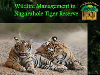
- 1. Wildlife Management in Nagarahole Tiger Reserve
- 2. Protected Areas of Western Ghats Nagarahole- Bandipur- Mudumalai- Wayanad tiger conservation landscape NTR- Vital connecting link…
- 4. Landscape dynamics of Kodagu district in (a) 1977, (b) 1997, and (c) 2007. The map from 1977 is derived from Landsat images, and maps from 1997 and 2007 are from IRS P6 LISS III images. In all cases, land uses were reclassified by manual digitization. The expansion of coffee cultivation has taken place predominantly on privately owned land. The area under forest is formally controlled by the state forest department (both reserve forests and protected areas) and has remained largely intact.
- 7. Location: 1. Nestled in the foot hills of Western Ghats, where the Western Ghats meets the Deccan plains on the eastern side. 2. Total area is 643.39 km2 spread over Mysore (354.96 km2) and Kodagu District (288.43 km2). Nagarahole Tiger Reserve Named after River ‘Nagarahole’ (‘Serpent River’).
- 8. 1. Tropical Semi-evergreen Forests 2. Tropical Moist Deciduous Forests 3. Tropical Dry Deciduous Forests 4. Swamps (Hadlus) Major Vegetation types of Nagarahole T
- 9. 1. Largest population of breeding tigers Density: 12.08/100 km2 (CWS Report 2013)
- 10. 2. Worlds Largest Congregation of Asiatic elephants in Kabini Back waters Density: 2.05/km2 Sex Ratio: 1:2.41 (KFD 2012)
- 11. 3. Co-existence of Top Predators
- 12. Herbivores Density (No/km 2) Spotted deer 29.84 Sambar 3.57 Gaur 3.69 Muntjack 2.42 Wild Pig 2.09 Principal Prey 41.61 4. High density of prey species ( Presence of Hadlu). (CWS Report 2013)
- 13. 5. Catchment for three major rivers (Nagarahole, Lakshmanthirtha & Kabini).
- 14. 1. •Protection (Poaching, illegal timber cutting, fire, grazing & disease) 2. • Habitat Management 3. • Tribal Relocation & Rehabilitation. 4. • Tourism Management 5. • Mitigation of Human Animal Conflict 6 6. • Monitoring of Animal Population Major Activities of Nagarahole
- 16. FOREST PROTECTION • Total executive staff in N.T.R. San. strength Filled Vacant – R.F.O. 9 8 1 – Forester 33 26 7 – Forest Guard 106 87 19 – Forester Watcher 81 79 2 TOTAL 229 200 29 • Anti-Poaching Camps – 27 Camps. • Good wireless communication system. • STPF fully functional 16
- 17. Sl. No Year No. of Poaching Cases (in no’s) Remarks 1 2002-03 23 - 2 2003-04 15 Tiger Nail missing 3 2004-05 14 - 4 2005-06 06 - 5 2006-07 08 Tiger Skin 6 2007-08 07 - 7 2008-09 08 - 8 2009-10 13 Tiger bone & Skin 9 2010-11 08 - 10 2011-12 06 - 11. 2012-13 0 - 12. 2013-14 0 - 13. 2014-15 0 - Poaching cases registered at Nagarahole TR for the last ten years
- 18. Protection against Poaching & illegal timber cutting 28 APC located at strategic points inside NTR
- 20. d. STPF deployed on sensitive locations & Emergency situations
- 21. e. Periodic surveillances outside the TR & Anti-snare drive
- 22. Protection against Fire Preventive measures: Fire line S. No. Wildlife Range Fire line (km)
- 23. Fire line cutting and control burning (at s
- 24. Snap Shot of Fire Burnt Area
- 25. Special Drive: Sowing of Bamboo seeds in the Fire burnt area of Nagarahole Range
- 27. Protection against Grazing 1. There are more than 50,000 cattle living around Nagarahole. 2. Some of tribal Haadis inside Nagarahole TR also have cattle 3. With strict protection Cattle grazing is reduced drastically, but not stopped completely. 4. Because of solar fencing cattle grazing was controlled to great extent in the Antharasanthe and DB Kuppe ranges.
- 28. Protection against Zoonotic DiseasesVaccination to all cattle present around the NTR . 60 village covering 15-20000 cattle (HD Kote taluk). 24 village covering 8-10000 cattle (Hunsur taluk). Normally done twice a year during Feb- March & Aug-Sept. Vaccination against FMD, Brucellosis, Black Quarter (cattle) & against Entro-toxemia.
- 29. CREATION OF IMMUNITY BELT AROUND NAGARAHOLE TIGER RESERVE (VACCINATION OF CATTLE TO SURROUNDING VILLAGE) DURING 2013-14 Name of the Wildlife Range No. of Cattle No. of Goat & Sheep Total Anechowkur 5,360 1,836 7,196 Veeranahosahally 7,024 2,481 9,505 Total 12,384 4,317 16,701
- 31. Protection against traffic along public roads1. There are 3 major roads pass across Nagarahole TR a. Mysore-Manantavady road b. Hunsur-Kutta road c. H.D.Kotte-Kallahatti-Murkal-Karmad- Gonikoppal road 2. Traffic will be closed between 6 P.M to 6 A.M 3. Sufficient number of speed breakers on all roads. 4. Signage boards are placed at suitable places. 5. Recently CCTV has been installed in one gate.
- 33. a. De-silting of water holes b. Maintenance of Hadlus/marshy swamp c. Removal of lantana at Nagarahole range on experimental basis in a small area during 2014 Habitat Management Activities
- 36. Captured / rescued tigers / leopards in Nagarahole Tiger Reserve Name of the place & wildlife range Date of capture / rescue Species Sex Age Remarks Boodanoor Village by Antharasanthe Range 26/08/2012 Tiger Male 12 Yrs Tranquilized with help of captive elephant
- 37. Captured / rescued tigers / leopards in Nagarahole Tiger Reserve Name of the place & wildlife range Date of capture / rescue Species Sex Age Remarks Coffee Estate of Kottagere Village by Kallahalla Range 04/12/2012 Tiger Female 3 Yrs Left knee joint struck with barbed wire & Tranquilized
- 38. Captured / rescued tigers / leopards in Nagarahole Tiger Reserve Name of the place & wildlife range Date of capture / rescue Species Sex Age Remarks Madanayakanahally Village in Antharasanthe Range 17/01/2013 Tiger Male 11 Yrs Tranquilized with help of captive elephant
- 39. Human Concerns: Property & Life Crop Damage Cattle Kill Human Injury
- 40. Major Strategies in Mitigation of Human- Elephant Conflict 1. Creation & Restoration of Elephant Proof Trench 2. Installation & Effective maintenance of SPF. 3. Construction of size stone masonry wall / rubble stone masonry walls / erection of barricade using railway rails on weak points along the EPT. 4. Timely payment of compensation for crop damage, human injury or human death.
- 41. 5. Scaring of elephants, back into the forests by engaging local villagers for elephant scaring team during night time. 6. Spreading public awareness regarding elephant conservation and do’s & dont’s when elephants stray into human habitations/crop fields. Other Strategies in Mitigation of Human-Elephant Conflict.
- 42. 7. Elephant Habitat improvement to contain them inside their habitat. Improved water availability in the park by de-silting of waterholes. Controlling domestic live stock grazing inside the park Protection of Natural habitats of Elephant (Bamboo regeneration). Sowing of Bamboo seeds
- 43. S. No Description Length (Kms) 1. Border Area of Nagarahole Tiger Reserve 226.00 2. Border with Taraka and Kabini Back Water 45.00 3. Inter State Boundary (Kerala) 15.00 4. Boundary with Forest areas ( Virajpet and Hunsur territorial Division) 10.00 5. Boundary with coffee estate in Coorg district 71.10 6. Boundary with adjoining villages 84.90 *** Number of villages located along the border areas of NTR: 125 Villages Border Areas & Land use Pattern around NTR Coffee Estate NTR RF/SF Villages Land use pattern around NTR Reason behind Human-Animal conflict Rehabilitation site
- 53. HUMAN DEATH DUE TO ELEPHANTS IN NAGARHOLE TIGER RESERVE YEAR HUNSUR H D KOTE VIRAJPET 2010 - 2011 NIL NIL 1 2011 - 2012 1 NIL NIL 2012 - 2013 NIL NIL 4 2013 – 2014 NIL NIL NIL 2014 – 2015 NIL NIL 1
- 54. HUMAN INJURY DUE TO ELEPHANTS IN NAGARHOLE TIGER RESERVE YEAR HUNSUR H D KOTE VIRAJPET 2010 - 11 NIL 2 5 2011 - 12 NIL 3 3 2012 - 13 NIL 8 1 2013 – 14 NIL 1 4 2014-15 1 NIL 1
- 55. ELEPHANT DEATHS S.NO. YEAR NATURAL DEATHS DEATH DUE TO GUN SHOTS DEATH DUE TO ELECTROCUTION 1 2010 - 11 15 2 NIL 2 2011 - 12 29 1 NIL 3 2012 - 13 51 1 1 4 2013 - 14 24 NIL NIL 5 2014-15 15 NIL NIL
- 56. CROP DAMAGE DUE TO ELEPHANTS YEAR HUNSUR H D KOTE VIRAJPET TOTAL 2010 - 11 402 (RS 11,74,494) 763 (RS 27,41,363) 472 (RS 18,82,864) 1,637 (RS 57,98,721) 2011 - 12 264 (RS 9,52,030) 670 (RS 48,98,893) 544 (RS 26,36,631) 1,478 (RS 84,87,554) 2012 - 13 292 (RS 10,17,260) 686 (RS 18,74,357) 761 (RS 43,67,340) 1,739 (RS 72,58,957) 2013 – 14 657 (RS 18,42,020) 640 (RS 14,38,020) 611 (RS 33,78,735) 1,908 (RS 66,58,775) 2014 – 15 262 (RS 8,10,867) 235 (RS 4,10,045) 460 (RS 20,93,461) 957 (RS 33,14,373) TOTAL RS 3,15,18,380/- including RS 5,57,012/- pending payment
- 57. NUMBER OF VILLAGES AFFECTED DUE TO ELEPHANTS 0 10 20 30 40 50 60 70 80 90 100 2011-12 2012-13 2013-14 2014-15 98 95 91 68 Total Number of Villages Around Nagarahole Tiger Reserve – 125 Villages No. of Villages Affected
- 59. Voluntary Tribal Relocation & Rehabilitation
- 60. Nagapura Tribal Rehabilitation S. No Name of Relocated site Year of Relocation No of families rehabilitated No of persons rehabilitated Scheme 1 Block – 1 1999-2000 50 199 BOTD * 2 Block – 2 2001-2002 45 185 BOTD 3 Block – 3 2000-2001 45 200 BOTD 4 Block – 4 2000-2001 55 220 BOTD 5 Block – 5 2000-2001 55 220 BOTD 6 Block - 6 2006-2007 30 95 CSS Project Tiger * BOTD- Beneficiary Oriented Tribal Development scheme
- 62. Sollepura Tribal Rehabilitation S. No Name of Relocated site Year of Relocation No of families rehabilitated No of persons rehabilitated Scheme 1 Block - 1 2007-2008 60 203 CSS Project Tiger
- 64. Shettyhally-Lakkapattana Block I Tribal Rehabilitation (Under Option II) S. No Name of Relocated site Year of Relocation No of families rehabilitated No of persons rehabilitated Scheme 1 Block - 1 2010-2011 & 2014-15 150 594 CSS Project Tiger
- 65. From Dark to Light…(Shettyhally- Block I)
- 67. Shettyhally Rehabilitation area Individual House Modified by the Tribes themselves.
- 68. Shettihalli Rehabilitation area (Nov 2010) Agriculture Operation done completely by Tribes themselves (2012)
- 69. Present Status of Human Settlements in TR S. No Name of the District No. of Tribal Haadis inside CTH Individual rights to be settled under FRA* Individual rights settled under FRA Balance Eligible family as per NTCA Guidelines * 1. Mysore 12 347 314 33 502 2. Kodagu 21 935 557 378 1198 Total : 33 1282 871 411 1700 * Subject to change after thorough verification
- 70. The proposed package has two options Option I – Payment of the entire package amount (Rs. 10 lakhs per family) to the family in case the family opts so, without involving any rehabilitation / relocation process by the Forest Department. Option II – Carrying out relocation / rehabilitation of village from protected area / tiger reserve by the Forest Department. (a) Agriculture land procurement (3 Acres) and development 35% of the total package (b) Settlement of rights 30% of the total package (c) Homestead land and house construction 20% of the total package (d) Incentive 5% of the total package (e) Community facilities commuted by the family (access road, irrigation, drinking water, sanitation, electricity, tele-communication, community center, religious places of worship, burial/cremation ground) 10% of the total package
- 71. Human Settlements in the interior areas of TR (Phase-I) S. No Name of the District No. of Tribal Haadis inside CTH Individual rights to be settled under FRA* Individual rights settled under FRA Balance Eligible family as per NTCA Guidelines * 1. Mysore 11 257 246 11 407 2. Kodagu 10 398 259 139 493 Total : 21 655 505 150 900 •Subject to change after thorough verification - Out of the 23 haadis, Individual Forest Rights have been settled completely in 12 haadis.
- 72. Human Settlements on the fringe of TR (Phase-II) S. No Name of the District No. of Tribal Haadis inside CTH Individual rights to be settled under FRA* Individual rights settled under FRA Balance Eligible family as per NTCA Guidelines * 1. Mysore 1 90 68 22 95 2. Kodagu 11 537 298 239 705 Total : 12 627 366 261 800 * Subject to change after through verification
- 73. Shettyhally-Lakkapattana Block -2 (Heballa) Tribal Rehabilitation S. No Name of Relocated site Year of Relocation No of houses ready Scheme 1 Block - 2 126 tribal families are relocated during 2014 & 2015 130 CSS Project Tiger
- 74. Providing LPG connection to fringe villages Year No. of Connection Distributed 2011-12 760 Nos. 2012-13 369 Nos. 2013-14 1627 Nos. 2014-15 263 Nos.
- 75. Monitoring the Tiger Population using camera traps- A CSR INITIATIVE BY CSS CORP- 200 PAIRS OF CAMERA WORTH RS.85 LAKHS HAS BEEN GIVEN UNDER CSR TO NTCF
- 76. Phase IV Tiger Monitoring 1. Carnivore Sign Survey is in progress. 2. Installation of 198 pairs of cameras. 3. Grid (2 x 2 km) is ready for sampling (placing camera). 4. Camera trap are fixed & data collected.
- 77. Tiger Monitoring through Camera Trapping
- 78. Tiger Monitoring through Camera Trapping
- 79. Tiger Monitoring through Camera Trapping
- 80. Tiger Monitoring through Camera Trapping
- 81. Tiger Monitoring through Camera Trapping
- 82. 82 .