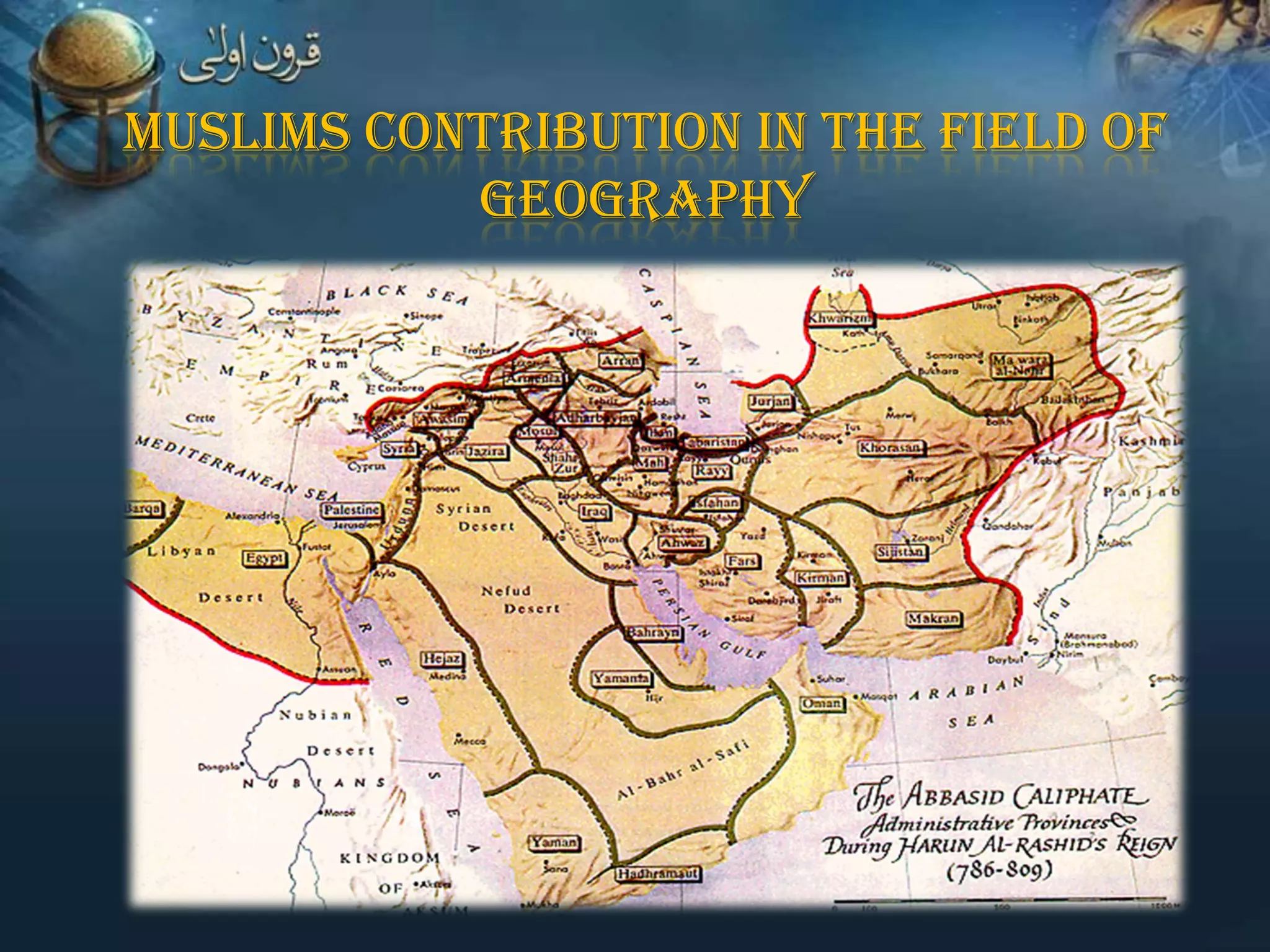
MUSLIMS CONTRIBUTION IN THE FIELD OF
GEOGRAPHY
Muslims' great concern for geography
originated with their religion.
Islam requires each Muslim to have at least enough
knowledge of geography to know the direction of the Qiblah
Pilgrimage as well as commerce in the vast Muslim
empire needed communication
From the beginning of the seventh century, the knowledge
of geography was equally growing with the spread of Islam
Thousands of Muslim coins, discovered in the
excavations of Scandinavia, Finland, Russia, Kazan, etc
Al-Khwārizmī's (780-850)


He was born in Baghdad,
Iraq.



His major work is Kitāb
ṣūrat al-Arḍ (Arabic: ‫كتاب‬
" ‫صورة األرض‬Book on the
appearance of the Earth" or
"The image of the Earth"
Al-Khwārizmī corrected Ptolemy's gross overestimate
for the length of the Mediterranean Sea
(from the Canary Islands to the eastern shores of the Mediterranean)
Al-Khwārizmī depicted the Atlantic and Indian Oceans as
open bodies of water, not land-locked seas as of Ptolemy
Abdullah al-Mamun
(786-833)
He was the seventh caliph,
or ruler of the Islamic Empire,
of the Abbasid dynasty
He ordered geodetic
measurements, to
determine the size of the earth,
and the drawing of a large map
of the world
Abu al-Hasan Ali ibn al-Husayn al-Masudi
(896-956)


He was an Abbasid-era Arab
historian based in Baghdad



He traveled the world
journeying from Persia,
Central Asia, India, the Near
East, Madagascar and the
China Sea
Al-Masudi’s book:
Muruj adh-Dhahab
(Meadows of gold)
is a compilation of his
travel observations and
studies
Muhammad ibn Ahmad Shams al-Din Al-Muqaddasi
(946-1000, Jerusalem)

He was author of :
"Ahsan al-Taqasim fi Ma`rifat il-Aqalim"
(The Best Divisions for Knowledge of the Regions)

His book gives a systematic account of all the places and
regions he had visited


Al-Muqaddasi was the first
geographer to produce
maps in natural colors



The Arab-Muslim maps
point upwards to the South,
the North downwards



The maritime voyages
necessitated the tables of
Latitude and Longitude as
well as the use of the
astrolabe and other nautical
instruments
Abu Rayhan al-Biruni
(973-1048, Kath [Uzbekistan] )

He is famous for
a)
Cartography
b)
Geodesy
c)
Mineralogy
Cartography
By the age of 22, Biruni had
written
including

several
a

short

study

of

works,
map

projections, Cartography, which

included a method for projecting
a hemisphere on a plane
Geodesy and geography




Al-Biruni is regarded as the
father of geodesy
He was the first known writer
to identify certain geological
facts, such as
The formation of sedimentary
rocks
 The great geological changes
that happened in the past

Mineralogy


Al-Biruni introduced the
scientific

method

into

mineralogy in his

Kitab al-Jawahir
(Book of Precious Stones)
Abū 'Ubayd 'Abd Allāh al-Bakrī
(1014-1094)


He was a SpanishArab geographer



He wrote about Europe,
North Africa, and the
Arabian peninsula

His primary work was:

a) Kitāb al-Masālik wa-al-Mamālik
("Book of Highways and of Kingdoms")

b) Mu'jam
 Al-Bakri work was

based on literature and

the reports of merchants
and travelers


Al-Bakri arranged place
names alphabetically,
and lists the names of
villages, towns, wadis,
and monuments which
he culled from the

Hadith
histories

and

from
Al Idrisi’s
(1099-1166, Ceuta –Spain)

His book:
‘Nuzhat al-Mushtaq fi Ikhtiraq al-Afaq,’
(The Delight of Him Who Desires to Journey
Through the Climates)

is a geographical encyclopedia
In 1166 Al-Idrisi, built a
large global map
He meticulously recorded on
it the seven continents
with trade routes, lakes
and rivers, major cities,
and plains and mountains.
Al-Idrisi’s books were translated into
Latin and became the standard
books on geography for three
centuries, both in the east and west
Ibn Battuta
(1304-1368, Tangier- Morocco)

He was the only medieval
traveler who is known to

have visited the lands of
every Muslim ruler of his

time.


•

Ibn Battuta lived by the
motto - 'never, if
possible, cover any road
a second time‘.
"Rihla - My Travels". Is the
story of Ibn Battuta’s
travels. It is a valuable
record of places.
Ibn Majid
(1430-1500, Julfar [UAE] )

He invented the compass in
the field of geography
Ibn Majid wrote several
books
on
marine
science
and
the
movements of ships,
which helped people of
the Persian Gulf to
reach the coasts of
India, East Africa and
other destinations


Ibn Majid’s most important
work was:

Kitab al-Fawa’id fi Usul

‘llmal-Bahr wa’l Qawa’id
(Book of Useful Information on the
Principles and Rules of Navigation)

written in 1490
It is a navigation encyclopedia
 Ibn

Majid’s Hawiyat, a poem of
some 1,082 verses, is a genuine
treasury of navigational theory

 Another

important book named
al-Urdjuza covering the same
subject


Ibn Majid’s rich
contribution to the affairs
of the sea benefited the
sciences of geography
and oceanography,
especially in the Indian
Ocean



In 1498, Vasco Da Gama,
while sailing up the east
coast of Africa met Ibn
Majid. His guidance to
Vasco Da Gama, led to
the downfall of Arab sea
power in the Indian Ocean
Discovery of the America is thought to have been
aided by Muslims’ contribution to Geography
E. Renan, in his book
Averroes and Averrosism,
mentions a letter written
by Columbus in October
1498 in which he admits
that one of the sources
which led him to assume
the existence of the 'New
World' was the work of Ibn
Rushd (Averroes) of the
12th century

Muslim Contributions in Geography

  • 1.
    MUSLIMS CONTRIBUTION INTHE FIELD OF GEOGRAPHY
  • 2.
    Muslims' great concernfor geography originated with their religion.
  • 3.
    Islam requires eachMuslim to have at least enough knowledge of geography to know the direction of the Qiblah
  • 4.
    Pilgrimage as wellas commerce in the vast Muslim empire needed communication
  • 5.
    From the beginningof the seventh century, the knowledge of geography was equally growing with the spread of Islam
  • 6.
    Thousands of Muslimcoins, discovered in the excavations of Scandinavia, Finland, Russia, Kazan, etc
  • 7.
    Al-Khwārizmī's (780-850)  He wasborn in Baghdad, Iraq.  His major work is Kitāb ṣūrat al-Arḍ (Arabic: ‫كتاب‬ " ‫صورة األرض‬Book on the appearance of the Earth" or "The image of the Earth"
  • 8.
    Al-Khwārizmī corrected Ptolemy'sgross overestimate for the length of the Mediterranean Sea (from the Canary Islands to the eastern shores of the Mediterranean)
  • 9.
    Al-Khwārizmī depicted theAtlantic and Indian Oceans as open bodies of water, not land-locked seas as of Ptolemy
  • 10.
    Abdullah al-Mamun (786-833) He wasthe seventh caliph, or ruler of the Islamic Empire, of the Abbasid dynasty He ordered geodetic measurements, to determine the size of the earth, and the drawing of a large map of the world
  • 11.
    Abu al-Hasan Aliibn al-Husayn al-Masudi (896-956)  He was an Abbasid-era Arab historian based in Baghdad  He traveled the world journeying from Persia, Central Asia, India, the Near East, Madagascar and the China Sea
  • 12.
    Al-Masudi’s book: Muruj adh-Dhahab (Meadowsof gold) is a compilation of his travel observations and studies
  • 13.
    Muhammad ibn AhmadShams al-Din Al-Muqaddasi (946-1000, Jerusalem) He was author of : "Ahsan al-Taqasim fi Ma`rifat il-Aqalim" (The Best Divisions for Knowledge of the Regions) His book gives a systematic account of all the places and regions he had visited
  • 14.
     Al-Muqaddasi was thefirst geographer to produce maps in natural colors  The Arab-Muslim maps point upwards to the South, the North downwards  The maritime voyages necessitated the tables of Latitude and Longitude as well as the use of the astrolabe and other nautical instruments
  • 15.
    Abu Rayhan al-Biruni (973-1048,Kath [Uzbekistan] ) He is famous for a) Cartography b) Geodesy c) Mineralogy
  • 16.
    Cartography By the ageof 22, Biruni had written including several a short study of works, map projections, Cartography, which included a method for projecting a hemisphere on a plane
  • 17.
    Geodesy and geography   Al-Biruniis regarded as the father of geodesy He was the first known writer to identify certain geological facts, such as The formation of sedimentary rocks  The great geological changes that happened in the past 
  • 18.
    Mineralogy  Al-Biruni introduced the scientific method into mineralogyin his Kitab al-Jawahir (Book of Precious Stones)
  • 19.
    Abū 'Ubayd 'AbdAllāh al-Bakrī (1014-1094)  He was a SpanishArab geographer  He wrote about Europe, North Africa, and the Arabian peninsula His primary work was: a) Kitāb al-Masālik wa-al-Mamālik ("Book of Highways and of Kingdoms") b) Mu'jam
  • 20.
     Al-Bakri workwas based on literature and the reports of merchants and travelers
  • 21.
     Al-Bakri arranged place namesalphabetically, and lists the names of villages, towns, wadis, and monuments which he culled from the Hadith histories and from
  • 22.
    Al Idrisi’s (1099-1166, Ceuta–Spain) His book: ‘Nuzhat al-Mushtaq fi Ikhtiraq al-Afaq,’ (The Delight of Him Who Desires to Journey Through the Climates) is a geographical encyclopedia
  • 23.
    In 1166 Al-Idrisi,built a large global map He meticulously recorded on it the seven continents with trade routes, lakes and rivers, major cities, and plains and mountains.
  • 24.
    Al-Idrisi’s books weretranslated into Latin and became the standard books on geography for three centuries, both in the east and west
  • 25.
    Ibn Battuta (1304-1368, Tangier-Morocco) He was the only medieval traveler who is known to have visited the lands of every Muslim ruler of his time.
  • 26.
     • Ibn Battuta livedby the motto - 'never, if possible, cover any road a second time‘. "Rihla - My Travels". Is the story of Ibn Battuta’s travels. It is a valuable record of places.
  • 27.
    Ibn Majid (1430-1500, Julfar[UAE] ) He invented the compass in the field of geography
  • 28.
    Ibn Majid wroteseveral books on marine science and the movements of ships, which helped people of the Persian Gulf to reach the coasts of India, East Africa and other destinations
  • 29.
     Ibn Majid’s mostimportant work was: Kitab al-Fawa’id fi Usul ‘llmal-Bahr wa’l Qawa’id (Book of Useful Information on the Principles and Rules of Navigation) written in 1490 It is a navigation encyclopedia
  • 30.
     Ibn Majid’s Hawiyat,a poem of some 1,082 verses, is a genuine treasury of navigational theory  Another important book named al-Urdjuza covering the same subject
  • 31.
     Ibn Majid’s rich contributionto the affairs of the sea benefited the sciences of geography and oceanography, especially in the Indian Ocean  In 1498, Vasco Da Gama, while sailing up the east coast of Africa met Ibn Majid. His guidance to Vasco Da Gama, led to the downfall of Arab sea power in the Indian Ocean
  • 32.
    Discovery of theAmerica is thought to have been aided by Muslims’ contribution to Geography E. Renan, in his book Averroes and Averrosism, mentions a letter written by Columbus in October 1498 in which he admits that one of the sources which led him to assume the existence of the 'New World' was the work of Ibn Rushd (Averroes) of the 12th century