The document discusses criticisms of and suggestions for improving the recently proposed Mumbai Development Plan 2034. It summarizes the views of several prominent architects and urban planners. They argue that while the plan proposed some positive changes like liberalizing floor space norms, it failed to address major issues and ignored the realities of the city. It did not properly consider areas under other authorities' control or issues like affordable housing and redevelopment. The experts call for engaging key stakeholders, addressing infrastructure needs, and planning for the city's long-term growth while coordinating with other development authorities.
The Mumbai Metropolitan Region extends over an area of 4355 sq. km and comprises Municipal Corporations of Greater Mumbai, Thane, Kalyan, Navi Mumbai and Ulhasnagar; 15 municipal towns; 7 non-municipal urban centers; and 995 villages. Its administrative limits cover Mumbai City and Mumbai Suburban Districts, and parts of Thane and Raigad District. There are 40 Planning Authorities in the Region that are responsible for the micro-level planning of the different areas.
This presentation was given by COE Pune for "Samavesh" - XVl Annual NOSPlan Convention. The Theme of Presentation - "Accessibility in Peri-urban area".
Chennai the fourth largest metropolis in India. Chennai Metropolitan Area (CMA) extends over 1189 sq.km.and comprises of
Chennai Corporation,
16 Municipalities,
20 Town Panchayats and
214 villages covered in 10 Panchayats Unions
It encompasses the Chennai District (176 sq.km.), part of Thiruvallur District (637 sq.km.) and a part of Kancheepuram District (376 sq.km.).
This presentation was given by SPA Delhi for "Samavesh" - XVl Annual NOSPlan Convention. The Theme of Presentation - "Accessibility in Peri-urban area".
This presentation covers major topics related to urban terminologies, issues faced in urban areas and how can those problem can be solved; as a example "Chandni Chowk" area of Delhi is explained.
Chennai the fourth largest metropolis in India. Chennai Metropolitan Area (CMA) extends over 1189 sq.km.and comprises of
Chennai Corporation,
16 Municipalities,
20 Town Panchayats and
214 villages covered in 10 Panchayats Unions
It encompasses the Chennai District (176 sq.km.), part of Thiruvallur District (637 sq.km.) and a part of Kancheepuram District (376 sq.km.).
Urban morphology approaches human settlements as generally unconscious products that
emerge over long periods, through the accrual of successive generations of building activity.
This leaves traces that serve to structure subsequent building activity and provide
opportunities and constraints for city-building processes, such as land subdivision,
infrastructure development, or building construction. Articulating and analysing the logic of
these traces is the central question of urban morphology. Urban morphology is not generally
object-centered, in that it emphasizes the relationships between components of the city. We
will be discussing in detail about the urban morphology of the Chennai metropolitan.
Prop Tiger Navi Mumbai Residential Analysis Jan 2014PROPTIGER
Navi Mumbai, a sister city of Mumbai had seen huge real estate activity in past few years. Two localities within Navi Mumbai - Panvel and Ulwe had shown a lot of promise. But current real estate scenario in Navi Mumbai is bad as the promised infrastructure is delayed or cancelled.
Presentation describes the journey of Chandigarh Master Plan right from its inception and tries to bring out facts which have gone into making of the Master Plan of 2013
Problems in metropolitan cities by vakharia_siddhiSiddhi Vakharia
Problems in metropolitan cities graduate report under smart metropolitan planning subject in masters of Town and Country planning. 11 major problems of metropolitan cities in India
Presentation to MCGM regarding Mumbai Development Plan 2014-34 - SWMRishi Aggarwal
This is a presentation made to the Municipal Corporation of Greater Mumbai on 21st January 2014 to apprise them of views about how land use should be done keeping solid waste management processes in mind.
This PPT attempts to explore one of the ignored segment of Civil Engineering and explains how their bidding process works and why this segment is important for Banks & Financial Institutions to venture into. It emphasizes on Project Finance (Debt Syndication in this field)
Disaster Management Training Seminar, A Citizen's Empowerment Initiative by Rotary Club of Mumbai Lakers supported by Hiranandani Construction and MCGM. Presentation of the seminar held on 21st February 2010 at Olympia, Hiranandani Gardens, Powai, Mumbai - 400076
What is property tax in India? How it is calculated? How property tax or house tax is different from the income tax that is generated from the property by way of renting it out? Find all these answers in this document.
Challenges opportunities and way forward in making indian cities and citizens...ANIRBAN CHOUDHURY
This was presented by me during Panel Discussions on Captioned Topic during IoT India Congress – 2016 Bangalore, on 8th September 2016.
http://theiet.in/The_IET_announces_Indias_largest_conclave_on_the_Internet_of_Things%E2%80%93IoT_India_Congress_2016
It was a coincidence that during panel discussions I came across team from Deloitte and C44, instrumental in preparation of NTK's winning Smart City Proposal. For me it was one of the happiest moment for being in the same panel with current mentors, as I was involved with the NTK project from pre-takeoff to maturity stage.
In the captioned presentation I have highlighted the fact that NTK was designed with resiliant features, especially AA-1 of NTK and also how the AA-1D was made LEED Traditional Neighborhood Design compliant more than 1/2 a decade before it was formalized by USGBC, NRF & CNU. I have highlighted the salient features namely
(1) hierarchy of built & open spaces; habitats starting from neighborhoods- community -Towns with distinct boundary have been planned; socio-economic infrastructure has been planned in early 2000 that even fulfill the changed requirements of NBC2005 and UDPFI 2015. ;
(2) Though the city has been planned for inclusion of all class, creed & castes of the society, AA-1D has been designed for a well-diversified population (housing option) such that the SIMPSON Diversity index > 0.75.
(3) The hierarchy of roads and surface drainage were designed in such a way that it's having an inversely proportional relationship.
All the above resilience features were designed and built in the early 2000, 1/2 decade before Draft LEED TND of USGBC was published after 2005.
The structure of AA1D was designed to be resilient as it was meant to promote (a) Compact densification; (b) Scaling of a Traditional neighbourhood; (c) Fine Grain diversity
I have also highlighted the fact that what we have done in (terms of TND design) more than 1.5 decades back in the year 2000-01, is being replicated now as a Brownfeild Retrofit by Global Smart City Barcelona through creation of SMART SUPER BLOCKS ( we were ahead of time).
Also refer to linked-in posting " GREENFIELD URBAN RETROFIT - INSPIRED BY TRADITIONAL NEIGHBORHOOD DESIGN & URBAN PATTERN" for the story behind Smart Retrofit done by me for Action Area 1D in the year 2001.
https://www.linkedin.com/pulse/greenfield-urban-retrofit-inspired-traditional-design-choudhury?trk=pulse_spock-articles
PLANNING THE CAPITAL CITY OF CHANDIGARH : PROBLEMS, LESSONS AND PROSPECTSJIT KUMAR GUPTA
Paper, written about 30 years back, tried to analyse the problems and challenges facing the growth and development of the Capital city of Chandigarh and suggested mesues to make it more rational. Paper also suggests the messages which planning and designing of the city communicates
Town planning - A Tool to Promote Holistic Development of Human settlementsJIT KUMAR GUPTA
Writing is an attempt to briefly describe the context, role and importance of town planning in shaping the human settlements and make them more livable, sustainable and making value addition to human living and working.
Town planning - A Tool to Promote Holistic Development of Human settlementsJIT KUMAR GUPTA
Updated paper tries to bring out the context, role and importance of town planning to make this world a better place to live and work and to make human life more sustainable and efficient. It also tries to brief about the approach which needs adoption to make town planning a better profession.
Apart from successful & knowledge sharing events like CSR summit & seminar on electric mobility, here is how the month of August was for us:
Interaction with government delegates like Hon. minister Mr. Gangwar, IAS metropolitan commissioner Mr. Vikram Kumar; a web-meeting with senior officials in China, an event under HR-IR committee, and a session on rooftop solar, were a few key activities.
MCCIA News - August 2019!
Apart from successful & knowledge sharing events like CSR summit & seminar on electric mobility, here is how the month of August was for us:
Interaction with government delegates like Hon. minister Mr. Gangwar, IAS metropolitan commissioner Mr. Vikram Kumar; a web-meeting with senior officials in China; an event under HR-IR committee, and a session on rooftop solar, were a few key activities
Mumbai Real Estate Analysis 2019-2020 by HomebookingindiaHome Booking India
Real estate is one of the major contributors to India’s GDP, and the market saw several progressive policy reforms in the last couple of years. While it’s true that most of these reforms were taken back in 2017-2018, the impacts were seen largely in 2019-2020
Navi Mumbai is the world's largest planned city.pdfyamunaNMH
The twin city of Mumbai is also known as Navi Mumbai. This city, which is located in the western suburbs of Mumbai, was conceptualize by renowned urban planner and architect Charles Correa, structural engineer Pravina Mehta, and engineer Shirish Patel. Navi Mumbai, a recently built township, is a well-planned city with a strong infrastructure for its period.
Review of Development Plans/ Master Plans of selected cities of India.KARTHICK KRISHNA
This is an academic assignment done for the purpose to draft a master plan/ development plan. This helps us to identify the concept and context of the various plans and its development proposals applicability and replicability.
APLI Mumbai - A Port Lands Initiative By Citizens To Re-Imagine Mumbaiapliportlands
The re-development of the Port Lands offers a unique
opportunity to re-invent our city by creating the much
needed public infrastructure, utilities and public spaces
that we are so short of.
Of the total holding by Mumbai Port Trust of 734 ha, the
land available for development is approx 400 ha (1000
acres) excluding the Docks and operational areas (196
ha) and residential areas ( approx 100 ha). A legislative
framework to enable these lands to be re-possessed and
a financial model to re-develop these lands as a public
Private partnership with Mumbai’s Industrial &Corporate
Houses using CSR funds has been proposed in Annexure 4.
Our plans integrate the Port lands, with adjacent city
areas such as Sewri, Lalbaug, Byculla, Mazagon,
Dongri and Bhendi Bazaar, and provide Mumbaikars
much needed public amenities and public open spaces
which are critical for our city’s sustainable growth, as the
commercial and entrepreneurial heart of India.
We see this as a living document and will share this
widely in the public domain. Feedback from citizens and
citizens groups will be collated and shared with you from
time to time.
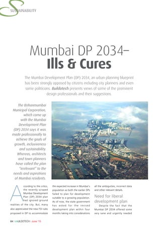
1. 64 l BUILDOTECH l June ’15
SSUSTAINABILITY
The Mumbai Development Plan (DP) 2034, an urban planning blueprint
has been strongly opposed by citizens including city planners and even
some politicians. Buildotech presents views of some of the prominent
design professionals and their suggestions.
Mumbai DP 2034–
Ills & Cures
A
ccording to the critics,
the recently scraped
Mumbai Development
Plan (DP) 2034 plan
had ignored ground
realities of the city. But, many
also appreciated the new FSI rules
proposed in DP to accommodate
the expected increase in Mumbai’s
population as both the earlier DPs
failed to plan for development
suitable to a growing population.
As of now, the state government
has asked for the revised
development plan within four
months taking into considerations
all the ambiguities, incorrect data
and other relevant details.
Need for liberal
development plan
Despite the fact that the
Mumbai DP 2034 offered some
very sane and urgently needed
The Brihanmumbai
Municipal Corporation,
which came up
with the Mumbai
Development Plan
(DP) 2034 says it was
made professionally to
achieve the goals of
growth, inclusiveness
and sustainability.
Whereas, architects
and town planners
have called the plan
“irrelevant” to the
needs and aspirations
of Mumbai residents.
2. June ’15 l BUILDOTECH l 65
SUSTAINABILITY
changes, it ran into rough weather
for two reasons. Its criticism for
many “errors” and more importantly,
opposition to its policy departures.”
Pointing out that the cities
of Hyderabad and Ahmedabad
have benefited from liberal realty
norms, President of CEPT (Center
for Environmental Planning and
Technology) University and Director
at HCP Design Planning and
Management Pvt. Ltd, Ahmedabad,
Bimal Patel emphasized that the
departures proposed in the Mumbai
DP are in the correct direction.
“Urban plans in India have generally
failed. Mumbai’s planners are
learning, the hard way, that the
politics of planning is far more
important than its technical aspects.
Instituting reforms and making bold
departures is never easy. Good ideas
are not adopted simply because they
are good. For them to be adopted,
powerful people have to believe in
them.”
Patel expressed the hope that
Mumbai’s planners will use the
coming four months to engage with
key decision- and opinion-makers to
convince them of the merit of their
proposals—and not to reverse their
proposals. “Forsaking the new liberal
planning approach that its planners
are proposing would be a tragedy
for Mumbai,” he said. Hyderabad,
for instance, has done away with
the FSI norms and Ahmedabad has
liberalized them to facilitate high-
rise buildings, supported by modern
urban infrastructure, including mass
rapid transport and BRT. Ahmedabad
also has the unique partnership
among the administrators-politicians-
and planners which ensures the DP
works without any hitches.
Patel felt that Mumbai’s
planners had taken a “brave new,
liberal approach” to the city’s new
Development Plan (DP)-2034. They
had, for example, liberalized floor
space index (FSI) limits to dispel the
artificial scarcity created by earlier
plans. It rightly recognized that
FSI limits do not limit population
densities, but only limit floor
space consumption. It integrated
land use proposals with the city’s
transportation networks, simplified
FSI regulations to ease governance
and unshackle architecture.
“The development plan adopted
policies for more efficient land use,
abandoned the policy of reserving
specific plots in favour of a fairer
approach that distributes the cost of
creating public benefits more broadly
as also liberalized rigid zoning in
favour of mixed-use zoning. It also
proposed new regulations to provide
better accessibility for disabled
people.” he adds.
Correlate plan with
other authorities
The draft DP-2034 was an
attempt to simplify the development
in the city however, it excluded
major parts of Mumbai which came
under various other authorities’
viz. MMRDA, Port Trust, Extended
Suburbs, etc. and missed addressing
areas like Slums, Redevelopment of
Cessed / old dilapidated structures.
Veteran architect Premnath,
Founder & Principal architect of
design organization Prem Nath &
associates in Mumbai points out
that Port trust land amounts to close
to 1,500 acres in the heart of city
“Key opinion-makers
have to be engaged with,
educated and brought
on board. Sincere, but
misguided, experts have to
be convinced or isolated.
Vested interests have
to be exposed. Public
opinion has to be formed
in favour of good ideas by
engaging with the public.
This is political work. Urban
planning requires technical
as well as political
acumen.”
– Bimal Patel
3. 66 l BUILDOTECH l June ’15
SSUSTAINABILITY
in South-Mumbai but, the said DP
didn’t consider the impact of the
ware houses, slums, commercial
spaces, workers & their housing
and a lot of junk space lying vacant
in this area. Likewise, mill lands in
Mumbai have been developed in
most haphazard manner, without
a proper planning for such lands
including. MHADA, BDD Chawls,
Corporations old vacant lands.
“The swanky Bandra-Kurla Complex
that started developing 30 years
ago is still under development
while, the surrounding areas have
mushroomed up much faster and in
a most unorganized manner. Similar
would be the case of the above
mentioned large land pockets if not
taken in account in the DP-2034.”
he adds.
Some of the ambiguities as per
Premnath include, the island city’s
coast line, about 40% land being
under the CRZ. DP 2034 had given
a blanket FSI enhancement without
considering the areas under the CRZ
– in-turn creating a conflict between
the DP and the CRZ. Salt Pan Lands
too were shown as developable with
New FSI while, these lands are not
under the State but the jurisdiction
of Central Govt. Similarly, the No
Development Zones in the City
were blindly demarcated with FSI
allowing commercial & residential
development. Instead, these could
have been marked as low density
developments with FSI of 0.5 or
1 for cottages, villas and low-rise
structures to maintain the sanctity
of these green areas. On the other
hand, he said, plan for the Arrey
Milk Colony seemed to have been
misunderstood by general public
as organized and developed green
space with some adventure activities
would have been beneficial.
“Variable FSI is good, however
one must have considered that
Mumbai is a densely populated
city and giving higher FSI near the
stations would only mean more
congestion near the stations.
Higher FSI will also mean high rise
structures, which shall be expensive
and not affordable. What one
needs is inexpensive housing close
to stations, so that a middle class
family is able to catch a train /
metro and go to work, affordably”
Premnath asserts.
As the said DP is planned for
high buildability the infrastructure
needs too should have been
addressed. With base FSI itself being
3 – development / construction
quantum would surely increased
however the roads, sewage systems,
water supply systems, remained
under planned. “DP 2034 didn’t
consider the traffic infrastructure,
internal commuting synchronization
and entry-exit points to the city.
What happens to the city which
has only a couple of entry-exit
points and the new ones are yet
being planned for more than two
decades, but not implemented, be it
the Panvel Airport, the road linkage
towards Nava-sheva or the city-side
exit to such linkages that are major
bottlenecks.” he states.
Premnath considers DP 2034
good in terms of the distribution
of FSI, simplification and clarity in
development and open spaces,
however it missed addressing some
pertinent issues such as the heritage
structures, the synchronization
between the wholesale markets,
planning for garbage disposal
and most importantly connecting
with the Mumbaikers. He said,
“Presently, 50% of Mumbai
population lives in slums and only
10% population is able to afford
living in this city Yet, Mumbai lacks
affordable housing & redevelopment
of dilapidated structures and since
last two Development Plans we
have not been able to provide any
unified thought in this matter. All
this resulted in the said draft DP
missing to achieve the trust of the
major population of the city.”
Define public
infrastructure
As architects and planners
design, based on the client brief
with a purview of the latent and
imminent needs, a development
plan too defines the requirement
of a city keeping in mind various
aspects such as climatic change,
waste management, infrastructure,
and urban development. These
guidelines give architects the
ability to make decisions based
on structured rules. With an
experience of working on numerous
international projects, renowned
Mumbai architect Reza Kabul feels,
the development plan for any place
should be designed keeping in mind
the growth for the next 100 years.
As he puts it, “The DP will create
transparency in the approval system
“The municipal corporation may be able to resolve smaller
issues in the four months time and might fail to address the
major issues requiring coordination with other authorities
like MMRDA, Port Trust, Rail Authorities, etc to prepare a
well inculcated development chart with fiscal components,
resources, budgeting and timelines.” – Premnath
4. June ’15 l BUILDOTECH l 67
SUSTAINABILITY
and calculations and streamline
and further simplify the procedure.
However, the current transition
period has put several projects on
hold based on the uncertainty. The
sooner the Mumbai Development
Plan is concrete, the city shall move
out of its current standstill.”
According to him, the inception
of transit oriented development is
a successful model but, in case of
Mumbai, the transit infrastructure
should be planned in co-ordination
with the same. Instead of focusing
on increasing the FSI close to
stations, the government should
emphasize on the development of
public transit infrastructure. This
will prevent the need to cluster
around spaces such as stations. “If
they start developing infrastructure,
that is parallel to the railways, or
the highways, or an alternative to
either people will not consider the
congested areas with proximity to
the stations as the only alternative.
In this scenario the governments’
public transit infrastructure policy
is key rather than just an increase
in FSI. After decongesting the
spaces, an increase in FSI can be
acceptable.” he adds.
A l l t h e s p a c e t h a t t h e
government is claiming for amenities
under this plan should be developed
and the amenities should be handed
over by the government to the public.
In the new DP there is a provision
which states that each plot must
leave a certain amount of amenity
space. Instead of handing it over to
the government, amenities should
be included in the development plan
itself. For instance, the government
has to make provisions for public
parking. If they are handing over
additional FSI, there needs to be
provision of extra parking under that
FSI which can be handed back to
the government for public parking
spaces. Kabul also points out that
development of certain areas of
the The Aarey Milk Colony, perhaps
the only dense green area within
the city limits might be a solution
to the unlawful encroachment and
slums that are currently in play in
that area. In addition, the DP 2034
notification stating that apartments
less than 50sqm in size fall under
the EWS because of its small
size and affordability by the segment
address the affordable housing
need.
Design a climate
responsive city
The world over, countries are
talking of climate responsive smart
cities. Mumbai sits on a coast line
and therefore it is urgent that the
proposed DP addresses the problem
of affordable housing, infrastructure
development in sync with the
population growth and the fast
changing climate to make it a climate
responsive city. It is extremely critical
that the DP 2034 is put into action
at the earliest.
Mumbai based Sandeep
Goswami, COO of Fountain Head-II
and Consultant of Science & Policy
of Climate Change, feels that the
overall mistakes in the DP made it fit
for review. But this has also severely
impacted real estate business and
prospects of planned growth. The
inadvertent mushrooming of 7000
illegal buildings in and around
Mumbai every year are exacerbating
the already creaking infrastructure
of Mumbai and unless corrective
measures are taken, shortage of
water, sanitation etc. would plunge
the livability index of the city
further.
Goswami finds merit in the DP
proposal of geographic distribution
of FSI instead of a uniform FSI but
recommends a systematic plan, so as
to decongest the city. The provision
should allow for infrastructural up
gradation, especially in the areas
with narrow roads and few open
spaces. According to him, the idea
of creating high-density residential
zones around stations is incorrect,
“The Mumbai
Development Plan 2014
– 2034 currently under
review is a completely
new approach to planning
system. Once on the right
lines, it will simplify a lot
of planning issues and
create uniform policies
for all, which will also
help in reducing the time
required for approvals.
Furthermore, it has been
in the draft phase and a
plan of such magnitude
does require additional
consideration before it
gets final.”
–Reza Kabul
5. 68 l BUILDOTECH l June ’15
SSUSTAINABILITY
without proper understanding of the
public infrastructure of that particular
area. No setting aside of adequate
open spaces for public amenities
while allowing no-development
zones for residential purposes adds
to the mistake. He suggests increase
in FSI around stations via urban
design intervention that provides
multi-tiered hawking and parking
spaces to decongest the city. It would
also provide green spaces along the
railways with promenade and parks.
But, unless these are explicitly spelt
out, the outcome would be ugly and
inefficient tall buildings, only adding
to the mess Mumbai already is in. “It
is the removal of ambiguity around
calculations of FSI which is the
panacea for all ills. As for the term
non-development zone, this in itself
is unclear, particularly concerning
the mapping of existing land use and
proposals related to densification,
infrastructure and open spaces.” he
added.
Commenting on the missing
provision of affordable housing
in DP, Goswami said, “As long as
commercial consideration rules,
“affordable housing” will be an
oxymoron. Somewhere down the
line the “house” as a necessity of
every citizen got lost because they
became an ‘investment’ product.
Unless this mindset changes, the
most expensive real-estates would
never build for the poor.”
“DP2034 was that it did not take into account
representation of people from all strata of life and
experts from environment, health and safety fields.
It lacked deliberation among the experts, peers and
public. Instead of giving four months to correct the
mistakes, the plan should be discussed area wise in an
open forum and then the joint decision incorporated to
pass the final draft with the backing of the public.”
– Sandeep Goswami