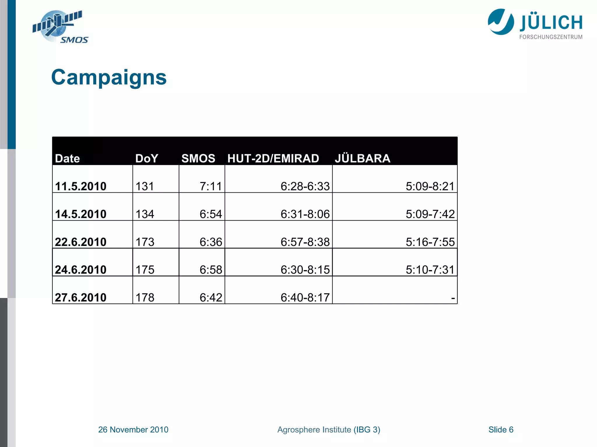
1. The document summarizes radiobrightness validation measurements taken during the SMOS Validation Campaign 2010 in the Rur catchment area of Germany.
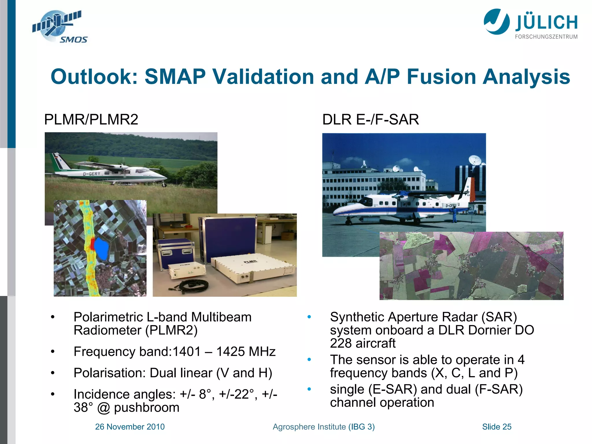
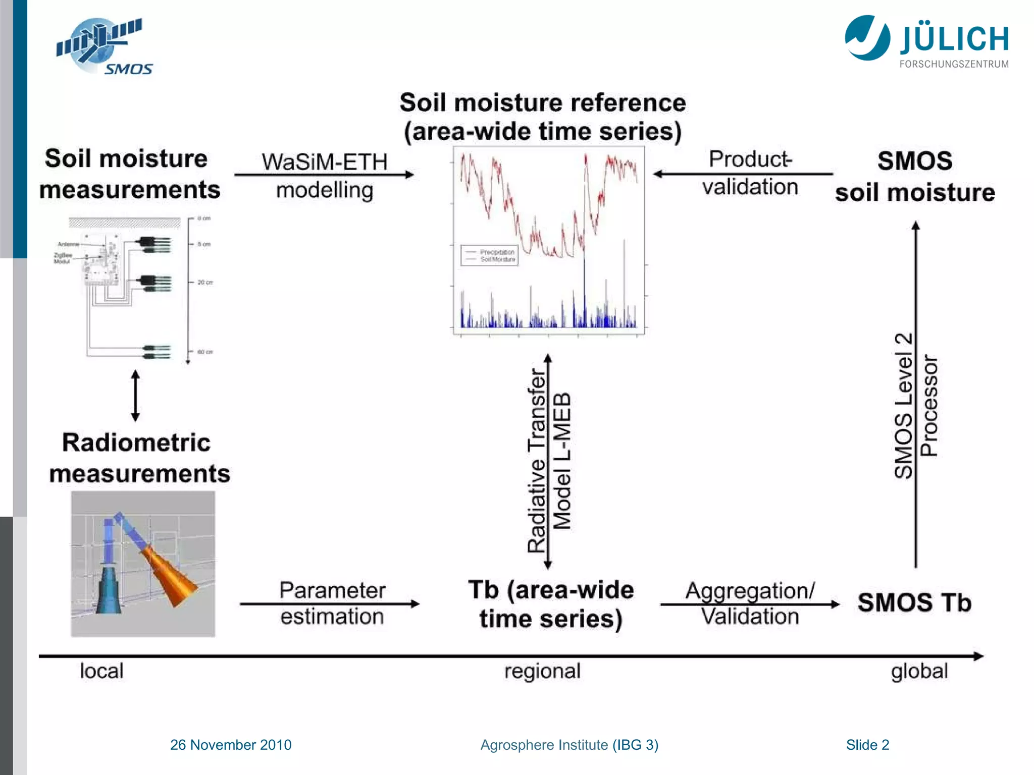
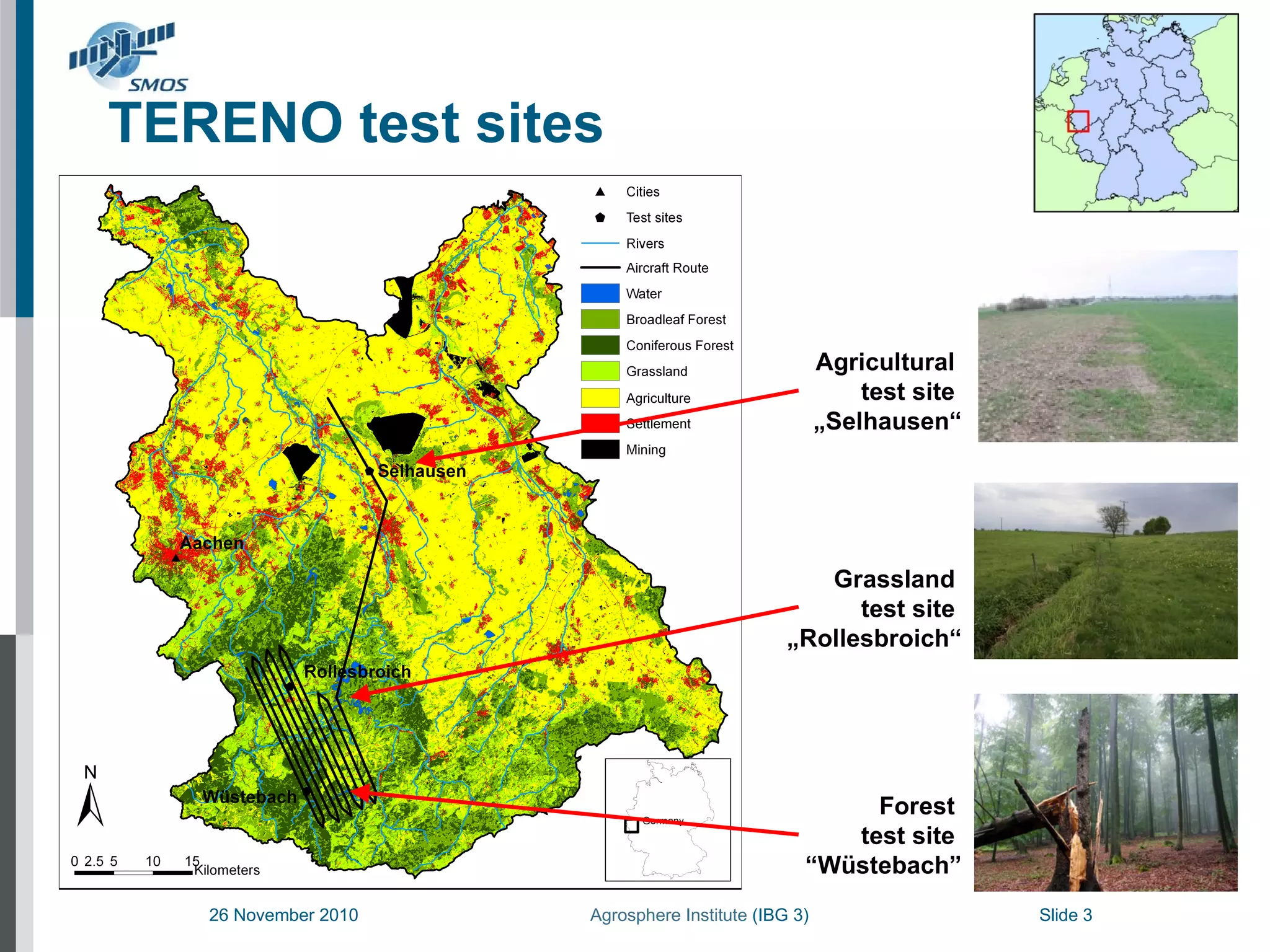
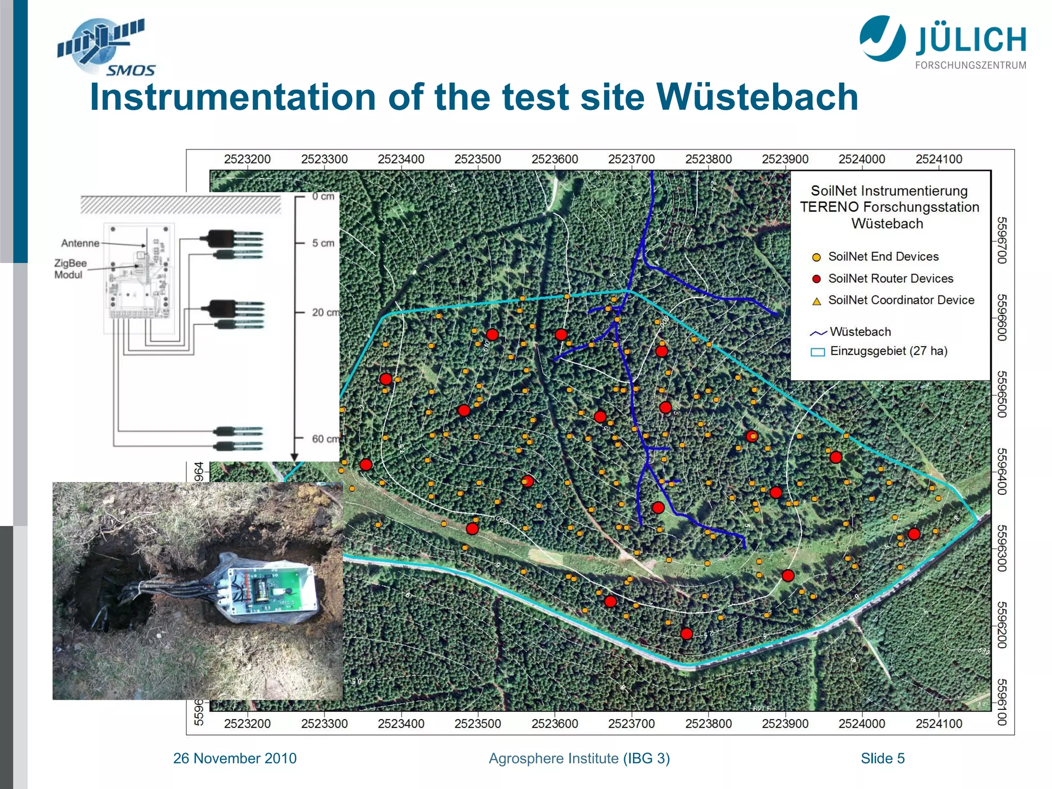
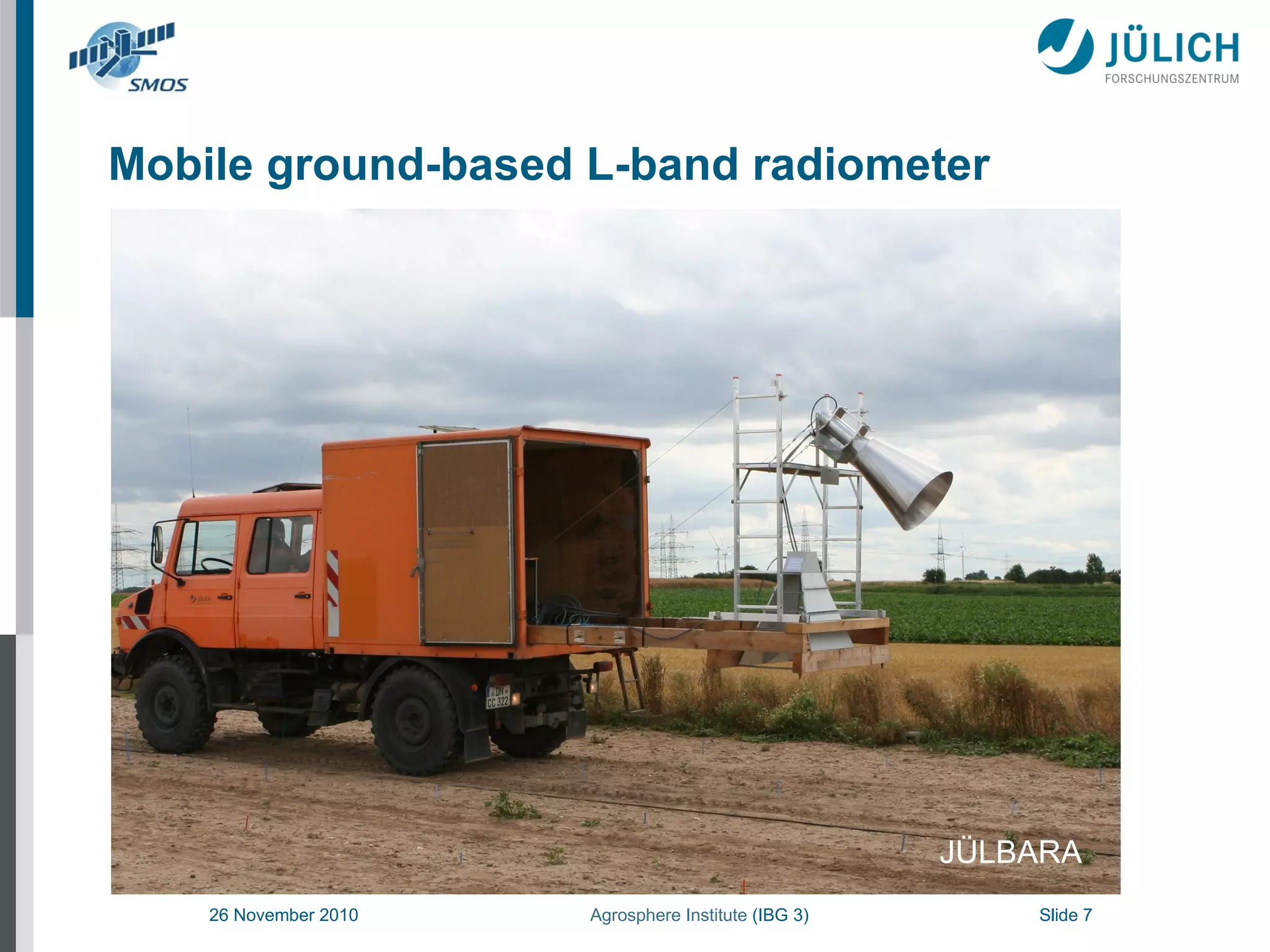
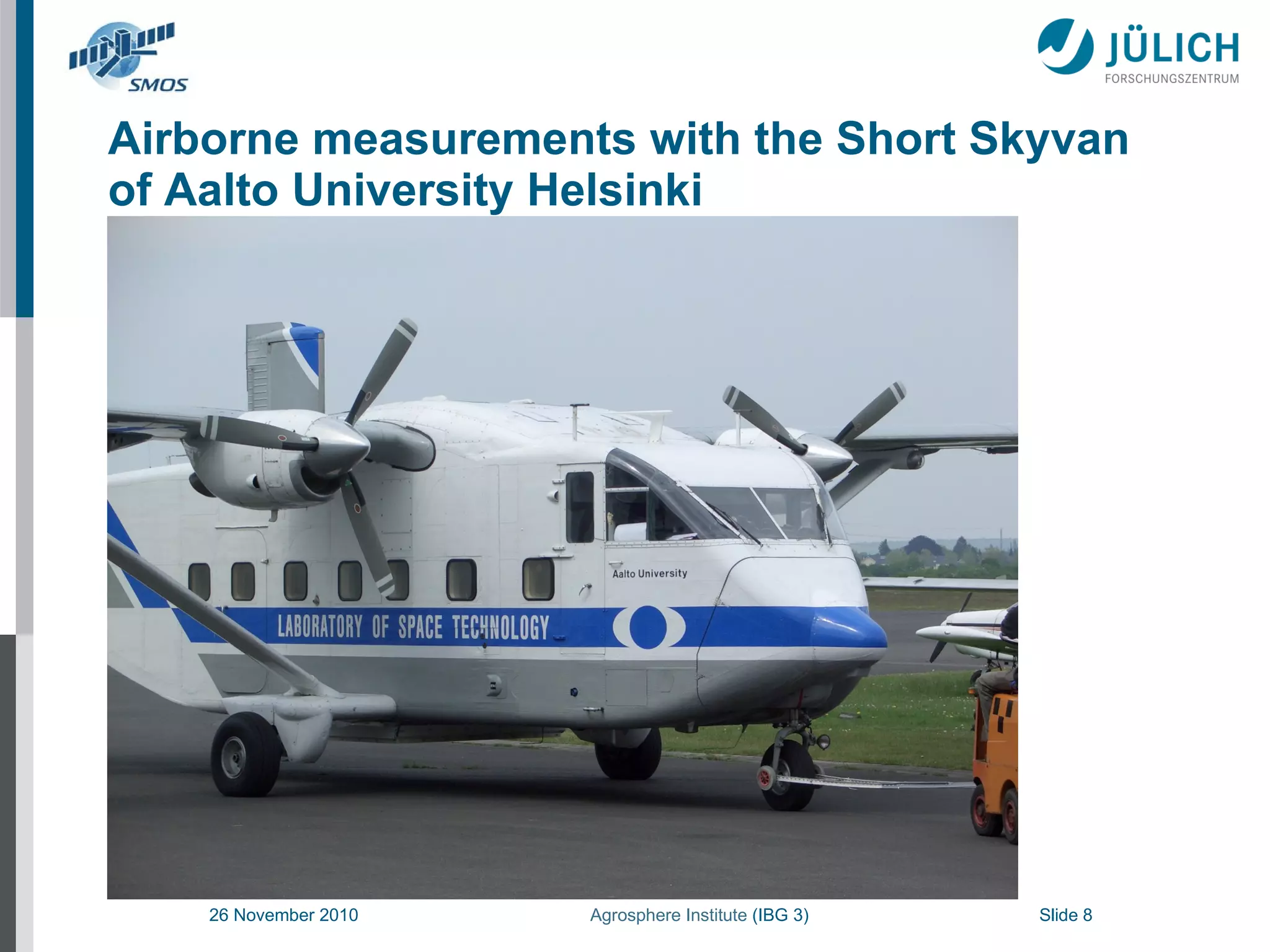
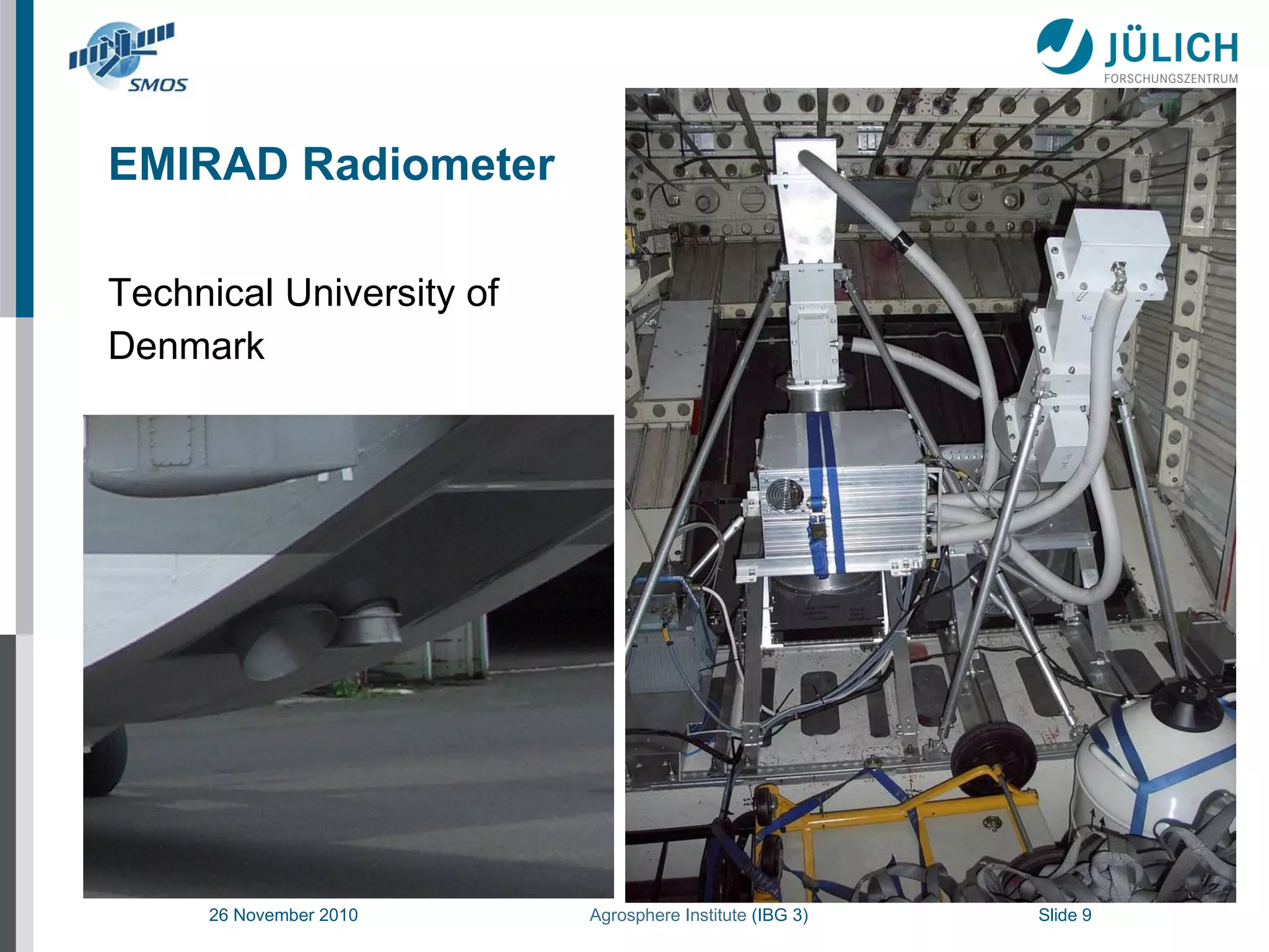
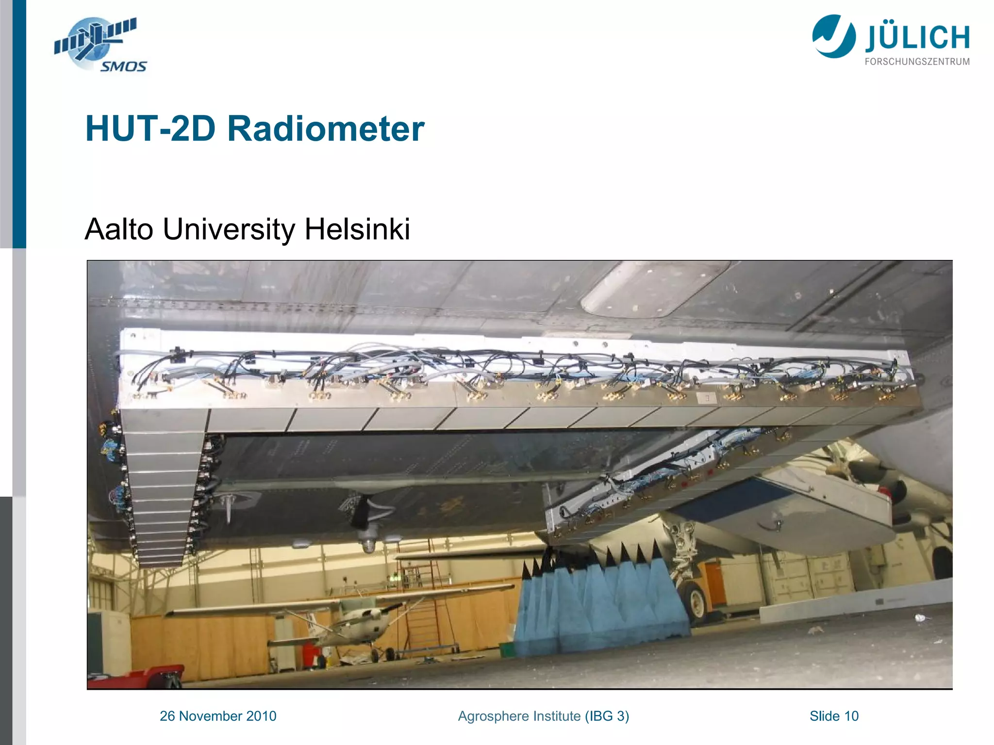
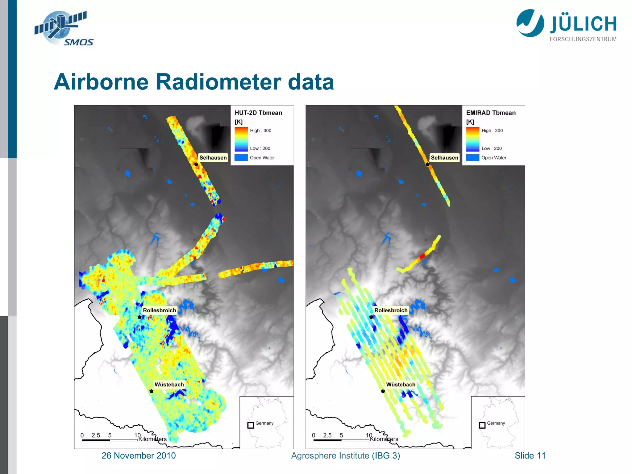
2. Ground-based, airborne, and satellite L-band radiometer measurements were taken at different agricultural and forest test sites and used to estimate soil moisture and validate SMOS satellite brightness temperature measurements.
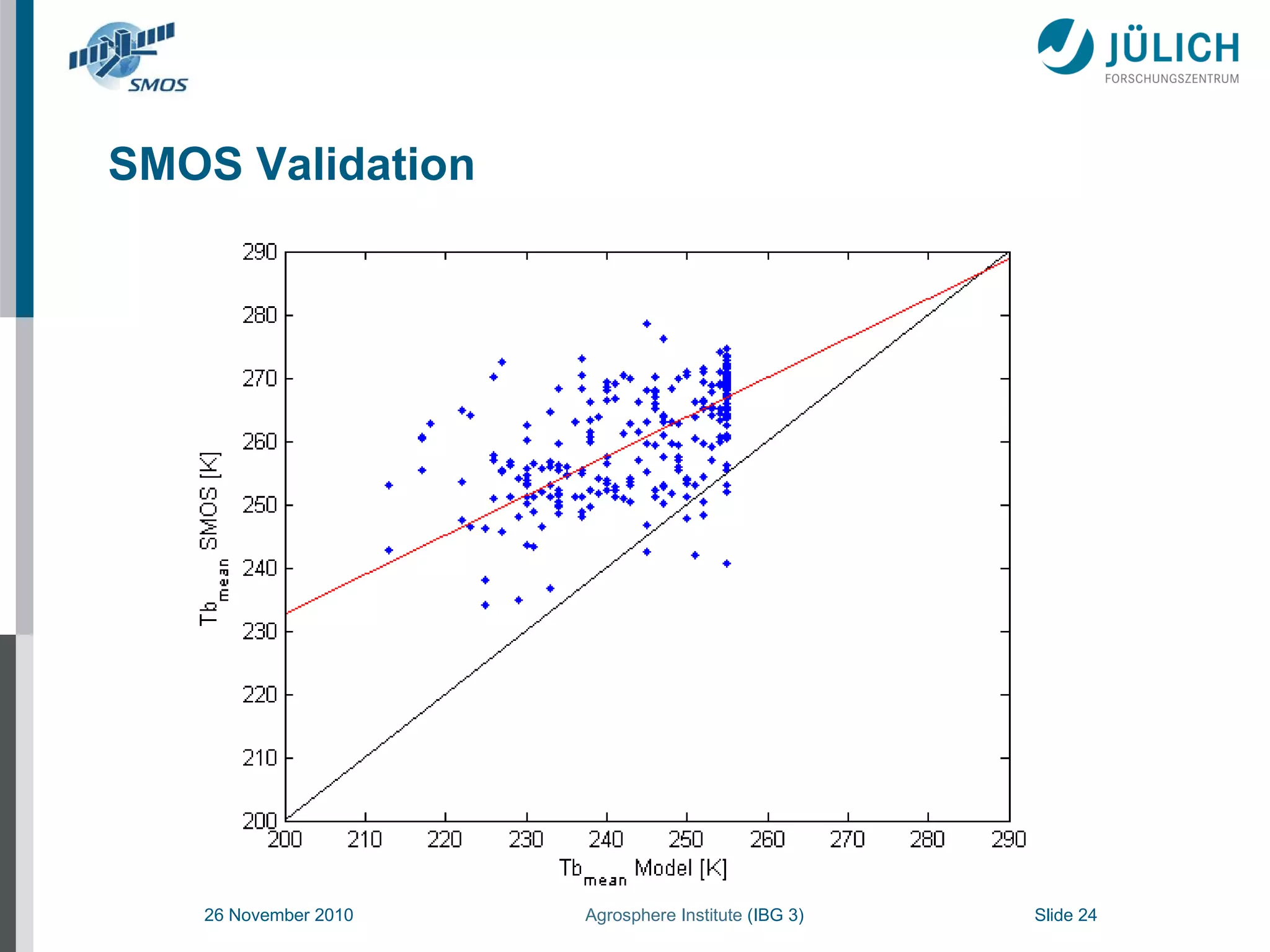
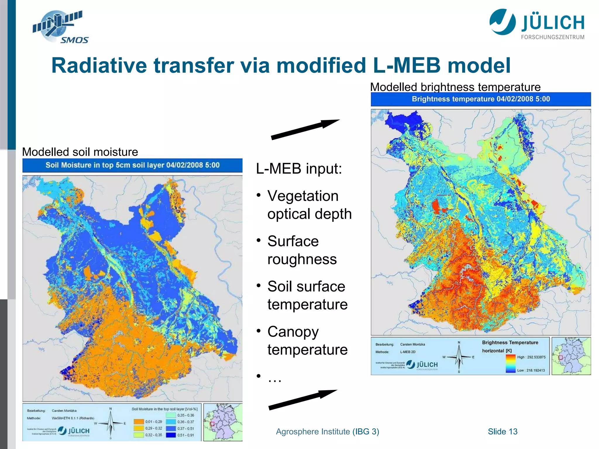
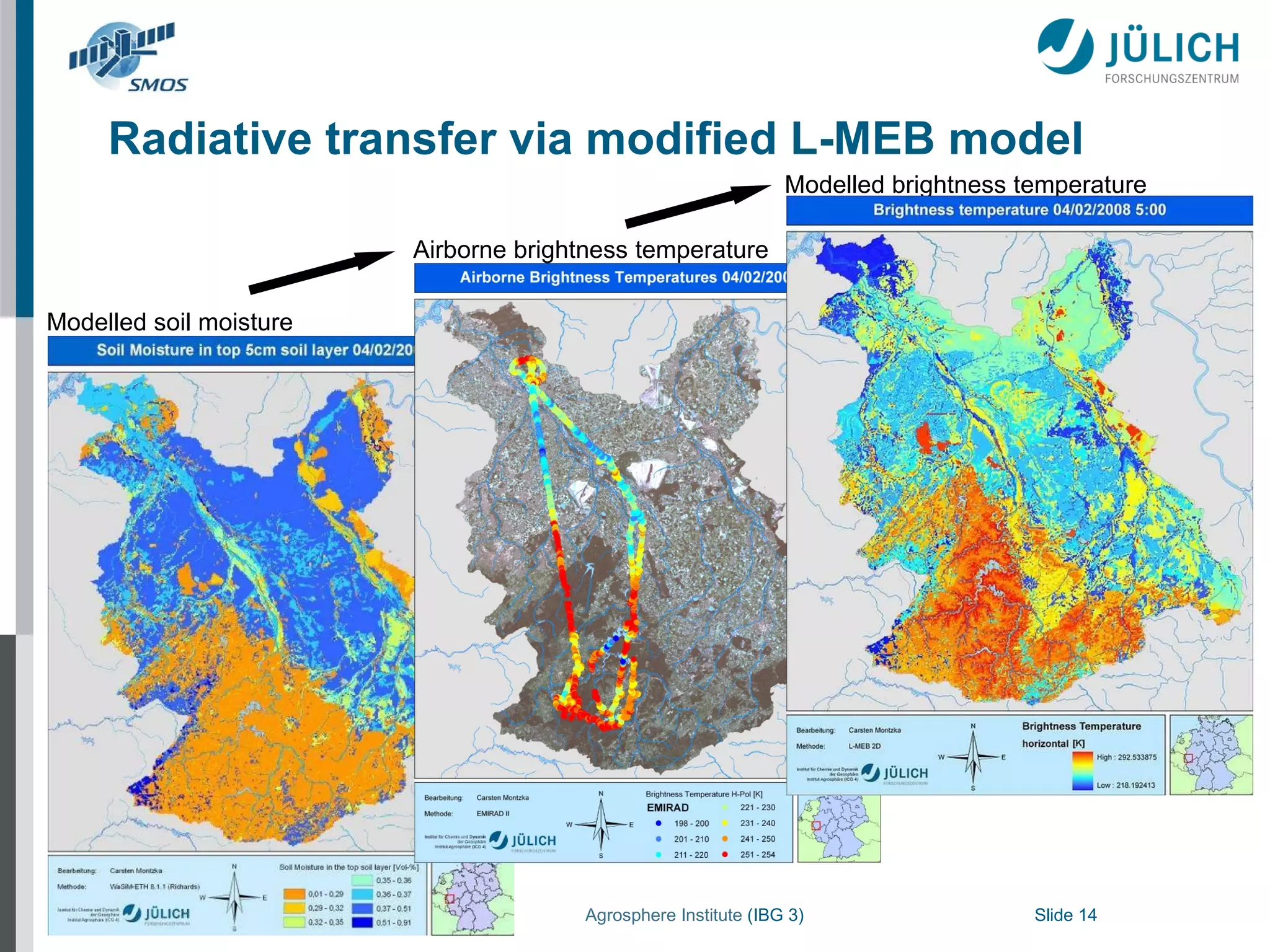
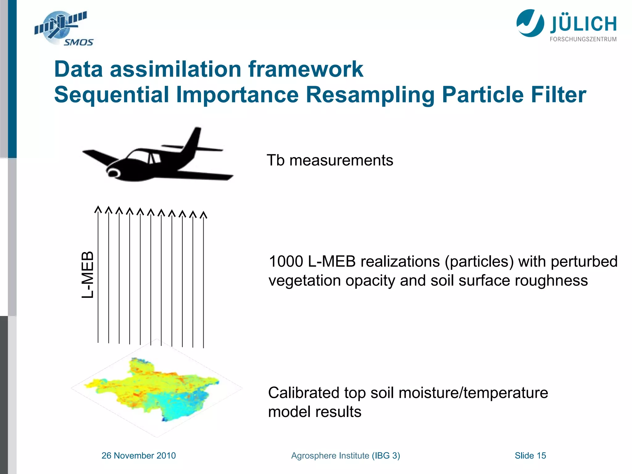
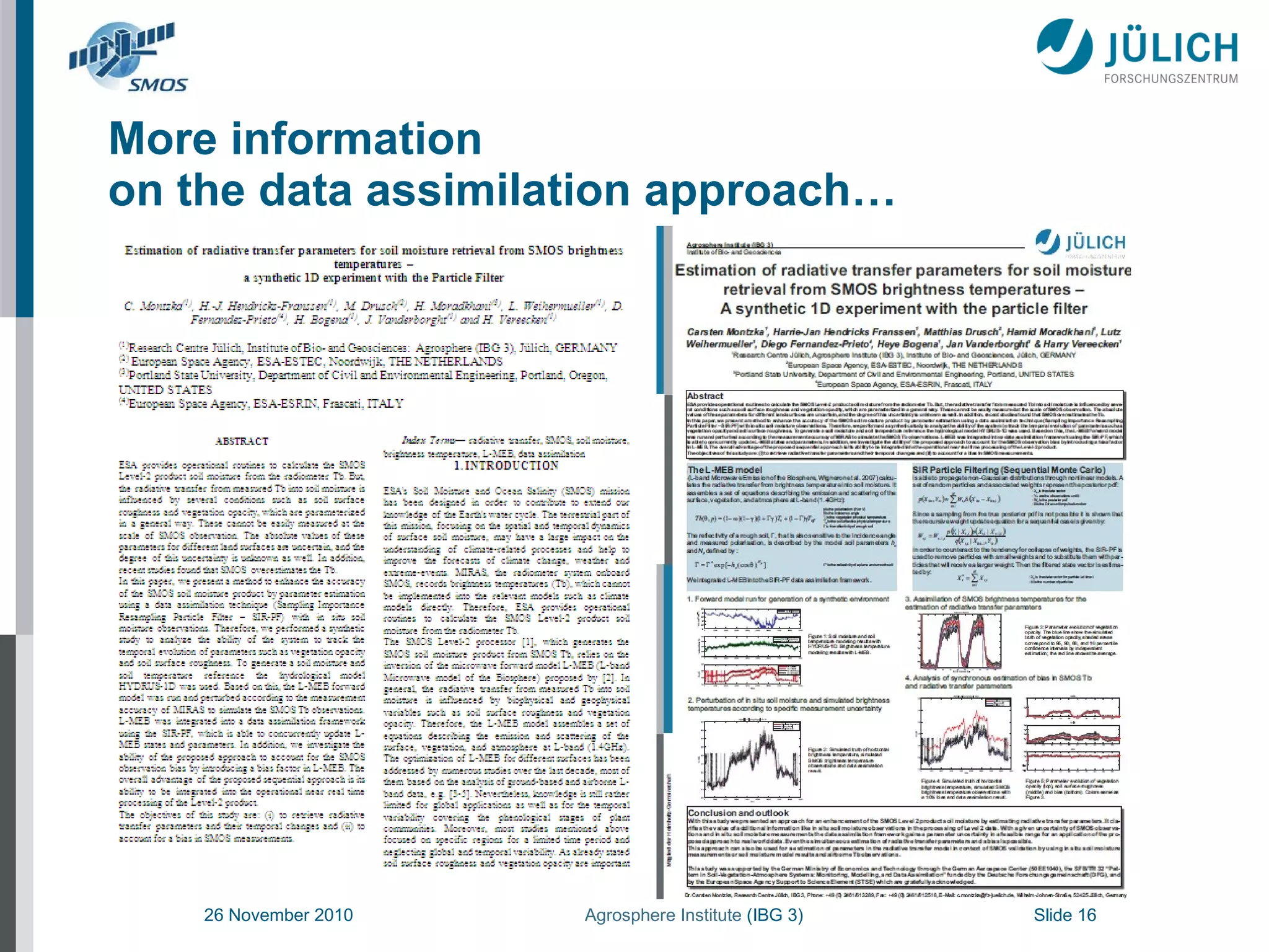
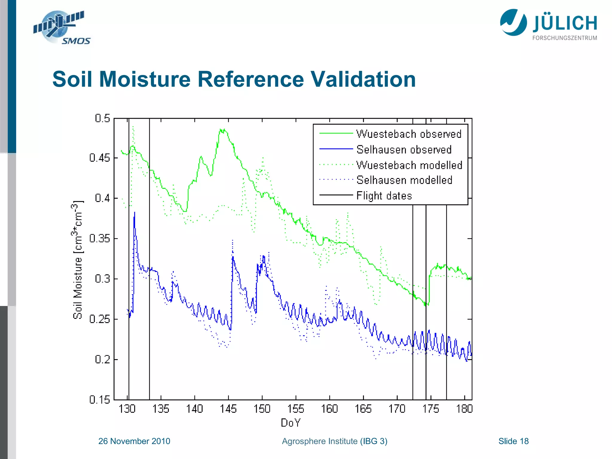
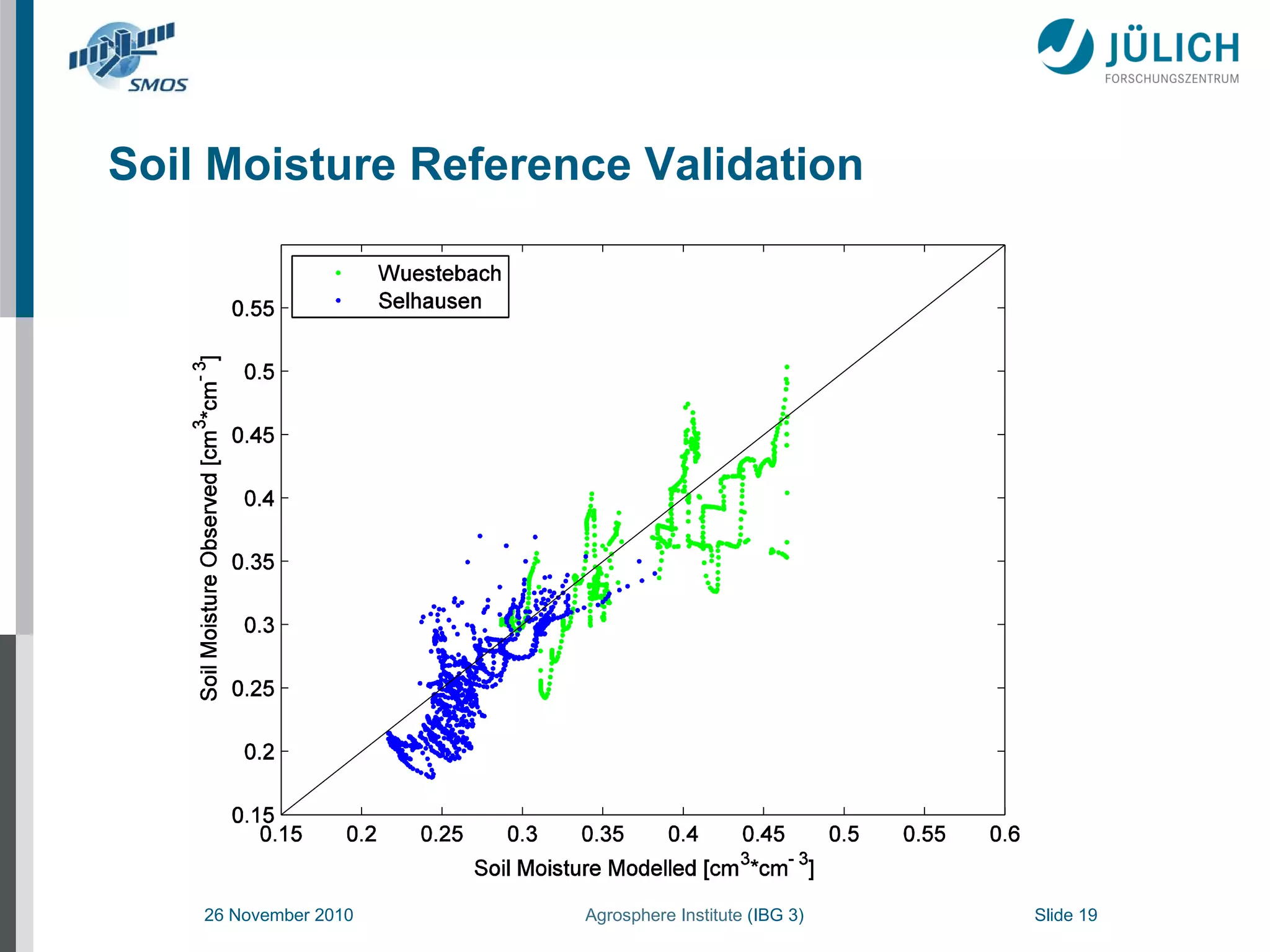
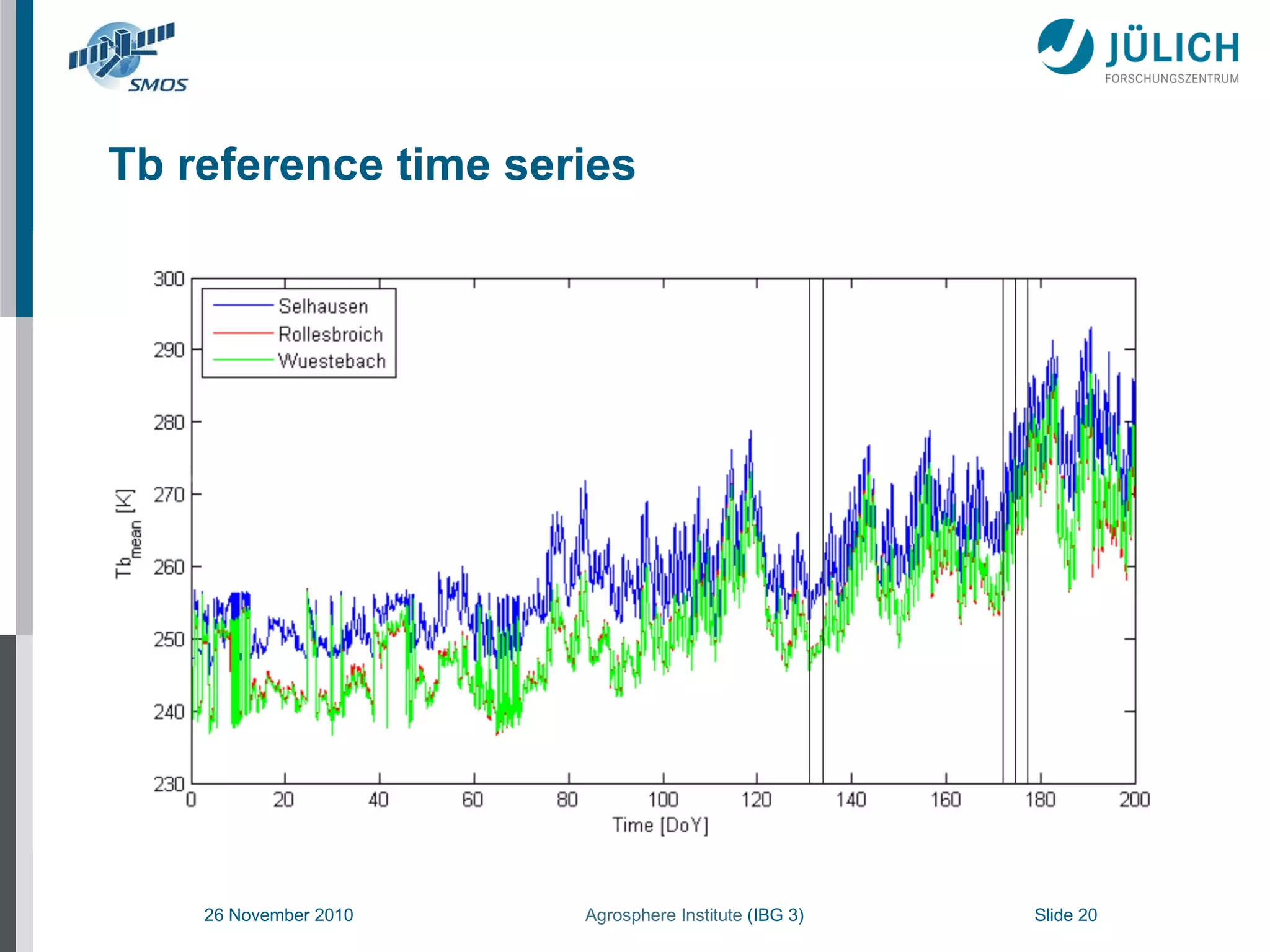
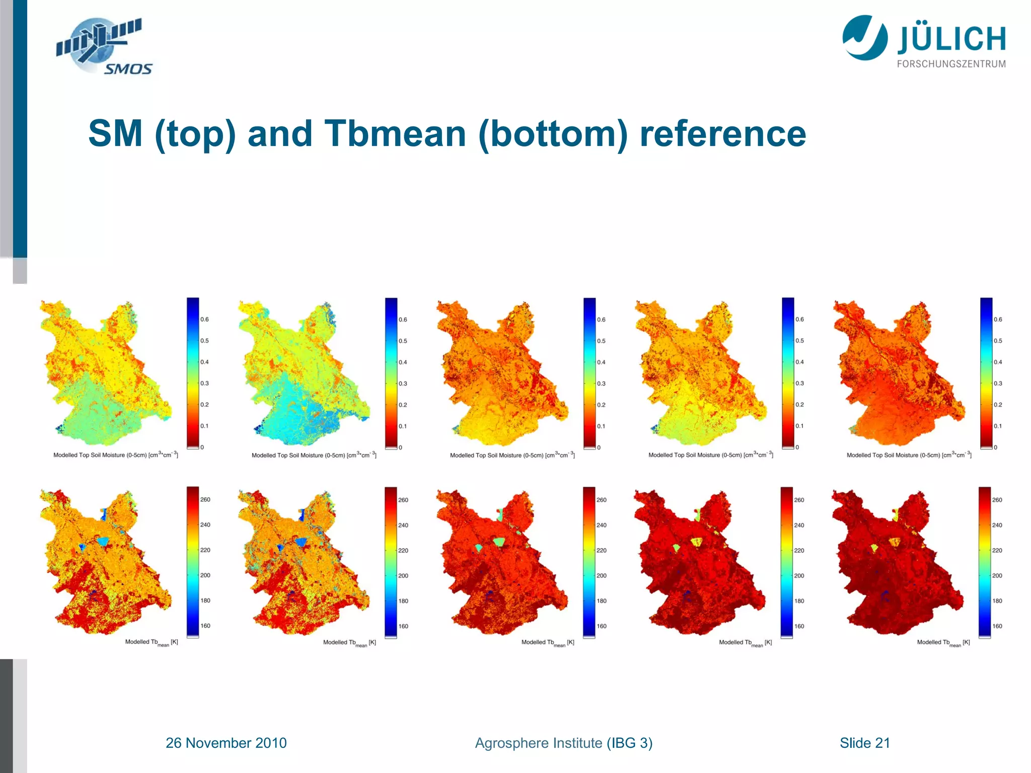
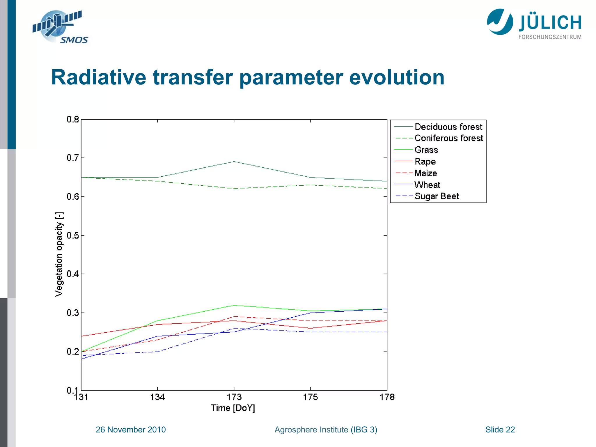
3. A data assimilation technique was used to calibrate a radiative transfer model using the measurements and estimate soil moisture and temperature profiles, with results showing SMOS validation had an RMSE of under 3K over the campaign period.
![SMOS Validation RMSE [K] over the campaign period](https://image.slidesharecdn.com/montzka-smos-validation-igarss-2011-110728150625-phpapp01/75/Montzka-SMOS-Validation-IGARSS-2011-ppt-23-2048.jpg)