SMOS provides first global soil moisture maps but has some issues to address. Calibration and validation activities are helping address biases in soil moisture retrievals. Algorithm improvements have increased accuracy over forested areas and rough surfaces. Continued algorithm development, additional calibration sites, and collaborations will help improve SMOS soil moisture products.
2013 ICEEFP 3D Tracking Error Analyses_Darin EtheringtonChrista Woodley
To 3-D track acoustically tagged fish with measured certainty, error analyses are needed to verify the tracking system‘s performance. The methods detailed below utilize JSATS cabled hydrophone array systems and acoustic micro-transmitters. These processes are conducted after deployment of the array systems, and verify the positional accuracy of tagged fish movements through the tracking baseline of a detection array.
The performance of portable mid-infrared spectroscopy for the prediction of s...ExternalEvents
This presentation was presented during the 3 Parallel session on Theme 1, Monitoring, mapping, measuring, reporting and verification (MRV) of SOC, of the Global Symposium on Soil Organic Carbon that took place in Rome 21-23 March 2017. The presentation was made by Mr. Martin Soriano-Disla, CSIRO Land and Water - Australia, in FAO Hq, Rome
Comparison of remote sensing soil moisture dataset across a range of spatial ...ICGCat
Presentació realitzada per Maria Jose Escorihuela, Pere Quintana-Seguí i Olivier Merlin (IsardSat) a la jornada "Validació de dades teletransportades en camp; Aplicacions agrícoles i hidrogeològiques" (03/06/2016)
This presentation was presented during the Workshop on Soil Cabon Mapping of the Global Soil Partnership (GSP) that took place at FAO headquarters 23 November 2016. The presentation was made by Carlos Cruz-Gaistardo from the National Institute of Statistics and Geography, Mexico
GSOC17 Introduction, Product specifications, Existing SOC maps and methodologiesFAO
This presentation was presented during the Workshop on Soil Cabon Mapping of the Global Soil Partnership (GSP) that took place at FAO headquarters 23 November 2016. The presentation was made by Rainer vargas
Validating satellite-derived land surface temperature over mountainous area w...ICGCat
Presentació realitzada per Yoann Malbeteau (CESBIO) a la jornada "Validació de dades teletransportades en camp; Aplicacions agrícoles i hidrogeològiques" (03/06/2016)
In this study, hydrological modeling is conducted for the Agusan River Basin (ARB) in Mindanao, Philippines using the Hydrological Simulation Program-Fortran (HSPF) model. The first major objective is to build the HSPF model and the second investigated the streamflow responses at nineteen (19) critical river outlets subjected to climate change and land use change scenarios.
Parker, L. Navarro-Racines, C. Available data for crop modelling and applications using EcoCrop. Second training in Climate vulnerability analysis using the EcoCrop model, organized by Mozambique Institute of Agricultural Research (IIAM) and the CGIAR Research Program on Climate Change, Agriculture and Food Security (CCAFS). Speaker and mentor. August – September 2014, Maputo-Mozambique.
Factors limiting SOC sequestration by no-tillage in Mediterranean agroecosystemsExternalEvents
This presentation was presented during the 3 Parallel session on Theme 2, Maintaining and/or increasing SOC stocks for climate change mitigation and adaptation and Land Degradation Neutrality, of the Global Symposium on Soil Organic Carbon that took place in Rome 21-23 March 2017. The presentation was made by Mr. Jorge Alvaro-Fuentes, from Spanish National Research Council - Spain, in FAO Hq, Rome
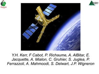
1. OVERVIEW OF SMOS RETRIEVALS OVER LAND Y.H. Kerr, F Cabot, P. Richaume, A. AlBitar, E. Jacquette, A. Mialon, C. Gruhier, S. Juglea, P. Ferrazzoli, A. Mahmoodi, S. Delwart, J.P. Wigneron
2.
3.
4. 1- Global Analysis – Results for All nodes % Rejected TB Nb of Retrievals norm % sucess LO freq Proc version L1C errors Pol mode More rejected TBs in FULL mod A;Al Bitar improvement Effect of Polarization mode is clear
5. % Rejected TB Nb of Retrievals norm % sucess LO freq Proc version L1C errors Pol mode In average 60% of the nodes ara retieved 1- Global Analysis – Results for Soil Cover 3% decrease in FULL
6. % Rejected TB Nb of Retrievals norm % sucess LO freq Proc version L1C errors Pol mode 1- Global Analysis – Results for Forest Cover 2% increase in FULL mode
13. PORTOS-1993: a re-analysis based on a 4 -parameter (Qr, Hr, Nrv, Nrh) approach [Wigneron et al., 2010] -> confirming Qr ~ = 0 -> calibrating Hr = f(STD) or =f(slope) -> calibrating ∆= (Nrh – Nrv) = f(STD): - ∆ ~ 2 over smooth soils - ∆ ~ 0 over rough soils -> Choudhury approach over-estimates Hr for STD > 15mm (Cf figure) soil-p = (Qr. soil-p + (1-Qr). soil-q ) e -Hr cosNrp( ) 7 fields, STD varies from 5 to 60 mm HR = (a.STD /(c.STD+d)) b Nrh-Nrv = a. STD +b
14.
15.
16.
17.
18. Cumulated precipitations between May 1 and May 3 , 2010. Ffrom the TRMM Science Data and Information System, http://earthobservatory.nasa.gov/IOTD/view.php?id=43873&src=eoa-iotd), source : http://earthobservatory.nasa.gov/IOTD/view.php?id=43873&src=eoa-iotd
22. Site Description Ambalavayal South india Kabini river bassin from west to east gradient Climate Humid Semi-arid Vegetation Forest Agriculture Topography Mountains plains A. Al Bitar Sat Kumar
23. SMOS Grids Points over site GPID: 3160499 LAT : 11.89 LON : 76.633 MOFN0: 0.80 MOFF0: 0.19 GPID: 3160498 LAT:11.753 LON:76.638 MOFN0:0.5742 M0FF0: 0.423
24. SMOS data – (1) Soil Moisture Ascending orbits If more than 50% of samples have been removed due to RFI the SMOS data is excluded i.e. (NRFIx + NRFI y -Nwild)/ M_AVA0 < 0,5 GPID 3160499 GPID 3160498
![Layout ,[object Object],[object Object],[object Object],[object Object],[object Object],[object Object],YHK July 2010](data:image/gif;base64,R0lGODlhAQABAIAAAAAAAP///yH5BAEAAAAALAAAAAABAAEAAAIBRAA7)