The slides are about different methods in estimating tall objects without measuring it directly. Particularly, it is about using the clinometer, shadow method, and mirror method.
This document provides an overview of the Garifuna people, including their origins, history, culture, language, religion, and food. It summarizes that the Garifuna are descendants of Carib, Arawak, and West African people who were exiled in the 18th century from Saint Vincent to Roatán island. It describes some key aspects of Garifuna culture such as their language, syncretic Catholic and traditional religious practices, music including punta, and staple foods like cassava bread. The document serves to inform about the unique history and cultural heritage of the Garifuna people.
This document discusses statistical surfaces and methods for mapping and modeling continuous surfaces from sampled data points. It defines statistical surfaces as distributions of data values within a defined area based on location. Continuous statistical surfaces have values at every location, while discrete surfaces have values only at control points. Methods for mapping and modeling continuous surfaces include isarithmic maps using contour lines, digital elevation models (DEMs) using raster grids, and interpolation techniques like kriging to estimate values between known points.
Este documento presenta resúmenes breves de varias fotografías históricas famosas, incluyendo la imagen del Che Guevara tomada por Alberto Korda, la foto de Omayra Sánchez atrapada en el lodo después de la erupción del volcán Nevado del Ruiz en Colombia, y la imagen de la niña Phan Thi Kim Phuc huyendo despues de ser bombardeada con napalm en Vietnam. También resume fotos como la ejecución de un prisionero Vietcong en Saigon, el retrato de Sharbat Gula
This document discusses photogrammetry and its applications. It describes the different types of aerial photographs based on lens systems and film properties. It then lists several applications of aerial photogrammetry including forestry, geology, agriculture, urban planning, and military intelligence. Finally, it explains some key principles of photogrammetry including central projection, orthogonal projection, stereo pairs, principal points, and fiducial marks.
The document discusses using GeoGebra to construct and investigate the properties of various geometric figures. Students will work in pairs using GeoGebra to construct shapes like rectangles, squares, triangles, parallelograms, and rhombuses. They will explore the defining properties of each figure and use a "drag test" to determine if their construction is accurate or just a drawing. The goal is for students to better understand geometric shapes and constructions through an interactive activity using dynamic geometry software.
This document provides an overview of photogrammetry, including a brief history of aerial photography, definitions of key terms, and descriptions of different types of photogrammetry and imaging. It discusses the general photogrammetric process and products that can be created. Specific topics covered include the development of aerial photography from the 1850s onwards, definitions of photogrammetry, close range, terrestrial, aerial, and space photogrammetry, types of aerial images, photogrammetric mapping techniques, and historical photogrammetric plotting instruments.
This document provides an overview of different types of quadrilaterals. It begins with a definition of a quadrilateral as a four-sided polygon with 360 degrees of interior angles. It then describes various quadrilaterals like trapezoids, parallelograms, rectangles, rhombi, and squares by their defining properties such as number of parallel sides, right angles, and side lengths. Kites are also discussed as a special type of quadrilateral with two pairs of equal adjacent sides and perpendicular diagonals where one bisects the other. The document aims to classify and distinguish between different quadrilaterals.
Photogrammetry is the science of obtaining spatial measurements from photographs. This document discusses key concepts in photogrammetry including:
- The differences between maps and aerial photographs in terms of projections, scales, and representations.
- Basic photogrammetry principles including exterior orientation to relate image coordinates to real-world coordinates using ground control points.
- Interior orientation to model the camera geometry and establish relationships between pixel coordinates and image coordinates.
- Calculating scanning resolution for digitizing aerial photographs to achieve a desired ground resolution for orthophotos.
- Photogrammetric triangulation to compute camera station positions and orientations using measured image tie points and ground control points.
The document defines and compares different types of quadrilaterals. A quadrilateral is a closed shape with four sides whose interior angles sum to 360 degrees. The main quadrilaterals discussed are: parallelograms, which have opposite sides that are parallel and equal; rectangles, which have four right angles; rhombi, which have four equal sides; squares, which are rhombi with four right angles; kites, which have two pairs of equal sides that meet at a right angle; and trapezoids, which have one set of parallel sides. Key differences between kites, squares, rhombi and parallelograms are outlined.
The document outlines learning objectives for calculating geometric properties of circles and compound shapes. It lists that the learner will learn to calculate: the circumference of a circle from the diameter and radius at grade D; the perimeter of compound shapes at grade C; and the area of a circle from the radius and diameter and of compound shapes at grades D and C respectively. Key words related to these calculations are also provided.
Our mission is to track hurricanes using precise latitude and longitude coordinates. Latitude and longitude form a grid system that allows us to pinpoint exact locations on Earth. We can track the latest hurricanes by their latitude and longitude coordinates using Google Earth.
An angle is formed by two lines that share a common point called the vertex. Angles are measured in degrees, with a full revolution being 360 degrees. A protractor can be used to both measure and construct angles. Angles are classified as acute (<90 degrees), right (90 degrees), obtuse (>90<180 degrees), or straight (180 degrees). Complementary angles sum to 90 degrees, while supplementary angles sum to 180 degrees.
This document defines and describes different types of angles:
1) Adjacent angles share a common vertex and side. Vertically opposite angles are formed when two lines intersect and are equal.
2) Complementary angles have a sum of 90 degrees. Supplementary angles have a sum of 180 degrees.
3) A linear pair is two adjacent supplementary angles.
4) A transversal intersects two or more lines. It forms corresponding, alternate, and interior angles that follow specific properties.
This document defines and classifies different types of quadrilaterals. It begins by defining a quadrilateral as a two-dimensional figure with four straight sides and four vertices, where the sum of the interior angles is always 360 degrees. It then classifies quadrilaterals based on the parallelism of their sides into parallelograms, trapezoids, and trapezoids. Parallelograms are further divided into squares, rectangles, rhombuses, and rhomboids based on their side lengths and angle measures. Trapezoids are separated into rectangle trapezoids, isosceles trapezoids, and scalene trapezoids depending on their parallel sides and
This document defines and describes basic solid figures and their components. It explains that a solid figure is a 3D object with length, width, and height or thickness. The key parts are faces, edges where faces meet, and vertices where three or more faces connect. It provides examples of prisms and pyramids, which are named after the shape of their base, and mentions curved surface solids.
This document defines an obtuse angle and its standard position. It then uses the coordinate definition of trigonometric ratios to find the sine, cosine, and tangent of various obtuse angles given points on their terminal arms. Examples are provided to find the size of angles given their trigonometric ratios, identifying acute and obtuse angles where possible. The document provides context, definitions, examples, and an assignment to practice finding angle measures using trigonometric ratios.
DEM generation, Image Matching in Aerial Photogrammetry.pptxIndraSubedi7
Digital photogrammetry uses digital images to extract geospatial data and generate digital elevation models (DEMs). A digital photogrammetric workstation processes images using techniques like orientation, aerial triangulation, and bundle block adjustment. DEM generation involves image matching to find corresponding points between stereo image pairs. Area-based matching uses cross-correlation while least squares matching considers geometric transformations. Feature-based matching extracts distinct points and matches their locations. Parameters like matching technique and search window influence results. Constraints like image pyramids and epipolar geometry aid the matching process.
here is a ppt on geometrical figures and it gives details all about the different types of geometrical shapes and give many pictures and short definitions on them.....
it is a really good power point presentation.......
What is GIS ?
Dimensions Modeling in GIS ?
GIS Models real word(Raster, Vector)
GIS Challenges ? Data and Tech.
GIS Functionality
Building information modeling (BIM) ?
GIS Components
Spatial Data
Solving problems involving parallelograms, trapezoids and kitesebenezerburgos
This document defines and discusses the properties of parallelograms, trapezoids, and kites. It states that parallelograms have two pairs of parallel sides with opposite sides and angles being congruent. Trapezoids have one pair of parallel sides, and the median is half the sum of the bases. Kites have two pairs of adjacent congruent sides and perpendicular diagonals that bisect angles and sides. Understanding these properties is important for solving geometry problems.
Ebook on Elementary Trigonometry by Debdita PanDebdita Pan
Trigonometry is a branch of Mathematics that deals with the distances or heights of objects which can be found using some mathematical techniques. The word ‘trigonometry’ is derived from the Greek words ‘tri’ (meaning three) , ‘gon’ (meaning sides) and ‘metron’ (meaning measure). Historically, it was developed for astronomy and geography, but scientists have been using it for centuries for other purposes, too. Besides other fields of mathematics, trigonometry is used in physics, engineering, and chemistry. Within mathematics, trigonometry is used primarily in calculus (which is perhaps its greatest application), linear algebra, and statistics. Since these fields are used throughout the natural and social sciences, trigonometry is a very useful subject to know
Ebook on Elementary Trigonometry By Debdita PanAniruddha Datta
A Short Introduction to Trigonometry. Trigonometry blends a bit of geometry with a lot of common sense. It lets you solve problems that is of common life and experience.
The student is able to use ratios to make indirect measurements and use scale drawings to solve problems. Indirect measurement uses formulas, similar figures, and proportions to measure an object. Examples are provided of using ratios and proportions to calculate the height of a flagpole based on shadow lengths, and calculating the height of Reunion Tower based on a mirror reflection. An example of using a scale on a map to calculate the distance between two cities is also provided.
This lesson teaches students how to calculate the area of acute triangles using the height and base. Students first decompose acute triangles into right triangles by drawing the altitude, and calculate the area of each right triangle. They then realize the total area is the sum of the right triangle areas. Finally, students learn that for any acute triangle, the area can be calculated as A = 1/2 x base x height, where the height is the altitude perpendicular to the base. Through examples, students verify this formula works for both decomposing triangles into right triangles and calculating the area directly.
Angle of Elevation and Angle depression.pptxMeryAnnMAlday
The document defines and provides examples of calculating angles of elevation and depression. It explains that angle of elevation is formed when looking at an object higher than the observer, while angle of depression is formed when looking at an object lower than the observer. Examples are provided to demonstrate calculating unknown lengths using trigonometric functions like tangent, sine and cosine based on the angles of elevation or depression and known lengths.
The document discusses properties of similar triangles that can be used to find unknown lengths, including:
- The triangle proportionality theorem and its converse, which state that if a line parallel to one side of a triangle intersects the other two sides, it divides them proportionally
- Using ratios to make indirect measurements of objects that can't be directly measured
- Applying the triangle angle bisector theorem to divide opposite sides of a triangle proportionally
- Using scale drawings and similar triangles to solve problems involving proportional relationships between corresponding parts of similar figures
Trigonometry studies triangles and relationships between sides and angles. This document discusses using trigonometric ratios to calculate heights and distances, including the angles of elevation and depression. It provides examples of using trigonometry to find the height of a tower from the angle of elevation measured 30 meters away (30 meters high), and the height of a pole from the angle made by a rope tied to its top (10 meters high). It also explains calculating the length of a kite string from the angle of elevation.
The student can use ratios and proportions to make indirect measurements from scale drawings or similar figures. An example shows using similar triangles to find the height of a flagpole given the height and shadow of a stick. Another example shows using similar triangles to find the height of Reunion Tower by measuring the angle of reflection in a mirror and distances from the observer's perspective.
Here are the steps to solve this problem using trigonometry:
1. Draw a sketch of the situation showing the hot air balloon, observer, and relevant angles and distances.
2. Label the given information: The observer is 20 m from the base of the balloon and the angle of elevation is 35°.
3. Identify the trigonometric ratio to use based on the given and missing information. Since we are given an angle of elevation and the distance from the observer to the base of the balloon, we will use tangent.
4. Set up and solve the trigonometric equation:
Tan 35° = Opposite/Adjacent
Tan 35° = Height/20
Height = 20 * Tan
Use properties of similar triangles to find segment lengths.
Apply proportionality and triangle angle bisector theorems.
Use ratios to make indirect measurements
Use scale drawings to solve problems.
The Pythagorean Theorem states that in a right triangle, the square of the hypotenuse is equal to the sum of the squares of the other two sides. It can be used to determine if a triangle is right, and to solve for missing sides. For example, if one side is 35m, another is 12m, and the hypotenuse is 37m, squaring and adding 35^2 + 12^2 equals 37^2, showing it is a right triangle. It can also solve for missing components, like finding a hypotenuse of 57.63m when the other two sides are 45m and 36m.
The Pythagorean Theorem states that in a right triangle, the square of the hypotenuse is equal to the sum of the squares of the other two sides. It can be used to determine if a triangle is right, and to calculate unknown sides. For example, if one side is 35m, another is 12m, and the hypotenuse is 37m, squaring and adding 35^2 + 12^2 equals 37^2, showing it is a right triangle. It can also solve for missing sides, like finding a hypotenuse of 57.63m when the other sides are 45m and 36m.
The Pythagorean Theorem states that in a right triangle, the square of the hypotenuse is equal to the sum of the squares of the other two sides. It can be used to determine if a triangle is right, and to calculate unknown sides. For example, if one side is 35m, another is 12m, and the hypotenuse is 37m, squaring and summing each side according to the theorem (35^2 + 12^2 = 37^2) shows it is a right triangle. It can also be used to solve for missing sides, like finding a hypotenuse of 57.63m when the other two sides are 45m and 36m.
This document summarizes key concepts about two-dimensional motion and vectors:
1) It introduces scalars, which have magnitude but no direction, and vectors, which have both magnitude and direction.
2) It describes methods for adding vectors graphically by drawing them as arrows and finding the resultant, or using trigonometry.
3) It explains projectile motion as objects moving under gravity with both horizontal and vertical components of motion that can be analyzed separately using kinematic equations.
The Pythagorean Theorem states that for any right triangle, the square of the hypotenuse is equal to the sum of the squares of the other two sides. It can be used to determine if a triangle is right, and to calculate unknown sides of a right triangle if two sides are known. Examples show how to use the theorem to find a missing hypotenuse or other side by setting up and solving an equation based on the formula a^2 + b^2 = c^2.
The Pythagorean Theorem states that in a right triangle, the square of the hypotenuse is equal to the sum of the squares of the other two sides. It was discovered by the Greek mathematician Pythagoras around 580 BC and can be used to determine if a triangle is a right triangle or to solve for a missing side. Examples are provided to demonstrate using the theorem to check if a triangle is right by adding the squares of two sides and comparing to the square of the hypotenuse, or to solve for the missing hypotenuse or other side.
Maths project --some applications of trignometry--class 10Mahip Singh
Amongst the lay public of non-mathematicians and non-scientists, trigonometry is known chiefly for its application to measurement problems, yet is also often used in ways that are far more subtle, such as its place in the theory of music; still other uses are more technical, such as in number theory. The mathematical topics of Fourier series and Fourier transforms rely heavily on knowledge of trigonometric functions and find application in a number of areas, including statistics.
1) A group of boys used trigonometry and angle measuring systems (AMS) to measure the height of a monument in a plaza.
2) They took angle measurements from two positions and measured the distance between the positions.
3) They then used trigonometric equations involving tangents, angles, and distances to calculate the height of the monument, which they determined to be 18.48 meters.
4) They acknowledged some potential errors in their angle measurements but concluded that trigonometry is a useful method for calculating heights and distances.
Lesson plan on introduction of trigonometry, students must aware about the history , concepts to be done, what common error they commit and what are the scope of this topic in careers
Similar to Measuring tall objects using clinometer, shadow, and mirror method (20)
Elevate Your Nonprofit's Online Presence_ A Guide to Effective SEO Strategies...TechSoup
Whether you're new to SEO or looking to refine your existing strategies, this webinar will provide you with actionable insights and practical tips to elevate your nonprofit's online presence.
🔥🔥🔥🔥🔥🔥🔥🔥🔥
إضغ بين إيديكم من أقوى الملازم التي صممتها
ملزمة تشريح الجهاز الهيكلي (نظري 3)
💀💀💀💀💀💀💀💀💀💀
تتميز هذهِ الملزمة بعِدة مُميزات :
1- مُترجمة ترجمة تُناسب جميع المستويات
2- تحتوي على 78 رسم توضيحي لكل كلمة موجودة بالملزمة (لكل كلمة !!!!)
#فهم_ماكو_درخ
3- دقة الكتابة والصور عالية جداً جداً جداً
4- هُنالك بعض المعلومات تم توضيحها بشكل تفصيلي جداً (تُعتبر لدى الطالب أو الطالبة بإنها معلومات مُبهمة ومع ذلك تم توضيح هذهِ المعلومات المُبهمة بشكل تفصيلي جداً
5- الملزمة تشرح نفسها ب نفسها بس تكلك تعال اقراني
6- تحتوي الملزمة في اول سلايد على خارطة تتضمن جميع تفرُعات معلومات الجهاز الهيكلي المذكورة في هذهِ الملزمة
واخيراً هذهِ الملزمة حلالٌ عليكم وإتمنى منكم إن تدعولي بالخير والصحة والعافية فقط
كل التوفيق زملائي وزميلاتي ، زميلكم محمد الذهبي 💊💊
🔥🔥🔥🔥🔥🔥🔥🔥🔥
Philippine Edukasyong Pantahanan at Pangkabuhayan (EPP) CurriculumMJDuyan
(𝐓𝐋𝐄 𝟏𝟎𝟎) (𝐋𝐞𝐬𝐬𝐨𝐧 𝟏)-𝐏𝐫𝐞𝐥𝐢𝐦𝐬
𝐃𝐢𝐬𝐜𝐮𝐬𝐬 𝐭𝐡𝐞 𝐄𝐏𝐏 𝐂𝐮𝐫𝐫𝐢𝐜𝐮𝐥𝐮𝐦 𝐢𝐧 𝐭𝐡𝐞 𝐏𝐡𝐢𝐥𝐢𝐩𝐩𝐢𝐧𝐞𝐬:
- Understand the goals and objectives of the Edukasyong Pantahanan at Pangkabuhayan (EPP) curriculum, recognizing its importance in fostering practical life skills and values among students. Students will also be able to identify the key components and subjects covered, such as agriculture, home economics, industrial arts, and information and communication technology.
𝐄𝐱𝐩𝐥𝐚𝐢𝐧 𝐭𝐡𝐞 𝐍𝐚𝐭𝐮𝐫𝐞 𝐚𝐧𝐝 𝐒𝐜𝐨𝐩𝐞 𝐨𝐟 𝐚𝐧 𝐄𝐧𝐭𝐫𝐞𝐩𝐫𝐞𝐧𝐞𝐮𝐫:
-Define entrepreneurship, distinguishing it from general business activities by emphasizing its focus on innovation, risk-taking, and value creation. Students will describe the characteristics and traits of successful entrepreneurs, including their roles and responsibilities, and discuss the broader economic and social impacts of entrepreneurial activities on both local and global scales.
Measuring tall objects using clinometer, shadow, and mirror method
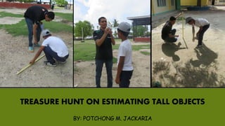
1. TREASURE HUNT ON ESTIMATING TALL OBJECTS
BY: POTCHONG M. JACKARIA
2. How the ancient Egyptians did calculated the height
of the great pyramid?
Measuring along the side of the pyramid will
not give the real height of the pyramid but the
slanting height. And it is not possible to measure
directly from the top towards the bottom using a
long rope since its made of a solid blocks.
It is said that Thales, a teacher of Pythagoras,
found the height of the Egyptian pyramids using a
quick and easy way. Thales realized that shadows of
different objects at the same time of day produce
similar triangles. Then he waited for a time when his
shadow equals his height therefore the shadow of
the pyramid at that time must be equal to the actual
height of the pyramid.
Picture is from https://en.wikipedia.org/wiki/Thales_of_Miletus
3. But was it possible for Thales to measure the height of
the great pyramid anytime of the day without waiting for
the time when his height and shadow becomes equal?
Yes. Because two triangles form by the shadow at the same time of the
day must be similar. We say the rays are parallel. When using our height as
reference, we can say the tree stands straight and so do you, so you and the
tree are parallel. Finally, if the ground is flat, the tree's shadow and your
shadow are parallel.
The similar triangle theorem, states that a triangle with the same angles
has proportionate sides.
This is called the Shadow Method.
4. The Mirror Method
It is done by placing the mirror on the ground between you
and the object of unknown height. Next move forward or
backward until you sight the top of the object in the middle of the
mirror. Measure the distance between you and the center of the
mirror and then the distance between the center of the mirror and
the base of the object of unknown height.
The reflection from the mirror causes our measurements (the
smaller ones measuring from the mirror to the person's feet and
the ground to the eyes) to form a triangle similar to the one
formed by the mirror, the bottom of the object and the top of the
object.
Illustration from: http://www.cpalms.org/Public/PreviewResourceLesson/Preview/43087
5. The use of Clinometer
A clinometer is an instrument used for measuring the
angle or elevation of slopes.
The theory behind the clinometer utilizes trigonometry.
Trigonometry is frequently used for indirect measurements
like measuring the height of an object.
We can easily make our clinometer,
you just need the following:
Protractor, straw, tape, tread and
weight.
Picture from http://www.brighthubengineering.com/building-construction-design/46130-how-to-measure-a-tall-building-or-skyscraper-without-leaving-the-ground/
6. Read the angle shown, and
subtract from 90° to find your
angle of vision from your eye to
the top of the pole .Record your
results on your paper.
Illustration is from https://www.monumentaltrees.com/en/content/measuringheight/
Look through the straw of your clinometer at the top of the
light pole (or whatever object you're measuring). The weighted
string should hang down freely, crossing the protractor portion of
the clinometer.
7. We made a tour in our school and find the height of four objects using the three
methods mentioned. We are interested to find the height of the following:
Flag Pole Coconut
Tree
Breadfruit TreeTamarind Tree
9. Finding the height of Flagpole
We compared the shadow form by the
flagpole with a shadow from a 3 feet stick.
Using proportion the height of the flagpole
(X) is given by:
ℎ𝑒𝑖𝑔ℎ𝑡 𝑜𝑓 𝑓𝑙𝑎𝑔𝑝𝑜𝑙𝑒
ℎ𝑒𝑖𝑔ℎ𝑡 𝑜𝑓 𝑠𝑡𝑖𝑐𝑘
=
𝑠ℎ𝑎𝑑𝑜𝑤 𝑜𝑓 𝑓𝑙𝑎𝑔𝑝𝑜𝑙𝑒
𝑠ℎ𝑎𝑑𝑜𝑤 𝑜𝑓 𝑠𝑡𝑖𝑐𝑘
𝑥
3𝑓𝑡
=
23𝑓𝑡
2.8𝑓𝑡
𝑥 = 24.64 𝑓𝑡
10. Finding the height of tamarind tree
We compared the shadow form by the
tamarind tree with a shadow from a 3 feet
stick. Using proportion the height of the
flagpole (X) is given by:
ℎ𝑒𝑖𝑔ℎ𝑡 𝑜𝑓 𝑡𝑟𝑒𝑒
ℎ𝑒𝑖𝑔ℎ𝑡 𝑜𝑓 𝑠𝑡𝑖𝑐𝑘
=
𝑠ℎ𝑎𝑑𝑜𝑤 𝑜𝑓 𝑡𝑟𝑒𝑒
𝑠ℎ𝑎𝑑𝑜𝑤 𝑜𝑓 𝑠𝑡𝑖𝑐𝑘
𝑥
3𝑓𝑡
=
52.8𝑓𝑡
3𝑓𝑡
𝑥 = 52.8 𝑓𝑡
11. Finding the height of breadfruit tree
We compared the shadow form by the
breadfruit tree with a shadow from a 3 feet
stick. Using proportion the height of the
flagpole (X) is given by:
ℎ𝑒𝑖𝑔ℎ𝑡 𝑜𝑓 𝑡𝑟𝑒𝑒
ℎ𝑒𝑖𝑔ℎ𝑡 𝑜𝑓 𝑠𝑡𝑖𝑐𝑘
=
𝑠ℎ𝑎𝑑𝑜𝑤 𝑜𝑓 𝑡𝑟𝑒𝑒
𝑠ℎ𝑎𝑑𝑜𝑤 𝑜𝑓 𝑠𝑡𝑖𝑐𝑘
𝑥
3𝑓𝑡
=
59𝑓𝑡
5.3𝑓𝑡
𝑥 = 33.40 𝑓𝑡
12. Finding the height of coconut tree
We compared the shadow form by the
coconut tree with a shadow from a 3 feet
stick. Using proportion the height of the
flagpole (X) is given by:
ℎ𝑒𝑖𝑔ℎ𝑡 𝑜𝑓 𝑡𝑟𝑒𝑒
ℎ𝑒𝑖𝑔ℎ𝑡 𝑜𝑓 𝑠𝑡𝑖𝑐𝑘
=
𝑠ℎ𝑎𝑑𝑜𝑤 𝑜𝑓 𝑡𝑟𝑒𝑒
𝑠ℎ𝑎𝑑𝑜𝑤 𝑜𝑓 𝑠𝑡𝑖𝑐𝑘
𝑥
3𝑓𝑡
=
43𝑓𝑡
3.5𝑓𝑡
𝑥 ≈ 36.86 𝑓𝑡
14. Finding the height of flagpole
Using proportion the height of the
flagpole (X) is given by:
ℎ𝑒𝑖𝑔ℎ𝑡 𝑜𝑓 𝑝𝑜𝑙𝑒
𝐸𝑦𝑒 𝑙𝑒𝑣𝑒𝑙 ℎ𝑒𝑖𝑔ℎ𝑡
=
𝑚𝑖𝑟𝑟𝑜𝑟 𝑑𝑖𝑠𝑡𝑎𝑛𝑐𝑒 𝑡𝑜 𝑝𝑜𝑙𝑒
𝑚𝑖𝑟𝑟𝑜𝑟 𝑑𝑖𝑠𝑡𝑎𝑛𝑐𝑒 𝑡𝑜 𝑜𝑏𝑠𝑒𝑟𝑣𝑒𝑟
𝑥
5.5𝑓𝑡
=
18𝑓𝑡
4𝑓𝑡
𝑥 ≈ 24.75 𝑓𝑡
15. Finding the height of tamarind tree
Using proportion the height of the
tamarind tree (X) is given by:
ℎ𝑒𝑖𝑔ℎ𝑡 𝑜𝑓 𝑡𝑟𝑒𝑒
𝐸𝑦𝑒 𝑙𝑒𝑣𝑒𝑙 ℎ𝑒𝑖𝑔ℎ𝑡
=
𝑚𝑖𝑟𝑟𝑜𝑟 𝑑𝑖𝑠𝑡𝑎𝑛𝑐𝑒 𝑡𝑜 𝑡𝑟𝑒𝑒
𝑚𝑖𝑟𝑟𝑜𝑟 𝑑𝑖𝑠𝑡𝑎𝑛𝑐𝑒 𝑡𝑜 𝑜𝑏𝑠𝑒𝑟𝑣𝑒𝑟
𝑥
5.5𝑓𝑡
=
29𝑓𝑡
3𝑓𝑡
𝑥 ≈ 53.17 𝑓𝑡
16. Finding the height of breadfruit tree
Using proportion the height of the
breadfruit tree (X) is given by:
ℎ𝑒𝑖𝑔ℎ𝑡 𝑜𝑓 𝑡𝑟𝑒𝑒
𝐸𝑦𝑒 𝑙𝑒𝑣𝑒𝑙 ℎ𝑒𝑖𝑔ℎ𝑡
=
𝑚𝑖𝑟𝑟𝑜𝑟 𝑑𝑖𝑠𝑡𝑎𝑛𝑐𝑒 𝑡𝑜 𝑡𝑟𝑒𝑒
𝑚𝑖𝑟𝑟𝑜𝑟 𝑑𝑖𝑠𝑡𝑎𝑛𝑐𝑒 𝑡𝑜 𝑜𝑏𝑠𝑒𝑟𝑣𝑒𝑟
𝑥
5.5𝑓𝑡
=
24.5𝑓𝑡
4𝑓𝑡
𝑥 ≈ 33.69 𝑓𝑡
17. Finding the height of coconut tree
Using proportion the height of the
coconut tree (X) is given by:
ℎ𝑒𝑖𝑔ℎ𝑡 𝑜𝑓 𝑡𝑟𝑒𝑒
𝐸𝑦𝑒 𝑙𝑒𝑣𝑒𝑙 ℎ𝑒𝑖𝑔ℎ𝑡
=
𝑚𝑖𝑟𝑟𝑜𝑟 𝑑𝑖𝑠𝑡𝑎𝑛𝑐𝑒 𝑡𝑜 𝑡𝑟𝑒𝑒
𝑚𝑖𝑟𝑟𝑜𝑟 𝑑𝑖𝑠𝑡𝑎𝑛𝑐𝑒 𝑡𝑜 𝑜𝑏𝑠𝑒𝑟𝑣𝑒𝑟
𝑥
5.5𝑓𝑡
=
20𝑓𝑡
3𝑓𝑡
𝑥 ≈ 36.67 𝑓𝑡
19. Finding the height of flagpole
This method uses trigonometry. Specifically we make use of tangent
(although other trigonometric functions can be use). The initial height
of the coconut tree (X) is given by:
Tan ɵ =
𝑙𝑒𝑛𝑔ℎ𝑡 𝑜𝑓 𝑜𝑝𝑝𝑜𝑠𝑖𝑡𝑒 𝑠𝑖𝑑𝑒 (ℎ𝑒𝑖𝑔ℎ𝑡 𝑜𝑓 𝑝𝑜𝑙𝑒 𝑓𝑟𝑜𝑚 𝑒𝑦𝑒 𝑙𝑒𝑣𝑒𝑙)
𝑎𝑑𝑗𝑎𝑠𝑐𝑒𝑛𝑡 𝑠𝑖𝑑𝑒 (𝑑𝑖𝑠𝑡𝑎𝑛𝑐𝑒 𝑜𝑓 𝑝𝑜𝑙𝑒 𝑡𝑜 𝑜𝑏𝑠𝑒𝑟𝑣𝑒𝑟)
Where ɵ is the angle of vision which is equal to 90°- the reading on
the clinometer.
Tan 45° =
𝑥
19𝑓𝑡
= 19𝑓𝑡 tan 45° = 19 ft
Height of flagpole = x + height of observer (eye level)
𝑥 = 19𝑓𝑡 + 5.5𝑓𝑡 = 24.5 𝑓𝑡
20. Finding the height of tamarind tree
This method uses trigonometry. Specifically we make use of
tangent (although other trigonometric functions can be use). The
initial height of the coconut tree (X) is given by:
Tan ɵ =
𝑙𝑒𝑛𝑔ℎ𝑡 𝑜𝑓 𝑜𝑝𝑝𝑜𝑠𝑖𝑡𝑒 𝑠𝑖𝑑𝑒 (ℎ𝑒𝑖𝑔ℎ𝑡 𝑜𝑓 𝑡𝑟𝑒𝑒 𝑓𝑟𝑜𝑚 𝑒𝑦𝑒 𝑙𝑒𝑣𝑒𝑙)
𝑎𝑑𝑗𝑎𝑠𝑐𝑒𝑛𝑡 𝑠𝑖𝑑𝑒 (𝑑𝑖𝑠𝑡𝑎𝑛𝑐𝑒 𝑜𝑓 𝑡𝑟𝑒𝑒 𝑡𝑜 𝑜𝑏𝑠𝑒𝑟𝑣𝑒𝑟)
Where ɵ is the angle of vision which is equal to 90°- the reading
on the clinometer.
Tan 55° =
𝑥
33 𝑓𝑡
𝑥 = 33 𝑓𝑡 tan 45° ≈ 47.1288 𝑓𝑡
Actual height of tree = x + height of observer
Actual height ≈ 47.1288 𝑓𝑡 + 5.5 ft ≈ 52.628 ft.
21. Finding the height of breadfruit tree
This method uses trigonometry. Specifically we make
use of tangent (although other trigonometric functions can
be use). The initial height of the coconut tree (X) is given by:
Tan ɵ =
𝑙𝑒𝑛𝑔ℎ𝑡 𝑜𝑓 𝑜𝑝𝑝𝑜𝑠𝑖𝑡𝑒 𝑠𝑖𝑑𝑒 (ℎ𝑒𝑖𝑔ℎ𝑡 𝑜𝑓 𝑡𝑟𝑒𝑒 𝑓𝑟𝑜𝑚 𝑒𝑦𝑒 𝑙𝑒𝑣𝑒𝑙)
𝑎𝑑𝑗𝑎𝑠𝑐𝑒𝑛𝑡 𝑠𝑖𝑑𝑒 (𝑑𝑖𝑠𝑡𝑎𝑛𝑐𝑒 𝑜𝑓 𝑡𝑟𝑒𝑒 𝑡𝑜 𝑜𝑏𝑠𝑒𝑟𝑣𝑒𝑟)
Where ɵ is the angle of vision which is equal to 90°- the
reading on the clinometer.
Tan 45° =
𝑥
28 𝑓𝑡
𝑥 = 28 𝑓𝑡 tan 45° = 28 ft
Actual height of tree = x + height of observer
Actual height ≈ 28 𝑓𝑡 + 5.5 ft ≈ 33.5 ft.
22. Finding the height of coconut tree
This method uses trigonometry. Specifically we make use of tangent
(although other trigonometric functions can be use). The initial height of the
coconut tree (X) is given by:
Tan ɵ =
𝑙𝑒𝑛𝑔ℎ𝑡 𝑜𝑓 𝑜𝑝𝑝𝑜𝑠𝑖𝑡𝑒 𝑠𝑖𝑑𝑒 (ℎ𝑒𝑖𝑔ℎ𝑡 𝑜𝑓 𝑡𝑟𝑒𝑒 𝑓𝑟𝑜𝑚 𝑒𝑦𝑒 𝑙𝑒𝑣𝑒𝑙)
𝑎𝑑𝑗𝑎𝑠𝑐𝑒𝑛𝑡 𝑠𝑖𝑑𝑒 (𝑑𝑖𝑠𝑡𝑎𝑛𝑐𝑒 𝑜𝑓 𝑡𝑟𝑒𝑒 𝑡𝑜 𝑜𝑏𝑠𝑒𝑟𝑣𝑒𝑟)
Where ɵ is the angle of vision which is equal to 90°- the reading on the
clinometer.
Tan 45° =
𝑥
31 𝑓𝑡
𝑥 = 31 𝑓𝑡 tan 45° = 31 ft
Actual height of tree = x + height of observer
Actual height = 31 𝑓𝑡 + 5.5 ft =36.5 ft.
Note: Slight variations in the estimates using the three methods
are due to the inaccuracy in the measuring devices used and in
rounding of measures to foot.
26. Venue:
Corazon Abubakar Iran
Memorial Central
Elementary School,
Tandubas, Tawi-Tawi.
Date:
July 11-12, 2017
Materials:
Meter stick, camera,
clinometer
Thanks to the following
grade-VI pupils.
Alchausar, Tahil, Sopian,
Gary, and Albasil.