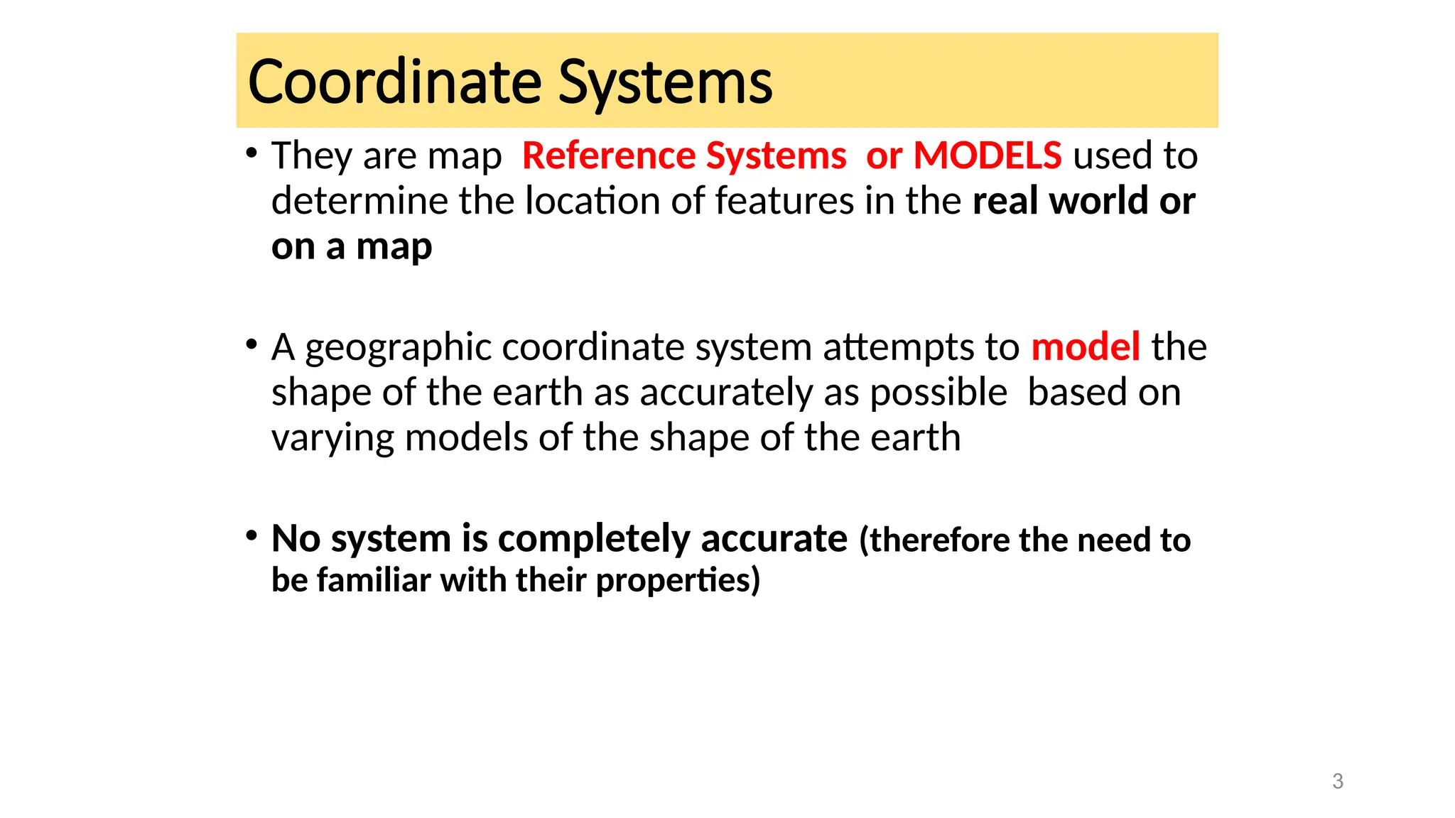
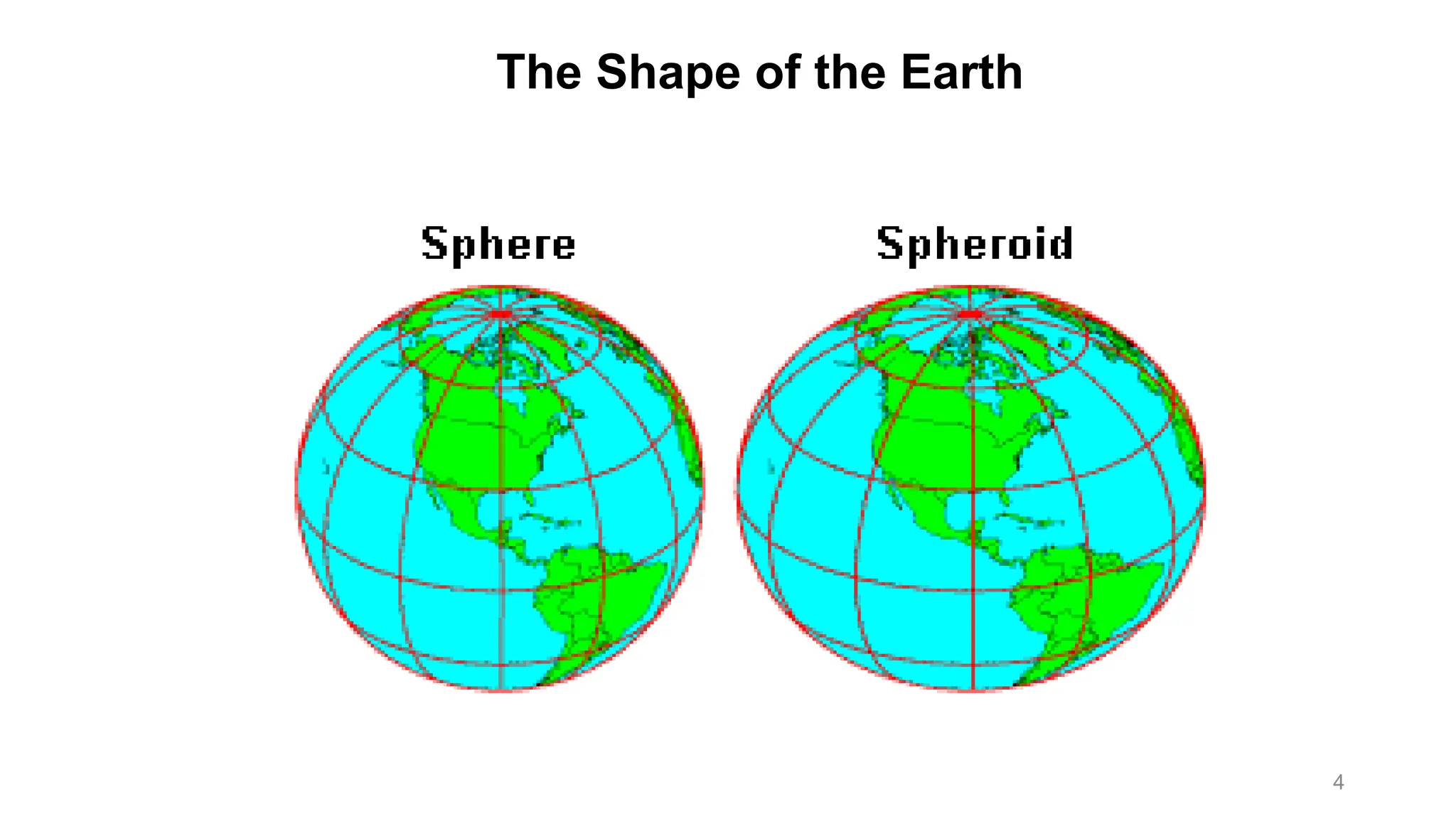
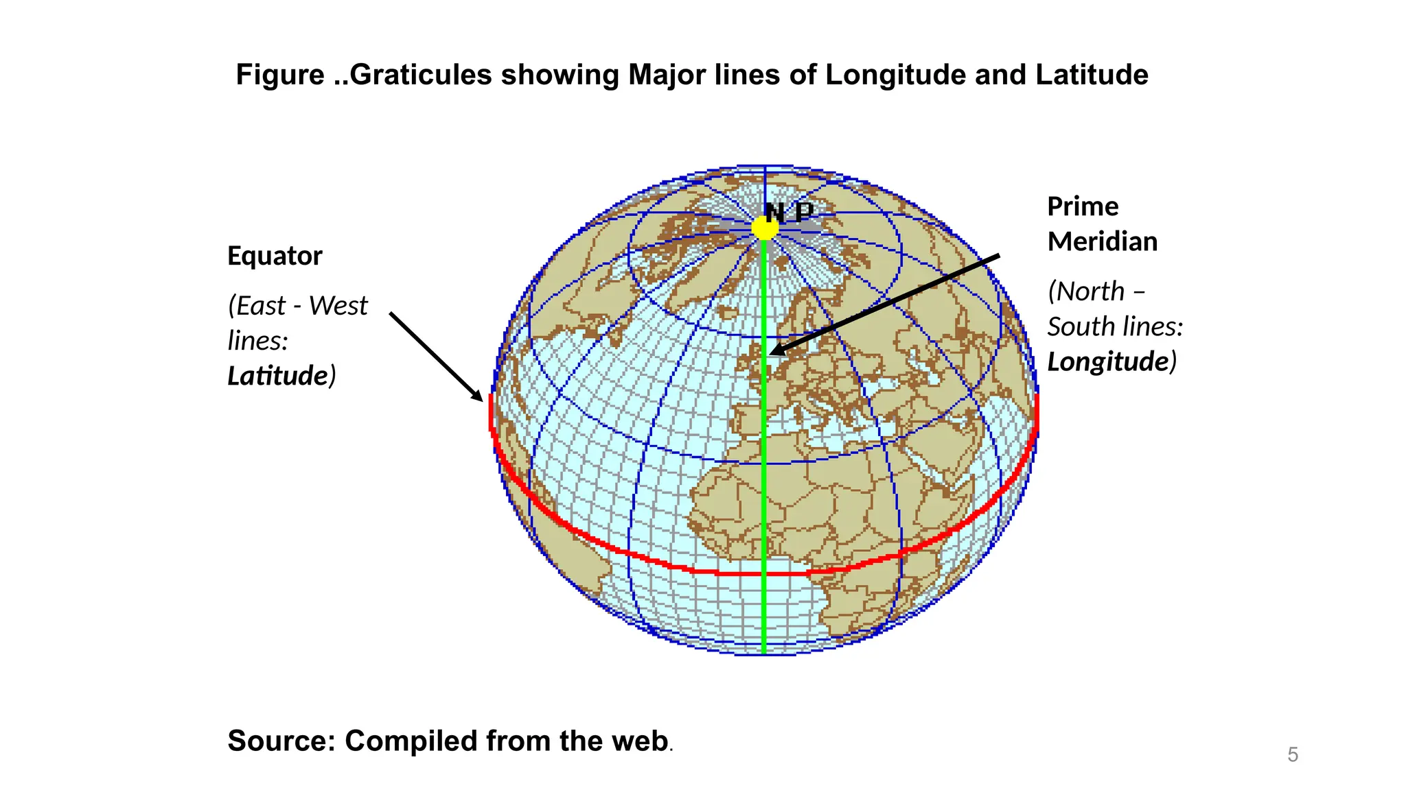
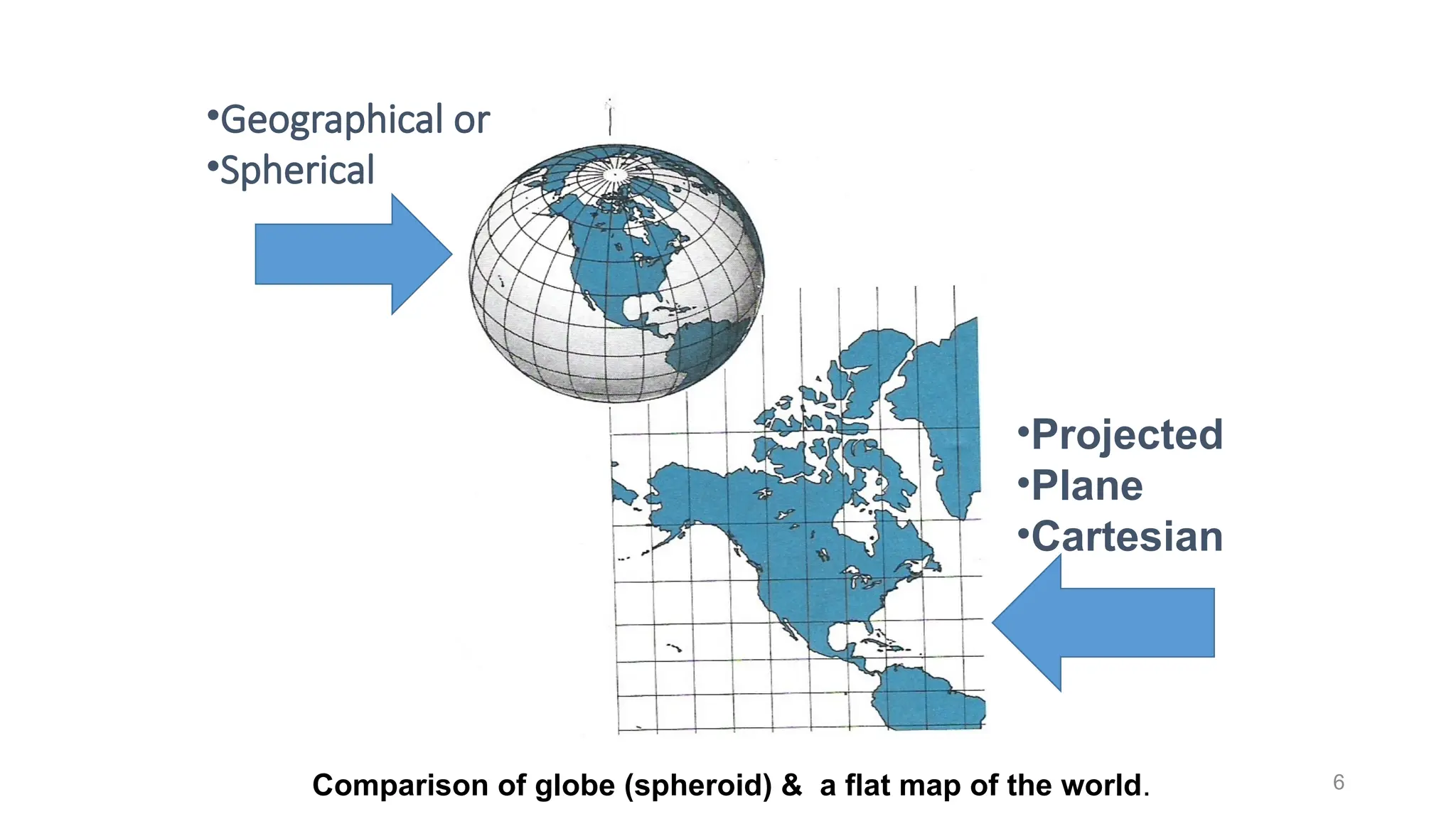
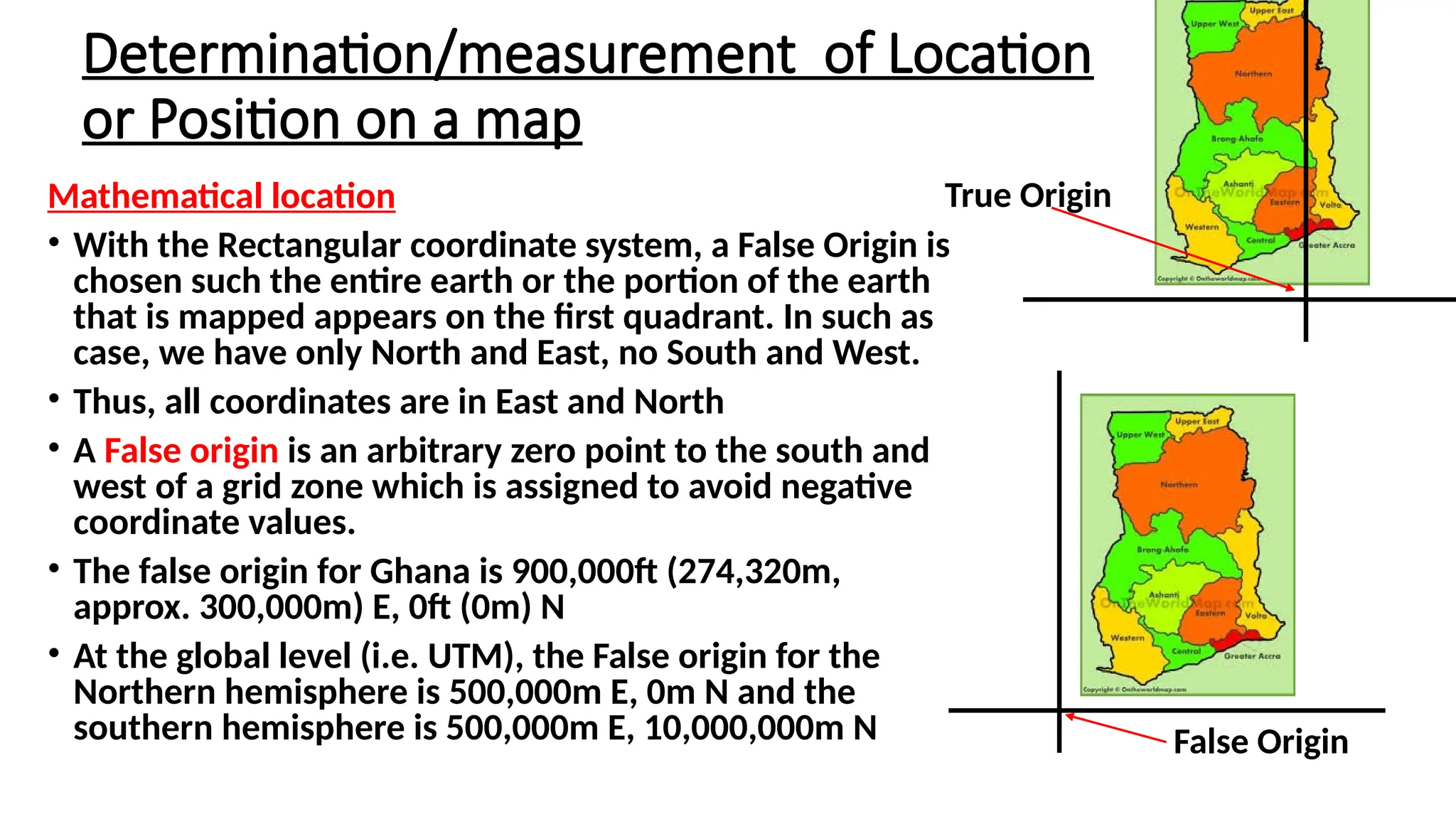
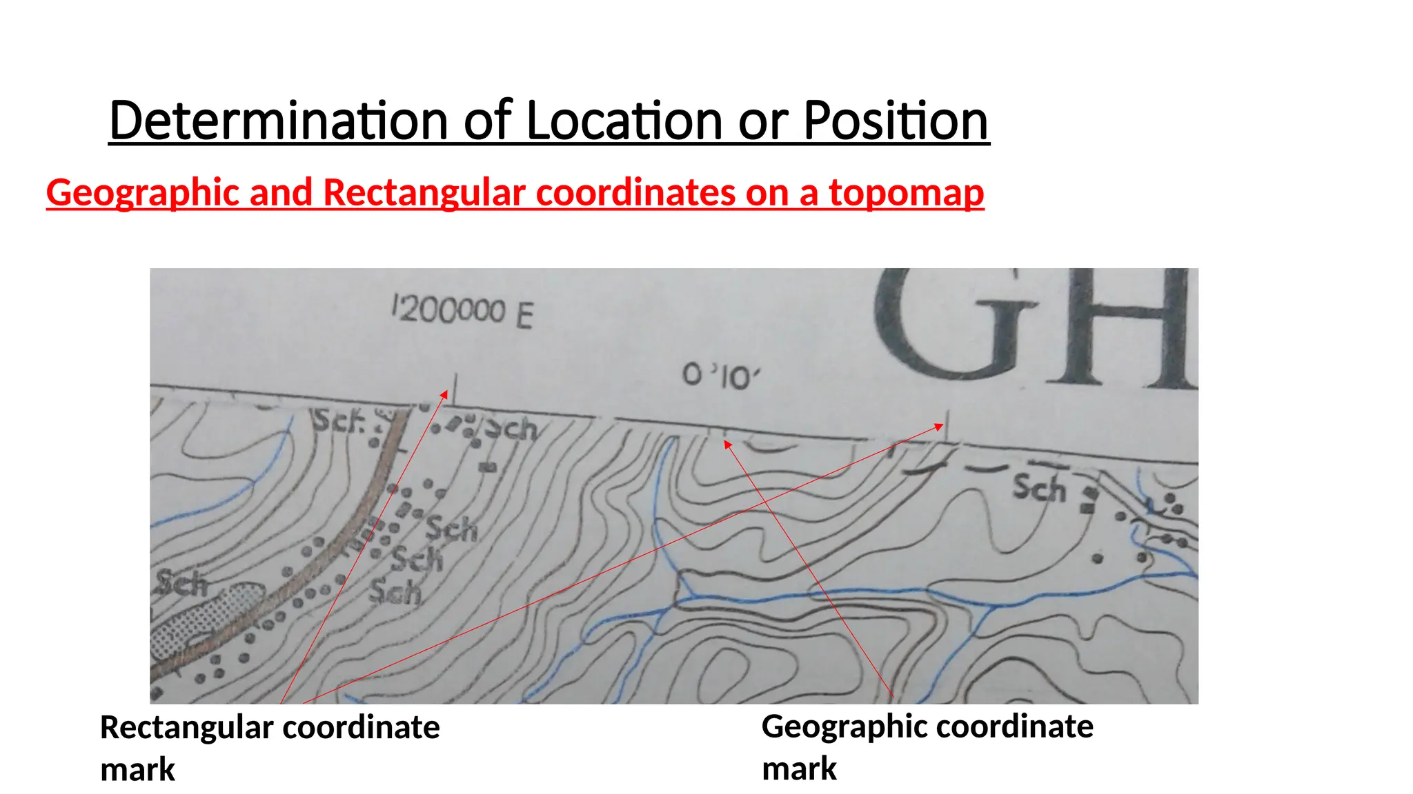
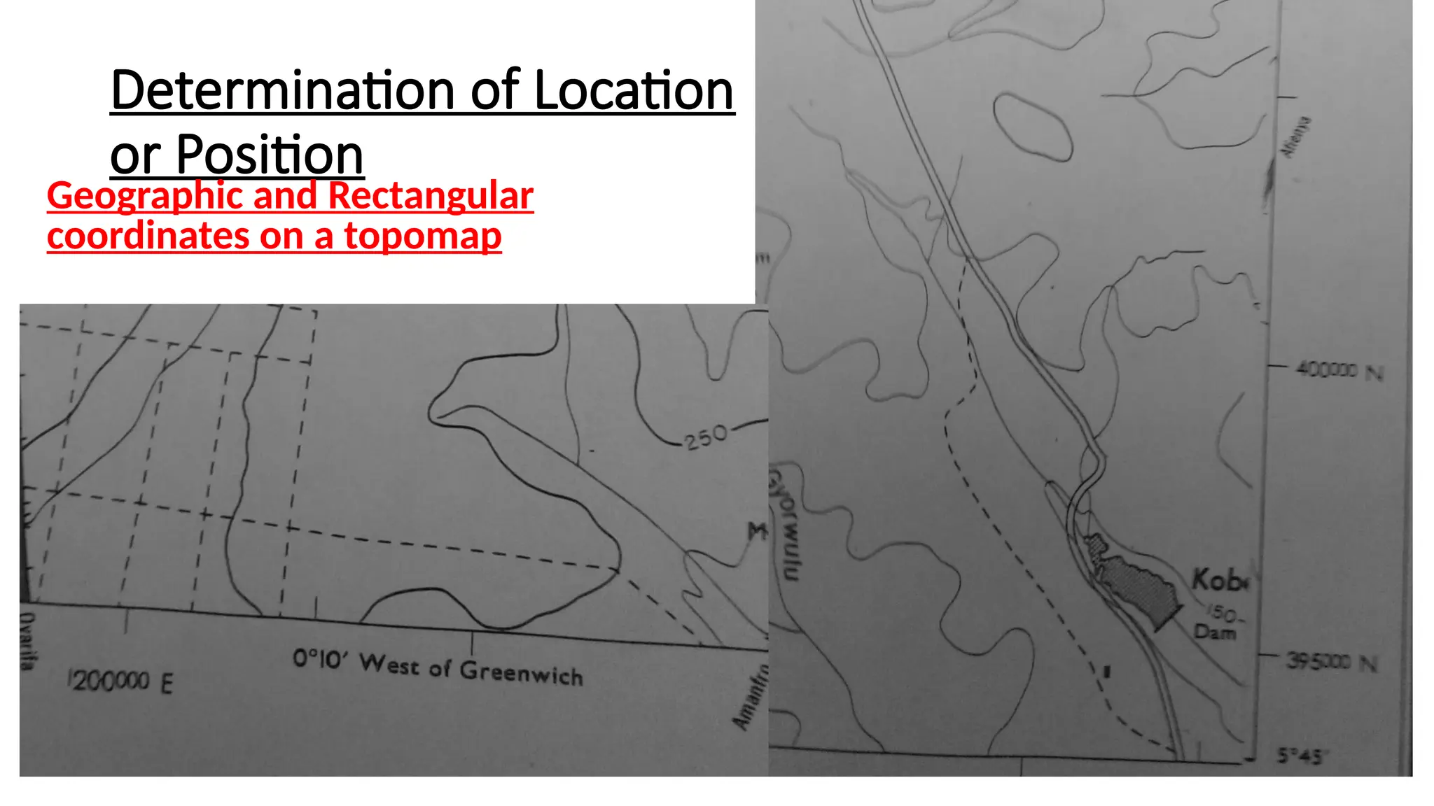
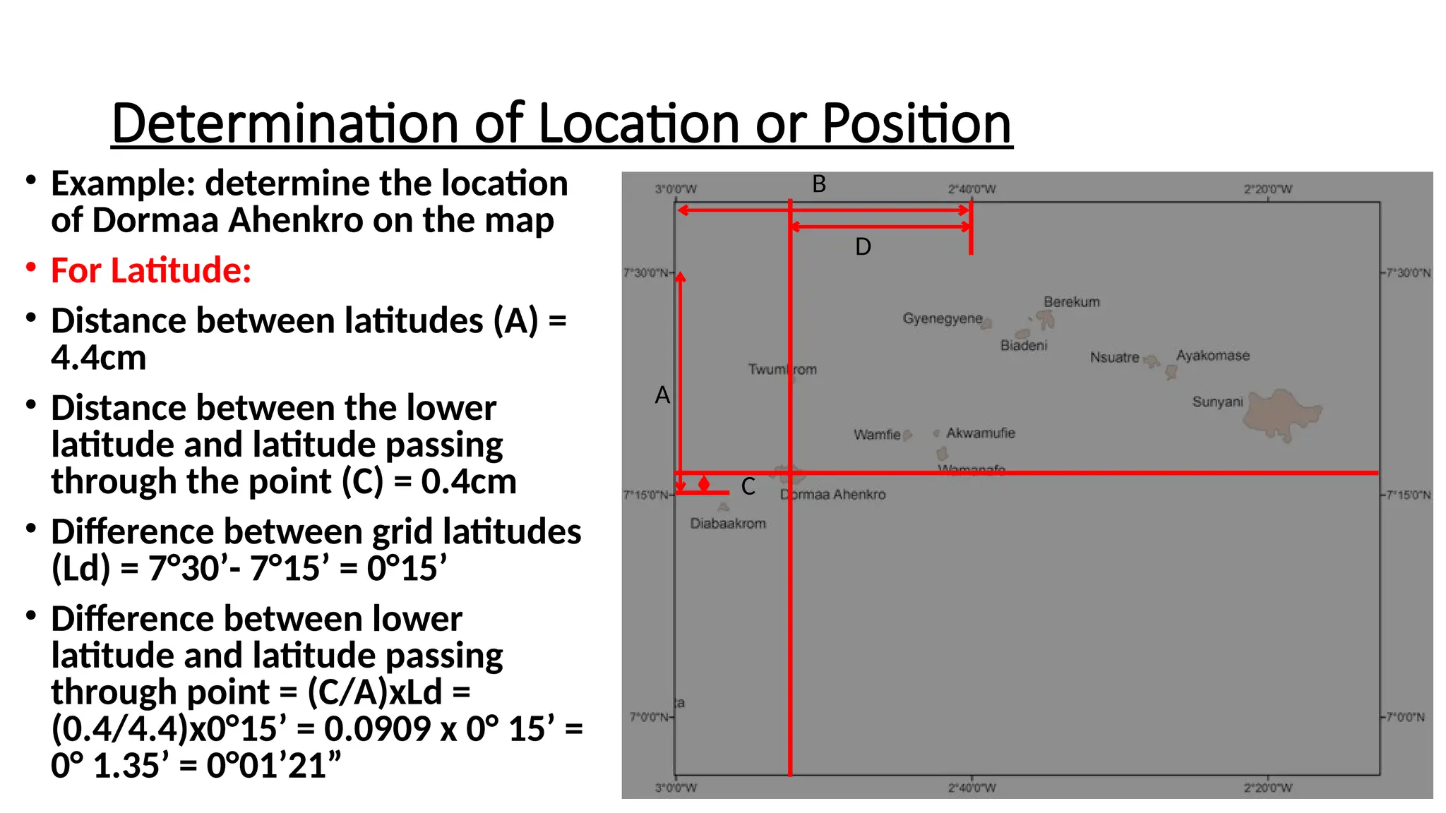
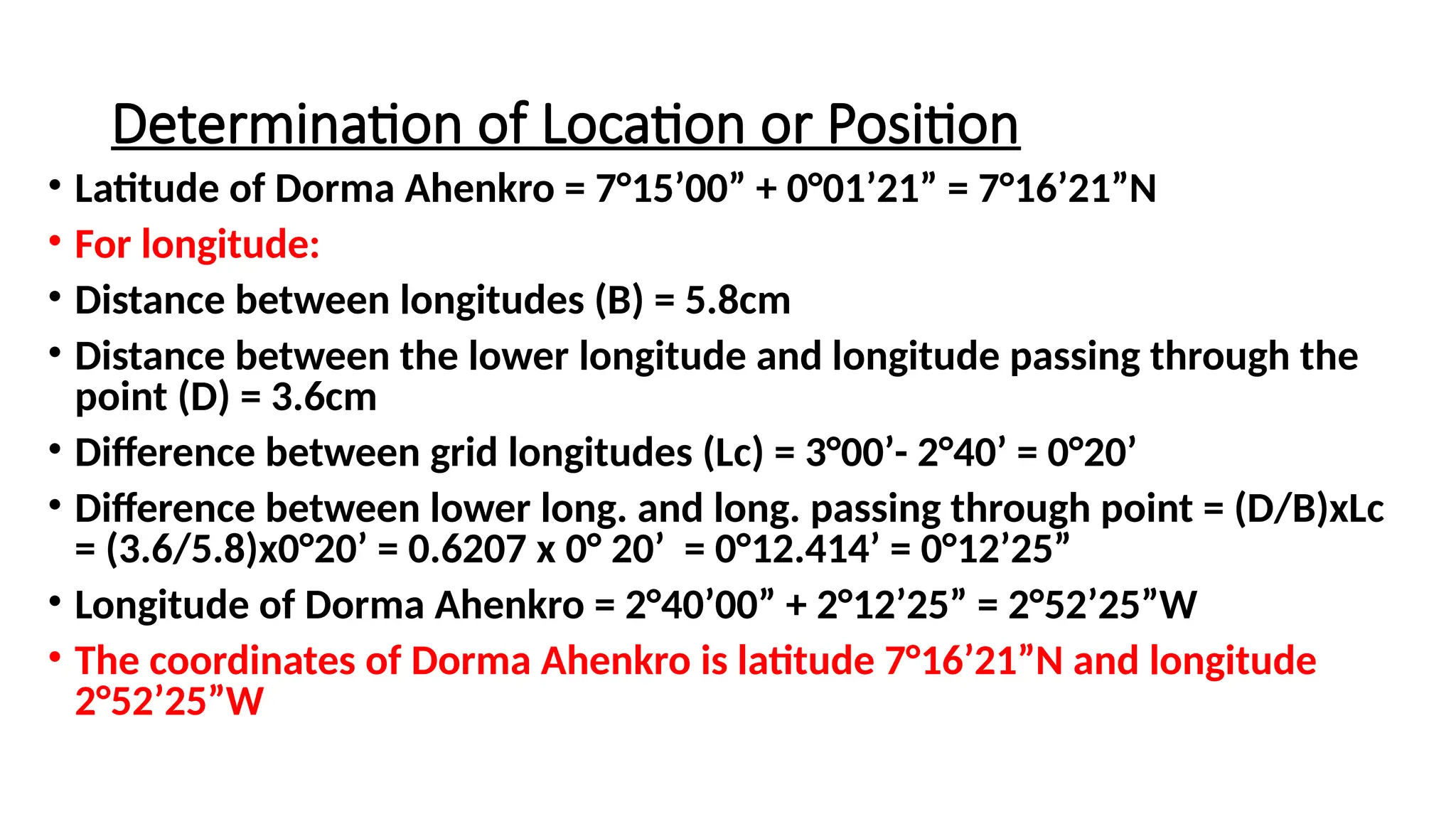
This lecture outlines how to make measurements on a map, particularly focusing on coordinate systems used to determine the location of features. It details the differences between geographic and projected coordinate systems, and outlines the steps to accurately determine and plot locations using mathematical coordinates. The lecture emphasizes the practical applications of these measurements for locating features, project siting, and navigation.