Lecture 5
•Download as PPT, PDF•
2 likes•336 views

Here are brief responses to your questions: A dam is a barrier built across a watercourse for retaining water. We build dams for water supply, irrigation, hydroelectric power generation, flood control, recreation etc. The main forces exerted on dams are water pressure, earth pressure, temperature stresses. Proper design is needed to withstand these forces. Common dam types are gravity dams, arch dams, buttress dams, embankment dams based on construction material and design. Key site conditions are impermeable foundation, adequate drainage, stable abutments, sufficient storage capacity. Geological parameters include type and

Recommended
More Related Content
What's hot
What's hot (20)
Similar to Lecture 5
Similar to Lecture 5 (20)
More from University of Gondar
Recently uploaded
Recently uploaded (20)
Lecture 5
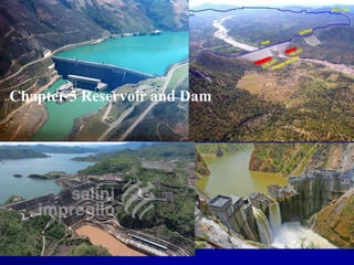
- 1. Chapter 5 Reservoir and Dam
- 2. Reservoir Definition of Reservoir Investigations of reservoir site Geological problems in reservoirs Types of Reservoirs Storage Capacity of Reservoirs 2 Dam Dam types and Loads on Dams Site Investigation of Dam Sites Selection of Type of Dam Geological consideration of dam site Causes of dam failure Chapter 5 Outline
- 3. Reservoir 1. Definition of Reservoir 2. Investigations of reservoir site 3. Geological problems in reservoirs 4. Types of reservoir
- 4. At the end of this chapter Students will be able to understand about different dams and reservoirs Students will be able to understand problems in dam foundation, abutments and reservoir Students will be acquire knowledge to fix problems in dam Students will be familiar with dam and reservoir site investigation 4
- 5. 5 Introduction: definitions and concepts Reservoir: a water body or lake which could be created when a barrier is constructed across a river or a stream. Advantages/uses of reservoirs: Water supply. Irrigation. Hydroelectric power generation. Recreation. Flood control. Navigation, and others. Disadvantages of reservoirs: Detract from natural settings, ruin nature's work. Inundate the spawning grounds of fish, and the potential for archaeological findings. Inhibit the seasonal migration of fish, and even endanger some species of fish. Foster diseases if not properly maintained. Water can evaporate significantly. Induce earthquakes.
- 6. Factors that affect Reservoir The most important factor are: a) Location of the dam b) Run-off characteristics of the catchment area. c) Water tightness of the proposed reservoir basin. d) Reservoir rim stability. e) Rate of sedimentation in the reservoir. f) Water quality and g) Seismic activity induced by the reservoir. 6
- 7. Reservoir Factors which influence the feasibility and economics of a proposed reservoir site are: Location of the dam
- 8. Reservoir Factors which influence the feasibility and economics of a proposed reservoir site are: Run-off characteristics of the catchment area
- 9. Reservoir Factors which influence the feasibility and economics of a proposed reservoir site are: Water tightness of the proposed reservoir basin
- 10. Reservoir Factors which influence the feasibility and economics of a proposed reservoir site are: Reservoir rim stability
- 11. Reservoir Factors which influence the feasibility and economics of a proposed reservoir site are: Rate of sedimentation in the reservoir
- 12. Reservoir Factors which influence the feasibility and economics of a proposed reservoir site are: Water quality(the effect of water and its contents) on building materials, especially concrete)
- 13. Reservoir Factors which influence the feasibility and economics of a proposed reservoir site are: Seismic activity induced by the reservoir Present land use and social factors
- 14. Investigation of Reservoir Sites The investigation of reservoir sites can be concentrated on Topographic surveys Geological investigations Hydrological investigations 14
- 15. Topographic Surveys Conducted for dam, reservoir and other associated work. Topographic survey of the area is carried out to evaluate the landscapes of the area evaluate accessibility of the area get most economical reservoir area 15
- 16. Hydrological Investigations The hydrological investigations are conducted for the following purposes : (i) To study the runoff pattern and storage capacity. (ii) To determine the maximum discharge at the site. 16
- 17. Hydrological Investigations Cont. In an investigation of a potential reservoir site, consideration must be given to : Rainfall Runoff Infiltration Evapotranspiration Topography Geological condition Vegetation cover/land use and land cover The two basic type of data needed for reservoir design are: Topographical maps Hydraulic records
- 18. Topographical Maps Storage capacity Catchment area and drainage density Reservoir volume Scale 1 Km Example Estimate the storage capacity of reservoir for Tefenya dam at MRL 2200m. Contour interval is 20m.
- 19. Solution Storage capacity of the reservoir is equal to (A+B)CI/2 + (B+C)CI/2 + (C+D)CI/2. Where A, B, C and D are the area between consecutive contour and CI is the contour interval.
- 20. Area No. Area b/n consecutive contour in m2 A-1 5899.18 A-2 5519.34 A-3 5240.67 A-4 5410.52 A-5 2319.08 A-6 317.77
- 21. Hydrological Records Hydrological records: amount of water available for storage purpose. Flood peaks and Volumes Rainfall Stream flow records The hydrological elaborations which are reported hereafter are aimed at the study of the following aspects: mean annual runoff and its monthly variability, flood sediment transport
- 22. Geological Investigation Geological investigations of the dam and reservoir site are done for the following purposes. (i) Suitability of foundation for the dam. (ii) Watertightness of the reservoir basin (iii) Location of the quarry sites for the construction materials. 22
- 23. Engineering Geological Investigation 1. Watertightness of the reservoir.. Hence the objective of the reservoir is to store water, so it is important to examine carefully, the lithological and geomorphological condition in the reservoir and surrounding areas because Water can escape… Through permeable rock slope… Through Continuous Fissures… Through Terrace Deposits Through ancient Buried Valleys Reservoir impounded water may escape through permeable beds into the adjoining valley
- 24. Engineering Geological Investigation 2. Stability of the reservoir slopes The slope stability condition of the area can be affected the function of the dam. reduced the storage capacity of the reservoir. caused over topping of the dam. Wave generation in reservoir due to landslide Example: Vajoint dam, Italy, in 1964 experienced such seiches, generated due to a catastrophic failure in the reservoir area, killing 2000 people in the low lying areas.
- 25. Engineering Geological Investigation 3. Siltation of the reservoir The siltation rate of the reservoir is depend on the amount and rate of inflow and the amount of solid material supplied. the size of a drainage basin The rock type, drainage density and gradient of slope. The time required to fill the critical storage volume. The land use and land cover condition of the areas
- 26. Considerations for successful reservoirs A reservoir can be claimed to be successful if: ♠ It is water tight or it does not suffer from any serious leakage of water. ♠ It has a long life due to a very low rate of silting in the reservoir basin. ♠ It should have adequate capacity to hold a large and desirable quantity of water. ♠ It should have less chances of occurrence of seismicity and landslides. ♠ It has a foundation rock with a good bearing capacity. Problems associated with reservoirs • The main geological problems associated with the reservoirs are ♠ Ground water conditions ♠ Silting ♠ Permeable rocks 26
- 27. Ground water conditions Rivers which loses water are known as influent rivers. Hence there is leakage under reservoirs. Rivers which gain water from the ground water are known as Effluent Rivers. Hence there is no leakage. 27 Fig.8.(a) Influent and (b) Effluent river condition at reservoir site
- 28. Silting of Reservoirs The amount of silt produced and supplied to the rivers depends mainly on: ♠ lithological character and ♠ topography of the catchment area. The rivers flowing over the soft rocks and high gradient areas carry greater amounts of silt. The measures that help to reduced silting of reservoirs are: ♠ Vegetation ♠ Covering with slabs on weak zones ♠ Terracing of the slope and construction of retaining walls ♠ Check dams ♠ By diversion of sediment-loaded waters. Permeable rocks The rocks, which are highly porous, are likely to cause series leakage from the reservoir. The following methods used to seal permeable zones: ♠ Natural silting ♠ Grouting ♠ Covering weak zones with concrete slabs. 28
- 29. Site Selection The following points are important to select suitable sites for reservoir Large storage capacity River valley should be narrow, length of dam to constructed is less. Water tightness of reservoir. Good hydrological conditions Deep reservoir 29
- 30. Small submerged area Low silt inflow No objectionable minerals Low cost of real estate Site easily accessible 30 Site Selection Cont.
- 31. 31 5.4 Types of reservoirs Depending upon the purposes they serve, reservoirs may be classified into the following: i. Storage or Conservation Reservoirs: Reservoirs constructed across a stream or river to store the seasonal flows (low flows and peak flows). Commonly used for water supply, irrigation, hydropower generation, recreation, etc. ii. Flood Control Reservoirs: Stores a portion of the flood flow in such a way as to minimize the flood peaks at the areas to be protected downstream iii. Distribution Reservoirs: Temporary storage facilities provided to store flows during low flows to be used for peak flows. E.g. Water supplies ponds, Night storage pond for irrigation. iv. Multipurpose Reservoirs: A reservoir planned and constructed to serve not only one purpose but various purposes together. E.g. Irrigation, water supply, recreation, hydropower, flood control, navigation etc.
- 32. Reservoir: Important physical characteristics of reservoir: Storage capacity Yield/Safe yield 32
- 33. 33 Storage Capacity of Reservoirs The volume of water stored in the reservoir can be refereed as reservoir capacity. It is determined after identifying the surface area covered by water and elevation differences between consecutive areas. The surface areas are determined from topographic maps of the reservoir area. There are a number of options to determine the storage capacity of a reservoir (E.g. End area method, prismoidal).
- 34. 34 Storage Capacity calculation formulae: 1. Trapezoidal formula. 2. Cone formula. 3. Prismoidal formula. 4. Storage Volume from cross-sectional areas.
- 35. Reservoir area contour map 35
- 36. Gross storage = Live storage + Dead storage Live storage Dead storage Dam 36
- 37. 37 Basic Terms and Definitions of Reservoir Zone (1) Full reservoir level (FRL): is the highest water level to which the water surface will rise during normal operating conditions. Also called the full tank level (FTL) or the normal pool level (NPL). (2) Maximum water level (MWL): is the maximum level to which the water surface will rise when the design flood passes over the spillway. Also called the maximum pool level (MPL) or maximum flood level (MFL). (3) Minimum pool level: is the lowest level up to which the water is withdrawn from the reservoir under ordinary conditions. It corresponds to the elevation of the lowest outlet (or sluiceway) of the dam. However, in the case of a reservoir for hydroelectric power; the minimum pool level is fixed after considering the minimum working head required for the efficient working of turbines.
- 38. 38 (4) Useful storage: volume of water stored between the full reservoir level and the minimum pool level. Also known as the live storage. (5) Surcharge storage: is the volume of water stored above the full reservoir level upto the maximum water level. The surcharge storage is an uncontrolled storage which exists only when the river is in flood and the flood water is passing over the spillway. This storage is available only for the absorption of flood and it cannot be used for other purposes. (6) Dead storage: volume of water held below the minimum pool level. The dead storage is not useful, as it cannot be used for any purpose under ordinary operating conditions.
- 39. 39 (7) Bank storage: If the banks of the reservoir are porous, some water is temporarily stored by them when the reservoir is full. (8) Valley storage: The volume of water held by the natural river channel in its valley upto the top of its banks before the construction of a reservoir is called the valley storage. May be important in flood control reservoirs. (9) Yield from a reservoir: Yield is the volume of water which can be withdrawn from a reservoir in a specified period of time. The yield is determined from the storage capacity of the reservoir and the mass inflow curve. (10) Safe yield (Firm yield): is the maximum quantity of water which can be supplied from a reservoir in a specified period of time during a critical dry year. Lowest recorded natural flow of the river for a number of years is taken as the critical dry period for determining the safe yield. (11) Secondary yield: is the quantity of water which is available during the period of high flow in the rivers when the yield is more than the safe yield. It is supplied on at the lower rates. The hydropower developed from secondary yield is sold to industries at cheaper rates.
- 40. 40 (12) Average yield: is the arithmetic average of the firm yield and the secondary yield over a long period of time. (13) Design yield: is the yield adopted in the design of a reservoir. Fixed after considering the urgency of the water needs and the amount of risk involved. The design yield should be such that the demands of the consumers are reasonably met with, and at the same time, the storage required is not unduly large.
- 41. Reservoir problems The main reservoir problems which are linked with geologic characteristics of the area are: Seepage and leakage: - no reservoir is free of seepage, - leakage is the abnormally large escape of water from the reservoir Leakage may occur along - buried channels, - solution cavities in soluble rocks, - joints, faults, and other weakness planes 41
- 42. Leakage buried channels beneath drift 50 km Modern river/valley Ancient river/valley Sautet dam and reservoir Bypass of reservoir in drift Reservoirs: leakage 42
- 43. river reservoir before after water table divide Leakage to next valley Bedrock with a water table and finite permeability new water table Reservoir problem: water table leakage-1 43
- 44. river before Bedrock with low permeability: aquiclude High permeability layer Water table in aquifer reservoir after High permeability layer Modified water table in aquifer Leakage to next valley Reservoirs: water table leakage-2 44
- 45. Before Water table river After - 1 reservoir Raised water table After - 2 reservoir Failure and slumping due to weakened rock mass Reservoirs: raised water table 45
- 47. 47 Consequences of Reservoir Sedimentation Loss of Storage (yield; reliability) Upstream: loss of navigable depths Downstream: degradation of channel; loss of land and habitats Hydropower: downstream deposits can increase and decrease efficiency HP Abrasion of turbines
- 48. 48 How do we control sedimentation?? 1. Reduce sediment inflow erosion control and upstream sediment trapping. 2. Route sediments Some or all of the inflowing sediment load may be hydraulically routed beyond the storage pool by techniques such as off-stream reservoirs, sediment bypass, and venting of turbid density currents. 3. Sediment removal Deposited sediments may be periodically removed by hydraulic flushing, hydraulic dredging, or dry excavation. 4. Provide large storage volume Reservoir benefits may be considered sustainable if a storage volume is provided that exceeds the volume of the sediment supply.
- 49. DamDam Dam Dam types and Loads on Dams Site Investigation of Dam Sites Selection of Type of Dam Geological consideration of dam site Causes of dam failure
- 50. Brain Storm Questions What is dam? Why we build dam Discuss forces that exert on dams What are different types of dams Explain site conditions for dams What are parameters we have to consider during geological and engineering geological study of dam sites? Discuss the remedial measurements if there engineering problems encountered at proposed dam site??
- 51. Dam and Dam Site A Dam is a solid barrier, which is constructed across a river to store water. A dam is built mainly: ♠ To store water for irrigation ♠ To generate hydro electric power ♠ To supply water to industries ♠ To supply water for domestic use ♠ To Control flood ♠ To control Siltation A dam that serves more than one purpose is called a multi purpose Dam 51
- 52. A Dam and Its Parts Heel: is that part of a dam which comes in contact with the ground on the upstream side Toe: It is that part of the dam which comes in contact with the ground on the downstream side Spillways: are the openings made in a dam near the top to let off excess water of the reservoir to the downstream side They are commonly placed on a sound foundation within or out side the body of the dam and the openings are controlled by suitably designed gates
- 53. Sluices: are openings in the dam near the ground level They are useful in clearing the slit of the reservoir Cut of wall: is an under ground wall like structure of concrete in the heel position. It is useful to prevent leakage and uplift pressure (or under thrust) under the foundation and thereby to avoid undercutting of the heel of the dam A Dam and Its Parts
- 54. Galleries: are small rooms left within a dam for checking operations Free board: It is the part of the dam structure between top of the dam and highest storage level Abutments: These are the sides of the valley supporting the dam structure Diversion tunnels: are the tunnels constructed beforehand for diverting the river water. These help in keeping the river bed dry at the dam site and facilitate dam construction A Dam and Its Parts
- 55. 55 Classification of Dams (a) Based on function: Storage dams Detention dams Diversion dams Debris dams Coffer dams - a temporary dam constructed for facilitating construction. It is an enclosure constructed around a site to exclude water so that the construction can be done in dry.
- 56. 56 (b) Based on Hydraulic Design: Overflow dams. Non-overflow dams.
- 57. 57 (c) Based on Materials of Construction: Masonry dam Concrete dam Earth dam Rock fill dam Timber dam Steel dam Combined concrete-earth dam Composite dam.
- 58. 58 (d) Based on Rigidity Rigid dams: A rigid dam is quite stiff. It is constructed of stiff materials such as concrete, masonry, steel and timber. • These dams deflect and deform very little when subjected to water pressure and other forces Non-rigid dams: A non-rigid dam is relatively less stiff compared to a rigid dam. • The dams constructed of earth and rock fill are non- rigid dams. There are relatively large settlements and deformations in a non-rigid dam. Rock fill dams are actually neither fully rigid nor fully non-rigid. These are sometimes classified as semi-rigid dams.
- 59. 59 (e) Based on structural action: Gravity dams Embankment dams Earth dams Rock fill dams Arch dams Buttress dams Others Steel dams Timber dams
- 60. Dam Types, Advantages and Disadvantages 60
- 61. 61 Gravity Dams A gravity dam resists the water pressure and other forces due to its weight (or gravitational forces). Rigid, heavy, massive, monolithic structure –Made of large amounts of concrete –Resistance is due to their own weight •Favorable site: –Constricted area of a valley –Close sound bed rock, both in the floor and abutments
- 63. 63 Concrete Gravity Dam with Overflow Section
- 64. 64 Advantages of Gravity Dams: Gravity dams are quite strong, stable and durable. are quite suitable across moderately wide valleys/gorges having steep slopes where earth dams, if constructed, might slip. can be constructed to very great heights, provided good rock foundations are available. are well adapted for use as an overflow spillway section. Earth dams cannot be used as an overflow section. Even in earth dams, the overflow section is usually a gravity dam. are specially suited to such areas where there is very heavy downpour. The slopes of the earth dams might be washed away in such an area. maintenance cost of a gravity dam is very low. does not fail suddenly. There is enough warning of the imminent failure and the valuable property and human life can be saved to some extent. can be constructed during all types of climatic conditions. sedimentation in the reservoir on the upstream of a gravity dam can be somewhat reduced by operation of deep-set sluices.
- 65. 65 Disadvantages of Gravity Dams: Gravity dams of great height can be constructed only on sound rock foundations. These cannot be constructed on weak or permeable foundations on which earth dams can be constructed. initial cost of a gravity dam is usually more than that of an earth dam. At the sites where good earth is available for construction and funds are limited, earth dams are better. usually take a longer time in construction than earth dams, especially when mechanized plants for batching, mixing and transporting concrete are not available. require more skilled labour than that in earth dams. subsequent raising is not possible in a gravity dam.
- 66. 66 Earth Dams An earth dam is made of earth (or soil) and resists the forces exerted upon it mainly due to shear strength of the soil. Are usually built in wide valleys having flat slopes at flanks (abutments). Can be homogeneous when the height of the dam is not great. Are of zoned sections, with an impervious zone (called core) in the middle and relatively pervious zones (called shells or shoulders) enclosing the impervious zone on both sides. Nowadays majority of dams constructed are of this type. The highest dams of the world are earth dams (Rongunsky dam Russia, 325 m and Nurek dam, Russia, 317 m).
- 67. 67 Advantages of Earth Dams: are usually cheaper than gravity dams if suitable earth for construction is available near the site. can be constructed on almost all types of foundations, provided suitable measures of foundation treatment and seepage control are taken. can be constructed in a relatively short period. skilled labour is not required in construction of an earth dam. can be raised subsequently. are aesthetically more pleasing than gravity dams. are more earthquake-resistant than gravity dams.
- 68. 68 Disadvantages of Earth Dams: are not suitable for narrow gorges with steep slopes. cannot be designed as an overflow section. a spillway has to be located away from the dam. cannot be constructed in regions with heavy downpour, as the slopes might be washed away. maintenance cost of an earth dam is quite high. it requires constant supervision. sluices cannot be provided in a high earth dam to remove slit. fails suddenly without any sign of imminent failure. a sudden failure causes havoc and untold miseries.
- 69. 69 Rock fill Dams A rock fill dam is built of rock fragments and boulders of large size. An impervious membrane (cement concrete or asphaltic concrete or earth core) is placed on the rock fill on the upstream side to reduce the seepage through the dam. A dry rubble cushion is placed between the rock fill and the membrane for the distribution of water load and for providing a support to the membrane. Side slopes of rock fill are usually kept equal to the angle of repose of rock (1.4:1 or 1.3:1). Rock fill dams are quite economical when a large quantity of rock is easily available near the site.
- 70. 70
- 71. 71
- 72. 72 Advantages of Rock fill Dams: Rockfill dams have almost the same advantages and disadvantages over gravity dams as discussed for earth dams. are quite inexpensive if rock fragments are easily available. can be constructed quite rapidly. can better withstand the shocks due to earthquake than earth dams. can be constructed even in adverse climates Disadvantages of Rock fill Dams: Rock fill dams require more strong foundations than earth dams. Rock fill dams require heavy machines for transporting, dumping and compacting rocks.
- 73. 73 Arch Dams • Composed of a single concrete wall of high strength, curved in plan with its convex face pointing upstream. • Transmits most of the horizontal thrust of the water load to the adjacent abutments by arch action. • Impose high stresses upon narrow zones • The rock mass at the abutments and immediately down valley of the dam must be strong. Favorable site: • Narrow gorges • Walls should be capable of withstanding the thrust produced by the arch action • Well-keyed into the abutments
- 74. 74
- 75. 75 Advantages of Arch Dams: requires less concrete as compared to a gravity dam as the section is thinner. are more suited to narrow, V-shaped valley, having very steep slopes. uplift pressure is not an important factor in the design of an arch dam because the arch dam has less width and the reduction in weight due to uplift does not affect the stability. can be constructed on a relatively less strong foundation because a small part of load is transferred to base, whereas in a gravity dam full load is transferred to base.
- 76. 76 Disadvantages of Arch Dams: Requires good rock in the flanks (abutments) to resist the thrust. If the abutments yield, extra stresses develop which may cause failure. Requires sophisticated formwork, more skilled labor and richer concrete. Cannot be constructed in very cold climates because spalling of concrete occurs due to alternate freezing and thawing. Are more prone to sabotage. The speed of construction is relatively slow.
- 77. 77 Buttress Dams Consists a slab/deck or reinforced concrete which slopes upstream and supported by a number of buttresses from the downstream side whose axis are normal to the slab. The buttresses support the deck and transmit the water load to the foundation Favorable site: –Competent foundation rock
- 78. 78
- 79. 79
- 80. 80 Advantages of Buttress Dams: Buttress dams require less concrete than gravity dams. Uplift/ice pressure is generally not a major factor. can be constructed on relatively weaker foundations. Power house and water treatment plants, etc. can be housed between buttresses. Vertical component of the water pressure on deck prevents the dam against overturning and sliding failures. Can be designed to accommodate moderate movements of foundations without serious damages. Heat dissipation is better in buttress dams. Back of the deck and the foundation between buttresses are accessible for inspection. Can be easily raised subsequently by extending buttresses and deck slabs.
- 81. 81
- 82. 82 Disadvantages of Buttress Dams: Buttress dams require costlier formwork, reinforcement and more skilled labor. Consequently, the overall cost of construction may be more than that of a gravity dam. Buttress dams are more susceptible to damage and sabotage. Buttress dams cannot be constructed in very cold climates because of spalling of concrete. Because the upstream deck slab is thin, its deterioration may have very serious effect on the stability.
- 83. 83 Composite Dams • Composite dams are combinations of one or more dam types. Most often a large section of a dam will be either an embankment or gravity dam, with the section responsible for power generation being a buttress or arch. The Bloemhof Dam on the Orange River of South Africa is an excellent example of a gravity/buttress dam.
- 84. 84 Loads on Dams (a) Primary loads: Water loads. Seepage forces. Self-weight loads. (b) Secondary loads: Sediment load: generates horizontal thrust. Hydrodynamic wave action: wave action. Ice load: extreme climate. Thermal load: concrete dams (change in Temperature, cement hydration and cooling). Abutment hydrostatic load: internal seepage load in abutment rock mass (arch dams). Interactive effects: from relative stiffness and differential deformation of dam and foundation. (c) Exceptional loads: seismic loads and tectonic effects.
- 85. 85 Schematic of principal loads: gravity dam profile.
- 86. 86 Internal uplift and pressure envelopes
- 87. 87 Questions: What is the purpose of drain holes/ gallery in gravity dams? Where is the position of the drain holes: upstream or downstream of curtain grout? Is uplift pressure a concern for embankment dams? Why?
- 88. Engineering Geological Dam Site investigation I. Reconnaissance Study 1. Evaluation of the data having at archives 2. Field investigation for limited time (Reconnaissance Study) 3. Some maps in small scale, for example 1:25.000 or 1:50.000 4. Some hydraulic data about a. Basin b. Precipitation area c. Runoff, maximum discharge 5. Some approach to the reservoir area, dam site and type of dam and height of dam...etc 6. Photogeological studies 88
- 89. Cont’d II. Prelımınary Studıes at the reservoır area and dam sıte 1. Dam site investigations Location of dam axis Location of diversion tunnel Location of spillway Location of powerhouse...etc 2. Geological studies 3. Geophysical surveying 4. Underground investigations Boreholes Drilling tests 5. Surveying for materials Field surveying Laboratory tests 89
- 90. Preliminary studies… cont’d 6. Slope stability investigations 7. Earthquake hazard & risk analysis 8. Environmental studies 9. Leakage possibilities from reservoir area 10. Leakage possibilities from dam site 11. Erosion, sedimentation & siltation 90
- 91. Detaıled Investıgatıon at Dam Sıte 1. Topographic surveyings 2. Geological mappings 1:5000 – 1:1000 or 1:500 3. Underground explorations Boreholes, adits....etc 4. Hydrogeological studies 5. Slope stability analysis 91
- 92. Factors Affectıng Dam Type Selectıon • Topography • Geology • Bearing capacity of the underlying soil • Foundation settlements • Permeability of the foundation soil Material availability Spillway position Earthquakes Safety Height Aesthetic view Qualified labour Cost 92
- 93. Factors Affecting Dam Axıs Topography Geology Materials Spillway location availability Sediments in the flowing water Water quality Earthquake possibility Downstream water rights 93
- 94. Geological considerations in the selection of a dam site The important geological requirements, which should be considered in the selection of a dam site, are as follows: •Narrow river valley •Occurrence of the bedrock at a shallow depth •Competent rocks to offer a stable foundation •Proper geological structures 94
- 95. Narrow River Valley At the proposed dam site, if the river valley is narrow, only a small dam is required, which means the cost of dam construction will be less. On the other hand, if the valley is wide, a bigger dam is necessary which means the construction cost will be very high. 95
- 96. Occurrence of the Bedrock at a shallow depth To ensure its safety and stability a dam has to necessarily rest on (Physically) very strong and (Structurally) very stable (i.e. bedrocks). If such competent bedrocks occur near the surface or at shallow depths, the foundation cost of the dam will naturally be less. On the other hand, if competent bedrocks occur at great depths, the cost of the foundation will be very high because it involves extensive work of excavation of loose overburden and concrete refilling. 96
- 97. Problems Related to Incompetence of Rocks. ♠ Dams on shale ♠ Dams on soluble rocks ♠ Dams on Volcanic rocks Dam on shale ♠ Shale is soft rock and when saturated with water under pressure likely produces lubricating material making a slippery base. ♠ Shale’s bearing capacity is low and it becomes plastic when wetted. 97
- 98. Dam on soluble rocks ♠ The soluble rocks include limestone, dolomite and marble. ♠ These rocks are generally strong to support the weight of the dam. ♠ But they may contain underground openings due to dissolution. 98 Dams on Volcanic rocks all plutonic rocks like Granites, Syenites, diorites and gabbros are very competent and desirable rocks. However, volcanic rocks which are vesicular or amygdaloidal, are not equally desirable, obviously because these character contributes to porosity, permeability and hollowness which, in turn, reflect the strength of the rocks.
- 99. Problems Related to Improper Geological Structures ♠ Dam on horizontal strata ♠ Dam built across the strike of the rocks ♠ Dam on strata dipping up stream. ♠ Dam on strata dipping down stream. ♠ Dam on jointed and permeable rocks. ♠ Dam on faults 99
- 100. Dam on horizontal strata Here the load of the dam acts perpendicular to the bedding planes and the beds as a whole can withstand the pressure with full competence Also, the compressing weight prevents seepage Thus, leakage is checked and uplift pressure is avoided This is a safe situation for a dam site
- 101. Dam built across the strike of the rocks If a dam is aligned across the strike of the strata, then its foundation will be on different rock types of varying properties. This situation leads to unequal settlements of the dam foundation. 101 Water Dam
- 102. Where the strike direction is parallel to the axis of the dam: i. Strata with gentle (100 to 450) upstream dip The resultant force acts more or less perpendicular to the bedding planes The formations are best positioned to withstand the loads effectively The infiltrated water is directed upstream side by the bedding planes. So the scope for leakage downstream side is restricted No scope for uplift pressure Gentle upstream dip is ideal for dam location better than the earlier situation
- 103. Where the strike direction is parallel to the axis of the dam: ii. Strata with steep (more than 450) upstream dip The bedding planes are not perpendicular to the resultant force and hence this is not as ideal as the previous situation Percolated water returns to upstream side and no scope for seepage There will not be uplift pressure Situation is good but not as good as the previous one
- 104. Where the strike direction is parallel to the axis of the dam: iii. Strata with 100 to 450 downstream dip The resultant force and bedding planes are in the same direction This situation is harmful to the dam for the following reasons: 1. The resultant force and the dip of bedding planes are in the same direction so it is vulnerable for slip 2. The scope for percolation of water along the bedding planes is enhanced 3. It enhances uplift pressure 4. Significant loss of water due to seepage 5. If a clay formation is there, it acts as a slippery plane. Situation of this kind is very undesirable and dangerous
- 105. Where the strike direction is parallel to the axis of the dam: vi. Strata with steep (more than 450) downstream dip Here the resultant force and the bedding planes are almost parallel and they are vulnerable for slip Situation here is worse than the previous one Such geological structure is bad and disadvantageous
- 106. Where the strike direction is parallel to the axis of the dam: v) Vertical strata Perfectly vertical beds are uncommon in nature and they normally have some inclination. If such situation is present: i. It will not pose the problem of uplift pressure ii. It does not allow percolation and seepage This situation is better than the above two situations Here the load of the dam acts parallel to the beds as a whole are resistant enough to with stand pressure, but not much as horizontal beds
- 107. Where the strata are vertical
- 108. Folded Strata Folds are generally less dangerous than faults They consist of two limbs and each limb can be considered as a set of dipping strata When viewed from this approach the influence of a fold at the dam site can be interpreted either as advantageous or disadvantageous just as in the case of occurrence of inclined beds
- 109. Folded Strata Case 1: This case is similar to the situation where the strata dip upstream side and it is advantageous Case 2: Here the dam is on the crest of the fold and the strata dip in the upstream side. This situation is similar to the case where the strata dip upstream side and it is also as advantageous Case 3: This case is similar to the situation were the strata dip downstream side and it is disadvantageous. However, it should be borne in the mind that unlike simple tilted strata, the folded rocks also are highly fractured along the crests because of the strain. Hence grouting and other precautions are to be considered to improve the stability and competence of the rocks at the dam site
- 110. Faulted Strata Occurrence of a fault irrespective of the attitude of the strata (strike and dip) at the dam site is most undesirable If the fault is active, under no circumstance, dam construction can be taken up It causes not only displacement of the site but also possible occurrence of earth quakes If crushed or intensively fractured, it becomes physically incompetent to bear the forces of a dam Due to the associated porosity and permeability, the water is percolated and seepage causes uplift However if need arises, and if the tectonic history of the faulted region indicates that it has become stable and has no threat of possible recurrence then such site can be considered after necessary treatment
- 111. Faulted StrataCase 1: i. If a fault occurs upstream side and dips upstream side, the fault face needs to be sealed to avoid possible leakage Case 1: ii. If a fault occurs upstream side and dips downstream side, it is not desirable because it has all the disadvantages like uplift pressure, heavy leakage of water, etc. Case 2: If the dam has to rest on inactive faults, it is harmful unless strong precautions are taken Case 3: If faults occur downstream side, they are not at all harmful irrespective of their attitude
- 112. ***
- 113. 113 Geological and geotechnical problems of dam sites in Ethiopia Problems related to dams and reservoirs: Stability, settlement/consolidation of dam foundation, Leakage/seepage, Geohazards: landslides and earthquakes, Sedimentation of reservoirs. Main aspects to be covered during engineering geological investigation include: Determination of geotechnical parameters: (a) deformability (settlement/consolidation), (b) shear strength, and (c) permeability. Evaluation of the hydrological aspects of the foundation rock mass. State of natural stress in the foundation rock. Natural hazards for the dam site and reservoir area. Construction materials for the project: (a) quality, (b) quantity and (c) proximity.
- 114. Geological factors to be given due attention in the design and construction of Dams Reading assignments On the effects of rock units for design and construction of Dams 114
- 115. Main causes of Dam Failure (1) Failure of concrete dams Lack of shear strength and discontinuity in foundation Excessive uplift in the foundation (inadequate or non-existent drainage) Lack of dam stability Excessive or differential deformation of the foundation Piping and erosion in the foundation caused by high permeability Flaw/error in design Lack of supervision during construction No monitoring or warning system (systems were out of order) 115
- 116. Main causes of Dam Failure… cont Human error during site investigation, design, construction and operation of concrete dams: Inadequate foundation investigation Incomplete data on available material Poor design Negligible construction supervision Incomplete first impoundment Incorrect operation of flood gates Insufficient monitoring and data analysis Lack of preventive measures or repair work 116
- 117. Main Causes of Dam Failure (II) Failure of Embankment Dam Overtopping during flood discharge because of inadequate spillway capacity or non-functioning flood gate Internal erosion along the dam-foundation interface or along embankment with adjoining or embedded appurtenant structures or concentrated piping in the embankment itself because of inadequate or non-existent filter zones Non-homogeneity in the foundation or dam (leading to foundation failure or erosion) Large settlement in the foundation Crack following the settlement, with resulting piping effect liquefaction 117
- 118. 118 Generally, Earth dam failures are mainly caused by improper design, lack of investigations, inadequate care in construction and poor maintenance. Various causes of failures can be grouped into three categories. Hydraulic failures Seepage failures Structural failures (a) Hydraulic failures:-The hydraulic failures may occur due to one or more of the following causes: Over topping Erosion of U/S face Erosion of upstream face Erosion of D/S toe (b) Seepage failures:- seepage failures may occur due to the following causes: Piping through the dam Piping through the foundation Conduit leakage Sloughing of downstream toe Piping is the progressive backward erosion starting from the exit point and subsequent removal of the soil from with in the body of the dam and the formation of pipe-like conduit inside the dam.
- 119. 119 (c) Structural failure – structural failures in earth dams are generally shear failures leading to sliding of the embankment or the foundation. Structural failures in the earth dams are of the following types: Slides in embankments: upstream sudden drawdown, downstream steady seepage. Foundation slides. Liquefaction slides – flow of fine sand and silt in loose condition. Failures by spreading – occurs when the earth dam is located above a stratified deposit that contains layers of site clay. Failure due to earthquakes etc.
- 120. Envıronmental Impacts of Constructıon Phase Of Dams River pollution Erosion Loss of aesthetic view Air pollution Noise pollution Dust 120
- 121. GEOLOGICAL FACTORS CONSIDERED IN THE SELECTION OF A DAM SITE