International Journal of Engineering Research and Applications (IJERA) is an open access online peer reviewed international journal that publishes research and review articles in the fields of Computer Science, Neural Networks, Electrical Engineering, Software Engineering, Information Technology, Mechanical Engineering, Chemical Engineering, Plastic Engineering, Food Technology, Textile Engineering, Nano Technology & science, Power Electronics, Electronics & Communication Engineering, Computational mathematics, Image processing, Civil Engineering, Structural Engineering, Environmental Engineering, VLSI Testing & Low Power VLSI Design etc.
A study confined to the lower tapi basin in Gujarat, India to find out the primary causes for 2006 floods in Surat city. The study involves collection of topographical data from the local geological survey organization, rainfall data from meteorological department of india and the application of HEC-HMS software from US Army corps of engineers to identify the primary cause of the runoff.
Using Computer-simulated hydrological model (SWAT) to estimate the ground-wat...Dhiraj Jhunjhunwala
Β
This work is the result of a project-based course, Water Resources Engineering. The project is about the estimation of ground-water recharge due to rainfall in a US-based watershed. The semi-distributed hydrological model(SWAT) has been used to simulate the monthly input and output sub-basin-wise streamflow values,which have been used to compute the total infiltration. The results have been depicted in th form of various monthy and yearly infilration values
Presentation of Four Centennial-long Global Gridded Datasets of the Standardi...Agriculture Journal IJOEAR
Β
Abstractβ In this article four global gridded datasets of the Standardized Precipitation Index (SPI) are presented. They are computed from four different data sources: UDEL/GEOG/CCR v3.02, GPCC/ v7.0, NOAA-CIRES 20CR v2c and ECMWF ERA-20C each covering more than a century-long period. The SPI is calculated for the most frequently used time windows of 1, 3, 6, and 12 months. UDEL/GEOG/CCR v3.02 and GPCC/ v7.0 are used in the highest native resolution of 0.5Γ0.5Β° whilst NOAA-CIRES 20CR v2c and ECMWF ERA-20C are interpolated at 1.5Γ1.5Β° and 0.5Γ0.5Β° correspondingly. In contrast to some other indices, for example the popular Palmer Drought Severity Index (PDSI), SPI has significant advantages such as simplicity, suitability on variable time scales and robustness rooted in a solid theoretical development. SPI has been selected by the World Meteorological Organization (WMO) as a key indicator for monitoring drought ('Lincoln declaration'). As a result, drought monitoring centres worldwide are effectively exploiting this index and the National Meteorological and Hydrological Services (NMHSs) are encouraged to use it for monitoring meteorological droughts. These facts and the strong conviction of the authors that the free exchange of data and software services are Π° basis of effective scientific collaboration, are the main motivators to provide these datasets free of charge at ftp://xeo.cfd.meteo.bg/SPI/. The paper briefly presents some possible applications of the SPI data, revealing its suitability for various objective long-term drought studies at any geographical location.
A rainfall-runoff model for Chew and Kinder Reservoirs, Peak District; utilising the Flood Studies Report to find whether the dams at Chew and Kinder could withstand a 1-in-10,000 year storm (UK recommended safety limit)
Grade: 91%
Projection of future Temperature and Precipitation for Jhelum river basin in ...IJERA Editor
Β
In this paper, downscaling models are developed using a Multiple Linear Regression (MLR) for obtaining projections of mean monthly temperature and precipitation for Jhelum river basin. Precipitation and temperature data are the most frequently used forcing terms in hydrological models. However, the available General Circulation Models (GCMs), which are widely used nowadays to simulate future climate scenarios, do not provide those variables to the need of the models. The purpose of this study is therefore, to apply a statistical downscaling method and assess its strength in reproducing current climate and project future climate. Regression based downscaling technique was usedtodownscaletheCGCM3, HadCM3 and Echam5 GCMpredictionsoftheA1B scenario for the Jhelum river basin located in India. The Multiple Linear Regression (MLR) model shows an increasing trend in temperature in the study area until the end of the 21st century. The average annual temperature showed an increase of 2.37Β°, 1.50Β°C and 2.02Β°C respectively for CGCM3, HadCM3 and Echam5 models over 21st century under A1B scenario. The total annual precipitation decreased by 30.27%, 30.58Β°C and 36.53% respectively for CGCM3, HadCM3 and Echam5 models over 21st century in A1B scenario using MLR technique. The performance of the linear multiple regression models was evaluated based on several statistical performance indicators.
Application of GIS and MODFLOW to Ground Water Hydrology- A ReviewIJERA Editor
Β
Groundwater is one of the most valuable natural resources, which supports human health, economic
development and ecological diversity. Due to over exploitation, the ground water systems are affected and
require management to maintain the conditions of ground water resources within acceptable limits. With the
development of computers and advances in information technology, efficient techniques for water management
has evolved. The main intent of the paper is to present a comprehensive review on application of GIS
(Geographic Information System) followed by coupling with MODFLOW package for ground water
management and development. Two major areas are discussed stating GIS applications in ground water
hydrology. (i) GIS based subsurface flow and pollution modelling (ii) Selection of artificial recharge sites.
Although the use of these techniques in groundwater studies has rapidly increased since last decade the sucess
rate is very limited. Based on this review , it is concluded that integation of GIS and MODFLOW have great
potential to revolutionize the monitoring and management of vital ground water resources in the future.
Aquifer recharge from flash floods in the arid environment: A mass balance ap...Amro Elfeki
Β
Estimation of the infiltration/natural recharge to groundwater from rainfall is an important issue in hydrology, particularly in arid regions. This paper proposes the application of The Natural Resources Conservation Service (NRCS) mass balance model to develop infiltration (F)βrainfall (P) relationship from flash flood events. Moreover, the NRCS method is compared with the rational and the Π€-index methods to investigate the discrepancies between these methods. The methods have been applied to five gauged basins and their 19 sub-basins (representative basins with detailed measurements) in the southwestern part of Saudi Arabia with 161 storms recorded in 4βyears. The FβP relationships developed in this study based on NRCS method are: F = 39% P with R2 =β0.932 for the initial abstraction factor, Ξ» = 0.2. However, F = 77% P with R2 =β0.986 for Ξ» = 0.01. The model at Ξ» = 0.01 is the best to fit the data, therefore, it is recommended to use the formula at Ξ» = 0.01. The results show that the NRCS model is appropriate for the estimation of the FβP relationships in arid regions when compared with the rational and the Π€ index methods. The latter overestimates the infiltration because they do not take Ξ» into account. There is no significant difference between FβP relationships at different time scales. This helps the prediction of infiltration rates for aquifer recharge at ungauged basins from monthly and annual rainfall data with a single formula.
Scale-dependency and Sensitivity of Hydrological Estimations to Land Use and ...Beniamino Murgante
Β
Scale-dependency and Sensitivity of Hydrological Estimations to Land Use and Topography for a Coastal Watershed in Mississippi - Vladimir J. Alarcon and Charles G. OβHara
There is a need for a water quality model for use in the Lake Victoria basin countries in East-Africa. The
region is characterised by data scarcity, a tropical climate and riverine, lacustrine tidal wetlands which form
an important buffer to riverine pollution of the lake. These characteristics of the basin form a challenge for
water quality models. The objective is to state the strengths and weaknesses of a potential water quality
model under these challenging conditions. This objective is executed with the soil water assessment tool
(SWAT) in a catchment of the Lake Victoria Basin as pilot area. The pilot area of the Mara river basin is
hydrologically complex containing tropical and plantation forest, savanna, grasslands, bi-annual agriculture,
shrublands and wetlands. It has varied soil types and bi-annual rain seasons
The study consist of literature research and flow simulation of the transboundary Mara river basin. The
model study aims to characterise the hydrology in the pilot area. The study includes a thorough analysis of
rainfall, stage and flow data. Model preparation steps include the use of weighted-area rainfall estimation
methods, climate model data and empirical derivation of soil input parameters. Discharge calibration
methods include multi-site calibration, by making use of an alternative objective function statistic for the
commonly used Nash-Sutcliffe Efficiency (NSE) called the Kling-Gupta Efficiency (KGE). The literature study
targets previous flow and water quality studies done in tropical or wetland areas, thereby looking to see how
these studies adapted to hydrological modelling with SWAT in tropical or wetland areas, and why theses
adaptions were made. The literature research also includes a comparison of wetland processes in SWAT
with the physical, biological and chemical processes as described in previous studies.
The Mara river basin flow simulation gave a satisfactory model performance for two out of three calibration
sites, thereby being able to give preliminary outputs on water-balance and other flow characteristics. During
research, a number of model, knowledge and data gaps were found to be critical for better understanding
the hydrological and water quality system workings in the Lake Victoria and Mara river basin. From the
model and literature study it is concluded that several issues on data scarcity and hydrological model
processes in the tropics can be overcome. These do not necessarily decrease model performance or
uncertainty in the SWAT model. However, wetland processes are oversimplified in SWAT. Modification and
coupled SWAT models yet have not been able to provide an alternative to the default model that adequately
represents the main flow, sediment and nutrients processes and fluxes that are present in Maraβs wetlands.
International Journal of Engineering Research and Applications (IJERA) is an open access online peer reviewed international journal that publishes research and review articles in the fields of Computer Science, Neural Networks, Electrical Engineering, Software Engineering, Information Technology, Mechanical Engineering, Chemical Engineering, Plastic Engineering, Food Technology, Textile Engineering, Nano Technology & science, Power Electronics, Electronics & Communication Engineering, Computational mathematics, Image processing, Civil Engineering, Structural Engineering, Environmental Engineering, VLSI Testing & Low Power VLSI Design etc.
Streamflow simulation using radar-based precipitation applied to the Illinois...Alireza Safari
Β
This paper describes the application of a spatially distributed hydrological model WetSpa (Water and Energy Transfer between Soil, Plants and Atmosphere) using radar-based rainfall data provide by the United States Hydrology Laboratory of NOAA's National Weather Service for a distributed model intercomparison project. The model is applied to the
river basin above Tahlequah hydrometry station with 30-m spatial resolution and one hour time--step for a total simulation period of 6 years. Rainfall inputs are derived from radar. The distributed model parameters are based on an extensive database of watershed characteristics available for the region, including digital maps of DEM, soil type, and land use. The model is calibrated and validated on part of the river flow records. The simulated hydrograph shows a good correspondence with observation (Nash efficiency coeffiecient >80%, indicating that the model is able to simulate the relevant hydrologic processes in the basin accurately.
ANN Modeling of Monthly and Weekly Behaviour of the Runoff of Kali River Catc...IOSR Journals
Β
Model is a system, by whose operation; the characteristics of other similar systems can be ascertained. Experimental observation made on a model bear a definite relationship with prototype. So, the model analysis or modeling is actually an experimental method of finding solution of complex flow problems like surface water modeling, sub-surface water modeling etc. Many flow situations are not amenable to theoretical analysis. Modeling is a valuable means of obtaining better understanding of particular situation. Inspired by the functioning of the brain and biological nervous system, Artificial Neural Networks (ANNs) has been applied to various hydrological problems in last two decades. In this study, two ANN models using feed forward β back propagation network are developed to correlate a relationship between rainfall and runoff on monthly and weekly basis for Kali river catchment up to Supa dam in Uttara Kannada District of Karnataka State, India. The developed two models are compared and evaluated using standard statistical parameters to know strength and weaknesses. This performance can be further refined by incorporating more input parameters of catchment properties like soil moisture index; land use and land cover details etc.
Time Series Data Analysis for Forecasting β A Literature ReviewIJMER
Β
In today's world there is ample opportunity to clout the numerous sources of time series data
available for decision making. This time ordered data can be used to improve decision making if the data
is converted to information and then into knowledge which is called knowledge discovery. Data Mining
(DM) methods are being increasingly used in prediction with time series data, in addition to traditional
statistical approaches. This paper presents a literature review of the use of DM and statistical approaches
with time series data, focusing on weather prediction. This is an area that has been attracting a great deal
of attention from researchers in the field.
Impacts of climate change on the water availability, seasonality and extremes...asimjk
Β
Projecting future hydrology for the mountainous, highly glaciated upper Indus basin (UIB) is a challenging task, because of uncertainties in the future climate projections and issues with the coverage and quality of available reference climatic data and hydrological modelling approaches. This study attempts to address these issues by utilizing tranthe semi-distributed hydrological model SWAT with new climate datasets with better spatial and altitudinal representation as well as a wider range of future climate forcing models (GCM_REG) from the CORDEX- project, to assess different aspects of future hydrology (mean flows, extremes and seasonal changes). Contour maps for the mean annual flow and actual evapotranspiration as a function of the downscaled projected mean annual precipitation and temperatures are produced which can serve as a βhands-onβ forecast tool of the future hydrology. The overall results of these future SWAT- hydrological projections indicate similar trends of changes in magnitudes, seasonal patterns and extremes of the UIB- streamflows for almost all climate scenarios/models/periods -combinations analysed. In particular, all but one GCM_REG- model β the one predicting a very high future temperature rise - indicate mean annual flow increases throughout the 21st century, wherefore, interestingly, these are stronger for the middle (2041-2070) than at its end (2071-2100). The seasonal shifts as well as the extremes follow also similar trends for all climate scenarios/models/periods β combinations, e.g. an earlier future arrival (in May-June instead of July-August) of high flows and increased spring and winter flows, with upper flow extremes (peaks) projected to drastically increase by 50 to >100%, and this with significantly decreased annual recurrence intervals, i.e. a tremendously increased future flood hazard for the UIB. The future low flows projections also show more extreme values, with lower than nowadays-experienced minimal flows, occurring more frequently and also with much longer annual total duration.
Planning for water sensitive communities: the need for a bottom up systems ap...Michael Barry
Β
This paper was prepared by myself and Dr Peter Coombes of Urban Water Cycle Solutions and accepted under peer review for inclusion in the WSUD 2018 conference in Perth, February 2018. It describes how the use of top down average potable water demands in network analyses can generate unreliable predictions of water security and water distribution patterns. In contrast, the use of highly resolved bottom up analysis is shown to produce robust outcomes that can reliably inform the future management of our water resources.
This paper presents a new method to accurately char- acterize and predict the annual variation of wind conditions. Estimation of the distribution of wind conditions is necessary (i) to quantify the available energy (power density) at a site, and (ii) to design optimal wind farm configurations. We develop a smooth multivariate wind distribution model that captures the coupled variation of wind speed, wind direction, and air density. The wind distribution model developed in this paper also avoids the limiting assumption of unimodality of the distribution. This method, which we call the Multivariate and Multimodal Wind distribution (MMWD) model, is an evolution from existing wind distribution modeling techniques. Multivariate kernel density estimation, a standard non-parametric approach to estimate the probability density function of random variables, is adopted for this purpose. The MMWD technique is successfully applied to model (i) the distribution of wind speed (univariate); (ii) the distribution of wind speed and wind direction (bivariate); and (iii) the distribution of wind speed, wind direction, and air density (multivariate). The latter is a novel contribution of this paper, while the former offers opportunities for validation. Ten-year recorded wind data, obtained from the North Dakota Agricultural Weather Network (NDAWN), is used in this paper. We found the coupled distribution to be multimodal. A strong correlation among the wind condition parameters was also observed.
International Journal of Computational Engineering Research(IJCER)ijceronline
Β
International Journal of Computational Engineering Research(IJCER) is an intentional online Journal in English monthly publishing journal. This Journal publish original research work that contributes significantly to further the scientific knowledge in engineering and Technology.
"Impact of front-end architecture on development cost", Viktor TurskyiFwdays
Β
I have heard many times that architecture is not important for the front-end. Also, many times I have seen how developers implement features on the front-end just following the standard rules for a framework and think that this is enough to successfully launch the project, and then the project fails. How to prevent this and what approach to choose? I have launched dozens of complex projects and during the talk we will analyze which approaches have worked for me and which have not.
Accelerate your Kubernetes clusters with Varnish CachingThijs Feryn
Β
A presentation about the usage and availability of Varnish on Kubernetes. This talk explores the capabilities of Varnish caching and shows how to use the Varnish Helm chart to deploy it to Kubernetes.
This presentation was delivered at K8SUG Singapore. See https://feryn.eu/presentations/accelerate-your-kubernetes-clusters-with-varnish-caching-k8sug-singapore-28-2024 for more details.
Essentials of Automations: Optimizing FME Workflows with ParametersSafe Software
Β
Are you looking to streamline your workflows and boost your projectsβ efficiency? Do you find yourself searching for ways to add flexibility and control over your FME workflows? If so, youβre in the right place.
Join us for an insightful dive into the world of FME parameters, a critical element in optimizing workflow efficiency. This webinar marks the beginning of our three-part βEssentials of Automationβ series. This first webinar is designed to equip you with the knowledge and skills to utilize parameters effectively: enhancing the flexibility, maintainability, and user control of your FME projects.
Hereβs what youβll gain:
- Essentials of FME Parameters: Understand the pivotal role of parameters, including Reader/Writer, Transformer, User, and FME Flow categories. Discover how they are the key to unlocking automation and optimization within your workflows.
- Practical Applications in FME Form: Delve into key user parameter types including choice, connections, and file URLs. Allow users to control how a workflow runs, making your workflows more reusable. Learn to import values and deliver the best user experience for your workflows while enhancing accuracy.
- Optimization Strategies in FME Flow: Explore the creation and strategic deployment of parameters in FME Flow, including the use of deployment and geometry parameters, to maximize workflow efficiency.
- Pro Tips for Success: Gain insights on parameterizing connections and leveraging new features like Conditional Visibility for clarity and simplicity.
Weβll wrap up with a glimpse into future webinars, followed by a Q&A session to address your specific questions surrounding this topic.
Donβt miss this opportunity to elevate your FME expertise and drive your projects to new heights of efficiency.
Software Delivery At the Speed of AI: Inflectra Invests In AI-Powered QualityInflectra
Β
In this insightful webinar, Inflectra explores how artificial intelligence (AI) is transforming software development and testing. Discover how AI-powered tools are revolutionizing every stage of the software development lifecycle (SDLC), from design and prototyping to testing, deployment, and monitoring.
Learn about:
β’ The Future of Testing: How AI is shifting testing towards verification, analysis, and higher-level skills, while reducing repetitive tasks.
β’ Test Automation: How AI-powered test case generation, optimization, and self-healing tests are making testing more efficient and effective.
β’ Visual Testing: Explore the emerging capabilities of AI in visual testing and how it's set to revolutionize UI verification.
β’ Inflectra's AI Solutions: See demonstrations of Inflectra's cutting-edge AI tools like the ChatGPT plugin and Azure Open AI platform, designed to streamline your testing process.
Whether you're a developer, tester, or QA professional, this webinar will give you valuable insights into how AI is shaping the future of software delivery.
State of ICS and IoT Cyber Threat Landscape Report 2024 previewPrayukth K V
Β
The IoT and OT threat landscape report has been prepared by the Threat Research Team at Sectrio using data from Sectrio, cyber threat intelligence farming facilities spread across over 85 cities around the world. In addition, Sectrio also runs AI-based advanced threat and payload engagement facilities that serve as sinks to attract and engage sophisticated threat actors, and newer malware including new variants and latent threats that are at an earlier stage of development.
The latest edition of the OT/ICS and IoT security Threat Landscape Report 2024 also covers:
State of global ICS asset and network exposure
Sectoral targets and attacks as well as the cost of ransom
Global APT activity, AI usage, actor and tactic profiles, and implications
Rise in volumes of AI-powered cyberattacks
Major cyber events in 2024
Malware and malicious payload trends
Cyberattack types and targets
Vulnerability exploit attempts on CVEs
Attacks on counties β USA
Expansion of bot farms β how, where, and why
In-depth analysis of the cyber threat landscape across North America, South America, Europe, APAC, and the Middle East
Why are attacks on smart factories rising?
Cyber risk predictions
Axis of attacks β Europe
Systemic attacks in the Middle East
Download the full report from here:
https://sectrio.com/resources/ot-threat-landscape-reports/sectrio-releases-ot-ics-and-iot-security-threat-landscape-report-2024/
Connector Corner: Automate dynamic content and events by pushing a buttonDianaGray10
Β
Here is something new! In our next Connector Corner webinar, we will demonstrate how you can use a single workflow to:
Create a campaign using Mailchimp with merge tags/fields
Send an interactive Slack channel message (using buttons)
Have the message received by managers and peers along with a test email for review
But thereβs more:
In a second workflow supporting the same use case, youβll see:
Your campaign sent to target colleagues for approval
If the βApproveβ button is clicked, a Jira/Zendesk ticket is created for the marketing design team
Butβif the βRejectβ button is pushed, colleagues will be alerted via Slack message
Join us to learn more about this new, human-in-the-loop capability, brought to you by Integration Service connectors.
And...
Speakers:
Akshay Agnihotri, Product Manager
Charlie Greenberg, Host
LF Energy Webinar: Electrical Grid Modelling and Simulation Through PowSyBl -...DanBrown980551
Β
Do you want to learn how to model and simulate an electrical network from scratch in under an hour?
Then welcome to this PowSyBl workshop, hosted by Rte, the French Transmission System Operator (TSO)!
During the webinar, you will discover the PowSyBl ecosystem as well as handle and study an electrical network through an interactive Python notebook.
PowSyBl is an open source project hosted by LF Energy, which offers a comprehensive set of features for electrical grid modelling and simulation. Among other advanced features, PowSyBl provides:
- A fully editable and extendable library for grid component modelling;
- Visualization tools to display your network;
- Grid simulation tools, such as power flows, security analyses (with or without remedial actions) and sensitivity analyses;
The framework is mostly written in Java, with a Python binding so that Python developers can access PowSyBl functionalities as well.
What you will learn during the webinar:
- For beginners: discover PowSyBl's functionalities through a quick general presentation and the notebook, without needing any expert coding skills;
- For advanced developers: master the skills to efficiently apply PowSyBl functionalities to your real-world scenarios.
Builder.ai Founder Sachin Dev Duggal's Strategic Approach to Create an Innova...Ramesh Iyer
Β
In today's fast-changing business world, Companies that adapt and embrace new ideas often need help to keep up with the competition. However, fostering a culture of innovation takes much work. It takes vision, leadership and willingness to take risks in the right proportion. Sachin Dev Duggal, co-founder of Builder.ai, has perfected the art of this balance, creating a company culture where creativity and growth are nurtured at each stage.
PHP Frameworks: I want to break free (IPC Berlin 2024)Ralf Eggert
Β
In this presentation, we examine the challenges and limitations of relying too heavily on PHP frameworks in web development. We discuss the history of PHP and its frameworks to understand how this dependence has evolved. The focus will be on providing concrete tips and strategies to reduce reliance on these frameworks, based on real-world examples and practical considerations. The goal is to equip developers with the skills and knowledge to create more flexible and future-proof web applications. We'll explore the importance of maintaining autonomy in a rapidly changing tech landscape and how to make informed decisions in PHP development.
This talk is aimed at encouraging a more independent approach to using PHP frameworks, moving towards a more flexible and future-proof approach to PHP development.
UiPath Test Automation using UiPath Test Suite series, part 4DianaGray10
Β
Welcome to UiPath Test Automation using UiPath Test Suite series part 4. In this session, we will cover Test Manager overview along with SAP heatmap.
The UiPath Test Manager overview with SAP heatmap webinar offers a concise yet comprehensive exploration of the role of a Test Manager within SAP environments, coupled with the utilization of heatmaps for effective testing strategies.
Participants will gain insights into the responsibilities, challenges, and best practices associated with test management in SAP projects. Additionally, the webinar delves into the significance of heatmaps as a visual aid for identifying testing priorities, areas of risk, and resource allocation within SAP landscapes. Through this session, attendees can expect to enhance their understanding of test management principles while learning practical approaches to optimize testing processes in SAP environments using heatmap visualization techniques
What will you get from this session?
1. Insights into SAP testing best practices
2. Heatmap utilization for testing
3. Optimization of testing processes
4. Demo
Topics covered:
Execution from the test manager
Orchestrator execution result
Defect reporting
SAP heatmap example with demo
Speaker:
Deepak Rai, Automation Practice Lead, Boundaryless Group and UiPath MVP
How world-class product teams are winning in the AI era by CEO and Founder, P...
Β
Iv3615381548
1. Rafa H. Al-Suhili et al Int. Journal of Engineering Research and Applications
ISSN : 2248-9622, Vol. 3, Issue 6, Nov-Dec 2013, pp.1538-1548
RESEARCH ARTICLE
www.ijera.com
OPEN ACCESS
A Multi-Sites Daily Precipitation Forecasting Model for
Sulaimania Governorate in Iraq
Rafa H. Al-Suhili1
and Naobahar F. Mustafa2
1
Prof. of civil engineering department, university of Baghdad, Baghdad, Iraq.
Visiting Prof. at city college of New York, NY, USA.
2
Assistant lecturer, department of dams and water resources, university of Sulaimania, Iraq.
Abstract
A new model for daily precipitation forecasting was developed. The model is a modification of Wilks (1999)
method that adopts a two state modeling process, one for the precipitation occurrences and the other for the
nonzero precipitation series values. However, a different method of precipitation occurrence representation was
adopted, that is to create codes values for this occurrence in a form of a series. This series of occurrence is then
fitted by a suitable frequency distribution. The non-zero values are also fitted by a suitable frequency
distribution. The best distributions are selected according to the Chi-square and Kolmogorov-Smirnov tests.
Another modification was also done by obtaining the minimum and maximum number of dry periods (runs) and
their minimum and maximum lengths on monthly basis from the historical records. The generation of future
precipitation values was performed by generating the occurrence series using the best fitted distribution and
modifying them according to the minimum and maximum numbers and lengths of the dry runs in each month.
The final generated series are obtained by generating non-zero values of precipitation according to the best fitted
distribution and combine them with the generated and modified series of occurrence. The model was applied for
the case study of three metrological stations at Sulaimania governorate located north of Iraq. These stations are
Sulaimania, dokan, and Derbendikhan. The data series used for obtaining the model parameters are the
precipitation of eight months (Oct to May) for years (2000-2008). The best fitted frequency distribution found
for the occurrence is the Gamma distribution, while for the non-zero precipitation were exponential for
sulaimania, and Gamma for Dokan and Derbendikhan stations. The verification of the model was obtained by
comparing the statistical properties of the generated with that of the observed precipitation series, for the three
years (2009-2011). The results indicate the capability of the model to preserve these statistical properties.
Key words: Precipitation, data generation, frequency distribution, Multi-sites data generation models,
Occurrence of wet and dry days state, Chi-square test, Kolmogorov-Smirnov test.
I.
Introduction
Recent researches in hydrologic modeling
tried to have a more global approach to understand
the behavior of hydrologic systems to make better
long term predictions and to face the major
challenges in water resources management. These
long term forecasting are needed to provide future
view of hydrologic variables such as precipitation
and evaporation which are important for water
resource management. Weather generation models
have been used successfully for a wide array of
applications. They became increasingly used in
various research topics, including more recently,
climate change studies. They can generate series of
climatic data with the same statistical properties as
the observed ones. Furthermore, weather generators
are able to produce series for any length of time,
which allows developing various applications linked
to extreme events, such as flood analyses, and
draught analysis, hence putting proper long term
water resources management to face the expected
draught or flood events.
www.ijera.com
Most of the existing weather generators are used at a
single site independently of the others, thus ignoring
the spatial dependence exhibited by the observed
data. Tobler, (1970) had mentioned in the first law of
geography that βeverything is related to everything
else, but near things are more related than distant
things.β Time series of daily precipitation are
required increasingly, not only for hydrological
purposes but also to provide inputs for models of
crop sensitive projects, Srikanthan and McMahon,
(2001). Wilks (1998) developed a multi-site version
of the Richardson (1984) weather generator based on
serially independent but spatially correlated random
numbers. The chain-dependent-process stochastic
model of daily precipitation, consisting of a twostate, first-order Markov chain for occurrences and a
mixed exponential distribution for nonzero amounts,
was extended to simultaneous simulation at multiple
sites by driving a collection of individual models
with serially independent but spatially correlated
random numbers. The procedure was illustrated for a
1538 | P a g e
2. Rafa H. Al-Suhili et al Int. Journal of Engineering Research and Applications
ISSN : 2248-9622, Vol. 3, Issue 6, Nov-Dec 2013, pp.1538-1548
network of 25 sites in New York State, with inter
station separations ranging approximately from 10 to
500 km.
Wilks (1999) described stochastic generation of daily
precipitation, maximum temperature, minimum
temperature and solar radiation, simultaneously at a
collection of stations in a way that preserves realistic
spatial correlations. The procedure is a generalization
of the familiar Richardson (1984) weather generator
(WGEN) approach using the same basic model
structure and local parameter sets. Beersma and
Buishand (2003) used nearest-neighbor re-sampling
to generate multi-site sequences of daily precipitation
and temperature; through re-sampling, the spatial
correlations of the daily precipitation and temperature
data that were automatically preserved in the
simulated series. Fowler et al (2003) examined the
impacts of climatic change and variability on water
resource reliability, resilience, and vulnerability using
eleven hydrometric stations within the Yorkshire
water resource zone, UK .The work was carried out
by modeling changes to weather type frequency,
mean rainfall statistics, and potential evapotranspiration. Mehrotra and Sharma (2005) described
and illustrated a semi-parametric stochastic model for
the generation of daily precipitation amounts,
simultaneously at a collection of stations in a way
that preserves realistic spatial correlations,
accommodates seasonality, and reproduces a number
of key aspects of the distributional and dependence
properties of observed rainfall. Khalili et al (2007)
proposed a multisite generation approach of daily
precipitation data based on the concept of spatial
autocorrelation. The theory referred to spatial
dependence between observations with respect to
their
geographical
adjacency.
Ilich
and
Despotovic(2008) presented an algorithm for
generating stationary stochastic hydrologic time
series at multiple sites. The algorithm relied on the
recent advances in statistical science for simulating
random
variables
with
arbitrary
marginal
distributions and a given covariance structure.
Bardossy and Pegram(2009) introduced two new
ideas concerning multisite stochastic daily rainfall
modeling. The first is the use of asymmetrical
copulas to model the spatial interdependence
structure of the rainfall amounts together with the
rainfall occurrences in one relationship. The second,
is the evaluation of congregating behavior of the
higher values of simulated rainfall. Khalili and
Brissette(2009) successfully used the concept of
spatial autocorrelation (a correlation between the
values of a single variable, considering their
geographical sites) for multi-site generation of daily
precipitation data. The study aimed to obtain an
accurate reproduction of the spatial intermittence
property in synthetic precipitation amounts, and to
extend the multi-site approach to the generation of
daily maximum temperature, minimum temperature
www.ijera.com
www.ijera.com
and solar radiation data. Makhnin and Mcallister
(2009) proposed a new precipitation generator based
on truncated and power transformed normal
distribution, with the spatial-temporal dependence
represented
by
multivariate
auto-regression.
Some of the most common and important probability
distributions used in hydrology are the normal, lognormal, gamma, Gumbel and Weibull. The normal
and log-normal distribution generally fits to the
annual flows of rivers. In hydrology the gamma
distribution has the advantages of having only
positive values, since hydrological variables are
usually greater than zero, the Gumbel and Weibull
distributions are used for extreme values of
hydrological variables. AKSOY, (2000) had found in
at least some cases that distribution of daily nonzero
rainfall amounts are better represented by the mixed
exponential distribution. However using the mixed
exponential distribution is sometimes more
complicated Wilks, (1999). The exponential one
parameters, a skewed normal three parameters, and
the Kappa distribution two parameters are also
frequency distributions used in daily rainfall amount
simulating, Chapman, (1994).
The problem of daily precipitation modeling is the
existence of so many zero values (dry days), a
problem that smoothened out in monthly
precipitation modeling. Hence, the modeling of these
daily precipitation series could not be done using the
applied models for monthly series. In most available
models the generation of daily precipitation involves
two components, Apipattanavis,(2007);
1.
2.
The occurrence process (i.e. the sequence of
βdryβ or βwetβ days),and
The intensity process (i.e. the sequence of
precipitation amounts on wet days).
For multisite modeling, the time series of
rainfall amounts at location (s) can be generally
represented as given by, Wilks, (1999), as:
ππ‘ π = πππ π π π‘ π β¦ β¦ β¦ β¦ β¦ β¦ β¦ β¦ β¦ 1)
Where
ππ‘ π : represents the rainfall amount series at site (s),
πππ π : represents the multisite occurrence series for
site (s), and
π π‘ π : represents the nonzero rainfall amounts at site
(s). Clearly, (ππ ) is equal zero when (πππ π =0) at day
(t) , and equals(π π‘ π ) when (πππ π =1) at day (t) for site
(s).
The previous literature review revealed that there
are many relatively recent trails to model spatialtemporal variations. However the models are rather
difficult to apply, and/or had some limitations. A new
1539 | P a g e
3. Rafa H. Al-Suhili et al Int. Journal of Engineering Research and Applications
ISSN : 2248-9622, Vol. 3, Issue 6, Nov-Dec 2013, pp.1538-1548
approach for daily precipitation modeling at multiple
sites was developed herein, based on the observed
nonzero daily rainfall amounts and wet-dry day
occurrences. The development made herein is in
concern with the simulation of the occurrence of the
daily precipitation in the multiple sites by a series of
codes obtained from the historical data and by
preserving the number of dry day runs and their
lengths on monthly basis.
II.
Stage1: Analysis and Model Parameter Estimation
Step1: occurrence codes for the day at time (t) and
the preceding day time t-1, for the ns-sites (ns=3 for
the case study) are estimated from the historical
series and converted to a series of observed
occurrence herein as follows:
πππ π=π
=
0β¦β¦β¦β¦β¦.. 0
0β¦β¦β¦β¦β¦.. 0
0 π‘β1 β¦β¦β¦.. 0 π‘
β¦β¦β¦β¦β¦β¦π ππ‘π 1
β¦β¦β¦β¦β¦β¦π ππ‘π 2
β¦β¦β¦β¦β¦β¦π ππ‘π 3
(2)
where this code (code =0) indicates that there is no
precipitation at all the sites and at both time (t) and (t1) i.e., the present day and the preceding day, while:
πππ
πππ π=π
=
This code indicates that precipitation occurs at day (t)
at site (1) only, while all other sites and times are in
dry day condition. Hence, so many codes can be
found to simulate the states of wet and dry days at all
sites and at both time steps. In general the number of
codes types, are given by the following equation:
Number of
codes=
number of state dry and wet
number of lag t,tβ1 βnumber of site ns
The developed model:
The new developed model is a modification of
Wilks (1999) method that adopt a two state modeling
process, one for the precipitation occurrences and the
other for the nonzero precipitation series frequency
distributions as in equation (1). The model developed
herein depends on two basic concepts for simulation.
The first concept is the simulation of the interrelation that exists between the occurrence of the
precipitation in three selected sites (Sulaimani,
Dokan, and Darbandikhan) in Sulaimania
governorate, north Iraq . The occurrence of the
precipitation in any day and any site as (βwet,1β and
βdry,0β) is designated as the state of occurrence .
Using these notations occurrence codes can be
developed using a certain time step. A one day time
step was selected for the present model. For three
sites for example and one time step, each code can be
represented by a matrix of three rows and two
columns. Each site is represented by a row and each
occurrence day is represented by a column. Hence for
the historical series of daily rainfall at the three sites
an observed occurrence series of codes could be
obtained. This occurrence series is then fitted by
different frequency distributions and a test of fit will
give the best frequency distribution that fits the series
of occurrence. Secondly the non zero precipitation
series are fitted to obtain the best frequency
distribution that fits this non zero series for each site.
The idea of this developed new multisite daily
precipitation model is presented in two stages as
follows:
πππ
www.ijera.com
0β¦β¦β¦β¦β¦.. 1
0β¦β¦β¦β¦β¦.. 0
0 π‘β1 β¦β¦β¦.. 0 π‘
www.ijera.com
β¦β¦β¦β¦β¦β¦π ππ‘π 1
β¦β¦β¦β¦β¦β¦π ππ‘π 2
β¦β¦β¦β¦β¦β¦π ππ‘π 3
(3)
(4)
for example for three sites, number of codes
types=22β3 = 64 types of codes.
Step2: Is to find a series of codes of occurrence for
each day and for all the sites using the observed daily
series of precipitation at all sites. Then the series of
observed occurrence is found with the number of
observations equal the number of years used for
analysis multiplied by the number of days per year.
This observed occurrence series is then fitted by a
frequency distribution to find which one is the best
that fits the occurrence series such as: (Normal,
Lognormal, Gamma, Exponential, and Chi-square
Distribution).
Step3: In this step further analysis is done on the
observed dry days number of sequences (ns) and
length of dry run of each sequence (Lr), for each
month, and all the years. Hence the range of (ns) and
length of run of each (Lr) is found for each month as
an observed parameters of the model, as follows:
ππ πππ
π β€ ππ π
πΏπ πππ
π β€ πΏπ π, π
β€ ππ πππ₯
β€ πΏπ πππ₯
π
(5)
π
(6)
Where
(m)is the month, m = 1,2 ,β¦..nm , j = 1,2,β¦..ns(m)
nm is the number of non-dry months per year(Oct to
May), nm=8, for the case study.
Step4: The observed nonzero values of the
precipitation data in each site is tested for the most
fitted frequency distribution, i.e. (Normal,
Lognormal, Gamma, Exponential, Chi-square) using
Chi-square test and Kolmogorov-Smirnov test,
Corder and Foreman ,( 2009) and the best one is
adopted for the generation purpose.
Stage2: Daily Precipitation Generation and
Verification
Step1: Generation of nonzero daily precipitation
values using the parameters of the best fitted
frequency distribution found in step 4 stage1.These
values represent (π π‘ π for the sites s= 1,2...ns, and for
all the time steps t=1,2β¦(nd * nyg), where (nd) is
number of days per year for the (nm) months and
(nyg) is the number of the years for the daily
1540 | P a g e
4. Rafa H. Al-Suhili et al Int. Journal of Engineering Research and Applications
ISSN : 2248-9622, Vol. 3, Issue 6, Nov-Dec 2013, pp.1538-1548
precipitation to be generated, then the total generated
values are (nd * nyg)
Step2: Generating the occurrence series using the
best fitted distribution with its observed parameters at
step2, satge1, with a number of values of (nd * nyg)
Step3:The generated occurrence series in step2
above is modified according to the observed values
of
[ππ πππ π , ππ πππ₯ π ,πΏπ πππ π , πΏπ πππ₯ π ]
found in step 3 stages 1. The modification is done by
using a randomly generated ns (m) value that is
located within the ranges observed and shown in
equation(5), then an πΏπ π, π value is also randomly
generated πΏπ π, π , j=1,2,.. ns (m)), each of the
value for πΏπ π, π should be in the range of
πΏπ πππ π ,πΏπ πππ₯ π ,i.e. according to equation(6),with other
condition
of
ππ (π )
πΏπ π, π β€ ππ. ππ πππ¦π πππ ππππ‘β (πππ).
π =1
After that an ns(m) position values of the start
day of the πΏπ π, π values were generated randomly
www.ijera.com
www.ijera.com
with (1 to πππ). Zero values of occurrence are then
placed in the position generated with the
lengths πΏπ π, π generated to replace those values of
occurrence generated in step2. Any πΏπ π, π value
that exceeds the length of month (m) is ignored
Step 4: for the estimation of the final generated
precipitation values equation (1) is to be applied
using the nonzero generated series in step1
as(ππ‘ π ),with the modified occurrence series
generated in step 2.
The Case Study I
In order to apply the new developed daily
precipitation model described above, Sulaimania
governorate is selected as a case study. This
governorate is located north of Iraq as shown in
figure (1) with a total area of (17,023 km2) and a
population of 1,350,000 according to(2009) records.
The city of Sulaimania is located (198) km from
Kurdistan Regional capital (Erbil) and (385) km from
the federal Iraqi capital (Baghdad).
1541 | P a g e
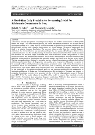
5. Rafa H. Al-Suhili et al Int. Journal of Engineering Research and Applications
ISSN : 2248-9622, Vol. 3, Issue 6, Nov-Dec 2013, pp.1538-1548
www.ijera.com
Figure (1) Sulaimania governorate location in Iraq and satellite image shows the locations of the selected
three meteorological stations. (Google Earth)
Sulaimania city is surrounded by the Azmar
Range, Goizja Range and the Qaiwan Range in the
north east, Baranan Mountain in the south and the
Tasluje Hills in the west. The area has a semi-arid
climate with very hot and dry summers and very cold
winters. Data are taken from three meteorological
stations (sites) inside and around Sulaimania city,
which are (Sulimania, Dokan dam, and Darbandikhan
dam meteorological stations). Dokan dam
metrological station is located (61 km) north east, and
Darbandikhan dam meteorological station is located
(55 km) south east of Sulaimania city respectively.
Dokan dam meteorological station is located (114
km) north east of Darbandikhan dam metrological
station .These sites coordinates are shown in table
(1), Barzinji,(2003). The Satellite image of the
locations of the three stations is shown in figure (1)
Table (1) The selected meteorological stations coordinates, Sulaimnia governorate.
Coordinate
Site
N
E
Sulaimani metrological station
350 33β 18β
450 27β 06β
Dokan dam metrological station
350 57β 15β
440 57β 10β
0
Darbandikhan dam metrological station
35 06β 46β
450 42β 23β
The application of the Developed Model to the
case study
The developed multisite daily precipitation
model given above was applied to the daily
precipitation series for the case study mentioned
before (Sulaimani, Dokan, and Darbandikhan daily
precipitation) data. The model parameters estimation
and its verification was done using the daily
precipitation records for the three metrological
stations for the period (2000-2011).The first (9) years
(2000-2008) were used for estimating the model
parameters, while the other (3) years (2009-2011)
were left for model validation. The model was
applied for the daily precipitation of eight months per
year, October to May. The developed model
www.ijera.com
application was carried out by the stages, and steps
explained above:
Stage1: Analysis and Model Parameter Estimation
Step1: The descriptive statistics of the daily
precipitation series from (2000-2008) are shown in
the table (2). The observed multisite occurrence
codes series was estimated from the precipitation data
of the nine years (2000-2008) for each day. The range
of the code values types is (0,63).
Step2: The observed occurrence series was fitted by
some frequency distributions to find which one is the
best that fits the data. These frequency distributions
are Normal, Lognormal, Gamma, Exponential, and
Chi-Square distribution. The results of these fittings
are shown in table (3).
1542 | P a g e
6. Rafa H. Al-Suhili et al Int. Journal of Engineering Research and Applications
ISSN : 2248-9622, Vol. 3, Issue 6, Nov-Dec 2013, pp.1538-1548
www.ijera.com
Table (2) Descriptive statistics for the daily precipitation series (2000-2008)
Variable
Observed Dokan
Observed
Descriptive statistics
Observed Sulaimania
Precipitation
Darbandikhan
Precipitation(mm)
(mm)
Precipitation(mm)
Mean
2.6
2.5
2.3
Minimum
0.0
0.0
0.0
Maximum
130.4
107.0
107.8
Variance
59.0
58.6
59.9
Standard deviation
7.7
7.7
7.7
Skewness
5.6
4.9
5.7
Kurtosis
53.3
33.2
44.7
Table (3) Results of occurrence series fitting to different distributions(2000-2008)
Distribution
Chi-Square test
Kolmogorov-Smirnov test
Normal
4906
0.223
Gamma
281
0.102
Exponential
696
0.192
Lognormal
402
0.082
Chi-Square
14011
0.489
Critical Chi-Square value = 2306 for ο‘ = 95%
As the results above show, the Gamma distribution (2-parameters) is the most fitted distribution for the
occurrence series.
Step3: In order to simulate the observed dry days sequences, the number of sequences (ns) and lengths of run of
each sequence (Lr), for each month, and all the years is found as observed parameters of the model. As
explained in step 3, above. The results are given in table (4).
Table(4) Observed lengths of run and number of sequences of dry days, for the case study,(2000-2008).
Parameter
Maximum Length of Dry
run ( Lr max)
Minimum Length of Dry
run ( Lr min)
Maximum number of Dry
sequences (ns max)
Minimum number of Dry
sequences (ns min)
Oct
Nov
Dec
Jan
Feb
Mar
Apr
May
24
26
29
12
8
18
12
25
1
1
1
1
1
1
1
1
4
1
Step4:In this step, tests for the most fitted frequency distribution(Normal, Lognormal, Gamma, Exponential,
and Chi-square) was carried out for the observed nonzero values of the precipitation data in each site. The series
of nonzero daily precipitation amount descriptive statistics are shown in table (5).
Table(5) Descriptive statistics for nonzero Sulaimani, Dokan, and Darbandikhan sites precipitation
(2000-2008).
Variable
Values No.
Mean
Minimum
Maximum
Variance
www.ijera.com
Nonzero Sulaimania
Precipitation(mm)
Nonzero Dokan
Precipitation(mm)
Nonzero
Darbandikhan
Precipitation(mm)
589
9.8
0.1
130.4
149.6
567
9.7
0.1
107.0
157.1
518
9.9
0.1
107.8
179.4
1543 | P a g e
7. Rafa H. Al-Suhili et al Int. Journal of Engineering Research and Applications
ISSN : 2248-9622, Vol. 3, Issue 6, Nov-Dec 2013, pp.1538-1548
Standard
deviation
Skewness
Kurtosis
www.ijera.com
12.2
12.5
13.4
3.3
23.0
2.4
11.9
2.8
14.3
Results of frequency distributions fitting for the nonzero series are shown in tables (6) to (8)
Table(6) Results of nonzero Sulaimania precipitation fitting to different distributions,(2000-2008).
Distribution
Chi-Square test
Kolmogorov-Smirnov test
Normal
378
0.21
Gamma
9
0.03
Exponential
6.1
0.01
Lognormal
80
0.083
Chi-Square
267
0.102
Critical Chi-Square value = 515 for ο‘ = 95%
Table (7) Results of nonzero Dokan precipitation fitting to different distributions,(2000-2008).
Distribution
Chi-Square test
Kolmogorov-Smirnov test
Normal
482
0.22
Gamma
12.8
0.02
Exponential
41
0.044
Lognormal
38
0.04
Chi-Square
447
0.12
Critical Chi-Square value = 468 for ο‘ = 95%
Table (8) Results of nonzero Darbandikhan precipitation fitting to different distributions(2000-2008).
Distribution
Chi-Square test
Kolmogorov-Smirnov test
Normal
533
0.23
Gamma
6.7
0.027
Exponential
32
0.051
Lognormal
23
0.038
Chi-Square
348
0.118
Critical Chi-Square value = 540 for ο‘ = 95%
It is clear that the most suitable frequency distributions for nonzero precipitation for Sulaimania is the
exponential distribution, while for both Dokan and Darbandikhan the Gamma distribution is the most suitable.
Equations (7) and (8) are the Gamma (2-parameters) and Exponential distribution functions respectively
(Johnson et al, 1994).
π
1
π π₯ π‘ ; ο‘, π½ = ο‘
π ο‘β1 π β π΅
πππ π₯ > 0 πππ πΌ, π½ > 0 β¦ β¦ . (7)
π½ ο ο‘
π π₯, ο¬ = ο¬ π βο¬ π₯
π₯β₯ π
β¦ β¦ β¦ β¦ β¦ β¦ β¦ β¦ β¦ β¦ β¦ β¦ β¦ β¦ . . β¦ . (8)
0,
π₯<0
where :
π₯ π‘ : Time series
ο βΆ Gamma function
ο’ : Scale parameter
ο‘ :Shape parameter
ο¬: Rate parameter
The estimated parameter ο¬ of the exponentially distributed nonzero Sulaimania precipitation series and
the maximum likelihood estimates (MLEs) for the parameters of the gamma distribution (ο‘ and ο’) for the
nonzero Dokan and Darbandikhan, precipitation are given in the table (9).
www.ijera.com
1544 | P a g e
8. Rafa H. Al-Suhili et al Int. Journal of Engineering Research and Applications
ISSN : 2248-9622, Vol. 3, Issue 6, Nov-Dec 2013, pp.1538-1548
www.ijera.com
Table(9) Distributions parameters for the nonzero series of precipitation at the three stations.
Variable
Parameter
Occurrence
series
Nonzero
Sulaimani
Precipitation
ο¬ο
-
9.7084
-
-
ο‘ο
0.6262
-
0.5983
0.5423
ο’
17.56
-
16.1943
18.1724
Stage2: A (MATLAB) code was written to
perform the steps of this stage.
Step1: Nonzero daily precipitation values were
generated using the distributions and parameters
calculated in step 4 stage1 for Sulaimani, Dokan, and
Darbandikhan sites (generated nonzero Sulaimania
precipitation, generated nonzero Dokan precipitation,
and
generated
nonzero
Darbandikhan
precipitation).The generation was performed for three
years ahead in order that the generated series can be
compared with the three years daily precipitation
data(2009-2011) that were left for validation. For
each site three sets of generated daily precipitation
was done.
Step2: The occurrence series was generated using the
Gamma distribution with its observed parameters at
step2, satge1, for three years (i.e. series length=732).
Nonzero
Dokan
Precipitation
Nonzero
Darbandikhan
Precipitation
Step3: The generated occurrence series in step 2
above is modified according to the procedure
explained above for the length of runs of zero
precipitation in each month according to equations
(5) and (6).
Step 4: Using the nonzero precipitation series
generated for each site, with the occurrence series
and equation (1), three daily precipitation series for
each site were generated.
5-3-2 Model Validation:
For the three generated series, descriptive
statistics were calculated and compared with those of
observed series. The generated series means and
standard deviations were also tested by the (t-test and
F-test). The descriptive statistics and testsβ results are
shown in tables (10) to (13) for the daily and the total
monthly precipitation series respectively.
Table (10) Descriptive statistics of observed and three generated series daily precipitation series (mm), for
each station,(2009-2011).
Site
Sulaimania Site
Dokan Site
Darbandikhan Site
www.ijera.com
Series
Mean
Observed
Generated 1
Generated 2
Generated 3
Observed
Generated 1
Generated 2
Generated 3
Observed
Generated 1
Generated 2
Generated 3
Min
Max
Sd
Cs
Ck
2.5
2.4
2.2
1.8
1.9
2.0
2.2
2.1
2.4
2.5
2.2
2.1
0.0
0.0
0.0
0.0
0.0
0.0
0.0
0.0
0.0
0.0
0.0
0.0
72.5
68.2
65.7
63.6
57.0
55.6
58.5
52.5
91.6
111.6
95.9
70.9
7.4
6.3
6.5
5.9
5.8
6.2
6.5
6.3
8.4
7.1
6.6
7.0
4.8
4.3
4.6
4.7
5.0
4.8
4.6
4.4
6.2
8.1
4.1
5.0
32.8
29.1
32.2
31.0
34.6
30.6
30.9
35.7
50.9
54.0
53.4
53.0
1545 | P a g e
9. Rafa H. Al-Suhili et al Int. Journal of Engineering Research and Applications
ISSN : 2248-9622, Vol. 3, Issue 6, Nov-Dec 2013, pp.1538-1548
www.ijera.com
Table (11) Results of t-test and F-test for daily precipitation series(2009-2011)
Site
Series Generated
t -value
F-value
Generated 1
0.4
1.38
Generated 2
Sulaimania site
0.8
1.30
Generated 3
2.2
1.57
Generated 1
-0.2
1.14
Generated 2
Dokan site
-1.0
1.26
Generated 3
-0.6
1.18
Generated 1
0.41.40
Generated 2
Darbandikhan site
0.5
1.62
Generated 3
0.8
1.44
Critical t-value tc=2.41
for ο‘=0.025
Critical F-value Fc= 2.07 for ο‘=0.025
Table (12) Results of t-test and F-test for the total monthly precipitation series (2009-2011).
Site
Variable
t -value
F-value
Generated 1
-0.70
1.37
Generated 2
Sulaimania site
0.30
1.67
Generated 3
0.70
1.05
Generated 1
-1.40
1.16
Generated 2
Dokan site
Generated 3
Generated 1
Generated 2
Generated 3
Darbandikhan site
-1.10
-0.95
-0.30
1.10
0.00
2.00
1.30
1.70
1.40
1.77
Critical t-valuetc=2.41 for ο‘=0.025
Critical F-value Fc= 2.07 for ο‘=0.025
Table (13) Descriptive statistics of observed and three generated series
(total monthly precipitation series)(mm)
Site
Max
Sd
Cs
Ck
74.1
83.8
0.6
1.1
214.8
207.9
53.2
45.5
0.8
0.8
3.8
3.9
Generated 2
70.1
1.7
198.5
41.1
0.5
3.2
65.4
2.6
224.6
54.6
0.6
2.2
Observed
Generated 1
58.4
1.2
165.8
44.2
0.7
3.2
70.4
1.2
157.0
41.1
0.9
2.3
Generated 2
69.5
2.5
137.7
31.3
0.5
2
Generated 3
66.0
4.2
163.4
38.7
0.6
2.1
Observed
Generated 1
73.5
3.6
224.6
56.2
1.1
4.5
77.4
4.2
214.7
43.2
0.9
6.7
Generated 2
81.0
3.0
208.7
47.2
0.4
3.4
Generated 3
Darbandikhan
Site
Min
Generated 3
Dokan Site
Mean
Observed
Generated 1
Sulaimania Site
Variable
73.5
4.4
223.0
42.2
0.8
2.8
These tables illustrate that the developed multisite
daily precipitation model is successful in resembling
the observed statistical properties of the observed
series with a high degree of accuracy. The t-test
values for preserving the daily precipitation means
www.ijera.com
and those of the total monthly precipitation are all
less than the critical t-values which indicates that
there are no significant differences in mean values of
the observed and generated series. Similar
observation was obtained for the F-test.
1546 | P a g e
10. Rafa H. Al-Suhili et al Int. Journal of Engineering Research and Applications
ISSN : 2248-9622, Vol. 3, Issue 6, Nov-Dec 2013, pp.1538-1548
Conclusions:
1.
2.
3.
4.
5.
The derived multisite daily precipitation
model was found capable of resembling the
precipitation data and it's occurrence in the
selected three sites of the cases study ,
Sulaimani , Dokan , and Darbandikhan .
The number of occurrence codes found were
(64) calculated for the observed series of the
three sites and is found to follow Gamma
frequency distribution as the best among the
checked frequency distributions ,Normal,
Exponential, Gamma, Lognormal, and Chisquare distributions. This was decided
according to the Chi-square test and
Kolmogorov-Smirnov test. The gamma
distribution gave the minimum tests values of
(281.11, 0.102) respectively.
The best fit frequency distribution of the nonzero precipitation values for Sulaimani daily
Precipitation was the exponential frequency
distribution with the minimum Chi-square and
Kolmogorov-Smirnov tests values of (6.12,
0.01) respectively. The best fit frequency
distribution for Dokan and Darbandikhan nonzero daily precipitation is the Gamma
distribution, with the minimum Chi-square
and Kolmogorov-Smirnov tests values of
(12.85, 0.02), and (6.7 ,0.027) respectively.
The t-test for means and the F-test for
variances shows that the developed model can
forecast daily data that had no significant
differences in their means and variances than
the those of the observed series. The two test
results indicate 100% succeed for a three sets
of generated daily precipitation for each site.
The t-test for means and F-test for variances
for the total monthly precipitation series
generated using the developed model indicate
the model capability to preserve the observed
total precipitation monthly means and
variances with 100% succeed.
[5]
[6]
[7]
[8]
[9]
[10]
[11]
[12]
[13]
[14]
References:
[1]
[2]
[3]
[4]
AKSOY H., 2000,βUse of Gamma
Distribution in Hydrological Analysisβ, Turk
J Engin Environ Sci, 24: 419-428.
Apipattanavis
S.,
Podesta
G.
and
Rajagoplalan B., 2007, "A Semiparametric
Multivariate
and
Multisite
Weather
Generator", Water Resource Research, Vol.
43, W11401 doi 10. 1029.
Bardossy A., andPegram G.G.S., 2009,
βCopula Based Multisite Model for Daily
Precipitation
Simulationβ,
J
Hdrol.EarthSyst.Sci., V13, 2299-2314.
Barzinji K. T., 2003,"Hydrogic Studies for
GoizhaDabashan and Other Watersheds in
Sulimani Governorate ", M.Sc. thesis
submitted to the college of Agriculture,
University of Sulaimani.
www.ijera.com
[15]
[16]
[17]
www.ijera.com
Beersma J.J. and Buishand T. A., 2003,
"Multi-Site Simulation of Daily Precipitation
and Temperature Conditional on the
Atmosphere Circulation", climate research,
Vol. 25:121-132.
Chapman T.G., 1994,βStochastic Models for
Daily Rainfallβ, Surface Hydrology and
Water Resources Papers; Preprints of Papers.
Barton, ACT: Institution of Engineers,
Australia, 7-12.
Corder
G.W.,and
Foreman
D.
I.,2009,βNonparametric Statistics for NonStatisticians: A Step-by-Step Approach β,John
Wiley and Sons.Inc.,Hoboken, New Jersey
Fowler H.J. , Kilsby C.G., and Oβconnel P.E.
, 2003, βModeling the Impacts of Climatic
Change and Variability on the Reliability
,Resilience ,and Vulnerability of a Water
Resource System", J Water Resource
Research, Vol. 399 no. 8, 1222
Illich N. and Despotivic J., 2008,"A Simple
Method for Affective Multi-Site Generation of
Stochastic Time Seriesβ,Stoch.Enviro Risk
Asses, 22:265-279
JohnsonN. L., and Kotz S., 1994, and
BalakrishnanN.,β Continuous Univariate
Distributionsβ, Vol. 1, Wiley Series in
Probability and Statistics.
Khalili M, Leconte R. and Brissette F., 2007,
"Stochastic Multisite Generation of Daily
Precipitation
Data Using
Spatial
Autocorrelation",
J Hydrometeorology,
Vol.8, P 396-412
Khalili M. and Brissette F., 2009, " Stochastic
Multi-Site Generation of Daily Weather
Dataβ, Stoch Environ. Risk Asses, 23, 837849.
Makhnin O.V. and Mcallister D. L., 2009,
"Stochastic precipitation Generation Based
on a Multivariate Autoregression Model", J
hydrometeor, 10, 1397-1413
Mehrotra, R. And Sharma A., 2005, "A SemiParametric
Stochastic
Model
for
Simultaneous Stochastic Simulation of Daily
Precipitation Amount at Multiple Sitesβ,
Journal of Hydrology,V-335,Issues 1-2,P180193
Richardson C. W. and Wright D. A., 1984,
"WGEN: A Model for Generating Daily
Weather
Variables",
United
States
Department of Agriculture, Agriculture
Research Service ARS-8
Srikanthan R. and McMahon T. A., 2001,
βStochastic Generation of Annual, Monthly
and
Daily
Climate
Data:
A
Review:,Hydrology and Earth System
Sciences, 5(4), 653β670.
Tobler W., (1970) "A computer Movie
Simulating Urban Growth in the Detroit
1547 | P a g e
11. Rafa H. Al-Suhili et al Int. Journal of Engineering Research and Applications
ISSN : 2248-9622, Vol. 3, Issue 6, Nov-Dec 2013, pp.1538-1548
www.ijera.com
Region". Economic Geography, 46(2): 234240.
[18] Wilks D.S., 1998, "Multisite Generalization
of Daily Stochastic Precipitation Generation
Model", journal of Hydrology 210, 178-191
[19] Wilks D. S., 1999, "Simultaneous Stochastic
Simulation
of
Daily
Precipitation,
Temperature and Solar Radiation at Multiple
Sites in Complex Terrain", Elsevier,
agricultural and forest meteorology 96:85101.
www.ijera.com
1548 | P a g e