Download to read offline


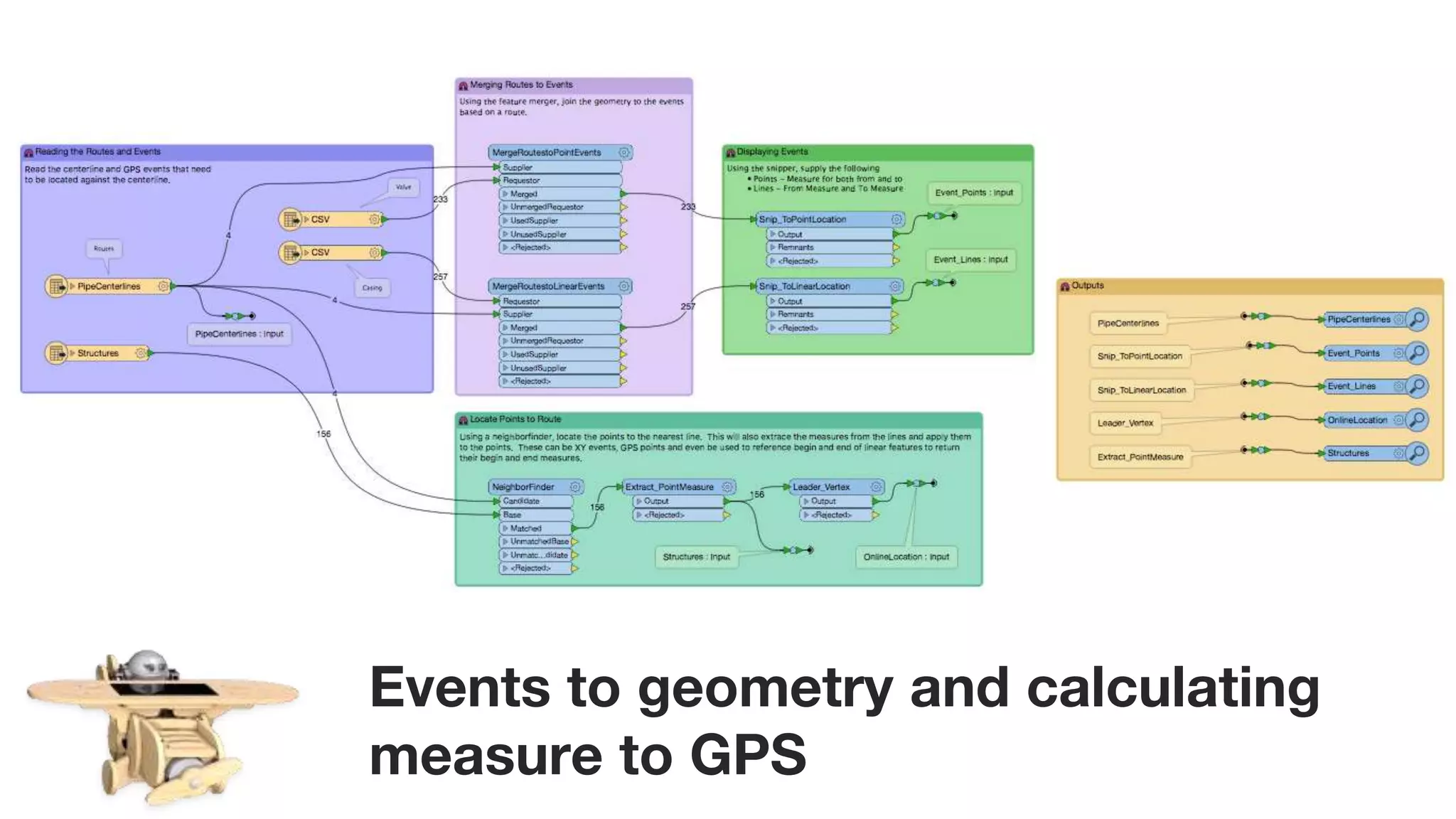
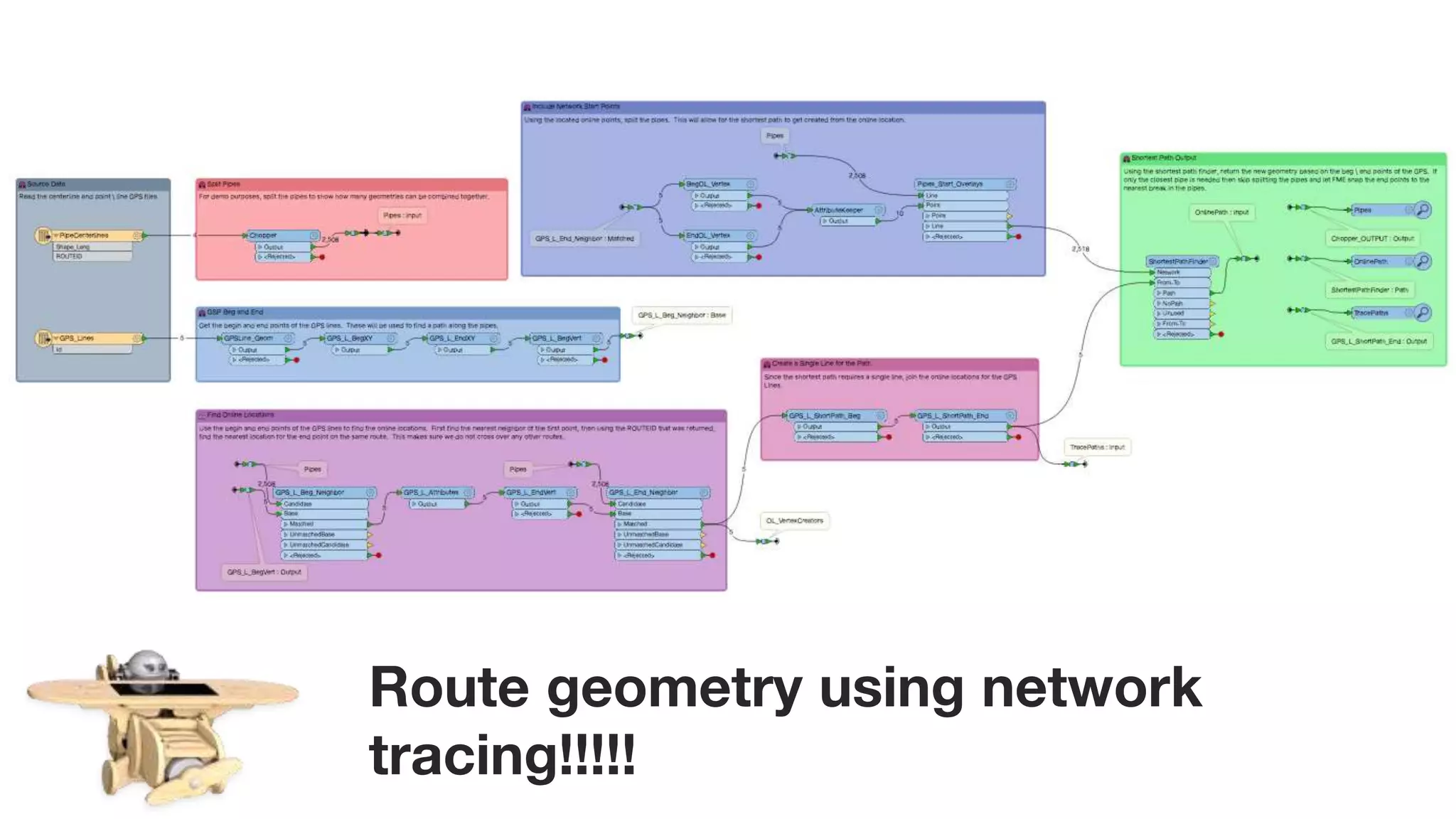


The document discusses the applicability of pipeline modeling, emphasizing the importance of geometry and measure handling in various pipeline scenarios. It highlights FME's capabilities in supporting pipeline companies through GIS approaches and transforming data to meet their requirements. The message encourages pipeline professionals to leverage FME's extensive options regardless of their specific models or techniques.


![Coded Agents – with UiPath SDK + LangGraph [Virtual Hands-on Workshop]](https://cdn.slidesharecdn.com/ss_thumbnails/codedagentsdeck-251215155422-5497c599-thumbnail.jpg?width=640&height=640&fit=bounds)


