Download as PDF, PPTX
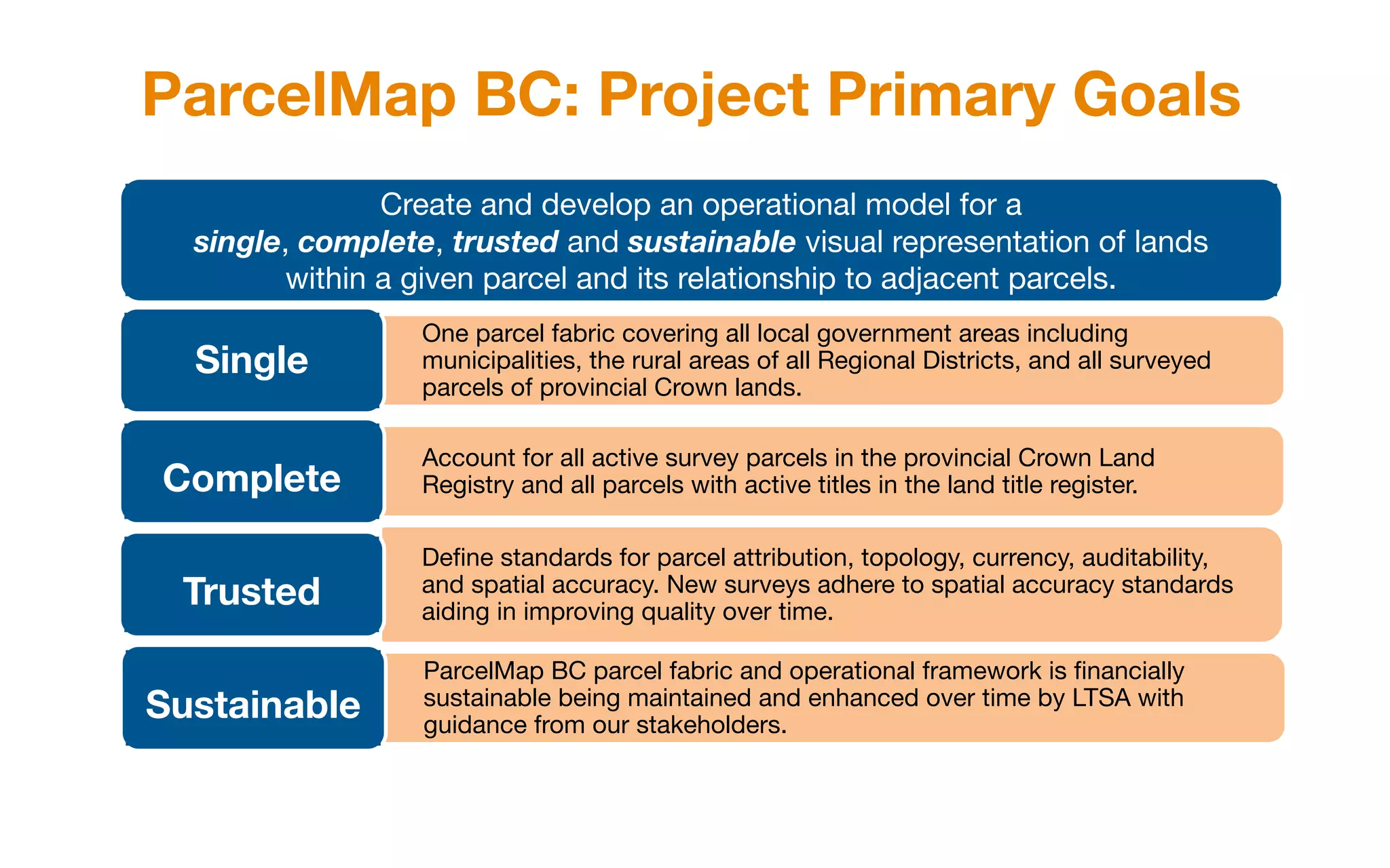
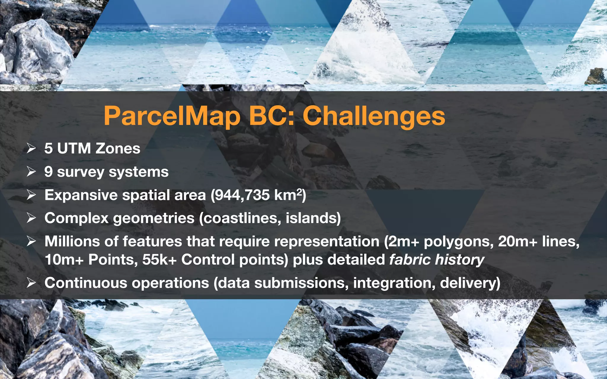
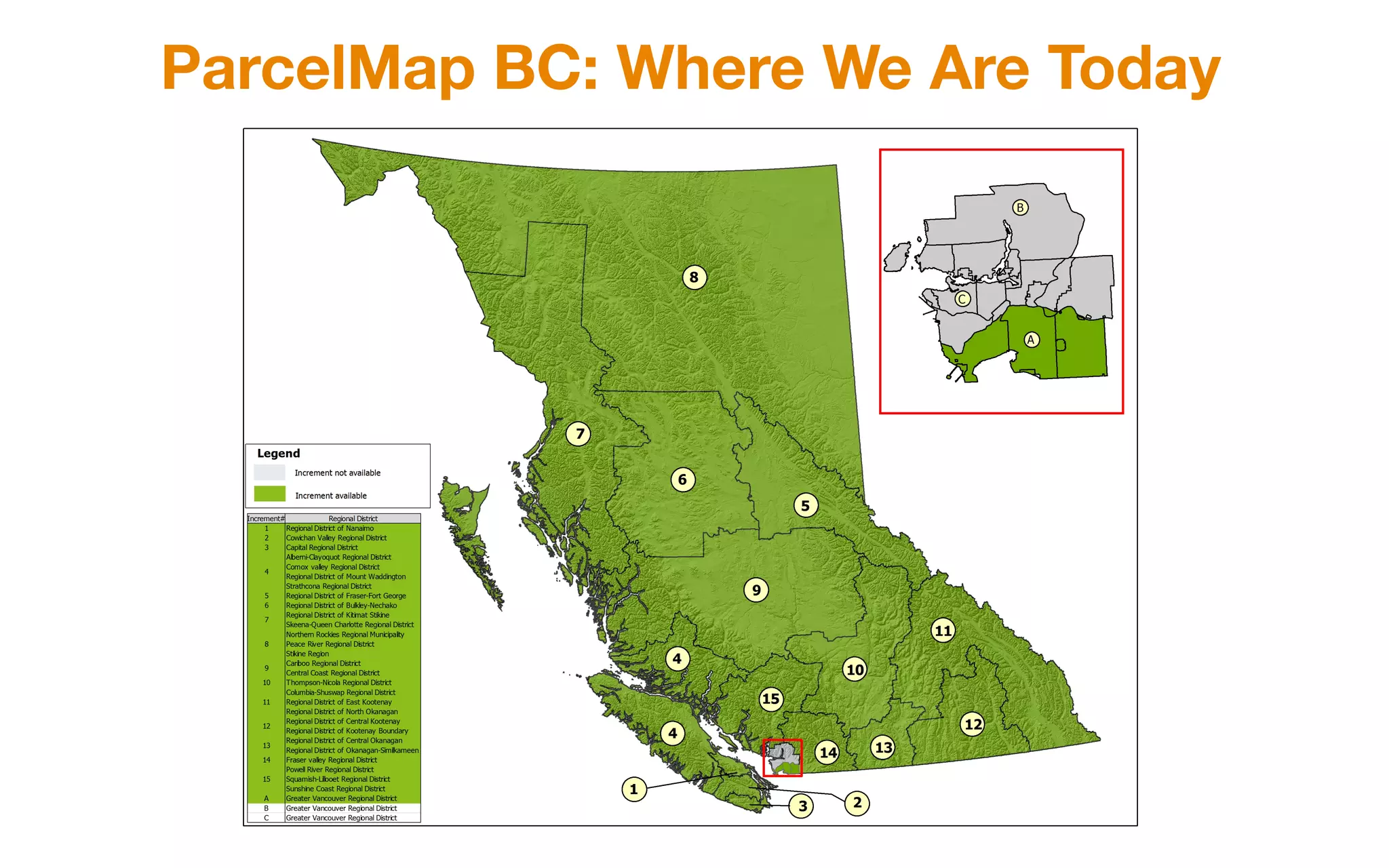
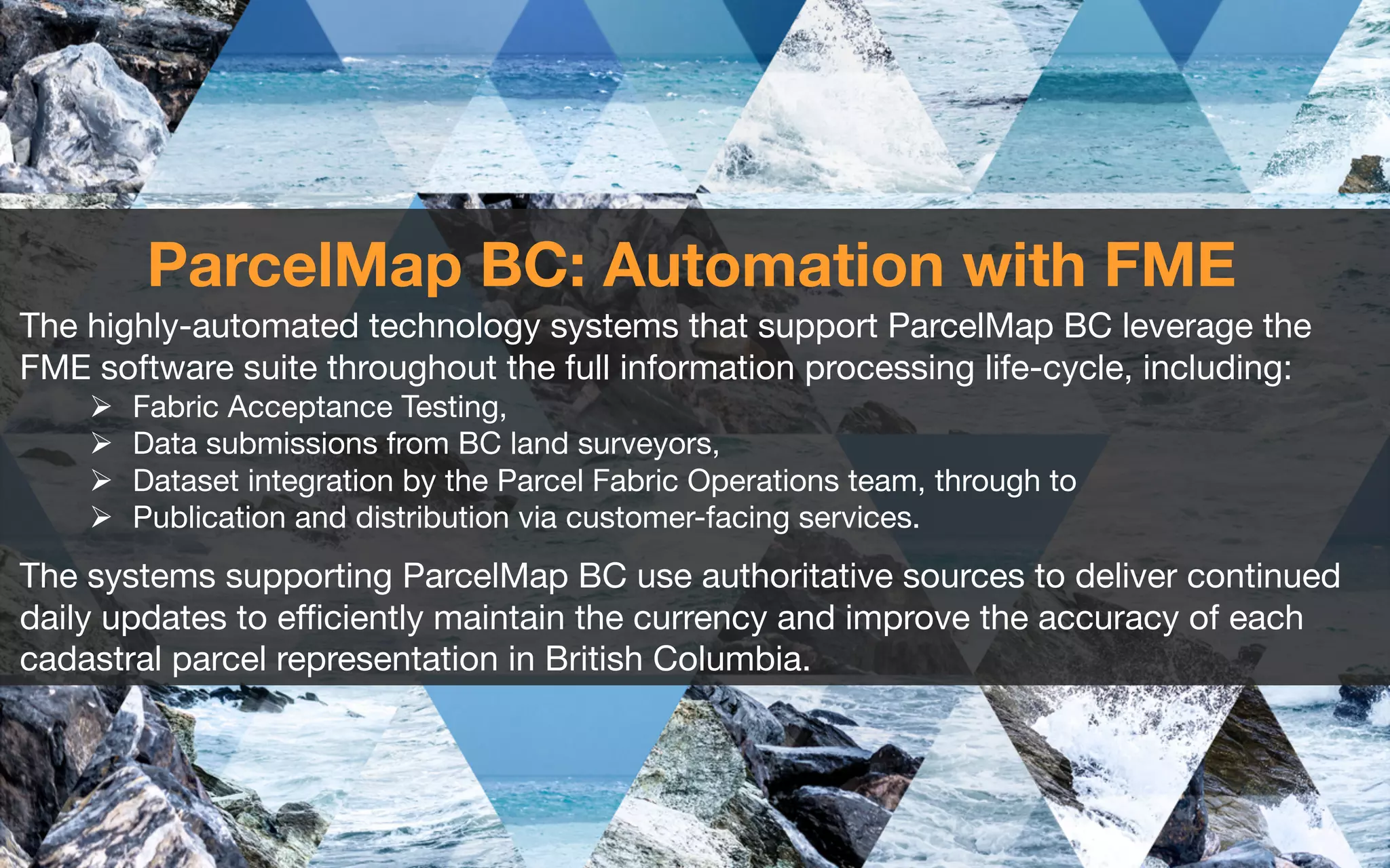
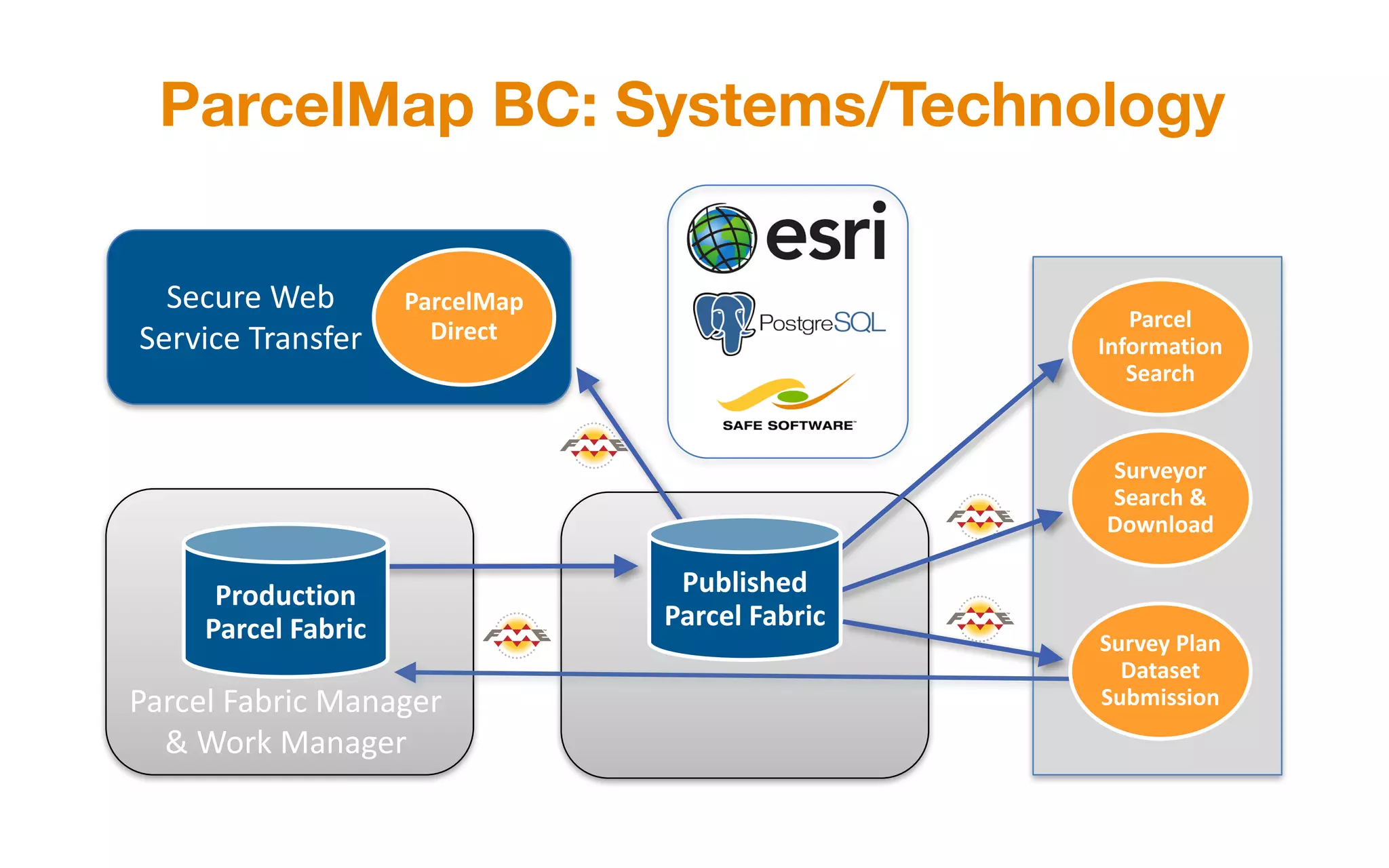
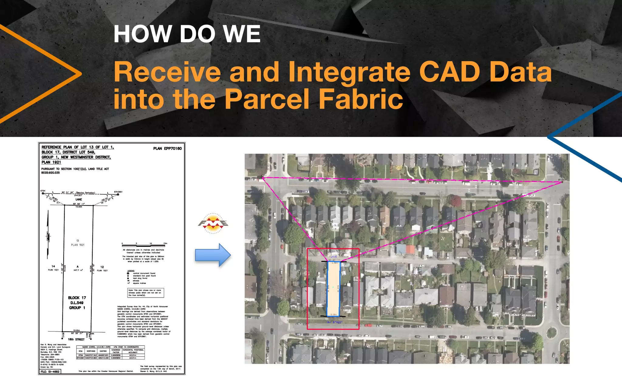
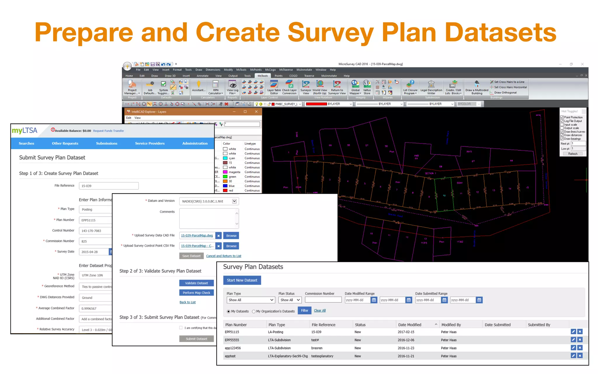
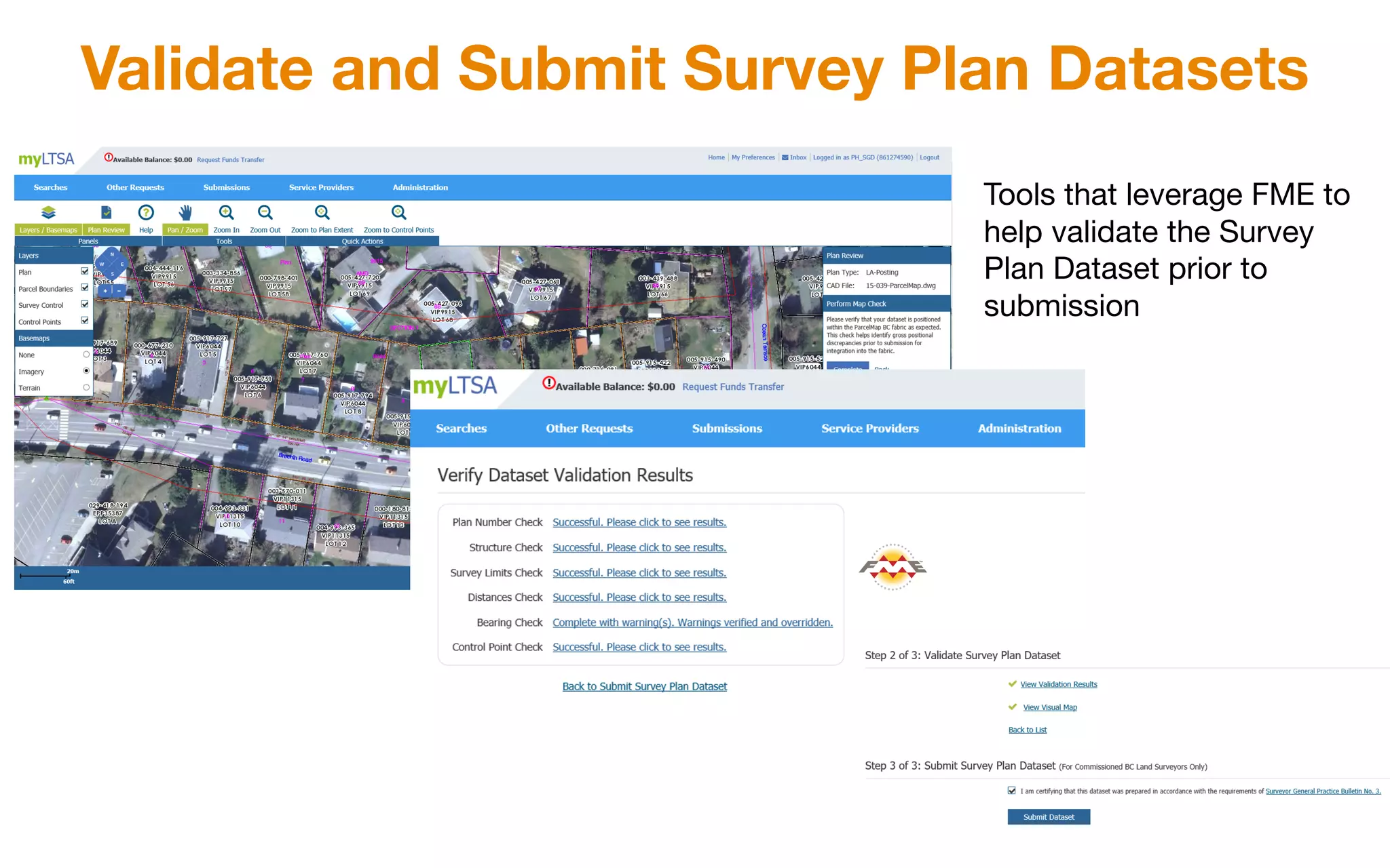
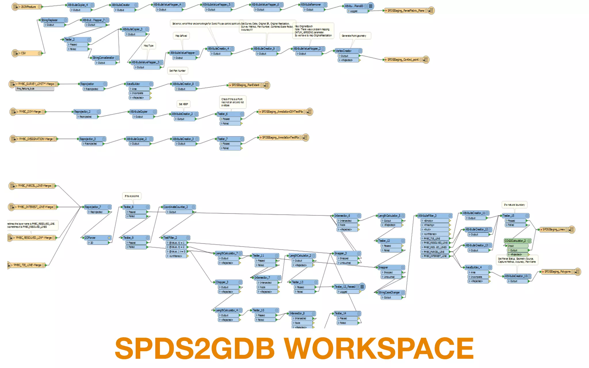
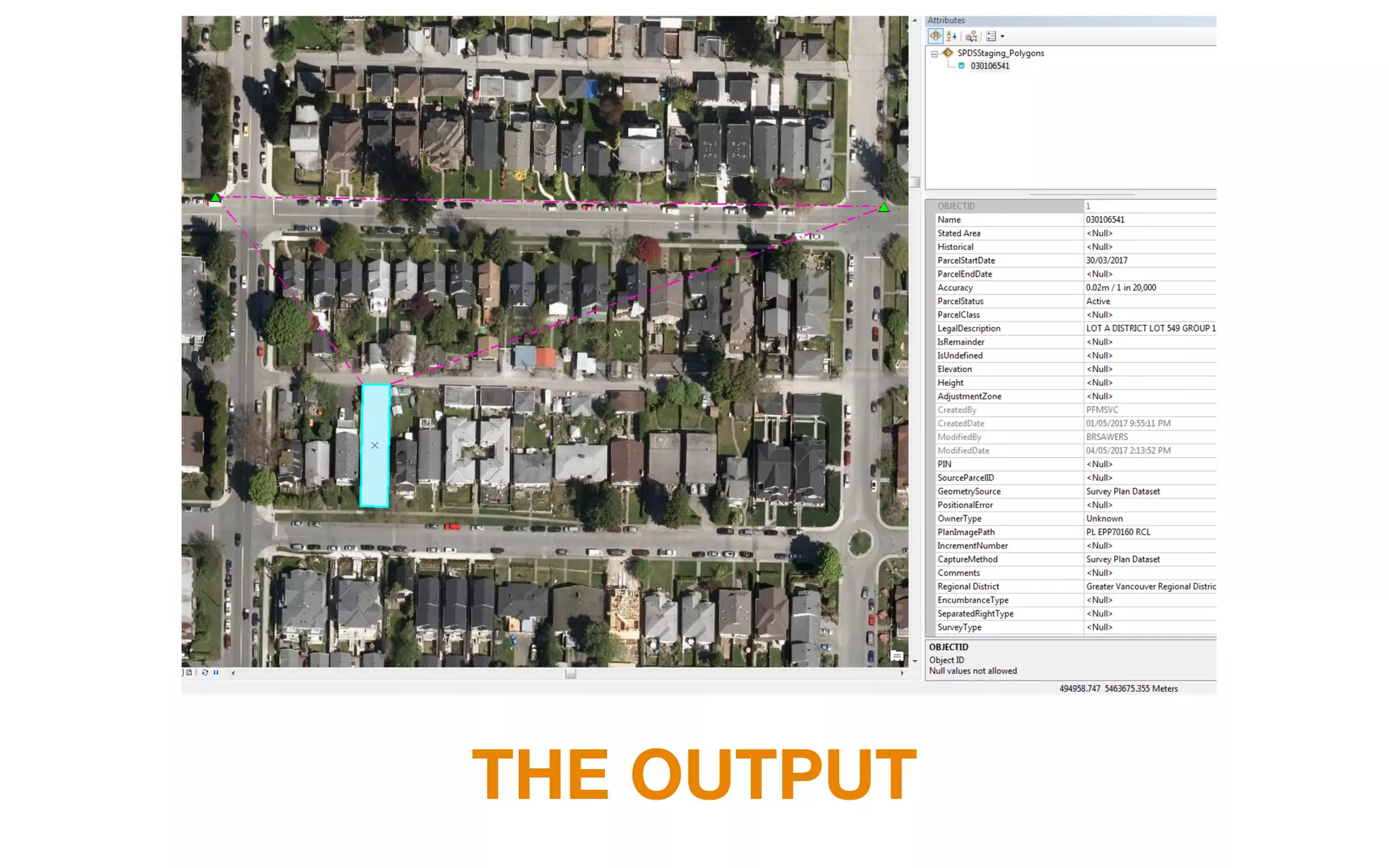
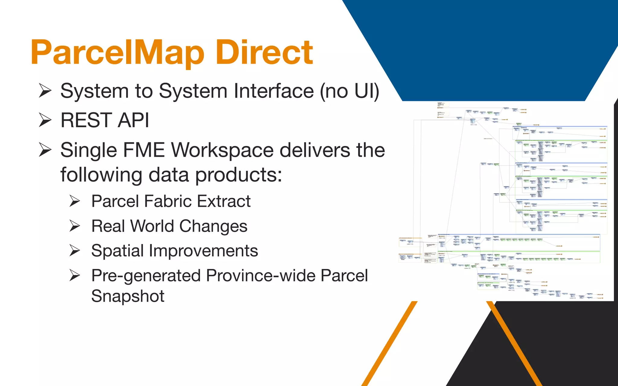


ParcelMap BC aims to create a comprehensive and sustainable mapping system that integrates various land parcels across British Columbia, ensuring accuracy and reliability in land representation. The project faces challenges such as diverse survey systems and large spatial coverage but utilizes advanced automation and FME software to streamline data processes. Ongoing updates and improvements are maintained through collaboration with stakeholders and a focus on financial sustainability.


![Vibe Coding vs. Spec-Driven Development [Free Meetup]](https://cdn.slidesharecdn.com/ss_thumbnails/vibecodingvsspecdrivendevelopment-251209105622-43f455e7-thumbnail.jpg?width=640&height=640&fit=bounds)


