Introduction+hydrology
•Download as PPTX, PDF•
0 likes•108 views

the material of this PPt according to the RTU syllabus

Recommended
More Related Content
What's hot
What's hot (20)
Similar to Introduction+hydrology
Similar to Introduction+hydrology (20)
More from brijlata sharma
Recently uploaded
Recently uploaded (20)
Introduction+hydrology
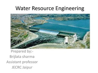
- 1. Water Resource Engineering Prepared by:- Brijlata sharma Assistant professor JECRC Jaipur
- 2. VISION To become a role model in the field of Civil Engineering for the sustainable development of the society. MISSION 1) To provide outcome base education. 2) To create a learning environment conducive for achieving academicexcellence. 3) To prepare civil engineers for the society with high ethical values.
- 3. CIVIL ENGINEERING DEPARTMENT Program Educational Objectives 1 To strengthen students with fundamental knowledge, effective computing, problem solving and communication skills enable them to have successful career in civil engineering. 2. To enable students in acquiring civil engineering’s latest tools, technologies and management principles to give them an ability to solve multidisciplinary engineering problems. 3. To impart students with ethical values and commitment towards sustainable development in collaborative mode. 4. To reinforce students with research aptitude and innovative approaches which help them to identify, analyze, formulate and solve real life problems and motivates them for lifelong learning. 5. To empower students with leadership quality and team building skills that prepare them for employment, entrepreneurship and to become competent professionals to serve societies and global needs
- 4. Course Outcomes of WRE CO 1 Various components of hydrologic cycle that affect the movement of water in the earth. CO 2 The concepts of movement of ground water beneath the earth, Basic components of river Training works. CO 3 The basic requirements of irrigation and various irrigation techniques, requirements of the crops. CO 4 Distribution systems for canal irrigation and the basics of design of unlined and lined irrigation canals design. CO 5 Various Stream flow measurements technique, Apply math, science, and technology in the field of water resource Engineering.
- 5. Introduction Definitions, Water resources engineering is the quantitative study of the hydrologic cycle -- the distribution and circulation of water linking the earth's atmosphere, land and water bodies. ... Applications include the management of the urban water supply, the design of urban storm-sewer systems, and flood forecasting.
- 6. Functions And Advantages Of Irrigation Definitions-Irrigation may be define as science of artificial application of water to the land with the crop requirement throughout the crop period. Advantages Of Irrigation- To increase food production. It improves the yields of crops . It improves the groundwater storage as water lost due to seepage adds to groundwater storage. We use it to help the growth of crops during the period of inadequate rainfall.
- 7. DISADVANTAGES OF IRRIGATION • Excessive seepage and leakage of water create marshes and ponds all along the channels. The marshes and the ponds in some time become breeding areas for mosquitoes. • It lowers the temperature and makes the locality damp due to the presence of irrigation water. • Excessive seepage into the ground raises the water, hence causing waterlogging of the area.
- 8. classification for irrigation 1. Surface irrigation - flow, lift 2. Subsurface irrigation -
- 9. 1 Surface irrigation In surface irrigation, water moves over and across the land by simple gravity flow to wetland and infiltrate the soil.
- 10. 2. Sprinkler irrigation It is a popular method. Pipes carry some amount of water to the fields and then sprays it directly over the crops with high-pressure sprinklers.
- 11. 3. Drip irrigation With this type, the drip lines take water near the root zone of plants and release it drop by drop.
- 12. 4. Center pivot irrigation It involves a self-propelled system in which a single pipeline moves on wheeled towers in a circular pattern.
- 13. Indian crop seasons The Kharif crops are rice, bajra, jowar, maize, cotton, tobacco, groundnut, e.tc. Rabi crops are wheat, barley, gram, linseed, mustard, potatoes, etc Summer crops Winter crops Zaid Crops pumpkin, cucumber, bitter groud.
- 14. Categories of Crops in India Food Crops (Wheat, Maize, Rice, Millets and Pulses etc.) Cash Crops-a crop which has to be encashed in the market for processing, etc. as it cannot be consumed directly by the cultivators. (Sugarcane, Tobacco, Cotton, Jute and Oilseeds etc.) Plantation Crops (Coffee, Coconut, Tea, and Rubber etc.)
- 15. HYDROLOGY INRODUCTION- . Hydrology means science of water. . It is the science that deals with the ccurance, circulation and distribution of water on the earth. . Hydrology is a broad subject of an inter- disciplinary nature drawing support from allied sciences.
- 16. HYDROLOGY DEALS WITH • Estimation of water resources • The study of processes such as precipitation, runoff, evapotranspiration and their interaction • The study of problems such as floods, droughts and strategies to combat them
- 17. ENGINEERING HYDROLOGY(APPLIED HYDROLOGY): A study concerned with engineering applications ENGINEERING HYDROLOGY APPLICATOINS: • In design • Operations of projects dealing with water supply • Irrigation and drainage • Water power • Flood control • Navigation • Costal works • Salinity control • Recreational uses of water etc.
- 20. THE HYDROLOGIC CYCLE: The hydrologic cycle is the general continuous circulation of water from the oceans to the atmosphere, to the ground and back to the oceas again. Sun is the main source of energy for hydrologic cycle. Let us consider the cycle begins with oceans
- 21. The various stages of hydrologic cycle are Evaporation Precipitation Infiltration Traspitation It is a continuous process Each path of hydrologic cycle may have one or more of the following Trasportation of water Temporary storage Change of state
- 22. TYPES OF PRECIPITATION PRECIPITATION CONVECTIVE OROGRAPHIC CYCLONIC NON-FRONTALFRONTAL WARM FRONT COLD FRONT
- 23. FORMS OF PRECIPITATION: Rain Snow Drizzle Glaze Sleet Hail
- 24. RAINFALL MEASURMENT: Rainfall is expressed interms of the depth to which rain water would stand on an area if allthe rain were collected in it. Rainfall is measured by rainguage Rainguage is a cylindrical vessel assembly kept in open to collect rain
- 25. TYPES OF RAINGUAGE TYPES OF RAINGUAGE NON-RECORDING RAINGUAGE SELF RECORDING(AUTOMATIC) SYMON’S GUAGE STANDARD NON RECORDING TYPE RAINGUAGE •TIPPING BUCKET •WEIGHING TYPE •FLOAT TYPE •TELEMETERING •RADAR MEASURMENT
- 26. NON RECORDING TYPE RAINGUAGES: It does not record the rainfall directly but only collect the rain water, which when measured gives the total amount of rainfall at the given point of time.
- 27. Precipitation gauge 1 - pole 2 - collector 3- support- galvanized metal sheet 4 – funnel 5 - steel ring 1. Non recording gauge
- 28. The graphic rain gauge 1-receiver 2-floater 3 siphon 4 recording needle 5drum with diagram 6-clock mechanism The rainguages that automatically record the intensity of rainfall over a period of time in the form of pen trace or a clock driven chart.
- 29. COMPUTATION OF AVERAGE RAINFALL OVERA BASIN: Inorder to compute the average Rainfall over a basin or catchment area, the rainfall is measured at a number of stations located in that area. If the basement area contains more than one rainguage station then following methods are used for computation of average rainfall. Arithmetic mean method Thiessen polygon method Isohytel method
- 30. Arithmetic mean method: Average rainfall is calculated by arithmetic average of recorded rainfall at various stations of selected area This is the simplest method of computing the average rainfall over a basin. As the name suggests, the result is obtained by the division of the sum of rain depths recorded at different rain gauge stations of the basin by the number of the stations. iP NN i1 P P1 N 1 P2 ..... Pi .....Pn
- 31. Thiessen Polygon Method: This is the weighted mean method. The rainfall is never uniform over the entire area of the basin or catchment, but varies in intensity and duration from place to place. Thus the rainfall recorded by each rain gauge station should be weighted according to the area, it represents. This method is more suitable under the following conditions: - For areas of moderate size. - When rainfall stations are few compared to the size of the basin. - In moderate rugged areas.
- 33. P P1A1 P2 A2 .....PmAm A1 A2 ..... Am M M i A A PP i i1 Pi Ai i1 Atotal The ratio Ai/A is called the weightage factor of station i
- 34. Thiessen Polygon Method Disadvantage: The disadvantages of the Thiessen method are its inflexibility that is addition of new station implies construction of new polygon, and it does not directly account for orographic influences of rainfall.
- 35. isohyetal Method: An isohyetal is a line joining places where the rainfall amounts are equal on a rainfall map of a basin. An isohyetal map showing contours of equal rainfall is more accurate picture of the rainfall over the basin. This method is more suited under the following conditions: - For hilly and rugged areas. - For large areas over 5000 km2. - For areas where the network of rainfall stations within the storm area is sufficiently dense, isohyetal method gives more accurate distribution of rainfall.
- 36. Isohyetal Method • P1, P2, P3, …. , Pn – the values of theisohytes • a1, a2, a3, …., a4 – are the inter isohytes area respectively • A – the total catchment area • P - the mean precipitation over the catchment A a a 2 ...a 22 Pn1Pn n12 P1P2 P2P3 1 P
- 38. m x NM N N N P ... Pm 2 P P2 1 x 1 Before using rainfall data, it is necessary to check the data for continuing and consistency ◦ Missing data ◦ Record errors Estimation of Missing Data • Given annual precipitation values – P1, P2, P3,… Pm at neighboring M stations of station X 1, 2, 3 & m respectively • The normal annual precipitation given by N1, N2, N3,…, Nm, Ni… (including station X) • To find the missing precipitation, Px , of station X
- 39. Test for consistency record • Let a group of 5 to 10 base stations in the neighbourhood of the problem station X is selected • Arrange the data of X stn rainfall and the average of the neighbouring stations in reverse chronological order (from recent to old record) the average values of the group base stations starting from the latest record. as shown on the next figure • A decided break in the slope of the resulting plot is observed that indicates a change in precipitation regime of station X, i.e inconsistency. • Therefore, is should be corrected by the factor shon on the next slide • Accumulate the precipitation of station X Px • Plot the Px against Pavg and Pavg
- 40. (Double mass curve techniques) Double Mass Curve Analysis 5 4.5 4 3.5 3 2.5 2 1.5 1 0.5 0 0 2.50.5 1 1.5 2 Accumulated annual rainfall of neigbouring stns in 10^3 cm accumulatedannualrainfallofXstnin10^3cm
- 41. c xcx M M P P • a •Mc c Ma a • Pcx – corrected precipitation at any time period t1 at stationX • Px – Original recorded precp. at time period t1 at • station X • Mc – corrected slope of the double mass curve Ma –
- 42. A few commonly used methods are Mass curve of rainfall Hytograph
- 43. 0 – 8 8 – 16 16 – 24 24 – 32 32 – 40 40 – 48 Time, hours Intensity,cm/hr Hyetograph - is a plot of the accumulated precipitation against time, plotted in chronological order Hyetograph of a storm 0.5 0.4 0.3 0.2 0.1 0
- 45. 0 20 40 80 100 12060 Time, hour accumulatedprecipitation,mm Mass Curve of Rainfall: The total accumulated percipitation is plotted against time Mass curve of rainfall 60 50 40 30 20 10 0
- 46. RUNOFF: It is a part of precipitation which is transmitted through natural surface channels, streams etc. Runoff is overlandflow and interflow which enters stream immediately after precipitation Runoff includes surface flow interflow groundwater flow
- 47. Runoff: Runoff is defined as the portion of precipitation that makes its way towards rivers or oceans as surface or subsurface flow.
- 48. Classification of runoff according to source: 1. Surface runoff: Includes all overland flow as well as precipitation falling directly onto stream channels. Overland flow: Portion of runoff that travels over the surface of the ground to reach a stream channel and through the channel to the basin outlet. This process occurs relatively quickly. 2.Subsurface runoff: Portion of runoff that travels under the ground to reach a stream channel and to the basin outlet. It includes: a) interflow, and b) groundwater runoff. Interflow: Portion of subsurface runoff that travels laterally through the unsaturated zone or through a shallow perched saturated zone towards a stream channel. This process is slower than surface runoff. Groundwater runoff: Portion of subsurface runoff that comes from infiltration and subsequently percolation down to the water table and eventually reaches a stream channel. This process occurs relatively slowly
- 49. • Factors affecting Runoff: 1.Climate factors a) Type of precipitation b) Intensity of rainfall c) Duration of rainfall d) Area distribution of rainfall e) Antecedent or Previous precipitation f) Other climatic factors that effect • evaporation and transpiration 2.Physiographic factors a) Land use b) Type of Soil c) Area of the basin or catchment d) Shape of the basin e) Elevation f) Slope g) Orientation or Aspect h) Type of drainage network i) Indirect drainage j) Artificial drainage
- 50. Estimation of Runoff: 1.Empirical Formulae (to find peak runoff) a)Dicken’s formula b)Ryve’s formula c)Igles’s formula d)Khosla’s formula 2.Rational Method 3.Unit Hydrograph Method
- 51. Runoff Calculations Rational Formula: This method was originally developed for urban catchments. Thus, the basic assumptions for development of this method were made for urban catchments. However, this method is fairly applicable to small agricultural watersheds of 40 to 80 hectares size. The rational method takes into account the following hydrological characteristics or processes: (1) rainfall intensity, (2) rainfall duration, (3) rainfall frequency, (4) watershed area, (5) hydrologic abstraction, and (6) runoff concentration. Assumptions: The Rational method is based on the assumption that constant intensity of rainfall is uniformly spread over an area, and the effective rain falling on the most remote part of the basin takes a certain period of time, known as the time of concentration (Tc) to arrive at the basin outlet. If the input rate of excess rainfall on the basin continues for the period of time of concentration, then the part of the excess rain that fell in the most remote part of the basin will just begin its outflow at the basin outlet and with it, the runoff will reach its ultimate and the
- 52. RATIONAL METHOD The Rational Method properly understood and applied can produce satisfactory results for urban storm sewer and small on- site detention design. Rational Formula: The Rational Method is based on the Rational Formula: Q =CIA Q = the maximum rate of runoff (cfs) C = a runoff coefficient that is the ratio between the runoff volume from an area and the average rate of rainfall depth over a given duration for that area I = average intensity of rainfall in inches per hour for a duration equal to the time of concentration, tc A = area (acres)
- 53. Factors affecting Evaporation: Temperature - Warmer the evaporating surface, higher the rate of evaporation. Relative Humidity - drier air evaporates more water than moist air Wind Speed - When the winds are light, evaporation is very low Area of the Evaporating Surface – Larger areas of evaporating surface increase the rate of evaporation Air Pressure - Lower pressure on open surface of the liquid results in the higher rate of evaporation. Composition of Water - Rate of evaporation is always greater over fresh water than over salt water
- 54. Methods of measurement of evaporation: A)Direct methods Water Budget Technique Lysimeter oWeighing Type oNon-weighing Type B)Indirect methods Aerodynamic method or Mass Transfer Method Energy Budget Method Penman Equation Blaney & Criddle Method Jensen Haise method Hargreaves method or Pan Evaporation Method
- 55. Transpiration: Transpiration is the process by which the water vapour escapes from the living plant leaves and enters the atmosphere. Evapotranspiration Evapotranspiration is the combined processes by which water is transferred to the atmosphere from open water surfaces and vegetation
- 56. Factors affecting Evapotranspiration Climatological factors like percentage sunshine hours, wind speed, mean monthly temperature and humidity. Crop factors like the type of crop and the percentage growing season. The moisture level in the soil. Estimation of Evapotranspiration Lysimeter Class ‘A’ Pan Method Penman Method Hargreaves Method Blaney & Criddle Method
- 57. Infiltration is the process of water entry into a soil from rainfall, or irrigation. Percolation is the process of water flow from one point to another point within the soil. Infiltration rate is the rate at which the water actually infiltrates through the soil during a storm and it must be equal the infiltration capacities or the rainfall rate, whichever is lesser. Infiltration capacity is the maximum rate at which a soil in any given condition is capable of absorbing water. Infiltration
- 58. Factors affecting infiltration Condition of the land surface (cracked, crusted, compacted etc.) Land vegetation cover Surface soil characteristics (grain size & gradation), Storm characteristics (intensity, duration & magnitude) Surface soil and water temperature, chemical properties of the water and soil. Surface factors
- 59. Measurement of Infiltration The rate of infiltration is initially high. It goes on reducing with time and after some time it becomes steady. The rate of infiltration for a soil is measured in the field as well as in the laboratory. These are known as Infiltrometers Types of Infiltrometers: Flooding-type Infiltrometers o Single-tube flooding Infiltrometers o Double-tube flooding Infiltrometers o Needle drip systems oStand pipes oSprinkler nozzles oRotating boom Sprinkling-type Infiltrometers or Rain Simulators
- 60. Infiltration indices: The average value of infiltration is called Infiltration Index. Types: ø - Index W – Index Where, P = total storm precipitation (cm), R = total surface runoff (cm) , Ia = Initial losses(cm) te = elapsed time period (in hours)
- 61. References 1. Madeeasy notes 2. https://www.nptel.ac.in › courses › 105 › 104 › 105104103 3. G. L. Asawa, Irrigation and Water Resources Engineering. 4. B.C.Punmia, Irrigation and Water Power Engineering