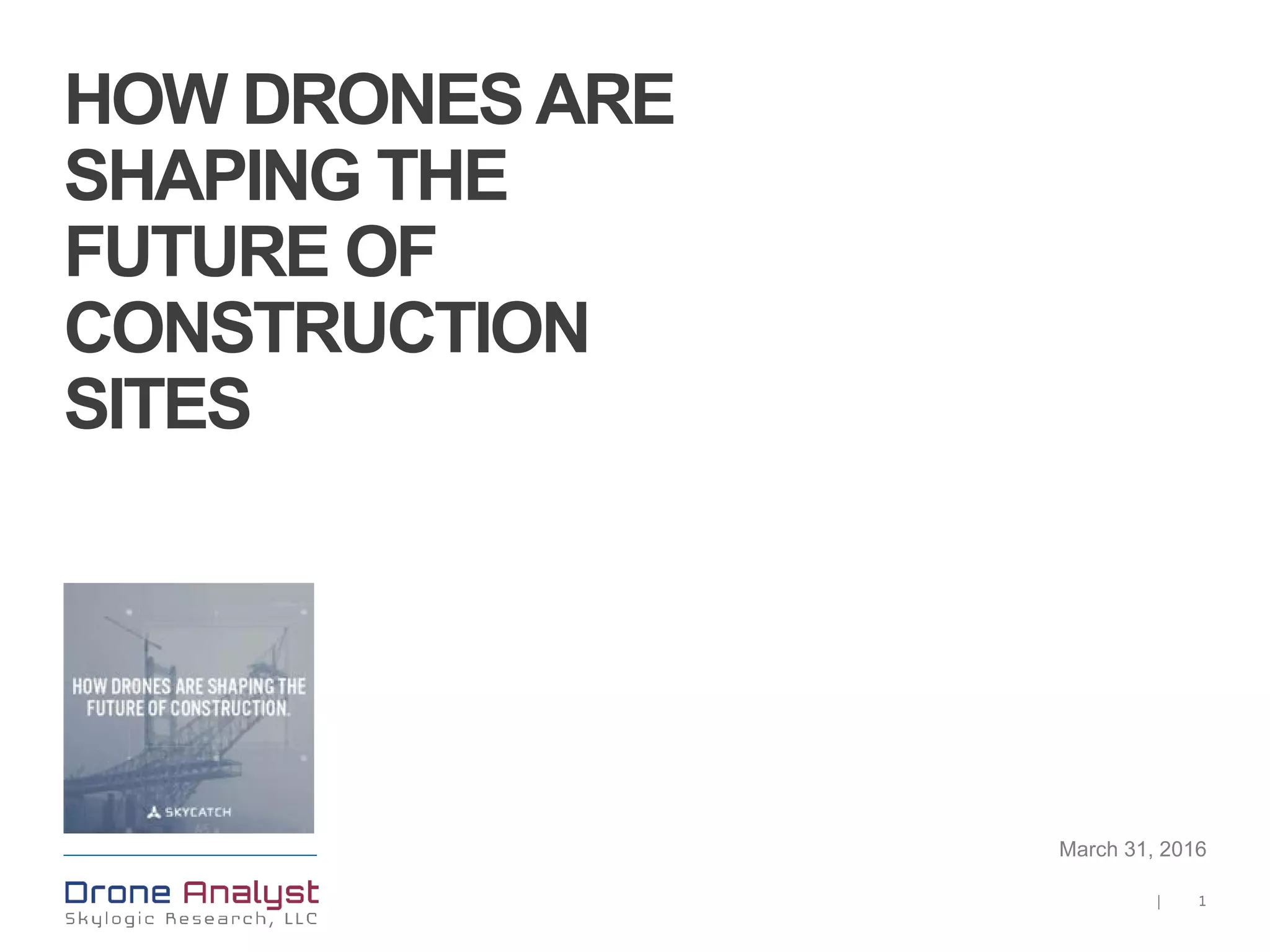
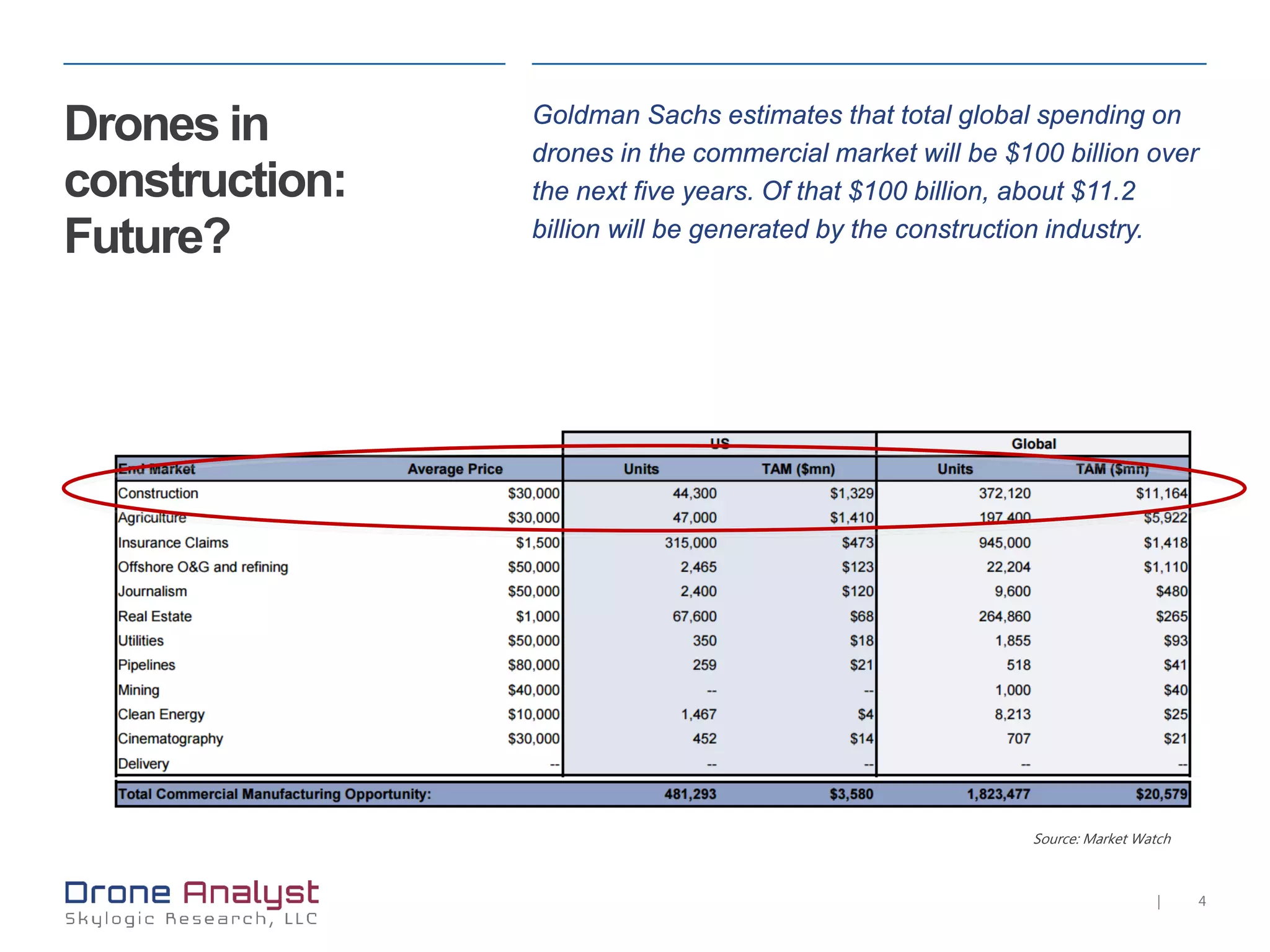
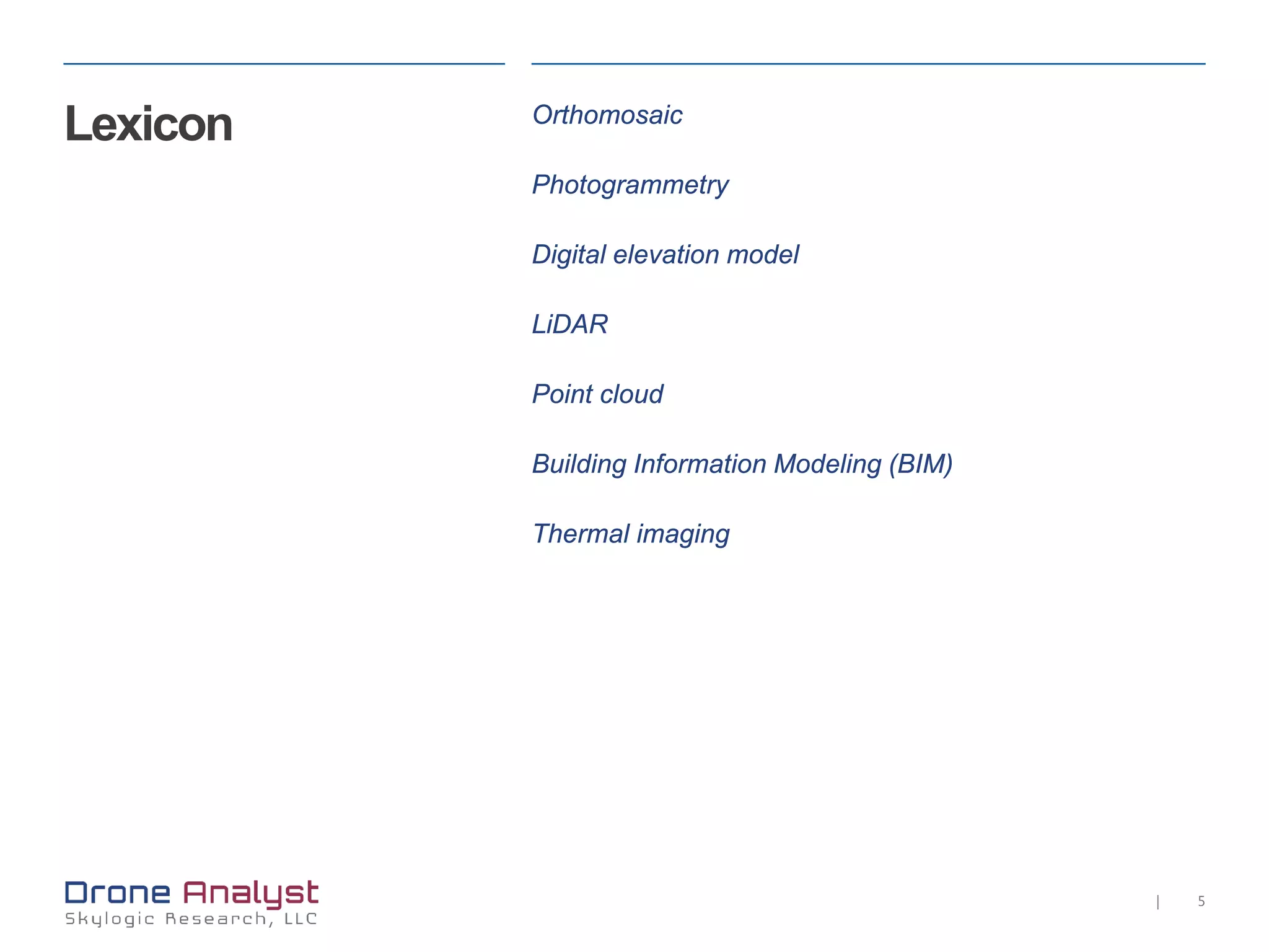
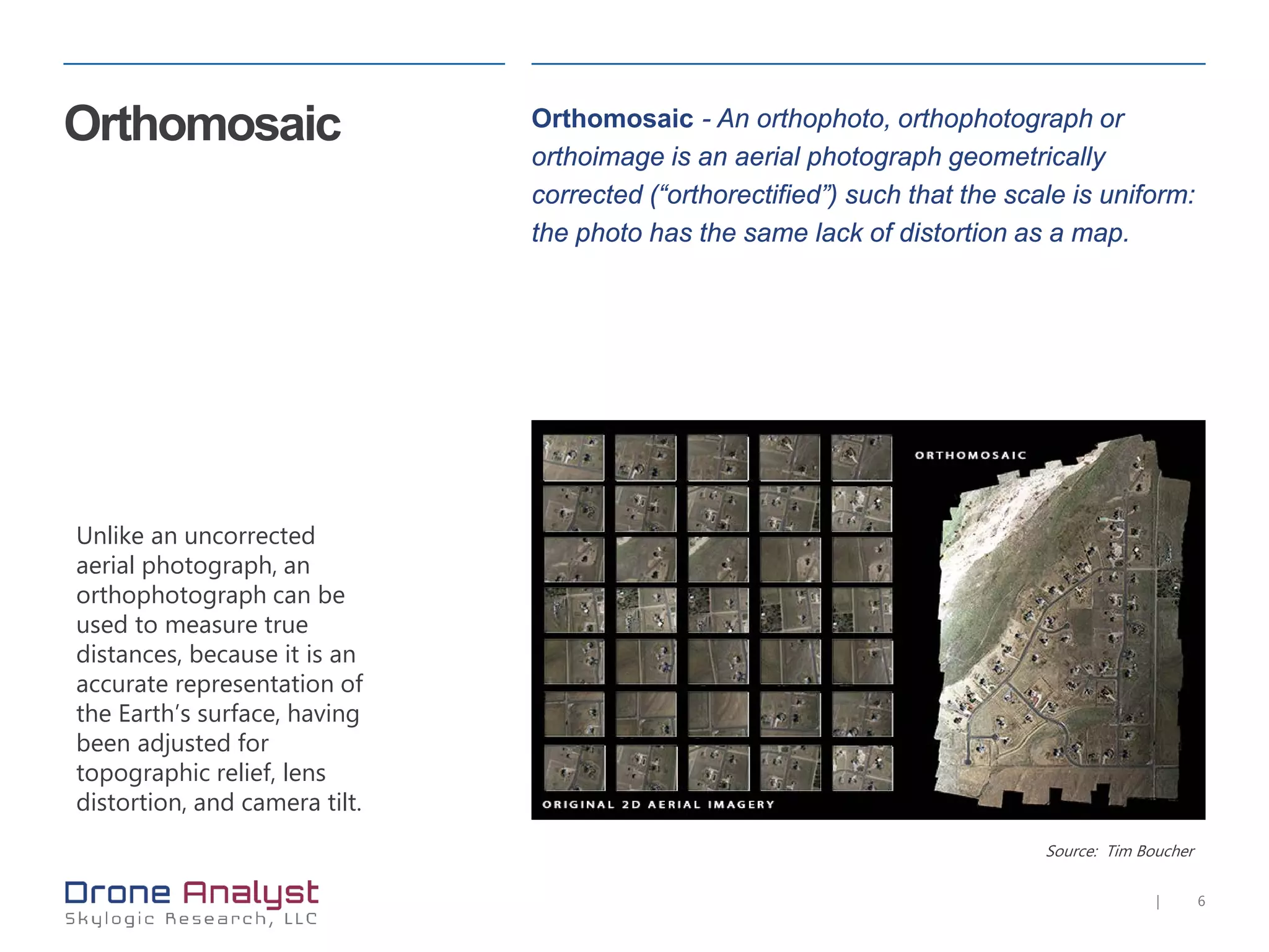
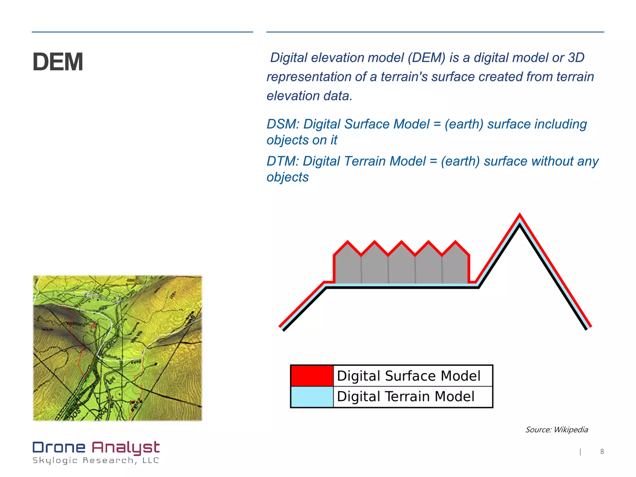
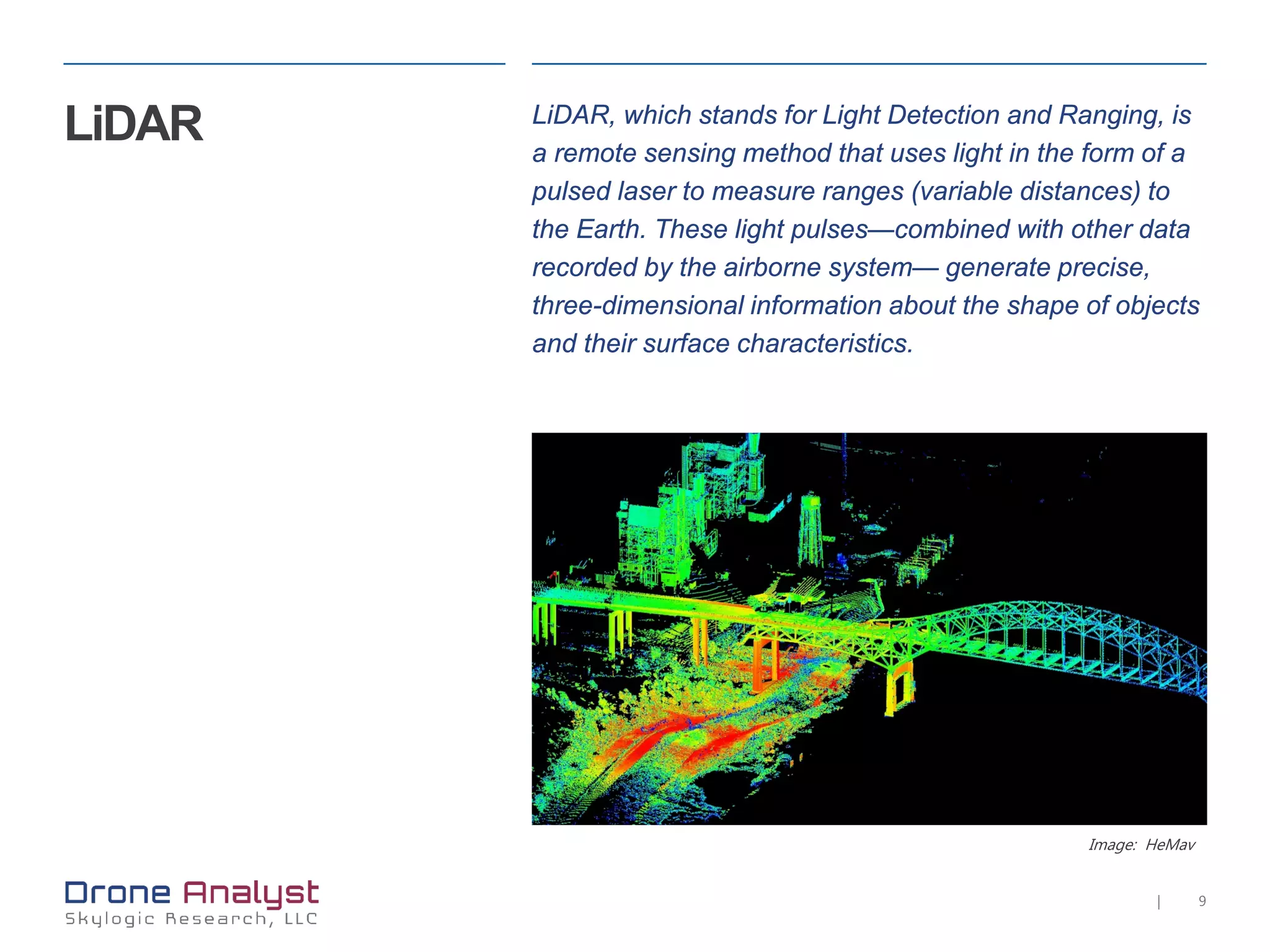
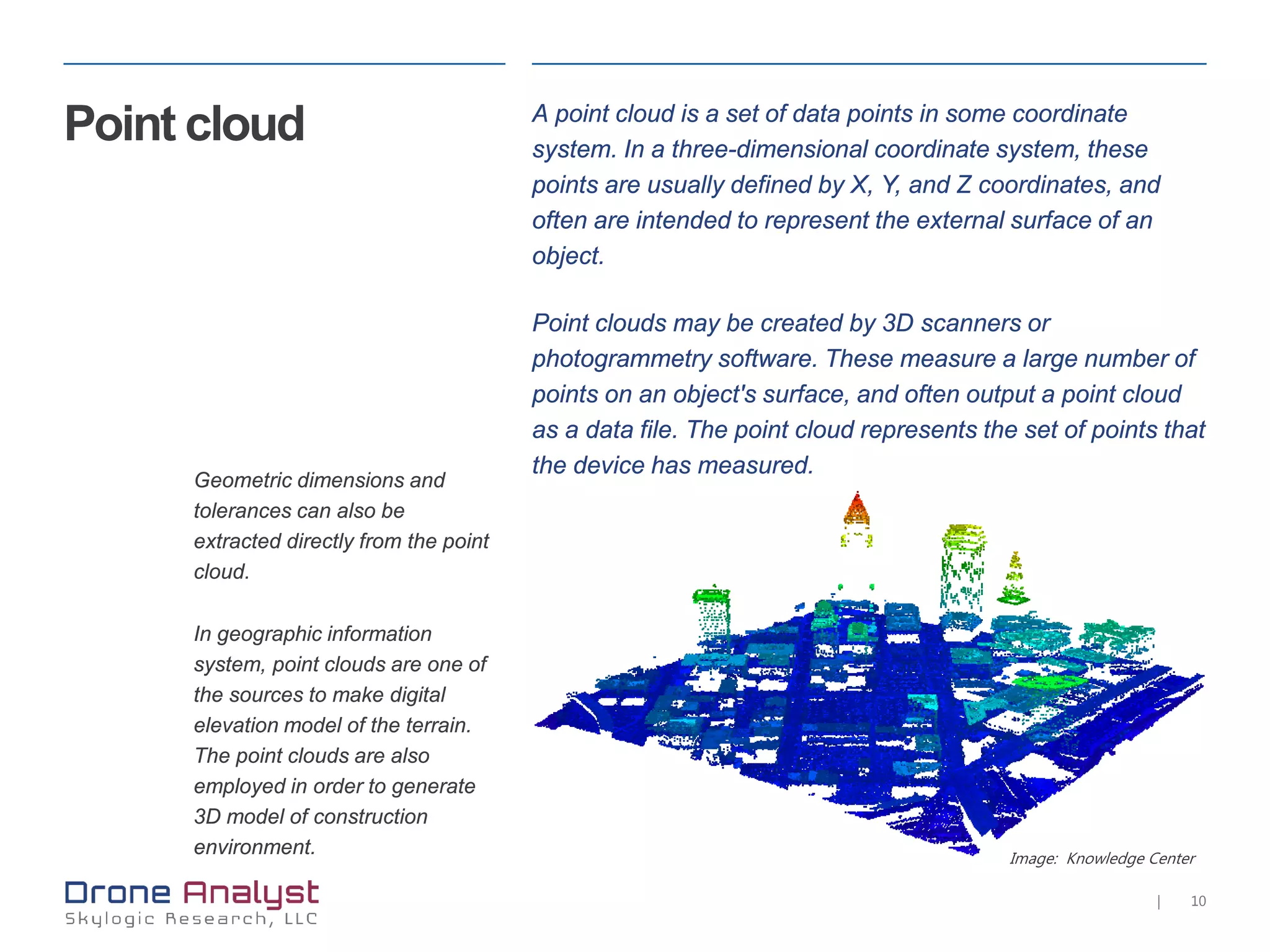
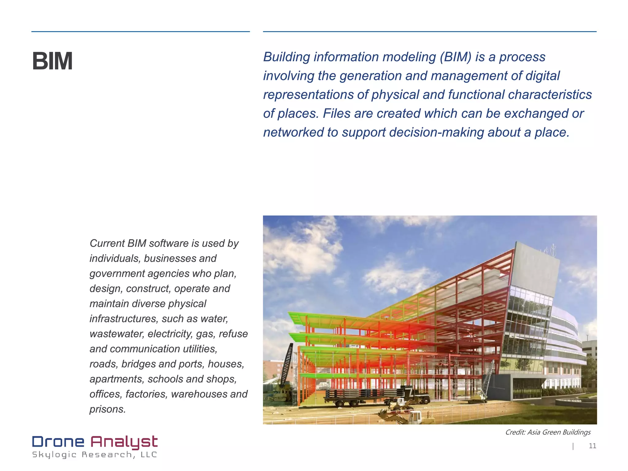
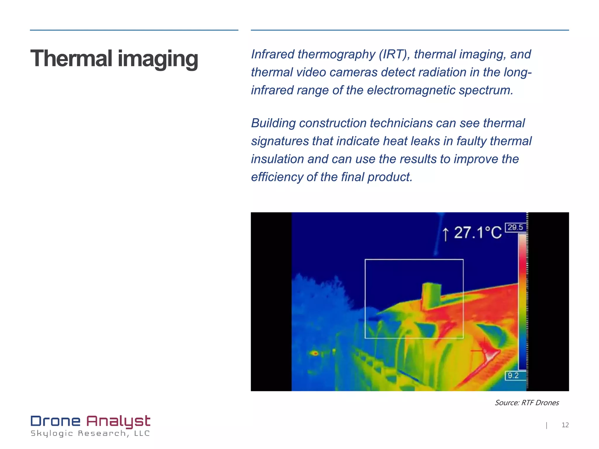
4. 4|
Drones in
construction:
Future?
Goldman Sachs estimates that total global spending on
drones in the commercial market will be $100 billion over
the next five years. Of that $100 billion, about $11.2
billion will be generated by the construction industry.
Source: Market Watch
6. 6|
Orthomosaic
Unlike an uncorrected
aerial photograph, an
orthophotograph can be
used to measure true
distances, because it is an
accurate representation of
the Earth’s surface, having
been adjusted for
topographic relief, lens
distortion, and camera tilt.
Orthomosaic - An orthophoto, orthophotograph or
orthoimage is an aerial photograph geometrically
corrected (“orthorectified”) such that the scale is uniform:
the photo has the same lack of distortion as a map.
Source: Tim Boucher
7. 7|
Source: Tim Boucher
Photogrammetry Photogrammetry is a technique which uses photography
to extract measurements of the environment. This is
achieved through the use of overlapping imagery; where
the same feature can be seen from two perspectives it is
possible to calculate m
8. 8|
DEM Digital elevation model (DEM) is a digital model or 3D
representation of a terrain's surface created from terrain
elevation data.
DSM: Digital Surface Model = (earth) surface including
objects on it
DTM: Digital Terrain Model = (earth) surface without any
objects
Source: Wikipedia
9. 9|
Image: HeMav
LiDAR LiDAR, which stands for Light Detection and Ranging, is
a remote sensing method that uses light in the form of a
pulsed laser to measure ranges (variable distances) to
the Earth. These light pulses—combined with other data
recorded by the airborne system— generate precise,
three-dimensional information about the shape of objects
and their surface characteristics.
10. 10|
Image: Knowledge Center
Point cloud A point cloud is a set of data points in some coordinate
system. In a three-dimensional coordinate system, these
points are usually defined by X, Y, and Z coordinates, and
often are intended to represent the external surface of an
object.
Point clouds may be created by 3D scanners or
photogrammetry software. These measure a large number of
points on an object's surface, and often output a point cloud
as a data file. The point cloud represents the set of points that
the device has measured.
Geometric dimensions and
tolerances can also be
extracted directly from the point
cloud.
In geographic information
system, point clouds are one of
the sources to make digital
elevation model of the terrain.
The point clouds are also
employed in order to generate
3D model of construction
environment.
11. 11|
BIM Building information modeling (BIM) is a process
involving the generation and management of digital
representations of physical and functional characteristics
of places. Files are created which can be exchanged or
networked to support decision-making about a place.
Current BIM software is used by
individuals, businesses and
government agencies who plan,
design, construct, operate and
maintain diverse physical
infrastructures, such as water,
wastewater, electricity, gas, refuse
and communication utilities,
roads, bridges and ports, houses,
apartments, schools and shops,
offices, factories, warehouses and
prisons.
Credit: Asia Green Buildings
12. 12|
Source: RTF Drones
Thermal imaging Infrared thermography (IRT), thermal imaging, and
thermal video cameras detect radiation in the long-
infrared range of the electromagnetic spectrum.
Building construction technicians can see thermal
signatures that indicate heat leaks in faulty thermal
insulation and can use the results to improve the
efficiency of the final product.
13. 13|
About Skylogic Research, LLC is a research, content, and
advisory firm supporting all participants in the
commercial unmanned aircraft systems (UAS)
industry.
We provide research-based insights needed to make critical investment
decisions with confidence.
Our focus is on the needs of three constituents:
• Buyers of UAS technology and services – to help inform their
acquisition decisions
• Suppliers and service providers – who need research and insight
into buyer needs
• Investors – who need to distinguish technical and market viability
This focus, plus research as a foundation and reach into a community of
more than 90,000 business executives and innovators through social
media and media partnerships, allows Skylogic Research to deliver a
high-value, low-risk method for achieving optimal understanding.
Learn more:
Web http://droneanalyst.com
Twitter @droneanalyst
Email colin@droneanalyst.com