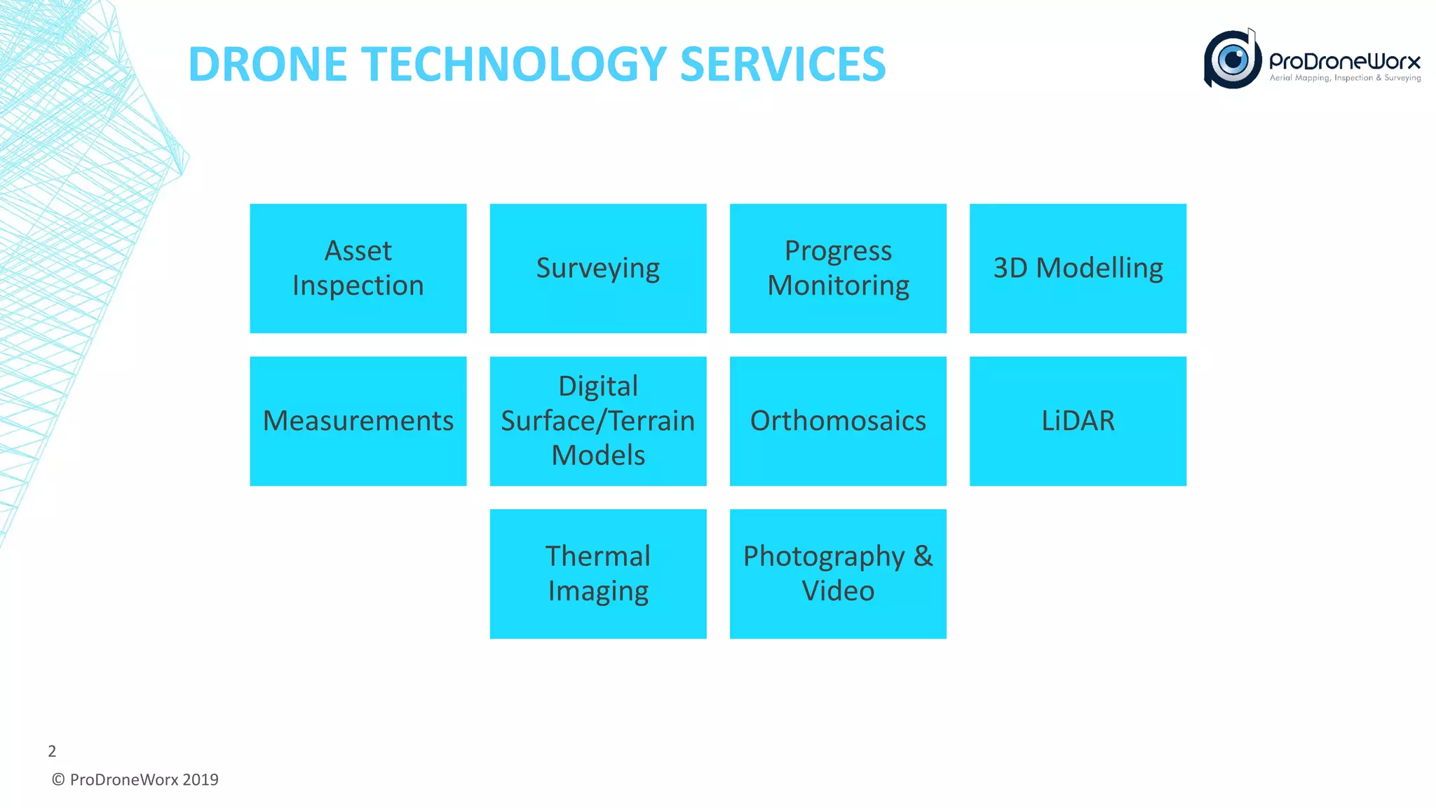
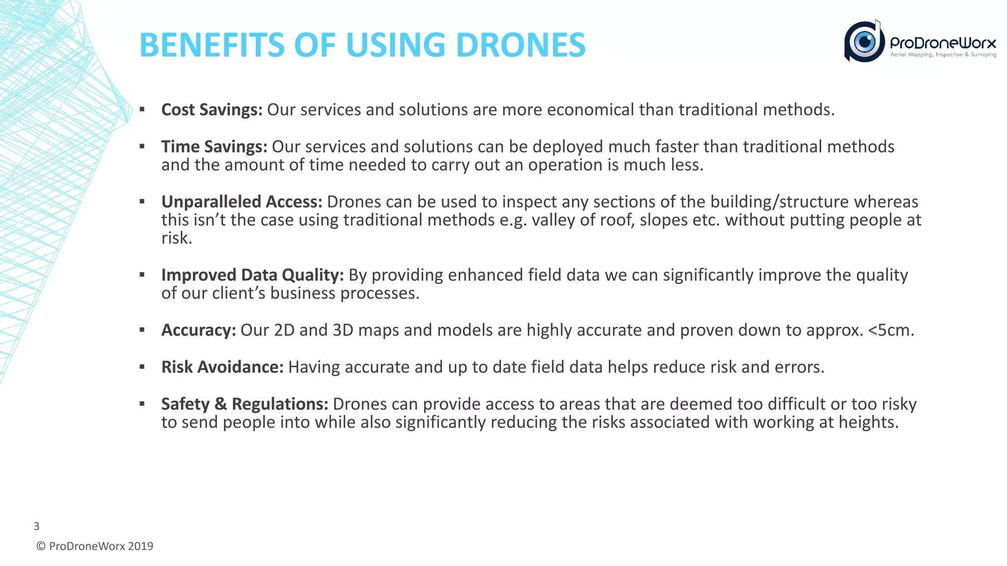
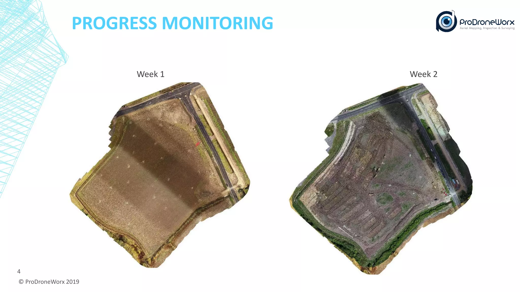
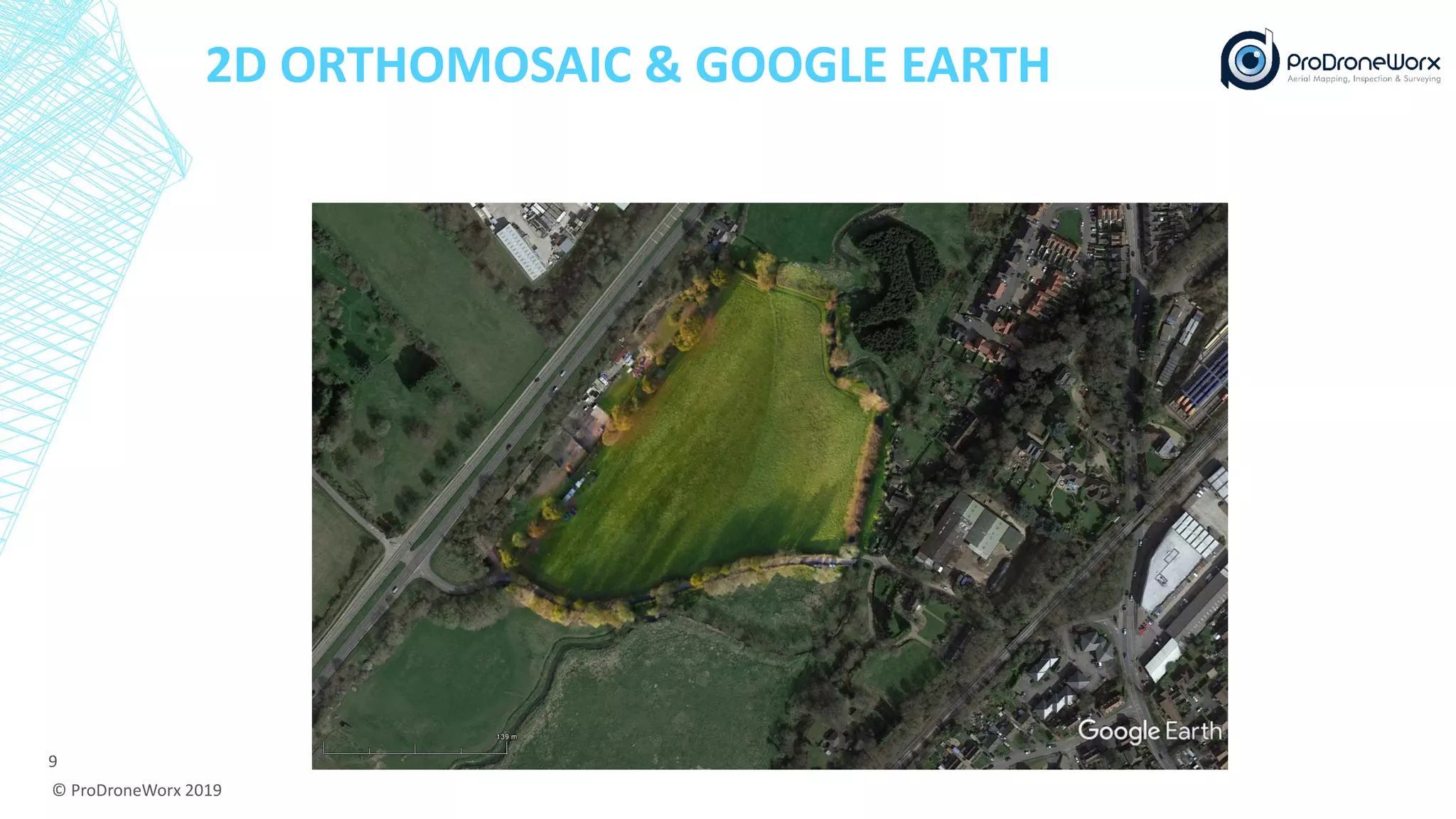
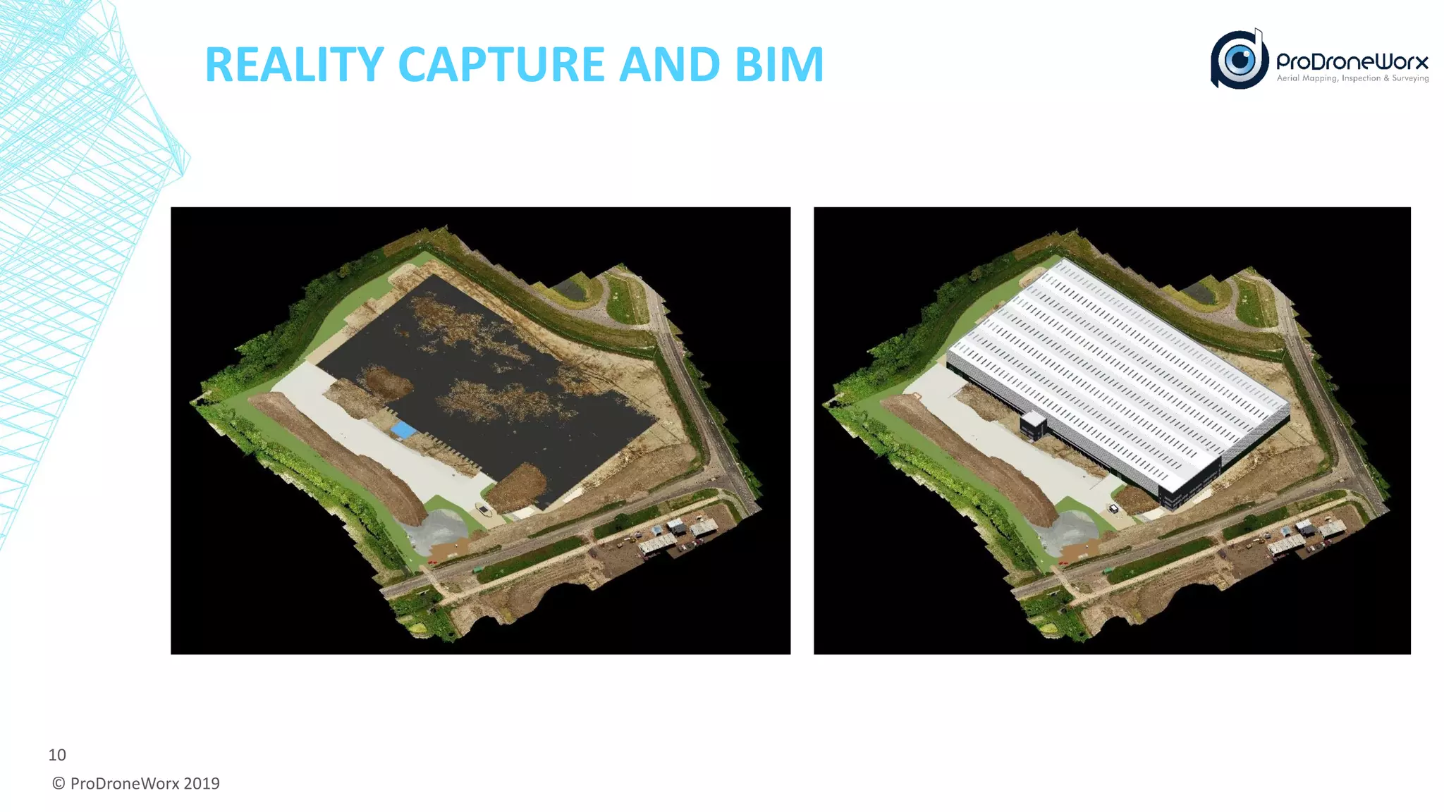
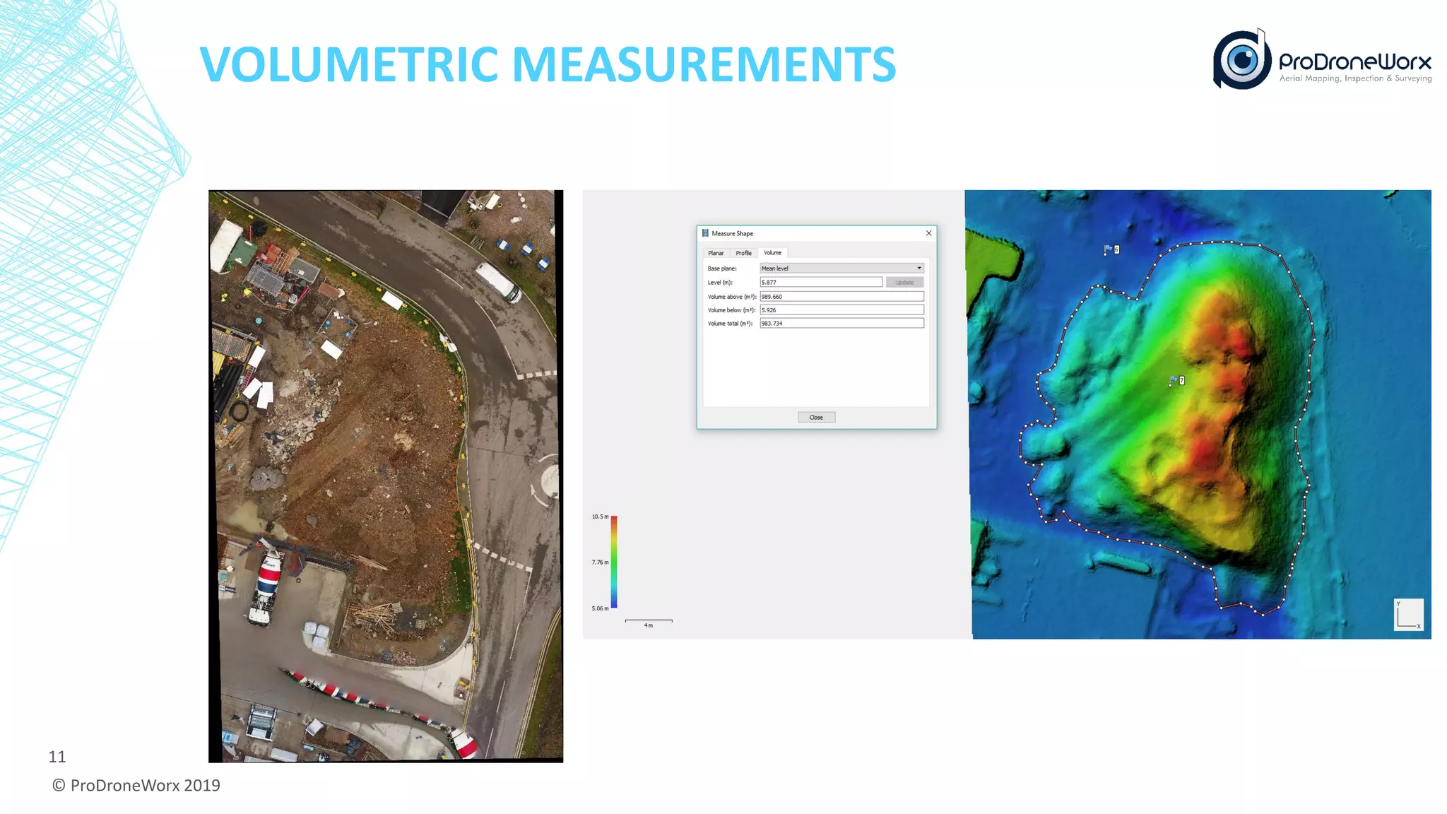
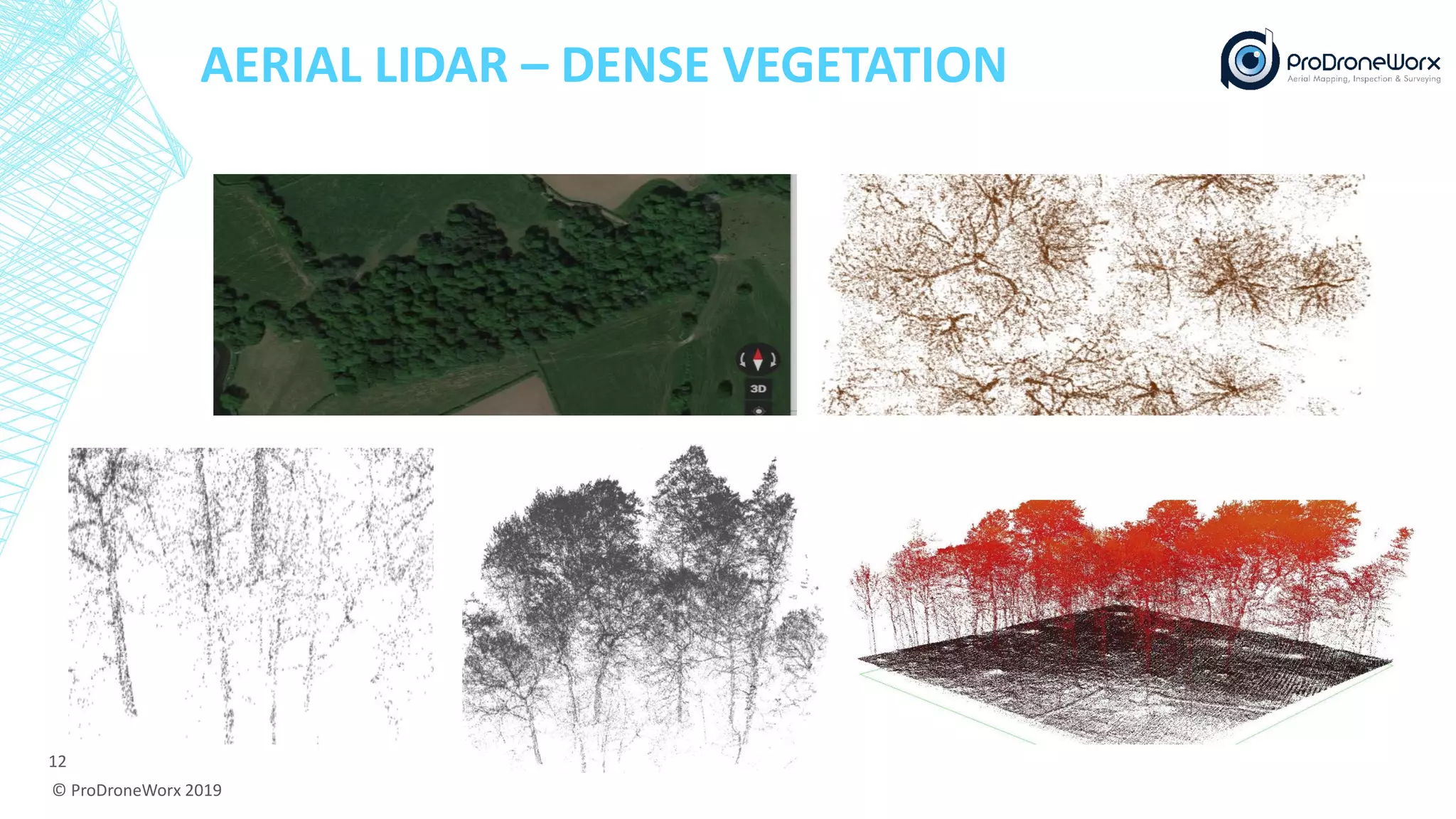
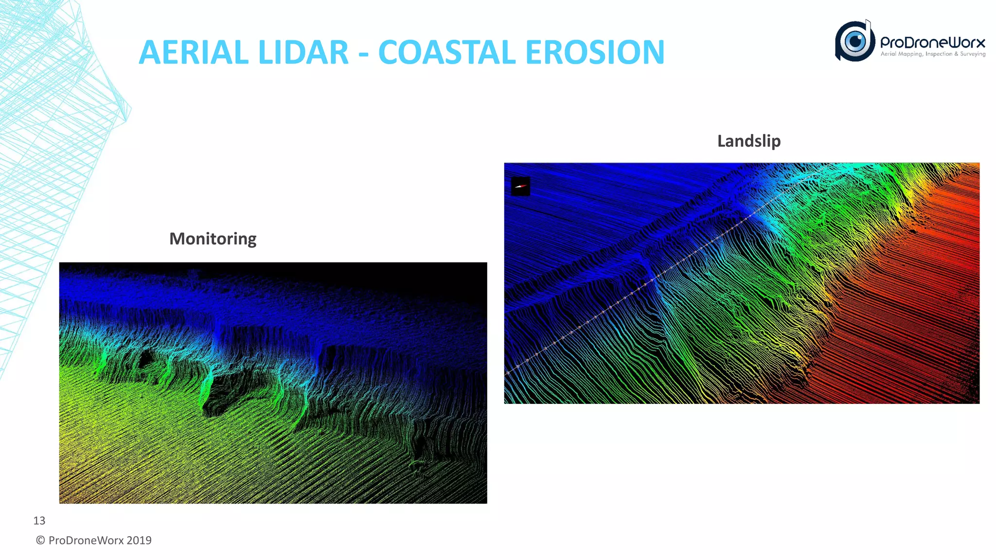
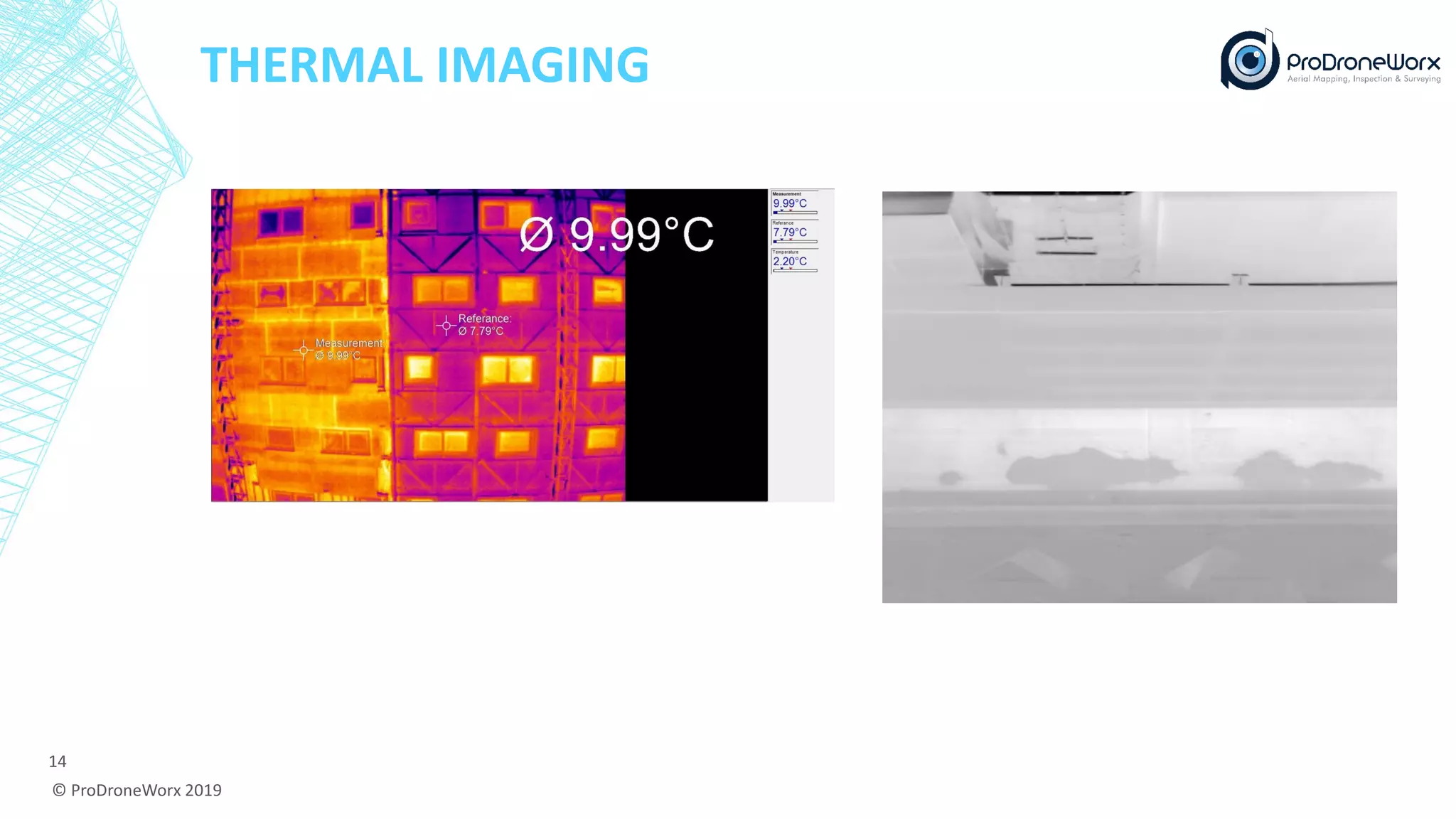
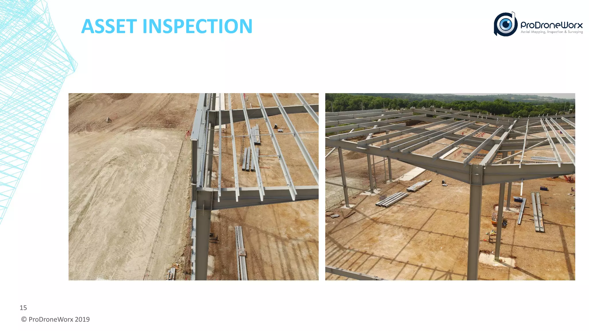
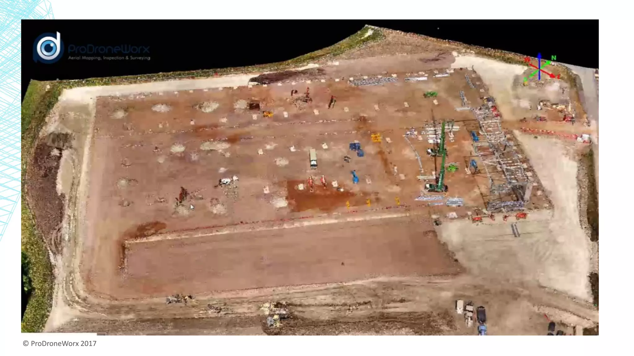
PRODRONEWORXUSING DIGITAL/REALITY CAPTURE DATA FROM DRONE
TECHNOLOGY IN CONSTRUCTION
Ian Tansey
Managing Director
© ProDroneWorx 2019
1
DRONE TECHNOLOGY SERVICES
Asset
Inspection
Surveying
Progress
Monitoring
3D Modelling
Measurements
Digital
Surface/Terrain
Models
Orthomosaics LiDAR
Thermal
Imaging
Photography &
Video
© ProDroneWorx 2019
2
BENEFITS OF USING DRONES
▪ Cost Savings: Our services and solutions are more economical than traditional methods.
▪ Time Savings: Our services and solutions can be deployed much faster than traditional methods
and the amount of time needed to carry out an operation is much less.
▪ Unparalleled Access: Drones can be used to inspect any sections of the building/structure whereas
this isn’t the case using traditional methods e.g. valley of roof, slopes etc. without putting people at
risk.
▪ Improved Data Quality: By providing enhanced field data we can significantly improve the quality
of our client’s business processes.
▪ Accuracy: Our 2D and 3D maps and models are highly accurate and proven down to approx. <5cm.
▪ Risk Avoidance: Having accurate and up to date field data helps reduce risk and errors.
▪ Safety & Regulations: Drones can provide access to areas that are deemed too difficult or too risky
to send people into while also significantly reducing the risks associated with working at heights.
© ProDroneWorx 2019
3
PROGRESS MONITORING
© ProDroneWorx 2019
4
Week 1 Week 2
2D ORTHOMOSAIC & CAD MODELS
© ProDroneWorx 2019
5
3D POINT CLOUD
© ProDroneWorx 2019
6
3D TEXTURED MODEL
© ProDroneWorx 2019
7
DIGITAL SURFACE MODEL (DSM)
8
© ProDroneWorx 2019
2D ORTHOMOSAIC & GOOGLE EARTH
© ProDroneWorx 2019
9
REALITY CAPTURE AND BIM
© ProDroneWorx 2019
10
VOLUMETRIC MEASUREMENTS
© ProDroneWorx 2019
11
AERIAL LIDAR – DENSE VEGETATION
© ProDroneWorx 2019
12
AERIAL LIDAR - COASTAL EROSION
© ProDroneWorx 2019
13
Monitoring
Landslip
THERMAL IMAGING
© ProDroneWorx 2019
14
ASSET INSPECTION
© ProDroneWorx 2019
15
© ProDroneWorx 2017
16

COMIT Community Day Spring 2019 - Prodroneworx