SlideShare a Scribd company logo
1 of 16
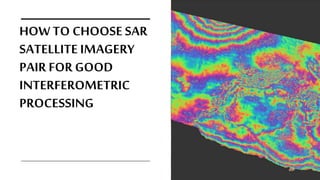
HOW TO CHOOSE SAR
SATELLITE IMAGERY
PAIR FOR GOOD
INTERFEROMETRIC
PROCESSING
WARNING!!!
YOU MUST HAVE AND UNDERSTAND BASIC KNOWLEDGE
AND THEORIES ABOUT REMOTE SENSING AND
RADAR/MICROWAVE REMOTE SENSING IN GENERAL.
THERE WILL BE SOME TECHNICAL TERMS THAT MAY BE
YOU ARE NOT YET UNDERSTAND WHAT THE MEANING
OF THOSE TERMS OR WHAT THOSE TERMS IS ABOUT.
SO READ AGAIN YOUR TEXTBOOKS OF USE GOOGLE
SEARCH ENGINE IF YOU FIND ANY UNFAMILIAR TERMS.
EITHER WAY COMMENTS BOX IS ALWAYS OPEN 24/7/365
THINGSNEED TO BE CONSIDEREDFOR INTERFEROMETRIC
IMAGE PAIR SELECTION
• View angle (ascending and descending passes)
• Geometrical baseline (important for Inferferometric DEM Generation!!)
• Temporal baseline
• Time of the acquisition
• ImageCoherence
• Meteorological conditions
Image Coherence
Coherence for the simplicity can be defined as the correlation of different acquisitionat same locationradar
backscatter(in single look complex values geometry).
Good coherence ( > 0,5) will guarantee accurateand precise interferometric processing of radar phase
information.
Because SAR radiowave targeting earth surface, the coherence will be affected greatly by
landcover type and behaviour.
Built-uparea and bare soil landcoverusuallygives a goodcoherence even afterseveral years because theyarequitesteady, if phase
differenceis detected from theselandcovers,it mustbe caused byvolcanic/seismic/terrainforce (good targetto measuredeformation,
subsidence, seismic properties)
Image Coherence • Low/sparsevegetationcover oragriculturalfieldsusuallymaintaingood
coherencein a shorttemporaldifference(1 to3 days,dependson thevegetation
dynamic)andit is graduallydecreased alongthe time.
• High vegetation cover likeforestis superhardtomaintaingood coherence(even
in hours,1daytimedifference)becauseit isfrequentlychangedin direction
(whooshedbywinds).
• RadarBandsis alsohavesomeeffectsto thecoherence,takeforestlandcoveras
example, shorterwavelength radarbandslike C-bandsandX-bands(used in
ERS,Envisat,Sentinel-1) usuallyfailstomaintaingoodcoherence,butlonger
radarbandslike L-bands(used in PALSAR,PALSAR-2)canmaintainbetter
coherenceforforestarea(in relativeshorttemporaldifference) becausethose
longer bandshavebetter abilitytopenetratethe earthsurfacetovegetation
stems andtrunksthatrelatively steady.
Viewangle
(ascending
and
descending)
• Selectingimageryfor interferometricpair should be in same directionof
viewing.SARsatellite usually recordsearthsurface inascending direction
or descending direction(eitherin same day acquisition or differentday).
• Whythe imageryshould be insame viewingdirection??? Because
ascending and descending acquisition willgenerateopposite angle of
foreshortening andlayovereffects onthe terrain,you willnot have any
coherence at allif you combine ascending and descending image as
interferometricpair.
• There arecertaincase/application that youstillcan use both of
ascending and descending images,BUT notina single pair(you can
mergethe interferogramresultsofascending and descending image to
geta richfeature composite interferogramfor certainanalysis)
Thingsto be
considered
aboutView
angle
• You must have deep knowledge about topography of you area of
interest.
• If your AOI is flat or gentle, consider yourself aslucky because
layover/foreshortening is not massive, so ascending or
descending image can be used without further problem.
• But if your AOI is mountainous, you should consider the
dominant aspect (slope angle) of the terrain. Why? It is because
area in foreshortening become non-coherent assoon asthe
perpendicular baseline is greater than a few metres, so if the area
of interest lies on a slope that ismainly oriented towards the
West, it wouldbe foreshortened on SAR ascending images. Thus,
descending orbits should be selected.
Geometrical Baseline
• There aretwo terms about geometrical baseline, (1)
interferometric baseline and (2) perpendicular baseline
• Interferograms with very small perpendicular baseline values (<
30 m)is easy and fast tounwrap, butusually useless because
they are prone to phase noise and atmospheric effects.
• Interferograms with normal/long baseline (values higher than
~450 m) are usually almost impossible to unwrap if it is not
assisted bya DEM and the topography of the areais notvery
smooth. Moreover the coherence is generally small, due to the
high geometrical and volume scattering decorrelation, although
the temporal difference of the pair relatively short!
FOR INTERFEROMETRIC DEM GENERATION
Geometrical Baseline
• Theoptimum perpendicular baseline is in the rangebetween 150
and 300 metres. However, the bestresult is achieved by using
more than oneinterferogram. Interferograms with small
baselines can be exploited to help unwrap interferograms with
high baselines. Moreover, different interferograms can be
combined in orderto reducethe atmospheric artefacts.
FOR INTERFEROMETRIC DEM GENERATION
Geometrical Baseline
• If you arelooking for interferometric phase caused by motion and
you dont have any DEM to assist the interferometry, usea single pair
of imagery (before and after the event) with close to zero
perpendicular baseline. Remember, You still have to consider other
criteria like meteorological condition, temporal baseline, and time of
acquisition to geta better coherence).Smaller baseline itself already
guarantee good coherence.
• If you cant find close to zero baselineinterferometric pair, you going
toneeds a DEM because the interferometric phase now is
contributed by motion andaltitude factor. Altitude contribution
can be removed using DEM (topographic phase removal)
FOR LAND SUBSIDENCE,VOLCANODEFORMATION,EARTHQUAKE INTERFEROMETRY
Temporal Baseline
Temporal baselinegenerally is
abouttime differences between
twoacquisitionofimages that
usedfor interferometricpair
(seconds, minutes,hours,days,
months)
01
Shorter temporal baseline
will guarantee better
coherence (without ignoring
other contributed factors)
02
Longer but consistent temporal
baseline are also possible to
generate good coherence (like
images taken from same season in
different years, or similar agricultural
growth stage in different months)
03
Time of
Acquisition
Night time acquisition usually less affected by
Atmospheric disturbation
Phasemeasurement of RADAR usually affected by atmosphere
dynamic.In theinteferogram it couldbe represented by a random
fringes, artefactsor non random phasestripes.
SAR Satellite usually operates in day timeor night time(obviously
because they are activeremote sensing system)
Meteorological Conditions
• Coherence values are affected by localweather. Avoid
acquisitions during rain, snow or strong wind. These
phenomena usuallycause loss of phase coherence.
• Discard images acquired during very hot days: hot air can
holdmuch more water vapour than cold air (a major
cause of atmospheric artefacts in SAR interferograms)
Further Reading
https://www.esa.int/esapub/tm/tm19/TM-19_ptB.pdf
THANKS FOR
WATCHING

More Related Content

What's hot

Understanding Coordinate Systems and Projections for ArcGIS
Understanding Coordinate Systems and Projections for ArcGISUnderstanding Coordinate Systems and Projections for ArcGIS
Understanding Coordinate Systems and Projections for ArcGISJohn Schaeffer
 
5 spatial data editing
5 spatial data editing5 spatial data editing
5 spatial data editinganita bodke
 
PERSISTENT SCATTERER SAR INTERFEROMETRY APPLICATION.pptx
PERSISTENT SCATTERER SAR INTERFEROMETRY APPLICATION.pptxPERSISTENT SCATTERER SAR INTERFEROMETRY APPLICATION.pptx
PERSISTENT SCATTERER SAR INTERFEROMETRY APPLICATION.pptxgrssieee
 
TYBSC IT PGIS Unit III Chapter II Data Entry and Preparation
TYBSC IT PGIS Unit III Chapter II Data Entry and PreparationTYBSC IT PGIS Unit III Chapter II Data Entry and Preparation
TYBSC IT PGIS Unit III Chapter II Data Entry and PreparationArti Parab Academics
 
Remote Sensing: Resolution Merge
Remote Sensing: Resolution MergeRemote Sensing: Resolution Merge
Remote Sensing: Resolution MergeKamlesh Kumar
 
Band ratioing presentation
Band ratioing presentationBand ratioing presentation
Band ratioing presentationsk asadul haque
 
10-Image rectification and restoration.ppt
10-Image rectification and restoration.ppt10-Image rectification and restoration.ppt
10-Image rectification and restoration.pptAJAYMALIK97
 
Chapter one gis
Chapter one gisChapter one gis
Chapter one gisGokul Saud
 
Presentation on the background theory of InSAR
Presentation on the background theory of InSARPresentation on the background theory of InSAR
Presentation on the background theory of InSARSERC at Carleton College
 
DATABASE & WEBGIS - GIS BOOTCAMP
DATABASE & WEBGIS - GIS BOOTCAMPDATABASE & WEBGIS - GIS BOOTCAMP
DATABASE & WEBGIS - GIS BOOTCAMPKevin Ng'eno
 
WHAT'S THERE IN GEOMATICS ENGINEERING???
WHAT'S THERE IN GEOMATICS ENGINEERING???WHAT'S THERE IN GEOMATICS ENGINEERING???
WHAT'S THERE IN GEOMATICS ENGINEERING???Nepal Flying Labs
 
Fundamentals of GIS
Fundamentals of GISFundamentals of GIS
Fundamentals of GISPallab Jana
 
Visual Image Interpretation in Remote Sensing
Visual Image Interpretation in Remote SensingVisual Image Interpretation in Remote Sensing
Visual Image Interpretation in Remote Sensingvishwanathabhat
 
Structure of geographic data
Structure of geographic dataStructure of geographic data
Structure of geographic dataMd. Yousuf Gazi
 

What's hot (20)

Understanding Coordinate Systems and Projections for ArcGIS
Understanding Coordinate Systems and Projections for ArcGISUnderstanding Coordinate Systems and Projections for ArcGIS
Understanding Coordinate Systems and Projections for ArcGIS
 
5 spatial data editing
5 spatial data editing5 spatial data editing
5 spatial data editing
 
PERSISTENT SCATTERER SAR INTERFEROMETRY APPLICATION.pptx
PERSISTENT SCATTERER SAR INTERFEROMETRY APPLICATION.pptxPERSISTENT SCATTERER SAR INTERFEROMETRY APPLICATION.pptx
PERSISTENT SCATTERER SAR INTERFEROMETRY APPLICATION.pptx
 
Basic remote sensing and gis
Basic remote sensing and gisBasic remote sensing and gis
Basic remote sensing and gis
 
komposit warna
komposit warnakomposit warna
komposit warna
 
TYBSC IT PGIS Unit III Chapter II Data Entry and Preparation
TYBSC IT PGIS Unit III Chapter II Data Entry and PreparationTYBSC IT PGIS Unit III Chapter II Data Entry and Preparation
TYBSC IT PGIS Unit III Chapter II Data Entry and Preparation
 
DTM DEM Generation
DTM DEM GenerationDTM DEM Generation
DTM DEM Generation
 
Remote Sensing: Resolution Merge
Remote Sensing: Resolution MergeRemote Sensing: Resolution Merge
Remote Sensing: Resolution Merge
 
Gis
GisGis
Gis
 
Band ratioing presentation
Band ratioing presentationBand ratioing presentation
Band ratioing presentation
 
10-Image rectification and restoration.ppt
10-Image rectification and restoration.ppt10-Image rectification and restoration.ppt
10-Image rectification and restoration.ppt
 
Chapter one gis
Chapter one gisChapter one gis
Chapter one gis
 
Map algebra
Map algebraMap algebra
Map algebra
 
Presentation on the background theory of InSAR
Presentation on the background theory of InSARPresentation on the background theory of InSAR
Presentation on the background theory of InSAR
 
DATABASE & WEBGIS - GIS BOOTCAMP
DATABASE & WEBGIS - GIS BOOTCAMPDATABASE & WEBGIS - GIS BOOTCAMP
DATABASE & WEBGIS - GIS BOOTCAMP
 
Geographical Information System.ppt
Geographical Information System.pptGeographical Information System.ppt
Geographical Information System.ppt
 
WHAT'S THERE IN GEOMATICS ENGINEERING???
WHAT'S THERE IN GEOMATICS ENGINEERING???WHAT'S THERE IN GEOMATICS ENGINEERING???
WHAT'S THERE IN GEOMATICS ENGINEERING???
 
Fundamentals of GIS
Fundamentals of GISFundamentals of GIS
Fundamentals of GIS
 
Visual Image Interpretation in Remote Sensing
Visual Image Interpretation in Remote SensingVisual Image Interpretation in Remote Sensing
Visual Image Interpretation in Remote Sensing
 
Structure of geographic data
Structure of geographic dataStructure of geographic data
Structure of geographic data
 

Similar to How to choose SAR satellite imagery for a good interferometric processing

REMOTE SENSING_TOPIC_II_2023.pptx
REMOTE SENSING_TOPIC_II_2023.pptxREMOTE SENSING_TOPIC_II_2023.pptx
REMOTE SENSING_TOPIC_II_2023.pptxarmanisingh31
 
Aitf 2014 pem_introduction_presentation_feb28_ram_version2
Aitf 2014 pem_introduction_presentation_feb28_ram_version2Aitf 2014 pem_introduction_presentation_feb28_ram_version2
Aitf 2014 pem_introduction_presentation_feb28_ram_version2Bob MacMillan
 
Change detection techniques
Change detection techniquesChange detection techniques
Change detection techniquesFemi Opaleye
 
Automated Motion Detection from space in sea surveillance
Automated Motion Detection from space in sea surveillanceAutomated Motion Detection from space in sea surveillance
Automated Motion Detection from space in sea surveillanceLiza Charalambous
 
Photographic surveying
Photographic surveyingPhotographic surveying
Photographic surveyingHUSSAINGHAZI1
 
Aerial photography- Concept and Terminologies
Aerial photography- Concept and Terminologies Aerial photography- Concept and Terminologies
Aerial photography- Concept and Terminologies UTTIYACHATTOPADHYAY2
 
Elastic response spectra
Elastic response spectra Elastic response spectra
Elastic response spectra Alban KURIQI
 
Seismic refractionsurveying r4a
Seismic refractionsurveying r4aSeismic refractionsurveying r4a
Seismic refractionsurveying r4aAlina Arshad
 
Seismic Refraction Surveying
Seismic Refraction SurveyingSeismic Refraction Surveying
Seismic Refraction SurveyingAli Osman Öncel
 
03 cameras &amp; their geometry
03 cameras &amp; their geometry03 cameras &amp; their geometry
03 cameras &amp; their geometrySarhat Adam
 
Remote Sensing error sources
Remote Sensing error sourcesRemote Sensing error sources
Remote Sensing error sourcesGilbert Okoth
 
Scalable Fiducial Tag Localization on a 3D Prior Map via Graph-Theoretic Glob...
Scalable Fiducial Tag Localization on a 3D Prior Map via Graph-Theoretic Glob...Scalable Fiducial Tag Localization on a 3D Prior Map via Graph-Theoretic Glob...
Scalable Fiducial Tag Localization on a 3D Prior Map via Graph-Theoretic Glob...KenjiKoide1
 
Pacific viz-keynote
Pacific viz-keynotePacific viz-keynote
Pacific viz-keynoteGerry Kim
 
6.3_DEM CREATION AND 3D MODELING.pptx
6.3_DEM CREATION AND 3D MODELING.pptx6.3_DEM CREATION AND 3D MODELING.pptx
6.3_DEM CREATION AND 3D MODELING.pptxDivyaPriya700213
 
Well Directional Survey Processing in FME
Well Directional Survey Processing in FMEWell Directional Survey Processing in FME
Well Directional Survey Processing in FMESafe Software
 
IGARSS presentation WKLEE.pptx
IGARSS presentation WKLEE.pptxIGARSS presentation WKLEE.pptx
IGARSS presentation WKLEE.pptxgrssieee
 
IGARSS presentation WKLEE.pptx
IGARSS presentation WKLEE.pptxIGARSS presentation WKLEE.pptx
IGARSS presentation WKLEE.pptxgrssieee
 

Similar to How to choose SAR satellite imagery for a good interferometric processing (20)

REMOTE SENSING_TOPIC_II_2023.pptx
REMOTE SENSING_TOPIC_II_2023.pptxREMOTE SENSING_TOPIC_II_2023.pptx
REMOTE SENSING_TOPIC_II_2023.pptx
 
Aitf 2014 pem_introduction_presentation_feb28_ram_version2
Aitf 2014 pem_introduction_presentation_feb28_ram_version2Aitf 2014 pem_introduction_presentation_feb28_ram_version2
Aitf 2014 pem_introduction_presentation_feb28_ram_version2
 
Change detection techniques
Change detection techniquesChange detection techniques
Change detection techniques
 
Automated Motion Detection from space in sea surveillance
Automated Motion Detection from space in sea surveillanceAutomated Motion Detection from space in sea surveillance
Automated Motion Detection from space in sea surveillance
 
Photographic surveying
Photographic surveyingPhotographic surveying
Photographic surveying
 
Aerial photography- Concept and Terminologies
Aerial photography- Concept and Terminologies Aerial photography- Concept and Terminologies
Aerial photography- Concept and Terminologies
 
Elastic response spectra
Elastic response spectra Elastic response spectra
Elastic response spectra
 
Seismic refractionsurveying r4a
Seismic refractionsurveying r4aSeismic refractionsurveying r4a
Seismic refractionsurveying r4a
 
Seismic Refraction Surveying
Seismic Refraction SurveyingSeismic Refraction Surveying
Seismic Refraction Surveying
 
03 cameras &amp; their geometry
03 cameras &amp; their geometry03 cameras &amp; their geometry
03 cameras &amp; their geometry
 
GIS
GISGIS
GIS
 
Remote Sensing error sources
Remote Sensing error sourcesRemote Sensing error sources
Remote Sensing error sources
 
Scalable Fiducial Tag Localization on a 3D Prior Map via Graph-Theoretic Glob...
Scalable Fiducial Tag Localization on a 3D Prior Map via Graph-Theoretic Glob...Scalable Fiducial Tag Localization on a 3D Prior Map via Graph-Theoretic Glob...
Scalable Fiducial Tag Localization on a 3D Prior Map via Graph-Theoretic Glob...
 
Pacific viz-keynote
Pacific viz-keynotePacific viz-keynote
Pacific viz-keynote
 
6.3_DEM CREATION AND 3D MODELING.pptx
6.3_DEM CREATION AND 3D MODELING.pptx6.3_DEM CREATION AND 3D MODELING.pptx
6.3_DEM CREATION AND 3D MODELING.pptx
 
Vector.pdf
Vector.pdfVector.pdf
Vector.pdf
 
SfM Workflow Presentation
SfM Workflow PresentationSfM Workflow Presentation
SfM Workflow Presentation
 
Well Directional Survey Processing in FME
Well Directional Survey Processing in FMEWell Directional Survey Processing in FME
Well Directional Survey Processing in FME
 
IGARSS presentation WKLEE.pptx
IGARSS presentation WKLEE.pptxIGARSS presentation WKLEE.pptx
IGARSS presentation WKLEE.pptx
 
IGARSS presentation WKLEE.pptx
IGARSS presentation WKLEE.pptxIGARSS presentation WKLEE.pptx
IGARSS presentation WKLEE.pptx
 

More from bramantiyo marjuki

Pemanfaatan Citra Satelit Medium Resolution Untuk Pemetaan Urban FootPrint
Pemanfaatan Citra Satelit Medium Resolution Untuk Pemetaan Urban FootPrintPemanfaatan Citra Satelit Medium Resolution Untuk Pemetaan Urban FootPrint
Pemanfaatan Citra Satelit Medium Resolution Untuk Pemetaan Urban FootPrintbramantiyo marjuki
 
Crowsource Mapping, Captures Neography Practices
Crowsource Mapping, Captures Neography PracticesCrowsource Mapping, Captures Neography Practices
Crowsource Mapping, Captures Neography Practicesbramantiyo marjuki
 
PENERAPAN TEKNIK PEMETAAN PARTISIPATIF UNTUK MENDUKUNG PENYUSUNAN BASIS DATA...
PENERAPAN TEKNIK PEMETAAN PARTISIPATIF UNTUK  MENDUKUNG PENYUSUNAN BASIS DATA...PENERAPAN TEKNIK PEMETAAN PARTISIPATIF UNTUK  MENDUKUNG PENYUSUNAN BASIS DATA...
PENERAPAN TEKNIK PEMETAAN PARTISIPATIF UNTUK MENDUKUNG PENYUSUNAN BASIS DATA...bramantiyo marjuki
 
Pan Sharpening (Transkrip Kuliah Telegram) di Group Telegram GIS.ID
Pan Sharpening (Transkrip Kuliah Telegram) di Group Telegram GIS.ID Pan Sharpening (Transkrip Kuliah Telegram) di Group Telegram GIS.ID
Pan Sharpening (Transkrip Kuliah Telegram) di Group Telegram GIS.ID bramantiyo marjuki
 
Mapping Water features from SAR Imagery
Mapping Water features from SAR ImageryMapping Water features from SAR Imagery
Mapping Water features from SAR Imagerybramantiyo marjuki
 
Ingin Belajar Penginderaan Jauh Bersama Saya ?
Ingin Belajar Penginderaan Jauh Bersama Saya ?Ingin Belajar Penginderaan Jauh Bersama Saya ?
Ingin Belajar Penginderaan Jauh Bersama Saya ?bramantiyo marjuki
 
Final Report WWF Landcover and High Conservation Area Mapping, North Borneo 2017
Final Report WWF Landcover and High Conservation Area Mapping, North Borneo 2017Final Report WWF Landcover and High Conservation Area Mapping, North Borneo 2017
Final Report WWF Landcover and High Conservation Area Mapping, North Borneo 2017bramantiyo marjuki
 
FGD Sosialisasi Analisis HCV - Landcover Mapping, WWF Indonesia Kalimantan Utara
FGD Sosialisasi Analisis HCV - Landcover Mapping, WWF Indonesia Kalimantan UtaraFGD Sosialisasi Analisis HCV - Landcover Mapping, WWF Indonesia Kalimantan Utara
FGD Sosialisasi Analisis HCV - Landcover Mapping, WWF Indonesia Kalimantan Utarabramantiyo marjuki
 
Laporan KKL PPW 2016 MPWK UNDIP, BALI
Laporan KKL PPW 2016 MPWK UNDIP, BALILaporan KKL PPW 2016 MPWK UNDIP, BALI
Laporan KKL PPW 2016 MPWK UNDIP, BALIbramantiyo marjuki
 
Wonogiri Development, Reduce Disparity, Reduce Inequity (Final Report Plannin...
Wonogiri Development, Reduce Disparity, Reduce Inequity (Final Report Plannin...Wonogiri Development, Reduce Disparity, Reduce Inequity (Final Report Plannin...
Wonogiri Development, Reduce Disparity, Reduce Inequity (Final Report Plannin...bramantiyo marjuki
 
Stakeholder Approach benefits in Organization Practices
Stakeholder Approach benefits in Organization PracticesStakeholder Approach benefits in Organization Practices
Stakeholder Approach benefits in Organization Practicesbramantiyo marjuki
 
Jenang Cluster Local Development in Kudus District
Jenang Cluster Local Development in Kudus DistrictJenang Cluster Local Development in Kudus District
Jenang Cluster Local Development in Kudus Districtbramantiyo marjuki
 
Planning theory in Toll Road Provision in Indonesia
Planning theory in Toll Road Provision in IndonesiaPlanning theory in Toll Road Provision in Indonesia
Planning theory in Toll Road Provision in Indonesiabramantiyo marjuki
 
Planning theory in Waster Management
Planning theory in Waster ManagementPlanning theory in Waster Management
Planning theory in Waster Managementbramantiyo marjuki
 
Implementation of Planning and development theories to Waster Management in K...
Implementation of Planning and development theories to Waster Management in K...Implementation of Planning and development theories to Waster Management in K...
Implementation of Planning and development theories to Waster Management in K...bramantiyo marjuki
 
A translation paper about Cellular Automata,
A translation paper about Cellular Automata, A translation paper about Cellular Automata,
A translation paper about Cellular Automata, bramantiyo marjuki
 
Pembangunan dan Pengelolaan Infrastruktur Wilayah, an Fieldwork Report study ...
Pembangunan dan Pengelolaan Infrastruktur Wilayah, an Fieldwork Report study ...Pembangunan dan Pengelolaan Infrastruktur Wilayah, an Fieldwork Report study ...
Pembangunan dan Pengelolaan Infrastruktur Wilayah, an Fieldwork Report study ...bramantiyo marjuki
 
Perkembangan Infrastruktur Provinsi Jawa Tengah Selama 10 Tahun
Perkembangan Infrastruktur Provinsi Jawa Tengah Selama 10 TahunPerkembangan Infrastruktur Provinsi Jawa Tengah Selama 10 Tahun
Perkembangan Infrastruktur Provinsi Jawa Tengah Selama 10 Tahunbramantiyo marjuki
 
Critical review insights debate about urban decline urban regeneration
Critical review insights debate about urban decline  urban regenerationCritical review insights debate about urban decline  urban regeneration
Critical review insights debate about urban decline urban regenerationbramantiyo marjuki
 
Pembiayaan Infrastruktur Transportasi di Kawasan Perkotaan Yogyakarta
Pembiayaan Infrastruktur Transportasi di Kawasan Perkotaan YogyakartaPembiayaan Infrastruktur Transportasi di Kawasan Perkotaan Yogyakarta
Pembiayaan Infrastruktur Transportasi di Kawasan Perkotaan Yogyakartabramantiyo marjuki
 

More from bramantiyo marjuki (20)

Pemanfaatan Citra Satelit Medium Resolution Untuk Pemetaan Urban FootPrint
Pemanfaatan Citra Satelit Medium Resolution Untuk Pemetaan Urban FootPrintPemanfaatan Citra Satelit Medium Resolution Untuk Pemetaan Urban FootPrint
Pemanfaatan Citra Satelit Medium Resolution Untuk Pemetaan Urban FootPrint
 
Crowsource Mapping, Captures Neography Practices
Crowsource Mapping, Captures Neography PracticesCrowsource Mapping, Captures Neography Practices
Crowsource Mapping, Captures Neography Practices
 
PENERAPAN TEKNIK PEMETAAN PARTISIPATIF UNTUK MENDUKUNG PENYUSUNAN BASIS DATA...
PENERAPAN TEKNIK PEMETAAN PARTISIPATIF UNTUK  MENDUKUNG PENYUSUNAN BASIS DATA...PENERAPAN TEKNIK PEMETAAN PARTISIPATIF UNTUK  MENDUKUNG PENYUSUNAN BASIS DATA...
PENERAPAN TEKNIK PEMETAAN PARTISIPATIF UNTUK MENDUKUNG PENYUSUNAN BASIS DATA...
 
Pan Sharpening (Transkrip Kuliah Telegram) di Group Telegram GIS.ID
Pan Sharpening (Transkrip Kuliah Telegram) di Group Telegram GIS.ID Pan Sharpening (Transkrip Kuliah Telegram) di Group Telegram GIS.ID
Pan Sharpening (Transkrip Kuliah Telegram) di Group Telegram GIS.ID
 
Mapping Water features from SAR Imagery
Mapping Water features from SAR ImageryMapping Water features from SAR Imagery
Mapping Water features from SAR Imagery
 
Ingin Belajar Penginderaan Jauh Bersama Saya ?
Ingin Belajar Penginderaan Jauh Bersama Saya ?Ingin Belajar Penginderaan Jauh Bersama Saya ?
Ingin Belajar Penginderaan Jauh Bersama Saya ?
 
Final Report WWF Landcover and High Conservation Area Mapping, North Borneo 2017
Final Report WWF Landcover and High Conservation Area Mapping, North Borneo 2017Final Report WWF Landcover and High Conservation Area Mapping, North Borneo 2017
Final Report WWF Landcover and High Conservation Area Mapping, North Borneo 2017
 
FGD Sosialisasi Analisis HCV - Landcover Mapping, WWF Indonesia Kalimantan Utara
FGD Sosialisasi Analisis HCV - Landcover Mapping, WWF Indonesia Kalimantan UtaraFGD Sosialisasi Analisis HCV - Landcover Mapping, WWF Indonesia Kalimantan Utara
FGD Sosialisasi Analisis HCV - Landcover Mapping, WWF Indonesia Kalimantan Utara
 
Laporan KKL PPW 2016 MPWK UNDIP, BALI
Laporan KKL PPW 2016 MPWK UNDIP, BALILaporan KKL PPW 2016 MPWK UNDIP, BALI
Laporan KKL PPW 2016 MPWK UNDIP, BALI
 
Wonogiri Development, Reduce Disparity, Reduce Inequity (Final Report Plannin...
Wonogiri Development, Reduce Disparity, Reduce Inequity (Final Report Plannin...Wonogiri Development, Reduce Disparity, Reduce Inequity (Final Report Plannin...
Wonogiri Development, Reduce Disparity, Reduce Inequity (Final Report Plannin...
 
Stakeholder Approach benefits in Organization Practices
Stakeholder Approach benefits in Organization PracticesStakeholder Approach benefits in Organization Practices
Stakeholder Approach benefits in Organization Practices
 
Jenang Cluster Local Development in Kudus District
Jenang Cluster Local Development in Kudus DistrictJenang Cluster Local Development in Kudus District
Jenang Cluster Local Development in Kudus District
 
Planning theory in Toll Road Provision in Indonesia
Planning theory in Toll Road Provision in IndonesiaPlanning theory in Toll Road Provision in Indonesia
Planning theory in Toll Road Provision in Indonesia
 
Planning theory in Waster Management
Planning theory in Waster ManagementPlanning theory in Waster Management
Planning theory in Waster Management
 
Implementation of Planning and development theories to Waster Management in K...
Implementation of Planning and development theories to Waster Management in K...Implementation of Planning and development theories to Waster Management in K...
Implementation of Planning and development theories to Waster Management in K...
 
A translation paper about Cellular Automata,
A translation paper about Cellular Automata, A translation paper about Cellular Automata,
A translation paper about Cellular Automata,
 
Pembangunan dan Pengelolaan Infrastruktur Wilayah, an Fieldwork Report study ...
Pembangunan dan Pengelolaan Infrastruktur Wilayah, an Fieldwork Report study ...Pembangunan dan Pengelolaan Infrastruktur Wilayah, an Fieldwork Report study ...
Pembangunan dan Pengelolaan Infrastruktur Wilayah, an Fieldwork Report study ...
 
Perkembangan Infrastruktur Provinsi Jawa Tengah Selama 10 Tahun
Perkembangan Infrastruktur Provinsi Jawa Tengah Selama 10 TahunPerkembangan Infrastruktur Provinsi Jawa Tengah Selama 10 Tahun
Perkembangan Infrastruktur Provinsi Jawa Tengah Selama 10 Tahun
 
Critical review insights debate about urban decline urban regeneration
Critical review insights debate about urban decline  urban regenerationCritical review insights debate about urban decline  urban regeneration
Critical review insights debate about urban decline urban regeneration
 
Pembiayaan Infrastruktur Transportasi di Kawasan Perkotaan Yogyakarta
Pembiayaan Infrastruktur Transportasi di Kawasan Perkotaan YogyakartaPembiayaan Infrastruktur Transportasi di Kawasan Perkotaan Yogyakarta
Pembiayaan Infrastruktur Transportasi di Kawasan Perkotaan Yogyakarta
 

Recently uploaded

mini mental status format.docx
mini    mental       status     format.docxmini    mental       status     format.docx
mini mental status format.docxPoojaSen20
 
Solving Puzzles Benefits Everyone (English).pptx
Solving Puzzles Benefits Everyone (English).pptxSolving Puzzles Benefits Everyone (English).pptx
Solving Puzzles Benefits Everyone (English).pptxOH TEIK BIN
 
MENTAL STATUS EXAMINATION format.docx
MENTAL     STATUS EXAMINATION format.docxMENTAL     STATUS EXAMINATION format.docx
MENTAL STATUS EXAMINATION format.docxPoojaSen20
 
Concept of Vouching. B.Com(Hons) /B.Compdf
Concept of Vouching. B.Com(Hons) /B.CompdfConcept of Vouching. B.Com(Hons) /B.Compdf
Concept of Vouching. B.Com(Hons) /B.CompdfUmakantAnnand
 
CARE OF CHILD IN INCUBATOR..........pptx
CARE OF CHILD IN INCUBATOR..........pptxCARE OF CHILD IN INCUBATOR..........pptx
CARE OF CHILD IN INCUBATOR..........pptxGaneshChakor2
 
Kisan Call Centre - To harness potential of ICT in Agriculture by answer farm...
Kisan Call Centre - To harness potential of ICT in Agriculture by answer farm...Kisan Call Centre - To harness potential of ICT in Agriculture by answer farm...
Kisan Call Centre - To harness potential of ICT in Agriculture by answer farm...Krashi Coaching
 
The basics of sentences session 2pptx copy.pptx
The basics of sentences session 2pptx copy.pptxThe basics of sentences session 2pptx copy.pptx
The basics of sentences session 2pptx copy.pptxheathfieldcps1
 
Introduction to AI in Higher Education_draft.pptx
Introduction to AI in Higher Education_draft.pptxIntroduction to AI in Higher Education_draft.pptx
Introduction to AI in Higher Education_draft.pptxpboyjonauth
 
The Most Excellent Way | 1 Corinthians 13
The Most Excellent Way | 1 Corinthians 13The Most Excellent Way | 1 Corinthians 13
The Most Excellent Way | 1 Corinthians 13Steve Thomason
 
How to Make a Pirate ship Primary Education.pptx
How to Make a Pirate ship Primary Education.pptxHow to Make a Pirate ship Primary Education.pptx
How to Make a Pirate ship Primary Education.pptxmanuelaromero2013
 
Science 7 - LAND and SEA BREEZE and its Characteristics
Science 7 - LAND and SEA BREEZE and its CharacteristicsScience 7 - LAND and SEA BREEZE and its Characteristics
Science 7 - LAND and SEA BREEZE and its CharacteristicsKarinaGenton
 
Contemporary philippine arts from the regions_PPT_Module_12 [Autosaved] (1).pptx
Contemporary philippine arts from the regions_PPT_Module_12 [Autosaved] (1).pptxContemporary philippine arts from the regions_PPT_Module_12 [Autosaved] (1).pptx
Contemporary philippine arts from the regions_PPT_Module_12 [Autosaved] (1).pptxRoyAbrique
 
URLs and Routing in the Odoo 17 Website App
URLs and Routing in the Odoo 17 Website AppURLs and Routing in the Odoo 17 Website App
URLs and Routing in the Odoo 17 Website AppCeline George
 
Introduction to ArtificiaI Intelligence in Higher Education
Introduction to ArtificiaI Intelligence in Higher EducationIntroduction to ArtificiaI Intelligence in Higher Education
Introduction to ArtificiaI Intelligence in Higher Educationpboyjonauth
 
APM Welcome, APM North West Network Conference, Synergies Across Sectors
APM Welcome, APM North West Network Conference, Synergies Across SectorsAPM Welcome, APM North West Network Conference, Synergies Across Sectors
APM Welcome, APM North West Network Conference, Synergies Across SectorsAssociation for Project Management
 
Separation of Lanthanides/ Lanthanides and Actinides
Separation of Lanthanides/ Lanthanides and ActinidesSeparation of Lanthanides/ Lanthanides and Actinides
Separation of Lanthanides/ Lanthanides and ActinidesFatimaKhan178732
 
A Critique of the Proposed National Education Policy Reform
A Critique of the Proposed National Education Policy ReformA Critique of the Proposed National Education Policy Reform
A Critique of the Proposed National Education Policy ReformChameera Dedduwage
 

Recently uploaded (20)

mini mental status format.docx
mini    mental       status     format.docxmini    mental       status     format.docx
mini mental status format.docx
 
Model Call Girl in Tilak Nagar Delhi reach out to us at 🔝9953056974🔝
Model Call Girl in Tilak Nagar Delhi reach out to us at 🔝9953056974🔝Model Call Girl in Tilak Nagar Delhi reach out to us at 🔝9953056974🔝
Model Call Girl in Tilak Nagar Delhi reach out to us at 🔝9953056974🔝
 
Código Creativo y Arte de Software | Unidad 1
Código Creativo y Arte de Software | Unidad 1Código Creativo y Arte de Software | Unidad 1
Código Creativo y Arte de Software | Unidad 1
 
Solving Puzzles Benefits Everyone (English).pptx
Solving Puzzles Benefits Everyone (English).pptxSolving Puzzles Benefits Everyone (English).pptx
Solving Puzzles Benefits Everyone (English).pptx
 
MENTAL STATUS EXAMINATION format.docx
MENTAL     STATUS EXAMINATION format.docxMENTAL     STATUS EXAMINATION format.docx
MENTAL STATUS EXAMINATION format.docx
 
Concept of Vouching. B.Com(Hons) /B.Compdf
Concept of Vouching. B.Com(Hons) /B.CompdfConcept of Vouching. B.Com(Hons) /B.Compdf
Concept of Vouching. B.Com(Hons) /B.Compdf
 
CARE OF CHILD IN INCUBATOR..........pptx
CARE OF CHILD IN INCUBATOR..........pptxCARE OF CHILD IN INCUBATOR..........pptx
CARE OF CHILD IN INCUBATOR..........pptx
 
Kisan Call Centre - To harness potential of ICT in Agriculture by answer farm...
Kisan Call Centre - To harness potential of ICT in Agriculture by answer farm...Kisan Call Centre - To harness potential of ICT in Agriculture by answer farm...
Kisan Call Centre - To harness potential of ICT in Agriculture by answer farm...
 
The basics of sentences session 2pptx copy.pptx
The basics of sentences session 2pptx copy.pptxThe basics of sentences session 2pptx copy.pptx
The basics of sentences session 2pptx copy.pptx
 
Introduction to AI in Higher Education_draft.pptx
Introduction to AI in Higher Education_draft.pptxIntroduction to AI in Higher Education_draft.pptx
Introduction to AI in Higher Education_draft.pptx
 
The Most Excellent Way | 1 Corinthians 13
The Most Excellent Way | 1 Corinthians 13The Most Excellent Way | 1 Corinthians 13
The Most Excellent Way | 1 Corinthians 13
 
How to Make a Pirate ship Primary Education.pptx
How to Make a Pirate ship Primary Education.pptxHow to Make a Pirate ship Primary Education.pptx
How to Make a Pirate ship Primary Education.pptx
 
Science 7 - LAND and SEA BREEZE and its Characteristics
Science 7 - LAND and SEA BREEZE and its CharacteristicsScience 7 - LAND and SEA BREEZE and its Characteristics
Science 7 - LAND and SEA BREEZE and its Characteristics
 
Contemporary philippine arts from the regions_PPT_Module_12 [Autosaved] (1).pptx
Contemporary philippine arts from the regions_PPT_Module_12 [Autosaved] (1).pptxContemporary philippine arts from the regions_PPT_Module_12 [Autosaved] (1).pptx
Contemporary philippine arts from the regions_PPT_Module_12 [Autosaved] (1).pptx
 
URLs and Routing in the Odoo 17 Website App
URLs and Routing in the Odoo 17 Website AppURLs and Routing in the Odoo 17 Website App
URLs and Routing in the Odoo 17 Website App
 
Staff of Color (SOC) Retention Efforts DDSD
Staff of Color (SOC) Retention Efforts DDSDStaff of Color (SOC) Retention Efforts DDSD
Staff of Color (SOC) Retention Efforts DDSD
 
Introduction to ArtificiaI Intelligence in Higher Education
Introduction to ArtificiaI Intelligence in Higher EducationIntroduction to ArtificiaI Intelligence in Higher Education
Introduction to ArtificiaI Intelligence in Higher Education
 
APM Welcome, APM North West Network Conference, Synergies Across Sectors
APM Welcome, APM North West Network Conference, Synergies Across SectorsAPM Welcome, APM North West Network Conference, Synergies Across Sectors
APM Welcome, APM North West Network Conference, Synergies Across Sectors
 
Separation of Lanthanides/ Lanthanides and Actinides
Separation of Lanthanides/ Lanthanides and ActinidesSeparation of Lanthanides/ Lanthanides and Actinides
Separation of Lanthanides/ Lanthanides and Actinides
 
A Critique of the Proposed National Education Policy Reform
A Critique of the Proposed National Education Policy ReformA Critique of the Proposed National Education Policy Reform
A Critique of the Proposed National Education Policy Reform
 

How to choose SAR satellite imagery for a good interferometric processing

  • 1. HOW TO CHOOSE SAR SATELLITE IMAGERY PAIR FOR GOOD INTERFEROMETRIC PROCESSING
  • 2. WARNING!!! YOU MUST HAVE AND UNDERSTAND BASIC KNOWLEDGE AND THEORIES ABOUT REMOTE SENSING AND RADAR/MICROWAVE REMOTE SENSING IN GENERAL. THERE WILL BE SOME TECHNICAL TERMS THAT MAY BE YOU ARE NOT YET UNDERSTAND WHAT THE MEANING OF THOSE TERMS OR WHAT THOSE TERMS IS ABOUT. SO READ AGAIN YOUR TEXTBOOKS OF USE GOOGLE SEARCH ENGINE IF YOU FIND ANY UNFAMILIAR TERMS. EITHER WAY COMMENTS BOX IS ALWAYS OPEN 24/7/365
  • 3. THINGSNEED TO BE CONSIDEREDFOR INTERFEROMETRIC IMAGE PAIR SELECTION • View angle (ascending and descending passes) • Geometrical baseline (important for Inferferometric DEM Generation!!) • Temporal baseline • Time of the acquisition • ImageCoherence • Meteorological conditions
  • 4. Image Coherence Coherence for the simplicity can be defined as the correlation of different acquisitionat same locationradar backscatter(in single look complex values geometry). Good coherence ( > 0,5) will guarantee accurateand precise interferometric processing of radar phase information. Because SAR radiowave targeting earth surface, the coherence will be affected greatly by landcover type and behaviour. Built-uparea and bare soil landcoverusuallygives a goodcoherence even afterseveral years because theyarequitesteady, if phase differenceis detected from theselandcovers,it mustbe caused byvolcanic/seismic/terrainforce (good targetto measuredeformation, subsidence, seismic properties)
  • 5. Image Coherence • Low/sparsevegetationcover oragriculturalfieldsusuallymaintaingood coherencein a shorttemporaldifference(1 to3 days,dependson thevegetation dynamic)andit is graduallydecreased alongthe time. • High vegetation cover likeforestis superhardtomaintaingood coherence(even in hours,1daytimedifference)becauseit isfrequentlychangedin direction (whooshedbywinds). • RadarBandsis alsohavesomeeffectsto thecoherence,takeforestlandcoveras example, shorterwavelength radarbandslike C-bandsandX-bands(used in ERS,Envisat,Sentinel-1) usuallyfailstomaintaingoodcoherence,butlonger radarbandslike L-bands(used in PALSAR,PALSAR-2)canmaintainbetter coherenceforforestarea(in relativeshorttemporaldifference) becausethose longer bandshavebetter abilitytopenetratethe earthsurfacetovegetation stems andtrunksthatrelatively steady.
  • 6. Viewangle (ascending and descending) • Selectingimageryfor interferometricpair should be in same directionof viewing.SARsatellite usually recordsearthsurface inascending direction or descending direction(eitherin same day acquisition or differentday). • Whythe imageryshould be insame viewingdirection??? Because ascending and descending acquisition willgenerateopposite angle of foreshortening andlayovereffects onthe terrain,you willnot have any coherence at allif you combine ascending and descending image as interferometricpair. • There arecertaincase/application that youstillcan use both of ascending and descending images,BUT notina single pair(you can mergethe interferogramresultsofascending and descending image to geta richfeature composite interferogramfor certainanalysis)
  • 7. Thingsto be considered aboutView angle • You must have deep knowledge about topography of you area of interest. • If your AOI is flat or gentle, consider yourself aslucky because layover/foreshortening is not massive, so ascending or descending image can be used without further problem. • But if your AOI is mountainous, you should consider the dominant aspect (slope angle) of the terrain. Why? It is because area in foreshortening become non-coherent assoon asthe perpendicular baseline is greater than a few metres, so if the area of interest lies on a slope that ismainly oriented towards the West, it wouldbe foreshortened on SAR ascending images. Thus, descending orbits should be selected.
  • 8. Geometrical Baseline • There aretwo terms about geometrical baseline, (1) interferometric baseline and (2) perpendicular baseline • Interferograms with very small perpendicular baseline values (< 30 m)is easy and fast tounwrap, butusually useless because they are prone to phase noise and atmospheric effects. • Interferograms with normal/long baseline (values higher than ~450 m) are usually almost impossible to unwrap if it is not assisted bya DEM and the topography of the areais notvery smooth. Moreover the coherence is generally small, due to the high geometrical and volume scattering decorrelation, although the temporal difference of the pair relatively short! FOR INTERFEROMETRIC DEM GENERATION
  • 9. Geometrical Baseline • Theoptimum perpendicular baseline is in the rangebetween 150 and 300 metres. However, the bestresult is achieved by using more than oneinterferogram. Interferograms with small baselines can be exploited to help unwrap interferograms with high baselines. Moreover, different interferograms can be combined in orderto reducethe atmospheric artefacts. FOR INTERFEROMETRIC DEM GENERATION
  • 10. Geometrical Baseline • If you arelooking for interferometric phase caused by motion and you dont have any DEM to assist the interferometry, usea single pair of imagery (before and after the event) with close to zero perpendicular baseline. Remember, You still have to consider other criteria like meteorological condition, temporal baseline, and time of acquisition to geta better coherence).Smaller baseline itself already guarantee good coherence. • If you cant find close to zero baselineinterferometric pair, you going toneeds a DEM because the interferometric phase now is contributed by motion andaltitude factor. Altitude contribution can be removed using DEM (topographic phase removal) FOR LAND SUBSIDENCE,VOLCANODEFORMATION,EARTHQUAKE INTERFEROMETRY
  • 11. Temporal Baseline Temporal baselinegenerally is abouttime differences between twoacquisitionofimages that usedfor interferometricpair (seconds, minutes,hours,days, months) 01 Shorter temporal baseline will guarantee better coherence (without ignoring other contributed factors) 02 Longer but consistent temporal baseline are also possible to generate good coherence (like images taken from same season in different years, or similar agricultural growth stage in different months) 03
  • 12. Time of Acquisition Night time acquisition usually less affected by Atmospheric disturbation Phasemeasurement of RADAR usually affected by atmosphere dynamic.In theinteferogram it couldbe represented by a random fringes, artefactsor non random phasestripes. SAR Satellite usually operates in day timeor night time(obviously because they are activeremote sensing system)
  • 13. Meteorological Conditions • Coherence values are affected by localweather. Avoid acquisitions during rain, snow or strong wind. These phenomena usuallycause loss of phase coherence. • Discard images acquired during very hot days: hot air can holdmuch more water vapour than cold air (a major cause of atmospheric artefacts in SAR interferograms)
  • 15.