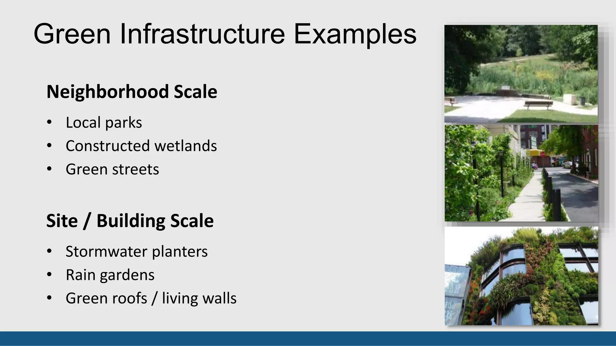
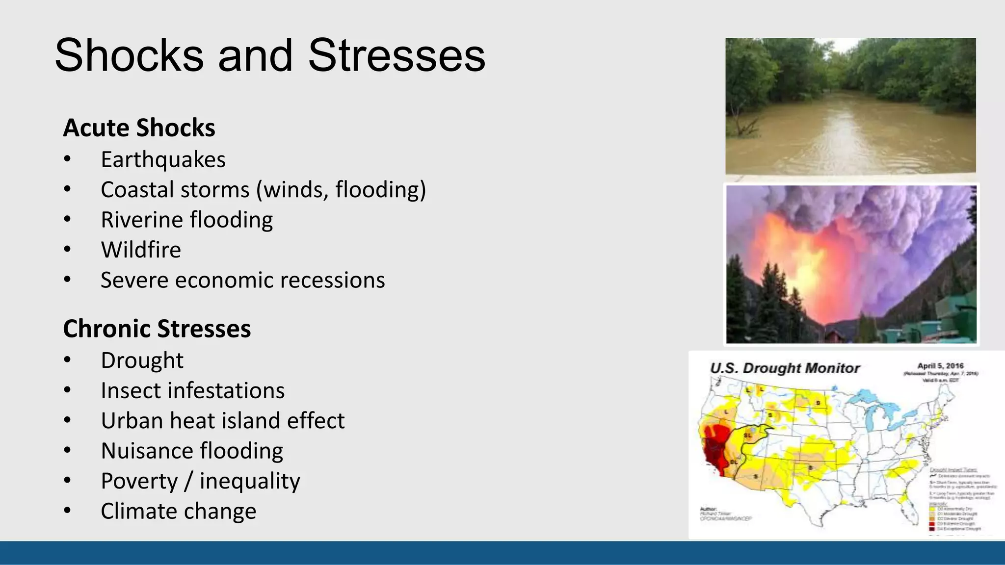
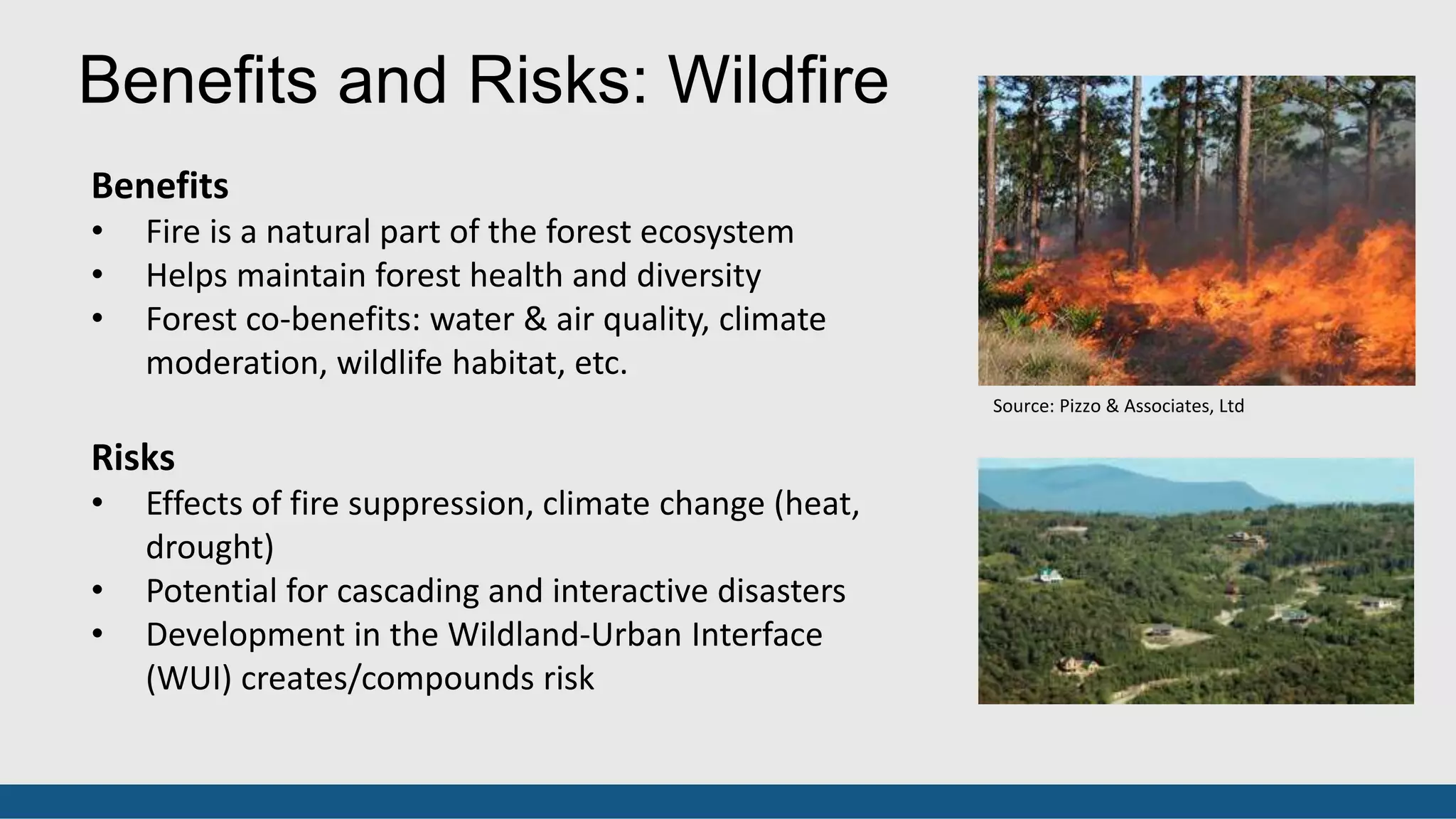
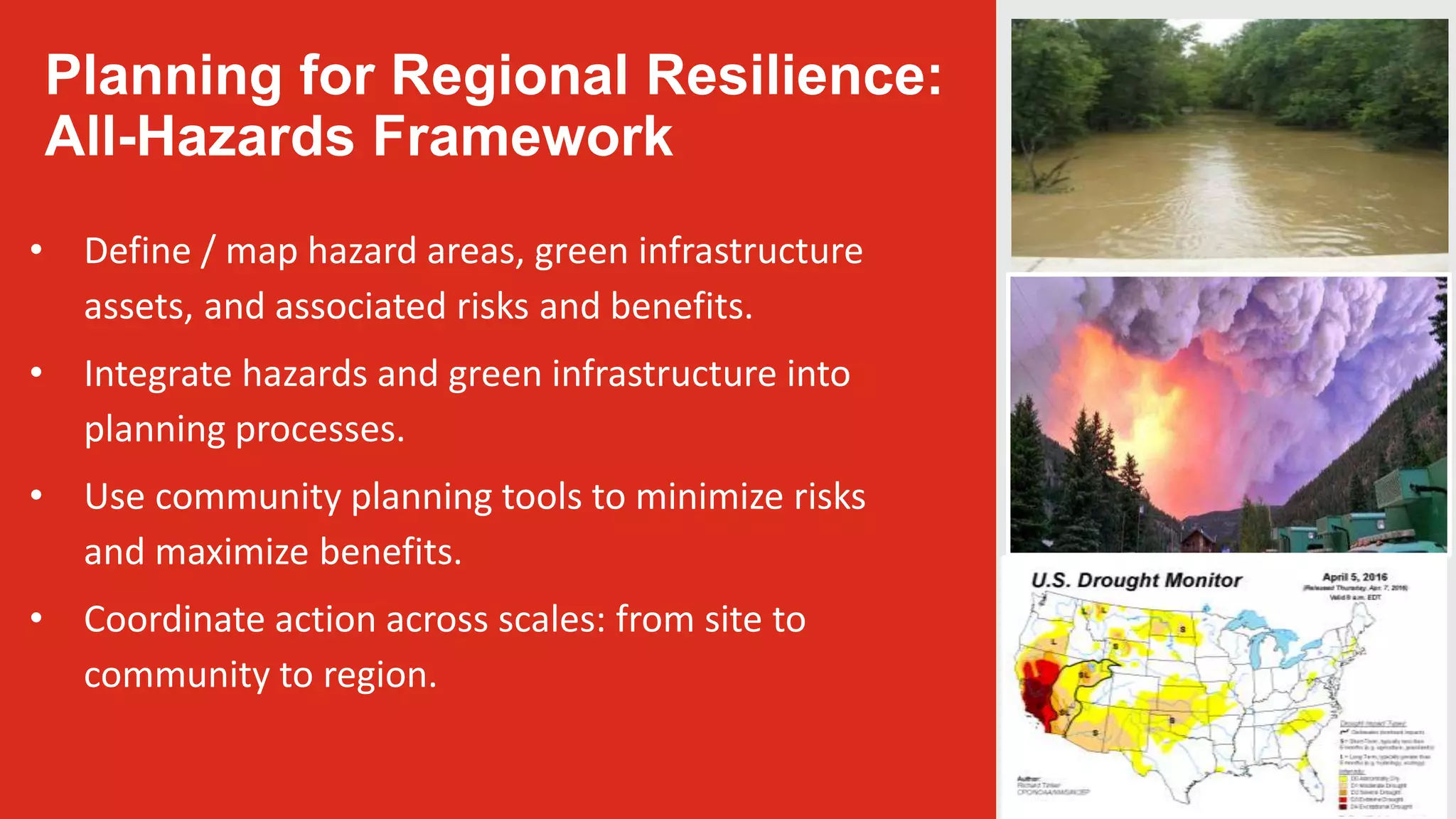
Call Girls Bhubaneswar +919777949614 call me Independent Escort Service Odisha
Green Infrastructure for Regional Resilience
1. Green Infrastructure for Regional
Resilience: The Role of America’s Forests
Partners in Community Forestry
November 17, 2016
David Rouse, FAICP, ASLA
American Planning Association
3. Green Infrastructure Definitions
City and Regional Open Space
An interconnected network of natural areas and other
open spaces that conserves natural ecosystem values
and functions, sustains clean area and water, and
provides a wide array of benefits to people and wildlife.
Green Stormwater Infrastructure
Systems and practices that use or mimic natural
processes to infiltrate, evapotranspirate, or reuse
stormwater on the site where it is generated.
4. Green Infrastructure Examples
Regional Scale
• Working farms and forests
• Regional parks and nature preserves
• River corridors and greenways
City Scale
• Urban forest / tree canopy
• Urban parks
• Parkways and boulevards
5. Green Infrastructure Examples
Neighborhood Scale
• Local parks
• Constructed wetlands
• Green streets
Site / Building Scale
• Stormwater planters
• Rain gardens
• Green roofs / living walls
6. Environmental
• Air
• Water
• Soil
Economic
• Real estate value
• Retail / business
• Energy conservation
Social
• Public health
• Public safety
• Connection to nature
Green Infrastructure Co-Benefits
• Climate
• Wildlife
Production:
• Food
• Fiber
• Education
• Aesthetics
7. Resilience is the ability
to prepare and plan for,
absorb, recover from,
and successfully adapt
to adverse events
(National Academy of
Sciences, 2012)
Resilience Definitions
Building community
resilience encompasses
the entire community,
including its physical
infrastructure, its
economic and social
capital, its natural
environment, and its
systems providing
essential services
(ICMA, 2011).
10. Benefits
• Forest cover absorbs rainfall, reducing downstream
flooding
• Trees intercept stormwater, reducing urban runoff
• Co-benefits: water & air quality, climate moderation,
wildlife habitat, etc.
Risks
• Climate change effects (extreme weather, sea level
rise)
• Trees can become hazards during extreme weather
events
• Development in floodprone areas creates /
compounds risk
Benefits and Risks: Flooding
Source: Donald Outen, from Planning the Urban
Forest, PAS Report No. 555 (2010)
11. Regional Green
Infrastructure and
Flooding
Greater Baltimore
Wilderness Resilience
Strategies:
• Natural Resource
Protection
• Urban Forest
Enhancement
• Multi-Benefit Green
Stormwater
Infrastructure
• Critical Infrastructure
Protection
• Coastal Defense
Opportunities to Enhance and Restore Tree Canopy
Baltimore City
Source: The Conservation Fund
12. Benefits
• Fire is a natural part of the forest ecosystem
• Helps maintain forest health and diversity
• Forest co-benefits: water & air quality, climate
moderation, wildlife habitat, etc.
Risks
• Effects of fire suppression, climate change (heat,
drought)
• Potential for cascading and interactive disasters
• Development in the Wildland-Urban Interface
(WUI) creates/compounds risk
Benefits and Risks: Wildfire
Source: Pizzo & Associates, Ltd
13. Regional Green
Infrastructure and
Wildfire
Only 16% of the WUI in
the west is developed.
Decisions by
individuals and local
communities have
regional consequences.
How can we maximize
forest benefits and
minimize risk at the
landscape scale?
National Cohesive Wildland Fire Management Strategy
• Restore and maintain landscapes
• Create fire-adapted communities
• Effectively respond to wildfire
Community Planning Assistance for Wildfire
• Manage Development in the WUI
Mapping of Wildfire Risk in Missoula, MT
Source: Headwater Economics
14. Planning for Regional Resilience:
All-Hazards Framework
• Define / map hazard areas, green infrastructure
assets, and associated risks and benefits.
• Integrate hazards and green infrastructure into
planning processes.
• Use community planning tools to minimize risks
and maximize benefits.
• Coordinate action across scales: from site to
community to region.
15. Define / map hazard areas, green infrastructure
assets, and associated risks and benefits.
Wildfire Hazard Potential in the U.S.
Source: U.S. Forest Service
Coastal Flood Frequency Map
Source: NOAA’s Digital Coast Partnership
Ecological Asset Network Map, Wasatch Front Region, UT
16. Integrate hazards and green infrastructure into
planning processes.
Long-Range Comprehensive/ Land Use
Plans
Functional Plans
• Parks/Green Infrastructure Plans
• Urban Forestry Plans
• Hazard Mitigation Plans
• Community Wildfire Protection
Plans
Area / Neighborhood Plans
Five Strategic Points of Intervention
1. Long-Range Community Visioning
and Goal Setting
2. Plan-making
3. Regulatory standards, policies, and
incentives
4. Development work
5. Public Investment
Source: American Planning Association
17. Use community planning tools to minimize risks and
maximize benefits.
Five Strategic Points of Intervention
1. Long-Range Community Visioning
and Goal Setting
2. Plan-making
3. Regulatory standards, policies, and
incentives
4. Development work
5. Public Investment
Source: American Planning Association
Regulations
• Zoning and subdivision
• Development standards
Incentives
• Conservation development
• Transfer of Development Rights
Public Investment
• Land acquisition
• Infrastructure investments
• Other capital improvements
18. Coordinate actions across scales:
from site to community to region.
Site
• Design / development standards
• Homeowner disclosure / education
Community
• Coordinate planning across jurisdictional
boundaries
Region
• Set regional framework
• Coordinate planning by local
jurisdictions
• Regional planning agencies play key role Region: Denver Water / USFS Partnership
Site: Portland Green Street
19. David Rouse, FAICP, ASLA
Managing Director of Research and Advisory
Services
drouse@planning.org
Editor's Notes
There are two standards definitions of green infrastructure. The first, older definition refers to a network of open space – parks, greenways, natural areas, etc. – at the scale of a city or metropolitan region. The second, more recent definition refers to stormwater management practices that use vegetation, soil, and permeable surfaces to absorb runoff close to where it is generated.
The City and Regional Open Space definition is from Mark A. Benedict and Edward T. McMahon, Green Infrastructure: Linking Landscapes and Communities, Island Press, 2006. The image is the Trinity River corridor in the Dallas-Fort Worth metropolitan region in Texas.
The Green Stormwater Infrastructure definition is from the United States Environmental Protection Agency. The image is a natural street drainage project in Seattle, WA, referred to as a SEA (Street Edge Alternative) street.
In reality there is no sharp differentiation between the two definitions of green infrastructure, which form a continuum across geographic scales from the region to the city, district, neighborhood, and site. This slide shows examples of green infrastructure at the regional and city scale. The images are: forest land in Baltimore County, MD (top); Philadelphia, PA (middle); and Queens Boulevard, New York City (bottom).
Make point: the urban forest is the largest structural component of green infrastructure in cities.
This slide shows examples of green infrastructure at the neighborhood and site/building scale. The images are a constructed wetland in a Philadelphia park (top); a green street in Philadelphia (middle); and a green wall, Musee d’Orsay, Paris (bottom).
Green infrastructure provides multiple benefits for ecosystems and people, which can be organized according to the triple bottom line of sustainability: environmental, economic, and social. i-Tree provides a tool for measuring many of these benefits, particularly environmental ones. The social benefits for people are particularly evident in the realm of public health, and there are many studies on the benefits of contact with nature for mental health and physical well-being.
Two definitions:
Classic one from National Academy of Sciences / based on dictionary definition
One from ICMA that emphasizes the holistic nature of mitigating hazards and building resilience across interrelated systems at the community scale. What is the role played by trees and green infrastructure in this diagram?
Picking up on the ICMA definition (referred to as “whole communities” by FEMA), the Rockefeller Foundation has developed an interesting definition for their 100 Resilient Cities and other resilience programs.
Look at a couple of the shocks in a little more detail, particularly as they relate to benefits and risks associates with green infrastructure and forest resources. First, flooding…
Here’s an example of using green infrastructure to build resiliency at the scale of the Greater Baltimore region. Funded by a Hurricane Sandy Coastal Resiliency Grant administered by NFWF, focuses on use of green infrastructure to enhance resilience to coastal storms and climate change across several watersheds.
Framework strategies:
Natural Resource Protection: Preserve lands with valuable and vulnerable resources providing hazard mitigation and other co-benefits, including floodplains, wetlands, forest, stream systems, steep slopes, hydric and highly erodible soils, and important habitat areas.
Urban Forest Enhancement and Restoration: Maintain, enhance, and restore tree canopy in urban and suburban communities to reduce stormwater runoff, ameliorate the urban heat island effect, and improve air quality.
Multi-Benefit Green Stormwater Infrastructure: Retrofit developed areas to reduce impervious surface and incorporate best management practices such as bioretention areas, green streets, and green roofs in order to reduce vulnerability to flooding.
Critical Infrastructure Protection: Use green infrastructure to reduce extreme weather risks to critical infrastructure, including key transportation corridors, power production and transmission facilities, hospitals, and emergency management centers.
Coastal Defense: Preserve/restore natural habitat and introduce nature-based practices (e.g., living shorelines) to protect against coastal flooding, storm surge, and sea level rise.
Work in idea of costs….
Coastal Flood Frequency map from Digital Coast.
Costs not necessarily absorbed locally.
Introduce APA’s model of five strategic points of intervention in planning. This relates to the first two points.
This slide relates to the third three points, which involve plan implementation.