
Recommended
Recommended
More Related Content
What's hot
What's hot (20)
Similar to How to Install ArcGIS Desktop 10.2
Similar to How to Install ArcGIS Desktop 10.2 (20)
More from Bahzad5
More from Bahzad5 (20)
Recently uploaded
Recently uploaded (20)
How to Install ArcGIS Desktop 10.2
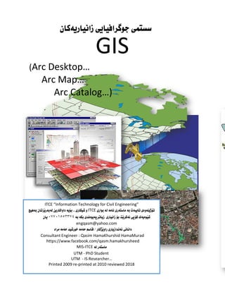
- 1. هةطبةي ربونىَيف راَيخ ..زانست ﺳسﺘﻤى GIS (Arc Desktop… Arc Map… Arc Catalog…) ITCE “Information Technology for Civil Engineering” ITCE ٠٧٧٠١٥٥٣٣٧٤ engqasm@yahoo.com Consultant Engineer : Qasim HamaKhurshid HamaMurad https://www.facebook.com/qasm.hamakhursheed MIS-ITCE UTM - PhD Student UTM - IS Researcher… Printed 2009 re-printed at 2010 reviewed 2018
- 2. Eng.Qasim Hama_khursheed Hama_murad (qasm_computer@hotmail.com) Ministry of Municipality Page 2 Geographic Information System ARC GIS Desktop GIS ) Geographic Information System ( GIS Geographic Information database
- 3. Eng.Qasim Hama_khursheed Hama_murad (qasm_computer@hotmail.com) Ministry of Municipality Page 3 Geographic Information System ARC GIS Desktop ESRI Environmental Systems Research Institute ١٩٦٩ jack laura dangermomda functionalities ( a system for input, storage (information management) , manipulation (information process), and output (information visualization) of geographic information) ; Arc view , Arc Info , Arc catalog Arc IMS ESRI components ( a class of software like Arc view, Arc Info, Arc catalog and Arc IMS in ESRI product family); GIS applications (a practical instance of a GIS combines software with hardware, data, a user, etc., to solve a problem, support a decision, help to plan ) ;
- 4. Eng.Qasim Hama_khursheed Hama_murad (qasm_computer@hotmail.com) Ministry of Municipality Page 4 Geographic Information System ARC GIS Desktop query GIS ١ ٢ ٣ ٤ GIS ١ Hardware ٢ software ٣ Graphical & attribute Data ٤ people ٥ procedure ١ - Hardware GIS main frame personal computer
- 5. Eng.Qasim Hama_khursheed Hama_murad (qasm_computer@hotmail.com) Ministry of Municipality Page 5 Geographic Information System ARC GIS Desktop ) GPS (Global Positioning System ٢ ) Software GIS GUI (Graphic User interface) Relational Database GUI topological relationship Multi –user management ٣ Graphical & Attribute Data GIS Tabular Data (Attribute Data) Spatial Data Arial photo Satellites Images Digital Maps
- 6. Eng.Qasim Hama_khursheed Hama_murad (qasm_computer@hotmail.com) Ministry of Municipality Page 6 Geographic Information System ARC GIS Desktop ٤ people ٥ procedure GIS Quality Control
- 7. Eng.Qasim Hama_khursheed Hama_murad (qasm_computer@hotmail.com) Ministry of Municipality Page 7 Geographic Information System ARC GIS Desktop GIS Thematic Maps GIS ١ Map Digitizing System Digit GIS vector pixel raster data . ٢ data base Database management system Table record Field query Filter Attribute spatial GIS ٣ Spatial Analysis System
- 8. Eng.Qasim Hama_khursheed Hama_murad (qasm_computer@hotmail.com) Ministry of Municipality Page 8 Geographic Information System ARC GIS Desktop ٤ Spatial Decision Support System ٥ Image Analysis System ARC INFO Pixel vector point , lines , polygon ٦ Cartographic Display System cartographic elements Title , North Arrow m Legends , symbol scale bar
- 9. Eng.Qasim Hama_khursheed Hama_murad (qasm_computer@hotmail.com) Ministry of Municipality Page 9 Geographic Information System ARC GIS Desktop postal code –name – trada –Census Raster & Vector Vector & Raster vector X,y x,y Raster & Vector Raster Vector
- 10. Eng.Qasim Hama_khursheed Hama_murad (qasm_computer@hotmail.com) Ministry of Municipality Page 10 Geographic Information System ARC GIS Desktop GIS data types and data models GIS GIS Spatial data describes the absolute and relative location of geographic features Attribute data describes characteristics of the spatial features. These characteristics can be quantitative and/or qualitative in nature. Attribute data is often referred to as tabular data Attributeinformation Spatial information Interconnected attribute information
- 11. Eng.Qasim Hama_khursheed Hama_murad (qasm_computer@hotmail.com) Ministry of Municipality Page 11 Geographic Information System ARC GIS Desktop GIS Spatial Data types GIS Raster Vectors Raster pixel In a GIS, raster data is a cell-based representation of map features. Satellite images, aerial photography and scanned images are all stored in raster format. ١ (DRG) Digitial Raster Graphic DRG Digitial This is a Digitial Raster Graphic (DRG) of York Pennsylvania NE. A Digital Raster Graphic (DRG) is a raster image of a scanned USGS topographic or planimetric map that is georeferenced to a real-world coordinate system. ٢ - Digital Ortho Quarter Quaddrangle (DOQQ) This is Digital Ortho Quarter Quaddrangle (DOQQ) of York Pennsylvania. Orthophotos combine the image characteristics of a photograph (aerial photos) with the g eometric qualities of a map.
- 12. Eng.Qasim Hama_khursheed Hama_murad (qasm_computer@hotmail.com) Ministry of Municipality Page 12 Geographic Information System ARC GIS Desktop ٣ SPOT satellite imagery ١٠ This raster is SPOT satellite imagery of State College, PA. This data is at a 10-meter resolution in the natural color scheme. Vectors data GIS x,y Vectors can be classified into three primary feature types: points, lines and polygons. Vector data is entered into a GIS by digitizing these features from a base map. All vector data is stored as an x,y coordinate, or a series of x,y coordinates. ١ Point ---
- 13. Eng.Qasim Hama_khursheed Hama_murad (qasm_computer@hotmail.com) Ministry of Municipality Page 13 Geographic Information System ARC GIS Desktop ٢ Point projection --- latitude longitude gis Universal Transverse Mercator (UTM). ٣ - Line --- ٤ - olygon P -- CAD TIN coordinated objects , CAD Computer Aid Design Tin Triangular irregular networks
- 14. Eng.Qasim Hama_khursheed Hama_murad (qasm_computer@hotmail.com) Ministry of Municipality Page 14 Geographic Information System ARC GIS Desktop ARC GIS Desktop 9.3 xp vista windows 7 ARCGIS desktop9.3 Processor Pentium® 1 GHz minimum Operating system Microsoft Windows 2000 Professional with Service Pack 3 or higher Microsoft Windows Server 2003 Microsoft XP Home Edition with Service Pack 1 or higher Microsoft XP Professional Edition with Service Pack 1 or higher Microsoft Vista (hereafter collectively referred to as Microsoft Windows) Internet Explorer You must obtain and install the appropriate language version of Internet Explorer 6.0 or higher prior to installing. See Note below. RAM 1 GB minimum
- 15. Eng.Qasim Hama_khursheed Hama_murad (qasm_computer@hotmail.com) Ministry of Municipality Page 15 Geographic Information System ARC GIS Desktop ARCGIS Desktop 9.3 ESRI Arc catalog , arc desktop , arc view GIS License manager setup ١ - >> - Setup up License manager browse license G:Crackcrack9.3license_server_setup37102011.efl9 G: dvd – rom
- 16. Eng.Qasim Hama_khursheed Hama_murad (qasm_computer@hotmail.com) Ministry of Municipality Page 16 Geographic Information System ARC GIS Desktop next License summery next Install
- 17. Eng.Qasim Hama_khursheed Hama_murad (qasm_computer@hotmail.com) Ministry of Municipality Page 17 Geographic Information System ARC GIS Desktop installation No. I will restart my computer later ok ٢ Copy License Manager Tool Copy Lmtool next
- 18. Eng.Qasim Hama_khursheed Hama_murad (qasm_computer@hotmail.com) Ministry of Municipality Page 18 Geographic Information System ARC GIS Desktop Finish
- 19. Eng.Qasim Hama_khursheed Hama_murad (qasm_computer@hotmail.com) Ministry of Municipality Page 19 Geographic Information System ARC GIS Desktop ٣ Registration Registration Registration ١ Configuration using Services ٢ Config Services path to the lmgrd.exe file path to the license file path to the debug log file ١
- 20. Eng.Qasim Hama_khursheed Hama_murad (qasm_computer@hotmail.com) Ministry of Municipality Page 20 Geographic Information System ARC GIS Desktop Browse Save Service ٣ Start /Stop/ Reread start service start service successfully 5 4 ٢ 3
- 21. Eng.Qasim Hama_khursheed Hama_murad (qasm_computer@hotmail.com) Ministry of Municipality Page 21 Geographic Information System ARC GIS Desktop ٤ Server Diagnosis Perform Diagnostics This License can be checked out. ARC desktop ARC Desktop setup >> ١ ARC DESKTOP next registration 6 7
- 22. Eng.Qasim Hama_khursheed Hama_murad (qasm_computer@hotmail.com) Ministry of Municipality Page 22 Geographic Information System ARC GIS Desktop registration later next I accept the license agreement next
- 23. Eng.Qasim Hama_khursheed Hama_murad (qasm_computer@hotmail.com) Ministry of Municipality Page 23 Geographic Information System ARC GIS Desktop Complete next next
- 24. Eng.Qasim Hama_khursheed Hama_murad (qasm_computer@hotmail.com) Ministry of Municipality Page 24 Geographic Information System ARC GIS Desktop Visual Basic for Applications next Register Later
- 25. Eng.Qasim Hama_khursheed Hama_murad (qasm_computer@hotmail.com) Ministry of Municipality Page 25 Geographic Information System ARC GIS Desktop ٢ copy data_interop next finish copy data_interop next Browse
- 26. Eng.Qasim Hama_khursheed Hama_murad (qasm_computer@hotmail.com) Ministry of Municipality Page 26 Geographic Information System ARC GIS Desktop Finish install
- 27. Eng.Qasim Hama_khursheed Hama_murad (qasm_computer@hotmail.com) Ministry of Municipality Page 27 Geographic Information System ARC GIS Desktop ٣ ARC desktop administrator software product ArcInf (floating) Apply
- 28. Eng.Qasim Hama_khursheed Hama_murad (qasm_computer@hotmail.com) Ministry of Municipality Page 28 Geographic Information System ARC GIS Desktop license manager change localhost ok apply Availability ok ARC DESKTOP
- 29. Eng.Qasim Hama_khursheed Hama_murad (qasm_computer@hotmail.com) Ministry of Municipality Page 29 Geographic Information System ARC GIS Desktop start programs ArcGIS ESRI
- 30. Eng.Qasim Hama_khursheed Hama_murad (qasm_computer@hotmail.com) Ministry of Municipality Page 30 Geographic Information System ARC GIS Desktop GIS ESRI ArcGIS Desktop v.9.3 - ArcInfo™ (ArcCatalog™, ArcMap, and ArcToolbox™) Desktop V9.3 Arc
- 31. Eng.Qasim Hama_khursheed Hama_murad (qasm_computer@hotmail.com) Ministry of Municipality Page 31 Geographic Information System ARC GIS Desktop 10.2 ARC GIS Desktop دابهزاندنی چۆنيهتی ArcGIS 10.2 دابهزان بهمهبهﺳﺘی ناوەڕۆکی باشﺘرە پرۆگرامه ئهم دنی DVD ﺳهر بکهينه کۆپی پرۆگرامهکه رەدا ل که قۆناغ چهند پرۆگرامه ئهم دابهزاندنی لهراﺳﺘيدا ،کۆمپيوتهرەکه درايڤهکانی له ک يهک .دەکهين باس قۆناغهکانی يهکهم قۆناغی پرۆگرامی دابهزاندنی : ArcGIS10.2DeskTop : تايبهت فۆلدەری ناو دەچينه فۆلدەری ئهويش که پرۆگرامهکه به ArcGIS10.2DeskTop رەدا ل ەو رەوە ل و دەکهين لهﺳهر کليکی setup up رين دەبژ هه پاشان next پاشان accept دەکهين کليک next ...دەکهين ديارە خوارەوە نهيهی و لهم وەک پاشان install complete ...رين دەبژ هه
- 32. Eng.Qasim Hama_khursheed Hama_murad (qasm_computer@hotmail.com) Ministry of Municipality Page 32 Geographic Information System ARC GIS Desktop پاشان next دابهزين له ت دەب بهردەوام پرۆگرامهکه
- 33. Eng.Qasim Hama_khursheed Hama_murad (qasm_computer@hotmail.com) Ministry of Municipality Page 33 Geographic Information System ARC GIS Desktop پاشان finish دەکهين وپاشان دەکهين ئۆپشنهکان بژاردنی هه وەيه بهش ديارە نهيهتا و لهم وەک Ok لهﺳهر کليل ديارە خوارەوەدا نهکهی و له وەک تر کی قۆناغ دەگهينه ئهوە لهپاش cancel ...دەکهين
- 34. Eng.Qasim Hama_khursheed Hama_murad (qasm_computer@hotmail.com) Ministry of Municipality Page 34 Geographic Information System ARC GIS Desktop د : دووەم قۆناغی پرۆگرامهکه دراوی گهپ ڕ ابهزاندنی license manager10.2 بهشی ﺳهر دەچينه پرۆگرامهکه ديڤيدی يان پرۆگرامهکه فۆلدەری لهناو lm License Manager لهﺳهر کليک پاشان lm10.2windows ...ﺘهوە دەکر ويندۆيهک وەيه ش بهم ...مهنجهرە سن ل ئهو لهﺳهر دەبين ڕازی پاشان ب دەچين ههنگاوەکانی ن هشو
- 35. Eng.Qasim Hama_khursheed Hama_murad (qasm_computer@hotmail.com) Ministry of Municipality Page 35 Geographic Information System ARC GIS Desktop پاشان finish
- 36. Eng.Qasim Hama_khursheed Hama_murad (qasm_computer@hotmail.com) Ministry of Municipality Page 36 Geographic Information System ARC GIS Desktop کراکهکهی و پرۆگرامهکه ئهکتڤکردنی : ههم س ههنگاوی فۆلدەری ﺳهر دەچينه Crack بهناوی ههيه ک فايل دا لهو Service.txt پاشان دەکهينهوەو ئهوفايله ووشهی فايلهکهدا لهناو anyserver کۆپ ناوی به دەگۆڕين کهههيه دەمانهوێ که يوتهرکهی نن تيادابهز بهرنامهکهی ﺳهر دەچينه کۆمپيوتهرەکه ناوی بۆدۆزينهوەی computer properties نهيهی و ئهم اوانه ب ...خوارەوە
- 37. Eng.Qasim Hama_khursheed Hama_murad (qasm_computer@hotmail.com) Ministry of Municipality Page 37 Geographic Information System ARC GIS Desktop ووشهی ئهوەی پاش يه بهوپ anyserver ﺳهيڤ به دەﺳﺘين هه ئهوا کۆپيوتهرکه ناوی به گۆڕی مان ... گۆڕانکاريانه ئهم کردنی کهناوی فايله ئهم پاشان Service.txt کهناوی تر کی فايل لهگهڵ گۆڕی تيا ووشهکهمان ﻤه ئ ەو ARCGIS.exe ،دەکهين کۆپی ههردوکيان له بريﺘيه دابهزيوە تيا پرۆگرامهکهی که ﺳی درايڤی لهﺳهر تايبهت کی فۆلدەر ﺳهر دەچينه C:Program FilesArcGISLicense10.2bin پهي رەدا ل ت بگۆڕدر کۆنهکان فاييله که دەدەين رەزامهندی ريپلهيس بۆ ت دەپرﺳ...دەکهين سﺘيان ...تازانه فايله بهم
- 38. Eng.Qasim Hama_khursheed Hama_murad (qasm_computer@hotmail.com) Ministry of Municipality Page 38 Geographic Information System ARC GIS Desktop پاشان copyandreplace پاشان ...رين ذەبژ هه continue ﺳهر ﺘه دەچ ديارە نهکهدا لهو وەک ArcGIS License Server Administrator 10.2 لهبهشی رەوە ل star/stop liecense service لهﺳهر کليک start .کارکردن ﺘه دەکهو و دەکهين لهﺳهر کليک دەتوانين Diagnostics ئهگهر بکهين testing licenses به Done ئهوا بو دەرچوو ok ی .....دەکهين
- 39. Eng.Qasim Hama_khursheed Hama_murad (qasm_computer@hotmail.com) Ministry of Municipality Page 39 Geographic Information System ARC GIS Desktop گروپی پرۆگرام ناو دەچينه کردن ئهوکارانهی پاش ARCGIS رەوە ل و ARCGIS Administrator دەب هه رين ژ ﺘهوە دەکر پرۆگرامهکهی وەيه ش بهم کردنی کليک به دەﺳﺘين هه Change گۆڕينی بهمهبهﺳﺘی not_set بۆ localhost .... پاشان apply و ok
- 40. Eng.Qasim Hama_khursheed Hama_murad (qasm_computer@hotmail.com) Ministry of Municipality Page 40 Geographic Information System ARC GIS Desktop پرۆگرامهکانيی کاربه و نين دابهز پرۆگرامهکه توانيﻤان کردمان لهﺳهرەوە ههنگاوانهی به ArC Catalog , ArcMap ,ArcGlob, ArcScence ...بکهين پ بکهين تری رۆگرامهکهنی پ
- 41. Eng.Qasim Hama_khursheed Hama_murad (qasm_computer@hotmail.com) Ministry of Municipality Page 41 Geographic Information System ARC GIS Desktop ArcGIS 10.4.1 www.esri.com ئه نه کهلهو وەی و ندکاران خو بۆ و رکردن ف مهبهﺳﺘی بۆ که ئوفۆلدەرانهن کهوتوە بهديار کهدا نی دايبهز دراوە گهپ ڕ قوتابيان : خوارەوە وەيهی ش بهم ١ - فايلی لهﺳهر کليک راﺳﺘهوخۆ ArcGIS Desktop_10.4.1.exe ن بهشو و ئنﺘهر پاشان ... ت دەبه تهواو قۆناخهکانی ههموو تا دەکهوين ههنگاوەکانی ٢ - مهلهفی لهﺳهر کليک دەچينه دابهزيی پرۆگرامهکه ئهوەی پاش وە ش بهههمان ArcGIS_License_Manager_Windows_10.4.1 ههنگاوەکانی ن بهشو و ئنﺘهر پاشان ... دەکات تهواو قۆناخهکانی ههموو تا يه پ بهو ،دەکهوين ٣ - فۆلدەری پاشان ArcGIS Crack 10.4.1 وەيهی ش بهم و دەکهينهوە ناو دەچينه خوارەوە دەری فۆ bin فايلی رەدا Service.txt و دەکهينهوە بهناوی دايه ت رڤهرەکهی ﺳ ناوی رەی لهود QASIM خۆمان کۆمپيوتهرەکهی ناوی بۆ دەگۆڕين ينهوەی بهﺳ ئهويش QASIM ناوی نوﺳين و خۆمان کۆمپيﺘوتهرەکهی
- 42. Eng.Qasim Hama_khursheed Hama_murad (qasm_computer@hotmail.com) Ministry of Municipality Page 42 Geographic Information System ARC GIS Desktop کۆمپيوتهرەکهی ناوی بزانين ئهوەی ۆ ..نين دەن ههنگاوانه ئهم ئهوا چيه خۆمان ويندۆی له ٨ ويندۆی و ١٠ ﺳهر دەچينه پاشان کۆمپيوتهرو مای ناو دەچينه دا COMPUTER دەکهين راﺳت ﻻی کليکی شهوە لهو و پ PROPERTIES ﺘهوە دەکر ويندۆيه ئهم و رين دەبژ ە ... بهشی ە Computer name نا دەبينين دا نوﺳراوە کۆمپيوتهرکه وی لهبهری رەدا کهل ... نهدا شو لهو وە ئ ت دەپ ، داپۆشراوە ﺳپی ناو بازنهيهکی به زی خۆپار بۆ رتی ﺳکو ﻻيهنی .هاککردن له زراوبن پار تا بيزانن خۆتان تهنها کۆمپيوتهرکهيهو ناوی دەيبينين ئهوناوەی له فايلهکهدا لهناو دەکهينهو کۆپی ناوە ئهو پاشان دەينوﺳين رڤهردا ﺳ ناوی نی شو فايلهکه پاشان دەخهين دای و دەکهين ﺳهيڤی ...
- 43. Eng.Qasim Hama_khursheed Hama_murad (qasm_computer@hotmail.com) Ministry of Municipality Page 43 Geographic Information System ARC GIS Desktop لهناو پاشان دەکهين کۆپی فايلهکه ههردوو فۆلدەردا ههمان ... داب تايا پرۆگرامهکهی که فۆلدەری ئهو ﺳهر ەچينه ...خۆمان کۆمپيﺘوەرەکهی لهناو هزيوە C:Program Files (x86)ArcGISLicense10.4.1bin ... دەبين رازی کرد رايﺘی ۆڤهر داوای ئهگهر ...دەکهين پهيسﺘی فۆلدەرەکهدا لهناو ... خوارەوە وەيهی ش بهم دەکهين بۆی کرد رڤهرەکهی ﺳ وەﺳﺘانی داوای ئهگهر فۆلدەر ههمهان لهناو LSAdmin.exe پاشان دەکهينهوەو Stop کۆپی بونی تهواو پاش دەکهين ئهو فايلهکان کردنی کات start .... دەکهينهوە بهههمان پاشان ناو دەچينه ميﻤرۆيهکهوەو فﻼش يان ڤيديهکه دی ناو دەچينه شوو پ وەی ش فۆلدەری E:programGISGIS 10.4ArcGIS Crack 10.4.1Program Files (x86)Desktop10.4bin
- 44. Eng.Qasim Hama_khursheed Hama_murad (qasm_computer@hotmail.com) Ministry of Municipality Page 44 Geographic Information System ARC GIS Desktop فايلی AfCore.dll فۆلد ناو دەچينه پاشان و دەکهين کۆپی ەری کهلهکۆمپيوتهرەکهدا پرۆگرامهکه دەکهين پهيسﺘی بهزندوە دامان C:Program Files (x86)ArcGISDesktop10.4.1bin فایلهکه رەدا ل داوای دەبينی دەکهين پهيست ئ ... دەبين رەزامهند دەکات ۆڤهريرايت و نی به بهکريان دەتوانی ﺘوەو دەکر بائاﺳانی پرۆگرامهکه دەبينين ئهوکات يان ئارکﻤاپ ەک .... کهتهلۆک ئارک 10.4.1
- 45. Eng.Qasim Hama_khursheed Hama_murad (qasm_computer@hotmail.com) Ministry of Municipality Page 45 Geographic Information System ARC GIS Desktop ArcCatalog Attribute Geography image vector ١ start ALL PROGRAMME Arc GIS ٢ ArcCatalog
- 46. Eng.Qasim Hama_khursheed Hama_murad (qasm_computer@hotmail.com) Ministry of Municipality Page 46 Geographic Information System ARC GIS Desktop ١ catalog Tree Flash memory Connect to Folder flash memory ok catalog tree
- 47. Eng.Qasim Hama_khursheed Hama_murad (qasm_computer@hotmail.com) Ministry of Municipality Page 47 Geographic Information System ARC GIS Desktop ٢ Preview tab arctree geography Content preview Metadata
- 48. Eng.Qasim Hama_khursheed Hama_murad (qasm_computer@hotmail.com) Ministry of Municipality Page 48 Geographic Information System ARC GIS Desktop ٣ ١ Title Bar ٢ Standard ٣ Geography √ view toolbars
- 49. Eng.Qasim Hama_khursheed Hama_murad (qasm_computer@hotmail.com) Ministry of Municipality Page 49 Geographic Information System ARC GIS Desktop Point Shape File Line Poly Line , Polygon Raster Image Import Catalog Arc
- 50. Eng.Qasim Hama_khursheed Hama_murad (qasm_computer@hotmail.com) Ministry of Municipality Page 50 Geographic Information System ARC GIS Desktop Arc Catalog ١ - start Programs all programs ARC GIS ArcCatalog ٢ - ٣ - ArcTree location D: CONNECT TO FOLDER D: ok ١ D: FILE NEW Folder ٢ SulProject enter ٣ ١ Image Data shape-Files Image satellite Areal photo Map digitalized shape-Files
- 51. Eng.Qasim Hama_khursheed Hama_murad (qasm_computer@hotmail.com) Ministry of Municipality Page 51 Geographic Information System ARC GIS Desktop SQL excel ١ - Image coordinate system GIS copy paste source copy Ctrl+C Image paste ctrl+v
- 52. Eng.Qasim Hama_khursheed Hama_murad (qasm_computer@hotmail.com) Ministry of Municipality Page 52 Geographic Information System ARC GIS Desktop ٢ - shape-Files image shape-Files Arcmap Point polyline polygon point polyline polygon Shape File shape-Files shape file coordinate system Image shape shape-Files new shape file A – point shape- files new Shape-file
- 53. Eng.Qasim Hama_khursheed Hama_murad (qasm_computer@hotmail.com) Ministry of Municipality Page 53 Geographic Information System ARC GIS Desktop ١ - Name shapeFile population point Name shapefile population ٢ - feature type point ٣ - Coordinate system Edit spatial references properties ٤ - xy coordinate system Name Select coordinate system GCS UTM Import… coordinate system Import New… ٥ - Select
- 54. Eng.Qasim Hama_khursheed Hama_murad (qasm_computer@hotmail.com) Ministry of Municipality Page 54 Geographic Information System ARC GIS Desktop Projected Coordinate Systems Geographic Coordinate Systems Projected Coordinate Systems UTM Add UTM WGS 1984 Add
- 55. Eng.Qasim Hama_khursheed Hama_murad (qasm_computer@hotmail.com) Ministry of Municipality Page 55 Geographic Information System ARC GIS Desktop WGS 1984 UTM Zone 38N Add spatial reference properties coordinate shape file ok ok population
- 56. Eng.Qasim Hama_khursheed Hama_murad (qasm_computer@hotmail.com) Ministry of Municipality Page 56 Geographic Information System ARC GIS Desktop B polyline Street polyline shape file polyline ١ - point shapefile preview tab new shapefile ٢ - street feature type polyline
- 57. Eng.Qasim Hama_khursheed Hama_murad (qasm_computer@hotmail.com) Ministry of Municipality Page 57 Geographic Information System ARC GIS Desktop ٣ - coordinate system Edit select UTM projected coordinate system UTM WGS 1984 WGS 1984 UTM Zone 48N
- 58. Eng.Qasim Hama_khursheed Hama_murad (qasm_computer@hotmail.com) Ministry of Municipality Page 58 Geographic Information System ARC GIS Desktop Add
- 59. Eng.Qasim Hama_khursheed Hama_murad (qasm_computer@hotmail.com) Ministry of Municipality Page 59 Geographic Information System ARC GIS Desktop ok shape file street arcmap DATA file type GIS ArcGIS Desktop v.9.3 - ArcInfo™ Functional Level (ArcCatalog™, ArcMap, and ArcToolbox™) ArcGIS Applications Description: ArcCatalog:
- 60. Eng.Qasim Hama_khursheed Hama_murad (qasm_computer@hotmail.com) Ministry of Municipality Page 60 Geographic Information System ARC GIS Desktop ArcCatalog™ allows the user to easily access and manage geographic data that is stored in folders on local disks or relational databases that are available on the user's network. Data can be copied, moved, deleted, and quickly viewed before it is added to a map. In addition, metadata can be either read or created using this ArcGIS application. ArcMap: ArcMap allows the user to display and query maps, create quality hardcopy maps and perform many spatial analysis tasks. ArcMap provides an easy transition from viewing a map to editing its spatial features. ArcToolbox™: ArcToolbox™ provides an environment for performing geoprocessing operations (i.e., operations that involve alteration or information extraction). Tools step the user through the many geoprocessing tasks. ArcToolbox is embedded in both ArcCatalog and ArcMap. GIS Desktop ArcMap allows the user to display and query maps, create quality hardcopy maps and perform many spatial analysis tasks. ArcMap provides an easy transition from viewing a map to editing its spatial features. ArcMap:
- 61. Eng.Qasim Hama_khursheed Hama_murad (qasm_computer@hotmail.com) Ministry of Municipality Page 61 Geographic Information System ARC GIS Desktop ArcMap start all programs ArcGIS
- 62. Eng.Qasim Hama_khursheed Hama_murad (qasm_computer@hotmail.com) Ministry of Municipality Page 62 Geographic Information System ARC GIS Desktop ArcMap start using arcmap with ١ A new empty map
- 63. Eng.Qasim Hama_khursheed Hama_murad (qasm_computer@hotmail.com) Ministry of Municipality Page 63 Geographic Information System ARC GIS Desktop ٢ A template Ok new my template General Ok
- 64. Eng.Qasim Hama_khursheed Hama_murad (qasm_computer@hotmail.com) Ministry of Municipality Page 64 Geographic Information System ARC GIS Desktop Industry USA
- 65. Eng.Qasim Hama_khursheed Hama_murad (qasm_computer@hotmail.com) Ministry of Municipality Page 65 Geographic Information System ARC GIS Desktop World create new document template document Template
- 66. Eng.Qasim Hama_khursheed Hama_murad (qasm_computer@hotmail.com) Ministry of Municipality Page 66 Geographic Information System ARC GIS Desktop ٣ an existing map Immediately add data Do not show this dialog again arc m ap LOAD LAST MAP ON STARTUP ARCMAP
- 67. Eng.Qasim Hama_khursheed Hama_murad (qasm_computer@hotmail.com) Ministry of Municipality Page 67 Geographic Information System ARC GIS Desktop START USING ARCMAP WITH A NEW EMPTY MAP OK ARCMAP ١ Title Bar untitled
- 68. Eng.Qasim Hama_khursheed Hama_murad (qasm_computer@hotmail.com) Ministry of Municipality Page 68 Geographic Information System ARC GIS Desktop ٢ - Editor toolbar Button Name Function Edit Selects and edits features and their geometries Sketch Adds points to the edit sketch Intersection Intersects two line segments to create a new point Arc Creates a circular arc segment Midpoint Creates a new point at the midpoint of a line Endpoint Arc Creates a circular arc segment Tangent Constructs a tangent curve
- 69. Eng.Qasim Hama_khursheed Hama_murad (qasm_computer@hotmail.com) Ministry of Municipality Page 69 Geographic Information System ARC GIS Desktop Distance- Distance Creates a point at the intersection of two distances from two other points Direction- Distance Creates a point at the intersection of a direction from one point and a distance from another point Trace Adds points to the edit sketch by tracing existing features Split Tool Splits a linear feature Rotate Tool Rotates the selected feature Attributes Shows the feature property editor Sketch Properties Shows a dialog box for editing properties of the edit sketch geometry
- 70. Eng.Qasim Hama_khursheed Hama_murad (qasm_computer@hotmail.com) Ministry of Municipality Page 70 Geographic Information System ARC GIS Desktop x,y
- 71. Eng.Qasim Hama_khursheed Hama_murad (qasm_computer@hotmail.com) Ministry of Municipality Page 71 Geographic Information System ARC GIS Desktop GIS GIS Geo GIS X,Y,Z X,Y GIS گ GIS X,Y,Z ١ - SHAPE Layers ٢ - Tin layers ٣ - Raster layers asbuild drawing AutoCad layers GIS ١ shape layers Vector layers Feature point
- 72. Eng.Qasim Hama_khursheed Hama_murad (qasm_computer@hotmail.com) Ministry of Municipality Page 72 Geographic Information System ARC GIS Desktop Line polygon ٢ Tin layers Triangle irregular networl ٣ raster layers Grid cell size discrete land cover
- 73. Eng.Qasim Hama_khursheed Hama_murad (qasm_computer@hotmail.com) Ministry of Municipality Page 73 Geographic Information System ARC GIS Desktop GIS digitize GIS GIS _ ARC Catalog Create New Layer Arc Catalog - D
- 74. Eng.Qasim Hama_khursheed Hama_murad (qasm_computer@hotmail.com) Ministry of Municipality Page 74 Geographic Information System ARC GIS Desktop ١ Folder connection Connect to folder ٢ D Make New Folder ٣ MapDigit ٤ Ok
- 75. Eng.Qasim Hama_khursheed Hama_murad (qasm_computer@hotmail.com) Ministry of Municipality Page 75 Geographic Information System ARC GIS Desktop shape file ١ New Shape file ٢ - Name Contour Contour - Feature type Contour polyline Polyline Ok Contour Shape file
- 76. Eng.Qasim Hama_khursheed Hama_murad (qasm_computer@hotmail.com) Ministry of Municipality Page 76 Geographic Information System ARC GIS Desktop Elevation Elevation Elevation Contour Elevation - Shape file Contour - Fields - Field Name Elevation Data Type Double - ok Elevation
- 77. Eng.Qasim Hama_khursheed Hama_murad (qasm_computer@hotmail.com) Ministry of Municipality Page 77 Geographic Information System ARC GIS Desktop Map Projection and Basic Data Contour shape file Contour xy Coordinate Projection properties xy coordinate system unknown Coordinate system detail legend projection Projected Coordinate systems
- 78. Eng.Qasim Hama_khursheed Hama_murad (qasm_computer@hotmail.com) Ministry of Municipality Page 78 Geographic Information System ARC GIS Desktop Map projection Ellipsoid , Datum or Reference Halmert 1906 WGS1984 World Geodetic System 1984 Ellipsoid ESRI Geoid Natural Ground Surface ) Datum Reference Ellipsoid of Earth named (Reference or Datum)
- 79. Eng.Qasim Hama_khursheed Hama_murad (qasm_computer@hotmail.com) Ministry of Municipality Page 79 Geographic Information System ARC GIS Desktop - GPS Project Coordinate systems - GPS GIS-GPS ArcPad GIS Geographic Coordinate systems Ellipsoid
- 80. Eng.Qasim Hama_khursheed Hama_murad (qasm_computer@hotmail.com) Ministry of Municipality Page 80 Geographic Information System ARC GIS Desktop shape file Contour xy coordinate system Project coordinate system World Mercator (World.prj) ١٩٨٤ Ellipsoid WGS1984 Geographic Coordinate system World WGS 1984 UTM Universal Transverse Mercator WGS_1984_UTM_Zone_38N Projection: Transverse_Mercator xy coordinate system projected coordinate system UTM WGS 1984 Northern Hemisphere WGS_1984_UTM_Zone_38N راخسﺘة Ellipsoid
- 81. Eng.Qasim Hama_khursheed Hama_murad (qasm_computer@hotmail.com) Ministry of Municipality Page 81 Geographic Information System ARC GIS Desktop Shpaefile Contour Polyline Properties Elevation Double Unknown Digitize _ ArcMap ArcCatalog TOC Table of contain Data View ١ ٢ GPS GIS-GPS ArcPad ٣ Satellite Image ١ - JPG TIFF -
- 82. Eng.Qasim Hama_khursheed Hama_murad (qasm_computer@hotmail.com) Ministry of Municipality Page 82 Geographic Information System ARC GIS Desktop ArcMap-Getting Started Blank Map ok Geo referencing Geo referencing Georeferencing
- 83. Eng.Qasim Hama_khursheed Hama_murad (qasm_computer@hotmail.com) Ministry of Municipality Page 83 Geographic Information System ARC GIS Desktop Georeferencing Add control points Input x and y … enter Coordinates X: 48 E 36 N E X N y x=48 y=36 ok zoom to layer ٤٨ ٣٦ ١
- 84. Eng.Qasim Hama_khursheed Hama_murad (qasm_computer@hotmail.com) Ministry of Municipality Page 84 Geographic Information System ARC GIS Desktop zoom to layer view link table save load
- 85. Eng.Qasim Hama_khursheed Hama_murad (qasm_computer@hotmail.com) Ministry of Municipality Page 85 Geographic Information System ARC GIS Desktop Google Earth Erdas PCI Geomatica Rectifying GeoReferenceing GIS ١ Google Earth ٢ ArcMap ٣ GeoReferencing
- 86. Eng.Qasim Hama_khursheed Hama_murad (qasm_computer@hotmail.com) Ministry of Municipality Page 86 Geographic Information System ARC GIS Desktop Geographic Information Systems Beginner –course Final Exam 1 July 2010 Q1 Multiple-choice questions (Choose the best or most appropriate ) answer(s) to the question. (30) 1- In addition to previewing the geography and the attribute table of a data layer, the user can view or create metadata. a) By clicking on the Metadata tab in the catalog display b) Using the Identify Tool c) Open attribute table in the catalog contain 2- A data source is any geographic data that may be used as input to or output from a geoprocessing tool. Supported data sources include: a) Geodatabase feature datasets b) Shapefile datasets c) CAD feature datasets d) Raster catalogs e) TIN datasets f) Tables 3- When ArcMap opens, the ArcMap dialog appears on top of the application window. To open a data layer, the user can specify, whether or not they want to start using ArcMap with: a) Only a new empty map a template, or an existing map. b) a new empty map or template. c) a new empty map a template, or an existing map. 4-Data sets that are added to ArcMap™ a default symbology. The user can change the default symbology for their features a) Data (point, line, polygons). b) Rasters data. c) Data (point, line, polygons) and rasters. 5- Which one of the following statements its True a) The user can identify features by clicking on them in order to display their attributes. b) The user can select features by clicking on the features to highlight them and look at their records in the layer attribute table. c) The user can find features by using known information about the feature in order to search the map for that particular feature. d) All above. Continue …
- 87. Eng.Qasim Hama_khursheed Hama_murad (qasm_computer@hotmail.com) Ministry of Municipality Page 87 Geographic Information System ARC GIS Desktop 6- Calculating Attribute Values: a) Using ArcMap, the user is capable of calculating new values within a layer's attribute table. b) Using ArcCatalog, the user is capable of calculating new values within a layer's attribute table. c) Using ArcReader, the user is capable of calculating new values within a layer's attribute table. Q2 Fill in the Blank (answers below) (30) 1. When scanning a map, the data are automatically transformed into raster form, 2. Examples of geometrical data are buildings, topography, roads, etc. 3. The most famous cylindrical projection is the Universal Transverse Mercator, also called the UTM projection. 4. When creating a new database, it is necessary to define the structure of the different fields (columns), 5. ArcGIS is developed by a company called Environmental Systems Research Institute, 6. There are two types of spatial data used by most geographic information systems: Raster and Vectors. 7. Arc GIS could be accessible by DBF file, Oracle and SQL databases; 8. When you do a query, you are asking a database to find all of the data that is related to the terms, phrases, or features that you choose. 9. Buffering is a method of creating an area of interest around a map feature (point, line, or polygon). 10.Change extent and scale automatically whenever the map is panned or zoomed. 11.GIS components are Computer hardware , GIS software , People and Data. 12.If the folder or network drive that contains the user's data is not shown in the existing catalog tree, the Connect to Folder button can be used. 12.Measure This tool allows the user to measure distances on the data layer. 13.A map title may be added to the layout by clicking the Insert menu and selecting the Title option. 14.Measure This tool allows the user to measure distances on the data layer. 15.If the folder or network drive that contains the user's data is not shown in the existing catalog tree, the Connect to Folder button can be used. 16.There are Three types of Coordinated object used by most geographic information systems are Vector ,,TIN and CAD 17.The user can clear selections by clicking on the options menu at the bottom of the attribute table and selecting the clear selection option Continue ---
- 88. Eng.Qasim Hama_khursheed Hama_murad (qasm_computer@hotmail.com) Ministry of Municipality Page 88 Geographic Information System ARC GIS Desktop Q3 True or False (answers below) , Write correct answer if False. (24) 1- T 2- F 2-The table of contents is used primarily to turn layers on and off 3-.F 3-In the vector model, the homogeneous units are points, lines and polygons. 4- F 4- GUI Graphical User Interface 5- F 5- How to create a selection layer ? (You can use any of the selection tools including Select By Location and Select By Attribute. ) and Right-click the layer in the table of contents, point to Selection, then click Create Layer from Selected Features. 6- T 7- T Good Luck Lecturer and Examiner Eng.Qasim Hama Khursheed
- 89. Eng.Qasim Hama_khursheed Hama_murad (qasm_computer@hotmail.com) Ministry of Municipality Page 89 Geographic Information System ARC GIS Desktop Geographic Information Systems Beginner –course Final Exam 1 July 2010 Q1 Multiple-choice questions (Choose the best or most appropriate ) answer(s) to the question. (30) 1- In addition to previewing the geography and the attribute table of a data layer, the user can view or create metadata. d) By clicking on the Metadata tab in the catalog display e) Using the Identify Tool f) Open attribute table in the catalog contain 2- A data source is any geographic data that may be used as input to or output from a geoprocessing tool. Supported data sources include: g) Geodatabase feature datasets h) Shapefile datasets i) CAD feature datasets j) Raster catalogs k) TIN datasets l) Tables 3- When ArcMap opens, the ArcMap dialog appears on top of the application window. To open a data layer, the user can specify, whether or not they want to start using ArcMap with: d) Only a new empty map a template, or an existing map. e) a new empty map or template. f) a new empty map a template, or an existing map. 4-Data sets that are added to ArcMap™ a default symbology. The user can change the default symbology for their features d) Data (point, line, polygons). e) Rasters data. f) Data (point, line, polygons) and rasters. 5- Which one of the following statements its True e) The user can identify features by clicking on them in order to display their attributes. f) The user can select features by clicking on the features to highlight them and look at their records in the layer attribute table. g) The user can find features by using known information about the feature in order to search the map for that particular feature. h) All above.
- 90. Eng.Qasim Hama_khursheed Hama_murad (qasm_computer@hotmail.com) Ministry of Municipality Page 90 Geographic Information System ARC GIS Desktop 6- Calculating Attribute Values: d) Using ArcMap, the user is capable of calculating new values within a layer's attribute table. e) Using ArcCatalog, the user is capable of calculating new values within a layer's attribute table. f) Using ArcReader, the user is capable of calculating new values within a layer's attribute table. Q2 Fill in the Blank (answers below) (30) 18.When scanning a map, the data are automatically transformed into form, 19.Examples of geometrical data are , , , etc. 20.The most famous cylindrical projection is the , also called the projection. 21.When creating a new database, it is necessary to define the structure of the different . 22.ArcGIS is developed by a company called . 23.There are two types of spatial data used by most geographic information systems: and . .. 24.Arc GIS could be accessible by file, and databases. 25.When you do a , you are asking a database to find all of the data that is related to the terms, phrases, or features that you choose. 26. is a method of creating an area of interest around a map feature (point, line, or polygon). 27.Change extent and scale automatically whenever the map is or . 28.GIS components are , , and . 12.If the folder or network drive that contains the user's data is not shown in the existing catalog tree, the button can be used. 29. This tool allows the user to measure distances on the data layer. 30.A map title may be added to the layout by clicking the menu and selecting the . option. 31. This tool allows the user to measure distances on the data layer. 32.If the folder or network drive that contains the user's data is not shown in the existing catalog tree, the button can be used. 33.There are Three types of Coordinated objects used by most geographic information systems are , , and . 34.The user can clear selections by clicking on the menu at the bottom of the attribute table and selecting the option Q3 True or False (answers below) , Write correct answer if False. (20) 1- There are two fundamental approaches towards the representation of the spatial component of geographical information the Raster and Vector models. 2-The table of contents is used primarily to turn layers printing 3-In the vector model, the homogeneous unit are grid cells (or pixels).. 4- GUI Geographical User Information
- 91. Eng.Qasim Hama_khursheed Hama_murad (qasm_computer@hotmail.com) Ministry of Municipality Page 91 Geographic Information System ARC GIS Desktop 5-How to create a selection layer ? (You can use any of the selection tools including Select By Location and Select By Attribute.) 6-The shapefile format extensions are : .shp—The main file that stores the feature geometry. Required. .shx—The index file that stores the index of the feature geometry. Required. .dbf—The dBASE table that stores the attribute information of features. Required. 7- Layer files (.lyr) are files that contain multiple references to geographic data stored on your disk. Good Luck Lecturer and Examiner Eng.Qasim Hama Khursheed
- 92. Eng.Qasim Hama_khursheed Hama_murad (qasm_computer@hotmail.com) Ministry of Municipality Page 92 Geographic Information System ARC GIS Desktop Geographic Information Systems Beginner –course Final Exam 20 May 2010 Q1 Multiple-choice questions (Choose the best or most appropriate ) answer(s) to the question. 1. In the world of GIS, another term for the property of connectivity is: 1. proximity 2. neighborhood 3. topology 4. boolean identity 5. location 2. By definition a GIS must include: 1. A subsystem for data reporting and product generation 2. A method for data storage, retrieval, and representation 3. A method for storing demographic information 4. A method for scanning maps to produce raster files 5. Data analysis functions 6. A means for the input of spatial and non-spatial data 3. Layers or levels in a GIS can be used to: 1. Group related geographic features by function 2. Isolate point, line, and area features 3. Develop thematic maps 4. Combine non-spatial and attribute information 5. Highlight logical relationships among geographic features 4. Which of the following are areas of GIS application in commercial industry? 1. Oil and gas exploration 2. Dispatch of emergency medical services 3. Timber and lumber production 4. Direct marketing and retailing 5. Managing telecommunication networks 6. Monitoring wetland habitats 5. Which of the following are true? 1. Digitizing is defined as converting aerial photographs into maps 2. Digitizing involves tracing map features into a computer 3. A keyboard cannot be used to digitize maps, only to enter attribute information 4. Digitizing from a tablet involves using a template 5. A digitizing tablet and mouse are examples of input devices used in digitizing 6. In addition to previewing the geography and the attribute table of a data layer, the user can view or create metadata. 1. By clicking on the Metadata tab in the catalog display 2. using the Identify Tool
- 93. Eng.Qasim Hama_khursheed Hama_murad (qasm_computer@hotmail.com) Ministry of Municipality Page 93 Geographic Information System ARC GIS Desktop 3. open attribute table in the catalog contain Q2 Fill in the Blank (answers below) 35. Picture element _“Pixel” is an abbreviation of what two words? 36. The Standard Toolbar The part of an ArcView GIS that shows small icons that initiate tasks is called what? 37. 1:24,000 (1 inch on the map is 24,000 inches in the real world) A 2000-foot road is represented on a map with a 1-inch line. What is the map scale? 38. GIS A particular form of information system applied to geographical data 39. A system A group of connected entities and activities which interact for a common purpose. 40. An information system A set of processes, executed on raw data, to produce information which will be useful for decision making 41. Geographical data Spatially referenced data sets 42. GIS components are Computer hardware , GIS software , People and Data. 43. ArcCatalog™ allows the user to easily access and manage geographic data that is stored in folders on local disks or relational databases that are available on the user's network. 44. ArcToolbox™ provides an environment for performing geoprocessing operations 45. The user can use the set selectable layers command in the selection pull-down menu to control which layers this tool will select features from. 46. Measure This tool allows the user to measure distances on the data layer. 47. Points, lines, or polygons (areas) represent geographic features in a shapefile. 48. If the folder or network drive that contains the user's data is not shown in the existing catalog tree, the Connect to Folder button can be used. 49. There are two types of spatial data used by most geographic information systems are Raster and Vectors. 50. To open the attribute table for a data layer in ArcMap, right click on the layer in the table of contents. Select open attribute table. 51. The user can clear selections by clicking on the options menu at the bottom of the attribute table and selecting the clear selection option Q3 True or False (answers below) Place a "T" or "F" in the space provided, Write correct answer if False. 1. The flat file model consists of tables of attributes for values (columns) and records (rows). __F__ Correct Answer: ...consists of tables of values for attributes (columns) and records (rows).
- 94. Eng.Qasim Hama_khursheed Hama_murad (qasm_computer@hotmail.com) Ministry of Municipality Page 94 Geographic Information System ARC GIS Desktop 2. No map projection can be both equivalent and conformal. ___T__ 3. An advantage of raster data storage is the smaller amount of data to be stored. __F___ Correct Answer : Raster is vaster. 4. Information systems help us to manage what we know, by making it easy to organize and store, access and retrieve, manipulate and synthesize , and apply to the solution of problems (T) 5. A GIS is an information technology ( false ) A GIS is an information system 6. Geo-technology to support both science and problem Solving (True ) 7. Perhaps the fastest way to get information about a single feature , using the R.C And Open Attribute Table. (F) using the Identify Tool 8. If a feature is selected by mistake it can be de-selected by holding down the shift key and clicking the feature again (T) 9. A Scale Bar may be added by clicking the Insert menu and selecting the Scale Bar option (T) Good Luck Lecturer and Examiner Eng.Qasim Hama Khursheed
- 95. Eng.Qasim Hama_khursheed Hama_murad (qasm_computer@hotmail.com) Ministry of Municipality Page 95 Geographic Information System ARC GIS Desktop Geographic Information Systems Beginner –course Final Exam 20 May 2018 Q1 Multiple-choice questions (Choose the best or most appropriate ) answer(s) to the question. (30) 6. In the world of GIS, another term for the property of connectivity is: 1. proximity 2. neighborhood 3. topology 4. boolean identity 5. location 7. By definition a GIS must include: 1. A subsystem for data reporting and product generation 2. A method for data storage, retrieval, and representation 3. A method for storing demographic information 4. A method for scanning maps to produce raster files 5. Data analysis functions 6. A means for the input of spatial and non-spatial data 8. Layers or levels in a GIS can be used to: 1. Group related geographic features by function 2. Isolate point, line, and area features 3. Develop thematic maps 4. Combine non-spatial and attribute information 5. Highlight logical relationships among geographic features 9. Which of the following are areas of GIS application in commercial industry? 1. Oil and gas exploration 2. Dispatch of emergency medical services 3. Timber and lumber production 4. Direct marketing and retailing 5. Managing telecommunication networks 6. Monitoring wetland habitats 10. Which of the following are true? 1. Digitizing is defined as converting aerial photographs into maps 2. Digitizing involves tracing map features into a computer 3. A keyboard cannot be used to digitize maps, only to enter attribute information 4. Digitizing from a tablet involves using a template 5. A digitizing tablet and mouse are examples of input devices used in digitizing 6. In addition to previewing the geography and the attribute table of a data layer, the user can view or create metadata. 4. By clicking on the Metadata tab in the catalog display 5. using the Identify Tool 6. open attribute table in the catalog contain
- 96. Eng.Qasim Hama_khursheed Hama_murad (qasm_computer@hotmail.com) Ministry of Municipality Page 96 Geographic Information System ARC GIS Desktop Q2 Fill in the Blank (answers below) (23) 52. _“Pixel” is an abbreviation of what two words? 53. The part of an ArcView GIS that shows small icons that initiate tasks is called what? 54. A 2000-foot road is represented on a map with a 1-inch line. What is the map scale? 55. A particular form of information system applied to geographical data 56. A group of connected entities and activities which interact for a common purpose. 57. An A set of processes, executed on raw data, to produce information which will be useful for decision making 58. Spatially referenced data sets 59. GIS components are , , and . 60. allows the user to easily access and manage geographic data that is stored in folders on local disks or relational that are available on the user's network. 61. provides an environment for performing geoprocessing operations 62. The user can use the command in the selection pull-down menu to control which layers this tool will select features from. 63. This tool allows the user to measure distances on the data layer. 64. Points, lines, or polygons (areas) represent geographic features in a . 65. If the folder or network drive that contains the user's data is not shown in the existing catalog tree, the button can be used. 66. There are two types of spatial data used by most geographic information systems are and . 67. To open the attribute table for a data layer in ArcMap, right click on the layer in the . Select open attribute table. 68. The user can clear selections by clicking on the menu at the bottom of the attribute table and selecting the option Q3 True or False (answers below) , Write correct answer if False. (27) 10. The flat file model consists of tables of attributes for values (columns) and records (rows). 11. No map projection can be both equivalent and conformal. 12. An advantage of raster data storage is the smaller amount of data to be stored.
- 97. Eng.Qasim Hama_khursheed Hama_murad (qasm_computer@hotmail.com) Ministry of Municipality Page 97 Geographic Information System ARC GIS Desktop 13. Information systems help us to manage what we know, by making it easy to organize and store, access and retrieve, manipulate and synthesize , and apply to the solution of problems 14. A GIS is an information technology. 15. Geo-technology to support both science and problem Solving. 16. Perhaps the fastest way to get information about a single feature , using the R.C And Open Attribute Table. 17. If a feature is selected by mistake it can be de-selected by holding down the shift key and clicking the feature again. 18. A Scale Bar may be added by clicking the Insert menu and selecting the Scale Bar option. Good Luck Lecturer and Examiner Eng.Qasim Hama Khursheed