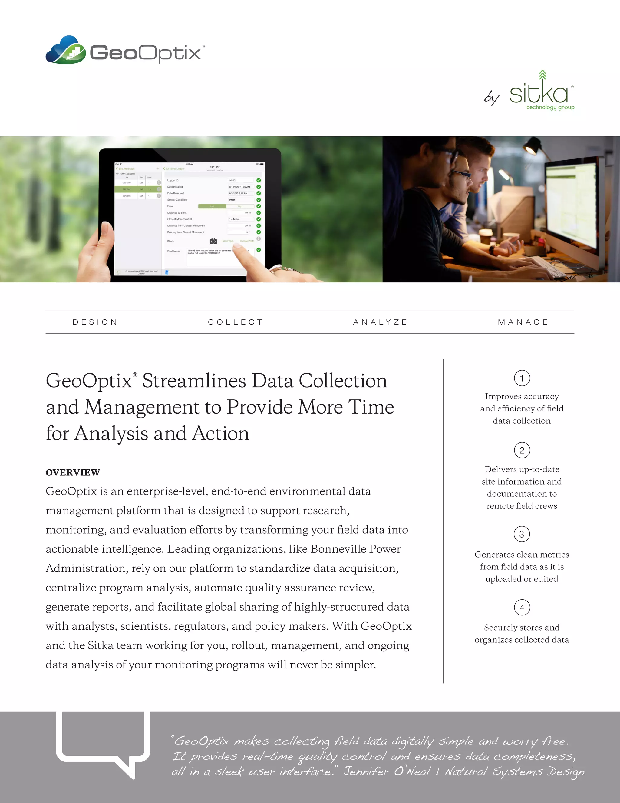
GeoOptix® Streamlines Data Collection
and Management to Provide More Time
for Analysis and Action
OVERVIEW
GeoOptix is an enterprise-level, end-to-end environmental data
management platform that is designed to support research,
monitoring, and evaluation efforts by transforming your field data into
actionable intelligence. Leading organizations, like Bonneville Power
Administration, rely on our platform to standardize data acquisition,
centralize program analysis, automate quality assurance review,
generate reports, and facilitate global sharing of highly-structured data
with analysts, scientists, regulators, and policy makers. With GeoOptix
and the Sitka team working for you, rollout, management, and ongoing
data analysis of your monitoring programs will never be simpler.
Improves accuracy
and efficiency of field
data collection
Delivers up-to-date
site information and
documentation to
remote field crews
Generates clean metrics
from field data as it is
uploaded or edited
Securely stores and
organizes collected data
1
2
3
4
“GeoOptix makes collecting field data digitally simple and worry free.
It provides real-time quality control and ensures data completeness,
all in a sleek user interface.” Jennifer O’Neal | Natural Systems Design
D E S I G N C O L L E C T A N A L Y Z E M A N A G E
by by
1. DESIGN
GeoOptix quickly consumes study designs from Monitoring Resources
(www.monitoringresources.org), an innovative and publicly available tool
designed to improve the accuracy and efficiency of field data collection
efforts. Using your spatial, temporal, and response design elements,
the platform will take you from design to field collection in minutes.
2. COLLECT
The platform automatically delivers up-to-date site information and
data collection forms to field crews operating in remote areas. Using our
intuitive software, vetted and refined from over five years of field testing,
crews quickly record observed data while receiving immediate quality
control confirmations during the visit. With a simple click, the collected
data is instantly uploaded to the cloud for secure post-processing.
3. ANALYZE
GeoOptix includes a flexible calculation engine that automatically
generates clean metrics from field data as it is uploaded or edited. If
empirical analysis isn’t enough, the platform provides resource-intensive
models or simulations to help validate findings and make predictions.
4. MANAGE
Your data is housed in a FISMA-compliant, enterprise-scale repository
accessible via your personal portal. The collected data is stored and organized
to ensure easy discoverability and sharing via customer-defined policies.
Sitka Technology Group • 309 SW Sixth Avenue, Suite 575, Portland, OR 97204 • 1.800.805.6740 • sales@sitkatech.com • www.sitkatech.com • @sitkatech
• Modern, cloud-based tools take the
headache out of project design
• Well suited for probabilistic designs and
stratification, opportunistic sampling,
and project-effectiveness efforts
• Proven technology and solution used by
leading organizations and programs
• Industry-leading software supports
tabular, geospatial, and image data
with real-time quality control
• New tasks and completed surveys
transmitted via mobile-enabled tablets
• Intuitive, field-tested form design
• Customizable metrics support empirical
analysis, visualization, and reporting efforts
• Automatic, multi-level metric generation
• Scalable resources to tackle the
largest modeling problems
• Flexible download formats and
transactional data access
• FISMA/NIST 800-53 security controls
• Compatible with regional metadata
exchange standards
• Sitka FlightPath™ data integration
• RESTful Web API facilitates integration
with cutting-edge visualization products
How It Works
Each customer implementation consists of the following four components:
GET STARTED
For organizations interested in streamlining their monitoring programs with
GeoOptix®, please contact us at 1.800.805.6740 or sales@sitkatech.com
For more information, please visit: www.sitkatech.com/GeoOptix
DESIGN COLLECT ANALYZE MANAGE
Sitka Technology Group is the leading provider of enterprise-level software solutions to streamline and power the acquisition, management, and visualization of field data for environmental conservation efforts.
Copyright © 2016 Sitka Technology Group. Sitka and the Sitka logo are registered trademarks of Sitka Technology Group. All rights reserved. All other trademarks are the property of their respective owners.

GeoOptix_ProductSheet_031816_FNL

  • 1.
    GeoOptix® Streamlines DataCollection and Management to Provide More Time for Analysis and Action OVERVIEW GeoOptix is an enterprise-level, end-to-end environmental data management platform that is designed to support research, monitoring, and evaluation efforts by transforming your field data into actionable intelligence. Leading organizations, like Bonneville Power Administration, rely on our platform to standardize data acquisition, centralize program analysis, automate quality assurance review, generate reports, and facilitate global sharing of highly-structured data with analysts, scientists, regulators, and policy makers. With GeoOptix and the Sitka team working for you, rollout, management, and ongoing data analysis of your monitoring programs will never be simpler. Improves accuracy and efficiency of field data collection Delivers up-to-date site information and documentation to remote field crews Generates clean metrics from field data as it is uploaded or edited Securely stores and organizes collected data 1 2 3 4 “GeoOptix makes collecting field data digitally simple and worry free. It provides real-time quality control and ensures data completeness, all in a sleek user interface.” Jennifer O’Neal | Natural Systems Design D E S I G N C O L L E C T A N A L Y Z E M A N A G E by by
  • 2.
    1. DESIGN GeoOptix quicklyconsumes study designs from Monitoring Resources (www.monitoringresources.org), an innovative and publicly available tool designed to improve the accuracy and efficiency of field data collection efforts. Using your spatial, temporal, and response design elements, the platform will take you from design to field collection in minutes. 2. COLLECT The platform automatically delivers up-to-date site information and data collection forms to field crews operating in remote areas. Using our intuitive software, vetted and refined from over five years of field testing, crews quickly record observed data while receiving immediate quality control confirmations during the visit. With a simple click, the collected data is instantly uploaded to the cloud for secure post-processing. 3. ANALYZE GeoOptix includes a flexible calculation engine that automatically generates clean metrics from field data as it is uploaded or edited. If empirical analysis isn’t enough, the platform provides resource-intensive models or simulations to help validate findings and make predictions. 4. MANAGE Your data is housed in a FISMA-compliant, enterprise-scale repository accessible via your personal portal. The collected data is stored and organized to ensure easy discoverability and sharing via customer-defined policies. Sitka Technology Group • 309 SW Sixth Avenue, Suite 575, Portland, OR 97204 • 1.800.805.6740 • sales@sitkatech.com • www.sitkatech.com • @sitkatech • Modern, cloud-based tools take the headache out of project design • Well suited for probabilistic designs and stratification, opportunistic sampling, and project-effectiveness efforts • Proven technology and solution used by leading organizations and programs • Industry-leading software supports tabular, geospatial, and image data with real-time quality control • New tasks and completed surveys transmitted via mobile-enabled tablets • Intuitive, field-tested form design • Customizable metrics support empirical analysis, visualization, and reporting efforts • Automatic, multi-level metric generation • Scalable resources to tackle the largest modeling problems • Flexible download formats and transactional data access • FISMA/NIST 800-53 security controls • Compatible with regional metadata exchange standards • Sitka FlightPath™ data integration • RESTful Web API facilitates integration with cutting-edge visualization products How It Works Each customer implementation consists of the following four components: GET STARTED For organizations interested in streamlining their monitoring programs with GeoOptix®, please contact us at 1.800.805.6740 or sales@sitkatech.com For more information, please visit: www.sitkatech.com/GeoOptix DESIGN COLLECT ANALYZE MANAGE Sitka Technology Group is the leading provider of enterprise-level software solutions to streamline and power the acquisition, management, and visualization of field data for environmental conservation efforts. Copyright © 2016 Sitka Technology Group. Sitka and the Sitka logo are registered trademarks of Sitka Technology Group. All rights reserved. All other trademarks are the property of their respective owners.