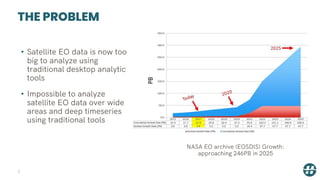
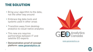
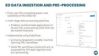
The document provides an overview of the Geo Analytics Canada demonstration platform. It describes how the platform addresses the challenge of analyzing large satellite datasets using traditional desktop tools by bringing algorithms to scalable cloud data and computing resources. Key features highlighted include on-demand compute and storage, tools for querying, discovering and analyzing satellite data, pre-processing pipelines, and personal analytic environments for interactive exploration and scaling of analyses. The platform aims to enable big data analytics of satellite datasets through open-source technologies and partnerships between IT and Earth observation experts.


![CONCLUSION
41
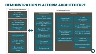
• The proof of concept platform demonstrates how [1]:
• Existing stores of satellite EO data can be
analyzed in-place using cloud-computing
resources, rather than requiring download
• New modular and user friendly metadata
protocols, particularly Spatio Temporal Asset
Catalogs (STAC), can be used to provide search
interface for satellite EO dataset discovery](https://image.slidesharecdn.com/geoanalyticscanadaoverview20200420-200421060121/85/GEO-Analytics-Canada-Overview-April-2020-41-320.jpg)
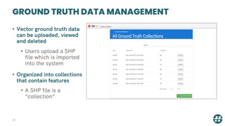
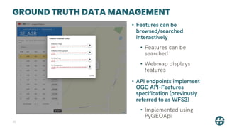
![CONCLUSION
42
• The proof of concept platform demonstrates how [2]:
• The new OGC API – Features (WFS 3) standard
can be used manage and make available ground
truth and other in-situ datasets
• Satellite EO analytic programs in Python can be
created interactively, and then scaled to analyze
large areas and deep timeseries using XArray
and Dask libraries
• Ingestion, machine learning, analytical and pre-
processing applications (both binary and python
based) can be linked to form scalable satellite EO
data processing chains](https://image.slidesharecdn.com/geoanalyticscanadaoverview20200420-200421060121/85/GEO-Analytics-Canada-Overview-April-2020-42-320.jpg)