Tim waters openhistoricalmap geomob london july 2015
•
3 likes•1,443 views
about open historical maps creating a map of everything that has existed, open history mapping openhistoricalmap.org with examples of peoples mapping from roman times to 18th century to 20th century in various different places
Report
Share
Report
Share
Download to read offline

Recommended
OpenHistoricalMap tim waters - Topomancy / NYPL Lightning Talk
historial mapping using openstreetmap stack lightning talk presented at the New York Public Library 2014
Rxjs
Rxjs is a library for reactive programming using observable streams. It provides tools for working with both synchronous and asynchronous data streams, including subscribing to and unsubscribing from streams, creating streams from arrays with "of", and transforming streams using operators like "map", "filter", and "do". Examples demonstrate mapping and filtering streams of data. Resources include the Rxjs GitHub for documentation and an introduction to reactive programming, as well as a video on viewing everything as a stream.
GI2010 symposium-stark (tele-addr)
This presentation discusses the OpenAddresses project, which aims to collect geocoded street address data from around the world and make it freely available. It summarizes the goals of OpenAddresses, how the project collects and stores address data, and some key metrics about the project's progress including over 11 million addresses currently in the database. The presentation encourages attendees to visit the OpenAddresses website to learn more or contribute address data.
Open Historical Maps at State of the Map (SOTM), 2009, Amsterdam
This document discusses tools and projects for digitizing and georeferencing historical maps on the web in an open and collaborative manner. It presents examples like Gutenkarte for browsing geographic texts, and the NYPL Map Rectifier and Digitizer. It also covers best practices for public editing, versioning, and resolving disputes on collaborative projects. Finally, it promotes open access to historical maps and building a shared database through crowd-sourcing with tools like Whooms and Mapwarper.
Some geospatial ruby libraries
This document summarizes several Ruby libraries for geospatial and geographic data processing:
- Rosemary is a Ruby library for interacting with the OpenStreetMap API to create, update, and delete map data like nodes and changesets.
- The Overpass API Ruby library allows querying OpenStreetMap data through Overpass and retrieving results as JSON.
- The GEOS extension provides spatial operations like buffering on geometric features.
- GDAL/OGR enables reading and writing raster and vector geospatial data formats.
- RGeo handles common geometric operations on spatial objects like distance calculations between points and geometries.
- PostGIS/Postgres allows storing and querying spatial data in PostgreSQL with PostGIS extensions,
Tim waters OpenHistoricalMap State of the Map Scotland 2015
This document introduces OpenHistoricalMap.org (OHM), a project to map historical objects and places in OpenStreetMap. OHM maintains a separate database from OSM to store historical data with start and end dates. Examples are given of areas mapped in both historical and current times. Contributors can add historical data by importing archive data from OSM, tracing from historical maps, or directly editing in OHM with normal OSM tags plus start/end dates. Future goals include more map layers, timesliders, and better tracing tools to make OHM data more accessible and usable.
OpenStreetMap and Geospatial Ruby Tim Waters sheffield ruby user group july 2...
OpenStreetMap is a collaborative project to create a free editable map of the world. It was founded in 2004 in response to expensive licensing of Ordnance Survey data. Users can map areas by collecting GPS data or editing existing maps. The data is openly licensed and used in many applications. OpenStreetMap has over a million users who have collected billions of GPS points to map nodes, ways and areas using a folksonomy tagging scheme. The data can be accessed through the website, API or exports and rendered into maps using tools like Ruby libraries, PostGIS, and Mapnik.
Tim waters OpenHistoricalMap Changes to the OSM Stack. SOTM-US 2015
This document discusses OpenHistoricalMap (OHM), which aims to create a map of everything that has ever existed by adding a time dimension to OpenStreetMap data. It provides background on OHM and outlines the technical stack used, including the website, editors, database replication, tile generation, and potential areas for future work like improved time-based querying and interfaces. The speaker encourages participants to get involved in further developing OHM through activities at an upcoming hack day.
Visible If You Can See it? The Superposition tim waters_20_may
Talk given at The Superposition, Leeds on 20 May about visible things which are invisible and that are never on any map.
Ken campbell interview hoax small 1994
Interview between John C.S. Quel and Ken Campbell
published in HOAX! Magazine 1994 pages 39-52
This is a smaller more compressed size
Ken campbell interview hoax 1994
John C.S. Quel interviewed Ken Campbell about his career as a hoaxer. Campbell discussed some of his most famous hoaxes including the nonexistent play "The Sweeney" and his hoaxing of the British Library. He also spoke about what motivated his hoaxes and how he was eventually able to admit they were not real.
Ohm
OpenHistoricalMap is creating a map of everything that has ever existed with a time slider to view how the world has changed over time. It currently has maps from prehistory through ancient and modern history and aims to map yesterday as well. OpenHistoricalMap wants contributors to help add more historical data and take part in a hackday event.
Space place psychogeography - foss4g 2013
This document discusses the concept of psychogeography and situationist practices related to exploring and mapping one's surroundings. It covers theories put forth by Guy Debord and the Situationists on deriving meaning from one's environment and how architecture can influence behavior. Specific situationist techniques are mentioned like the dérive, which involves drifting through an area and mapping psychogeographical features. Examples are given of alternative mapping projects that apply these ideas like mapping unusual or subjective attributes of places. The document advocates exploring one's surroundings through playful derivation to gain new perspectives and insights.
The map is not whats there - psychogeography and openstreetmap
This document discusses the concept of psychogeography and mapping. It provides an overview of psychogeography as defined by Situationists like Debord, involving deriving or drifting through varied urban environments and being aware of how places shape interactions. It discusses different types of psychogeography and gives examples of related practices like urban exploration, parkour and mapping community spaces. The document emphasizes that maps reflect the interests of their creators and can be used to argue perspectives or identify things worth advocating for. It encourages participants to go outside in small groups and engage in informal mapping activities.
Leeds Data Thing OpenStreetMap and Other Geo Visualization Stuff
This document discusses OpenStreetMap, a collaborative project to create a free editable map of the world. It provides statistics on OSM's growth, encourages participants to contribute data, and demonstrates how OSM data can be accessed and visualized through tools like OverPass, TagInfo, various map APIs, and platforms like CartoDB, GeoCommons, and Stamen Maps. Videos and animations are linked to illustrate how OSM is edited and has grown over time. The presenter advocates for OSM as an open alternative to proprietary mapping platforms.
Introduction to OpenStreetMap and Humanitarian OSM Team for Plan Internationa...
Presentation about OSM for Humanitarian use at Plan International Mapping Workshop, Woking, Nov. 2012.
Getting started with OSM: http://learnosm.org
About HOT: http://hot.openstreetmap.org/
Current HOT projects: http://hot.openstreetmap.org/projects
You know when you are addicted to OSM when...
talk by tim waters at State Of The Map 2012 OpenStreetMap Conference - a lighthearted talk about the enthusiasms about the project
Psychogeography tim waters wherecampEU 2012
Psychogeography is the study of how geographic environments influence individuals' emotions and behaviors. It involves exploring landscapes in unconventional ways to gain unique perspectives. Techniques include deriving, which involves drifting through an area without a fixed route or purpose. The Situationists in 1950s Paris were early practitioners of psychogeography and deriving as a way to transform perceptions of places and everyday life. Modern interest has revived with groups conducting psychogeographic walks and events to re-experience urban environments. Mobile apps now offer new ways to engage in psychogeographic mapping and storytelling about places.
LSxCafe Swtich2OSM.org talk
The story about why and how companies are making the switch from google maps to openstreetmap By Tim Waters at LSxCafe, leeds, UK. 6 march 2012
Fuzzy foss4g 2006 tim waters poster
The document describes a web-based GIS tool called Tagger that allows users to capture fuzzy geographic areas and attributes. It has three main components: 1) A user input tool that lets users spray fuzzy areas on a map and tag attributes. 2) A storage and weighting tool that aggregates inputs from multiple users. 3) A querying tool that represents the aggregated data and allows searching tagged comments based on perceived importance. The tool was developed to capture everyday geography like areas people perceive as "nice" or having "high crime", which usually have vague boundaries and vary within.
Mapping The Fear of Crime
Presentation about a new mapping tool to help map vernacular geographies, with the example of mapping the fear of crime, in Keighley, West Yorkshire
Soc map rectification_tools_2011
The document discusses crowdsourcing the georectification of historical maps by having people trace over digitized maps online. It provides context that while crowdsourcing work to users can build a site, companies must also provide structure for users to collaborate. Examples are given of past mapping projects that used crowdsourcing as well as technical steps to georectify maps and tools that can be used.
Community Analytics on the GeoWeb
This document discusses community analytics on the GeoWeb and outlines challenges and opportunities for collaborative analysis of big, real-time, linked geospatial data. It proposes creating web-based platforms to make analytics easy, powerful, collaborative and traceable for decision makers and the general public. The goal is to enable people to work together to analyze information and draw more informed conclusions, as was done for disaster relief in Haiti, by addressing issues around data volume, sharing models and keeping analyses extendable and improving over time.
Psychogeography at geekup leeds
Psychogeography is the study of how geography and the built environment can influence human emotions, behavior, and perceptions. It involves exploring and mapping an area using techniques like deriving (drifting through an area) to experience places in unique ways and transform perceptions. The concept originated with the Situationists in 1950s Paris and has since inspired various groups and individuals to map areas while cultivating unusual perspectives on places through activities like psychogeographic walks.
OpenStreetMap - Case Study Haiti Crisis Response
This document discusses how OpenStreetMap data and volunteers helped respond to the 2010 Haiti earthquake. It describes how within a week of the earthquake, over 700 volunteers had mapped Haiti using satellite imagery. The highly detailed maps helped first responders locate roads, buildings, and camps. Damage assessments were also mapped. The UN noted that mapping Haiti normally would have taken years but OSM did it in just 3 weeks. OSM data continues to help with ongoing crisis response and reconstruction efforts in Haiti through tools like the Humanitarian Data Model and deployments of the OSM Humanitarian Team.
OpenStreetMap Using, Tools, Services & Hows its changed Humanitarian Response
OpenStreetMap is a collaborative project to create a free editable map of the world. The document discusses how to contribute map data by making small edits using simple tools. It also describes how OpenStreetMap data is being used for humanitarian purposes such as crisis mapping and disaster response, providing an open alternative to proprietary mapping solutions. Over 240,000 users have contributed to OpenStreetMap, including 14,000 classified as active contributors.
Psychogeography. Guest talk at Leeds University
Psychogeography is the study of how geography and the built environment influence human emotions and behavior. It began in the 1950s with the Situationist International group in France who saw it as a way to critique modern capitalist cities. Some key practices of psychogeography include the derive, where one explores an area by drifting aimlessly and observing how the environment shapes their movements and perceptions. In recent years there has been a resurgence of interest in psychogeography through community mapping projects, guided walks, and sharing experiences of places online.
Open Historical Map at AGI North's Where2.0Now Conference
Tim Waters discusses putting historical map libraries online and making them accessible through crowdsourcing. While some are skeptical of relying too heavily on users, structuring projects properly can facilitate user collaboration. Waters demonstrates a map warping tool that allows georectification and overlay of multiple map layers. Users are encouraged to try uploading and georectifying their own historical imagery through the open source tool.
制作毕业证书(ANU毕业证)莫纳什大学毕业证成绩单官方原版办理
在线办理莫纳什大学毕业证【微信:176555708】(ANU毕业证书)成绩单学位证【微信:176555708】,留信认证(真实可查,永久存档)纸张工艺/offer、雅思、外壳等材料/诚信可靠,可直接看成品样本,帮您解决无法毕业带来的各种难题!外壳,原版制作,诚信可靠,可直接看成品样本。行业标杆!精益求精,诚心合作,真诚制作!多年品质 ,按需精细制作,24小时接单,全套进口原装设备。十五年致力于帮助留学生解决难题,包您满意。#一整套莫纳什大学文凭证件办理#—包含莫纳什大学莫纳什大学毕业证文凭证书学历认证|使馆认证|归国人员证明|教育部认证|留信网认证永远存档教育部学历学位认证查询办理国外文凭国外学历学位认证#我们提供全套办理服务。
一整套留学文凭证件服务:
一:莫纳什大学莫纳什大学毕业证文凭证书毕业证 #成绩单等全套材料从防伪到印刷水印底纹到钢印烫金
二:真实使馆认证(留学人员回国证明)使馆存档
三:真实教育部认证教育部存档教育部留服网站永久可查
四:留信认证留学生信息网站永久可查
国外毕业证学位证成绩单办理方法:
1客户提供办理莫纳什大学莫纳什大学毕业证文凭证书信息:姓名生日专业学位毕业时间等(如信息不确定可以咨询顾问:我们有专业老师帮你查询);
2开始安排制作毕业证成绩单电子图;
3毕业证成绩单电子版做好以后发送给您确认;
4毕业证成绩单电子版您确认信息无误之后安排制作成品;
5成品做好拍照或者视频给您确认;
6快递给客户(国内顺丰国外DHLUPS等快读邮寄)。
教育部文凭学历认证认证的用途:
如果您计划在国内发展那么办理国内教育部认证是必不可少的。事业性用人单位如银行国企公务员在您应聘时都会需要您提供这个认证。其他私营 #外企企业无需提供!办理教育部认证所需资料众多且烦琐所有材料您都必须提供原件我们凭借丰富的经验帮您快速整合材料让您少走弯路。
实体公司专业为您服务如有需要请联系我: 微信176555708
Bridging the Digital Gap Brad Spiegel Macon, GA Initiative.pptx
Brad Spiegel Macon GA’s journey exemplifies the profound impact that one individual can have on their community. Through his unwavering dedication to digital inclusion, he’s not only bridging the gap in Macon but also setting an example for others to follow.
More Related Content
More from chippy
Visible If You Can See it? The Superposition tim waters_20_may
Talk given at The Superposition, Leeds on 20 May about visible things which are invisible and that are never on any map.
Ken campbell interview hoax small 1994
Interview between John C.S. Quel and Ken Campbell
published in HOAX! Magazine 1994 pages 39-52
This is a smaller more compressed size
Ken campbell interview hoax 1994
John C.S. Quel interviewed Ken Campbell about his career as a hoaxer. Campbell discussed some of his most famous hoaxes including the nonexistent play "The Sweeney" and his hoaxing of the British Library. He also spoke about what motivated his hoaxes and how he was eventually able to admit they were not real.
Ohm
OpenHistoricalMap is creating a map of everything that has ever existed with a time slider to view how the world has changed over time. It currently has maps from prehistory through ancient and modern history and aims to map yesterday as well. OpenHistoricalMap wants contributors to help add more historical data and take part in a hackday event.
Space place psychogeography - foss4g 2013
This document discusses the concept of psychogeography and situationist practices related to exploring and mapping one's surroundings. It covers theories put forth by Guy Debord and the Situationists on deriving meaning from one's environment and how architecture can influence behavior. Specific situationist techniques are mentioned like the dérive, which involves drifting through an area and mapping psychogeographical features. Examples are given of alternative mapping projects that apply these ideas like mapping unusual or subjective attributes of places. The document advocates exploring one's surroundings through playful derivation to gain new perspectives and insights.
The map is not whats there - psychogeography and openstreetmap
This document discusses the concept of psychogeography and mapping. It provides an overview of psychogeography as defined by Situationists like Debord, involving deriving or drifting through varied urban environments and being aware of how places shape interactions. It discusses different types of psychogeography and gives examples of related practices like urban exploration, parkour and mapping community spaces. The document emphasizes that maps reflect the interests of their creators and can be used to argue perspectives or identify things worth advocating for. It encourages participants to go outside in small groups and engage in informal mapping activities.
Leeds Data Thing OpenStreetMap and Other Geo Visualization Stuff
This document discusses OpenStreetMap, a collaborative project to create a free editable map of the world. It provides statistics on OSM's growth, encourages participants to contribute data, and demonstrates how OSM data can be accessed and visualized through tools like OverPass, TagInfo, various map APIs, and platforms like CartoDB, GeoCommons, and Stamen Maps. Videos and animations are linked to illustrate how OSM is edited and has grown over time. The presenter advocates for OSM as an open alternative to proprietary mapping platforms.
Introduction to OpenStreetMap and Humanitarian OSM Team for Plan Internationa...
Presentation about OSM for Humanitarian use at Plan International Mapping Workshop, Woking, Nov. 2012.
Getting started with OSM: http://learnosm.org
About HOT: http://hot.openstreetmap.org/
Current HOT projects: http://hot.openstreetmap.org/projects
You know when you are addicted to OSM when...
talk by tim waters at State Of The Map 2012 OpenStreetMap Conference - a lighthearted talk about the enthusiasms about the project
Psychogeography tim waters wherecampEU 2012
Psychogeography is the study of how geographic environments influence individuals' emotions and behaviors. It involves exploring landscapes in unconventional ways to gain unique perspectives. Techniques include deriving, which involves drifting through an area without a fixed route or purpose. The Situationists in 1950s Paris were early practitioners of psychogeography and deriving as a way to transform perceptions of places and everyday life. Modern interest has revived with groups conducting psychogeographic walks and events to re-experience urban environments. Mobile apps now offer new ways to engage in psychogeographic mapping and storytelling about places.
LSxCafe Swtich2OSM.org talk
The story about why and how companies are making the switch from google maps to openstreetmap By Tim Waters at LSxCafe, leeds, UK. 6 march 2012
Fuzzy foss4g 2006 tim waters poster
The document describes a web-based GIS tool called Tagger that allows users to capture fuzzy geographic areas and attributes. It has three main components: 1) A user input tool that lets users spray fuzzy areas on a map and tag attributes. 2) A storage and weighting tool that aggregates inputs from multiple users. 3) A querying tool that represents the aggregated data and allows searching tagged comments based on perceived importance. The tool was developed to capture everyday geography like areas people perceive as "nice" or having "high crime", which usually have vague boundaries and vary within.
Mapping The Fear of Crime
Presentation about a new mapping tool to help map vernacular geographies, with the example of mapping the fear of crime, in Keighley, West Yorkshire
Soc map rectification_tools_2011
The document discusses crowdsourcing the georectification of historical maps by having people trace over digitized maps online. It provides context that while crowdsourcing work to users can build a site, companies must also provide structure for users to collaborate. Examples are given of past mapping projects that used crowdsourcing as well as technical steps to georectify maps and tools that can be used.
Community Analytics on the GeoWeb
This document discusses community analytics on the GeoWeb and outlines challenges and opportunities for collaborative analysis of big, real-time, linked geospatial data. It proposes creating web-based platforms to make analytics easy, powerful, collaborative and traceable for decision makers and the general public. The goal is to enable people to work together to analyze information and draw more informed conclusions, as was done for disaster relief in Haiti, by addressing issues around data volume, sharing models and keeping analyses extendable and improving over time.
Psychogeography at geekup leeds
Psychogeography is the study of how geography and the built environment can influence human emotions, behavior, and perceptions. It involves exploring and mapping an area using techniques like deriving (drifting through an area) to experience places in unique ways and transform perceptions. The concept originated with the Situationists in 1950s Paris and has since inspired various groups and individuals to map areas while cultivating unusual perspectives on places through activities like psychogeographic walks.
OpenStreetMap - Case Study Haiti Crisis Response
This document discusses how OpenStreetMap data and volunteers helped respond to the 2010 Haiti earthquake. It describes how within a week of the earthquake, over 700 volunteers had mapped Haiti using satellite imagery. The highly detailed maps helped first responders locate roads, buildings, and camps. Damage assessments were also mapped. The UN noted that mapping Haiti normally would have taken years but OSM did it in just 3 weeks. OSM data continues to help with ongoing crisis response and reconstruction efforts in Haiti through tools like the Humanitarian Data Model and deployments of the OSM Humanitarian Team.
OpenStreetMap Using, Tools, Services & Hows its changed Humanitarian Response
OpenStreetMap is a collaborative project to create a free editable map of the world. The document discusses how to contribute map data by making small edits using simple tools. It also describes how OpenStreetMap data is being used for humanitarian purposes such as crisis mapping and disaster response, providing an open alternative to proprietary mapping solutions. Over 240,000 users have contributed to OpenStreetMap, including 14,000 classified as active contributors.
Psychogeography. Guest talk at Leeds University
Psychogeography is the study of how geography and the built environment influence human emotions and behavior. It began in the 1950s with the Situationist International group in France who saw it as a way to critique modern capitalist cities. Some key practices of psychogeography include the derive, where one explores an area by drifting aimlessly and observing how the environment shapes their movements and perceptions. In recent years there has been a resurgence of interest in psychogeography through community mapping projects, guided walks, and sharing experiences of places online.
Open Historical Map at AGI North's Where2.0Now Conference
Tim Waters discusses putting historical map libraries online and making them accessible through crowdsourcing. While some are skeptical of relying too heavily on users, structuring projects properly can facilitate user collaboration. Waters demonstrates a map warping tool that allows georectification and overlay of multiple map layers. Users are encouraged to try uploading and georectifying their own historical imagery through the open source tool.
More from chippy (20)
Visible If You Can See it? The Superposition tim waters_20_may
Visible If You Can See it? The Superposition tim waters_20_may
The map is not whats there - psychogeography and openstreetmap
The map is not whats there - psychogeography and openstreetmap
Leeds Data Thing OpenStreetMap and Other Geo Visualization Stuff
Leeds Data Thing OpenStreetMap and Other Geo Visualization Stuff
Introduction to OpenStreetMap and Humanitarian OSM Team for Plan Internationa...
Introduction to OpenStreetMap and Humanitarian OSM Team for Plan Internationa...
OpenStreetMap Using, Tools, Services & Hows its changed Humanitarian Response
OpenStreetMap Using, Tools, Services & Hows its changed Humanitarian Response
Open Historical Map at AGI North's Where2.0Now Conference
Open Historical Map at AGI North's Where2.0Now Conference
Recently uploaded
制作毕业证书(ANU毕业证)莫纳什大学毕业证成绩单官方原版办理
在线办理莫纳什大学毕业证【微信:176555708】(ANU毕业证书)成绩单学位证【微信:176555708】,留信认证(真实可查,永久存档)纸张工艺/offer、雅思、外壳等材料/诚信可靠,可直接看成品样本,帮您解决无法毕业带来的各种难题!外壳,原版制作,诚信可靠,可直接看成品样本。行业标杆!精益求精,诚心合作,真诚制作!多年品质 ,按需精细制作,24小时接单,全套进口原装设备。十五年致力于帮助留学生解决难题,包您满意。#一整套莫纳什大学文凭证件办理#—包含莫纳什大学莫纳什大学毕业证文凭证书学历认证|使馆认证|归国人员证明|教育部认证|留信网认证永远存档教育部学历学位认证查询办理国外文凭国外学历学位认证#我们提供全套办理服务。
一整套留学文凭证件服务:
一:莫纳什大学莫纳什大学毕业证文凭证书毕业证 #成绩单等全套材料从防伪到印刷水印底纹到钢印烫金
二:真实使馆认证(留学人员回国证明)使馆存档
三:真实教育部认证教育部存档教育部留服网站永久可查
四:留信认证留学生信息网站永久可查
国外毕业证学位证成绩单办理方法:
1客户提供办理莫纳什大学莫纳什大学毕业证文凭证书信息:姓名生日专业学位毕业时间等(如信息不确定可以咨询顾问:我们有专业老师帮你查询);
2开始安排制作毕业证成绩单电子图;
3毕业证成绩单电子版做好以后发送给您确认;
4毕业证成绩单电子版您确认信息无误之后安排制作成品;
5成品做好拍照或者视频给您确认;
6快递给客户(国内顺丰国外DHLUPS等快读邮寄)。
教育部文凭学历认证认证的用途:
如果您计划在国内发展那么办理国内教育部认证是必不可少的。事业性用人单位如银行国企公务员在您应聘时都会需要您提供这个认证。其他私营 #外企企业无需提供!办理教育部认证所需资料众多且烦琐所有材料您都必须提供原件我们凭借丰富的经验帮您快速整合材料让您少走弯路。
实体公司专业为您服务如有需要请联系我: 微信176555708
Bridging the Digital Gap Brad Spiegel Macon, GA Initiative.pptx
Brad Spiegel Macon GA’s journey exemplifies the profound impact that one individual can have on their community. Through his unwavering dedication to digital inclusion, he’s not only bridging the gap in Macon but also setting an example for others to follow.
Search Result Showing My Post is Now Buried
Search results burying my post that used to rank before Google's March 2024 algorithm update.
APNIC Foundation, presented by Ellisha Heppner at the PNG DNS Forum 2024
Ellisha Heppner, Grant Management Lead, presented an update on APNIC Foundation to the PNG DNS Forum held from 6 to 10 May, 2024 in Port Moresby, Papua New Guinea.
制作原版1:1(Monash毕业证)莫纳什大学毕业证成绩单办理假
退学买莫纳什大学毕业证>【微信176555708】办理莫纳什大学毕业证成绩单【微信176555708】Monash毕业证成绩单Monash学历证书Monash文凭【Monash毕业套号文凭网认证莫纳什大学毕业证成绩单】【哪里买莫纳什大学毕业证文凭Monash成绩学校快递邮寄信封】【开版莫纳什大学文凭】Monash留信认证本科硕士学历认证1:1完美还原海外各大学毕业材料上的工艺:水印阴影底纹钢印LOGO烫金烫银LOGO烫金烫银复合重叠。文字图案浮雕激光镭射紫外荧光温感复印防伪。
可办理以下真实莫纳什大学存档留学生信息存档认证:
1莫纳什大学真实留信网认证(网上可查永久存档无风险百分百成功入库);
2真实教育部认证(留服)等一切高仿或者真实可查认证服务(暂时不可办理);
3购买英美真实学籍(不用正常就读直接出学历);
4英美一年硕士保毕业证项目(保录取学校挂名不用正常就读保毕业)
留学本科/硕士毕业证书成绩单制作流程:
1客户提供办理信息:姓名生日专业学位毕业时间等(如信息不确定可以咨询顾问:我们有专业老师帮你查询莫纳什大学莫纳什大学毕业证offer);
2开始安排制作莫纳什大学毕业证成绩单电子图;
3莫纳什大学毕业证成绩单电子版做好以后发送给您确认;
4莫纳什大学毕业证成绩单电子版您确认信息无误之后安排制作成品;
5莫纳什大学成品做好拍照或者视频给您确认;
6快递给客户(国内顺丰国外DHLUPS等快读邮寄)
— — — — — — — — — — — 《文凭顾问微信:176555708》
不能毕业如何获得(USYD毕业证)悉尼大学毕业证成绩单一比一原版制作
挂科购买☀【悉尼大学毕业证购买】【微信176555708】【USYD毕业证模板办理】加拿大文凭、本科、硕士、研究生学历都可以做,二、业务范围:
★、全套服务:毕业证、成绩单、化学专业毕业证书伪造【悉尼大学大学毕业证】微信176555708【USYD学位证书购买】◆◆◆◆◆ — — — 归国服务中心 — — -◆◆◆◆◆
【主营项目】
一.毕业证、成绩单、使馆认证、教育部认证、雅思托福成绩单、学生卡等!
二.真实使馆公证(即留学回国人员证明,不成功不收费)
三.真实教育部学历学位认证(教育部存档!教育部留服网站永久可查)
四.办理各国各大学文凭(一对一专业服务,可全程监控跟踪进度)
国外毕业证、学位证、成绩单办理流程:
1、客户提供办理信息:姓名、生日、专业、学位、毕业时间等(如信息不确定可以咨询顾问:【微信176555708】我们有专业老师帮你查询);
2、开始安排制作毕业证、成绩单电子图;
3、毕业证、成绩单电子版做好以后发送给您确认;
4、毕业证、成绩单电子版您确认信息无误之后安排制作成品;
5、成品做好拍照或者视频给您确认;
6、快递给客户(国内顺丰,国外DHL、UPS等快读邮寄)。
专业服务,请勿犹豫联系我!本公司是留学创业和海归创业者们的桥梁。一次办理,终生受用,一步到位,高效服务。详情请在线咨询办理,欢迎有诚意办理的客户咨询!洽谈。
◆招聘代理:本公司诚聘英国、加拿大、澳洲、新西兰、加拿大、法国、德国、新加坡各地代理人员,如果你有业余时间,有兴趣就请联系我们咨询【微信176555708】
没文凭怎么找工作。让您回国发展信心十足!
★、真实教育部学历学位认证;(一对一专业服务,可全程监控跟踪进度)
★、真实使馆认证,可以通过大使馆查询确认;(即教育部留服认证,不成功不收费)
★、毕业证、成绩单等材料,从防伪到印刷、水印到钢印烫金,高精仿度都是跟学校原版100%相同的;(敬请放心使用)
★、可以提供钢印、水印、烫金、激光防伪、凹凸版、最新版的毕业证、百分之百让您绝对满意、
★、印刷,DHL快递毕业证、成绩单7个工作日,真实大使馆教育部认证1个月。为了达到高水准高效率。
Understanding User Behavior with Google Analytics.pdf
Unlocking the full potential of Google Analytics is crucial for understanding and optimizing your website’s performance. This guide dives deep into the essential aspects of Google Analytics, from analyzing traffic sources to understanding user demographics and tracking user engagement.
Traffic Sources Analysis:
Discover where your website traffic originates. By examining the Acquisition section, you can identify whether visitors come from organic search, paid campaigns, direct visits, social media, or referral links. This knowledge helps in refining marketing strategies and optimizing resource allocation.
User Demographics Insights:
Gain a comprehensive view of your audience by exploring demographic data in the Audience section. Understand age, gender, and interests to tailor your marketing strategies effectively. Leverage this information to create personalized content and improve user engagement and conversion rates.
Tracking User Engagement:
Learn how to measure user interaction with your site through key metrics like bounce rate, average session duration, and pages per session. Enhance user experience by analyzing engagement metrics and implementing strategies to keep visitors engaged.
Conversion Rate Optimization:
Understand the importance of conversion rates and how to track them using Google Analytics. Set up Goals, analyze conversion funnels, segment your audience, and employ A/B testing to optimize your website for higher conversions. Utilize ecommerce tracking and multi-channel funnels for a detailed view of your sales performance and marketing channel contributions.
Custom Reports and Dashboards:
Create custom reports and dashboards to visualize and interpret data relevant to your business goals. Use advanced filters, segments, and visualization options to gain deeper insights. Incorporate custom dimensions and metrics for tailored data analysis. Integrate external data sources to enrich your analytics and make well-informed decisions.
This guide is designed to help you harness the power of Google Analytics for making data-driven decisions that enhance website performance and achieve your digital marketing objectives. Whether you are looking to improve SEO, refine your social media strategy, or boost conversion rates, understanding and utilizing Google Analytics is essential for your success.
一比一原版(LBS毕业证)伦敦商学院毕业证成绩单专业办理
LBS毕业证原版定制【微信:176555708】【伦敦商学院毕业证成绩单-学位证】【微信:176555708】(留信学历认证永久存档查询)采用学校原版纸张、特殊工艺完全按照原版一比一制作(包括:隐形水印,阴影底纹,钢印LOGO烫金烫银,LOGO烫金烫银复合重叠,文字图案浮雕,激光镭射,紫外荧光,温感,复印防伪)行业标杆!精益求精,诚心合作,真诚制作!多年品质 ,按需精细制作,24小时接单,全套进口原装设备,十五年致力于帮助留学生解决难题,业务范围有加拿大、英国、澳洲、韩国、美国、新加坡,新西兰等学历材料,包您满意。
◆◆◆◆◆ — — — — — — — — 【留学教育】留学归国服务中心 — — — — — -◆◆◆◆◆
【主营项目】
一.毕业证【微信:176555708】成绩单、使馆认证、教育部认证、雅思托福成绩单、学生卡等!
二.真实使馆公证(即留学回国人员证明,不成功不收费)
三.真实教育部学历学位认证(教育部存档!教育部留服网站永久可查)
四.办理各国各大学文凭(一对一专业服务,可全程监控跟踪进度)
如果您处于以下几种情况:
◇在校期间,因各种原因未能顺利毕业……拿不到官方毕业证【微信:176555708】
◇面对父母的压力,希望尽快拿到;
◇不清楚认证流程以及材料该如何准备;
◇回国时间很长,忘记办理;
◇回国马上就要找工作,办给用人单位看;
◇企事业单位必须要求办理的
◇需要报考公务员、购买免税车、落转户口
◇申请留学生创业基金
留信网认证的作用:
1:该专业认证可证明留学生真实身份
2:同时对留学生所学专业登记给予评定
3:国家专业人才认证中心颁发入库证书
4:这个认证书并且可以归档倒地方
5:凡事获得留信网入网的信息将会逐步更新到个人身份内,将在公安局网内查询个人身份证信息后,同步读取人才网入库信息
6:个人职称评审加20分
7:个人信誉贷款加10分→ 【关于价格问题(保证一手价格)
我们所定的价格是非常合理的,而且我们现在做得单子大多数都是代理和回头客户介绍的所以一般现在有新的单子 我给客户的都是第一手的代理价格,因为我想坦诚对待大家 不想跟大家在价格方面浪费时间
对于老客户或者被老客户介绍过来的朋友,我们都会适当给一些优惠。
8:在国家人才网主办的国家网络招聘大会中纳入资料,供国家高端企业选择人才
选择实体注册公司办理,更放心,更安全!我们的承诺:可来公司面谈,可签订合同,会陪同客户一起到教育部认证窗口递交认证材料,客户在教育部官方认证查询网站查询到认证通过结果后付款,不成功不收费!
学历顾问:微信:176555708
Should Repositories Participate in the Fediverse?
Presentation for OR2024 making the case that repositories could play a part in the "fediverse" of distributed social applications
办理毕业证(UPenn毕业证)宾夕法尼亚大学毕业证成绩单快速办理
官方原版办理宾夕法尼亚大学毕业证【微信176555708】学历认证怎么做:原版仿制宾夕法尼亚大学电子版成绩单毕业证认证【宾夕法尼亚大学毕业证成绩单】、宾夕法尼亚大学文凭证书成绩单复刻offer录取通知书、购买UPenn圣力嘉学院本科毕业证、【宾夕法尼亚大学毕业证办理UPenn毕业证书哪里买】、宾夕法尼亚大学 Offer在线办理UPenn Offer宾夕法尼亚大学Bachloer Degree。(留信学历认证永久存档查询)采用学校原版纸张、特殊工艺完全按照原版一比一制作(包括:隐形水印,阴影底纹,钢印LOGO烫金烫银,LOGO烫金烫银复合重叠,文字图案浮雕,激光镭射,紫外荧光,温感,复印防伪)行业标杆!精益求精,诚心合作,真诚制作!多年品质 ,按需精细制作,24小时接单,全套进口原装设备,十五年致力于帮助留学生解决难题,业务范围有加拿大、英国、澳洲、韩国、美国、新加坡,新西兰等学历材料,包您满意。
◆◆◆◆◆ — — — — — — — — 【留学教育】留学归国服务中心 — — — — — -◆◆◆◆◆
【主营项目】
一.毕业证【微信:176555708】成绩单、使馆认证、教育部认证、雅思托福成绩单、学生卡等!
二.真实使馆公证(即留学回国人员证明,不成功不收费)
三.真实教育部学历学位认证(教育部存档!教育部留服网站永久可查)
四.办理各国各大学文凭(一对一专业服务,可全程监控跟踪进度)
如果您处于以下几种情况:
◇在校期间,因各种原因未能顺利毕业……拿不到官方毕业证【微信:176555708】
◇面对父母的压力,希望尽快拿到;
◇不清楚认证流程以及材料该如何准备;
◇回国时间很长,忘记办理;
◇回国马上就要找工作,办给用人单位看;
◇企事业单位必须要求办理的
◇需要报考公务员、购买免税车、落转户口
◇申请留学生创业基金
留信网认证的作用:
1:该专业认证可证明留学生真实身份
2:同时对留学生所学专业登记给予评定
3:国家专业人才认证中心颁发入库证书
4:这个认证书并且可以归档倒地方
5:凡事获得留信网入网的信息将会逐步更新到个人身份内,将在公安局网内查询个人身份证信息后,同步读取人才网入库信息
6:个人职称评审加20分
7:个人信誉贷款加10分→ 【关于价格问题(保证一手价格)
8:在国家人才网主办的国家网络招聘大会中纳入资料,供国家高端企业选择人才
选择实体注册公司办理,更放心,更安全!我们的承诺:可来公司面谈,可签订合同,会陪同客户一起到教育部认证窗口递交认证材料,客户在教育部官方认证查询网站查询到认证通过结果后付款,不成功不收费!
我们所定的价格是非常合理的,而且我们现在做得单子大多数都是代理和回头客户介绍的所以一般现在有新的单子 我给客户的都是第一手的代理价格,因为我想坦诚对待大家 不想跟大家在价格方面浪费时间
对于老客户或者被老客户介绍过来的朋友,我们都会适当给一些优惠。
学历顾问:微信:176555708
重新申请毕业证书(RMIT毕业证)皇家墨尔本理工大学毕业证成绩单精仿办理
不能毕业办理【RMIT毕业证【微信176555708】皇家墨尔本理工大学文凭学历】【微信176555708】【皇家墨尔本理工大学文凭学历证书】【皇家墨尔本理工大学毕业证书与成绩单样本图片】毕业证书补办 Fake Degree做学费单【毕业证明信-推荐信】成绩单,录取通知书,Offer,在读证明,雅思托福成绩单,真实大使馆教育部认证,回国人员证明,留信网认证。网上存档永久可查!全套服务:皇家墨尔本理工大学皇家墨尔本理工大学本科学位证成绩单真实回国人员证明 #真实教育部认证。让您回国发展信心十足#铸就十年品质!信誉!实体公司!可以视频看办公环境样板如需办理真实可查可以先到公司面谈勿轻信小中介黑作坊!
可以提供皇家墨尔本理工大学钢印 #水印 #烫金 #激光防伪 #凹凸版 #最新版的毕业证 #百分之百让您绝对满意
印刷DHL快递毕业证 #成绩单7个工作日真实大使馆教育部认证1个月。为了达到高水准高效率
请您先以qq或微信的方式对我们的服务进行了解后如果有皇家墨尔本理工大学皇家墨尔本理工大学本科学位证成绩单帮助再进行电话咨询。
国外毕业证学位证成绩单如何办理:
1客户提供办理信息:姓名生日专业学位毕业时间等(如信息不确定可以咨询顾问:我们有专业老师帮你查询);
2开始安排制作皇家墨尔本理工大学毕业证成绩单电子图;
3毕业证成绩单电子版做好以后发送给您确认;
4毕业证成绩单电子版您确认信息无误之后安排制作成品;
5成品做好拍照或者视频给您确认;
6快递给客户(国内顺丰国外DHLUPS等快读邮寄)。
办理新西兰奥克兰大学毕业证学位证书范本原版一模一样
原版一模一样【微信:741003700 】【新西兰奥克兰大学毕业证学位证书】【微信:741003700 】学位证,留信认证(真实可查,永久存档)offer、雅思、外壳等材料/诚信可靠,可直接看成品样本,帮您解决无法毕业带来的各种难题!外壳,原版制作,诚信可靠,可直接看成品样本。行业标杆!精益求精,诚心合作,真诚制作!多年品质 ,按需精细制作,24小时接单,全套进口原装设备。十五年致力于帮助留学生解决难题,包您满意。
本公司拥有海外各大学样板无数,能完美还原海外各大学 Bachelor Diploma degree, Master Degree Diploma
1:1完美还原海外各大学毕业材料上的工艺:水印,阴影底纹,钢印LOGO烫金烫银,LOGO烫金烫银复合重叠。文字图案浮雕、激光镭射、紫外荧光、温感、复印防伪等防伪工艺。材料咨询办理、认证咨询办理请加学历顾问Q/微741003700
留信网认证的作用:
1:该专业认证可证明留学生真实身份
2:同时对留学生所学专业登记给予评定
3:国家专业人才认证中心颁发入库证书
4:这个认证书并且可以归档倒地方
5:凡事获得留信网入网的信息将会逐步更新到个人身份内,将在公安局网内查询个人身份证信息后,同步读取人才网入库信息
6:个人职称评审加20分
7:个人信誉贷款加10分
8:在国家人才网主办的国家网络招聘大会中纳入资料,供国家高端企业选择人才
国外证书(Lincoln毕业证)新西兰林肯大学毕业证成绩单不能毕业办理
退学办理新西兰林肯大学毕业证【微信176555708】学历认证怎么做:原版仿制新西兰林肯大学电子版成绩单毕业证认证【新西兰林肯大学毕业证成绩单】、新西兰林肯大学文凭证书成绩单复刻offer录取通知书、购买Lincoln圣力嘉学院本科毕业证、【新西兰林肯大学毕业证办理Lincoln毕业证书哪里买】、新西兰林肯大学 Offer在线办理Lincoln Offer新西兰林肯大学Bachloer Degree。1客户提供办理信息:姓名生日专业学位毕业时间等(如信息不确定可以咨询顾问:微信176555708我们有专业老师帮你查询);
2开始安排制作毕业证成绩单电子图;
3毕业证成绩单电子版做好以后发送给您确认;
4毕业证成绩单电子版您确认信息无误之后安排制作成品;
5成品做好拍照或者视频给您确认;
6快递给客户(国内顺丰国外DHLUPS等快读邮寄)。
7完成交易删除客户资料
高精端提供以下服务:
一:新西兰林肯大学新西兰林肯大学毕业证文凭证书全套材料从防伪到印刷水印底纹到钢印烫金
二:真实使馆认证(留学人员回国证明)使馆存档
三:真实教育部认证教育部存档教育部留服网站可查
四:留信认证留学生信息网站可查
五:与学校颁发的相关证件1:1纸质尺寸制定(定期向各大院校毕业生购买最新版本毕,业证成绩单保证您拿到的是鲁昂大学内部最新版本毕业证成绩单微信176555708)
A.为什么留学生需要操作留信认证?
留信认证全称全国留学生信息服务网认证,隶属于北京中科院。①留信认证门槛条件更低,费用更美丽,并且包过,完单周期短,效率高②留信认证虽然不能去国企,但是一般的公司都没有问题,因为国内很多公司连基本的留学生学历认证都不了解。这对于留学生来说,这就比自己光拿一个证书更有说服力,因为留学学历可以在留信网站上进行查询!
B.为什么我们提供的毕业证成绩单具有使用价值?
查询留服认证是国内鉴别留学生海外学历的唯一途径但认证只是个体行为不是所有留学生都操作所以没有办理认证的留学生的学历在国内也是查询不到的他们也仅仅只有一张文凭。所以这时候我们提供的和学校颁发的一模一样的毕业证成绩单就有了使用价值。
Internet of Things in Manufacturing: Revolutionizing Efficiency & Quality | C...
This article delves into how the Internet of Things in manufacturing is reshaping the industry, its benefits, challenges, and future prospects.
一比一原版(SLU毕业证)圣路易斯大学毕业证成绩单专业办理
SLU毕业证原版定制【微信:176555708】【圣路易斯大学毕业证成绩单-学位证】【微信:176555708】(留信学历认证永久存档查询)采用学校原版纸张、特殊工艺完全按照原版一比一制作(包括:隐形水印,阴影底纹,钢印LOGO烫金烫银,LOGO烫金烫银复合重叠,文字图案浮雕,激光镭射,紫外荧光,温感,复印防伪)行业标杆!精益求精,诚心合作,真诚制作!多年品质 ,按需精细制作,24小时接单,全套进口原装设备,十五年致力于帮助留学生解决难题,业务范围有加拿大、英国、澳洲、韩国、美国、新加坡,新西兰等学历材料,包您满意。
◆◆◆◆◆ — — — — — — — — 【留学教育】留学归国服务中心 — — — — — -◆◆◆◆◆
【主营项目】
一.毕业证【微信:176555708】成绩单、使馆认证、教育部认证、雅思托福成绩单、学生卡等!
二.真实使馆公证(即留学回国人员证明,不成功不收费)
三.真实教育部学历学位认证(教育部存档!教育部留服网站永久可查)
四.办理各国各大学文凭(一对一专业服务,可全程监控跟踪进度)
如果您处于以下几种情况:
◇在校期间,因各种原因未能顺利毕业……拿不到官方毕业证【微信:176555708】
◇面对父母的压力,希望尽快拿到;
◇不清楚认证流程以及材料该如何准备;
◇回国时间很长,忘记办理;
◇回国马上就要找工作,办给用人单位看;
◇企事业单位必须要求办理的
◇需要报考公务员、购买免税车、落转户口
◇申请留学生创业基金
留信网认证的作用:
1:该专业认证可证明留学生真实身份
2:同时对留学生所学专业登记给予评定
3:国家专业人才认证中心颁发入库证书
4:这个认证书并且可以归档倒地方
5:凡事获得留信网入网的信息将会逐步更新到个人身份内,将在公安局网内查询个人身份证信息后,同步读取人才网入库信息
6:个人职称评审加20分
7:个人信誉贷款加10分→ 【关于价格问题(保证一手价格)
我们所定的价格是非常合理的,而且我们现在做得单子大多数都是代理和回头客户介绍的所以一般现在有新的单子 我给客户的都是第一手的代理价格,因为我想坦诚对待大家 不想跟大家在价格方面浪费时间
对于老客户或者被老客户介绍过来的朋友,我们都会适当给一些优惠。
8:在国家人才网主办的国家网络招聘大会中纳入资料,供国家高端企业选择人才
选择实体注册公司办理,更放心,更安全!我们的承诺:可来公司面谈,可签订合同,会陪同客户一起到教育部认证窗口递交认证材料,客户在教育部官方认证查询网站查询到认证通过结果后付款,不成功不收费!
学历顾问:微信:176555708
留学学历(UoA毕业证)奥克兰大学毕业证成绩单官方原版办理
制做办理奥克兰大学学历证书<176555708微信>【毕业证明信-推荐信做学费单>【微信176555708】【制作UoA毕业证文凭认证奥克兰大学毕业证成绩单购买】【UoA毕业证书】{奥克兰大学文凭购买}】成绩单,录取通知书,Offer,在读证明,雅思托福成绩单,真实大使馆教育部认证,回国人员证明,>【制作UoA毕业证文凭认证奥克兰大学毕业证成绩单购买】【UoA毕业证书】{奥克兰大学文凭购买}留信网认证。
奥克兰大学学历证书<微信176555708(一对一服务包括毕业院长签字,专业课程,学位类型,专业或教育领域,以及毕业日期.不要忽视这些细节.这两份文件同样重要!毕业证成绩单文凭留信网学历认证!)[留学文凭学历认证(留信认证使馆认证)奥克兰大学毕业证成绩单毕业证证书大学Offer请假条成绩单语言证书国际回国人员证明高仿教育部认证申请学校等一切高仿或者真实可查认证服务。
多年留学服务公司,拥有海外样板无数能完美1:1还原海外各国大学degreeDiplomaTranscripts等毕业材料。海外大学毕业材料都有哪些工艺呢?工艺难度主要由:烫金.钢印.底纹.水印.防伪光标.热敏防伪等等组成。而且我们每天都在更新海外文凭的样板以求所有同学都能享受到完美的品质服务。
国外毕业证学位证成绩单办理方法:
1客户提供办理奥克兰大学奥克兰大学硕士毕业证成绩单信息:姓名生日专业学位毕业时间等(如信息不确定可以咨询顾问:我们有专业老师帮你查询);
2开始安排制作毕业证成绩单电子图;
3毕业证成绩单电子版做好以后发送给您确认;
4毕业证成绩单电子版您确认信息无误之后安排制作成品;
5成品做好拍照或者视频给您确认;
6快递给客户(国内顺丰国外DHLUPS等快读邮寄)
— — — — 我们是挂科和未毕业同学们的福音我们是实体公司精益求精的工艺! — — — -
一真实留信认证的作用(私企外企荣誉的见证):
1:该专业认证可证明留学生真实留学身份同时对留学生所学专业等级给予评定。
2:国家专业人才认证中心颁发入库证书这个入网证书并且可以归档到地方。
3:凡是获得留信网入网的信息将会逐步更新到个人身份内将在公安部网内查询个人身份证信息后同步读取人才网入库信息。
4:个人职称评审加20分个人信誉贷款加10分。
5:在国家人才网主办的全国网络招聘大会中纳入资料供国家500强等高端企业选择人才。
Explore-Insanony: Watch Instagram Stories Secretly
Instagram has become one of the most popular social media platforms, allowing people to share photos, videos, and stories with their followers. Sometimes, though, you might want to view someone's story without them knowing.
成绩单ps(UST毕业证)圣托马斯大学毕业证成绩单快速办理
一比一原版制作UST毕业证【微信176555708】圣托马斯大学毕业证书原版↑制作圣托马斯大学学历认证文凭办理圣托马斯大学留信网认证,留学回国办理毕业证成绩单文凭学历认证【微信176555708】专业为海外学子办理毕业证成绩单、文凭制作,学历仿制,回国人员证明、做文凭,研究生、本科、硕士学历认证、留信认证、结业证、学位证书样本、美国教育部认证百分百真实存档可查】(留信学历认证永久存档查询)采用学校原版纸张、特殊工艺完全按照原版一比一制作(包括:隐形水印,阴影底纹,钢印LOGO烫金烫银,LOGO烫金烫银复合重叠,文字图案浮雕,激光镭射,紫外荧光,温感,复印防伪)行业标杆!精益求精,诚心合作,真诚制作!多年品质 ,按需精细制作,24小时接单,全套进口原装设备,十五年致力于帮助留学生解决难题,业务范围有加拿大、英国、澳洲、韩国、美国、新加坡,新西兰等学历材料,包您满意。
◆◆◆◆◆ — — — — — — — — 【留学教育】留学归国服务中心 — — — — — -◆◆◆◆◆
【主营项目】
一.毕业证【微信:176555708】成绩单、使馆认证、教育部认证、雅思托福成绩单、学生卡等!
二.真实使馆公证(即留学回国人员证明,不成功不收费)
三.真实教育部学历学位认证(教育部存档!教育部留服网站永久可查)
四.办理各国各大学文凭(一对一专业服务,可全程监控跟踪进度)
如果您处于以下几种情况:
◇在校期间,因各种原因未能顺利毕业……拿不到官方毕业证【微信:176555708】
◇面对父母的压力,希望尽快拿到;
◇不清楚认证流程以及材料该如何准备;
◇回国时间很长,忘记办理;
◇回国马上就要找工作,办给用人单位看;
◇企事业单位必须要求办理的
◇需要报考公务员、购买免税车、落转户口
◇申请留学生创业基金
留信网认证的作用:
1:该专业认证可证明留学生真实身份
2:同时对留学生所学专业登记给予评定
3:国家专业人才认证中心颁发入库证书
4:这个认证书并且可以归档倒地方
5:凡事获得留信网入网的信息将会逐步更新到个人身份内,将在公安局网内查询个人身份证信息后,同步读取人才网入库信息
6:个人职称评审加20分
7:个人信誉贷款加10分→ 【关于价格问题(保证一手价格)
8:在国家人才网主办的国家网络招聘大会中纳入资料,供国家高端企业选择人才
选择实体注册公司办理,更放心,更安全!我们的承诺:可来公司面谈,可签订合同,会陪同客户一起到教育部认证窗口递交认证材料,客户在教育部官方认证查询网站查询到认证通过结果后付款,不成功不收费!
我们所定的价格是非常合理的,而且我们现在做得单子大多数都是代理和回头客户介绍的所以一般现在有新的单子 我给客户的都是第一手的代理价格,因为我想坦诚对待大家 不想跟大家在价格方面浪费时间
对于老客户或者被老客户介绍过来的朋友,我们都会适当给一些优惠。
学历顾问:微信:176555708
Recently uploaded (20)
Bridging the Digital Gap Brad Spiegel Macon, GA Initiative.pptx
Bridging the Digital Gap Brad Spiegel Macon, GA Initiative.pptx
APNIC Foundation, presented by Ellisha Heppner at the PNG DNS Forum 2024
APNIC Foundation, presented by Ellisha Heppner at the PNG DNS Forum 2024
Understanding User Behavior with Google Analytics.pdf
Understanding User Behavior with Google Analytics.pdf
Internet of Things in Manufacturing: Revolutionizing Efficiency & Quality | C...
Internet of Things in Manufacturing: Revolutionizing Efficiency & Quality | C...
Explore-Insanony: Watch Instagram Stories Secretly
Explore-Insanony: Watch Instagram Stories Secretly
Tim waters openhistoricalmap geomob london july 2015
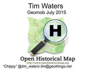
- 1. Tim Waters Geomob July 2015 “Chippy” @tim_waters tim@geothings.net
- 2. What it isn't (quite) Historical Objects in OSM
- 3. What is it? (The logo is a hint)
- 4. OpenHistoricalMap.org Most modest mapping project EVER! Everything that has ever existed World's most out of date map.
- 5. OSM Stack Separate Server Separate Database Planet Overpass API http://overpass.openhistoricalmap.org
- 6. Examples
- 9. Saeby – Denmark 18C
- 10. Saeby – Denmark Now
- 11. Roman Roads
- 12. Roman Mainz
- 13. WWI Trenches, Artillery positions etc
- 14. Paris 19C
- 17. in OHM
- 19. OHM OSM 20C Treasure Island - SF Bay
- 20. Manhattan 1854
- 21. How to add stuff to OHM
- 22. A very old garmin
- 23. Imports Archive from OSM Tracing from Historical Maps
- 24. WikiMedia Commons - Wikimaps
- 25. Wikimaps
- 29. Editing ● Tags – normal OSM ones ● start_date end_date – YYYY / YYYY-MM-DD ● Note of source map would be nice
- 30. Simple? ● Rabbit hole ● Cart before horse? ● Gregorian dates. ● Vagueness / fuzzy
- 31. imho ● OSM way - – good enough is better than perfect. ● Contributors not historical GIS “experts” ● Do whatever and let the renderers sort it out!
- 32. Future ● More Map layers ● Timesliders everywhere! ● Vector tiles ● Better tracing tools OpenHistoricalMap.org #ohm on irc.oftc.net https://lists.openstreetmap.org/listinfo/historic https://github.com/openhistoricalmap/ “Chippy” @tim_waters tim@geothings.net