
More Related Content
Viewers also liked
Viewers also liked (20)
More from chippy
More from chippy (20)
Recently uploaded
Recently uploaded (10)
Tim waters OpenHistoricalMap State of the Map Scotland 2015
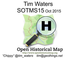
- 1. Tim Waters SOTMS15 Oct 2015 “Chippy” @tim_waters tim@geothings.net
- 2. What it isn't (quite) Historical Objects in OSM
- 3. What is it? (The logo is a hint)
- 4. OpenHistoricalMap.org Most modest mapping project EVER! Everything that has ever existed World's most out of date map.
- 5. OSM Stack Separate Server Separate Database Planet Overpass API http://overpass.openhistoricalmap.org
- 6. Examples
- 9. Saeby – Denmark 18C
- 10. Saeby – Denmark Now
- 11. Roman Roads
- 12. Roman Mainz
- 13. WWI Trenches, Artillery positions etc
- 14. Paris 19C
- 17. in OHM
- 19. OHM OSM 20C Treasure Island - SF Bay
- 20. Manhattan 1854
- 21. How to add stuff to OHM
- 22. A very old garmin
- 23. Imports Archive from OSM Tracing from Historical Maps
- 24. WikiMedia Commons - Wikimaps
- 25. Wikimaps
- 30. Editing ● Tags – normal OSM ones ● start_date end_date – YYYY / YYYY-MM-DD ● Note of source map would be nice
- 31. Simple? ● Rabbit hole ● Cart before horse? ● Gregorian dates. ● Vagueness / fuzzy
- 32. imho ● OSM way - – good enough is better than perfect. ● Contributors not historical GIS “experts” ● Do whatever and let the renderers sort it out!
- 33. Future ● More Map layers ● Timesliders. ● Vector tiles ● Better tracing tools OpenHistoricalMap.org #ohm on irc.oftc.net https://lists.openstreetmap.org/listinfo/historic https://github.com/openhistoricalmap/ “Chippy” @tim_waters tim@geothings.net