Download to read offline


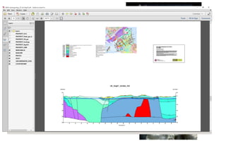


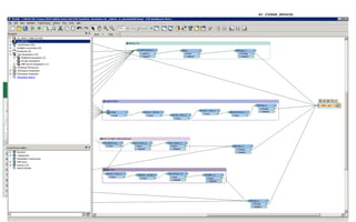


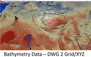


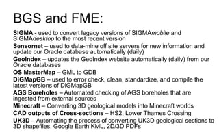


The British Geological Survey (BGS) is the UK's principal supplier of geoscience data and uses FME for a variety of tasks. BGS uses FME to convert data between formats for projects like updating databases and websites daily, cleaning and standardizing geology maps, automating borehole checking, and converting 3D models to formats like Minecraft. Examples of conversions include converting 2D data to 3D, tables to boreholes, and drawings to grids; and BGS will continue using FME for more of the same types of data preparation and conversion tasks in the future.