calculating wind speed and direction using arcgis
•Download as PPTX, PDF•
0 likes•143 views
The document outlines 8 objectives for calculating wind direction and speed for an area of interest in KPK using ArcGIS. It will obtain a shapefile for the area and stations with speed and direction data, perform kriging analysis for wind speed and direction, extract this data for the study area, create and clip a fishnet, extract multi-value points, assign symbols and directions to represent wind on a map, and present the final mapped results. The work is being presented by Saqib Javaid and Saifullah Khalil.
Report
Share
Report
Share

Recommended
Co gps energy efficient gps sensing with cloud offloading
Co gps energy efficient gps sensing with cloud offloading
ieee projects, ieee projects chennai, ieee projects 2016,ieee projects 2017,
Petroleum lunch seminar 30.10.2014
Fugro Survey performs geophysical surveys and site surveys in Norwegian waters to identify hazards for offshore drilling. They use seismic data to interpret shallow soils and identify features like shallow gas. An amplitude anomaly workflow in ArcGIS is used to standardize mapping and visualizing interpreted seismic amplitude anomalies from site surveys in a geodatabase. This allows the data to be easily incorporated into reports, presentations, web maps, and 3D visualizations.
Geocap seismic oil and gas for ArcGIS- Oil and Gas seminar October 10th
This document describes Geocap Seismic/Oil & Gas for ArcGIS software. It can be used by geoscientists for exploration and field development planning, creating high quality maps, calculating oil and gas volumes, assessing subsurface risk, and input to well planning and production forecasting. The software includes modules for seismic visualization and interpretation, and modeling petrophysical properties to calculate oil and gas volumes initially in place. It integrates seismic data, wells, and interpretations in ArcGIS for geoscience analysis and decision making.
Multi Limn Leica Hds Conference 2009
A two-person surveying firm in southeast England has successfully utilized HDS (high definition surveying) technology in their work for over 15 years. The document details how the firm is able to complete many surveying projects with just one person in the field using an HDS scanner, GPS, and total station. It discusses the phases of incorporating HDS into their business, metrics on HDS use, and examples of projects where HDS provided benefits over traditional surveying methods.
1Spatial: Edinburgh FME World Tour: Performance tips
This document discusses performance tips for processing large spatial datasets used by the Improvement Service. It recommends using a Clipper transformer to process features as early as possible, batch processing with WorkspaceRunner, and using a spatial database with SQLExecutor. An example shows clipping a polygon dataset to local authority boundaries throughout Scotland was reduced from 122 minutes to just 33 minutes using these techniques. It also discusses using FeatureReader to read files without knowing the table name in advance and creating "master" workbenches that can be run by altered "runner" workbenches to batch processes and run them in parallel.
LIDAR-derived DTM for archaeology and landscape history research some recent ...
This document discusses using QGIS and GRASS software to analyze LIDAR data and digital terrain models (DTMs) for archaeology and landscape history research. It provides examples of merging DTM tiles, applying color styles, using GRASS tools like r.slope.aspect to exaggerate surface differentials and reveal archaeological features, and overlaying processed DTMs with historical maps. GDAL and Python scripts are also used to further process the DTM data.
Oil&gas projects
This document outlines several oil and gas projects that Andrew Zolnai worked on between 1996-2015 involving major oil companies and vendors. It describes projects focused on rationalizing applications, exchanging geoscience data across workflows and systems, restructuring workflows to improve collaboration across offices and time zones, implementing GIS systems for geoscience and infrastructure, and business process reengineering of GIS and geological systems. Recent projects involved workflow and toolkit rationalization for bp and providing GIS training for oil and gas applications.
Presentation may30th
This document summarizes a project investigating the use of GIS software for weather forecasting applications. The project was completed for Scotia Weather Services Inc., which provides weather forecasting services and wants to use GIS to analyze how weather events could impact the power grid. The project used QGIS and ArcGIS to process wind speed data into maps of wind gust speeds at power line pylon heights. The outputs identified regions where wind speeds exceeded thresholds that could affect transmission lines. While QGIS is free and open source, the analysis found ArcGIS scripts were more stable and better documented than PyQGIS scripts.
Snow cover assessment tool using Python
This document describes a tool created using Python to calculate snow cover area from MODIS Terra datasets and plot the change over time. It uses PyQt4 and PySide for the GUI, GDAL for image processing, NumPy for arithmetic and file listing, and Matplotlib for plotting. The tool allows the user to select input and output folders, runs snow cover calculations on the MODIS files, and displays the results as a graph of snow cover area over time. Future improvements could involve using more GDAL and OGR capabilities to generate output maps of permanent and seasonal snow cover.
Hydrology TEP Flood Mapping Quick Guide
This document provides guidelines for using a flood monitoring service that processes satellite imagery to generate hydrological maps and statistics. It describes how to select background maps and Earth observation data, define an area of interest, choose processing services, run jobs, and view different types of results like flood maps and frequency maps.
GEP Diapason services for differential interferograms generation
The document discusses DIAPASON, a DInSAR software used for generating differential interferograms on the Geohazard Exploitation Platform (GEP). It provides an overview of DIAPASON processing services for ERS, ENVISAT, and Sentinel-1 SAR data on GEP. It also demonstrates example interferograms generated on GEP for earthquakes in Japan and New Zealand, and describes future plans to add persistent scatterer interferometry capabilities with the FASTVEL service.
2018 China Gas Fields Map
This document is a 2018 edition of a map showing China's over 880 conventional natural gas fields. The map provides the latest information on the layout and locations of China's extensive network of natural gas fields. It serves as a blueprint or guide to understanding China's natural gas extraction and distribution infrastructure.
TechBrief_LIDARvsUAV_050416_FNL
UAV and LIDAR surveys were conducted of a 5-acre site to compare elevation measurements. The UAV survey had a vertical RMSE of 7 cm and captured 271 images at 60m altitude. The LIDAR data had a resolution of 1m and vertical RMSE of 8cm after correction. Comparisons showed the UAV and LIDAR elevations varied by less than 10cm at control points and had a 90% correlation at 100 verification points, demonstrating the surveys produced comparable results.
Incorporating Google Street View Imagery with the LLPG
This document discusses incorporating Google Street View imagery into a local land and property gazetteer (LLPG) using FME. It introduces the speaker and the LLPG. It then describes a workflow in FME that takes OS Highways data, finds the closest street point to each address point, calculates the viewing angle, and generates a Street View URL template with the coordinates and angle for each address. Examples of the generated Street View URLs are provided. The document concludes that FME is capable of handling complex tasks like processing millions of points and automatically generating URLs.
Designing a Language for Spatial Computing
This document presents a design for a language for spatial computing. It discusses core concepts of spatial information like fields, objects, networks and events. It uses the example question "How long will a hill walk take?" to illustrate how spatial questions can be answered using core computations in GIS like analyzing granularity and accuracy. The goal is to develop high-level query operators, validate them in projects and create generic APIs for spatial question answering.
Kinder Morgan's Tennessee Gas Pipeline Northeast Energy Direct Pipeline Expan...
Kinder Morgan's Tennessee Gas Pipeline Northeast Energy Direct Pipeline Expan...Marcellus Drilling News
A map showing the latest proposed route for the massive, $3.3 billion Northeast Energy Direct pipeline that would bring cheap, abundant, clean-burning Marcellus Shale gas from northeastern Pennsylvania to New England energy markets. The NED project is currently in the pre-filing stage with the Federal Energy Regulatory Commission (as of July 2015).OWL-Time and enhancements
This document discusses potential enhancements to OWL-Time. It notes that OWL-Time currently uses Allen's temporal model and represents time positions using the Gregorian calendar only. It proposes a generalization that would allow OWL-Time to indicate and use other temporal reference systems like geological time scales or non-Gregorian calendars. This would support more temporal representations like coordinates on a timeline or ordinal named intervals, while retaining interval logic and avoiding changes to existing OWL-Time users and data.
Assignment 2
The document discusses the Geological and Mining Department of Suriname's use of ArcGIS software to digitally map mining concessions. It notes that previously mapping was done offline, but in August 2017 the Ministry of Natural Resources launched an online GMD website hosting the mining concession maps. The website, accessible at a given URL, features an interactive map of gold and building material concessions as well as examples of how ArcGIS allows joining related tabular data. It highlights that the website benefits students, investors, entrepreneurs and other government ministries in Suriname.
BACK TRAJECTORY CLUSTER
This document discusses using a K-Means algorithm method to identify the source regions of black carbon found over the Himalayan region. The K-Means algorithm clusters seven-day back-trajectories of air parcels over Darjeeling to minimize the total energy of the clusters and assign each data point to the nearest cluster centroid, in order to determine the source regions of the black carbon transported over the Himalayas. The study uses back-trajectories from May 2015 retrieved from the Hysplit Air Trajectory Model to apply the K-Means algorithm and identify the source of black carbon over Darjeeling.
40th_csrs&ga_fredericton2019_ndirlarouche
This document presents a method for statically calibrating the boresight angles of mobile LiDAR systems. It involves collecting scan lines from different positions on a planar surface and estimating the boresight angles through least squares adjustment to minimize misalignment. The method was tested on a commercial MLS, producing repeatable results comparable to more complex dynamic calibration methods. It has advantages of simplicity and not requiring precise metrological equipment. Validation with a surveying instrument showed improved alignment when using the estimated angles over the manufacturer's values.
Centre of Geographic Sciences Remote Sensing Field Camp 2015
Students from the 2015 Centre of Geographic Sciences Remote Sensing Field Camp will collect aerial photographs of the COGS grounds using GoPro cameras to create an orthomosaic with 50cm resolution by May 22nd. They will also collect LiDAR scans of Sinclair Inn in Annapolis Royal using a Faro scanner to create a georeferenced point cloud and 3D model with 10cm point density accuracy. The document outlines the preparation, data collection, post-processing, and validation steps for both the aerial photography and Faro scanning projects.
FME and the BGS in 2016/2017
The British Geological Survey (BGS) is the UK's principal supplier of geoscience data and uses FME for a variety of tasks. BGS uses FME to convert data between formats for projects like updating databases and websites daily, cleaning and standardizing geology maps, automating borehole checking, and converting 3D models to formats like Minecraft. Examples of conversions include converting 2D data to 3D, tables to boreholes, and drawings to grids; and BGS will continue using FME for more of the same types of data preparation and conversion tasks in the future.
On the reconstruction of quad pol sar data from compact polarimetry data for ...
The document discusses reconstructing quad-polarized synthetic aperture radar (SAR) data from compact polarimetry data for ocean target detection. It presents an empirical reconstruction model that was tested on ocean scenes and found to outperform two existing reconstruction algorithms by providing superior reconstruction and target detection performance. The empirical model is a simple approach whose assumptions were found to be more valid for ocean scenes compared to the two published reconstruction algorithms.
Arc 1950
This document provides details about the Arc 1950 datum including its name, code, ellipsoid, prime meridian, scope, realization epoch, area of use, and source. The Arc 1950 datum uses the Clarke 1880 ellipsoid with a semi-major axis of 6378249.145 meters and inverse flattening of 293.4663077 meters. It has been used for topographic mapping and geodetic surveys in Botswana, Malawi, Zambia, and Zimbabwe since 1950.
2nd Galileo Android Hackathon intro
This document introduces GNSS raw measurements that are available on Android smartphones through the android.location API. It discusses two main GNSS APIs - android.gms.location which simplifies positioning for applications but focuses on battery life, and android.location which gives access to more detailed GNSS observations at the cost of increased battery usage. Applications that could make use of raw GNSS measurements on smartphones include crowdsourcing, low-cost reference networks, and improving positioning in urban areas. Sample code is provided showing how to access raw observations and calculate a position from them.
Petroleum seminar 28.05.2014
North Energy is an oil and gas exploration company based in Norway with offices in four locations. They use GIS software ArcGIS to integrate and analyze exploration data from their interpretation software Petrel. This includes directly importing grids, seismic attributes, and maps into ArcGIS to visualize results. Well data is also joined to attribute data to analyze lithology and reservoir properties. They have implemented a Portal for ArcGIS to publish maps and data for sharing internally and to manage their prospect inventory using a prospect uploader tool.
Hexagon binning for petroleum data
Hexagonal binning helps aggregate large point datasets like oil wells into hexagon polygons to reduce overlap and improve map visualization at smaller scales. The document describes using hexagonal binning to summarize over 50,000 oil wells in the Gulf of Mexico across different scales, calculating statistics like mean depth and earliest drilling date for each hexagon. It provides tips for storing interim results, exporting joined tables, and using multiple hexagon sizes to balance data density and map performance for ArcGIS Online.
The History of Stoke Newington Street Names
Presented at the Stoke Newington Literary Festival on 9th June 2024
www.StokeNewingtonHistory.com
RHEOLOGY Physical pharmaceutics-II notes for B.pharm 4th sem students
Physical pharmaceutics notes for B.pharm students
More Related Content
What's hot
Snow cover assessment tool using Python
This document describes a tool created using Python to calculate snow cover area from MODIS Terra datasets and plot the change over time. It uses PyQt4 and PySide for the GUI, GDAL for image processing, NumPy for arithmetic and file listing, and Matplotlib for plotting. The tool allows the user to select input and output folders, runs snow cover calculations on the MODIS files, and displays the results as a graph of snow cover area over time. Future improvements could involve using more GDAL and OGR capabilities to generate output maps of permanent and seasonal snow cover.
Hydrology TEP Flood Mapping Quick Guide
This document provides guidelines for using a flood monitoring service that processes satellite imagery to generate hydrological maps and statistics. It describes how to select background maps and Earth observation data, define an area of interest, choose processing services, run jobs, and view different types of results like flood maps and frequency maps.
GEP Diapason services for differential interferograms generation
The document discusses DIAPASON, a DInSAR software used for generating differential interferograms on the Geohazard Exploitation Platform (GEP). It provides an overview of DIAPASON processing services for ERS, ENVISAT, and Sentinel-1 SAR data on GEP. It also demonstrates example interferograms generated on GEP for earthquakes in Japan and New Zealand, and describes future plans to add persistent scatterer interferometry capabilities with the FASTVEL service.
2018 China Gas Fields Map
This document is a 2018 edition of a map showing China's over 880 conventional natural gas fields. The map provides the latest information on the layout and locations of China's extensive network of natural gas fields. It serves as a blueprint or guide to understanding China's natural gas extraction and distribution infrastructure.
TechBrief_LIDARvsUAV_050416_FNL
UAV and LIDAR surveys were conducted of a 5-acre site to compare elevation measurements. The UAV survey had a vertical RMSE of 7 cm and captured 271 images at 60m altitude. The LIDAR data had a resolution of 1m and vertical RMSE of 8cm after correction. Comparisons showed the UAV and LIDAR elevations varied by less than 10cm at control points and had a 90% correlation at 100 verification points, demonstrating the surveys produced comparable results.
Incorporating Google Street View Imagery with the LLPG
This document discusses incorporating Google Street View imagery into a local land and property gazetteer (LLPG) using FME. It introduces the speaker and the LLPG. It then describes a workflow in FME that takes OS Highways data, finds the closest street point to each address point, calculates the viewing angle, and generates a Street View URL template with the coordinates and angle for each address. Examples of the generated Street View URLs are provided. The document concludes that FME is capable of handling complex tasks like processing millions of points and automatically generating URLs.
Designing a Language for Spatial Computing
This document presents a design for a language for spatial computing. It discusses core concepts of spatial information like fields, objects, networks and events. It uses the example question "How long will a hill walk take?" to illustrate how spatial questions can be answered using core computations in GIS like analyzing granularity and accuracy. The goal is to develop high-level query operators, validate them in projects and create generic APIs for spatial question answering.
Kinder Morgan's Tennessee Gas Pipeline Northeast Energy Direct Pipeline Expan...
Kinder Morgan's Tennessee Gas Pipeline Northeast Energy Direct Pipeline Expan...Marcellus Drilling News
A map showing the latest proposed route for the massive, $3.3 billion Northeast Energy Direct pipeline that would bring cheap, abundant, clean-burning Marcellus Shale gas from northeastern Pennsylvania to New England energy markets. The NED project is currently in the pre-filing stage with the Federal Energy Regulatory Commission (as of July 2015).OWL-Time and enhancements
This document discusses potential enhancements to OWL-Time. It notes that OWL-Time currently uses Allen's temporal model and represents time positions using the Gregorian calendar only. It proposes a generalization that would allow OWL-Time to indicate and use other temporal reference systems like geological time scales or non-Gregorian calendars. This would support more temporal representations like coordinates on a timeline or ordinal named intervals, while retaining interval logic and avoiding changes to existing OWL-Time users and data.
Assignment 2
The document discusses the Geological and Mining Department of Suriname's use of ArcGIS software to digitally map mining concessions. It notes that previously mapping was done offline, but in August 2017 the Ministry of Natural Resources launched an online GMD website hosting the mining concession maps. The website, accessible at a given URL, features an interactive map of gold and building material concessions as well as examples of how ArcGIS allows joining related tabular data. It highlights that the website benefits students, investors, entrepreneurs and other government ministries in Suriname.
BACK TRAJECTORY CLUSTER
This document discusses using a K-Means algorithm method to identify the source regions of black carbon found over the Himalayan region. The K-Means algorithm clusters seven-day back-trajectories of air parcels over Darjeeling to minimize the total energy of the clusters and assign each data point to the nearest cluster centroid, in order to determine the source regions of the black carbon transported over the Himalayas. The study uses back-trajectories from May 2015 retrieved from the Hysplit Air Trajectory Model to apply the K-Means algorithm and identify the source of black carbon over Darjeeling.
40th_csrs&ga_fredericton2019_ndirlarouche
This document presents a method for statically calibrating the boresight angles of mobile LiDAR systems. It involves collecting scan lines from different positions on a planar surface and estimating the boresight angles through least squares adjustment to minimize misalignment. The method was tested on a commercial MLS, producing repeatable results comparable to more complex dynamic calibration methods. It has advantages of simplicity and not requiring precise metrological equipment. Validation with a surveying instrument showed improved alignment when using the estimated angles over the manufacturer's values.
Centre of Geographic Sciences Remote Sensing Field Camp 2015
Students from the 2015 Centre of Geographic Sciences Remote Sensing Field Camp will collect aerial photographs of the COGS grounds using GoPro cameras to create an orthomosaic with 50cm resolution by May 22nd. They will also collect LiDAR scans of Sinclair Inn in Annapolis Royal using a Faro scanner to create a georeferenced point cloud and 3D model with 10cm point density accuracy. The document outlines the preparation, data collection, post-processing, and validation steps for both the aerial photography and Faro scanning projects.
FME and the BGS in 2016/2017
The British Geological Survey (BGS) is the UK's principal supplier of geoscience data and uses FME for a variety of tasks. BGS uses FME to convert data between formats for projects like updating databases and websites daily, cleaning and standardizing geology maps, automating borehole checking, and converting 3D models to formats like Minecraft. Examples of conversions include converting 2D data to 3D, tables to boreholes, and drawings to grids; and BGS will continue using FME for more of the same types of data preparation and conversion tasks in the future.
On the reconstruction of quad pol sar data from compact polarimetry data for ...
The document discusses reconstructing quad-polarized synthetic aperture radar (SAR) data from compact polarimetry data for ocean target detection. It presents an empirical reconstruction model that was tested on ocean scenes and found to outperform two existing reconstruction algorithms by providing superior reconstruction and target detection performance. The empirical model is a simple approach whose assumptions were found to be more valid for ocean scenes compared to the two published reconstruction algorithms.
On the reconstruction of quad pol sar data from compact polarimetry data for ...
The document discusses reconstructing quad-polarized synthetic aperture radar (SAR) data from compact polarimetry data for ocean target detection. It presents an empirical reconstruction model that was tested on ocean scenes and found to outperform two existing reconstruction algorithms by providing superior reconstruction and target detection performance. The empirical model is a simple approach whose assumptions were found to be more valid for ocean scenes compared to the two published reconstruction algorithms.
Arc 1950
This document provides details about the Arc 1950 datum including its name, code, ellipsoid, prime meridian, scope, realization epoch, area of use, and source. The Arc 1950 datum uses the Clarke 1880 ellipsoid with a semi-major axis of 6378249.145 meters and inverse flattening of 293.4663077 meters. It has been used for topographic mapping and geodetic surveys in Botswana, Malawi, Zambia, and Zimbabwe since 1950.
2nd Galileo Android Hackathon intro
This document introduces GNSS raw measurements that are available on Android smartphones through the android.location API. It discusses two main GNSS APIs - android.gms.location which simplifies positioning for applications but focuses on battery life, and android.location which gives access to more detailed GNSS observations at the cost of increased battery usage. Applications that could make use of raw GNSS measurements on smartphones include crowdsourcing, low-cost reference networks, and improving positioning in urban areas. Sample code is provided showing how to access raw observations and calculate a position from them.
Petroleum seminar 28.05.2014
North Energy is an oil and gas exploration company based in Norway with offices in four locations. They use GIS software ArcGIS to integrate and analyze exploration data from their interpretation software Petrel. This includes directly importing grids, seismic attributes, and maps into ArcGIS to visualize results. Well data is also joined to attribute data to analyze lithology and reservoir properties. They have implemented a Portal for ArcGIS to publish maps and data for sharing internally and to manage their prospect inventory using a prospect uploader tool.
Hexagon binning for petroleum data
Hexagonal binning helps aggregate large point datasets like oil wells into hexagon polygons to reduce overlap and improve map visualization at smaller scales. The document describes using hexagonal binning to summarize over 50,000 oil wells in the Gulf of Mexico across different scales, calculating statistics like mean depth and earliest drilling date for each hexagon. It provides tips for storing interim results, exporting joined tables, and using multiple hexagon sizes to balance data density and map performance for ArcGIS Online.
What's hot (20)
GEP Diapason services for differential interferograms generation
GEP Diapason services for differential interferograms generation
Incorporating Google Street View Imagery with the LLPG
Incorporating Google Street View Imagery with the LLPG
Kinder Morgan's Tennessee Gas Pipeline Northeast Energy Direct Pipeline Expan...
Kinder Morgan's Tennessee Gas Pipeline Northeast Energy Direct Pipeline Expan...
Centre of Geographic Sciences Remote Sensing Field Camp 2015
Centre of Geographic Sciences Remote Sensing Field Camp 2015
On the reconstruction of quad pol sar data from compact polarimetry data for ...
On the reconstruction of quad pol sar data from compact polarimetry data for ...
On the reconstruction of quad pol sar data from compact polarimetry data for ...
On the reconstruction of quad pol sar data from compact polarimetry data for ...
Recently uploaded
The History of Stoke Newington Street Names
Presented at the Stoke Newington Literary Festival on 9th June 2024
www.StokeNewingtonHistory.com
RHEOLOGY Physical pharmaceutics-II notes for B.pharm 4th sem students
Physical pharmaceutics notes for B.pharm students
বাংলাদেশ অর্থনৈতিক সমীক্ষা (Economic Review) ২০২৪ UJS App.pdf
বাংলাদেশের অর্থনৈতিক সমীক্ষা ২০২৪ [Bangladesh Economic Review 2024 Bangla.pdf] কম্পিউটার , ট্যাব ও স্মার্ট ফোন ভার্সন সহ সম্পূর্ণ বাংলা ই-বুক বা pdf বই " সুচিপত্র ...বুকমার্ক মেনু 🔖 ও হাইপার লিংক মেনু 📝👆 যুক্ত ..
আমাদের সবার জন্য খুব খুব গুরুত্বপূর্ণ একটি বই ..বিসিএস, ব্যাংক, ইউনিভার্সিটি ভর্তি ও যে কোন প্রতিযোগিতা মূলক পরীক্ষার জন্য এর খুব ইম্পরট্যান্ট একটি বিষয় ...তাছাড়া বাংলাদেশের সাম্প্রতিক যে কোন ডাটা বা তথ্য এই বইতে পাবেন ...
তাই একজন নাগরিক হিসাবে এই তথ্য গুলো আপনার জানা প্রয়োজন ...।
বিসিএস ও ব্যাংক এর লিখিত পরীক্ষা ...+এছাড়া মাধ্যমিক ও উচ্চমাধ্যমিকের স্টুডেন্টদের জন্য অনেক কাজে আসবে ...
Chapter 4 - Islamic Financial Institutions in Malaysia.pptx
Chapter 4 - Islamic Financial Institutions in Malaysia.pptxMohd Adib Abd Muin, Senior Lecturer at Universiti Utara Malaysia
This slide is special for master students (MIBS & MIFB) in UUM. Also useful for readers who are interested in the topic of contemporary Islamic banking.
The Diamonds of 2023-2024 in the IGRA collection
A review of the growth of the Israel Genealogy Research Association Database Collection for the last 12 months. Our collection is now passed the 3 million mark and still growing. See which archives have contributed the most. See the different types of records we have, and which years have had records added. You can also see what we have for the future.
Your Skill Boost Masterclass: Strategies for Effective Upskilling
Your Skill Boost Masterclass: Strategies for Effective UpskillingExcellence Foundation for South Sudan
Strategies for Effective Upskilling is a presentation by Chinwendu Peace in a Your Skill Boost Masterclass organisation by the Excellence Foundation for South Sudan on 08th and 09th June 2024 from 1 PM to 3 PM on each day.PCOS corelations and management through Ayurveda.
This presentation includes basic of PCOS their pathology and treatment and also Ayurveda correlation of PCOS and Ayurvedic line of treatment mentioned in classics.
BÀI TẬP BỔ TRỢ TIẾNG ANH LỚP 9 CẢ NĂM - GLOBAL SUCCESS - NĂM HỌC 2024-2025 - ...
BÀI TẬP BỔ TRỢ TIẾNG ANH LỚP 9 CẢ NĂM - GLOBAL SUCCESS - NĂM HỌC 2024-2025 - ...Nguyen Thanh Tu Collection
https://app.box.com/s/tacvl9ekroe9hqupdnjruiypvm9rdaneHow to Fix the Import Error in the Odoo 17
An import error occurs when a program fails to import a module or library, disrupting its execution. In languages like Python, this issue arises when the specified module cannot be found or accessed, hindering the program's functionality. Resolving import errors is crucial for maintaining smooth software operation and uninterrupted development processes.
Chapter wise All Notes of First year Basic Civil Engineering.pptx
Chapter wise All Notes of First year Basic Civil Engineering
Syllabus
Chapter-1
Introduction to objective, scope and outcome the subject
Chapter 2
Introduction: Scope and Specialization of Civil Engineering, Role of civil Engineer in Society, Impact of infrastructural development on economy of country.
Chapter 3
Surveying: Object Principles & Types of Surveying; Site Plans, Plans & Maps; Scales & Unit of different Measurements.
Linear Measurements: Instruments used. Linear Measurement by Tape, Ranging out Survey Lines and overcoming Obstructions; Measurements on sloping ground; Tape corrections, conventional symbols. Angular Measurements: Instruments used; Introduction to Compass Surveying, Bearings and Longitude & Latitude of a Line, Introduction to total station.
Levelling: Instrument used Object of levelling, Methods of levelling in brief, and Contour maps.
Chapter 4
Buildings: Selection of site for Buildings, Layout of Building Plan, Types of buildings, Plinth area, carpet area, floor space index, Introduction to building byelaws, concept of sun light & ventilation. Components of Buildings & their functions, Basic concept of R.C.C., Introduction to types of foundation
Chapter 5
Transportation: Introduction to Transportation Engineering; Traffic and Road Safety: Types and Characteristics of Various Modes of Transportation; Various Road Traffic Signs, Causes of Accidents and Road Safety Measures.
Chapter 6
Environmental Engineering: Environmental Pollution, Environmental Acts and Regulations, Functional Concepts of Ecology, Basics of Species, Biodiversity, Ecosystem, Hydrological Cycle; Chemical Cycles: Carbon, Nitrogen & Phosphorus; Energy Flow in Ecosystems.
Water Pollution: Water Quality standards, Introduction to Treatment & Disposal of Waste Water. Reuse and Saving of Water, Rain Water Harvesting. Solid Waste Management: Classification of Solid Waste, Collection, Transportation and Disposal of Solid. Recycling of Solid Waste: Energy Recovery, Sanitary Landfill, On-Site Sanitation. Air & Noise Pollution: Primary and Secondary air pollutants, Harmful effects of Air Pollution, Control of Air Pollution. . Noise Pollution Harmful Effects of noise pollution, control of noise pollution, Global warming & Climate Change, Ozone depletion, Greenhouse effect
Text Books:
1. Palancharmy, Basic Civil Engineering, McGraw Hill publishers.
2. Satheesh Gopi, Basic Civil Engineering, Pearson Publishers.
3. Ketki Rangwala Dalal, Essentials of Civil Engineering, Charotar Publishing House.
4. BCP, Surveying volume 1
BÀI TẬP BỔ TRỢ TIẾNG ANH 8 CẢ NĂM - GLOBAL SUCCESS - NĂM HỌC 2023-2024 (CÓ FI...
BÀI TẬP BỔ TRỢ TIẾNG ANH 8 CẢ NĂM - GLOBAL SUCCESS - NĂM HỌC 2023-2024 (CÓ FI...Nguyen Thanh Tu Collection
https://app.box.com/s/y977uz6bpd3af4qsebv7r9b7s21935vdANATOMY AND BIOMECHANICS OF HIP JOINT.pdf
it describes the bony anatomy including the femoral head , acetabulum, labrum . also discusses the capsule , ligaments . muscle that act on the hip joint and the range of motion are outlined. factors affecting hip joint stability and weight transmission through the joint are summarized.
How to Build a Module in Odoo 17 Using the Scaffold Method
Odoo provides an option for creating a module by using a single line command. By using this command the user can make a whole structure of a module. It is very easy for a beginner to make a module. There is no need to make each file manually. This slide will show how to create a module using the scaffold method.
Recently uploaded (20)
RHEOLOGY Physical pharmaceutics-II notes for B.pharm 4th sem students
RHEOLOGY Physical pharmaceutics-II notes for B.pharm 4th sem students
বাংলাদেশ অর্থনৈতিক সমীক্ষা (Economic Review) ২০২৪ UJS App.pdf
বাংলাদেশ অর্থনৈতিক সমীক্ষা (Economic Review) ২০২৪ UJS App.pdf
NEWSPAPERS - QUESTION 1 - REVISION POWERPOINT.pptx
NEWSPAPERS - QUESTION 1 - REVISION POWERPOINT.pptx
Chapter 4 - Islamic Financial Institutions in Malaysia.pptx
Chapter 4 - Islamic Financial Institutions in Malaysia.pptx
Digital Artefact 1 - Tiny Home Environmental Design
Digital Artefact 1 - Tiny Home Environmental Design
Your Skill Boost Masterclass: Strategies for Effective Upskilling
Your Skill Boost Masterclass: Strategies for Effective Upskilling
BÀI TẬP BỔ TRỢ TIẾNG ANH LỚP 9 CẢ NĂM - GLOBAL SUCCESS - NĂM HỌC 2024-2025 - ...
BÀI TẬP BỔ TRỢ TIẾNG ANH LỚP 9 CẢ NĂM - GLOBAL SUCCESS - NĂM HỌC 2024-2025 - ...
Liberal Approach to the Study of Indian Politics.pdf
Liberal Approach to the Study of Indian Politics.pdf
Chapter wise All Notes of First year Basic Civil Engineering.pptx
Chapter wise All Notes of First year Basic Civil Engineering.pptx
BÀI TẬP BỔ TRỢ TIẾNG ANH 8 CẢ NĂM - GLOBAL SUCCESS - NĂM HỌC 2023-2024 (CÓ FI...
BÀI TẬP BỔ TRỢ TIẾNG ANH 8 CẢ NĂM - GLOBAL SUCCESS - NĂM HỌC 2023-2024 (CÓ FI...
How to Build a Module in Odoo 17 Using the Scaffold Method
How to Build a Module in Odoo 17 Using the Scaffold Method
calculating wind speed and direction using arcgis
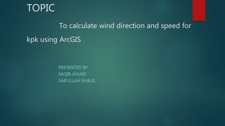
- 1. TOPIC To calculate wind direction and speed for kpk using ArcGIS PRESENTED BY SAQIB JAVAID SAIFULLAH KHALIL
- 2. OBJECTIVE 1 GETTING SHAPE FILE FOR AREA OF INTEREST
- 3. GETTING SHAPEFILE FOR STATION HAVING SPEED AND DIRECTION DATA IN ATTRIBUTE
- 4. OBJECTIVE 2 KRIGING FOR SPEED AND DIRECTION KRIGING FOR SPEED
- 8. OBJECTIVE 3 EXTRACTION OF DIRECTION FOR STUDY AREA
- 9. OUTPUT FOR DIRECTION EXTRACTION
- 10. EXTRACTION OF SPEED FOR STUDY AREA
- 11. OUTPUT FOR SPEED EXTRACTION
- 12. OBJECTIVE 4 CREATING FISHNET FOR STUDY AREA
- 13. FISHNET OUTPUT
- 14. OBJECTIVE 5 CLIPING FISHNET FOR STUDY AREA
- 15. CLIP OUTPUT
- 16. OBJECTIVE 6 EXTRACT MULTI VALUE TO POINT
- 17. EXTRACT POINT VALUE OUTPUT
- 18. OBJECTIVE 7 ASSIGNING SYMBOL AND DIRECTION
- 19. ASSIGNING ARROW
- 20. OUTPUT
- 21. OBJECTI VE 8; PRESENTATION OF MAP
- 22. THANKS