Equatorial regions are very interesting regions, that are evergreen in nature, Many forests are seen in such regions like Amazon, USA, and Africa. They are the most beautiful places with the presence of flowers, trees and rainfalls.
Here is another creative presentation by your slide maker on the topic "EQUIATORIAL REGIONS OF THE WORLD". Hope you like it. If you like it then please, *like*, *Download* and *Share*.
By- Slide_maker4u (Abhishek Sharma)
*******For presentation Orders, contact me on the Email addresses Written below********
Email- Sharmaabhishek576@gmail.com
or
Sharmacomputers87@gmail.com
*******THANK YOU***************
This document discusses the major landforms of the Earth. It describes landforms as natural shapes or features on the Earth's surface, including mountains, valleys, plateaus, plains, islands, and peninsulas. Mountains form through various geological processes like folding, faulting, volcanic activity, and erosion. There are different types of mountains such as fold mountains, block mountains, volcanic mountains, and residual mountains. Valleys can be V-shaped, U-shaped, or flat-floored. Other landforms discussed include plateaus, plains, islands, and peninsulas.
The document describes several different climate regions around the world, including their key characteristics. The hot, wet equatorial region is described as having great temperature uniformity, the heaviest rainfall on the planet, and the densest forests containing the greatest biodiversity. The monsoon region is said to have three distinct seasons and be greatly impacted by the periodic reversal of wind systems. Savanna regions are described as having the tallest grasses, being prone to fires, and containing the greatest variety of large herbivores and carnivores.
Here are the key differences between moist and dry deciduous forests:
- Moist deciduous forests receive higher rainfall between 100-200 cm, while dry deciduous forests receive lower rainfall between 75-100 cm.
- Moist deciduous forests are found in rainier areas like the Northeastern states, along the Himalayan foothills, Jharkhand, West Orissa, Chhattisgarh and the eastern slopes of the Western Ghats.
- Dry deciduous forests are found in less rainy parts of the peninsular plateau, plains of Bihar and Uttar Pradesh, and have more open stretches between trees.
India has a variety of landforms created by geological processes over time. It has mountains, plains, deserts, and plateaus formed during different geological periods. India's relief has also been modified by weathering, erosion, and deposition. The Himalayas were formed by the collision of the Indian and Eurasian tectonic plates over millions of years, which caused the sediments of the former Tethys Sea to fold and uplift into mountains. The northern plains were formed by deposits of the Indus, Ganges, and Brahmaputra river systems and their tributaries. The Peninsular Plateau in southern India was formed from the oldest rock of the former Gondwana land and is divided into
Class 7 chapter 6 , natural vegetation and wild life PoonamMudaliar
This ppt is class 7 Geography, chapter 6 , Natural vegetation and wild life, NCERT and Chhattisgarh board.
It's helpful for on-line and offline teaching.
The northern plain of India is formed by the interplay of three major rivers - the Ganga, Indus, and Brahmaputra. During the Tertiary period, a sea called Tethys extended north and west. Due to the movement of tectonic plates, the Indian plate underthrust the Eurasian plate, causing folding of marine sediments from compressive forces. This created the Himalayas and left the northern plain as a foredeep filled with sediments eroded from the mountains. The three dominant rivers continue depositing alluvial soil, making the plain one of the most fertile regions and important agricultural areas in India.
The document summarizes the climate and geography of the hot and wet equatorial region, which extends from 100 north to 100 south of the equator. This region experiences high heat and rainfall throughout the year and is home to equatorial rainforests like the Amazon and Congo basins. These forests contain four layers - the forest floor, understory, canopy, and emergent layers - and support a rich diversity of plant and animal life. Indigenous tribes traditionally engaged in shifting agriculture, hunting, fishing and mining for subsistence, while plantation agriculture of crops like rubber, tea and cocoa was later introduced. However, the region now faces challenges of balancing economic development with environmental protection and preserving tribal ways of life.
Natural vegetation and wildlife slideshare for class 7 with 33 slidespruthvik p
1. The document describes several types of natural vegetation and their characteristics, including tropical evergreen forest, tropical deciduous forest, temperate evergreen forest, temperate deciduous forest, Mediterranean vegetation, coniferous forest, desert vegetation, tundra vegetation, tropical grasslands, and temperate grasslands.
2. Each vegetation type is defined by its location, climate, dominant plant species, and examples of animal life found there.
3. Key details provided include rainfall levels, temperature ranges, tree heights, economically important trees, seasonal patterns of leaf drop, and adaptations of plants and animals to each environment.
The document summarizes the climate and vegetation zones of South Asia. It describes how tropical rainforests grow along coastal regions receiving high rainfall, like Sri Lanka and the Bay of Bengal. These rainforests contain trees like ebony, vines and orchids. Deciduous forests surround the rainforests in the Western Ghats. Other forest types mentioned include bamboo and mango forests in Bangladesh and the extensive mangrove forests of the Sundarbans. The climate varies from tropical wet along the coasts to tropical dry savanna inland and deserts in the northwest, like the Thar Desert. Seasonal monsoons and cyclones impact the region, sometimes causing natural disasters.
The document discusses life in deserts, focusing on the Sahara Desert. It describes the Sahara's climate as scorching hot with short rainy seasons and cloudless, clear skies. Temperatures during the day can reach 50 degrees Celsius while nights can drop to near zero. The oases in the Sahara support settled populations who grow crops like dates, rice, wheat, and beans using irrigation from underground water. Recent discovery of oil in countries within the Sahara has transformed the region, bringing office buildings, highways, and new jobs in the oil industry that are replacing nomadic lifestyles.
The document summarizes the three parallel mountain ranges that make up the Himalayas in northern India. The highest range is the Great Himalayas or Himadri, containing the highest peaks in the world like Mount Everest. The Lesser Himalayas or Himachal range has numerous hill stations and forests. The lowest range is the Lower Himalayas or Shiwalik, where farming and wildlife thrive in the foothills. Glaciers in the higher ranges feed major rivers like the Ganges.
Natural vegetation and Wildlife - Class VIIIAkanksha
Natural vegetation includes plants that grow without human intervention. Wildlife refers to animals that live in natural habitats away from human settlements. The document describes various types of natural vegetation like forests, grasslands, and shrubs found in different parts of the world based on climate and rainfall. It also discusses the characteristic wildlife found in each vegetation type, such as tropical forests being home to monkeys, apes, and snakes, while temperate grasslands support herbivores like wild horses and antelopes.
Natural vegetation refers to plants and trees that exist in an area before human modification. There are several categories of natural vegetation, including forests, grasslands, and shrubs. Forests form complete ecosystems and include trees, plants, animals, and microorganisms. There are several types of forests such as tropical rainforests, tropical deciduous forests, temperate evergreen forests, temperate deciduous forests, coniferous forests, and Mediterranean forests. Grasslands are areas dominated by grasses and can be tropical or temperate. They provide habitat for many large herbivores. Wildlife is important both ecologically and economically as it helps maintain balance in nature and can be used to generate income.
Hunter-gatherers began transitioning to farming and herding around 10,000 years ago. They started domesticating plants like wheat and barley by selecting seeds from productive crops to sow. They also domesticated animals like sheep and goats. This led to the establishment of permanent settlements like at Burzoham in Kashmir, where archaeologists have found evidence of pit houses and grain storage. Sites like Mehrgarh in present-day Pakistan provide evidence of early farming through remains of domesticated crops and animals.
The Northern Plains of India were formed by the deposition of sediments from the Himalayan mountains and peninsular plateau over millions of years. The plains stretch from the Indus River in the west to the Brahmaputra River in the east, covering an area of 7 lakh square kilometers. The major rivers of the Ganga and Brahmaputra plains, along with their many distributaries, have deposited fertile alluvial soil, making this one of the most productive agricultural regions in India.
This document discusses the beginnings of farming and herding lifestyles. It describes how early humans transitioned from nomadic hunter-gatherers to settling in places and cultivating plants and domesticating animals. They discovered which plants grew well in different environments and learned to store seeds and the harvested plants. They also started keeping animals like sheep and goats near their camps and protecting them. This led to the first settled villages like Mehrgarh in modern-day Pakistan and Daojali Hading in China, where evidence of plant cultivation and animal domestication has been found, along with artifacts like pottery and tools.
This document summarizes different types of natural vegetation found in India. It discusses flaura and fauna, and provides details on the number of plant and animal species in India. It then describes different types of forests found in India like tropical rainforests, tropical deciduous forests, tropical thorn forests and scrubs, montane forests, and mangrove forests. For each forest type, it lists example plant and animal species found there. It also discusses the importance of trees, wildlife preservation, and the economic value of wild plants and animals.
1) Diesel and electric engines have largely replaced the steam engines. Settlements can be permanent or temporary. Transport is the means by which people and goods move. The plains have a dense network of roads.
Natural vegetation can be classified into forests, grasslands, and shrubs. Forests grow where temperature and rainfall support trees, and include tropical rainforests, tropical deciduous forests, temperate evergreen and deciduous forests, and coniferous forests. Grasslands include tropical and temperate grasslands. Shrubs include thorny bushes found in dry, desert-like regions. Tundra vegetation consists of mosses, lichens, and small shrubs in polar regions.
The document discusses how pastoralist communities in India and Africa have been impacted by colonial rule and policies. In India, colonial rulers reduced grazing lands by converting them into cultivated farms and declaring forests off limits, negatively impacting pastoralists' livelihoods. In Africa, colonial powers redrew borders separating pastoralist groups from grazing lands, restricting their migration patterns. This has led to loss of grazing lands and livestock deaths during droughts for communities like the Maasai in Kenya and Tanzania. The colonial policies eroded traditional pastoralist lifestyles and authority structures, creating new socioeconomic divisions within these communities.
The document discusses two major river basins - the Amazon Basin and the Ganga-Brahmaputra Basin. The Amazon Basin covers parts of South America and is home to the dense Amazon rainforest, which contains a diverse array of flora and fauna. The Ganga-Brahmaputra Basin lies in the Indian subcontinent and is drained by the Ganga and Brahmaputra rivers and their tributaries. It contains plains, Himalayan foothills, and the Sundarbans delta and experiences a monsoon climate. Major cities in the basin include Kolkata, Patna, and Varanasi.
The document discusses the four main life-supporting systems on Earth: lithosphere, atmosphere, hydrosphere, and biosphere. It provides details on each system, including that the lithosphere comprises the solid rocks and minerals of the planet, the atmosphere is the gaseous envelope surrounding Earth, the hydrosphere covers the planet with water, and the biosphere is the total of all three spheres that supports life. It then goes on to describe the composition and key features of the lithosphere, hydrosphere, and atmosphere.
This PPt may be useful for the 9th std students. it is based on the 9th Std Geography (CBSE) book. for better understanding, some of the other related PPTs and pictures are also included in this PPT. Let enjoy your studies. yours.. R. Ezhilraman, PGT-Social Science, JNV Lepakshi, Ananthapur Andhra Pradesh
The document discusses India's climate zones and natural vegetation. It describes the four main seasons - winter, summer, monsoon, and post-monsoon - and their characteristic weather patterns. It also outlines the major types of natural vegetation found in India, including tropical and deciduous forests, thorny bushes, mountain vegetation, and mangrove forests. Key details are provided on the location and features of these vegetation zones.
This document provides an overview of the nature and scope of human geography. It discusses how human geography studies the relationship between human societies and the earth's surface. Key points covered include the different approaches to geography like environmental determinism and possibilism. Environmental determinism suggests that the environment determines human activities, while possibilism argues that humans can modify their environment. The document also discusses new determinism as a middle path between these views. It outlines the different schools of thought in human geography like welfare, radical, and behavioral schools. Finally, it discusses how human geography relates to other social science disciplines through different time periods.
The Indian sub-continent is characterised by a great and diversified group of physical features.
They are classified into the following physiographic units :
1. The Himalayas and other ranges.
2. The Indo-Gangetic plain.
3. The Thar Deserts
4. The Peninsular Plateau.
5. The Coastal belts and Islands.
This document provides an overview of different ecosystem types, including terrestrial ecosystems like forests, grasslands, deserts, and mountains, and aquatic ecosystems like marine and freshwater. It defines ecosystem as a biological environment consisting of organisms and abiotic components that interact. It describes various forest, grassland, desert, and tundra biomes and their locations. It also outlines the economic and environmental importance of ecosystems in providing resources and regulating climate and water.
Aquatic ecosystems include freshwater ecosystems like lakes, ponds, rivers and streams, as well as marine ecosystems like oceans, estuaries and coral reefs. Terrestrial ecosystems include forest ecosystems like coniferous, deciduous and rainforests, as well as tundra, desert and grassland ecosystems. Mixed ecosystems combine aquatic and terrestrial elements, such as wetlands that flood seasonally and coastlines where land meets the sea.
The natural environment chapter discusses the natural environment of various regions including Southeast Asia, East Asia, Europe, and North America. It defines the natural environment and discusses components like climate, vegetation, wildlife, and natural hazards specific to each region. Some key environmental problems discussed are natural disasters like tsunamis, diseases prevalent in different areas, and types of pollution including thermal and haze pollution. It also provides details on climate types such as tropical, equatorial, oceanic, continental, and Mediterranean climates.
The natural environment of Southeast Asia is characterized by a tropical climate with hot and rainy weather year-round. Tropical rainforests cover only 6% of the world's surface but produce 40% of oxygen. Major environmental problems in the region include tsunamis, pollution from land clearing fires in Indonesia, and diseases spread by insects. Over 2 million people have died from natural disasters in Asia and the Pacific since 1970. The 2004 Indian Ocean tsunami was particularly devastating, killing over 250,000 people across 18 countries.
The natural environment of Southeast Asia is characterized by a tropical climate with hot and rainy weather year-round. Tropical rainforests cover only 6% of the world's surface but produce 40% of oxygen. Major environmental problems in the region include tsunamis, pollution from land clearing fires in Indonesia, and diseases spread by insects. The 2004 Indian Ocean tsunami was one of the most devastating, killing over 250,000 people across 18 countries.
The natural environment of East Asia includes continental climates with distinct seasons, subtropical rainy climates, and oceanic climates. East Asia Pacific is at high risk for natural disasters due to dense populations and rapid urbanization. Environmental problems include air pollution,
The document discusses three major biomes: tropical forests, savannas, and deserts. Tropical forests receive large amounts of rainfall and have broadleaf trees that lose their leaves during dry seasons. Savannas receive moderate rainfall and have trees adapted to fire and drought with grasses covering the ground. Deserts receive very little rainfall and have temperatures that vary greatly between seasons and days. Humans have impacted these biomes through activities like agriculture, hunting, and starting fires.
The document discusses six major terrestrial ecosystems and three major aquatic ecosystems. The six terrestrial ecosystems are tundra, coniferous forest, deciduous forest, grassland, desert, and rainforest. Each ecosystem is characterized by dominant plant life and climate factors like temperature and rainfall. The three major aquatic ecosystems are freshwater, estuary, and marine ecosystems. The marine ecosystem contains intertidal, pelagic, and benthic zones that differ based on depth and salinity.
Landscapes can be natural or man-made. Natural landscapes are formed by nature and include elements like relief, flora and fauna. Man-made landscapes are altered by humans through activities like agriculture and construction. Landscapes change over time through both natural processes like erosion and weathering, as well as human impacts such as building infrastructure. Governments establish national parks and protected areas to conserve landscapes and the plants and animals within them from harmful human changes.
There are 7 major terrestrial biomes: tropical rainforests, savannas, taiga, tundra, deserts, temperate grasslands, and temperate forests. The two most important factors determining a biome are temperature and precipitation. Each biome has characteristic climate conditions and plant and animal communities adapted to that climate. For example, tropical rainforests have high rainfall year-round while deserts have less than 25 cm of annual precipitation.
The document defines and describes the major biomes of the world, including aquatic, desert, forest, grassland, tundra, and rainforest biomes. It provides details on the key physical features, animals, vegetation, climate, seasons and threats for each biome. The aquatic biome is further divided into saltwater and freshwater habitats. The forest biome includes temperate forests, taiga/boreal forests, and rainforests. Grasslands contain savannas and temperate grasslands.
Chapter 7 Interaction and InterdependenceSimple ABbieC
This document discusses different types of ecosystems. It defines interaction and interdependence as the variety and variability among organisms within ecological complexes. There are two main types of ecosystems - natural ecosystems which form without human intervention and have high biodiversity, and man-made ecosystems which are constructed by humans. The key ecosystems are terrestrial ecosystems which occur on land, and aquatic ecosystems which include freshwater and marine habitats. Examples of terrestrial ecosystems provided are grasslands, chaparral, and temperate and tropical forests. Freshwater ecosystems include streams, rivers, lakes and wetlands while marine ecosystems cover most of the Earth's surface and contain oceans, coral reefs and estuaries.
It tackles about ecosystem and helps students and teachers to understand from being complex into simple presentation plus adding quiz for class progress
Types, structure, characteristics and components of of major ecosystem, Classification of ecosystem, Forest ecosystem, Grass ecosystem, Dessert ecosystem, Salt water ecosystem
This document discusses different types of natural landscapes and their climates. It describes equatorial rainforests, which have consistent hot temperatures and high rainfall. Tropical savannahs are open grasslands with scattered trees, found in Africa. Deserts have very little precipitation and vegetation is scarce. Mediterranean landscapes have hot, dry summers and mild, wet winters. Polar landscapes are the coldest on Earth with little precipitation falling as snow. Mountain landscapes have vegetation and climates that vary with altitude.
The Amazon jungle spans 9 countries in South America and covers over 2.5 million square miles. It produces over 20% of the world's oxygen and is home to over 5 million species of plants and animals, including over 1/3 of the world's bird species. The jungle features the immense Amazon River, which is over 7,000 km long, and is home to many indigenous tribes. However, the jungle is now under threat, with over 108,000 square miles destroyed each year due to deforestation and other human impacts that endanger species and reduce biodiversity.
Amazon rainforest is the largest rainforest in the world, it is located at the northern part of south america. Due to human activities and other illegal entities the rainforest is in verge of disaster.
Created by María Jesús Campos, teacher of Social Studies, Geoography and History in a bilingual section in Madrid.
learningfromgeography.wikispaces.com
learningfromhistory.wikispaces.com
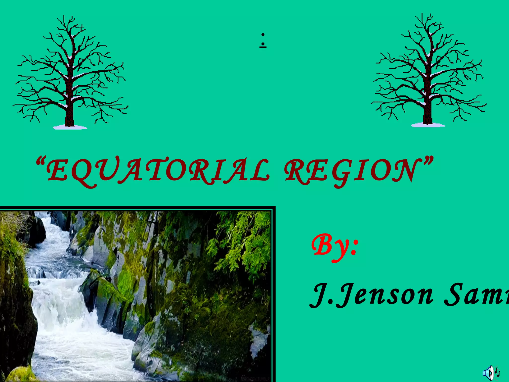
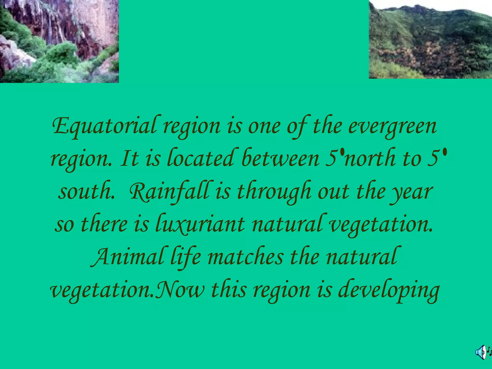
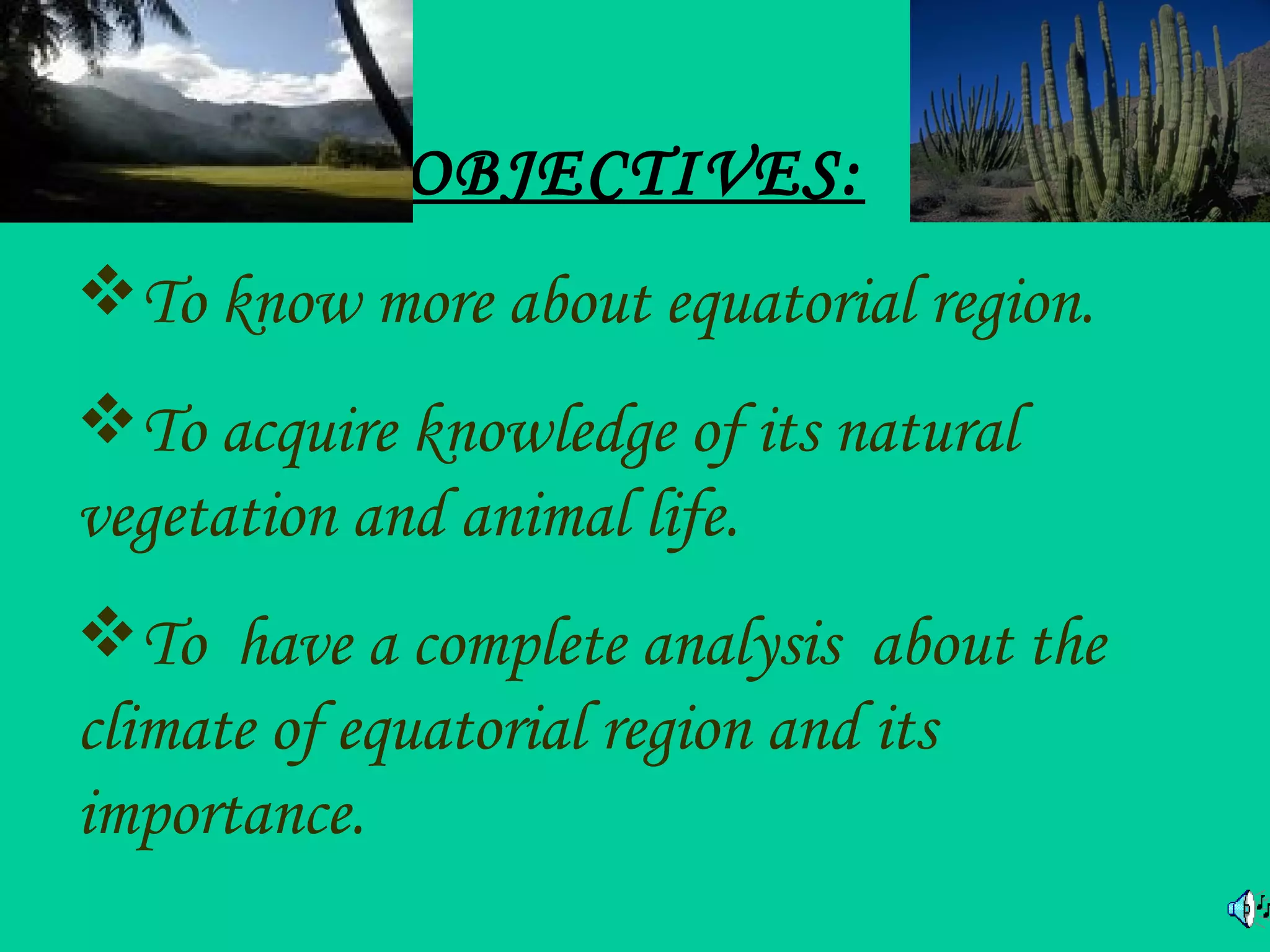
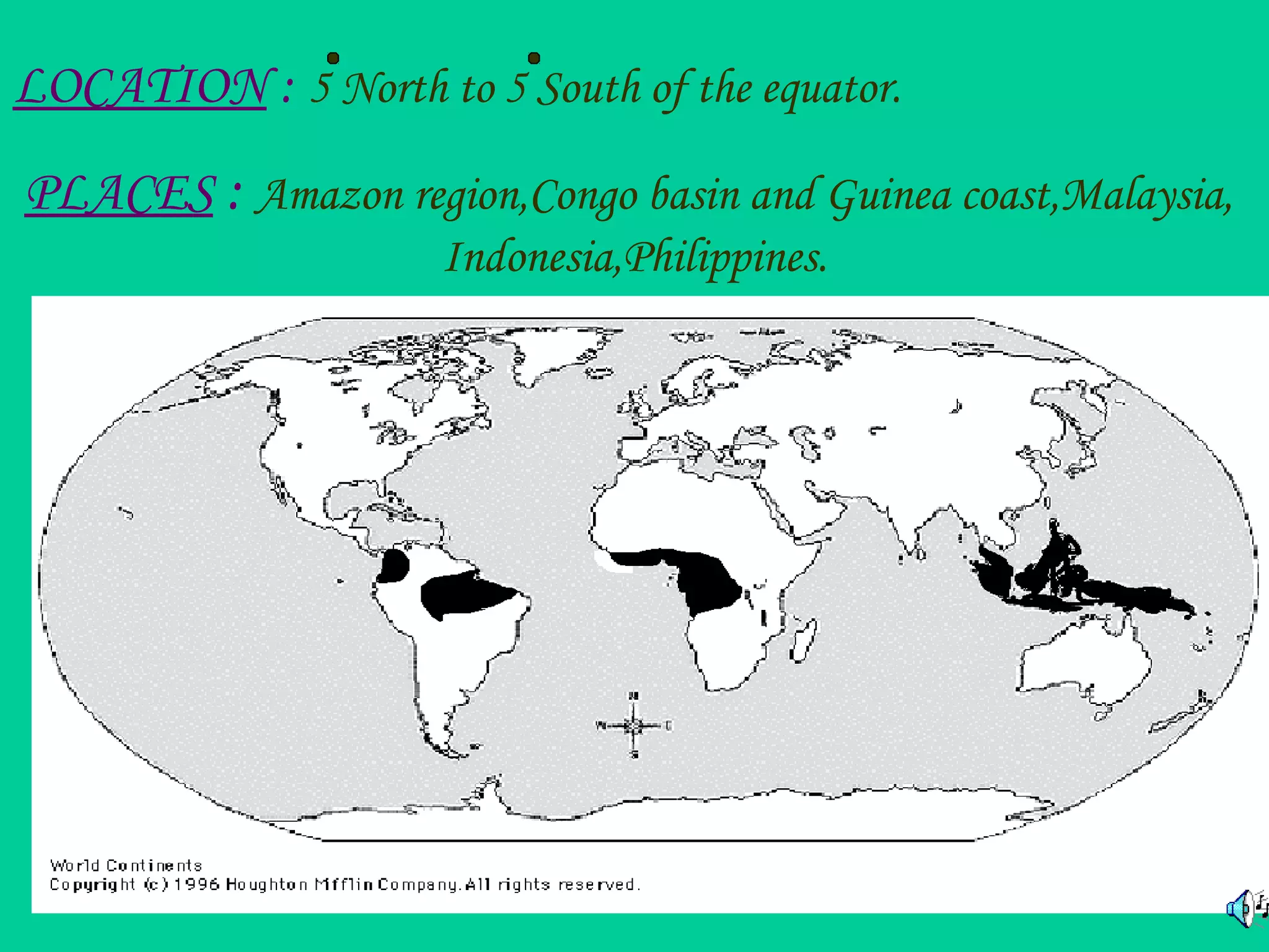
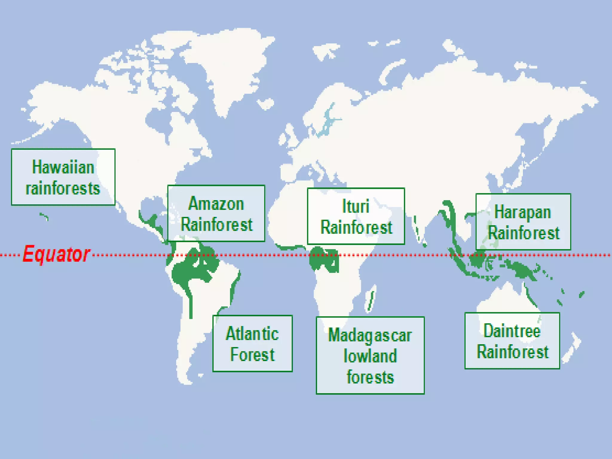
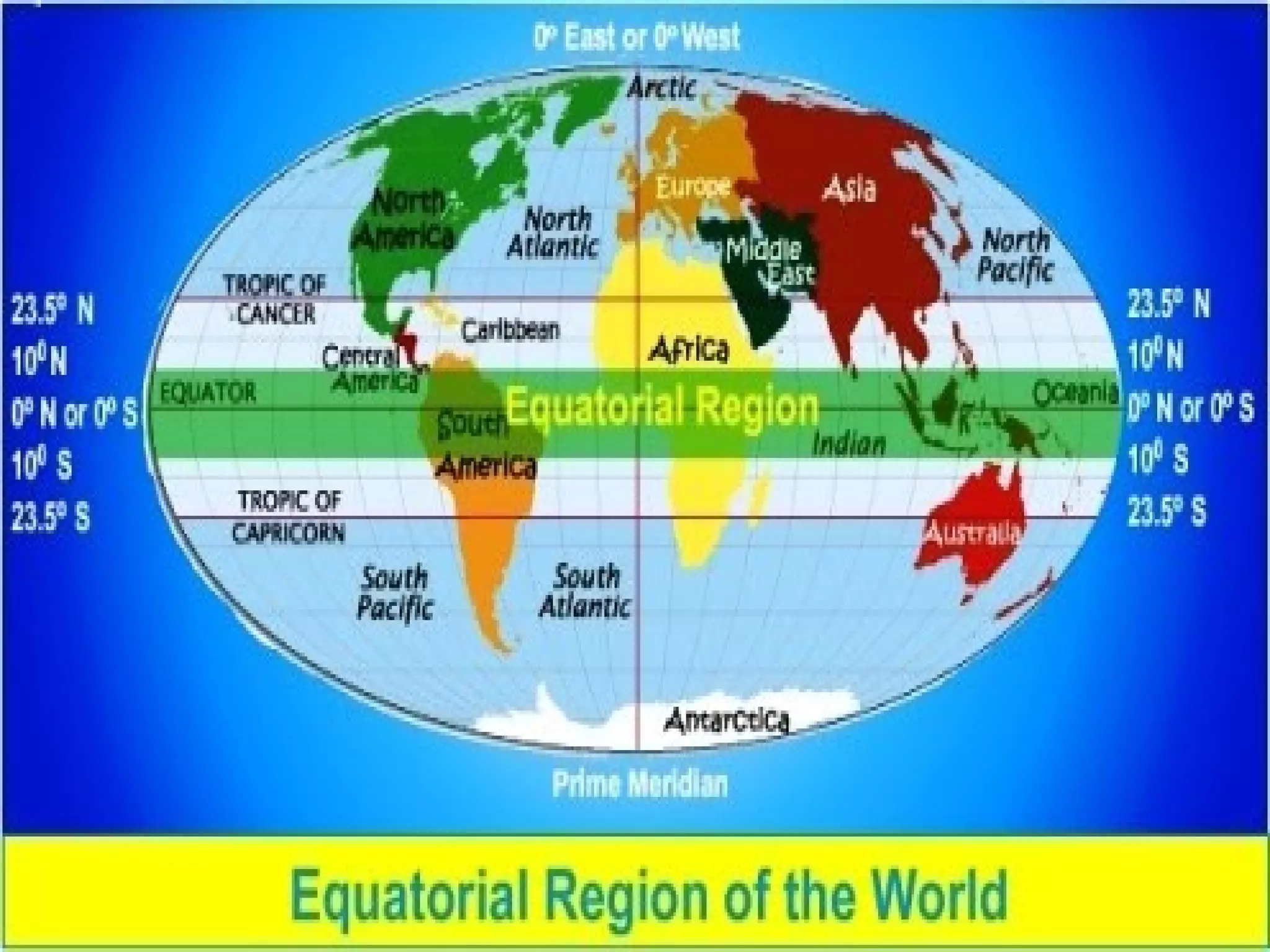
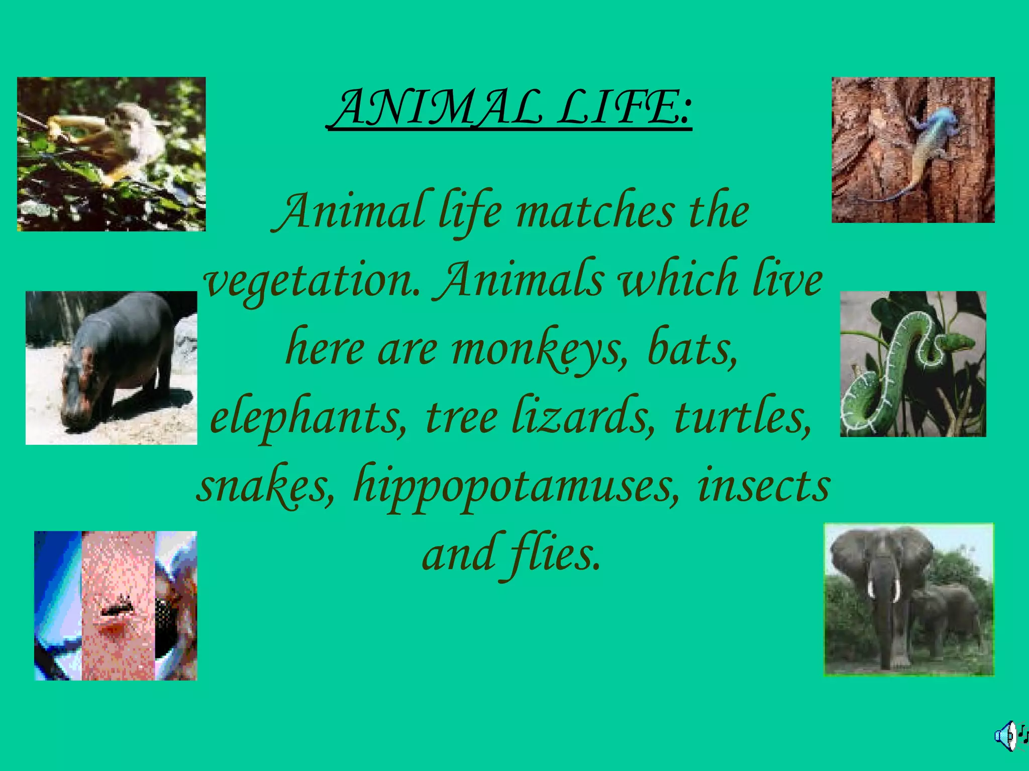
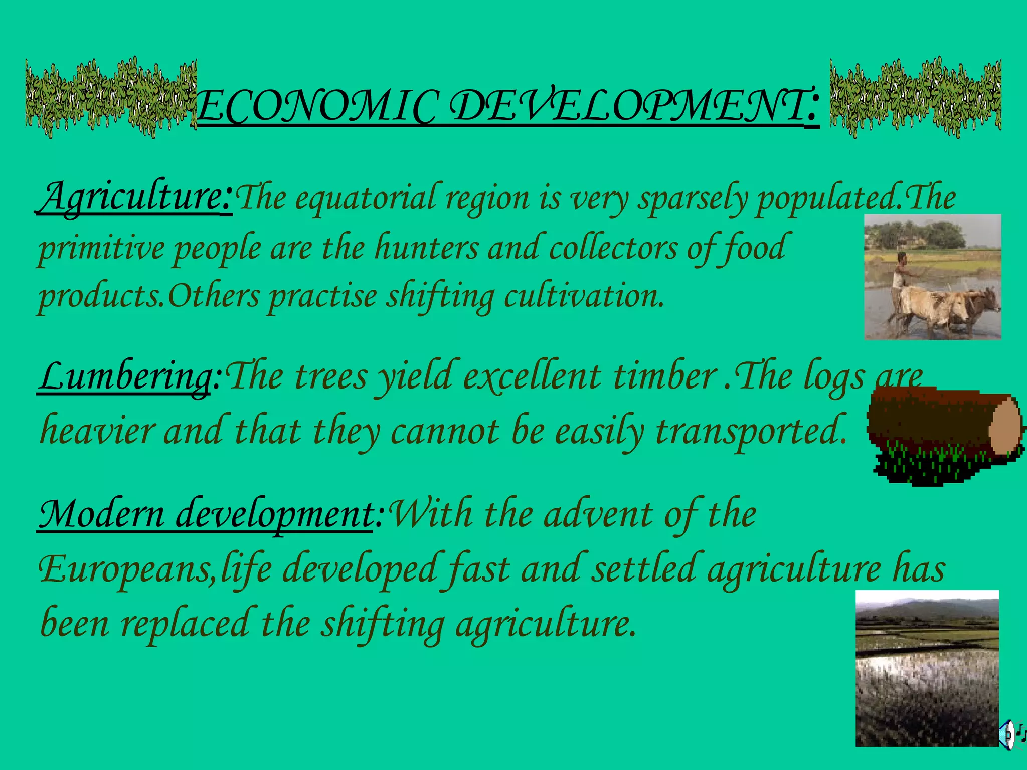
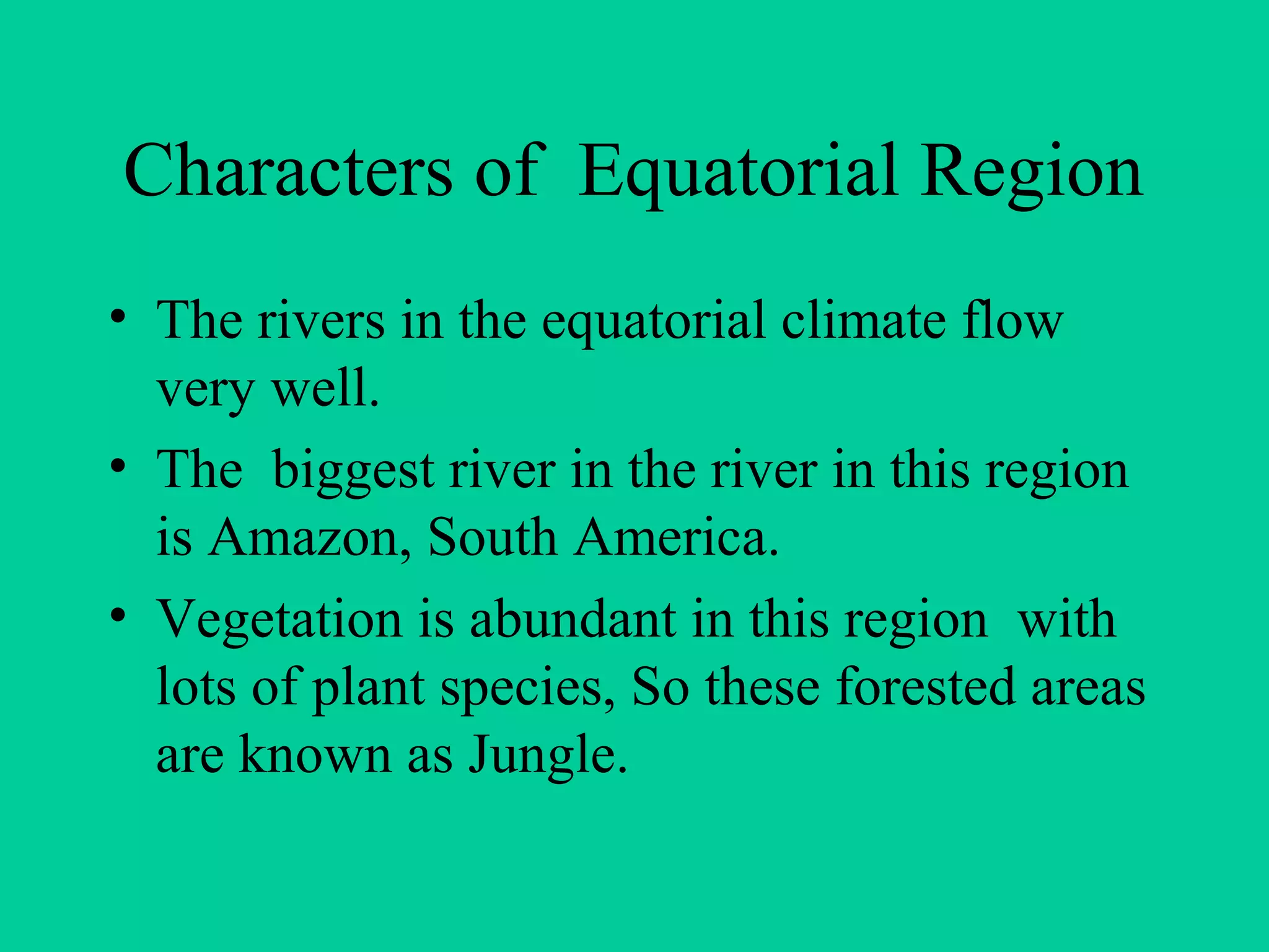
The document provides an overview of the Amazon rainforest, including its location, structure, climate, inhabitants, resources, importance, threats from deforestation, and conservation efforts. Specifically, it notes that the rainforest spans many South American and African countries near the equator, contains many layers of vegetation up to 70 meters tall, has a warm, humid climate without distinct seasons, and is an important source of oxygen, water, minerals, and biodiversity for the planet. However, deforestation from agriculture, logging, pollution, and other abuses threatens this critical ecosystem, though some national parks like Manu's Park in Brazil are working to protect endangered species and rescue the rainforest.
This document provides information about ecosystems. It begins by defining an ecosystem as a community of living organisms interacting with their environment. It then describes the main components of ecosystems, including producers, consumers, and decomposers.
It classifies ecosystems into two main types - terrestrial and aquatic. Terrestrial ecosystems discussed include forests, deserts, grasslands, and mountains. Forest ecosystems are described in more detail. Aquatic ecosystems include marine, freshwater, and wetlands.
The document also covers food chains and webs, and ecological pyramids including pyramids of numbers, biomass and energy. Finally, it introduces the topic of environmental pollution, which will be covered in more depth in the next unit.
EIA for Major development projects - Mining projectsJenson Samraj
EIA is a decision making tool for developmental projects (Mining, construction of dams).
It will have environmental implication in changing the variables such as quality of air, ground water, soil in that area.
The purpose of assessment is to ensure that decision makers consider the environmental impacts to implement the project
EIA helps us to measure or predict the impact of any developmental projects on the environment. Mining refers to Extraction of valuable minerals or other geological materials from the Earth, usually from an ore body, lode, vein, seam, reef, or placer deposit.
Metals, coal, oil shale, gemstones, limestone, chalk, dimension stone, rock salt, potash, gravel, and clay. Large scale mining pollution contaminates all living organisms within the body of water
Affects environment adversely
Results in deforestation
New Educational Policy 2020 and its ImplicationJenson Samraj
New Education Policy and its Implementation replaces the old educational policy 1986. New education policy 2020 approved by the Union Cabinet of India on 29 July 2020, outlines the vision of India’s new education system. This policy is a comprehensive framework for elementary education to higher education. It aims to increase state expenditure on education from around 4-6% as soon as policy.
Rainwater harvesting is the collection and storage of rain, rather than allowing it to run off. Rainwater is collected from a roof-like surface and redirected to a tank, cistern, deep pit, aquifer, or a reservoir with percolation, so that it seeps down and restores the ground water.
Rainwater harvesting is one of the simplest and oldest methods of self-supply of water for households, and residential and household-scale projects, usually financed by the user.[5] However, larger systems for schools, hospitals, and other facilities can run up costs only able to be financed by owners, organizations, and governmental units.
This slide brings us to know about the Amendments of 2006 and 2009 in Environmental Impact Assessment. The draft EIA notification issued by the ministry and forests for amendment 2009. The process of amendment 2006 was well sketched in the presentation. Hope everyone would like this.
Baseline data is a significant part of EIA. As the proverb says "Look before you leap". Every environmental aspect should be considered before initiating each and everything. The baseline should be well-known about an environment.
This is my presentation for the World Wetlands Day celebration. Testified wetland's significance, awareness, and ways to conserve. Finally, conducted a quiz for more interactions.
Antibodies, also known as immunoglobulins, are Y-shaped proteins produced by plasma cells that are involved in the immune response. They are composed of two light chains and two heavy chains that give them a flexible structure allowing them to recognize and bind to foreign objects like bacteria and viruses. There are five main classes of antibodies - IgG, IgA, IgM, IgE, and IgD - that carry out different functions in the immune system such as neutralizing toxins, marking pathogens for destruction, and activating immune cells.
PAPER PRESENTATION ON REMOVAL OF LEAD IONSJenson Samraj
This presentation describes the removal of lead contents from the waste stream using Water hyacinth. In this way, the elimination of water hyacinth occurs corresponding to the removal of Lead ions.
This is the certificate designed for conducting an awareness program at SPKCEES, Alwarkurichi. If you want in presentation format, I am ready to provide you soon.
1) Climate change directly and indirectly affects land degradation through changes in temperature, precipitation, and soil properties. 2) Both climate change and human activities like intensive agriculture and fossil fuel use contribute to increased greenhouse gas emissions and rising global temperatures. 3) Addressing land degradation and climate change requires international cooperation to reduce emissions, as well as measures to help local communities adapt through sustainable land management practices.
It is an unforgettable thing and it is the first conference paper which I have presented in my university. This describes how the Nanotechnology alters the world to advance. It also has lots of applications due to it's large surface area.
This document provides 10 ways to have fun on a rainy day. Some suggestions include enjoying the weather from your balcony with tea or coffee, getting drenched in the rain, going for a long drive with snacks and music, taking walks in light rain with friends, dancing in the rain on your terrace with music, playing outside in the rain as a child, searching for rainbows and trying to catch them, making dams in running water, pretending to be animals like frogs that enjoy the rain, and filling vessels with rainwater for future use. The overall message is that there are many ways to enjoy rainy days and make the most of the special weather.
CHEMICALLY DERIVED NANO-PIGMENT FOR ANTIBACTERIAL ACTIVITY, SURFACE COATING A...Jenson Samraj
This dissertation summarizes research conducted on synthesizing nanopigments from iron sand for potential antibacterial, surface coating, and cytotoxicity applications. Three nanopigments were synthesized - black magnetite (Fe3O4), red hematite (α-Fe2O3), and yellow goethite (α-FeOOH). Magnetite and goethite nanoparticles were synthesized using a co-precipitation method with pH variation. Extensive literature on the safe use of nano-sized pigments was reviewed. The potential risks of different uses of nanopigments like in paints, coatings, printer toner, and personal care products are discussed. However, limited toxicity data is available for most identified nanopigments to draw
COMPARATIVE ANALYSIS OF WATER QUALITY IN TAMIRABARANI RIVER ENCROACHED BY WAT...Jenson Samraj
This dissertation explains the analysis of water quality in which the Eichhornia crassipes lives further from many different samples the water was analyzed by my friend Mr. Esakki Raja
It is our Mini-project report which we will submit at the end of B.Sc completion. I browsed many things for obtaining the articles and it is my hard work to complete this for my friend Mr. SENTHIL KUMAR. Hope that it will be very useful for those who write Mini-project report.
A MINI PROJECT REPORT ON MANIMUTHAR RIVER, DAM AND CANALJenson Samraj
It is our Mini-project report which we will submit at the end of B.Sc completion. I browsed many things for obtaining the articles and it is my hard work to complete this for my friend Mr. AJAY KALLAPIRAN. Hope that it will be very useful for those who write Mini-project report.
hematic appreciation test is a psychological assessment tool used to measure an individual's appreciation and understanding of specific themes or topics. This test helps to evaluate an individual's ability to connect different ideas and concepts within a given theme, as well as their overall comprehension and interpretation skills. The results of the test can provide valuable insights into an individual's cognitive abilities, creativity, and critical thinking skills
Current Ms word generated power point presentation covers major details about the micronuclei test. It's significance and assays to conduct it. It is used to detect the micronuclei formation inside the cells of nearly every multicellular organism. It's formation takes place during chromosomal sepration at metaphase.
Travis Hills' Endeavors in Minnesota: Fostering Environmental and Economic Pr...Travis Hills MN
Travis Hills of Minnesota developed a method to convert waste into high-value dry fertilizer, significantly enriching soil quality. By providing farmers with a valuable resource derived from waste, Travis Hills helps enhance farm profitability while promoting environmental stewardship. Travis Hills' sustainable practices lead to cost savings and increased revenue for farmers by improving resource efficiency and reducing waste.
Or: Beyond linear.
Abstract: Equivariant neural networks are neural networks that incorporate symmetries. The nonlinear activation functions in these networks result in interesting nonlinear equivariant maps between simple representations, and motivate the key player of this talk: piecewise linear representation theory.
Disclaimer: No one is perfect, so please mind that there might be mistakes and typos.
dtubbenhauer@gmail.com
Corrected slides: dtubbenhauer.com/talks.html
Describing and Interpreting an Immersive Learning Case with the Immersion Cub...Leonel Morgado
Current descriptions of immersive learning cases are often difficult or impossible to compare. This is due to a myriad of different options on what details to include, which aspects are relevant, and on the descriptive approaches employed. Also, these aspects often combine very specific details with more general guidelines or indicate intents and rationales without clarifying their implementation. In this paper we provide a method to describe immersive learning cases that is structured to enable comparisons, yet flexible enough to allow researchers and practitioners to decide which aspects to include. This method leverages a taxonomy that classifies educational aspects at three levels (uses, practices, and strategies) and then utilizes two frameworks, the Immersive Learning Brain and the Immersion Cube, to enable a structured description and interpretation of immersive learning cases. The method is then demonstrated on a published immersive learning case on training for wind turbine maintenance using virtual reality. Applying the method results in a structured artifact, the Immersive Learning Case Sheet, that tags the case with its proximal uses, practices, and strategies, and refines the free text case description to ensure that matching details are included. This contribution is thus a case description method in support of future comparative research of immersive learning cases. We then discuss how the resulting description and interpretation can be leveraged to change immersion learning cases, by enriching them (considering low-effort changes or additions) or innovating (exploring more challenging avenues of transformation). The method holds significant promise to support better-grounded research in immersive learning.
The use of Nauplii and metanauplii artemia in aquaculture (brine shrimp).pptxMAGOTI ERNEST
Although Artemia has been known to man for centuries, its use as a food for the culture of larval organisms apparently began only in the 1930s, when several investigators found that it made an excellent food for newly hatched fish larvae (Litvinenko et al., 2023). As aquaculture developed in the 1960s and ‘70s, the use of Artemia also became more widespread, due both to its convenience and to its nutritional value for larval organisms (Arenas-Pardo et al., 2024). The fact that Artemia dormant cysts can be stored for long periods in cans, and then used as an off-the-shelf food requiring only 24 h of incubation makes them the most convenient, least labor-intensive, live food available for aquaculture (Sorgeloos & Roubach, 2021). The nutritional value of Artemia, especially for marine organisms, is not constant, but varies both geographically and temporally. During the last decade, however, both the causes of Artemia nutritional variability and methods to improve poorquality Artemia have been identified (Loufi et al., 2024).
Brine shrimp (Artemia spp.) are used in marine aquaculture worldwide. Annually, more than 2,000 metric tons of dry cysts are used for cultivation of fish, crustacean, and shellfish larva. Brine shrimp are important to aquaculture because newly hatched brine shrimp nauplii (larvae) provide a food source for many fish fry (Mozanzadeh et al., 2021). Culture and harvesting of brine shrimp eggs represents another aspect of the aquaculture industry. Nauplii and metanauplii of Artemia, commonly known as brine shrimp, play a crucial role in aquaculture due to their nutritional value and suitability as live feed for many aquatic species, particularly in larval stages (Sorgeloos & Roubach, 2021).
The binding of cosmological structures by massless topological defectsSérgio Sacani
Assuming spherical symmetry and weak field, it is shown that if one solves the Poisson equation or the Einstein field
equations sourced by a topological defect, i.e. a singularity of a very specific form, the result is a localized gravitational
field capable of driving flat rotation (i.e. Keplerian circular orbits at a constant speed for all radii) of test masses on a thin
spherical shell without any underlying mass. Moreover, a large-scale structure which exploits this solution by assembling
concentrically a number of such topological defects can establish a flat stellar or galactic rotation curve, and can also deflect
light in the same manner as an equipotential (isothermal) sphere. Thus, the need for dark matter or modified gravity theory is
mitigated, at least in part.
The ability to recreate computational results with minimal effort and actionable metrics provides a solid foundation for scientific research and software development. When people can replicate an analysis at the touch of a button using open-source software, open data, and methods to assess and compare proposals, it significantly eases verification of results, engagement with a diverse range of contributors, and progress. However, we have yet to fully achieve this; there are still many sociotechnical frictions.
Inspired by David Donoho's vision, this talk aims to revisit the three crucial pillars of frictionless reproducibility (data sharing, code sharing, and competitive challenges) with the perspective of deep software variability.
Our observation is that multiple layers — hardware, operating systems, third-party libraries, software versions, input data, compile-time options, and parameters — are subject to variability that exacerbates frictions but is also essential for achieving robust, generalizable results and fostering innovation. I will first review the literature, providing evidence of how the complex variability interactions across these layers affect qualitative and quantitative software properties, thereby complicating the reproduction and replication of scientific studies in various fields.
I will then present some software engineering and AI techniques that can support the strategic exploration of variability spaces. These include the use of abstractions and models (e.g., feature models), sampling strategies (e.g., uniform, random), cost-effective measurements (e.g., incremental build of software configurations), and dimensionality reduction methods (e.g., transfer learning, feature selection, software debloating).
I will finally argue that deep variability is both the problem and solution of frictionless reproducibility, calling the software science community to develop new methods and tools to manage variability and foster reproducibility in software systems.
Exposé invité Journées Nationales du GDR GPL 2024
EWOCS-I: The catalog of X-ray sources in Westerlund 1 from the Extended Weste...Sérgio Sacani
Context. With a mass exceeding several 104 M⊙ and a rich and dense population of massive stars, supermassive young star clusters
represent the most massive star-forming environment that is dominated by the feedback from massive stars and gravitational interactions
among stars.
Aims. In this paper we present the Extended Westerlund 1 and 2 Open Clusters Survey (EWOCS) project, which aims to investigate
the influence of the starburst environment on the formation of stars and planets, and on the evolution of both low and high mass stars.
The primary targets of this project are Westerlund 1 and 2, the closest supermassive star clusters to the Sun.
Methods. The project is based primarily on recent observations conducted with the Chandra and JWST observatories. Specifically,
the Chandra survey of Westerlund 1 consists of 36 new ACIS-I observations, nearly co-pointed, for a total exposure time of 1 Msec.
Additionally, we included 8 archival Chandra/ACIS-S observations. This paper presents the resulting catalog of X-ray sources within
and around Westerlund 1. Sources were detected by combining various existing methods, and photon extraction and source validation
were carried out using the ACIS-Extract software.
Results. The EWOCS X-ray catalog comprises 5963 validated sources out of the 9420 initially provided to ACIS-Extract, reaching a
photon flux threshold of approximately 2 × 10⁻⁸ photons cm−2
s
−1
. The X-ray sources exhibit a highly concentrated spatial distribution,
with 1075 sources located within the central 1 arcmin. We have successfully detected X-ray emissions from 126 out of the 166 known
massive stars of the cluster, and we have collected over 71 000 photons from the magnetar CXO J164710.20-455217.
The debris of the ‘last major merger’ is dynamically youngSérgio Sacani
The Milky Way’s (MW) inner stellar halo contains an [Fe/H]-rich component with highly eccentric orbits, often referred to as the
‘last major merger.’ Hypotheses for the origin of this component include Gaia-Sausage/Enceladus (GSE), where the progenitor
collided with the MW proto-disc 8–11 Gyr ago, and the Virgo Radial Merger (VRM), where the progenitor collided with the
MW disc within the last 3 Gyr. These two scenarios make different predictions about observable structure in local phase space,
because the morphology of debris depends on how long it has had to phase mix. The recently identified phase-space folds in Gaia
DR3 have positive caustic velocities, making them fundamentally different than the phase-mixed chevrons found in simulations
at late times. Roughly 20 per cent of the stars in the prograde local stellar halo are associated with the observed caustics. Based
on a simple phase-mixing model, the observed number of caustics are consistent with a merger that occurred 1–2 Gyr ago.
We also compare the observed phase-space distribution to FIRE-2 Latte simulations of GSE-like mergers, using a quantitative
measurement of phase mixing (2D causticality). The observed local phase-space distribution best matches the simulated data
1–2 Gyr after collision, and certainly not later than 3 Gyr. This is further evidence that the progenitor of the ‘last major merger’
did not collide with the MW proto-disc at early times, as is thought for the GSE, but instead collided with the MW disc within
the last few Gyr, consistent with the body of work surrounding the VRM.
2. “EQUATORIAL REGION”
We opted this topic to get more
information about Equatorial
region,its climate, its natural
vegetation, its animal life, its
economic importance etc…
3. Equatorial region is one of the evergreen
region. It is located between 5 north to 5
south. Rainfall is through out the year
so there is luxuriant natural vegetation.
Animal life matches the natural
vegetation.Now this region is developing
4. OBJECTIVES:
To know more about equatorial region.
To acquire knowledge of its natural
vegetation and animal life.
To have a complete analysis about the
climate of equatorial region and its
importance.
5. CONTENTS:
Meaning of Natural region.
Types of Major Natural Region.
Introduction to the topic.
Location.
Climate.
Natural vegetation.
Animal Life..
Economic Life & development.
6.
7. MEANING OF NATURAL
REGION:
A Natural region may be defined as an area of
an earth throughout which similarities prevail
in relief, climate, temperature, soil, rainfall,
vegetation and human activities.
9. LOCATION : 5 North to 5 South of the equator.
PLACES : Amazon region,Congo basin and Guinea coast,Malaysia,
Indonesia,Philippines.
10.
11.
12. CLIMATE:
The region has hot and wet climate because of
its nearness to the equator and the sunrays are
always vertical .
Average temperature is 25 C to 30 C.
There is no winter.
There is rainfall throughout the year.
Climate is unfavourable for human life and
activity.
13.
14. NATURAL VEGETATION:
High temperature and heavy
rainfall helps luxuriant growth.
The trees are evergreen throughout
the year. The vegetation includes
Mahogany, Ebony, Rosewood,
Cinchona and Rubber.
mahogany ebony
cinchona Rubber
15.
16. ANIMAL LIFE:
Animal life matches the
vegetation. Animals which live
here are monkeys, bats,
elephants, tree lizards, turtles,
snakes, hippopotamuses, insects
and flies.
17. ECONOMIC DEVELOPMENT:
Agriculture:The equatorial region is very sparsely populated.The
primitive people are the hunters and collectors of food
products.Others practise shifting cultivation.
Lumbering:The trees yield excellent timber .The logs are
heavier and that they cannot be easily transported.
Modern development:With the advent of the
Europeans,life developed fast and settled agriculture has
been replaced the shifting agriculture.
18. Characters of Equatorial Region
• The rivers in the equatorial climate flow
very well.
• The biggest river in the river in this region
is Amazon, South America.
• Vegetation is abundant in this region with
lots of plant species, So these forested areas
are known as Jungle.