Unusually warm water temperatures continue in central and south Puget Sound. River flows remain lower than normal, especially the Fraser and Skagit rivers. Thus, with estuarine circulation much weaker, Puget Sound waters stay put. Mats of organic debris persist in Central Sound near Port Madison. Red-brown and brown blooms are now very strong in southern inlets and jellyfish patches are exceptionally numerous and large. Explore media coverage of unusual Puget Sound conditions including jellyfish.
Air temperatures are warm and Puget Sound continues to show record high water temperatures. Some rain has returned to our region, yet river flows remain unusually low. Puget Sound is saltier than normal allowing oxygen-rich surface waters to more easily mix to greater depths. Lower oxygen was measured only in the Coastal Bays, Hood Canal, and South Sound. Large jellyfish aggregations continue in South Sound, the Kitsap Peninsula, and East Sound (Orcas Island). Sediment plumes in Bellingham Bay form unique patterns. Warm waters and sunny conditions fostered green tides, raising a stink along some local beaches.
Puget Sound is starting to normalize in response to fall conditions with cooler air temperatures, rain, and recovering river flows. We are seeing fewer algal blooms, jellyfish, and macro-algae as salinities become more normal. Yet warm waters persist and El Nino and the Blob are likely to affect Puget Sound throughout the winter. The Nisqually River fared better through the drought than other rivers and best management practices have been improving its water quality. EOPS and ferry monitoring gain recognition with a national award for innovation!
Puget Sound is feeling the heat! Starting in October, temperatures are the highest on our record since 1989. Salinity and oxygen are much lower. Recent rains have rivers flowing high. Aerial views show dramatic sediment loads from rivers mixing into otherwise blue water. But don’t be fooled – by summer, snow-fed rivers are expected to run significantly below normal, with implications for Puget Sound water quality. For details, explore the special Drought Effects segment. Spring blooms are visible only in some confined bays. Jellyfish are going strong in finger inlets of South Sound. Glimpse Puget Sound’s glacial history.
EOPS_July_20_2016,
Through June, air temperatures and sunlight were higher than normal. Recent rain generally improved river flows. However, the Fraser river flow remains extremely low, reducing water exchange with the ocean. Water temperatures are still breaking records, yet dissolved oxygen levels are normal. Coastal bays are influenced by upwelling and exhibit lower oxygen and higher salinities. Puget Sound algae are thriving with blooms observed in many South Sound inlets. Macro-algae is seen piling up on beaches and drifting in Central Sound. Jellyfish smacks are numerous in Eld and Budd Inlets. Our fliers notice seals hanging out at the beach!
Ecology Publication No. 16-03-075
The ocean and air remain warm with sunshine and dry weather across the region. As a result, Puget Sound is a lot warmer going into the new year. Hood Canal is responding with temperatures warmer than previous measurements, breaking its low temperature stint. First signs of growing phytoplankton are coloring the water green. Patches of jellyfish are overwintering in finger inlets of South Sound. Tidal fronts and suspended sediment are visible amidst the stunning San Juan Islands scenery. A sediment-rich water mass is trapped in Rosario Strait. Check out the South Sound Estuarium and the many reasons we love Puget Sound!
Warm waters from “The Blob” in Puget Sound combine with drought conditions as warm air has left little snow to feed the rivers. Water temperatures throughout Puget Sound are the highest in 25 years and oxygen is exhibiting record lows. High suspended sediment in the north is still coming in from the Fraser River. Otherwise, the surface waters appear very clear due to recent low river flows and weak blooming activity. A red bloom is present in Sinclair Inlet and in some confined bays. Patches of jellyfish, however, are going strong in inlets of South Sound and Sinclair Inlet. What does this all mean for salmon? Get to know some intertidal critters!
EOPS_May_2_2016,
Spring air temperatures are higher - it has been sunny and dry. The snowpack is quickly disappearing as temperatures are up to 7 °F warmer at higher elevations. Snowmelt-fed rivers are running very high. How does this affect water quality in Puget Sound? A strong spring phytoplankton bloom extends across Puget Sound and the Strait of Juan de Fuca. Water temperatures are still higher than normal and jellyfish are already numerous in southern inlets. The high biological activity is causing organic material to drift at the surface and wash onto beaches. Do you know how fast a Sand Star can move?
Ecology Publication No. 16-03-073
EOPS_July_24_2017,
July had warm air temperatures, sunshine, and an abundant snowpack. Previous months had higher river flows (bringing freshwater) and weak upwelling (low delivery of saltier water) which resulted in very low salinities in Puget Sound, especially in the South Sound. Water temperatures are expected and warmer in Central Sound. Above normal sunshine has made Puget Sound biologically very active! Intense and unusual blooms color Hood Canal (coccolithophores) and south sound inlets. Large mats of organic material containing macro-algae drift at the surface. Many schools of fish are visible though jellyfish were absent.
Ecology Publication No. 17-03-071
EOPS_September_26_2016,
September is jellyfish season and they are everywhere in southern Puget Sound! Sunny, warm, and dry conditions promoted strong late-summer plankton blooms in colors of red, green, and brown, now widespread in many bays. In contrast, Central Sound looks clear with low algal activity. Southern Puget Sound has large floating mats of organic material and developed lower oxygen in August. Meet the Critter of the Month - The Sweet Potato Sea Cucumber.
Publication No. 16-03-077
A stunning view of a second large Noctiluca bloom captures the attention of many living near Puget Sound. Favorable conditions support several regional phytoplankton blooms. Red-brown blooms in Port Townsend, Discovery Bay and Bellingham Bay. Large algal mats or organic material particularly in Samish Bay. Jellyfish patches increasing in Budd, Totten and Eld Inlets.
Puget Sound conditions are normalizing after seven months of lower oxygen. Calm, dry, cool, and foggy mornings abruptly changed on October 28 to sun and strong northerly winds. Red-brown blooms and abundant jellyfish in south Puget Sound inlets appeared as we flew to the coast. Blooms were still visible near ocean beaches and inner bays. Grays Harbor had abundant surface debris with green algae in North Bay. We spotted red-brown blooms in rivers and sloughs in Willapa Bay, as well as schooling fish near sandbanks. Many patches of suspended sediment appeared in shallow water unrelated to tidal currents and remain unexplained.
EOPS_June_27_2016,
Record-breaking warmer and fresher water in Puget Sound. May-June conditions are more unusual than last year. Recent rain brought river flows close to normal but water exchange in Puget Sound remains weak due to low Fraser River flow. Phytoplankton blooms and organic material are visible in some areas of Central and South Sound but not in others. Noctiluca, while absent in Central Basin, was reported in unusual places. Jelly fish occur only in some south sound bays. Follow our BEACH program kick off, discover the Stinkworm, and find good underwater visibility for diving.
Ecology Publication No. 16-03-074
EOPS_December_14_2015,
As coastal and regional conditions gradually normalize in response to a fading Blob and increased rain, the big question remains. Will the snow in the mountains stay there or come down prematurely and lower salinity in Puget Sound like last winter? Cascade snowpack is currently below normal. The El Niño at the equator is still brewing! Major rivers transport large amounts of suspended sediments and soil into Puget Sound, also seen in our ferry sensor data. Our flight team gets in the pool for safety training.
Ecology Publication No. 15-03-079
Sunshine and warm temperatures return after last week’s intense rain. The Puyallup and Nisqually Rivers are flowing high. Red-brown blooms and numerous patches of jellyfish remain strong in South Sound, Sinclair and Dyes Inlets, and Bellingham Bay, with brown-green blooms in Whidbey Basin. Macro-algae surface debris is very high in South and Central Sound. Hood Canal remains cooler but Puget Sound-wide temperatures are now warmer and less salty. Sea surface temperatures are above 15 °C, conditions favorable for some pathogens, and harmful algae blooms. Read about super colonies of by-the-wind sailors washing up on our shores.
EOPS_June_5_2017,
Cooler and wetter conditions early in 2017 have set the stage for a favorable supply of freshwater. River flows are all above normal due to melting of the abundant snowpack from warmer May air temperatures. This is creating significantly fresher conditions in Puget Sound surface waters. Algae blooms are limited to some yellow-green blooms growing in bays near the Kitsap Peninsula and blooms near estuaries of the Skagit, Stillaguamish, and Puyallup Rivers. Red blooms are present in rivers feeding into Willapa Bay. Also see what is “blooming” in the sediments of Puget Sound.
Ecology Publication No. 17-03-070
EOPS_March_16_2016,
In response to warm and wet conditions, rivers have been running high. Salinity in Puget Sound is notably lower. Below a cooler surface, water temperatures remain high, especially in Hood Canal. We still see numerous jellyfish patches in Puget Sound inlets. Phytoplankton blooms are going strong in Hood Canal and Henderson Inlet, and picking up elsewhere. Many places showed long stretches of suspended sediments nearshore, a sign of potential shore erosion. Check out the critters inhabiting the sediments of Puget Sound.
Ecology Publication No. 16-03-071
Abundant sunshine gives rise to large algal mats in South Sound, Hood Canal, and Sinclair Inlet. Red-brown algal blooms dominate in Budd, Totten, and Eld Inlets and jellyfish begin to increase. Northerly winds push algal blooms from Whidbey and Central Basins past Seattle and a bloom in northern Hood Canal southward. Satellite thermal imagery shows patterns of near-surface mixing and injection of nutrients into the surface layer. Glacial-fed rivers deliver glacial flour into Commencement Bay, stratifying the water and supporting different colored phytoplankton blooms (green, brown, and red). Since the beginning of 2013, dissolved oxygen is dropping below expected values.
EOPS_August_24_2016,
In July, conditions were normalizing, yet river flows remained lower, continuing into August. July also saw lower oxygen appearing in southern Puget Sound. By August, jellyfish are occurring in high numbers in Eld and Budd Inlet. South Puget Sound has Noctiluca drifting at the surface in large orange lines in many places and red-brown blooms widespread in finger inlets, as well as in Sinclair Inlet. Central Sound surface-water temperatures are high, still in the 60s, and algae are abundant. See what we are measuring to understand ocean acidification in Puget Sound.
Publication No. 16-03-076
After a dry and sunny summer extending well into October, air temperatures are cooler than normal and precipitation has increased allowing rivers to regain strength. Despite a dry summer, Puget Sound is fresher this year than the past 17 years. As of September, warmer temperatures remained in South Sound. In October, surface water in the Straits however began to cool and the influence of rivers can be seen in our ferry data. Leaves drift on the water in South Sound and smaller blooms are confined to inlets as the productive season winds down. Meet our new intern and discover if Puget Sound really has sea spiders.
Dr. Christopher Krembs, with the marine monitoring unit of the Department of Ecology, presented on the warm water conditions in Puget Sound. He discussed the impacts on marine food webs and potential scenarios in 2015. He presented at the June 2015 NRC meeting.
EOPS_February_8_2016,
January air temperatures and precipitation were above normal as El Nino conditions prevail. This winter our snowpack is in much better shape, though we’ve lost some snow from the stint of warm weather. More rain and higher river flows have lowered salinities in Puget Sound and coastal bays. Nonetheless, water temperatures in Puget Sound remain at record-breaking highs. Jellyfish patches are numerous in finger inlets of South Sound and signs of phytoplankton blooms are visible in coastal bays. When conditions limit flying, Ecology’s research vessel gets the job done.
Publication No. 16-03-070
EOPS_December_30_2015,
The year 2015 in pictures: Jellyfish patches persisted through the entire year in response to the exceptionally warm water caused by the Blob. Sediment loads are high as snow melts fast in the winter of 2015. Unexpected phytoplankton species occur in some bays in spring. Noctiluca, jellyfish and macro-algae appear in high numbers when rivers drop to record-low flows in early summer. Low river flows slow the renewal of in Puget Sound throughout summer and fall and jellyfish patches reach record highs.
Ecology Publication No. 15-03-080
A recent cold spell hits Puget Sound lowlands, interrupting this year’s warmer air temperatures. The warm ocean coincides with new maximum water temperatures observed throughout Puget Sound in October! Hood Canal’s higher dissolved oxygen and cold water anomalies are disappearing. November brings cold water from Whidbey Basin into Puget Sound with moderate levels of chlorophyll fluorescence. Abundant smacks of jellyfish in finger inlets of South Sound observed from our flight. Red-brown blooms remain strong in smaller bays of South Sound. Visible suspended sediments in the coastal estuaries from rain, wind, and waves. Playing in the water? Visit our BEACH program.
EOPS_August_28_2017,
Warm air temperatures, abundant sunshine, and drier conditions persisted. River flows are lower in the north. Puget Sound waters are still fresher than in the past 17 years from the combination of abundant spring rain and weak upwelling bringing less salty water from the ocean. July upwelling was stronger, however. Warmer water temperatures are notable in parts of Central Sound, accompanied by large rafts of drifting macroalgae. Diverse blooms in colors of green, orange and red-brown are present in many inlets. Jellyfish abundance is lower this year. Find out how we assess if the benthos is changing.
Ecology Publication No. 17-03-072
Warmer and sunnier days result in higher than normal river flows from the Skagit and Nisqually. Biological activity in the water column is high. Abundant organic surface debris in Hood Canal, Padilla Bay, and many Inlets. Red-brown blooms in South Sound, Discovery Bay, and regions of Bellingham Bay. Different blooms in Skagit Bay, Padilla Bay, and Sinclair Inlet. Jelly fish are numerous in all southernmost South Sound Bays. Hood Canal remains cold but Puget Sound-wide temperatures are now warmer and less salty. Data from the Victoria Clipper and our sampling in the Strait provides important information on water exchange with the ocean.
Eyes Over Puget Sound (EOPS) is a news report, and is made available within two days of observation.
http://www.ecy.wa.gov/programs/eap/mar_wat/eops/
We inform on current surface conditions in Puget Sound and links several scales of observation together. The report contains condition summaries, personal flight observations, aerial photographs, en route ferry data, satellite images, and mooring data collected by the Marine Monitoring Unit at Ecology.
Ecology's Marine Monitoring Unit conducts several marine observations with a sampling frequency of minutes to 1 month. We use our routine commute flight between Kenmore Airbase and Olympia to document current marine water conditions by camera and supplement the information with satellite images and en route ferry data between Seattle WA and Victoria BC. This program is an example to optimize monitoring resources. You may subscribe or unsubscribe to the Eyes Over Puget Sound email listserv by going to this link:
http://listserv.wa.gov/cgi-bin/wa?A0=ECOLOGY-EYES-OVER-PUGET-SOUND
Unusually warm water temperatures continue in central and south Puget Sound while Willapa Bay returns to expected water temperatures as a result of stronger coastal upwelling. Extensive mats of organic debris develop in many places, particularly in Central Sound overlapping with a fading Noctiluca bloom. King County confirms Noctiluca and shares plankton species information. Red-brown and brown blooms are going strong in southern inlets and around the San Juan Islands. Our inspiring WCC Intern gets on boats, into the air, and to the lab.
Data has been increasing at an exponential rate and organizations are either struggling to cope up or rushing to take advantage by analyzing it. Hadoop is an excellent open source framework, which addresses this big data problem.
I have used Hadoop within the financial sector for the last few years but could not find any resource or book that explains the usage of Hadoop for finance use cases. The best books I have ever found are again on Hadoop, Hive, or some MapReduce patterns, with examples on counting words or Twitter messages in all possible ways.
I have written this book with the objective of explaining the basic usage of Hadoop and other products to tackle big data for finance use cases. I have touched base on the majority of use cases, providing a very practical approach.
The book sold on:
http://www.amazon.co.uk/381/dp/B00X3TVGJY/ref=tmm_kin_swatch_0?_encoding=UTF8&sr=&qid=
http://www.amazon.com/381/dp/B00X3TVGJY/ref=tmm_kin_swatch_0?_encoding=UTF8&sr=&qid=
http://www.amazon.in/381/dp/B00X3TVGJY/ref=tmm_kin_swatch_0?_encoding=UTF8&sr=&qid=
EOPS_April_6_2016,
Despite warmer air temperatures, normal snowpack in the mountains suggest that summer freshwater flows into Puget Sound might be higher than last year. As of April, the spring plankton bloom has extended across Central and South Puget Sound. Ferry data shows chlorophyll increasing after March 25 and expanding across the area. With water temperatures above normal as a carry-over from 2015, jellyfish patches are numerous in inlets of South Sound and in Sinclair Inlet, unusual for this time of year. Check out the tiny burrowing ostracods as well as our Washington Conservation Corps Intern analyzing seawater oxygen.
Ecology Publication No. 16-03-072
River flows are above normal and air temperatures are increasing slowly. The spring phytoplankton bloom is slow to develop with visible blooms limited to smaller bays such as Sequim and Bellingham Bays. Noctiluca observed in East Sound on Orcas Island, coinciding with high numbers of jellyfish. Debris lines are mostly confined to Hood Canal. Pockets of colder water observed in Central Sound and Hood Canal, likely from the colder, saltier conditions that developed during the winter in the northern regions. Oxygen is variable yet close to expected ranges. Sizable oil sheens were sighted in Gig Harbor and Carr Inlet.
Warm air and water temperatures and offshore winds have persisted since fall. Numerous and sizable jelly fish patches are still present in southern inlets of Puget Sound. Coastal waters were colored in shades of gray to brown by sediment and humic substances. Phytoplankton blooms were restricted to the surf zone. We were treated to artful views of meandering sloughs and gullies on exposed mud flats during low tide in Willapa Bay, interspersed with the geometry of shellfish management. Brown pelicans: a story of recovery.
Record warm water temperatures and low oxygen continue in Ecology’s Puget Sound marine monitoring station network. Record low stream flows result in visibly low river discharge into Puget Sound, in particular for the Puyallup River. Abundant sun and unusually warm water temperatures fuel phytoplankton blooms in many areas. Bright orange Noctiluca blooms are surfacing in the Commencement Bay area and around Port Madison. Finger inlets of South Sound support extensive patches of jellyfish.
EOPS_November_22_2016,
ENSO is in a cold phase (La Niña) and it is wetter and warmer than normal. Strong precipitation in October greatly improved Puget Sound streamflows. At the coast, we had strong downwelling. As a result, water temperatures, salinities, and oxygen in Puget Sound are returning to normal. While surface water in Puget Sound has cooled, it is still warmer than in the Straits. Surprisingly, masses of suspended sediment occurred east of Steamboat Island in Totten Inlet. We continue to see large jellyfish aggregations in finger Inlets of South Sound and slowly fading red-brown blooms.
Publication No. 16-03-078
Sunshine and warmth continue into September. Upwelling is higher, yet low Fraser River flow reduces the likelihood of low-oxygen water moving into Puget Sound. Dissolved oxygen remains relatively high in Hood Canal and is lower elsewhere. Satellites show relatively warm water in the Strait of Georgia and Whidbey Basin and an extensive offshore bloom. Water temperatures also remain high in South Sound were red-brown plankton blooms and large smacks of jellyfish adorn the water surface. Explore what frequent blooms in smaller bays can tell us.
Air temperatures are warm and Puget Sound continues to show record high water temperatures. Some rain has returned to our region, yet river flows remain unusually low. Puget Sound is saltier than normal allowing oxygen-rich surface waters to more easily mix to greater depths. Lower oxygen was measured only in the Coastal Bays, Hood Canal, and South Sound. Large jellyfish aggregations continue in South Sound, the Kitsap Peninsula, and East Sound (Orcas Island). Sediment plumes in Bellingham Bay form unique patterns. Warm waters and sunny conditions fostered green tides, raising a stink along some local beaches.
The year 2014 in pictures: In 2014, Puget Sound and Hood Canal behaved distinctly different in temperature and dissolved oxygen. In Puget Sound, generally warmer conditions, abundant and diverse algal blooms, and large pools of organic material persisted along with lower oxygen, high jellyfish abundances, and a lot of suspended sediment. On the other hand, Hood Canal was colder, more oxygenated, and algae blooms were rare. People and planes: past and present.
At the end of summer, water temperatures are still high, and salinities and dissolved oxygen are low in Puget Sound. Both sea surface temperature and upwelling off the coast are elevated (PDO and Upwelling indices) and the the Fraser River flow is low. This combination makes it an interesting fall. Very dense and large patches of jellyfish appear in finger inlets of South Sound. Red-brown blooms also remain strong in South Sound.
After weeks of clouds and warmer air, blue skies and cold temperatures set in. Strong tidal fronts and sediment-rich brackish plumes leave Whidbey Basin and move into Admiralty Reach. A pod of Orcas follows the edge of the plume heading north! Red-brown blooms continue in Henderson, Eld, and northern Budd Inlets. Long organic debris lines are numerous in northern Budd Inlet, Hood Canal, and in Central Sound north of Edmonds (Triple Junction). Conditions in the water column in Puget Sound continue to normalize after seven months of lower oxygen. Water is very clear for this time of the year, particularly in the north.
Sun and high air temperatures warrant en route ozone measurements for model validations. A furry visitor takes a rest on the float plane. Spotlight on our pilot, Joe Leatherman. High river flows lead to striking fronts of turquoise-colored water carrying glacial flour in many northeastern regions. Satellite and aerial images show widespread phytoplankton blooms in Whidbey Basin, Hood Canal, South Puget Sound, and West Bay of Orcas Island. Numerous large debris patches in Hood Canal, Central Sound, and South Sound Inlets. After two years of colder temperatures and higher oxygen, Puget Sound waters are returning to expected or lower dissolved oxygen levels.
The year 2013 in pictures: Low oxygen conditions persisted from January into August and broke a two year anomaly of more favorable water quality conditions (lower temperature and salinity and higher dissolved oxygen). Dramatic Noctiluca blooms appeared one month earlier than normal (May), lasted for two months and coincided with lower oxygen. Large jellyfish patches persisted over the winter but then were less visible for the rest of the year. Large drifting algal mats appeared in August.
The weather changed from cool, cloudy and southerlies, to sunny warm conditions and light northerly winds on Mother’s Day. At the water surface, blooms and large debris lines occur in Bellingham, Padilla, and Samish Bays, Hood Canal, East Sound, and the Straits, as well as the finger inlets of South Sound. Large amounts of sediment-laden water from Port Susan are flowing into Central Basin. Turquoise water mixing to the surface in places around the San Juan Islands. After some trouble-shooting of the hardware and communication system, we will resume collecting Victoria Clipper data next week. Meet Eyes Under Puget Sound: Sediment Monitoring Program at Ecology.
Air temperatures have been slightly warmer and river flows are higher. Blooms are present only in Whidbey Basin and isolated bays. The water column otherwise is relatively clear. Sediment rich water is entering from the Stillaguamish River. Debris lines were visible in Hood Canal and North Sound. Multiple reported oil sheens seen in Lake Washington Ship Canal. Generally, the year 2014 started colder and saltier throughout Puget Sound. Oxygen is lower in Whidbey Basin, Central and South Sound, but higher in Hood Canal. Upwelling favorable conditions stimulate a spring phytoplankton bloom off the Washington coast.
A stunning view of a second large Noctiluca bloom captures the attention of many living near Puget Sound. Favorable conditions support several regional phytoplankton blooms. Red-brown blooms in Port Townsend, Discovery Bay and Bellingham Bay. Large algal mats or organic material particularly in Samish Bay. Jellyfish patches increasing in Budd, Totten and Eld Inlets.
After 2-years of conditions favorable for water quality, with colder temperatures and higher oxygen, Puget Sound water conditions are closer to expected again. This year phytoplankton blooms and seasonal oxygen maxima are notable, while extensive Noctiluca blooms showed up early following a period high freshwater inputs and milder weather conditions. The Fraser River sediment influence is very strong north of San Juan Islands and warm, fresh water is entering Central Puget Sound from Whidbey Basin. In the past few weeks river flows and air temperatures have been higher than normal and now are decreasing.
The Indian economy is classified into different sectors to simplify the analysis and understanding of economic activities. For Class 10, it's essential to grasp the sectors of the Indian economy, understand their characteristics, and recognize their importance. This guide will provide detailed notes on the Sectors of the Indian Economy Class 10, using specific long-tail keywords to enhance comprehension.
For more information, visit-www.vavaclasses.com
The French Revolution, which began in 1789, was a period of radical social and political upheaval in France. It marked the decline of absolute monarchies, the rise of secular and democratic republics, and the eventual rise of Napoleon Bonaparte. This revolutionary period is crucial in understanding the transition from feudalism to modernity in Europe.
For more information, visit-www.vavaclasses.com
The Roman Empire A Historical Colossus.pdfkaushalkr1407
The Roman Empire, a vast and enduring power, stands as one of history's most remarkable civilizations, leaving an indelible imprint on the world. It emerged from the Roman Republic, transitioning into an imperial powerhouse under the leadership of Augustus Caesar in 27 BCE. This transformation marked the beginning of an era defined by unprecedented territorial expansion, architectural marvels, and profound cultural influence.
The empire's roots lie in the city of Rome, founded, according to legend, by Romulus in 753 BCE. Over centuries, Rome evolved from a small settlement to a formidable republic, characterized by a complex political system with elected officials and checks on power. However, internal strife, class conflicts, and military ambitions paved the way for the end of the Republic. Julius Caesar’s dictatorship and subsequent assassination in 44 BCE created a power vacuum, leading to a civil war. Octavian, later Augustus, emerged victorious, heralding the Roman Empire’s birth.
Under Augustus, the empire experienced the Pax Romana, a 200-year period of relative peace and stability. Augustus reformed the military, established efficient administrative systems, and initiated grand construction projects. The empire's borders expanded, encompassing territories from Britain to Egypt and from Spain to the Euphrates. Roman legions, renowned for their discipline and engineering prowess, secured and maintained these vast territories, building roads, fortifications, and cities that facilitated control and integration.
The Roman Empire’s society was hierarchical, with a rigid class system. At the top were the patricians, wealthy elites who held significant political power. Below them were the plebeians, free citizens with limited political influence, and the vast numbers of slaves who formed the backbone of the economy. The family unit was central, governed by the paterfamilias, the male head who held absolute authority.
Culturally, the Romans were eclectic, absorbing and adapting elements from the civilizations they encountered, particularly the Greeks. Roman art, literature, and philosophy reflected this synthesis, creating a rich cultural tapestry. Latin, the Roman language, became the lingua franca of the Western world, influencing numerous modern languages.
Roman architecture and engineering achievements were monumental. They perfected the arch, vault, and dome, constructing enduring structures like the Colosseum, Pantheon, and aqueducts. These engineering marvels not only showcased Roman ingenuity but also served practical purposes, from public entertainment to water supply.
How to Split Bills in the Odoo 17 POS ModuleCeline George
Bills have a main role in point of sale procedure. It will help to track sales, handling payments and giving receipts to customers. Bill splitting also has an important role in POS. For example, If some friends come together for dinner and if they want to divide the bill then it is possible by POS bill splitting. This slide will show how to split bills in odoo 17 POS.
This is a presentation by Dada Robert in a Your Skill Boost masterclass organised by the Excellence Foundation for South Sudan (EFSS) on Saturday, the 25th and Sunday, the 26th of May 2024.
He discussed the concept of quality improvement, emphasizing its applicability to various aspects of life, including personal, project, and program improvements. He defined quality as doing the right thing at the right time in the right way to achieve the best possible results and discussed the concept of the "gap" between what we know and what we do, and how this gap represents the areas we need to improve. He explained the scientific approach to quality improvement, which involves systematic performance analysis, testing and learning, and implementing change ideas. He also highlighted the importance of client focus and a team approach to quality improvement.
Palestine last event orientationfvgnh .pptxRaedMohamed3
An EFL lesson about the current events in Palestine. It is intended to be for intermediate students who wish to increase their listening skills through a short lesson in power point.
Operation “Blue Star” is the only event in the history of Independent India where the state went into war with its own people. Even after about 40 years it is not clear if it was culmination of states anger over people of the region, a political game of power or start of dictatorial chapter in the democratic setup.
The people of Punjab felt alienated from main stream due to denial of their just demands during a long democratic struggle since independence. As it happen all over the word, it led to militant struggle with great loss of lives of military, police and civilian personnel. Killing of Indira Gandhi and massacre of innocent Sikhs in Delhi and other India cities was also associated with this movement.
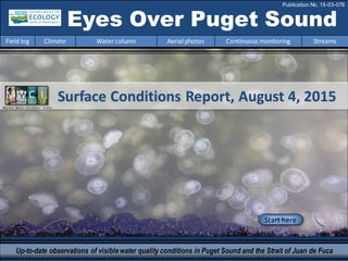
1. Surface Conditions Report, August 4, 2015Marine Water Condition Index
Start here
Up-to-date observations of visiblewater quality conditions in Puget Sound and the Strait of Juan de Fuca
Eyes Over Puget Sound
Field log Climate Watercolumn Aerial photos Continuous monitoring Streams
Publication No. 15-03-076
2. Personalfield log p. 3
Scientists engage the media to talk about “the Blob”.
Ecology andNOAAteamupto track jellyfish.
Climateconditions p. 6
Air temperature andoceanconditions remainwarm.
River flows are below normal,especially the FraserandSkagit
rivers. Upwellingoff the coast is normal.
Watercolumn p. 7
Puget Sound waters are warmbecauseof “the Blob”.
Temperatures are the highest onrecordsince 1989 and
we keep sitting onthe same warmwater.
Aerialphotography p. 11
Impressive jellyfishmasses in some finger inlets of South Sound.
Large debris islands in CentralSoundpersist. Phytoplankton
blooms in colors of red-brown,green,and brownin SouthSound
and some bays of KitsapPeninsula.
Continuous monitoring p. 36
Wateris warmer andsaltier than the past 5 years.
Streams p. 39
The Deschutes River has very low flows andhigh nitrogen
concentration stemmingfrom groundwater.
Does this contribute to the blooms in Budd Inlet?
LONG-TERMMARINEMONITORINGUNIT
Skip Albertson
Dr. Christopher
Krembs
Julia Bos
Suzan Pool
Editorial assistanceprovided by: Julianne Ruffner, Suzan Pool, CarolMaloy
Marine conditionsfrom 8-4-2015 at a glance
Field log Climate Watercolumn Aerial photos Continuous monitoring Streams
Mya Keyzers
Laura Hermanson
Jessica Payne
Markus von Prause
3. Personal Field Impression
Field log Weather Watercolumn Aerial photos Continuous monitoring Streams
Personal Field Impression
Field log Climate Watercolumn Aerial photos Continuous monitoring Streams
On July 30th, Ecology invited local scientists and the media to talk about the warmwater “blob” that is affecting the
waters of Puget Sound. Warmer water combined with lower than normalriver flows, droughtconditions, and the
resulting lower dissolved oxygen content in the water can lead to many negative environmentalrepercussions. This
media event was an effort to informthe public on the important work agency scientists (local, state, federal, and
academic) are doing to monitor and assess these unusualconditions. Visit our blog and links below for details.
Scientists Engage the Media to Talk About “the Blob”
Hydrologist Jim Shedd talking toa reporter
about drought conditions.
Flight technicianLaura Hermanson talking
to a KUOW reporter about the CTD.
OceanographerChristopher Krembs helps set the
stageabout theunusual conditions.
Some links tomedia coverage about the warm water Blob:
King 5 video:Warm water “blob” invadesPugetSound
http://www.king5.com/story/news/local/2015/07/30/blob-in-puget-sound/30916753/
Ecology’s ECOconnect blog: Puget Soundwaters leftswelteringafterdouble punch
from the droughtand the Blob
http://ecologywa.blogspot.com/2015/07/puget-sound-waters-left-sweltering.html?m=1
KUOW: PugetSound Salmon Losing, JellyfishWinning
http://kuow.org/post/puget-sound-salmon-losing-jellyfish-winning
Special thanks to
JessicaPayne, our
Communications
Manager, for
setting up the
media day.
4. Can aerial photos of jellyfish smacks be used to track jellyfish populations in Puget Sound? To find out, scientists
fromNOAA, the Department of Ecology, and Western Washington University are sampling giant patches of jellyfish
and comparing the numbers to images of jellyfish aggregations taken on EOPS flights. The goal is to use aerial
photos to estimate overalljellyfish abundanceand distribution in the inlets of Puget Sound. With the plane in the
air and the research vesselSkookum on the water, we set out to do some ground-truthing.
Personal Field Impression
Field log Climate Watercolumn Aerial photos Continuous monitoring Streams
I collect sediment samples in the
field. Look at this huge polychaete
we caught in the grab!
Ecology and NOAA team up to track jellyfish in Puget Sound
Ecology’s RV
Skookum with
captain Randy Coots
Excellent coverage by reporter Alison Morrow, King 5 News:
http://www.king5.com/story/tech/science/environment/2015/08/05/jellyfish-ecology-noaa-puget-sound/31194035/
5. Field log Climate Watercolumn Aerial photos Continuous monitoring Streams
Climateand natural influencesthrough8-4-2015
Summary:
Air temperatures werewarmer
than normal across western
Washington in July.
Precipitation levels have
remained below normal in the
Puget Sound region.
Sunshine has generally been
abovenormal.
River flows areall below normal,
especially the Fraser and Skagit
rivers to the north.
Upwelling has returned to normal
and the PDO remains in the warm
phase (July data not yet released).
Climate and naturalinfluences,includingweather,rivers,and the adjacent ocean,canaffect our
marine waters. Graphics are basedonprovisional data andare subject to change.
http://www.ecy.wa.gov/programs/eap/mar_wat/weather.html,page 26.
Putting the puzzle piecesof influencing factorstogether…
No data
lowerhigher expected No data*Upwelling Anomalies (PFEL)
*
6. We usea chartered float
plane and boat to access
our monthly monitoring
stations.
We communicate data and
environmentalmarine
conditions using:
1. Marine Water
Condition Index
(MWCI)
2. Eyes OverPuget
Sound (EOPS)
3. Anomaliesand
sourcedata
Field log Weather Watercolumn Aerial photos Continuous monitoring Streams
Ourlong-termmarinemonitoringstationsinWashington
Starthere
Isl.
.
7. In2014, a massive pool of warmwater developedinthe NE Pacific (the Blob). Duringthe summer of 2014,Blobwaters
were held offshore by the process of upwelling,as northerly winds movedsurface watersoffshore to be replacedby
cooler upwelledwater. This bufferedthe coast. Inthe fall of 2014,northerly winds subsided and the Blobmoved
onshore,entering Puget Sound on a massive scale.
Field log Weather Watercolumn Aerial photos Continuous monitoring Streams
UnusualPugetSoundconditionsexplained
Fraser River is the largest freshwater source for the Salish Sea - significantlyaffectingestuarine circulation
0
2000
4000
6000
8000
10000
12000
Mar-14
Mar-14
Apr-14
May-14
Jun-14
Jul-14
Aug-14
Sep-14
Oct-14
Nov-14
Dec-14
Jan-15
Feb-15
Mar-15
Apr-15
May-15
Jun-15
Discharge(m3
s-1
)
Higherthan normal
Lower thannormal
Expected
As of June 2015
(left), the Blobis
sitting offshore,
separatedfrom
the coast by a
thin band of
cooler,upwelled
water,like in
summer of 2014. Estuarine circulationis now weak since the snowpack-starved
rivers have recordlow flows. This reduces chances tobringcool,
upwelledoceanwaterinto Puget Sound.
The freshet of the Fraser River and other rivers
flowinginto Puget Sound came muchearlier due to
the mild winter, resulting in below normal flows.
Water that is in Puget Sound will therefore remain
longer. That means more warmingand, potentially,
an accumulationofpollutants.
Credit: Christopher Krembs
8. Physical conditionstracked in historicalcontext
Field log Weather Watercolumn Aerial photos Continuous monitoring Streams
Higher Temperature! ExpectedOxygenExpectedSalinity
Coastal stations
warmer and
saltier.
Black boxes
show expected
temperatures
based on
historical data
Explore profiles
at all stations
June temperatures were still exceptionally high,even withthe onset of seasonal upwelling. InMay,
temperatures insome regions suggested a possible return to normal (Willapa Bay,HoodCanal)but residual
Pacific OceanBlob effects continue to dominate our waters. Coastal bays showedsaltier waters withlower
oxygen,while Puget Sound regions had more expectedsalinity andoxygen.
Region
5 6 7 8 9 10 11 12 1 2 3 4 5 6 7 8 9 10 11 12 1 2 3 4 5 6 5 6 7 8 9 10 11 12 1 2 3 4 5 6 7 8 9 10 11 12 1 2 3 4 5 6 5 6 7 8 9 10 11 12 1 2 3 4 5 6 7 8 9 10 11 12 1 2 3 4 5 6
Hood Canal
Central Sound
South Sound
2015
Grays Harbor
Willapa Bay
North Sound
San Juan
Whidbey Basin
20142015 201520142014 20132013 2013
9. a) PacificDecadalOscillationIndex(PDO,temperature) (explanation)
b) UpwellingIndex(anomalies)(Upwelling,low oxygen) (explanation)
c) NorthPacificGyreOscillationIndex(NPGO, productivity) (explanation)
Field log Weather Watercolumn Aerial photos Continuous monitoring Streams
Theoceanaffectswaterquality:OceanClimateIndices
NPGO(x10)
PDO/UpwellingIndex
Three-year running average of PDO, Upwelling, and NPGO indices scores
.
Ocean boundaryconditions are in transition: (a)water is warm (PDO), (b) upwellingoflow oxygen and
high nutrient ocean water is expected (UpwellingIndex), and (c) higher surface productivityalongthe
coast (NPGO) is expected. Where are we headingnext?
-25
-20
-15
-10
-5
0
5
10
15
20
25
-1.5
-1
-0.5
0
0.5
1
1.5
1945 1950 1955 1960 1965 1970 1975 1980 1985 1990 1995 2000 2005 2010 2015
10. Is the food web changing in Puget Sound?
Followthe experts
WebEx
Hypothesis!
Increasesin
nitrate
concentrations
could be caused
by a top-down
controlon
phytoplankton
biomass.
Is Noctiluca
a visible
harbingerof a
food web
change?
Hypothesis for combining a series of recent observations
affecting energy and material transfer to higher trophic levels
Are changesin highertropic levelspart of a story of the lowerfood web?
11. Summary: Aerial photography8-4-2015
Impressivejellyfish masses in some finger inlets of South Sound and, to a lesser extent,
presentin inlets of the Kitsap Peninsula. Largedebris islands in Central Sound. Phytoplankton
blooms in colors of red-brown, green, and brown in South Sound and somebays of the Kitsap
Peninsula.
Field log Weather Water column Aerial photos Continuous monitoring Streams
Start here
Mixing and Fronts:
Well developed tidal fronts exiting fromPickering Passage
and Central Sound.
Debris:
High occurrences in PortMadison, Central Sound.
Visible blooms:
Green-brown: Totten Inlet
Red-brown on a large scale: Eld, Budd, Henderson, and Case
Inlets; Liberty Bay.
Green: Henderson Bay
Jellyfish:
Very abundant and largejellyfish patches in southern inlets
of South Sound (Budd and Eld Inlets), Sinclair Inlet, and
Liberty Bay.BloomDebrisFront
Suspendedsediment:
Suspended sediments found in expected locations near rivers.
Plume
Greetedin the morning by moonjellyfish
Casimir Rice (NOAA)…no words needed.
12. Strait of
Juan de Fuca
San Juan Islands
Padilla Bay
Main Basin
Hood Canal
SouthSound
Whidbey Basin
Field log Climate Water column Aerial photos Continuous monitoring Streams
Observation Maps:
Good visibilityin South Sound,
cloudyin Central Sound with limited
visibility.
Flight Information:
11
10
Aerial photography
and navigation guide
Central and NorthSound
South Sound
7
12
5
Flight route
9
18
32 1
4
14
19
16
15
20
8
Tide data (Seattle):
02:32 AM 2.84 L
08:14 AM 9.97 H
02:28 PM 0.68 L
09:03 PM 12.37 H
17
6
13
13. Large patches of moon jellyfishmixedin with red-brown bloom.
Location: Budd Inlet (South Sound),2:56 PM.
1 Aerial photography 8-4-2015 Navigate
Field log Climate Watercolumn Aerial photos Continuous monitoring Streams
jellyfish
Bloom
boat
boat
boat
jellyfish
jellyfish
jellyfish
jellyfish
jellyfish
14. 2 NavigateAerial photography 8-4-2015
Field log Climate Watercolumn Aerial photos Continuous monitoring Streams
Numerous patches of jellyfishin water containing bright red-brown algal bloom.
Location: Priest Point Park, Budd Inlet (South Sound),2:59 PM.
Bloom
boat
jellyfish
boat
jellyfish
jellyfish
jellyfish
15. 3 NavigateAerial photography 8-4-2015
Large jellyfishpatches in water containing red-brown algal bloom.
Location: Budd Inlet (South Sound),3:00 PM.
Field log Climate Watercolumn Aerial photos Continuous monitoring Streams
Bloom
jellyfish
jellyfish
jellyfish
boat
boatboat
boat
boat
jellyfish
jellyfish
16. 4 Navigate
Field log Climate Watercolumn Aerial photos Continuous monitoring Streams
Aerial photography 8-4-2015
Numerous large patches of jellyfishin water containing red-brown algal bloom.
Location: Budd Inlet (South Sound),3:12 PM.
Bloom
boat
jellyfishjellyfish
jellyfish
jellyfish
jellyfish
jellyfish
jellyfish
jellyfish
jellyfish
jellyfish
jellyfish
jellyfish
jellyfish
jellyfish
17. 5 NavigateAerial photography 8-4-2015
Field log Climate Watercolumn Aerial photos Continuous monitoring Streams
Long and curvy patches of jellyfishin water containing red-brown algal bloom in the inner inlet.
Location: Budd Inlet (South Sound),3:12 PM.
Bloom
boat
jellyfish
Bloom
18. Numerous small round patches of jellyfishin the outer part of the inlet.
Location: Budd Inlet (South Sound),3:13 PM.
6 NavigateAerial photography 8-4-2015
Field log Climate Watercolumn Aerial photos Continuous monitoring Streams
boat
Bloom
jellyfish
jellyfish
jellyfish
jellyfish
jellyfish
jellyfish
jellyfish
jellyfish
19. Numerous patches of jellyfishin water containing red-brown algal bloom.
Location: Eld Inlet (South Sound), 3:09 PM.
7 NavigateAerial photography 8-4-2015
Field log Climate Watercolumn Aerial photos Continuous monitoring Streams
Bloom
jellyfish
jellyfishjellyfish
jellyfish
Bloom
Bloom
boat
20. Numerous patches of jellyfishin water containing red-brown algal bloom.
Location: Eld Inlet (South Sound),3:09 PM.
8 NavigateAerial photography 8-4-2015
Field log Climate Watercolumn Aerial photos Continuous monitoring Streams
Bloom
boat
boat
jellyfish
jellyfish
jellyfish
jellyfish
21. A.
Collaborating on air to ground measurements of jellyfishsuper smacks (this one is > 2 millionindividuals)
Location: Eld Inlet (South Sound, 1400 ft), 1:10 PM.
9 NavigateAerial photography 8-4-2015
Field log Climate Watercolumn Aerial photos Continuous monitoring Streams
Eyes Over Puget Sound
CorreighGreene (Scientist)
JenniferPurcell (Scientist)
AlisonMorrow (Reporter)
ChristopherKrembs(Scientist)
Joe Leatherman(Pilot)
Mya Keyzers
Laura Hermanson
Bloom
jellyfish
jellyfish
jellyfish
jellyfish
Our boat
22. 10 NavigateAerial photography 8-4-2015
Sediment from river plume and bloom blend (no jellyfish).
Location: Totten Inlet (South Sound),3:04 PM.
Field log Climate Watercolumn Aerial photos Continuous monitoring Streams
Bloom
Plume
23. 11 NavigateAerial photography 8-4-2015
Patches of red-brown bloom.
Location: Henderson Inlet (South Sound),3:14 PM.
Field log Climate Watercolumn Aerial photos Continuous monitoring Streams
Bloom
boat
24. Tidal front with organic debris separating feather-shaped red-brown bloom from green water originating
from Pickering Passage. Location: Stretch Island,Case Inlet (South Sound),3:20 PM.
12 Navigate
Field log Climate Watercolumn Aerial photos Continuous monitoring Streams
Aerial photography 8-4-2015
Debris
boat
Bloom
Bloom
25. Red-brown bloom and organic debris.
Location: Off Rock Bay, Case Inlet (South Sound),3:20 PM.
13 NavigateAerial photography 8-4-2015
Field log Climate Watercolumn Aerial photos Continuous monitoring Streams
Debris
Bloom
26. Bands of red-brown bloom.
Location: Off Vaughn Bay, Case Inlet (South Sound),3:20 PM.
14 Navigate
Field log Climate Watercolumn Aerial photos Continuous monitoring Streams
Aerial photography 8-4-2015
Bloom
boat
27. 15 Navigate
Field log Climate Watercolumn Aerial photos Continuous monitoring Streams
Greenbloom and organic debris patches
Location: Henderson Bay, Carr Inlet (South Sound),3:25 PM.
Aerial photography 8-4-2015
Debris
Bloom
boat
29. 17 Navigate
Field log Climate Watercolumn Aerial photos Continuous monitoring Streams
Patches of red-brown bloom, organic debris, and some jellyfishpatches.
Location: LibertyBay(Central Sound),3:40 PM.
Aerial photography 8-4-2015
Bloom
Debris
30. Numerous patches of organic debris, some accumulating along front; bloom in background.
Location: Port Madison (CentralSound),3:43 PM.
18 Navigate
Field log Climate Watercolumn Aerial photos Continuous monitoring Streams
Aerial photography 8-4-2015
Bloom
Debris
Debris
31. 19 Navigate
Field log Climate Watercolumn Aerial photos Continuous monitoring Streams
Numerous patches of organic debris, some accumulating along front.
Location: Off Point Jefferson (Central Sound),3:43 PM.
Aerial photography 8-4-2015
Debris
ferry
32. 20 Navigate
Numerous patches of organic debris (tug and barge provide scale).
Location: Across Port Madison (Central Sound),3:46 PM.
Aerial photography 8-4-2015
Field log Climate Watercolumn Aerial photos Continuous monitoring Streams
Debris
Debris
Debris
Debris
Debris
barge
33. n.a.
Numbers on map refer to picture numbers for spatial reference
Date: 8-4-2015
Central Sound
Aerial photography observations in Central SoundQualitative aerial observer map during transit Navigate
Field log Climate Water column Aerial photos Continuous monitoring Streams
Numbers on map refer to picture numbers for spatial reference
North Sound/SanJuan Islands
20
19
18
15
16
17
34. Date: 8-4-2015
Qualitative aerial observer map during transit
Numbers on map refer to picture numbers for spatial reference
Navigate
Field log Climate Water column Aerial photos Continuous monitoring Streams
South Sound
12
10
3
4
5
6
7
8
9
11
12
13
14
35. Legendto map annotations
Comments:
Maps are producedby observers during and
afterflights. They are intendedto give an
approximate reconstructionofthe surface
conditions onscales that connect to and
overlapwithsatellite images in the sectionthat
follows.
Debris:
Debris canbe distinguished into natural and
anthropogenic debris floatingat the surface
sensu Moore andAllen (2000). The majority of
organic debris in Puget Sound is natural and
mixedwith discardedman-made pieces of
plastic,wood,etc. Fromthe plane,we cannot
differentiatethe quality of debris at the surface
and therefore,call it forreasons of practicality
just “debris”.
S.L. Moore,M. J. Allen. 2000. Distribution of
Anthropogenic and Natural Debris on the
Mainland Shelf of the Southern California Bight.
Marine Pollution Bulletin,40(1): 83–88.
Navigate
Field log Climate Watercolumn Aerial photos Continuous monitoring Streams
36. Field log Climate Watercolumn Aerial photos Continuous monitoring Streams
Continuousmonitoring 8-4-2015
Summary: The Mukilteo mooring station has been deployed since September 2009. A near-surface
sensor is also measuring water that is warmer and saltier than normal. Before July, the near-bottom
sensor has recorded a maximum water temperature of 15.7 °C. During July, a new maximum of 16.7 °C
was measured; the mean was 13.2 °C. River flows remain low and minimal. Mostly tides are driving
changes in water characteristics.
The above plot shows the probability
of near-surfaceobservations over
the pasttwo-week period. High
probability shown in warmcolors.
Density is defined by salinity and
temperature.
2-6 m depth
For monthly means of near-bottomdata, go to next page.
37. Field log Climate Watercolumn Aerial photos Continuous monitoring Streams
Continuousmonitoring 8-4-2015
At the Mukilteo mooring, weuse the near-bottom
sensor (12-16 mdeep) to measuresignificant inter-
annual variability in temperature, salinity, and dissolved
oxygen.
Inter-annualvariability is shown over a 5-year period.
All three variables show strong seasonality.
In July, the near-bottomsensor recorded the warmest
water temperature since late 2009, when the near-
bottom mooring began (highlighted by red circle in top
plot). Salinity and dissolved oxygen declined slightly
fromJune to July.
Seasonally, variability of each parameter in 2015
remains small from January to July compared to
previous years.
Please note that data are provisional. Data are in GMT.
38. Our mooring station in Mukilteo is located in
Whidbey Basin near Everett. Itis also
located at the transition between Possession
and Central Sounds at a depth that is
influenced by the Skagitand Snohomish
River discharges, prevailing winds, and tidal
mixing.
As the largestregional contributor of
freshwater to Puget Sound, understanding
the timing and magnitude of the Skagit River
flow is important.
We presentdaily means for the past31 days.
Data are plotted in Pacific Standard Time.
Wind data are fromPaine Field in Everett.
River flow data are from USGS.
Click on icon to view real-time
data of the moorings
Field log Climate Watercolumn Aerial photos Continuous monitoring Streams
Continuousmonitoring 8-4-2015
39. Ecology’s Riverand Stream MonitoringProgram measureswater quality of the Deschutes River since 1978 (13A060).
Water Qualityof the DeschutesRiver
Field log Climate Water column Aerial photos Continuous monitoring Streams
When rivers are flowing low, nutrients become concentrated
The Deschutes River discharges
into Budd Inlet and could fuel the
presentalgal blooms because
of low summer flows (below) and
elevated nitrate (NO3)
concentrations. As flows drop, concentrations
of nitrogen increase due to increased
groundwater influence(left).
Half of the Deschutes River summer flow (55%) comes
fromwater that enters the river from underground.
This groundwater carries higher nitrate concentrations
with it.
The Deschutes River is the 2nd largestcontributor of total
nitrogen loads to southern Puget Sound (Monhamedali
et al, 2011). Annualaveragenitrateloads are estimated
to be 678 kg/d (Sackmann, 2011).
Daily baseline (1948-2015)
Flows in 2015
Historicalminimal flows
The Deschutes River is now flowing
USGS 12079000DESCHUTES RIVERNEARRAINIER,WA
40. Water Qualityof the DeschutesRiver
Field log Climate Water column Aerial photos Continuous monitoring Streams
Flow conditions on the Deschutes River reflect the combined effects of climate and water withdrawals.
Stream flows during June and July fell below the normal mean historical (<20%) summer flows. Overall
summer base flows havedeclined since the 1950s.
The Deschutes River is currently on the Clean Water Act
303d list for violating water quality standards for
temperature, bacteria, and oxygen.
Water Quality Index trends show annual nitrogen scores
are consistently very low, indicating that nitrogen
loading is very high.
Deschutes River nitrate concentrations, observed during
summer low flow conditions, continue to show
increasing trends since 1995 (Von Prause, 2013).
Instream flow on the Deschutes River influences stream
temperature, dissolved oxygen, and pH while reductions
in flow may increase peak temperatures (Roberts et al,
2012 ).
Capitol Lake receives Deschutes River water
beforeit enters Budd Inlet. Capitol Lake has
had lots of algae growth this summer.
42. You may subscribe or unsubscribe to the Eyes Over Puget Sound email listservby going to:
http://listserv.wa.gov/cgi-bin/wa?A0=ECOLOGY-EYES-OVER-PUGET-SOUND
Many thanks to our business partners: Clipper Navigation,SwantownMarina,andKenmore Air.
We are looking forfeedbackto improve ourproducts.
Dr. ChristopherKrembs
christopher.krembs@ecy.wa.gov
Marine Monitoring Unit
EnvironmentalAssessment Program
WA Department of Ecology
Field log Climate Water column Aerial photos Continuous monitoring Streams