SlideShare a Scribd company logo
Surface Conditions Report, September 26, 2016
Eyes Over Puget Sound
Field log Climate Water column Aerial photos Continuous monitoring Streams
Publication No. 16-03-077
Up-to-date observations of water quality conditions in Puget Sound and coastal bays
Start here
Scuba info
Critter of the Month– The Sweet Potato Sea Cucumber
Dr. Christopher
Krembs (Editor)
Personalimpressions p. 4
September is jellyfish season!
Climateinfluences p. 6
Sunny, warm,and dry conditions withlow river flows.
Watercolumn p. 7
Lower oxygenwasobservedinsouthernPuget Sound in August.
Water in coastal bays was saltier due to lack of rain.
Aerialphotography p. 11
Large jellyfishaggregations inSouth Sound. Red-brownand
green-brownblooms were widespreadinmany bays across
Puget Sound andthe San JuanIslands. Incontrast,Central Sound
had clear water withlittle algal activity.
Continuous monitoring p. 35
Algal concentrations are decreasingacross Central Basinwith
some short-termgrowthinmid-September.
Streams p. 37
InAugust, many streams had slipped back to below-normal
flows. Precipitationevents inSeptember improvedPuget Sound
streamflows.
LONG-TERMMARINEMONITORINGUNIT
Skip Albertson
Julia Bos
Suzan Pool
Editorial assistanceprovided by: Suzan Pool, CarolMaloy
Marine conditionsfrom 9-26-2016at a glance
Field log Climate Water column Aerial photos Continuous monitoring Streams
Jim
Shedd
JuliaSuzan
Mattie Michalek
Critter of the Month – The Sweet Potato Sea Cucumber
Personal Field Impression
Field log Weather Water column Aerial photos Continuous monitoring Streams
Eyes Under Puget Sound 9-26-2016
Field log Climate Water column Aerial photos Continuous monitoring Streams
Learn more about Molpadiaand othercritters on Ecology’s EcoConnect blog here.
Angela Eagleston& Dany Burgess
Marine Sediment Monitoring Team
Fun Facts!
• Their skeleton is composed of
tiny particles called ossicles.
• They eat upside down with
their faces buried in the mud.
• They are smooth and shiny
because they lack tube feet.
Molpadiaintermedia
This critter sounds like a vegetable
and looks a bit like a breakfast
sausage, butthe structures in its skin
make it special! Find out what
makes this plump mud-dweller an
important partof Puget Sound
benthic communities.
Personal Field Impression
Field log Weather Water column Aerial photos Continuous monitoring Streams
Personal Field Impression 9-26-2016
Field log Climate Water column Aerial photos Continuous monitoring Streams
Our WCC intern, Mattie Michalek, presented a projecton the large jellyfish
masses wehave been seeing in Budd Inlet. Mattie analyzed photos frommonthly
EOPS flights over the last 6 years. Sheassigned jellyfish images to 5 categories to
indicate how abundantthe jellyfish mass aggregations (smacks) were.
Mattie presented her study
results at the 2016 South Sound
Science Symposium: “Do
salinity and temperaturein
Budd Inlet drivejellyfish mass
aggregations?”
September is jellyfish season in South Sound!
Jellyfish biomass reached
record levels in Budd Inlet
and other finger inlets of
South PugetSound in the
fall of 2014 and summer of
2015, coinciding with ‘the
Blob’ of unusually warm
water and with the drought.
Budd Inlet 2014
View poster
This isa newfeatureandwearesolicitingfeedback (salb461@ecy.wa.gov).
Eventuallywewill featurethemostrecentdata.
good poor
visibility
Find depths with high and low visibility
• Best visibility wasabout35 feet or more
around SeacrestPark in Elliott Bay.
• Poor visibility occurred in many places of
Puget Sound within the first10 feet of the
surface.
• In August, visibility took a downturn
perhaps in responseto abundantsunshine
and resultantplanktonic blooms.
• Elliott Bay decreased visibility from42 ft to
36 ft since July.
• We usetransmissometer readings fromour
CTD packageand convertthem into
horizontalvisibility.
What was the visibility in the water for divers?
Personal Field ImpressionThe divers' page, visibility 9-26-2016
Field log Weather Water column Aerial photos Continuous monitoring StreamsField log Climate Water column Aerial photos Continuous monitoring Streams
August
Climate Influences leading to 9-26-2016
Climate and naturalinfluences,includingweather,rivers,and the adjacent ocean,can
affect our marine waters. Graphics are basedonprovisional dataandare subject to
change. http://www.ecy.wa.gov/programs/eap/mar_wat/weather.html,page 26.
August Summary:
Air temperatures wereslightly
abovenormal.
Precipitationwas below
normal.
Sunshine levels werehigher.
River flows werestill below
normal, particularly to the
north (Nisqually River is
regulated).
Upwelling, ENSO, and PDO are
abovenormal.
higher No datalowerexpected
*UpwellingAnomalies (PFEL)
PDO = PacificDecadal Oscillation
NPGO = North Pacific GyreOscillation
ENSO = El Niño Southern Oscillation
Field log Weather Water column Aerial photos Continuous monitoring StreamsField log Climate Water column Aerial photos Continuous monitoring Streams
We usea boatand
a chartered float plane
equipped with a CTD
package
to access our monthly
monitoring stations.
We communicate data
and environmental
marine conditions using:
1. Marine Water
Condition Index
(MWCI)
2. Eyes OverPuget
Sound (EOPS)
3. Anomaliesand
sourcedata
Field log Climate Water column Aerial photos Continuous monitoring Streams
Ourlong-termmarinemonitoringstationsinWashington
Starthere
Isl.
.
Station network of abmient
water quality monitoring stations
Field log Climate Water column Aerial photos Continuous monitoring Streams
HowwellisPugetSoundexchangingitswater?
Year 2016 continues to have record-breakingglobal temperatures. Inour region,the Fraser River flow has plummeted.
Estuarine circulationis important because water temperatures inPuget Sound are still warmer thannormal! The Fraser
River is the largest freshwater source for the SalishSea,significantly affectinganddriving estuarine circulation.
Inwinter andspring 2016, the Fraser
River and other rivers dischargedprematurely. This
year’s Fraser River summer flow has been extremely
low in response to warmwinter temperatures and
lack of snowpack inBC. Very low summer flows
inhibit the renewal of water inPuget Sound. The
flow is now normalizing.
Source: http://wateroffice.ec.gc.ca/index_e.html
Very low Fraser River flow this
summer meant stagnant
water inthe Salish Sea and
reducedexchange with
coastal water.
As a consequence,water
warmedandpollution hada
chance to accumulate.
Credit: Christopher Krembs
0
2000
4000
6000
8000
10000
12000
Dec-13
Jan-14
Feb-14
Mar-14
Apr-14
May-14
Jun-14
Jul-14
Aug-14
Sep-14
Oct-14
Nov-14
Dec-14
Jan-15
Feb-15
Mar-15
Apr-15
May-15
Jun-15
Jul-15
Aug-15
Sep-15
Oct-15
Nov-15
Dec-15
Jan-16
Feb-16
Mar-16
Apr-16
May-16
Jun-16
Jul-16
Aug-16
Sep-16
Discharge(m3s-1)
Higher than normal
Lower than normal
Expected
Fraser RiverFlow
Physical conditionstracked in historicalcontext
Explore profiles
at all stations
Temperature Normalizing Oxygen lowerSalinity higher
Region
7 8 9 10 11 12 1 2 3 4 5 6 7 8 9 10 11 12 1 2 3 4 5 6 7 8 7 8 9 10 11 12 1 2 3 4 5 6 7 8 9 10 11 12 1 2 3 4 5 6 7 8 7 8 9 10 11 12 1 2 3 4 5 6 7 8 9 10 11 12 1 2 3 4 5 6 7 8
Whidbey Basin
Hood Canal
Central Sound
South Sound
Grays Harbor
Willapa Bay
North Sound
San Juan
2015 2015 201620152016 2016
After nearly 2 years of record-breakingwater temperatures,Puget Soundtemperatures andsalinity are not
quite to expectedranges inAugust. Lower oxygenconditions continue insouthernPuget Sound. At the
coast,salinity is higher due to very low river flows (see page 37).
Field log Climate Water column Aerial photos Continuous monitoring Streams
a) PacificDecadalOscillationIndex(PDO,temperature) (explanation)
b) UpwellingIndex(anomalies)(Upwelling,low oxygen) (explanation)
c) NorthPacificGyreOscillationIndex(NPGO, productivity) (explanation)
Field log Climate Water column Aerial photos Continuous monitoring Streams
Theoceanaffectswaterquality: OceanClimateIndices
NPGO(x10)
PDO/UpwellingIndex
Three-year running average of PDO, Upwelling, and NPGO indices scores
.
Ocean boundaryconditions long-term variability: (a)water is still warm (PDO), (b) upwellingoflow
oxygen and high nutrient ocean water are normal (UpwellingIndex anomaly),and (c) surface productivity
alongthe coast is normalizing(NPGO).
-25
-20
-15
-10
-5
0
5
10
15
20
25
-1.5
-1
-0.5
0
0.5
1
1.5
1945 1950 1955 1960 1965 1970 1975 1980 1985 1990 1995 2000 2005 2010 2015
Summary: Aerial photography9-26-2016
Large jellyfishaggregations were infinger Inlets of SouthSound. Red-brownandgreen-brownblooms
were widespreadin many bays across Puget Soundand aroundthe San JuanIslands. Incontrast,
Central Soundhad clear water withlower algal activity.
Field log Climate Water column Aerial photos Continuous monitoring Streams
Start here
Mixing and Fronts:
Many and large tidal eddies outlined by blooms of different
colors.
Debris:
Largeorganic debris rafts in Budd and Case Inlets and
Nisqually Reach.
Visible blooms:
Strong red-brown blooms in South Sound and in Sinclair,
Liberty, and Samish Bays. Brown-green blooms seen around
tidal eddies. In Totten, Eld, and Dyes Inlets.
Jellyfish:
Very numerous in Budd, Eld, and Totten Inlets. Not seen in
other inlets.
BloomDebrisFront Suspendedsediment:
Near shoresuspended sediments mostly due to strong tidal
activity. Some regional river input of suspended sediment.
Plume
Blooms in Budd Inletwithstrikingintensity
SinclairInletwith red-brownbloom
Bloom
Bloom
jellyfish jellyfish
Strait of
Juan de Fuca
San Juan Islands
Padilla Bay
Main Basin
Hood Canal
South Sound
Whidbey Basin
Field log Climate Water column Aerial photos Continuous monitoring Streams
Sunny, very good visibility
Flight Information:
Aerial photography
and navigation guide
Flight route
9
3
2
8
Tide data(Seattle):
Time Height (ft) High/Low
01:29 AM 9.13 H
08:02 AM 0.75 L
03:29 PM 10.94 H
09:27 PM 4.55 L
6
11
14
41
Observation Maps:
Central and NorthSound
South Sound
15
12
13
7
5
18
19
20
16
10
17
Strong red-brown bloom, jellyfishpatches, and organic debris at surface.
Location: Near Big Tykle Cove,Budd Inlet (South Sound),12:28 PM.
1 Aerial photography 9-26-2016 Navigate
Field log Climate Water column Aerial photos Continuous monitoring Streams
boat
Bloom
Bloom
jellyfish jellyfish
Debris
boat
boat
boat
Two differently colored red-brown blooms and abundant jellyfishpatches.
Location: Across Butler Cove, Budd Inlet (South Sound),12:31 PM.
Bloom
jellyfish
jellyfish
jellyfish
jellyfish
jellyfish
jellyfish
jellyfish
2 NavigateAerial photography 9-26-2016
Field log Climate Water column Aerial photos Continuous monitoring Streams
jellyfish
jellyfish
boat
marker
jellyfish
Bloom
boat
boat
jellyfish
jellyfish
Bloom
boat
3 NavigateAerial photography 9-26-2016
Strong red-brown bloom and abundant jellyfishpatches. Tidal eddy.
Location: YoungCove, Eld Inlet (South Sound),12:35 PM.
Field log Climate Water column Aerial photos Continuous monitoring Streams
eddy
jellyfish
jellyfish
jellyfish jellyfish
jellyfish
boat
jellyfish
jellyfish
jellyfish
Bloom
jellyfish
A. B.
4 Navigate
Field log Climate Water column Aerial photos Continuous monitoring Streams
Aerial photography 9-26-2016
A. Red-brown and green blooms around tidal eddy during incoming tide. B. Large patch of organic debris.
Location: A. Eld Inlet,B. Budd Inlet (South Sound),12:37 PM.
Bloom
boat
Debris
Bloom
Debris
boat
Debris
eddy
A.
5 NavigateAerial photography 9-26-2016
Field log Climate Water column Aerial photos Continuous monitoring Streams
Tidal currents and eddies with different colored blooms (green and red-brown) during incoming tide.
Location: A. Carlyon Beach,Totten Inlet,B. Hope Island (South Sound),12:39 PM.
Bloom
Bloom
B. Bloom
eddy
eddyBloom
Strong red-brown bloom and abundant jellyfishpatches.
Location: Henderson Bayand BurleyLagoon, Carr Inlet (South Sound),12:49 PM.
6 NavigateAerial photography 9-26-2016
Field log Climate Water column Aerial photos Continuous monitoring Streams
Bloom
suspendedsediment
Debris
mussel raft
boat
powerline
Burley
Lagoon
Tidal currents and eddies with different colored blooms (green and red-brown) during incoming tide.
Location: Dyes Inlet (Central Sound),12:57 PM.
7 NavigateAerial photography 9-26-2016
Field log Climate Water column Aerial photos Continuous monitoring Streams
Bloom
boat
Bloom
Debris
eddy
boat
Red-brown bloom in shallow embayment near Keyport.
Location: Keyport,entrance to Liberty Bay (Central Sound),1:00 PM.
8 NavigateAerial photography 9-26-2016
Field log Climate Water column Aerial photos Continuous monitoring Streams
boat
Debris
Bloom
Large tidal eddy and water with different colored blooms.
Location: LibertyBay (Central Sound), 1:01 PM.
9 NavigateAerial photography 9-26-2016
Field log Climate Water column Aerial photos Continuous monitoring Streams
Bloom
Bloomv
Bloom
eddy
10 NavigateAerial photography 9-26-2016
Red-brown bloom with adjacent river plume.
Location: LibertyBay (Central Sound),1:02 PM.
Field log Climate Water column Aerial photos Continuous monitoring Streams
boat
Plume
Bloom
Bloom
NavigateAerial photography 9-26-2016
Red-brown bloom and flood tide settingoff eddy. River plume with suspended sediment on easternshore.
Location: Port Gamble (Hood Canal),1:06 PM.
Field log Climate Water column Aerial photos Continuous monitoring Streams
11
barge
barge
Bloom
eddy
mussel raft
Plume
boat
B.A.
NavigateAerial photography 9-26-2016
A. Red-brown bloom and suspended sediment next to Samish Island. B. Ship slowed by tug reveals that
bloom is only at surface. Location: Samish Bay(North Sound),1:31 PM.
Field log Climate Water column Aerial photos Continuous monitoring Streams
12
suspendedsediment
tug
ship
Bloom
suspendedsediment
Bloom
clear
suspendedsediment
Bloom
SamishIsland
NavigateAerial photography 9-26-2016
Jet from Samish Bay flowing north alongside Lummi Island. Fraser River plume/bloom and front.
Location: Lummi Island,Rosario Strait (North Sound),1:36 PM.
Field log Climate Water column Aerial photos Continuous monitoring Streams
13
Plume
Lummi Island
NavigateAerial photography 9-26-2016
Fraser River plume/bloom meetingflood tide which causes turbulent mixing.
Location: Rosario Strait (North Sound),1:39 PM.
Field log Climate Water column Aerial photos Continuous monitoring Streams
14
Plume
Cypress Island
NavigateAerial photography 9-26-2016
Fraser River plume/bloom mixing into eddy in Lopez Sound.
Location: Mud Bay,Lopez Sound (North Sound),1:47 PM.
Field log Climate Water column Aerial photos Continuous monitoring Streams
15
eddy
Plume
NavigateAerial photography 9-26-2016
Red-brown bloom and suspended sediment.
Location: Mud Bay,Lopez Sound (North Sound),1:47 PM.
Field log Climate Water column Aerial photos Continuous monitoring Streams
16
boat
Bloom
suspendedsediment
B.
A.
NavigateAerial photography 9-26-2016
Strong red-brown fillingDiscovery Bay and extendingto the bay entrance.
Location: A. West Side, B. East Side Discovery Bay (North Sound), 2:01 PM.
Field log Climate Water column Aerial photos Continuous monitoring Streams
17
Bloom
Bloom
boat
Bloom
Beckett Point
Diamond Point
Field log Climate Water column Aerial photos Continuous monitoring Streams
NavigateAerial photography 9-26-2016
Greenand red-brown blooms show how patchy blooms can be.
Location: Quartermaster Harbor (Central Sound), 2:30 PM.
18
boat
Bloom
boat
Bloom
Bloom
suspendedsediment
B.A.
NavigateAerial photography 9-26-2016
Green-brown bloom leaving Carr Inlet in a meandering ribbon betweenMcNeil and Fox Islands.
Location: Carr Inlet (South Sound),2:39 PM.
Field log Climate Water column Aerial photos Continuous monitoring Streams
19
Bloom
Bloom
Fox Island
McNeil Island
B.A.
NavigateAerial photography 9-26-2016
A. Large organic debris patch and B. Plume/bloom trapped in Oro Bay.
Location: AndersonIsland (South Sound),2:43 PM.
Field log Climate Water column Aerial photos Continuous monitoring Streams
20
Debris
Debris
NisquallyDelta
NisquallyDelta
Plume
Debris
North Sound Central Sound
Numbers on map refer to picture numbers for spatial reference
Date: 9-26-2016
Qualitative aerial observer map during transit Navigate
Numbers on map refer to picture numbers for spatial reference
Field log Climate Water column Aerial photos Continuous monitoring Streams
17
18
16
15
8
9
7
10
11
12
14
13
Port Gamble
Date: 9-26-2016
Qualitative aerial observer map during transit
Numbers on map refer to picture numbers for spatial reference
Navigate
South Sound
Field log Climate Water column Aerial photos Continuous monitoring Streams
1 2
3
4
5
6
19
20
The Victoria
Clipper IV carries
sensorsin its
sea chest. The
sensorsallow us
to plot transects
of:
A. Temperature
B. Chlorophyll
C. Turbidity
Over time,
we see the
dynamics of
these variables
in surface water
betweenSeattle
and Victoria,BC.
Field log Climate Water column Aerial photos Continuous monitoring Streams
Continuousmonitoring September2016
Summary of Victoria Clipper IVferry data:
Water temperatures continue to be warm,andCentral Basinis still warmer thanthe Juan
de Fuca Strait. Algal concentrations are decreasingacross Central Basinwithsome short-
termgrowthin mid-September. Turbidity is slightly higher in the Strait than Puget Sound,
likely causedby Fraser River sediment outflow.
C.
B.A.
Not
shown,
fouling
effects
Field log Climate Water column Aerial photos Continuous monitoring Streams
Continuousmonitoring September2016
Figures show daily data from
sensors installed on the ferry
which measure near-surface
waters at 5-secintervals while
the Victoria Clipper IV transits
between Seattle and Victoria,
BC.
A. Sea Surface Temperature:
Water is warmer inCentral
Basinthan the Strait.
B. Chlorophyll: Concentrations
are higher in Puget Soundthan
in the Strait.
C. Turbidity: Turbidity is low on
the entire route.
A.
C.
Victoria
Olympic
Peninsula
Seattle
Victoria
Olympic
Peninsula
Seattle
Victoria
Olympic
Peninsula
Seattle
B.
How have streamflows fared over Summer 2016?
Field log Climate Water column Aerial photos Continuous monitoring Streams
Jim Shedd,
Ecology
C. In August, about 30 to 50% of streams
were below normal for most of the month.
In September, streamflows increased over
the second half of the month. Currently
about 75% of the state’s streamflows are
within the normal range.
In August, many streamflows werebelow-normalfromdrier and warmer conditions.
Precipitation in September improved streamflows in Puget Sound .
A. Well below normal precipitation in the
Puget Sound basin in August resulted in
declining streamflows after conditions
temporarily had improved in July.
B. Particularly low river flows occurred in the
Olympics and north Cascades in August. (See
page 9 inceasing salinity in coastal bays)
A. C.B.
Accessmooring
data:
ftp://www.ecy.wa.gov/ea
p/Mooring_Raw/Puget_S
ound/
Continuous monitoring :
Suzan.Pool@ecy.wa.gov
Get data from Ecology’sMarine MonitoringPrograms
Long–Term
MonitoringNetwork
Real–Time
Sensor Network
Accesscore
monitoringdata:
https://fortress.wa.gov/ec
y/eap/marinewq/mwdata
set.asp
christopher.krembs@ecy.w
a.gov
Ecology’s long-termmarine
monitoring stations
Continuous track
Field log Climate Water column Aerial photos Continuous monitoring Streams
Riverand Stream WaterQuality
Monitoring
http://www.ecy.wa.gov/programs/eap/fw_riv
/rv_main.html
Discontinued (fundingcuts)
You may subscribe or unsubscribe to the Eyes Over Puget Sound email listservby going to:
http://listserv.wa.gov/cgi-bin/wa?A0=ECOLOGY-EYES-OVER-PUGET-SOUND
Many thanks to our business partners: Clipper Navigation,SwantownMarina,andKenmore Air.
We are looking forfeedbackto improve ourproducts.
Dr. ChristopherKrembs
christopher.krembs@ecy.wa.gov
Marine Monitoring Unit
EnvironmentalAssessment Program
WA Department of Ecology
Field log Climate Water column Aerial photos Continuous monitoring Streams

More Related Content

What's hot

Eops 2015 9_21
Eops 2015 9_21Eops 2015 9_21
Eops 2015 9_21
Christopher Krembs
 
Eops 2016 06_27
Eops 2016 06_27Eops 2016 06_27
Eops 2016 06_27
EOPS EOPS
 
Eops 2016 02_08
Eops 2016 02_08Eops 2016 02_08
Eops 2016 02_08
EOPS EOPS
 
Eops 2016 03_16
Eops 2016 03_16Eops 2016 03_16
Eops 2016 03_16
EOPS EOPS
 
Eops 2017 7_24
Eops 2017 7_24Eops 2017 7_24
Eops 2017 7_24
EOPS EOPS
 
The Blob, El Nino and the Drought in Puget Sound
The Blob, El Nino and the Drought in Puget SoundThe Blob, El Nino and the Drought in Puget Sound
The Blob, El Nino and the Drought in Puget Sound
Nisqually River Council
 
Eops 2015 3_24
Eops 2015 3_24Eops 2015 3_24
Eops 2015 3_24
Christopher Krembs
 
Eops 2015 1_28
Eops 2015 1_28Eops 2015 1_28
Eops 2015 1_28
Christopher Krembs
 
Eops 2015 10_6
Eops 2015 10_6Eops 2015 10_6
Eops 2015 10_6
Christopher Krembs
 
Eops 2015 2_17
Eops 2015 2_17Eops 2015 2_17
Eops 2015 2_17
Christopher Krembs
 
Eops 2013 03_25
Eops 2013 03_25Eops 2013 03_25
Eops 2013 03_25
Christopher Krembs
 
Eops 2015 12_14
Eops 2015 12_14Eops 2015 12_14
Eops 2015 12_14
EOPS EOPS
 
Eops 2016 12_31
Eops 2016 12_31Eops 2016 12_31
Eops 2016 12_31
EOPS EOPS
 
Eops 2015 4_29
Eops 2015 4_29Eops 2015 4_29
Eops 2015 4_29
Christopher Krembs
 
Eops 2015 12_30
Eops 2015 12_30Eops 2015 12_30
Eops 2015 12_30
EOPS EOPS
 
Eops 2013 08_21
Eops 2013 08_21Eops 2013 08_21
Eops 2013 08_21
Christopher Krembs
 
Eops 2015 7_6
Eops 2015 7_6Eops 2015 7_6
Eops 2015 7_6
Christopher Krembs
 
Eops 2014 11_17
Eops 2014 11_17Eops 2014 11_17
Eops 2014 11_17
Christopher Krembs
 
Eops 2015 6_8
Eops 2015 6_8Eops 2015 6_8
Eops 2015 6_8
Christopher Krembs
 

What's hot (19)

Eops 2015 9_21
Eops 2015 9_21Eops 2015 9_21
Eops 2015 9_21
 
Eops 2016 06_27
Eops 2016 06_27Eops 2016 06_27
Eops 2016 06_27
 
Eops 2016 02_08
Eops 2016 02_08Eops 2016 02_08
Eops 2016 02_08
 
Eops 2016 03_16
Eops 2016 03_16Eops 2016 03_16
Eops 2016 03_16
 
Eops 2017 7_24
Eops 2017 7_24Eops 2017 7_24
Eops 2017 7_24
 
The Blob, El Nino and the Drought in Puget Sound
The Blob, El Nino and the Drought in Puget SoundThe Blob, El Nino and the Drought in Puget Sound
The Blob, El Nino and the Drought in Puget Sound
 
Eops 2015 3_24
Eops 2015 3_24Eops 2015 3_24
Eops 2015 3_24
 
Eops 2015 1_28
Eops 2015 1_28Eops 2015 1_28
Eops 2015 1_28
 
Eops 2015 10_6
Eops 2015 10_6Eops 2015 10_6
Eops 2015 10_6
 
Eops 2015 2_17
Eops 2015 2_17Eops 2015 2_17
Eops 2015 2_17
 
Eops 2013 03_25
Eops 2013 03_25Eops 2013 03_25
Eops 2013 03_25
 
Eops 2015 12_14
Eops 2015 12_14Eops 2015 12_14
Eops 2015 12_14
 
Eops 2016 12_31
Eops 2016 12_31Eops 2016 12_31
Eops 2016 12_31
 
Eops 2015 4_29
Eops 2015 4_29Eops 2015 4_29
Eops 2015 4_29
 
Eops 2015 12_30
Eops 2015 12_30Eops 2015 12_30
Eops 2015 12_30
 
Eops 2013 08_21
Eops 2013 08_21Eops 2013 08_21
Eops 2013 08_21
 
Eops 2015 7_6
Eops 2015 7_6Eops 2015 7_6
Eops 2015 7_6
 
Eops 2014 11_17
Eops 2014 11_17Eops 2014 11_17
Eops 2014 11_17
 
Eops 2015 6_8
Eops 2015 6_8Eops 2015 6_8
Eops 2015 6_8
 

Similar to Eops 2016 09_26

EOPS_2020_09_28.pdf
EOPS_2020_09_28.pdfEOPS_2020_09_28.pdf
EOPS_2020_09_28.pdf
EOPS EOPS
 
Eops 2015 10_6
Eops 2015 10_6Eops 2015 10_6
Eops 2015 10_6
EOPS EOPS
 
Eops 2017 10_31
Eops 2017 10_31Eops 2017 10_31
Eops 2017 10_31
EOPS EOPS
 
Eops 2015 9_21
Eops 2015 9_21Eops 2015 9_21
Eops 2015 9_21
Christopher Krembs
 
EOPS_2020_03_16.pdf
EOPS_2020_03_16.pdfEOPS_2020_03_16.pdf
EOPS_2020_03_16.pdf
EOPS EOPS
 
Eops 2014 08_18
Eops 2014 08_18Eops 2014 08_18
Eops 2014 08_18
Christopher Krembs
 
EOPS_2019_03_26.pdf
EOPS_2019_03_26.pdfEOPS_2019_03_26.pdf
EOPS_2019_03_26.pdf
EOPS EOPS
 
EOPS_2019_09_12.pdf
EOPS_2019_09_12.pdfEOPS_2019_09_12.pdf
EOPS_2019_09_12.pdf
EOPS EOPS
 
EOPS_2018_11_06.pdf
EOPS_2018_11_06.pdfEOPS_2018_11_06.pdf
EOPS_2018_11_06.pdf
EOPS EOPS
 
EOPS_2019_02_21.pdf
EOPS_2019_02_21.pdfEOPS_2019_02_21.pdf
EOPS_2019_02_21.pdf
EOPS EOPS
 
EOPS_2018_06_28.pdf
EOPS_2018_06_28.pdfEOPS_2018_06_28.pdf
EOPS_2018_06_28.pdf
EOPS EOPS
 
Eops 2014 09_16
Eops 2014 09_16Eops 2014 09_16
Eops 2014 09_16
Christopher Krembs
 
EOPS_06_17_2021.pdf
EOPS_06_17_2021.pdfEOPS_06_17_2021.pdf
EOPS_06_17_2021.pdf
EOPS EOPS
 
EOPS_2019_10_30.pdf
EOPS_2019_10_30.pdfEOPS_2019_10_30.pdf
EOPS_2019_10_30.pdf
EOPS EOPS
 
EOPS_2018_09_17.pdf
EOPS_2018_09_17.pdfEOPS_2018_09_17.pdf
EOPS_2018_09_17.pdf
EOPS EOPS
 
EOPS_2018_05_22.pdf
EOPS_2018_05_22.pdfEOPS_2018_05_22.pdf
EOPS_2018_05_22.pdf
EOPS EOPS
 

Similar to Eops 2016 09_26 (17)

EOPS_2020_09_28.pdf
EOPS_2020_09_28.pdfEOPS_2020_09_28.pdf
EOPS_2020_09_28.pdf
 
Eops 2015 10_6
Eops 2015 10_6Eops 2015 10_6
Eops 2015 10_6
 
Eops 2017 10_31
Eops 2017 10_31Eops 2017 10_31
Eops 2017 10_31
 
Eops 2015 9_21
Eops 2015 9_21Eops 2015 9_21
Eops 2015 9_21
 
EOPS_2020_03_16.pdf
EOPS_2020_03_16.pdfEOPS_2020_03_16.pdf
EOPS_2020_03_16.pdf
 
Eops 2014 08_18
Eops 2014 08_18Eops 2014 08_18
Eops 2014 08_18
 
EOPS_2019_03_26.pdf
EOPS_2019_03_26.pdfEOPS_2019_03_26.pdf
EOPS_2019_03_26.pdf
 
EOPS_2019_09_12.pdf
EOPS_2019_09_12.pdfEOPS_2019_09_12.pdf
EOPS_2019_09_12.pdf
 
EOPS_2018_11_06.pdf
EOPS_2018_11_06.pdfEOPS_2018_11_06.pdf
EOPS_2018_11_06.pdf
 
EOPS_2019_02_21.pdf
EOPS_2019_02_21.pdfEOPS_2019_02_21.pdf
EOPS_2019_02_21.pdf
 
EOPS_2018_06_28.pdf
EOPS_2018_06_28.pdfEOPS_2018_06_28.pdf
EOPS_2018_06_28.pdf
 
Eops 2014 09_16
Eops 2014 09_16Eops 2014 09_16
Eops 2014 09_16
 
Eops 2014 09_16
Eops 2014 09_16Eops 2014 09_16
Eops 2014 09_16
 
EOPS_06_17_2021.pdf
EOPS_06_17_2021.pdfEOPS_06_17_2021.pdf
EOPS_06_17_2021.pdf
 
EOPS_2019_10_30.pdf
EOPS_2019_10_30.pdfEOPS_2019_10_30.pdf
EOPS_2019_10_30.pdf
 
EOPS_2018_09_17.pdf
EOPS_2018_09_17.pdfEOPS_2018_09_17.pdf
EOPS_2018_09_17.pdf
 
EOPS_2018_05_22.pdf
EOPS_2018_05_22.pdfEOPS_2018_05_22.pdf
EOPS_2018_05_22.pdf
 

More from EOPS EOPS

EOPS_2021_02_03.pdf
EOPS_2021_02_03.pdfEOPS_2021_02_03.pdf
EOPS_2021_02_03.pdf
EOPS EOPS
 
EOPS_2021_01_14.pdf
EOPS_2021_01_14.pdfEOPS_2021_01_14.pdf
EOPS_2021_01_14.pdf
EOPS EOPS
 
EOPS_2018_07_16.pdf
EOPS_2018_07_16.pdfEOPS_2018_07_16.pdf
EOPS_2018_07_16.pdf
EOPS EOPS
 
EOPS_2019_07_29.pdf
EOPS_2019_07_29.pdfEOPS_2019_07_29.pdf
EOPS_2019_07_29.pdf
EOPS EOPS
 
EOPS_2019_06_04.pdf
EOPS_2019_06_04.pdfEOPS_2019_06_04.pdf
EOPS_2019_06_04.pdf
EOPS EOPS
 
EOPS_2019_01_10.pdf
EOPS_2019_01_10.pdfEOPS_2019_01_10.pdf
EOPS_2019_01_10.pdf
EOPS EOPS
 
EOPS_2021_04_01.pdf
EOPS_2021_04_01.pdfEOPS_2021_04_01.pdf
EOPS_2021_04_01.pdf
EOPS EOPS
 
EOPS_2021_03_11.pdf
EOPS_2021_03_11.pdfEOPS_2021_03_11.pdf
EOPS_2021_03_11.pdf
EOPS EOPS
 
EOPS_04_01_2021.pdf
EOPS_04_01_2021.pdfEOPS_04_01_2021.pdf
EOPS_04_01_2021.pdf
EOPS EOPS
 
EOPS_21_01_14.pdf
EOPS_21_01_14.pdfEOPS_21_01_14.pdf
EOPS_21_01_14.pdf
EOPS EOPS
 
EOPS_2011_05_04.pdf
EOPS_2011_05_04.pdfEOPS_2011_05_04.pdf
EOPS_2011_05_04.pdf
EOPS EOPS
 
EOPS_2012_01_30.pdf
EOPS_2012_01_30.pdfEOPS_2012_01_30.pdf
EOPS_2012_01_30.pdf
EOPS EOPS
 
EOPS_2011_04_15.pdf
EOPS_2011_04_15.pdfEOPS_2011_04_15.pdf
EOPS_2011_04_15.pdf
EOPS EOPS
 
EOPS_2011_08_08.pdf
EOPS_2011_08_08.pdfEOPS_2011_08_08.pdf
EOPS_2011_08_08.pdf
EOPS EOPS
 
EOPS_2012_03_19.pdf
EOPS_2012_03_19.pdfEOPS_2012_03_19.pdf
EOPS_2012_03_19.pdf
EOPS EOPS
 
EOPS_2012_02_27.pdf
EOPS_2012_02_27.pdfEOPS_2012_02_27.pdf
EOPS_2012_02_27.pdf
EOPS EOPS
 
EOPS_2011_07_06.pdf
EOPS_2011_07_06.pdfEOPS_2011_07_06.pdf
EOPS_2011_07_06.pdf
EOPS EOPS
 
EOPS_2011_06_20.pdf
EOPS_2011_06_20.pdfEOPS_2011_06_20.pdf
EOPS_2011_06_20.pdf
EOPS EOPS
 
EOPS_2011_06_06.pdf
EOPS_2011_06_06.pdfEOPS_2011_06_06.pdf
EOPS_2011_06_06.pdf
EOPS EOPS
 

More from EOPS EOPS (19)

EOPS_2021_02_03.pdf
EOPS_2021_02_03.pdfEOPS_2021_02_03.pdf
EOPS_2021_02_03.pdf
 
EOPS_2021_01_14.pdf
EOPS_2021_01_14.pdfEOPS_2021_01_14.pdf
EOPS_2021_01_14.pdf
 
EOPS_2018_07_16.pdf
EOPS_2018_07_16.pdfEOPS_2018_07_16.pdf
EOPS_2018_07_16.pdf
 
EOPS_2019_07_29.pdf
EOPS_2019_07_29.pdfEOPS_2019_07_29.pdf
EOPS_2019_07_29.pdf
 
EOPS_2019_06_04.pdf
EOPS_2019_06_04.pdfEOPS_2019_06_04.pdf
EOPS_2019_06_04.pdf
 
EOPS_2019_01_10.pdf
EOPS_2019_01_10.pdfEOPS_2019_01_10.pdf
EOPS_2019_01_10.pdf
 
EOPS_2021_04_01.pdf
EOPS_2021_04_01.pdfEOPS_2021_04_01.pdf
EOPS_2021_04_01.pdf
 
EOPS_2021_03_11.pdf
EOPS_2021_03_11.pdfEOPS_2021_03_11.pdf
EOPS_2021_03_11.pdf
 
EOPS_04_01_2021.pdf
EOPS_04_01_2021.pdfEOPS_04_01_2021.pdf
EOPS_04_01_2021.pdf
 
EOPS_21_01_14.pdf
EOPS_21_01_14.pdfEOPS_21_01_14.pdf
EOPS_21_01_14.pdf
 
EOPS_2011_05_04.pdf
EOPS_2011_05_04.pdfEOPS_2011_05_04.pdf
EOPS_2011_05_04.pdf
 
EOPS_2012_01_30.pdf
EOPS_2012_01_30.pdfEOPS_2012_01_30.pdf
EOPS_2012_01_30.pdf
 
EOPS_2011_04_15.pdf
EOPS_2011_04_15.pdfEOPS_2011_04_15.pdf
EOPS_2011_04_15.pdf
 
EOPS_2011_08_08.pdf
EOPS_2011_08_08.pdfEOPS_2011_08_08.pdf
EOPS_2011_08_08.pdf
 
EOPS_2012_03_19.pdf
EOPS_2012_03_19.pdfEOPS_2012_03_19.pdf
EOPS_2012_03_19.pdf
 
EOPS_2012_02_27.pdf
EOPS_2012_02_27.pdfEOPS_2012_02_27.pdf
EOPS_2012_02_27.pdf
 
EOPS_2011_07_06.pdf
EOPS_2011_07_06.pdfEOPS_2011_07_06.pdf
EOPS_2011_07_06.pdf
 
EOPS_2011_06_20.pdf
EOPS_2011_06_20.pdfEOPS_2011_06_20.pdf
EOPS_2011_06_20.pdf
 
EOPS_2011_06_06.pdf
EOPS_2011_06_06.pdfEOPS_2011_06_06.pdf
EOPS_2011_06_06.pdf
 

Recently uploaded

Presentación Giulio Quaggiotto-Diálogo improbable .pptx.pdf
Presentación Giulio Quaggiotto-Diálogo improbable .pptx.pdfPresentación Giulio Quaggiotto-Diálogo improbable .pptx.pdf
Presentación Giulio Quaggiotto-Diálogo improbable .pptx.pdf
Innovation and Technology for Development Centre
 
Navigating the complex landscape of AI governance
Navigating the complex landscape of AI governanceNavigating the complex landscape of AI governance
Navigating the complex landscape of AI governance
Piermenotti Mauro
 
Natural farming @ Dr. Siddhartha S. Jena.pptx
Natural farming @ Dr. Siddhartha S. Jena.pptxNatural farming @ Dr. Siddhartha S. Jena.pptx
Natural farming @ Dr. Siddhartha S. Jena.pptx
sidjena70
 
How about Huawei mobile phone-www.cfye-commerce.shop
How about Huawei mobile phone-www.cfye-commerce.shopHow about Huawei mobile phone-www.cfye-commerce.shop
How about Huawei mobile phone-www.cfye-commerce.shop
laozhuseo02
 
"Understanding the Carbon Cycle: Processes, Human Impacts, and Strategies for...
"Understanding the Carbon Cycle: Processes, Human Impacts, and Strategies for..."Understanding the Carbon Cycle: Processes, Human Impacts, and Strategies for...
"Understanding the Carbon Cycle: Processes, Human Impacts, and Strategies for...
MMariSelvam4
 
DRAFT NRW Recreation Strategy - People and Nature thriving together
DRAFT NRW Recreation Strategy - People and Nature thriving togetherDRAFT NRW Recreation Strategy - People and Nature thriving together
DRAFT NRW Recreation Strategy - People and Nature thriving together
Robin Grant
 
一比一原版(UMTC毕业证书)明尼苏达大学双城分校毕业证如何办理
一比一原版(UMTC毕业证书)明尼苏达大学双城分校毕业证如何办理一比一原版(UMTC毕业证书)明尼苏达大学双城分校毕业证如何办理
一比一原版(UMTC毕业证书)明尼苏达大学双城分校毕业证如何办理
zm9ajxup
 
Q&A with the Experts: The Food Service Playbook
Q&A with the Experts: The Food Service PlaybookQ&A with the Experts: The Food Service Playbook
Q&A with the Experts: The Food Service Playbook
World Resources Institute (WRI)
 
Sustainable Rain water harvesting in india.ppt
Sustainable Rain water harvesting in india.pptSustainable Rain water harvesting in india.ppt
Sustainable Rain water harvesting in india.ppt
chaitaliambole
 
ppt on beauty of the nature by Palak.pptx
ppt on  beauty of the nature by Palak.pptxppt on  beauty of the nature by Palak.pptx
ppt on beauty of the nature by Palak.pptx
RaniJaiswal16
 
Daan Park Hydrangea flower season I like it
Daan Park Hydrangea flower season I like itDaan Park Hydrangea flower season I like it
Daan Park Hydrangea flower season I like it
a0966109726
 
Sustainable farming practices in India .pptx
Sustainable farming  practices in India .pptxSustainable farming  practices in India .pptx
Sustainable farming practices in India .pptx
chaitaliambole
 
growbilliontrees.com-Trees for Granddaughter (1).pdf
growbilliontrees.com-Trees for Granddaughter (1).pdfgrowbilliontrees.com-Trees for Granddaughter (1).pdf
growbilliontrees.com-Trees for Granddaughter (1).pdf
yadavakashagra
 
alhambra case study Islamic gardens part-2.pptx
alhambra case study Islamic gardens part-2.pptxalhambra case study Islamic gardens part-2.pptx
alhambra case study Islamic gardens part-2.pptx
CECOS University Peshawar, Pakistan
 
Alert-driven Community-based Forest monitoring: A case of the Peruvian Amazon
Alert-driven Community-based Forest monitoring: A case of the Peruvian AmazonAlert-driven Community-based Forest monitoring: A case of the Peruvian Amazon
Alert-driven Community-based Forest monitoring: A case of the Peruvian Amazon
CIFOR-ICRAF
 
Willie Nelson Net Worth: A Journey Through Music, Movies, and Business Ventures
Willie Nelson Net Worth: A Journey Through Music, Movies, and Business VenturesWillie Nelson Net Worth: A Journey Through Music, Movies, and Business Ventures
Willie Nelson Net Worth: A Journey Through Music, Movies, and Business Ventures
greendigital
 
Characterization and the Kinetics of drying at the drying oven and with micro...
Characterization and the Kinetics of drying at the drying oven and with micro...Characterization and the Kinetics of drying at the drying oven and with micro...
Characterization and the Kinetics of drying at the drying oven and with micro...
Open Access Research Paper
 
NRW Board Paper - DRAFT NRW Recreation Strategy
NRW Board Paper - DRAFT NRW Recreation StrategyNRW Board Paper - DRAFT NRW Recreation Strategy
NRW Board Paper - DRAFT NRW Recreation Strategy
Robin Grant
 
Artificial Reefs by Kuddle Life Foundation - May 2024
Artificial Reefs by Kuddle Life Foundation - May 2024Artificial Reefs by Kuddle Life Foundation - May 2024
Artificial Reefs by Kuddle Life Foundation - May 2024
punit537210
 
Environmental Science Book By Dr. Y.K. Singh
Environmental Science Book By Dr. Y.K. SinghEnvironmental Science Book By Dr. Y.K. Singh
Environmental Science Book By Dr. Y.K. Singh
AhmadKhan917612
 

Recently uploaded (20)

Presentación Giulio Quaggiotto-Diálogo improbable .pptx.pdf
Presentación Giulio Quaggiotto-Diálogo improbable .pptx.pdfPresentación Giulio Quaggiotto-Diálogo improbable .pptx.pdf
Presentación Giulio Quaggiotto-Diálogo improbable .pptx.pdf
 
Navigating the complex landscape of AI governance
Navigating the complex landscape of AI governanceNavigating the complex landscape of AI governance
Navigating the complex landscape of AI governance
 
Natural farming @ Dr. Siddhartha S. Jena.pptx
Natural farming @ Dr. Siddhartha S. Jena.pptxNatural farming @ Dr. Siddhartha S. Jena.pptx
Natural farming @ Dr. Siddhartha S. Jena.pptx
 
How about Huawei mobile phone-www.cfye-commerce.shop
How about Huawei mobile phone-www.cfye-commerce.shopHow about Huawei mobile phone-www.cfye-commerce.shop
How about Huawei mobile phone-www.cfye-commerce.shop
 
"Understanding the Carbon Cycle: Processes, Human Impacts, and Strategies for...
"Understanding the Carbon Cycle: Processes, Human Impacts, and Strategies for..."Understanding the Carbon Cycle: Processes, Human Impacts, and Strategies for...
"Understanding the Carbon Cycle: Processes, Human Impacts, and Strategies for...
 
DRAFT NRW Recreation Strategy - People and Nature thriving together
DRAFT NRW Recreation Strategy - People and Nature thriving togetherDRAFT NRW Recreation Strategy - People and Nature thriving together
DRAFT NRW Recreation Strategy - People and Nature thriving together
 
一比一原版(UMTC毕业证书)明尼苏达大学双城分校毕业证如何办理
一比一原版(UMTC毕业证书)明尼苏达大学双城分校毕业证如何办理一比一原版(UMTC毕业证书)明尼苏达大学双城分校毕业证如何办理
一比一原版(UMTC毕业证书)明尼苏达大学双城分校毕业证如何办理
 
Q&A with the Experts: The Food Service Playbook
Q&A with the Experts: The Food Service PlaybookQ&A with the Experts: The Food Service Playbook
Q&A with the Experts: The Food Service Playbook
 
Sustainable Rain water harvesting in india.ppt
Sustainable Rain water harvesting in india.pptSustainable Rain water harvesting in india.ppt
Sustainable Rain water harvesting in india.ppt
 
ppt on beauty of the nature by Palak.pptx
ppt on  beauty of the nature by Palak.pptxppt on  beauty of the nature by Palak.pptx
ppt on beauty of the nature by Palak.pptx
 
Daan Park Hydrangea flower season I like it
Daan Park Hydrangea flower season I like itDaan Park Hydrangea flower season I like it
Daan Park Hydrangea flower season I like it
 
Sustainable farming practices in India .pptx
Sustainable farming  practices in India .pptxSustainable farming  practices in India .pptx
Sustainable farming practices in India .pptx
 
growbilliontrees.com-Trees for Granddaughter (1).pdf
growbilliontrees.com-Trees for Granddaughter (1).pdfgrowbilliontrees.com-Trees for Granddaughter (1).pdf
growbilliontrees.com-Trees for Granddaughter (1).pdf
 
alhambra case study Islamic gardens part-2.pptx
alhambra case study Islamic gardens part-2.pptxalhambra case study Islamic gardens part-2.pptx
alhambra case study Islamic gardens part-2.pptx
 
Alert-driven Community-based Forest monitoring: A case of the Peruvian Amazon
Alert-driven Community-based Forest monitoring: A case of the Peruvian AmazonAlert-driven Community-based Forest monitoring: A case of the Peruvian Amazon
Alert-driven Community-based Forest monitoring: A case of the Peruvian Amazon
 
Willie Nelson Net Worth: A Journey Through Music, Movies, and Business Ventures
Willie Nelson Net Worth: A Journey Through Music, Movies, and Business VenturesWillie Nelson Net Worth: A Journey Through Music, Movies, and Business Ventures
Willie Nelson Net Worth: A Journey Through Music, Movies, and Business Ventures
 
Characterization and the Kinetics of drying at the drying oven and with micro...
Characterization and the Kinetics of drying at the drying oven and with micro...Characterization and the Kinetics of drying at the drying oven and with micro...
Characterization and the Kinetics of drying at the drying oven and with micro...
 
NRW Board Paper - DRAFT NRW Recreation Strategy
NRW Board Paper - DRAFT NRW Recreation StrategyNRW Board Paper - DRAFT NRW Recreation Strategy
NRW Board Paper - DRAFT NRW Recreation Strategy
 
Artificial Reefs by Kuddle Life Foundation - May 2024
Artificial Reefs by Kuddle Life Foundation - May 2024Artificial Reefs by Kuddle Life Foundation - May 2024
Artificial Reefs by Kuddle Life Foundation - May 2024
 
Environmental Science Book By Dr. Y.K. Singh
Environmental Science Book By Dr. Y.K. SinghEnvironmental Science Book By Dr. Y.K. Singh
Environmental Science Book By Dr. Y.K. Singh
 

Eops 2016 09_26

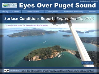
  • 1. Surface Conditions Report, September 26, 2016 Eyes Over Puget Sound Field log Climate Water column Aerial photos Continuous monitoring Streams Publication No. 16-03-077 Up-to-date observations of water quality conditions in Puget Sound and coastal bays Start here Scuba info Critter of the Month– The Sweet Potato Sea Cucumber
  • 2. Dr. Christopher Krembs (Editor) Personalimpressions p. 4 September is jellyfish season! Climateinfluences p. 6 Sunny, warm,and dry conditions withlow river flows. Watercolumn p. 7 Lower oxygenwasobservedinsouthernPuget Sound in August. Water in coastal bays was saltier due to lack of rain. Aerialphotography p. 11 Large jellyfishaggregations inSouth Sound. Red-brownand green-brownblooms were widespreadinmany bays across Puget Sound andthe San JuanIslands. Incontrast,Central Sound had clear water withlittle algal activity. Continuous monitoring p. 35 Algal concentrations are decreasingacross Central Basinwith some short-termgrowthinmid-September. Streams p. 37 InAugust, many streams had slipped back to below-normal flows. Precipitationevents inSeptember improvedPuget Sound streamflows. LONG-TERMMARINEMONITORINGUNIT Skip Albertson Julia Bos Suzan Pool Editorial assistanceprovided by: Suzan Pool, CarolMaloy Marine conditionsfrom 9-26-2016at a glance Field log Climate Water column Aerial photos Continuous monitoring Streams Jim Shedd JuliaSuzan Mattie Michalek
  • 3. Critter of the Month – The Sweet Potato Sea Cucumber Personal Field Impression Field log Weather Water column Aerial photos Continuous monitoring Streams Eyes Under Puget Sound 9-26-2016 Field log Climate Water column Aerial photos Continuous monitoring Streams Learn more about Molpadiaand othercritters on Ecology’s EcoConnect blog here. Angela Eagleston& Dany Burgess Marine Sediment Monitoring Team Fun Facts! • Their skeleton is composed of tiny particles called ossicles. • They eat upside down with their faces buried in the mud. • They are smooth and shiny because they lack tube feet. Molpadiaintermedia This critter sounds like a vegetable and looks a bit like a breakfast sausage, butthe structures in its skin make it special! Find out what makes this plump mud-dweller an important partof Puget Sound benthic communities.
  • 4. Personal Field Impression Field log Weather Water column Aerial photos Continuous monitoring Streams Personal Field Impression 9-26-2016 Field log Climate Water column Aerial photos Continuous monitoring Streams Our WCC intern, Mattie Michalek, presented a projecton the large jellyfish masses wehave been seeing in Budd Inlet. Mattie analyzed photos frommonthly EOPS flights over the last 6 years. Sheassigned jellyfish images to 5 categories to indicate how abundantthe jellyfish mass aggregations (smacks) were. Mattie presented her study results at the 2016 South Sound Science Symposium: “Do salinity and temperaturein Budd Inlet drivejellyfish mass aggregations?” September is jellyfish season in South Sound! Jellyfish biomass reached record levels in Budd Inlet and other finger inlets of South PugetSound in the fall of 2014 and summer of 2015, coinciding with ‘the Blob’ of unusually warm water and with the drought. Budd Inlet 2014 View poster
  • 5. This isa newfeatureandwearesolicitingfeedback (salb461@ecy.wa.gov). Eventuallywewill featurethemostrecentdata. good poor visibility Find depths with high and low visibility • Best visibility wasabout35 feet or more around SeacrestPark in Elliott Bay. • Poor visibility occurred in many places of Puget Sound within the first10 feet of the surface. • In August, visibility took a downturn perhaps in responseto abundantsunshine and resultantplanktonic blooms. • Elliott Bay decreased visibility from42 ft to 36 ft since July. • We usetransmissometer readings fromour CTD packageand convertthem into horizontalvisibility. What was the visibility in the water for divers? Personal Field ImpressionThe divers' page, visibility 9-26-2016 Field log Weather Water column Aerial photos Continuous monitoring StreamsField log Climate Water column Aerial photos Continuous monitoring Streams August
  • 6. Climate Influences leading to 9-26-2016 Climate and naturalinfluences,includingweather,rivers,and the adjacent ocean,can affect our marine waters. Graphics are basedonprovisional dataandare subject to change. http://www.ecy.wa.gov/programs/eap/mar_wat/weather.html,page 26. August Summary: Air temperatures wereslightly abovenormal. Precipitationwas below normal. Sunshine levels werehigher. River flows werestill below normal, particularly to the north (Nisqually River is regulated). Upwelling, ENSO, and PDO are abovenormal. higher No datalowerexpected *UpwellingAnomalies (PFEL) PDO = PacificDecadal Oscillation NPGO = North Pacific GyreOscillation ENSO = El Niño Southern Oscillation Field log Weather Water column Aerial photos Continuous monitoring StreamsField log Climate Water column Aerial photos Continuous monitoring Streams
  • 7. We usea boatand a chartered float plane equipped with a CTD package to access our monthly monitoring stations. We communicate data and environmental marine conditions using: 1. Marine Water Condition Index (MWCI) 2. Eyes OverPuget Sound (EOPS) 3. Anomaliesand sourcedata Field log Climate Water column Aerial photos Continuous monitoring Streams Ourlong-termmarinemonitoringstationsinWashington Starthere Isl. . Station network of abmient water quality monitoring stations
  • 8. Field log Climate Water column Aerial photos Continuous monitoring Streams HowwellisPugetSoundexchangingitswater? Year 2016 continues to have record-breakingglobal temperatures. Inour region,the Fraser River flow has plummeted. Estuarine circulationis important because water temperatures inPuget Sound are still warmer thannormal! The Fraser River is the largest freshwater source for the SalishSea,significantly affectinganddriving estuarine circulation. Inwinter andspring 2016, the Fraser River and other rivers dischargedprematurely. This year’s Fraser River summer flow has been extremely low in response to warmwinter temperatures and lack of snowpack inBC. Very low summer flows inhibit the renewal of water inPuget Sound. The flow is now normalizing. Source: http://wateroffice.ec.gc.ca/index_e.html Very low Fraser River flow this summer meant stagnant water inthe Salish Sea and reducedexchange with coastal water. As a consequence,water warmedandpollution hada chance to accumulate. Credit: Christopher Krembs 0 2000 4000 6000 8000 10000 12000 Dec-13 Jan-14 Feb-14 Mar-14 Apr-14 May-14 Jun-14 Jul-14 Aug-14 Sep-14 Oct-14 Nov-14 Dec-14 Jan-15 Feb-15 Mar-15 Apr-15 May-15 Jun-15 Jul-15 Aug-15 Sep-15 Oct-15 Nov-15 Dec-15 Jan-16 Feb-16 Mar-16 Apr-16 May-16 Jun-16 Jul-16 Aug-16 Sep-16 Discharge(m3s-1) Higher than normal Lower than normal Expected Fraser RiverFlow
  • 9. Physical conditionstracked in historicalcontext Explore profiles at all stations Temperature Normalizing Oxygen lowerSalinity higher Region 7 8 9 10 11 12 1 2 3 4 5 6 7 8 9 10 11 12 1 2 3 4 5 6 7 8 7 8 9 10 11 12 1 2 3 4 5 6 7 8 9 10 11 12 1 2 3 4 5 6 7 8 7 8 9 10 11 12 1 2 3 4 5 6 7 8 9 10 11 12 1 2 3 4 5 6 7 8 Whidbey Basin Hood Canal Central Sound South Sound Grays Harbor Willapa Bay North Sound San Juan 2015 2015 201620152016 2016 After nearly 2 years of record-breakingwater temperatures,Puget Soundtemperatures andsalinity are not quite to expectedranges inAugust. Lower oxygenconditions continue insouthernPuget Sound. At the coast,salinity is higher due to very low river flows (see page 37). Field log Climate Water column Aerial photos Continuous monitoring Streams
  • 10. a) PacificDecadalOscillationIndex(PDO,temperature) (explanation) b) UpwellingIndex(anomalies)(Upwelling,low oxygen) (explanation) c) NorthPacificGyreOscillationIndex(NPGO, productivity) (explanation) Field log Climate Water column Aerial photos Continuous monitoring Streams Theoceanaffectswaterquality: OceanClimateIndices NPGO(x10) PDO/UpwellingIndex Three-year running average of PDO, Upwelling, and NPGO indices scores . Ocean boundaryconditions long-term variability: (a)water is still warm (PDO), (b) upwellingoflow oxygen and high nutrient ocean water are normal (UpwellingIndex anomaly),and (c) surface productivity alongthe coast is normalizing(NPGO). -25 -20 -15 -10 -5 0 5 10 15 20 25 -1.5 -1 -0.5 0 0.5 1 1.5 1945 1950 1955 1960 1965 1970 1975 1980 1985 1990 1995 2000 2005 2010 2015
  • 11. Summary: Aerial photography9-26-2016 Large jellyfishaggregations were infinger Inlets of SouthSound. Red-brownandgreen-brownblooms were widespreadin many bays across Puget Soundand aroundthe San JuanIslands. Incontrast, Central Soundhad clear water withlower algal activity. Field log Climate Water column Aerial photos Continuous monitoring Streams Start here Mixing and Fronts: Many and large tidal eddies outlined by blooms of different colors. Debris: Largeorganic debris rafts in Budd and Case Inlets and Nisqually Reach. Visible blooms: Strong red-brown blooms in South Sound and in Sinclair, Liberty, and Samish Bays. Brown-green blooms seen around tidal eddies. In Totten, Eld, and Dyes Inlets. Jellyfish: Very numerous in Budd, Eld, and Totten Inlets. Not seen in other inlets. BloomDebrisFront Suspendedsediment: Near shoresuspended sediments mostly due to strong tidal activity. Some regional river input of suspended sediment. Plume Blooms in Budd Inletwithstrikingintensity SinclairInletwith red-brownbloom Bloom Bloom jellyfish jellyfish
  • 12. Strait of Juan de Fuca San Juan Islands Padilla Bay Main Basin Hood Canal South Sound Whidbey Basin Field log Climate Water column Aerial photos Continuous monitoring Streams Sunny, very good visibility Flight Information: Aerial photography and navigation guide Flight route 9 3 2 8 Tide data(Seattle): Time Height (ft) High/Low 01:29 AM 9.13 H 08:02 AM 0.75 L 03:29 PM 10.94 H 09:27 PM 4.55 L 6 11 14 41 Observation Maps: Central and NorthSound South Sound 15 12 13 7 5 18 19 20 16 10 17
  • 13. Strong red-brown bloom, jellyfishpatches, and organic debris at surface. Location: Near Big Tykle Cove,Budd Inlet (South Sound),12:28 PM. 1 Aerial photography 9-26-2016 Navigate Field log Climate Water column Aerial photos Continuous monitoring Streams boat Bloom Bloom jellyfish jellyfish Debris boat boat boat
  • 14. Two differently colored red-brown blooms and abundant jellyfishpatches. Location: Across Butler Cove, Budd Inlet (South Sound),12:31 PM. Bloom jellyfish jellyfish jellyfish jellyfish jellyfish jellyfish jellyfish 2 NavigateAerial photography 9-26-2016 Field log Climate Water column Aerial photos Continuous monitoring Streams jellyfish jellyfish boat marker jellyfish Bloom boat boat jellyfish jellyfish
  • 15. Bloom boat 3 NavigateAerial photography 9-26-2016 Strong red-brown bloom and abundant jellyfishpatches. Tidal eddy. Location: YoungCove, Eld Inlet (South Sound),12:35 PM. Field log Climate Water column Aerial photos Continuous monitoring Streams eddy jellyfish jellyfish jellyfish jellyfish jellyfish boat jellyfish jellyfish jellyfish Bloom jellyfish
  • 16. A. B. 4 Navigate Field log Climate Water column Aerial photos Continuous monitoring Streams Aerial photography 9-26-2016 A. Red-brown and green blooms around tidal eddy during incoming tide. B. Large patch of organic debris. Location: A. Eld Inlet,B. Budd Inlet (South Sound),12:37 PM. Bloom boat Debris Bloom Debris boat Debris eddy
  • 17. A. 5 NavigateAerial photography 9-26-2016 Field log Climate Water column Aerial photos Continuous monitoring Streams Tidal currents and eddies with different colored blooms (green and red-brown) during incoming tide. Location: A. Carlyon Beach,Totten Inlet,B. Hope Island (South Sound),12:39 PM. Bloom Bloom B. Bloom eddy eddyBloom
  • 18. Strong red-brown bloom and abundant jellyfishpatches. Location: Henderson Bayand BurleyLagoon, Carr Inlet (South Sound),12:49 PM. 6 NavigateAerial photography 9-26-2016 Field log Climate Water column Aerial photos Continuous monitoring Streams Bloom suspendedsediment Debris mussel raft boat powerline Burley Lagoon
  • 19. Tidal currents and eddies with different colored blooms (green and red-brown) during incoming tide. Location: Dyes Inlet (Central Sound),12:57 PM. 7 NavigateAerial photography 9-26-2016 Field log Climate Water column Aerial photos Continuous monitoring Streams Bloom boat Bloom Debris eddy boat
  • 20. Red-brown bloom in shallow embayment near Keyport. Location: Keyport,entrance to Liberty Bay (Central Sound),1:00 PM. 8 NavigateAerial photography 9-26-2016 Field log Climate Water column Aerial photos Continuous monitoring Streams boat Debris Bloom
  • 21. Large tidal eddy and water with different colored blooms. Location: LibertyBay (Central Sound), 1:01 PM. 9 NavigateAerial photography 9-26-2016 Field log Climate Water column Aerial photos Continuous monitoring Streams Bloom Bloomv Bloom eddy
  • 22. 10 NavigateAerial photography 9-26-2016 Red-brown bloom with adjacent river plume. Location: LibertyBay (Central Sound),1:02 PM. Field log Climate Water column Aerial photos Continuous monitoring Streams boat Plume Bloom Bloom
  • 23. NavigateAerial photography 9-26-2016 Red-brown bloom and flood tide settingoff eddy. River plume with suspended sediment on easternshore. Location: Port Gamble (Hood Canal),1:06 PM. Field log Climate Water column Aerial photos Continuous monitoring Streams 11 barge barge Bloom eddy mussel raft Plume boat
  • 24. B.A. NavigateAerial photography 9-26-2016 A. Red-brown bloom and suspended sediment next to Samish Island. B. Ship slowed by tug reveals that bloom is only at surface. Location: Samish Bay(North Sound),1:31 PM. Field log Climate Water column Aerial photos Continuous monitoring Streams 12 suspendedsediment tug ship Bloom suspendedsediment Bloom clear suspendedsediment Bloom SamishIsland
  • 25. NavigateAerial photography 9-26-2016 Jet from Samish Bay flowing north alongside Lummi Island. Fraser River plume/bloom and front. Location: Lummi Island,Rosario Strait (North Sound),1:36 PM. Field log Climate Water column Aerial photos Continuous monitoring Streams 13 Plume Lummi Island
  • 26. NavigateAerial photography 9-26-2016 Fraser River plume/bloom meetingflood tide which causes turbulent mixing. Location: Rosario Strait (North Sound),1:39 PM. Field log Climate Water column Aerial photos Continuous monitoring Streams 14 Plume Cypress Island
  • 27. NavigateAerial photography 9-26-2016 Fraser River plume/bloom mixing into eddy in Lopez Sound. Location: Mud Bay,Lopez Sound (North Sound),1:47 PM. Field log Climate Water column Aerial photos Continuous monitoring Streams 15 eddy Plume
  • 28. NavigateAerial photography 9-26-2016 Red-brown bloom and suspended sediment. Location: Mud Bay,Lopez Sound (North Sound),1:47 PM. Field log Climate Water column Aerial photos Continuous monitoring Streams 16 boat Bloom suspendedsediment
  • 29. B. A. NavigateAerial photography 9-26-2016 Strong red-brown fillingDiscovery Bay and extendingto the bay entrance. Location: A. West Side, B. East Side Discovery Bay (North Sound), 2:01 PM. Field log Climate Water column Aerial photos Continuous monitoring Streams 17 Bloom Bloom boat Bloom Beckett Point Diamond Point
  • 30. Field log Climate Water column Aerial photos Continuous monitoring Streams NavigateAerial photography 9-26-2016 Greenand red-brown blooms show how patchy blooms can be. Location: Quartermaster Harbor (Central Sound), 2:30 PM. 18 boat Bloom boat Bloom Bloom suspendedsediment
  • 31. B.A. NavigateAerial photography 9-26-2016 Green-brown bloom leaving Carr Inlet in a meandering ribbon betweenMcNeil and Fox Islands. Location: Carr Inlet (South Sound),2:39 PM. Field log Climate Water column Aerial photos Continuous monitoring Streams 19 Bloom Bloom Fox Island McNeil Island
  • 32. B.A. NavigateAerial photography 9-26-2016 A. Large organic debris patch and B. Plume/bloom trapped in Oro Bay. Location: AndersonIsland (South Sound),2:43 PM. Field log Climate Water column Aerial photos Continuous monitoring Streams 20 Debris Debris NisquallyDelta NisquallyDelta Plume Debris
  • 33. North Sound Central Sound Numbers on map refer to picture numbers for spatial reference Date: 9-26-2016 Qualitative aerial observer map during transit Navigate Numbers on map refer to picture numbers for spatial reference Field log Climate Water column Aerial photos Continuous monitoring Streams 17 18 16 15 8 9 7 10 11 12 14 13 Port Gamble
  • 34. Date: 9-26-2016 Qualitative aerial observer map during transit Numbers on map refer to picture numbers for spatial reference Navigate South Sound Field log Climate Water column Aerial photos Continuous monitoring Streams 1 2 3 4 5 6 19 20
  • 35. The Victoria Clipper IV carries sensorsin its sea chest. The sensorsallow us to plot transects of: A. Temperature B. Chlorophyll C. Turbidity Over time, we see the dynamics of these variables in surface water betweenSeattle and Victoria,BC. Field log Climate Water column Aerial photos Continuous monitoring Streams Continuousmonitoring September2016 Summary of Victoria Clipper IVferry data: Water temperatures continue to be warm,andCentral Basinis still warmer thanthe Juan de Fuca Strait. Algal concentrations are decreasingacross Central Basinwithsome short- termgrowthin mid-September. Turbidity is slightly higher in the Strait than Puget Sound, likely causedby Fraser River sediment outflow. C. B.A. Not shown, fouling effects
  • 36. Field log Climate Water column Aerial photos Continuous monitoring Streams Continuousmonitoring September2016 Figures show daily data from sensors installed on the ferry which measure near-surface waters at 5-secintervals while the Victoria Clipper IV transits between Seattle and Victoria, BC. A. Sea Surface Temperature: Water is warmer inCentral Basinthan the Strait. B. Chlorophyll: Concentrations are higher in Puget Soundthan in the Strait. C. Turbidity: Turbidity is low on the entire route. A. C. Victoria Olympic Peninsula Seattle Victoria Olympic Peninsula Seattle Victoria Olympic Peninsula Seattle B.
  • 37. How have streamflows fared over Summer 2016? Field log Climate Water column Aerial photos Continuous monitoring Streams Jim Shedd, Ecology C. In August, about 30 to 50% of streams were below normal for most of the month. In September, streamflows increased over the second half of the month. Currently about 75% of the state’s streamflows are within the normal range. In August, many streamflows werebelow-normalfromdrier and warmer conditions. Precipitation in September improved streamflows in Puget Sound . A. Well below normal precipitation in the Puget Sound basin in August resulted in declining streamflows after conditions temporarily had improved in July. B. Particularly low river flows occurred in the Olympics and north Cascades in August. (See page 9 inceasing salinity in coastal bays) A. C.B.
  • 38. Accessmooring data: ftp://www.ecy.wa.gov/ea p/Mooring_Raw/Puget_S ound/ Continuous monitoring : Suzan.Pool@ecy.wa.gov Get data from Ecology’sMarine MonitoringPrograms Long–Term MonitoringNetwork Real–Time Sensor Network Accesscore monitoringdata: https://fortress.wa.gov/ec y/eap/marinewq/mwdata set.asp christopher.krembs@ecy.w a.gov Ecology’s long-termmarine monitoring stations Continuous track Field log Climate Water column Aerial photos Continuous monitoring Streams Riverand Stream WaterQuality Monitoring http://www.ecy.wa.gov/programs/eap/fw_riv /rv_main.html Discontinued (fundingcuts)
  • 39. You may subscribe or unsubscribe to the Eyes Over Puget Sound email listservby going to: http://listserv.wa.gov/cgi-bin/wa?A0=ECOLOGY-EYES-OVER-PUGET-SOUND Many thanks to our business partners: Clipper Navigation,SwantownMarina,andKenmore Air. We are looking forfeedbackto improve ourproducts. Dr. ChristopherKrembs christopher.krembs@ecy.wa.gov Marine Monitoring Unit EnvironmentalAssessment Program WA Department of Ecology Field log Climate Water column Aerial photos Continuous monitoring Streams