Sun and high air temperatures warrant en route ozone measurements for model validations. A furry visitor takes a rest on the float plane. Spotlight on our pilot, Joe Leatherman. High river flows lead to striking fronts of turquoise-colored water carrying glacial flour in many northeastern regions. Satellite and aerial images show widespread phytoplankton blooms in Whidbey Basin, Hood Canal, South Puget Sound, and West Bay of Orcas Island. Numerous large debris patches in Hood Canal, Central Sound, and South Sound Inlets. After two years of colder temperatures and higher oxygen, Puget Sound waters are returning to expected or lower dissolved oxygen levels.
Air temperatures have been slightly warmer and river flows are higher. Blooms are present only in Whidbey Basin and isolated bays. The water column otherwise is relatively clear. Sediment rich water is entering from the Stillaguamish River. Debris lines were visible in Hood Canal and North Sound. Multiple reported oil sheens seen in Lake Washington Ship Canal. Generally, the year 2014 started colder and saltier throughout Puget Sound. Oxygen is lower in Whidbey Basin, Central and South Sound, but higher in Hood Canal. Upwelling favorable conditions stimulate a spring phytoplankton bloom off the Washington coast.
Abundant sunshine gives rise to large algal mats in South Sound, Hood Canal, and Sinclair Inlet. Red-brown algal blooms dominate in Budd, Totten, and Eld Inlets and jellyfish begin to increase. Northerly winds push algal blooms from Whidbey and Central Basins past Seattle and a bloom in northern Hood Canal southward. Satellite thermal imagery shows patterns of near-surface mixing and injection of nutrients into the surface layer. Glacial-fed rivers deliver glacial flour into Commencement Bay, stratifying the water and supporting different colored phytoplankton blooms (green, brown, and red). Since the beginning of 2013, dissolved oxygen is dropping below expected values.
A stunning view of a second large Noctiluca bloom captures the attention of many living near Puget Sound. Favorable conditions support several regional phytoplankton blooms. Red-brown blooms in Port Townsend, Discovery Bay and Bellingham Bay. Large algal mats or organic material particularly in Samish Bay. Jellyfish patches increasing in Budd, Totten and Eld Inlets.
River flows are above normal and air temperatures are increasing slowly. The spring phytoplankton bloom is slow to develop with visible blooms limited to smaller bays such as Sequim and Bellingham Bays. Noctiluca observed in East Sound on Orcas Island, coinciding with high numbers of jellyfish. Debris lines are mostly confined to Hood Canal. Pockets of colder water observed in Central Sound and Hood Canal, likely from the colder, saltier conditions that developed during the winter in the northern regions. Oxygen is variable yet close to expected ranges. Sizable oil sheens were sighted in Gig Harbor and Carr Inlet.
The weather changed from cool, cloudy and southerlies, to sunny warm conditions and light northerly winds on Mother’s Day. At the water surface, blooms and large debris lines occur in Bellingham, Padilla, and Samish Bays, Hood Canal, East Sound, and the Straits, as well as the finger inlets of South Sound. Large amounts of sediment-laden water from Port Susan are flowing into Central Basin. Turquoise water mixing to the surface in places around the San Juan Islands. After some trouble-shooting of the hardware and communication system, we will resume collecting Victoria Clipper data next week. Meet Eyes Under Puget Sound: Sediment Monitoring Program at Ecology.
Puget Sound conditions are normalizing after seven months of lower oxygen. Calm, dry, cool, and foggy mornings abruptly changed on October 28 to sun and strong northerly winds. Red-brown blooms and abundant jellyfish in south Puget Sound inlets appeared as we flew to the coast. Blooms were still visible near ocean beaches and inner bays. Grays Harbor had abundant surface debris with green algae in North Bay. We spotted red-brown blooms in rivers and sloughs in Willapa Bay, as well as schooling fish near sandbanks. Many patches of suspended sediment appeared in shallow water unrelated to tidal currents and remain unexplained.
For the last week sunshine was low and rivers and air temperatures have been higher than expected due to prevailing southerly winds. Heavy rains have resulted in long foam lines and large river plumes that are filled with sediment. Jelly fish patches have persisted through the winter in smaller bays. Are higher oxygen conditions seen over the last 2 years starting to disappear? We were busy in 2012 and spooled out 37 miles of CTD line to explore the depths of our estuaries!
Warmer and sunnier days result in higher than normal river flows from the Skagit and Nisqually. Biological activity in the water column is high. Abundant organic surface debris in Hood Canal, Padilla Bay, and many Inlets. Red-brown blooms in South Sound, Discovery Bay, and regions of Bellingham Bay. Different blooms in Skagit Bay, Padilla Bay, and Sinclair Inlet. Jelly fish are numerous in all southernmost South Sound Bays. Hood Canal remains cold but Puget Sound-wide temperatures are now warmer and less salty. Data from the Victoria Clipper and our sampling in the Strait provides important information on water exchange with the ocean.
EOPS_December_14_2015,
As coastal and regional conditions gradually normalize in response to a fading Blob and increased rain, the big question remains. Will the snow in the mountains stay there or come down prematurely and lower salinity in Puget Sound like last winter? Cascade snowpack is currently below normal. The El Niño at the equator is still brewing! Major rivers transport large amounts of suspended sediments and soil into Puget Sound, also seen in our ferry sensor data. Our flight team gets in the pool for safety training.
Ecology Publication No. 15-03-079
A stunning view of a second large Noctiluca bloom captures the attention of many living near Puget Sound. Favorable conditions support several regional phytoplankton blooms. Red-brown blooms in Port Townsend, Discovery Bay and Bellingham Bay. Large algal mats or organic material particularly in Samish Bay. Jellyfish patches increasing in Budd, Totten and Eld Inlets.
Sunshine and warm temperatures return after last week’s intense rain. The Puyallup and Nisqually Rivers are flowing high. Red-brown blooms and numerous patches of jellyfish remain strong in South Sound, Sinclair and Dyes Inlets, and Bellingham Bay, with brown-green blooms in Whidbey Basin. Macro-algae surface debris is very high in South and Central Sound. Hood Canal remains cooler but Puget Sound-wide temperatures are now warmer and less salty. Sea surface temperatures are above 15 °C, conditions favorable for some pathogens, and harmful algae blooms. Read about super colonies of by-the-wind sailors washing up on our shores.
A recent cold spell hits Puget Sound lowlands, interrupting this year’s warmer air temperatures. The warm ocean coincides with new maximum water temperatures observed throughout Puget Sound in October! Hood Canal’s higher dissolved oxygen and cold water anomalies are disappearing. November brings cold water from Whidbey Basin into Puget Sound with moderate levels of chlorophyll fluorescence. Abundant smacks of jellyfish in finger inlets of South Sound observed from our flight. Red-brown blooms remain strong in smaller bays of South Sound. Visible suspended sediments in the coastal estuaries from rain, wind, and waves. Playing in the water? Visit our BEACH program.
The ocean and air remain warm with sunshine and dry weather across the region. As a result, Puget Sound is a lot warmer going into the new year. Hood Canal is responding with temperatures warmer than previous measurements, breaking its low temperature stint. First signs of growing phytoplankton are coloring the water green. Patches of jellyfish are overwintering in finger inlets of South Sound. Tidal fronts and suspended sediment are visible amidst the stunning San Juan Islands scenery. A sediment-rich water mass is trapped in Rosario Strait. Check out the South Sound Estuarium and the many reasons we love Puget Sound!
Record warm water temperatures and low oxygen continue in Ecology’s Puget Sound marine monitoring station network. Record low stream flows result in visibly low river discharge into Puget Sound, in particular for the Puyallup River. Abundant sun and unusually warm water temperatures fuel phytoplankton blooms in many areas. Bright orange Noctiluca blooms are surfacing in the Commencement Bay area and around Port Madison. Finger inlets of South Sound support extensive patches of jellyfish.
After 2-years of conditions favorable for water quality, with colder temperatures and higher oxygen, Puget Sound water conditions are closer to expected again. This year phytoplankton blooms and seasonal oxygen maxima are notable, while extensive Noctiluca blooms showed up early following a period high freshwater inputs and milder weather conditions. The Fraser River sediment influence is very strong north of San Juan Islands and warm, fresh water is entering Central Puget Sound from Whidbey Basin. In the past few weeks river flows and air temperatures have been higher than normal and now are decreasing.
The year 2013 in pictures: Low oxygen conditions persisted from January into August and broke a two year anomaly of more favorable water quality conditions (lower temperature and salinity and higher dissolved oxygen). Dramatic Noctiluca blooms appeared one month earlier than normal (May), lasted for two months and coincided with lower oxygen. Large jellyfish patches persisted over the winter but then were less visible for the rest of the year. Large drifting algal mats appeared in August.
EOPS_February_8_2016,
January air temperatures and precipitation were above normal as El Nino conditions prevail. This winter our snowpack is in much better shape, though we’ve lost some snow from the stint of warm weather. More rain and higher river flows have lowered salinities in Puget Sound and coastal bays. Nonetheless, water temperatures in Puget Sound remain at record-breaking highs. Jellyfish patches are numerous in finger inlets of South Sound and signs of phytoplankton blooms are visible in coastal bays. When conditions limit flying, Ecology’s research vessel gets the job done.
Publication No. 16-03-070
Unusually warm water temperatures continue in central and south Puget Sound while Willapa Bay returns to expected water temperatures as a result of stronger coastal upwelling. Extensive mats of organic debris develop in many places, particularly in Central Sound overlapping with a fading Noctiluca bloom. King County confirms Noctiluca and shares plankton species information. Red-brown and brown blooms are going strong in southern inlets and around the San Juan Islands. Our inspiring WCC Intern gets on boats, into the air, and to the lab.
The pattern of colder and fresher Puget Sound water persists. Jellyfish aggregations continue to persist in Budd Inlet. Debris lines are numerous and long. There are multiple oil sheens in Seattle waterways. CDOM (colored dissolved organic matter) sensor and en route ferry thermosalinograph provide an important tracer for freshwater entering Puget Sound from Whidbey Basin.
Warm air and water temperatures and offshore winds have persisted since fall. Numerous and sizable jelly fish patches are still present in southern inlets of Puget Sound. Coastal waters were colored in shades of gray to brown by sediment and humic substances. Phytoplankton blooms were restricted to the surf zone. We were treated to artful views of meandering sloughs and gullies on exposed mud flats during low tide in Willapa Bay, interspersed with the geometry of shellfish management. Brown pelicans: a story of recovery.
Lower than expected air temperatures and sunshine are now both increasing; rivers are generally running high. Willapa Bay unfolds its beauty from a bird’s-eye view. The spring phytoplankton bloom is picking up in Puget Sound. A large red-orange-brown bloom persists in southern Hood Canal at a scale sufficient for the MODIS satellite to pick up. Jellyfish are still going strong in southern inlets. Ocean climate indices (PDO, NPGO and Upwelling Index) explain much of the variability in Puget Sound temperature, salt and oxygen. Nutrients, however, are steadily increasing while sub-surface algal pigments (chlorophyll a) are declining!
EOPS_March_16_2016,
In response to warm and wet conditions, rivers have been running high. Salinity in Puget Sound is notably lower. Below a cooler surface, water temperatures remain high, especially in Hood Canal. We still see numerous jellyfish patches in Puget Sound inlets. Phytoplankton blooms are going strong in Hood Canal and Henderson Inlet, and picking up elsewhere. Many places showed long stretches of suspended sediments nearshore, a sign of potential shore erosion. Check out the critters inhabiting the sediments of Puget Sound.
Ecology Publication No. 16-03-071
EOPS_July_24_2017,
July had warm air temperatures, sunshine, and an abundant snowpack. Previous months had higher river flows (bringing freshwater) and weak upwelling (low delivery of saltier water) which resulted in very low salinities in Puget Sound, especially in the South Sound. Water temperatures are expected and warmer in Central Sound. Above normal sunshine has made Puget Sound biologically very active! Intense and unusual blooms color Hood Canal (coccolithophores) and south sound inlets. Large mats of organic material containing macro-algae drift at the surface. Many schools of fish are visible though jellyfish were absent.
Ecology Publication No. 17-03-071
A stunning view of a second large Noctiluca bloom captures the attention of many living near Puget Sound. Favorable conditions support several regional phytoplankton blooms. Red-brown blooms in Port Townsend, Discovery Bay and Bellingham Bay. Large algal mats or organic material particularly in Samish Bay. Jellyfish patches increasing in Budd, Totten and Eld Inlets.
After 2-years of conditions favorable for water quality, with colder temperatures and higher oxygen, Puget Sound water conditions are closer to expected again. This year phytoplankton blooms and seasonal oxygen maxima are notable, while extensive Noctiluca blooms showed up early following a period high freshwater inputs and milder weather conditions. The Fraser River sediment influence is very strong north of San Juan Islands and warm, fresh water is entering Central Puget Sound from Whidbey Basin. In the past few weeks river flows and air temperatures have been higher than normal and now are decreasing.
Unusually warm water temperatures continue in central and south Puget Sound. River flows remain lower than normal, especially the Fraser and Skagit rivers. Thus, with estuarine circulation much weaker, Puget Sound waters stay put. Mats of organic debris persist in Central Sound near Port Madison. Red-brown and brown blooms are now very strong in southern inlets and jellyfish patches are exceptionally numerous and large. Explore media coverage of unusual Puget Sound conditions including jellyfish.
EOPS_June_5_2017,
Cooler and wetter conditions early in 2017 have set the stage for a favorable supply of freshwater. River flows are all above normal due to melting of the abundant snowpack from warmer May air temperatures. This is creating significantly fresher conditions in Puget Sound surface waters. Algae blooms are limited to some yellow-green blooms growing in bays near the Kitsap Peninsula and blooms near estuaries of the Skagit, Stillaguamish, and Puyallup Rivers. Red blooms are present in rivers feeding into Willapa Bay. Also see what is “blooming” in the sediments of Puget Sound.
Ecology Publication No. 17-03-070
The weather has been relatively cloudy, warm and dry. We found less debris in the water but saw several large tidal eddies and suspended sediment plumes. Jellyfish continue to go strong this winter. We also observed early algae blooms in Hood Canal and Eld Inlet as well as multiple oil sheens in Seattle waterways. Listen to our marine flight technician discuss EOPS on the radio.
EOPS_August_24_2016,
In July, conditions were normalizing, yet river flows remained lower, continuing into August. July also saw lower oxygen appearing in southern Puget Sound. By August, jellyfish are occurring in high numbers in Eld and Budd Inlet. South Puget Sound has Noctiluca drifting at the surface in large orange lines in many places and red-brown blooms widespread in finger inlets, as well as in Sinclair Inlet. Central Sound surface-water temperatures are high, still in the 60s, and algae are abundant. See what we are measuring to understand ocean acidification in Puget Sound.
Publication No. 16-03-076
Air temperatures are warm and Puget Sound continues to show record high water temperatures. Some rain has returned to our region, yet river flows remain unusually low. Puget Sound is saltier than normal allowing oxygen-rich surface waters to more easily mix to greater depths. Lower oxygen was measured only in the Coastal Bays, Hood Canal, and South Sound. Large jellyfish aggregations continue in South Sound, the Kitsap Peninsula, and East Sound (Orcas Island). Sediment plumes in Bellingham Bay form unique patterns. Warm waters and sunny conditions fostered green tides, raising a stink along some local beaches.
Puget Sound is starting to normalize in response to fall conditions with cooler air temperatures, rain, and recovering river flows. We are seeing fewer algal blooms, jellyfish, and macro-algae as salinities become more normal. Yet warm waters persist and El Nino and the Blob are likely to affect Puget Sound throughout the winter. The Nisqually River fared better through the drought than other rivers and best management practices have been improving its water quality. EOPS and ferry monitoring gain recognition with a national award for innovation!
Air temperatures are warm and Puget Sound continues to show record high water temperatures. Some rain has returned to our region, yet river flows remain unusually low. Puget Sound is saltier than normal allowing oxygen-rich surface waters to more easily mix to greater depths. Lower oxygen was measured only in the Coastal Bays, Hood Canal, and South Sound. Large jellyfish aggregations continue in South Sound, the Kitsap Peninsula, and East Sound (Orcas Island). Sediment plumes in Bellingham Bay form unique patterns. Warm waters and sunny conditions fostered green tides, raising a stink along some local beaches.
Warm waters from “The Blob” in Puget Sound combine with drought conditions as warm air has left little snow to feed the rivers. Water temperatures throughout Puget Sound are the highest in 25 years and oxygen is exhibiting record lows. High suspended sediment in the north is still coming in from the Fraser River. Otherwise, the surface waters appear very clear due to recent low river flows and weak blooming activity. A red bloom is present in Sinclair Inlet and in some confined bays. Patches of jellyfish, however, are going strong in inlets of South Sound and Sinclair Inlet. What does this all mean for salmon? Get to know some intertidal critters!
Puget Sound is feeling the heat! Starting in October, temperatures are the highest on our record since 1989. Salinity and oxygen are much lower. Recent rains have rivers flowing high. Aerial views show dramatic sediment loads from rivers mixing into otherwise blue water. But don’t be fooled – by summer, snow-fed rivers are expected to run significantly below normal, with implications for Puget Sound water quality. For details, explore the special Drought Effects segment. Spring blooms are visible only in some confined bays. Jellyfish are going strong in finger inlets of South Sound. Glimpse Puget Sound’s glacial history.
The year 2014 in pictures: In 2014, Puget Sound and Hood Canal behaved distinctly different in temperature and dissolved oxygen. In Puget Sound, generally warmer conditions, abundant and diverse algal blooms, and large pools of organic material persisted along with lower oxygen, high jellyfish abundances, and a lot of suspended sediment. On the other hand, Hood Canal was colder, more oxygenated, and algae blooms were rare. People and planes: past and present.
At the end of summer, water temperatures are still high, and salinities and dissolved oxygen are low in Puget Sound. Both sea surface temperature and upwelling off the coast are elevated (PDO and Upwelling indices) and the the Fraser River flow is low. This combination makes it an interesting fall. Very dense and large patches of jellyfish appear in finger inlets of South Sound. Red-brown blooms also remain strong in South Sound.
Sunshine and warmth continue into September. Upwelling is higher, yet low Fraser River flow reduces the likelihood of low-oxygen water moving into Puget Sound. Dissolved oxygen remains relatively high in Hood Canal and is lower elsewhere. Satellites show relatively warm water in the Strait of Georgia and Whidbey Basin and an extensive offshore bloom. Water temperatures also remain high in South Sound were red-brown plankton blooms and large smacks of jellyfish adorn the water surface. Explore what frequent blooms in smaller bays can tell us.
After weeks of clouds and warmer air, blue skies and cold temperatures set in. Strong tidal fronts and sediment-rich brackish plumes leave Whidbey Basin and move into Admiralty Reach. A pod of Orcas follows the edge of the plume heading north! Red-brown blooms continue in Henderson, Eld, and northern Budd Inlets. Long organic debris lines are numerous in northern Budd Inlet, Hood Canal, and in Central Sound north of Edmonds (Triple Junction). Conditions in the water column in Puget Sound continue to normalize after seven months of lower oxygen. Water is very clear for this time of the year, particularly in the north.
Instructions for Submissions thorugh G- Classroom.pptxJheel Barad
This presentation provides a briefing on how to upload submissions and documents in Google Classroom. It was prepared as part of an orientation for new Sainik School in-service teacher trainees. As a training officer, my goal is to ensure that you are comfortable and proficient with this essential tool for managing assignments and fostering student engagement.
Ethnobotany and Ethnopharmacology:
Ethnobotany in herbal drug evaluation,
Impact of Ethnobotany in traditional medicine,
New development in herbals,
Bio-prospecting tools for drug discovery,
Role of Ethnopharmacology in drug evaluation,
Reverse Pharmacology.
How to Create Map Views in the Odoo 17 ERPCeline George
The map views are useful for providing a geographical representation of data. They allow users to visualize and analyze the data in a more intuitive manner.
How to Make a Field invisible in Odoo 17Celine George
It is possible to hide or invisible some fields in odoo. Commonly using “invisible” attribute in the field definition to invisible the fields. This slide will show how to make a field invisible in odoo 17.
Operation “Blue Star” is the only event in the history of Independent India where the state went into war with its own people. Even after about 40 years it is not clear if it was culmination of states anger over people of the region, a political game of power or start of dictatorial chapter in the democratic setup.
The people of Punjab felt alienated from main stream due to denial of their just demands during a long democratic struggle since independence. As it happen all over the word, it led to militant struggle with great loss of lives of military, police and civilian personnel. Killing of Indira Gandhi and massacre of innocent Sikhs in Delhi and other India cities was also associated with this movement.
We all have good and bad thoughts from time to time and situation to situation. We are bombarded daily with spiraling thoughts(both negative and positive) creating all-consuming feel , making us difficult to manage with associated suffering. Good thoughts are like our Mob Signal (Positive thought) amidst noise(negative thought) in the atmosphere. Negative thoughts like noise outweigh positive thoughts. These thoughts often create unwanted confusion, trouble, stress and frustration in our mind as well as chaos in our physical world. Negative thoughts are also known as “distorted thinking”.
Unit 8 - Information and Communication Technology (Paper I).pdfThiyagu K
This slides describes the basic concepts of ICT, basics of Email, Emerging Technology and Digital Initiatives in Education. This presentations aligns with the UGC Paper I syllabus.
Palestine last event orientationfvgnh .pptxRaedMohamed3
An EFL lesson about the current events in Palestine. It is intended to be for intermediate students who wish to increase their listening skills through a short lesson in power point.
Students, digital devices and success - Andreas Schleicher - 27 May 2024..pptxEduSkills OECD
Andreas Schleicher presents at the OECD webinar ‘Digital devices in schools: detrimental distraction or secret to success?’ on 27 May 2024. The presentation was based on findings from PISA 2022 results and the webinar helped launch the PISA in Focus ‘Managing screen time: How to protect and equip students against distraction’ https://www.oecd-ilibrary.org/education/managing-screen-time_7c225af4-en and the OECD Education Policy Perspective ‘Students, digital devices and success’ can be found here - https://oe.cd/il/5yV
Welcome to TechSoup New Member Orientation and Q&A (May 2024).pdfTechSoup
In this webinar you will learn how your organization can access TechSoup's wide variety of product discount and donation programs. From hardware to software, we'll give you a tour of the tools available to help your nonprofit with productivity, collaboration, financial management, donor tracking, security, and more.
Welcome to TechSoup New Member Orientation and Q&A (May 2024).pdf
Eops 2013 09_11
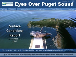
1. Surface
Conditions
Report
September 11,
2013
Ozone sensors on board: Donovan Rafferty, Ecology Air Quality Program (here)
Eyes Over Puget Sound
Up-to-date observations of visible water quality conditions in Puget Sound and the Strait of Juan de Fuca
Flight log Weather Water column Aerial photos Ferry and Satellite Moorings
Start here
Publication No. 13-03-078
2. Personal flight log p. 4
Flying for Ecology’s marine program attracts
experienced and engaged float-plane pilots.
Joe Leatherman fits the bill like no other. A little
visitor sweetened our day (see more).
Weather conditions p. 6
New record temperature of 91 deg F on EOPS flight day.
Overall: warm air temperatures, more sunshine in the south,
and decreasing river flows during the past week.
Water column and mooring p. 7, p. 38
After 2 years of colder temperatures and higher
oxygen, Puget Sound waters are taking a turn towards
lower dissolved oxygen. Or are they?
Aerial photography p. 11
Red-brown blooms in South Sound inlets and San Juans. Large
amounts of floating organic material in Hood Canal and Puget
Sound inlets. Flows from glacier-fed rivers are visible by the
turquoise-colored water. Many fronts seen at the surface in the
San Juans.
Ferry and satellite p. 36
Satellite imagery reveals widespread phytoplankton blooms in
Whidbey Basin, Hood Canal, and South Puget Sound. Fraser River
plume extends across Strait of Georgia!
LONG-TERMMARINEMONITORINGUNIT
Mya Keyzers
Laura Friedenberg
Joe Leatherman
Skip Albertson
Dr. Christopher
Krembs
Dr. Brandon
Sackmann
Julia Bos
Suzan Pool
David Mora
www.ecy.wa.gov/programs/eap/mar_wat/eops/Previous Eyes Over Puget Sound reports:
Marine conditions from 9-11-2013 at a glance
Flight log Weather Water column Aerial photos Ferry and Satellite Moorings
3. North Sound Flight with Kenmore Air pilot Joe Leatherman
Personal flight log 9-11-2013
Flight log Weather Water column Aerial photos Ferry and Satellite Moorings
Want to fly a float plane like Joe?
Get a commercial pilot certificate,
add 100 hours of flight time, pass
written & oral flight tests, add
10 hours of in-plane instructor
training, and pass a ride
check with an FAA
pilot examiner.
Joe was hand-picked by Kenmore Air’s director of operations, Chuck Perry, for our work. Joe is
dedicated to our safety and our success. He got the float plane bug after flying to Alaska. EOPS
flights include friendship, science, flying skills, environmental curiosity, and knowledge. To learn
more: http://www.ecology.com/2013/08/28/healthy-puget-sound/
4. Personal flight log 9-11-2013
Flight log Weather Water column Aerial photos Ferry and Satellite Moorings
A.
B.
C.
D.
E.
JOE ON THE GO:
A. Loading CTD sensors
B. Installing CTD winch
C. Flying to stations
D. Helping with samples
E. Unloading plane
5. Elevated ozone concentrations can occur when sunlight and air temperatures are high.
The Air Indicator Report for Public Awareness and Community Tracking (AIRPACT) is a computerized system for
predicting air quality that might impact public and environmental health. With high ozone concentrations
predicted on Sept. 11, GPS-referenced ozone monitoring equipment joined the flight to compare predicted
(AIRPACT) and measured concentrations.
http://www.eopugetsound.org/Comparing predicted and measured ozone levels on 9-11-2013
Flight log Weather Water column Aerial photos Ferry and Satellite Moorings
Olympia
Seattle
“Today’s target,
ozone hunting!”
6. Flight log Weather Water column Aerial photos Ferry and Satellite Moorings
Weather patterns from 8-28-2013 to 9-11-2013
Meteorological conditions typically explain up to half of the variance in observed marine
variables (Moore et al. 2008), particularly in shallower waters like those of south Puget
Sound. I summarized the specific conditions prevalent during the past two weeks, from north
to south. Source: http://www-k12.atmos.washington.edu/k12/grayskies/nw_weather.html
Moore et al. 2008. Local and large-scale climate forcing of Puget Sound oceanographic properties on seasonal to interdecadal timescales. Limnol. Oceanogr., 53(5), 1746–1758
Two week summary:
Air temperatures: Daily
average air temperatures have
increased to mostly above-
normal levels.
Sunshine: Daily averages
frequently have been below
normal during the past week
as the result of a marine layer.
River flows have decreased to
near-normal from higher
levels after the heavy rain last
week. Below normal flow
levels exist for the Nooksack.
Winds have been weak and
variable throughout the
region.
Moore et al. 2008. Local and large-scale climate forcing of Puget Sound oceanographic properties on seasonal to interdecadal timescales. Limnol. Oceanogr., 53(5), 1746–1758
7. We use a chartered float
plane to access our
monthly monitoring
stations most cost
effectively.
We communicate data and
environmental marine
conditions using:
1. Marine Water
Condition Index
(MWCI)
2. Eyes Over Puget
Sound (EOPS)
3. Anomalies and
source data
Flight log Weather Water column Aerial photos Ferry and Satellite Moorings
Our long-termmarinemonitoringstationsin Washington
Start here
Isl.
8. In 2013: Temp. is warming! Salinity is increasing! Is Oxygen decreasing?
Flight log Weather Water column Aerial photos Ferry and Satellite Moorings
Conditions of the last two years change at our stations
Puget Sound water conditions are changing again! Compared to 2011-2012, when waters were colder and
fresher with higher oxygen, stations are showing signs of warmer temperatures and decreasing oxygen. Each
pixel is a monthly survey at a single station.
9. -25
-20
-15
-10
-5
0
5
10
15
20
25
-1.5
-1
-0.5
0
0.5
1
1.5
1945 1950 1955 1960 1965 1970 1975 1980 1985 1990 1995 2000 2005 2010 2015
a) Pacific Decadal Oscillation Index (PDO) …(explanation)
b) Upwelling Index (anomalies) (Upwelling) …(explanation)
c) North Pacific Gyre Oscillation Index (NPGO) …(explanation)
NPGO(x10)
PDO/UpwellingIndex
Three-year running average of PDO, Upwelling, and NPGO indices scores
Ocean boundary conditions have been favorable for water quality in Puget Sound: (a) colder water (PDO),
(b) less upwelled low oxygen and high nutrient ocean water reaching Puget Sound (Upwelling Index), and
(c) higher surface productivity along the coast (NPGO). Where are we heading next?
Flight log Weather Water column Aerial photos Ferry and Satellite Moorings
.
The oceanaffectswater quality: Ocean ClimateIndices
10. Nitrate Phosphate
Nutrients in Puget Sound are increasing, read http://www.ecy.wa.gov/programs/eap/mar_wat/trends.html
Nitrate Phosphate Nutrient Balance (Si:N)
Get the data and trends from us!
We observe increasing nutrients and changing algal biomass patterns in Puget Sound
Changing
Nutrient Balance
Algae bloom, Budd Inlet 2010
11. Summary: Aerial photography 9-11-2013
Red-brown blooms in South Sound inlets and San Juans. Large amounts of floating organic
material in Hood Canal and Puget Sound inlets. Flows from glacier-fed rivers are visible by the
turquoise-colored water containing glacial flour. Many fronts seen at the surface in the San
Juans.
Flight log Weather Water column Aerial photos Ferry and Satellite Moorings
Start here
Mixing and Fronts:
Pronounced fronts due to suspended sediment in Rosario
Strait, Skagit Bay, the San Juan Islands, and Dana Passage.
Debris:
Abundant in Case, Budd, and Totten inlets, Dana Passage,
Hood Canal, Port Susan, Port Madison, Mukilteo, and Sinclair
Inlet.
Visible blooms:
Red brown: Anacortes marina, West Sound, and Budd, Eld, and
Totten inlets.
Green : Sinclair Inlet, Port Susan, Port Angeles, Olympia marina.
Jellyfish: Only a few patches seen in Budd Inlet.
BloomDebrisFront
Suspended sediment:
Glacier-fed rivers bring glacial flour to north Puget Sound.
Plume
Bloom in Cap Sante Marina, Anacortes
Bloom in Swantown Marina, Olympia
2 6 7 8 9 10 11
2 6 7
9 11
12 13 14 15 16
1 2 3 18 19 20
1 2 10 16 17 18 19
4 5 12 15 16 19
4 5
9 10 13 1612
85 20
12. Aerial photography
& navigation guide
Flight log Weather Water column Aerial photos Ferry and Satellite Moorings
Central Sound & North Sound
Observation Maps:
Seattle: H. tide: 10:17 AM, 9:23 PM, L. tide: 3:30 AM, 3:44 PM
Afternoon flight, photos 8-20:
Good visibility, calm, hot.
Strait of
Juan de Fuca
San Juan Islands
Flight Information:
Morning flight, photos 1-7:
Good visibility, calm
Hood Canal & South Sound
Padilla Bay
Main Basin
Hood Canal
South Sound
1
3
4 5
6
78
12
16
20
18
19
Whidbey Basin
11
10
9
2
13
14
15
17
13. A. B.
C. D.
Red-brown blooms, wave structures and organic debris in southern inlets.
Location: A. Budd Inlet. B. Eld Inlet. C-D. Totten Inlet. (South Sound) 9:19 AM.
1 Aerial photography 9-11-2013 Navigate
Flight log Weather Water column Aerial photos Ferry and Satellite Moorings
Internal waves
boats
boats
Bloom
Bloom
Bloom
Bloom
Debris
14. B.
A.
2 NavigateAerial photography 9-11-2013
Flight log Weather Water column Aerial photos Ferry and Satellite Moorings
Water with high silt content entering into Port Townsend Bay from two sides.
Location: A. Near Port Townsend Canal, B. Port Townsend (Central Sound), 10:01 AM.
boats PlumePlume
Bloom
Debris
15. B.
A.
3 NavigateAerial photography 9-11-2013
A. Surface debris (algal mats). B. Green-yellow and red-brown phytoplankton bloom.
Location: Scow Bay in Kilisut Harbor (Indian Island near Port Townsend), 10:00 AM.
Flight log Weather Water column Aerial photos Ferry and Satellite Moorings
boats
Bloom
Debris
16. 4 Navigate
Flight log Weather Water column Aerial photos Ferry and Satellite Moorings
Aerial photography 9-11-2013
Large front delineating sediment-rich water from other water.
Location: Rosario Strait (San Juan Islands), 11:38 AM.
boats
Plume
17. 5 NavigateAerial photography 9-11-2013
Flight log Weather Water column Aerial photos Ferry and Satellite Moorings
Large-scale mosaic of water masses with different sediment content.
Location: Rosario Strait (San Juan Islands), 11:40 AM.
sail boat
Front
Plume
Debris
Debris
18. Strong front and bordering surface water with different sediment content.
Location: Rosario Strait (San Juan Islands), 11:41 AM.
6 NavigateAerial photography 9-11-2013
Flight log Weather Water column Aerial photos Ferry and Satellite Moorings
boats
Front
Plume
19. Fraser River sediment traversing and mixing dramatically with water in the San Juan Islands.
Location: Near Obstruction Island (San Juan Islands), 12:15 PM.
7 NavigateAerial photography 9-11-2013
Flight log Weather Water column Aerial photos Ferry and Satellite Moorings
boats
Plume
20. Fraser River sediment traversing and mixing with water in the San Juan Islands.
Location: Orcas Island (San Juan Islands), 12:23 PM.
8 NavigateAerial photography 9-11-2013
Flight log Weather Water column Aerial photos Ferry and Satellite Moorings
boats
Debris
21. Red-brown bloom in West Sound and sediment-rich water.
Location: Orcas Island (San Juan Islands), 12:24 PM.
9 NavigateAerial photography 9-11-2013
Flight log Weather Water column Aerial photos Ferry and Satellite Moorings
boats
Bloom
Debris
22. 10 NavigateAerial photography 9-11-2013
Red-brown bloom in West Sound and Massacre Bay.
Location: Orcas Island (San Juan Islands), 12:24 PM.
Flight log Weather Water column Aerial photos Ferry and Satellite Moorings
boats
Bloom
Debris
23. 11 NavigateAerial photography 9-11-2013
Fraser River plume and front with debris originating out of Rosario Strait.
Location: North of Rosario Strait (Georgia Basin), 1:35 PM.
Flight log Weather Water column Aerial photos Ferry and Satellite Moorings
boats
boats
Debris
Front
24. Large-scale eddies with different sediment and algal content.
Location: Northwest of Lummi Island (San Juan Islands), 1:36 PM.
12 Navigate
Flight log Weather Water column Aerial photos Ferry and Satellite Moorings
Aerial photography 9-11-2013
Front
Plume
Bloom
Debris
25. Intense red-brown bloom in Cap Sante Marina and sediment in water near barge.
Location: Anacortes Harbor (Anacortes), 2:19 PM.
13 Navigate
Flight log Weather Water column Aerial photos Ferry and Satellite Moorings
Aerial photography 9-11-2013
boats
Plume
Bloom
Bloom
26. Distinctly different water separated by dike: Swinomish Channel and Skagit glacier-fed water
Location: Near La Conner (Skagit Bay), 2:26 PM.
14 Navigate
Flight log Weather Water column Aerial photos Ferry and Satellite Moorings
Aerial photography 9-11-2013
Plume
27. 15 Navigate
Flight log Weather Water column Aerial photos Ferry and Satellite Moorings
Narrow band of Skagit river plume rich in glacial silt hugging the western shore of Skagit Bay.
Location: Skagit River estuary near Dugualla Bay (Skagit Bay), 2:27 PM.
Aerial photography 9-11-2013
boats
Plume
Plume
28. 16 Navigate
Flight log Weather Water column Aerial photos Ferry and Satellite Moorings
Green phytoplankton bloom meeting plume of Stillaguamish River with debris line .
Location: Triangle Cove (Port Susan), 2:54 PM.
Aerial photography 9-11-2013
Plume
Bloom
Debris
29. A. C.
B. D.
17 Navigate
Flight log Weather Water column Aerial photos Ferry and Satellite Moorings
Large floating debris patches. A. Mukilteo. B. Port Madison. C. Sinclair Inlet. D. Case Inlet.
Location: A-C. Central Sound, D. South Sound, 5:10 PM.
Aerial photography 9-11-2013
4:17 PM
4:27 PM
5:12 PM
5:25 PM
ferry
boats
boats
Debris
Debris
Debris
Debris
30. A.
18 Navigate
Flight log Weather Water column Aerial photos Ferry and Satellite Moorings
A. Red-brown algae bloom and organic surface debris. B. Debris in Pickering Passage.
Location: Between Harstine and Squaxin Island. (South Sound), 5:31PM.
Aerial photography 9-11-2013
fish pens
Bloom
Debris
DebrisB.
31. 19 Navigate
Flight log Weather Water column Aerial photos Ferry and Satellite Moorings
Red-brown algae bloom and abundant surface debris outlining front.
Location: Dana Passage (South Sound), 5:32 PM.
Aerial photography 9-11-2013
boats
Bloom
Debris
32. A.
B.
20 Navigate
Flight log Weather Water column Aerial photos Ferry and Satellite Moorings
Red-brown algae bloom and long organic debris lines.
Location: Budd Inlet (South Sound), 5:35 PM.
Aerial photography 9-11-2013
boats
boats
Bloom
Bloom
Debris
Debris
Debris
33. North Sound/San Juans
Aerial photography observations in Central Sound Navigate
Flight log Weather Water column Aerial photos Ferry and Satellite Moorings
Numbers on map refer to picture numbers for spatial reference
Date: 9-11-2013
Central Sound
Strait of
Juan de Fuca
San Juan Islands
6
7
8
16
1110
9
13
14
15
5
12
2
4
3
17
17
34. South SoundHood Canal
Aerial photography observations in Central Sound Navigate
Date: 9-11-2013
Flight log Weather Water column Aerial photos Ferry and Satellite Moorings
18
19
1
17
20
35. Legend to map annotations
Comments:
Maps are produced by observers during and
after flights. They are intended to give an
approximate reconstruction of the surface
conditions on scales that connect to and
overlap with satellite images in the section that
follows.
Debris:
Debris can be distinguished into natural and
anthropogenic debris floating at the surface
sensu Moore and Allen (2000). The majority of
organic debris in Puget Sound is natural mixed
with discarded man-made pieces of plastic,
wood, etc. From the plane, we cannot
differentiate the quality of debris at the surface
and therefore, call it for reasons of practicality
just “debris”.
S.L. Moore, M. J. Allen. 2000. Distribution of
Anthropogenic and Natural Debris on the
Mainland Shelf of the Southern California Bight.
Marine Pollution Bulletin, 40(1), 83–88.
Navigate
Flight log Weather Water column Aerial photos Ferry and Satellite Moorings
36. Brandon Sackmann
Contact:
bsackmann@ecy.wa.gov
MERIS True Color image used for spatial context (19 February 2011) of the Victoria Clipper en route monitoring route (red dashes on map).
Ferry and satellite observations 9-11-2013
Flight log Weather Water column Aerial photos Ferry and Satellite Moorings
Start here
No Victoria Clipper data available –
Hardware upgrades in progress!!!
Current Conditions:
MODIS-Aqua continues to provide valuable near-
surface imagery of key water quality parameters
throughout greater Puget Sound. Widespread
phytoplankton blooms seen in Whidbey Basin,
Hood Canal and South Puget Sound. Fraser River
plume extends across Strait of Georgia!
37. Ferry and satellite observations 9-11-2013
Flight log Weather Water column Aerial photos Ferry and Satellite Moorings
Satellite Ocean Color
MODIS-Aqua
11 September 2013
Satellite imagery reveals
synoptic view of river
plumes, phytoplankton
blooms, and mud flats!
Widespread phytoplankton
blooms observed in
Whidbey Basin, Hood Canal,
and South Puget Sound.
Fraser River plume extends
across Strait of Georgia.
MODIS-Aqua 14:05 PDT Chlorophyll Turbidity
River Plumes
Phytoplankton Blooms
Mud Flats
38. Strength through collaboration across agencies, academic institutions and companies.
We have plans to continue to collect data at our Admiralty Reach (UW Applied Physics Lab) and
Mukilteo (ORCA College) moorings into the future. Operations at all other mooring locations
have been suspended in order to reallocate existing resources.
Note: Due to state and federal budget reductions, our mooring program is being downscaled.
We are now focusing on measuring ocean intrusions!
Why? The importance of the ocean on water quality in Puget Sound is being emphasized by
Ecology’s mooring at Admiralty Reach, long term monitoring data, modeling studies, and
academic publications. Admiralty Reach is a challenge - it requires a team effort!
Upwelling along the coast can bring high nutrient, low oxygen and low pH ocean water into
Puget Sound. Such intrusions explain much of the year to year variability in water quality.
For intrusions to enter Puget Sound, several conditions have to align:
• Prolonged upwelling along the Washington coast. Driver: Northerly winds
• Estuarine circulation moving dense water from the coast into the Strait of Juan de
Fuca. Driver: High Fraser River flow during summer
• Neap-Spring tide phase and character favorable to intrusions along the 30 km length
of Admiralty Reach. Drivers: Neap tides and tidal harmonics
Future Focus of Mooring Operations
Flight log Weather Water column Aerial photos Ferry and Satellite Moorings
40. You may subscribe or unsubscribe to the Eyes Over Puget Sound email listserv by going to:
http://listserv.wa.gov/cgi-bin/wa?A0=ECOLOGY-EYES-OVER-PUGET-SOUND
Many thanks to our business partners: Clipper Navigation, Swantown Marina, and Kenmore Air.
We are looking for feedback to improve our products.
Dr. Christopher Krembs
christopher.krembs@ecy.wa.gov
Marine Monitoring Unit
Environmental Assessment Program
WA Department of Ecology
Flight log Weather Water column Aerial photos Ferry and Satellite Moorings