Abundant sunshine gives rise to large algal mats in South Sound, Hood Canal, and Sinclair Inlet. Red-brown algal blooms dominate in Budd, Totten, and Eld Inlets and jellyfish begin to increase. Northerly winds push algal blooms from Whidbey and Central Basins past Seattle and a bloom in northern Hood Canal southward. Satellite thermal imagery shows patterns of near-surface mixing and injection of nutrients into the surface layer. Glacial-fed rivers deliver glacial flour into Commencement Bay, stratifying the water and supporting different colored phytoplankton blooms (green, brown, and red). Since the beginning of 2013, dissolved oxygen is dropping below expected values.
Puget Sound conditions are normalizing after seven months of lower oxygen. Calm, dry, cool, and foggy mornings abruptly changed on October 28 to sun and strong northerly winds. Red-brown blooms and abundant jellyfish in south Puget Sound inlets appeared as we flew to the coast. Blooms were still visible near ocean beaches and inner bays. Grays Harbor had abundant surface debris with green algae in North Bay. We spotted red-brown blooms in rivers and sloughs in Willapa Bay, as well as schooling fish near sandbanks. Many patches of suspended sediment appeared in shallow water unrelated to tidal currents and remain unexplained.
A stunning view of a second large Noctiluca bloom captures the attention of many living near Puget Sound. Favorable conditions support several regional phytoplankton blooms. Red-brown blooms in Port Townsend, Discovery Bay and Bellingham Bay. Large algal mats or organic material particularly in Samish Bay. Jellyfish patches increasing in Budd, Totten and Eld Inlets.
After 2-years of conditions favorable for water quality, with colder temperatures and higher oxygen, Puget Sound water conditions are closer to expected again. This year phytoplankton blooms and seasonal oxygen maxima are notable, while extensive Noctiluca blooms showed up early following a period high freshwater inputs and milder weather conditions. The Fraser River sediment influence is very strong north of San Juan Islands and warm, fresh water is entering Central Puget Sound from Whidbey Basin. In the past few weeks river flows and air temperatures have been higher than normal and now are decreasing.
A stunning view of a second large Noctiluca bloom captures the attention of many living near Puget Sound. Favorable conditions support several regional phytoplankton blooms. Red-brown blooms in Port Townsend, Discovery Bay and Bellingham Bay. Large algal mats or organic material particularly in Samish Bay. Jellyfish patches increasing in Budd, Totten and Eld Inlets.
The weather changed from cool, cloudy and southerlies, to sunny warm conditions and light northerly winds on Mother’s Day. At the water surface, blooms and large debris lines occur in Bellingham, Padilla, and Samish Bays, Hood Canal, East Sound, and the Straits, as well as the finger inlets of South Sound. Large amounts of sediment-laden water from Port Susan are flowing into Central Basin. Turquoise water mixing to the surface in places around the San Juan Islands. After some trouble-shooting of the hardware and communication system, we will resume collecting Victoria Clipper data next week. Meet Eyes Under Puget Sound: Sediment Monitoring Program at Ecology.
Air temperatures have been slightly warmer and river flows are higher. Blooms are present only in Whidbey Basin and isolated bays. The water column otherwise is relatively clear. Sediment rich water is entering from the Stillaguamish River. Debris lines were visible in Hood Canal and North Sound. Multiple reported oil sheens seen in Lake Washington Ship Canal. Generally, the year 2014 started colder and saltier throughout Puget Sound. Oxygen is lower in Whidbey Basin, Central and South Sound, but higher in Hood Canal. Upwelling favorable conditions stimulate a spring phytoplankton bloom off the Washington coast.
Sunshine and warm temperatures return after last week’s intense rain. The Puyallup and Nisqually Rivers are flowing high. Red-brown blooms and numerous patches of jellyfish remain strong in South Sound, Sinclair and Dyes Inlets, and Bellingham Bay, with brown-green blooms in Whidbey Basin. Macro-algae surface debris is very high in South and Central Sound. Hood Canal remains cooler but Puget Sound-wide temperatures are now warmer and less salty. Sea surface temperatures are above 15 °C, conditions favorable for some pathogens, and harmful algae blooms. Read about super colonies of by-the-wind sailors washing up on our shores.
Sun and high air temperatures warrant en route ozone measurements for model validations. A furry visitor takes a rest on the float plane. Spotlight on our pilot, Joe Leatherman. High river flows lead to striking fronts of turquoise-colored water carrying glacial flour in many northeastern regions. Satellite and aerial images show widespread phytoplankton blooms in Whidbey Basin, Hood Canal, South Puget Sound, and West Bay of Orcas Island. Numerous large debris patches in Hood Canal, Central Sound, and South Sound Inlets. After two years of colder temperatures and higher oxygen, Puget Sound waters are returning to expected or lower dissolved oxygen levels.
Warmer and sunnier days result in higher than normal river flows from the Skagit and Nisqually. Biological activity in the water column is high. Abundant organic surface debris in Hood Canal, Padilla Bay, and many Inlets. Red-brown blooms in South Sound, Discovery Bay, and regions of Bellingham Bay. Different blooms in Skagit Bay, Padilla Bay, and Sinclair Inlet. Jelly fish are numerous in all southernmost South Sound Bays. Hood Canal remains cold but Puget Sound-wide temperatures are now warmer and less salty. Data from the Victoria Clipper and our sampling in the Strait provides important information on water exchange with the ocean.
River flows are above normal and air temperatures are increasing slowly. The spring phytoplankton bloom is slow to develop with visible blooms limited to smaller bays such as Sequim and Bellingham Bays. Noctiluca observed in East Sound on Orcas Island, coinciding with high numbers of jellyfish. Debris lines are mostly confined to Hood Canal. Pockets of colder water observed in Central Sound and Hood Canal, likely from the colder, saltier conditions that developed during the winter in the northern regions. Oxygen is variable yet close to expected ranges. Sizable oil sheens were sighted in Gig Harbor and Carr Inlet.
The ocean and air remain warm with sunshine and dry weather across the region. As a result, Puget Sound is a lot warmer going into the new year. Hood Canal is responding with temperatures warmer than previous measurements, breaking its low temperature stint. First signs of growing phytoplankton are coloring the water green. Patches of jellyfish are overwintering in finger inlets of South Sound. Tidal fronts and suspended sediment are visible amidst the stunning San Juan Islands scenery. A sediment-rich water mass is trapped in Rosario Strait. Check out the South Sound Estuarium and the many reasons we love Puget Sound!
Warm waters from “The Blob” in Puget Sound combine with drought conditions as warm air has left little snow to feed the rivers. Water temperatures throughout Puget Sound are the highest in 25 years and oxygen is exhibiting record lows. High suspended sediment in the north is still coming in from the Fraser River. Otherwise, the surface waters appear very clear due to recent low river flows and weak blooming activity. A red bloom is present in Sinclair Inlet and in some confined bays. Patches of jellyfish, however, are going strong in inlets of South Sound and Sinclair Inlet. What does this all mean for salmon? Get to know some intertidal critters!
Unusually warm water temperatures continue in central and south Puget Sound. River flows remain lower than normal, especially the Fraser and Skagit rivers. Thus, with estuarine circulation much weaker, Puget Sound waters stay put. Mats of organic debris persist in Central Sound near Port Madison. Red-brown and brown blooms are now very strong in southern inlets and jellyfish patches are exceptionally numerous and large. Explore media coverage of unusual Puget Sound conditions including jellyfish.
Air temperatures are warm and Puget Sound continues to show record high water temperatures. Some rain has returned to our region, yet river flows remain unusually low. Puget Sound is saltier than normal allowing oxygen-rich surface waters to more easily mix to greater depths. Lower oxygen was measured only in the Coastal Bays, Hood Canal, and South Sound. Large jellyfish aggregations continue in South Sound, the Kitsap Peninsula, and East Sound (Orcas Island). Sediment plumes in Bellingham Bay form unique patterns. Warm waters and sunny conditions fostered green tides, raising a stink along some local beaches.
The pattern of colder and fresher Puget Sound water persists. Jellyfish aggregations continue to persist in Budd Inlet. Debris lines are numerous and long. There are multiple oil sheens in Seattle waterways. CDOM (colored dissolved organic matter) sensor and en route ferry thermosalinograph provide an important tracer for freshwater entering Puget Sound from Whidbey Basin.
The year 2013 in pictures: Low oxygen conditions persisted from January into August and broke a two year anomaly of more favorable water quality conditions (lower temperature and salinity and higher dissolved oxygen). Dramatic Noctiluca blooms appeared one month earlier than normal (May), lasted for two months and coincided with lower oxygen. Large jellyfish patches persisted over the winter but then were less visible for the rest of the year. Large drifting algal mats appeared in August.
EOPS_March_16_2016,
In response to warm and wet conditions, rivers have been running high. Salinity in Puget Sound is notably lower. Below a cooler surface, water temperatures remain high, especially in Hood Canal. We still see numerous jellyfish patches in Puget Sound inlets. Phytoplankton blooms are going strong in Hood Canal and Henderson Inlet, and picking up elsewhere. Many places showed long stretches of suspended sediments nearshore, a sign of potential shore erosion. Check out the critters inhabiting the sediments of Puget Sound.
Ecology Publication No. 16-03-071
For the last week sunshine was low and rivers and air temperatures have been higher than expected due to prevailing southerly winds. Heavy rains have resulted in long foam lines and large river plumes that are filled with sediment. Jelly fish patches have persisted through the winter in smaller bays. Are higher oxygen conditions seen over the last 2 years starting to disappear? We were busy in 2012 and spooled out 37 miles of CTD line to explore the depths of our estuaries!
EOPS_December_14_2015,
As coastal and regional conditions gradually normalize in response to a fading Blob and increased rain, the big question remains. Will the snow in the mountains stay there or come down prematurely and lower salinity in Puget Sound like last winter? Cascade snowpack is currently below normal. The El Niño at the equator is still brewing! Major rivers transport large amounts of suspended sediments and soil into Puget Sound, also seen in our ferry sensor data. Our flight team gets in the pool for safety training.
Ecology Publication No. 15-03-079
A recent cold spell hits Puget Sound lowlands, interrupting this year’s warmer air temperatures. The warm ocean coincides with new maximum water temperatures observed throughout Puget Sound in October! Hood Canal’s higher dissolved oxygen and cold water anomalies are disappearing. November brings cold water from Whidbey Basin into Puget Sound with moderate levels of chlorophyll fluorescence. Abundant smacks of jellyfish in finger inlets of South Sound observed from our flight. Red-brown blooms remain strong in smaller bays of South Sound. Visible suspended sediments in the coastal estuaries from rain, wind, and waves. Playing in the water? Visit our BEACH program.
Record warm water temperatures and low oxygen continue in Ecology’s Puget Sound marine monitoring station network. Record low stream flows result in visibly low river discharge into Puget Sound, in particular for the Puyallup River. Abundant sun and unusually warm water temperatures fuel phytoplankton blooms in many areas. Bright orange Noctiluca blooms are surfacing in the Commencement Bay area and around Port Madison. Finger inlets of South Sound support extensive patches of jellyfish.
EOPS_May_2_2016,
Spring air temperatures are higher - it has been sunny and dry. The snowpack is quickly disappearing as temperatures are up to 7 °F warmer at higher elevations. Snowmelt-fed rivers are running very high. How does this affect water quality in Puget Sound? A strong spring phytoplankton bloom extends across Puget Sound and the Strait of Juan de Fuca. Water temperatures are still higher than normal and jellyfish are already numerous in southern inlets. The high biological activity is causing organic material to drift at the surface and wash onto beaches. Do you know how fast a Sand Star can move?
Ecology Publication No. 16-03-073
Lower than expected air temperatures and sunshine are now both increasing; rivers are generally running high. Willapa Bay unfolds its beauty from a bird’s-eye view. The spring phytoplankton bloom is picking up in Puget Sound. A large red-orange-brown bloom persists in southern Hood Canal at a scale sufficient for the MODIS satellite to pick up. Jellyfish are still going strong in southern inlets. Ocean climate indices (PDO, NPGO and Upwelling Index) explain much of the variability in Puget Sound temperature, salt and oxygen. Nutrients, however, are steadily increasing while sub-surface algal pigments (chlorophyll a) are declining!
EOPS_February_8_2016,
January air temperatures and precipitation were above normal as El Nino conditions prevail. This winter our snowpack is in much better shape, though we’ve lost some snow from the stint of warm weather. More rain and higher river flows have lowered salinities in Puget Sound and coastal bays. Nonetheless, water temperatures in Puget Sound remain at record-breaking highs. Jellyfish patches are numerous in finger inlets of South Sound and signs of phytoplankton blooms are visible in coastal bays. When conditions limit flying, Ecology’s research vessel gets the job done.
Publication No. 16-03-070
At the end of summer, water temperatures are still high, and salinities and dissolved oxygen are low in Puget Sound. Both sea surface temperature and upwelling off the coast are elevated (PDO and Upwelling indices) and the the Fraser River flow is low. This combination makes it an interesting fall. Very dense and large patches of jellyfish appear in finger inlets of South Sound. Red-brown blooms also remain strong in South Sound.
Eyes Over Puget Sound (EOPS) is a news report, and is made available within two days of observation.
http://www.ecy.wa.gov/programs/eap/mar_wat/eops/
We inform on current surface conditions in Puget Sound and links several scales of observation together. The report contains condition summaries, personal flight observations, aerial photographs, en route ferry data, satellite images, and mooring data collected by the Marine Monitoring Unit at Ecology.
Ecology's Marine Monitoring Unit conducts several marine observations with a sampling frequency of minutes to 1 month. We use our routine commute flight between Kenmore Airbase and Olympia to document current marine water conditions by camera and supplement the information with satellite images and en route ferry data between Seattle WA and Victoria BC. This program is an example to optimize monitoring resources. You may subscribe or unsubscribe to the Eyes Over Puget Sound email listserv by going to this link:
http://listserv.wa.gov/cgi-bin/wa?A0=ECOLOGY-EYES-OVER-PUGET-SOUND
The year 2014 in pictures: In 2014, Puget Sound and Hood Canal behaved distinctly different in temperature and dissolved oxygen. In Puget Sound, generally warmer conditions, abundant and diverse algal blooms, and large pools of organic material persisted along with lower oxygen, high jellyfish abundances, and a lot of suspended sediment. On the other hand, Hood Canal was colder, more oxygenated, and algae blooms were rare. People and planes: past and present.
Sunshine and warmth continue into September. Upwelling is higher, yet low Fraser River flow reduces the likelihood of low-oxygen water moving into Puget Sound. Dissolved oxygen remains relatively high in Hood Canal and is lower elsewhere. Satellites show relatively warm water in the Strait of Georgia and Whidbey Basin and an extensive offshore bloom. Water temperatures also remain high in South Sound were red-brown plankton blooms and large smacks of jellyfish adorn the water surface. Explore what frequent blooms in smaller bays can tell us.
Eyes Over Puget Sound (EOPS) is a news report, and is made available within two days of observation.
http://www.ecy.wa.gov/programs/eap/mar_wat/eops/
We inform on current surface conditions in Puget Sound and links several scales of observation together. The report contains condition summaries, personal flight observations, aerial photographs, en route ferry data, satellite images, and mooring data collected by the Marine Monitoring Unit at Ecology.
Ecology's Marine Monitoring Unit conducts several marine observations with a sampling frequency of minutes to 1 month. We use our routine commute flight between Kenmore Airbase and Olympia to document current marine water conditions by camera and supplement the information with satellite images and en route ferry data between Seattle WA and Victoria BC. This program is an example to optimize monitoring resources. You may subscribe or unsubscribe to the Eyes Over Puget Sound email listserv by going to this link:
http://listserv.wa.gov/cgi-bin/wa?A0=ECOLOGY-EYES-OVER-PUGET-SOUND
Puget Sound is feeling the heat! Starting in October, temperatures are the highest on our record since 1989. Salinity and oxygen are much lower. Recent rains have rivers flowing high. Aerial views show dramatic sediment loads from rivers mixing into otherwise blue water. But don’t be fooled – by summer, snow-fed rivers are expected to run significantly below normal, with implications for Puget Sound water quality. For details, explore the special Drought Effects segment. Spring blooms are visible only in some confined bays. Jellyfish are going strong in finger inlets of South Sound. Glimpse Puget Sound’s glacial history.
Eyes Over Puget Sound (EOPS) is a news report, and is made available within two days of observation.
http://www.ecy.wa.gov/programs/eap/mar_wat/eops/
We inform on current surface conditions in Puget Sound and links several scales of observation together. The report contains condition summaries, personal flight observations, aerial photographs, en route ferry data, satellite images, and mooring data collected by the Marine Monitoring Unit at Ecology.
Ecology's Marine Monitoring Unit conducts several marine observations with a sampling frequency of minutes to 1 month. We use our routine commute flight between Kenmore Airbase and Olympia to document current marine water conditions by camera and supplement the information with satellite images and en route ferry data between Seattle WA and Victoria BC. This program is an example to optimize monitoring resources. You may subscribe or unsubscribe to the Eyes Over Puget Sound email listserv by going to this link:
http://listserv.wa.gov/cgi-bin/wa?A0=ECOLOGY-EYES-OVER-PUGET-SOUND
A stunning view of a second large Noctiluca bloom captures the attention of many living near Puget Sound. Favorable conditions support several regional phytoplankton blooms. Red-brown blooms in Port Townsend, Discovery Bay and Bellingham Bay. Large algal mats or organic material particularly in Samish Bay. Jellyfish patches increasing in Budd, Totten and Eld Inlets.
After 2-years of conditions favorable for water quality, with colder temperatures and higher oxygen, Puget Sound water conditions are closer to expected again. This year phytoplankton blooms and seasonal oxygen maxima are notable, while extensive Noctiluca blooms showed up early following a period high freshwater inputs and milder weather conditions. The Fraser River sediment influence is very strong north of San Juan Islands and warm, fresh water is entering Central Puget Sound from Whidbey Basin. In the past few weeks river flows and air temperatures have been higher than normal and now are decreasing.
After weeks of clouds and warmer air, blue skies and cold temperatures set in. Strong tidal fronts and sediment-rich brackish plumes leave Whidbey Basin and move into Admiralty Reach. A pod of Orcas follows the edge of the plume heading north! Red-brown blooms continue in Henderson, Eld, and northern Budd Inlets. Long organic debris lines are numerous in northern Budd Inlet, Hood Canal, and in Central Sound north of Edmonds (Triple Junction). Conditions in the water column in Puget Sound continue to normalize after seven months of lower oxygen. Water is very clear for this time of the year, particularly in the north.
EOPS_July_24_2017,
July had warm air temperatures, sunshine, and an abundant snowpack. Previous months had higher river flows (bringing freshwater) and weak upwelling (low delivery of saltier water) which resulted in very low salinities in Puget Sound, especially in the South Sound. Water temperatures are expected and warmer in Central Sound. Above normal sunshine has made Puget Sound biologically very active! Intense and unusual blooms color Hood Canal (coccolithophores) and south sound inlets. Large mats of organic material containing macro-algae drift at the surface. Many schools of fish are visible though jellyfish were absent.
Ecology Publication No. 17-03-071
EOPS_June_5_2017,
Cooler and wetter conditions early in 2017 have set the stage for a favorable supply of freshwater. River flows are all above normal due to melting of the abundant snowpack from warmer May air temperatures. This is creating significantly fresher conditions in Puget Sound surface waters. Algae blooms are limited to some yellow-green blooms growing in bays near the Kitsap Peninsula and blooms near estuaries of the Skagit, Stillaguamish, and Puyallup Rivers. Red blooms are present in rivers feeding into Willapa Bay. Also see what is “blooming” in the sediments of Puget Sound.
Ecology Publication No. 17-03-070
The Legacy of Breton In A New Age by Master Terrance LindallBBaez1
Brave Destiny 2003 for the Future for Technocratic Surrealmageddon Destiny for Andre Breton Legacy in Agenda 21 Technocratic Great Reset for Prison Planet Earth Galactica! The Prophecy of the Surreal Blasphemous Desires from the Paradise Lost Governments!
thGAP - BAbyss in Moderno!! Transgenic Human Germline Alternatives ProjectMarc Dusseiller Dusjagr
thGAP - Transgenic Human Germline Alternatives Project, presents an evening of input lectures, discussions and a performative workshop on artistic interventions for future scenarios of human genetic and inheritable modifications.
To begin our lecturers, Marc Dusseiller aka "dusjagr" and Rodrigo Martin Iglesias, will give an overview of their transdisciplinary practices, including the history of hackteria, a global network for sharing knowledge to involve artists in hands-on and Do-It-With-Others (DIWO) working with the lifesciences, and reflections on future scenarios from the 8-bit computer games of the 80ies to current real-world endeavous of genetically modifiying the human species.
We will then follow up with discussions and hands-on experiments on working with embryos, ovums, gametes, genetic materials from code to slime, in a creative and playful workshop setup, where all paticipant can collaborate on artistic interventions into the germline of a post-human future.
The perfect Sundabet Slot mudah menang Promo new member Animated PDF for your conversation. Discover and Share the best GIFs on Tenor
Admin Ramah Cantik Aktif 24 Jam Nonstop siap melayani pemain member Sundabet login via apk sundabet rtp daftar slot gacor daftar
Explore the multifaceted world of Muntadher Saleh, an Iraqi polymath renowned for his expertise in visual art, writing, design, and pharmacy. This SlideShare delves into his innovative contributions across various disciplines, showcasing his unique ability to blend traditional themes with modern aesthetics. Learn about his impactful artworks, thought-provoking literary pieces, and his vision as a Neo-Pop artist dedicated to raising awareness about Iraq's cultural heritage. Discover why Muntadher Saleh is celebrated as "The Last Polymath" and how his multidisciplinary talents continue to inspire and influence.
2137ad Merindol Colony Interiors where refugee try to build a seemengly norm...luforfor
This are the interiors of the Merindol Colony in 2137ad after the Climate Change Collapse and the Apocalipse Wars. Merindol is a small Colony in the Italian Alps where there are around 4000 humans. The Colony values mainly around meritocracy and selection by effort.
2137ad - Characters that live in Merindol and are at the center of main storiesluforfor
Kurgan is a russian expatriate that is secretly in love with Sonia Contado. Henry is a british soldier that took refuge in Merindol Colony in 2137ad. He is the lover of Sonia Contado.
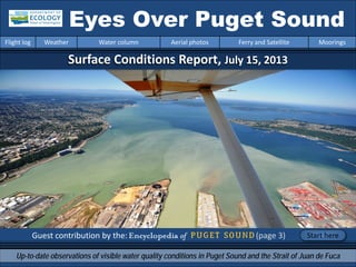
1. Surface Conditions Report, July 15, 2013
Guest contribution by the: (page 3)
Eyes Over Puget Sound
Up-to-date observations of visible water quality conditions in Puget Sound and the Strait of Juan de Fuca
Flight log Weather Water column Aerial photos Ferry and Satellite Moorings
Start here
2. LONG-TERMMARINEMONITORINGUNIT
Personal flight log p. 4
Winds blowing from the north in Central Sound
change flight plans and surface water.
Weather conditions p.6
Sunshine levels are high. Rivers are running below
normal. Air temperatures have been cooler and are increasing.
Northerly winds began to blow on 6/28 in Central Sound.
Water column and mooring p.7 , p.39
After 2 years of favorable conditions with colder
temperatures and higher oxygen, Puget Sound waters
are turning warmer, resulting in lower dissolved oxygen.
Aerial photography p. 11
Olive-brown bloom being blown in from the north moves past
Seattle. Many large algal mats and floating organic material in
South Sound, Hood Canal, and Sinclair Inlet. Red-brown algal
blooms and jellyfish patches in Budd, Totten, and Eld Inlets.
Ferry and satellite p. 36
Phytoplankton bloom in Whidbey Basin, northern Hood Canal
and Central Basin (between Elliott Bay and the Triple Junction).
Thermal imagery from earlier in the month reveals patterns of
near-surface mixing.
Mya Keyzers
Laura Friedenberg
Joe Leatherman
Skip Albertson
Dr. Christopher
Krembs
Dr. Brandon
Sackmann
Julia Bos
Suzan Pool
David Mora
www.ecy.wa.gov/programs/eap/mar_wat/eops/Previous Eyes Over Puget Sound reports:
Marine conditions from 7-15-2013 at a glance
Flight log Weather Water column Aerial photos Ferry and Satellite Moorings
3. http://www.eopugetsound.org/
The Encyclopedia of Puget Sound is
published by the University of
Washington’s Puget Sound Institute.
It represents the collective
knowledge of leading experts from
state and federal agencies, academic
institutions, and Puget Sound area
tribes.
It is intended as a primary source for
synthesized and integrated scientific
information about the Puget Sound
and Salish Sea watersheds.
Read more about Puget Sound on the pages of the
Flight log Weather Water column Aerial photos Ferry and Satellite Moorings
Visit the Encyclopedia of Puget Sound pages at:
http://www.eopugetsound.org/Guest Contribution
4. Central Sound Flight
A patchwork in Olympic Mountains and
turquoise water of Hood Canal
Van loaded and ready to go
Personal flight log 7-15-2013
Flight log Weather Water column Aerial photos Ferry and Satellite Moorings
Loading gear from the lab
to the van
Monday, there wasn’t a cloud in the sky
and the temperatures were hot. You would
think it would be the perfect day for
sampling by float plane. But even in July,
winds can often help or hinder a flight. With
a tail wind, a flight can be shortened
dramatically. With strong winds, whitecaps,
and waves, the float plane cannot land.
Loading gear onto plane
5. The Puyallup River’s journey from Mt. Rainier to Commencement Bay
Often, we consider wind patterns in changing the order of stations we fly to. With yesterday's strengthening
northerly wind, we had to skip stations. When a station is missed, we sample it on another flight during the
month. Luckily, we have two more flights this month.
Personal flight log 7-15-2013
Flight log Weather Water column Aerial photos Ferry and Satellite Moorings
6. Flight log Weather Water column Aerial photos Ferry and Satellite Moorings
Weather patterns from 7-1-2013 to 7-15-2013
Meteorological conditions typically explain up to half of the variance in observed marine
variables (Moore et al. 2008), particularly in shallower waters like those of south Puget
Sound. I summarized the specific conditions prevalent during the past two weeks, from north
to south. Source: http://www-k12.atmos.washington.edu/k12/grayskies/nw_weather.html
Moore et al. 2008. Local and large-scale climate forcing of Puget Sound oceanographic properties on seasonal to interdecadal timescales. Limnol. Oceanogr., 53(5), 1746–1758
Summary:
Air temperatures are
increasing again after a short
cooling period in early July.
Sunshine levels in the
north have been above
normal for the past several
days.
Rivers are now running below
normal.
Winds have mostly been from
the south to southwest with
the exception of Central
Sound (2nd wind plot from
top). Here, wind began
blowing from the north
around June 28.
Moore et al. 2008. Local and large-scale climate forcing of Puget Sound oceanographic properties on seasonal to interdecadal timescales. Limnol. Oceanogr., 53(5), 1746–1758
7. We use a chartered float
plane to access our
monthly monitoring
stations most cost
effectively.
We communicate data and
environmental marine
conditions using:
1. Marine Water
Condition Index
(MWCI)
2. Eyes Over Puget
Sound (EOPS)
3. Anomalies and
source data
Flight log Weather Water column Aerial photos Ferry and Satellite Moorings
Our long-termmarinemonitoringstationsin Puget Sound
Start here
Isl.
8. In 2013: Temp. is warming
Warming
Salinity is increasing? Oxygen is decreasing!
Puget Sound water conditions are changing again! Compared to 2011-2012, when waters were colder and
fresher with higher oxygen, values are beginning to show signs of warmer temperatures and decreasing
oxygen. Each pixel is a monthly survey at a single station.
Flight log Weather Water column Aerial photos Ferry and Satellite Moorings
Conditions of the last two years change at our stations
9. a) Pacific Decadal Oscillation Index (PDO) …(explanation)
b) Upwelling Index (anomalies) (Upwelling) …(explanation)
c) North Pacific Gyre Oscillation Index (NPGO) …(explanation)
-25
-15
-5
5
15
25
-1.5
-1
-0.5
0
0.5
1
1.5
1945 1950 1955 1960 1965 1970 1975 1980 1985 1990 1995 2000 2005 2010 2015
NPGO
PDO/UpwellingIndex
Three-year running average of PDO, Upwelling, and NPGO indices scores
Ocean boundary conditions have been favorable for water quality in Puget Sound: (a) colder water (PDO),
(b) less upwelled low oxygen and high nutrient ocean water reaching Puget Sound (Upwelling Index), and
(c) higher surface productivity along the coast (NPGO). Where are we heading next?
Flight log Weather Water column Aerial photos Ferry and Satellite Moorings
.
The oceanaffectswater quality: Ocean ClimateIndices
10. Nitrate Phosphate
Nutrients in Puget Sound are increasing, read http://www.ecy.wa.gov/programs/eap/mar_wat/trends.html
Nitrate Phosphate Nutrient Balance (Si:N)
Get the data and trends from us!
We observe increasing nutrients and changing algal biomass patterns in Puget Sound
Changing
Nutrient Balance
Algae bloom, Budd Inlet 2010
11. Summary: Aerial photography 7-15-2013
Olive-brown bloom, blown in from the north, is moving past Seattle. Many large algal mats and
floating organic material are present in South Sound, Hood Canal, and Sinclair Inlet. Red-brown
algal blooms and jellyfish patches in Budd, Totten, and Eld Inlets.
Flight log Weather Water column Aerial photos Ferry and Satellite Moorings
Start here
Mixing and Fronts:
Pronounced fronts near Blake Island, Rich and Agate
Passages, and Hood Canal. Olive-brown water flowing
southward.
Debris:
Very abundant in South Sound, Commencement Bay, Hood
Canal, Dyes and Sinclair Inlets, and Port Madison.
Visible blooms:
Red: Budd, Eld, Totten, Henderson, and Sinclair Inlets.
Brown: Main Basin, Commencement Bay, Case Inlet, and
Drayton Passage.
Green: Commencement Bay.
Jellyfish: Present in increasing numbers in Budd, Eld, and
Totten Inlets and in Hood Canal at depth.
BloomDebrisFront
Suspended sediment:
High sediment load from Puyallup River and wave exposed
beaches.
Plume
10 13 14 15
16
18
19
20
1 2 5 7
8 9Debris island near Hamma Hamma R.
Small red-brown bloom, Hidden Cove Park
11 12
14 15 16
17
8 9 11
5 9 10 11 12 13 14 15 16 17
11 12 13 14 17
1 2 6 7
2 11 20
18
20
3 4
12. Aerial photography
navigation guide,
Flight log Weather Water column Aerial photos Ferry and Satellite Moorings
Central Sound & Hood Canal
Observation Maps:
Seattle: H. tide: 10:42 PM , L. tides: 4:50 AM, 4:11 PM
Afternoon flight, 7-20:
Good visibility, wind increasing
from the north.
Strait of
Juan de Fuca
San Juan Islands
Flight Information:
Morning flight, 1-6:
Good visibility calm
South Sound
Padilla Bay
Main Basin
Hood Canal
South Sound
1
3
4
5
6
7
8
12 13
15
14
1617
20
1819
Whidbey Basin
11
10
9
2
13. Vertical net tows were conducted on 7/17/13 at West Bay Marina (WBM), Port of Olympia near Anthony’s Hearthfire (HF), Swantown Marina’s
Boatworks in East Bay (STM), Boston Harbor Marina (BHM). Phytoplankton concentrations were very dense in lower Budd Inlet (WBM & HF) and
dominated by the dinoflagellates Ceratium fusus and Akashiwo sanguinea. Concentrations were lighter at East Bay and Boston Harbor. For more
detailed information, contact Pacific Shellfish Institute (aimee@pacshell.org, www.pacshell.org).
Red-brown bloom and organic debris (macroalgae).
Location: Swantown Marina (Budd Inlet, South Sound), 9:39 AM.
1 Aerial photography 7-15-2013 Navigate
Flight log Weather Water column Aerial photos Ferry and Satellite Moorings
Bloom
Debris
14. 2 NavigateAerial photography 7-15-2013
Flight log Weather Water column Aerial photos Ferry and Satellite Moorings
Red-brown bloom, organic debris (macroalgae), and jellyfish patches.
Location: Budd Inlet (South Sound), 9:41 AM.
Bloom
jellyfish
jellyfishjellyfish
jellyfish
jellyfish
boat
boat
Debris
15. 3 NavigateAerial photography 7-15-2013
Large lines of organic surface debris and a weak olive-brown bloom.
Location: Case Inlet near Pickering Passage (South Sound), 9:55 AM.
Flight log Weather Water column Aerial photos Ferry and Satellite Moorings
Debris
Debris
Bloom
16. 4 Navigate
Flight log Weather Water column Aerial photos Ferry and Satellite Moorings
Aerial photography 7-15-2013
Large drifting mats of organic material at surface.
Location: Hamma Hamma River (Hood Canal), 11:13 AM.
Jellyfish at depth
boat
Debris
Debris
17. 5 NavigateAerial photography 7-15-2013
Flight log Weather Water column Aerial photos Ferry and Satellite Moorings
Large drifting mats of organic material at surface partially delineating a front.
Location: Hamma Hamma River (Hood Canal), 11:59 AM.
Front
Debris
Debris
Debris
18. Olive-brown water moving in from the north with tides, waves, and strong northerly winds.
Location: Little Beef Harbor, Dabob Bay (Hood Canal), 12:08 PM.
6 NavigateAerial photography 7-15-2013
Flight log Weather Water column Aerial photos Ferry and Satellite Moorings
Bloom
boat
boat
19. Large debris rafts (algal mats) lining up parallel to wind direction.
Location: Dyes Inlet (Kitsap Peninsula), 12:11 PM.
7 NavigateAerial photography 7-15-2013
Flight log Weather Water column Aerial photos Ferry and Satellite Moorings
boat
boat
boatboat
Debris
Debris
Debris
20. Large debris rafts (algal mats) following water movement.
Location: Sinclair Inlet (Kitsap Peninsula), 12:15 PM.
8 NavigateAerial photography 7-15-2013
Flight log Weather Water column Aerial photos Ferry and Satellite Moorings
Bloom
boat
boat
boat
Debris
Debris
21. A. B.
C. D. 1:19 PM
12:50 PM
1:12 PM
12:19 PM
Debris rafts and discolored water from blooms show water movement and fronts.
A. Sinclair Inlet, B. Agate Passage C. Rich Passage D. Off Blake Island.
Location: Near Bainbridge Island (Kitsap Peninsula).
9 NavigateAerial photography 7-15-2013
Flight log Weather Water column Aerial photos Ferry and Satellite Moorings
Front
Front
Front
Bloom
Bloom
Bloom
boat
boat
boat
ferry
Debris
Debris
22. 10 NavigateAerial photography 7-15-2013
Olive-brown water blown in by northerly winds meets clearer water from Colvos Passage.
Location: North Vashon Island (Central Basin), 1:20 PM.
Flight log Weather Water column Aerial photos Ferry and Satellite Moorings
Bloom
ship
boat
boat
boat
boat
23. 11 NavigateAerial photography 7-15-2013
Algal bloom and jellyfish? A & B. Quartermaster Harbor. Puyallup River plume near C. Entrance
to Quartermaster Harbor and D. Dash Point. Location: South Central Basin.
Flight log Weather Water column Aerial photos Ferry and Satellite Moorings
A. B.
C. D. 1:26 PM
1:24 PM
1:26 PM
1:24 PM
Front
Front
Plume
Plume
Bloom
jellyfish?
boat
boat
boat
boat
24. Puyallup River Plume and olive-brown water (algal bloom?)
Location: Commencement Bay (South Central Basin), 1:28 PM.
12 Navigate
Flight log Weather Water column Aerial photos Ferry and Satellite Moorings
Aerial photography 7-15-2013
Front
Plume
Bloom
boat
boat
25. Puyallup River Plume and a sand bar
Location: Commencement Bay (South Central Basin), 1:29 PM.
13 Navigate
Flight log Weather Water column Aerial photos Ferry and Satellite Moorings
Aerial photography 7-15-2013
Plume
boat
sand bar
26. Puyallup River Plume, olive-brown and yellow-green water (algal bloom?), and organic debris.
Location: Commencement Bay (South Central Basin), 1:31 PM.
14 Navigate
Flight log Weather Water column Aerial photos Ferry and Satellite Moorings
Aerial photography 7-15-2013
Front
Plume
Bloom
Bloom
boat
boat
ship
Debris
27. 15 Navigate
Flight log Weather Water column Aerial photos Ferry and Satellite Moorings
Large debris rafts (algal mats) following water movement into Carr Inlet.
Location: Pitt Passage Island (South Sound), 1:37 PM.
Aerial photography 7-15-2013
Bloom
boat
Debris
Debris
28. 16 Navigate
Flight log Weather Water column Aerial photos Ferry and Satellite Moorings
Large debris rafts (algal mats) and olive-brown algal bloom following water movement.
Location: West of Anderson Island (South Sound), 1:38 PM.
Aerial photography 7-15-2013
Bloom
boat
boat
Debris
Debris
29. 17 Navigate
Flight log Weather Water column Aerial photos Ferry and Satellite Moorings
Large debris rafts (algal mats) following water movement.
Location: Nisqually Reach (South Sound), 1:41 PM.
Aerial photography 7-15-2013
Plume
boat
boat
Debris
30. 18 Navigate
Flight log Weather Water column Aerial photos Ferry and Satellite Moorings
Red-brown algae bloom near the surface.
Location: Budd Inlet (South Sound), 1:45 PM.
Aerial photography 7-15-2013
Bloom
boat
boat
boat
31. 19 Navigate
Flight log Weather Water column Aerial photos Ferry and Satellite Moorings
Red-brown bloom near the surface and organic debris.
Location: Eld Inlet (South Sound), 1:46 PM.
Aerial photography 7-15-2013
Bloom
boat
Debris
Debris
Debris
32. 20 Navigate
Flight log Weather Water column Aerial photos Ferry and Satellite Moorings
Orange and red-brown bloom and patches of jellyfish near the surface.
Location: Eld Inlet (South Sound), 1:47 PM.
Aerial photography 7-15-2013
Bloom
Bloom
jellyfish
jellyfishjellyfish
jellyfish
boat
Debris
33. Hood Canal
Aerial photography observations in Central Sound Navigate
Flight log Weather Water column Aerial photos Ferry and Satellite Moorings
Numbers on map refer to picture numbers for spatial reference
Date: 7-15-2013
Central Sound
4
5
6
8
12
1314
7
9
11
10
35. Legend to map annotations
Comments:
Maps are produced by observers during and
after flights. They are intended to give an
approximate reconstruction of the surface
conditions on scales that connect to and
overlap with satellite images in the section that
follows.
Debris:
Debris can be distinguished into natural and
anthropogenic debris floating at the surface
sensu Moore and Allen (2000). The majority of
organic debris in Puget Sound is natural mixed
with discarded man-made pieces of plastic,
wood, etc. From the plane, we cannot
differentiate the quality of debris at the surface
and therefore, call it for reasons of practicality
just “debris”.
S.L. Moore, M. J. Allen. 2000. Distribution of
Anthropogenic and Natural Debris on the
Mainland Shelf of the Southern California Bight.
Marine Pollution Bulletin, 40(1), 83–88.
Navigate
Flight log Weather Water column Aerial photos Ferry and Satellite Moorings
36. Brandon Sackmann
Contact:
bsackmann@ecy.wa.gov
MERIS True Color image used for spatial context (19 February 2011) of the Victoria Clipper en route monitoring route (red dashes on map).
Ferry and satellite observations 7-15-2013
Flight log Weather Water column Aerial photos Ferry and Satellite Moorings
Start here
Current Conditions:
Phytoplankton bloom in Whidbey Basin, northern
Hood Canal and Central Basin (between Elliott Bay
and the Triple Junction). Thermal imagery from
earlier in the month reveals patterns of near-
surface mixing.
No Victoria Clipper data available
–
Sensor maintenance
37. MODIS Aqua
13-14 July 2013
Satellite ocean color
imagery leading up to over
flight on 7/15 reveals blooms in
Whidbey Basin, northern Hood
Canal and the Central Basin
between Elliott Bay and the
Triple Junction.
Lower chlorophyll values
observed in the Strait of Juan
de Fuca.
Fraser River plumes can be seen
spreading out across the entire
Strait of Georgia!
July 13 July 14
MODIS Aqua
250/500-m Chl
Ferry and satellite observations 7-15-2013
Flight log Weather Water column Aerial photos Ferry and Satellite Moorings
38. Ferry and satellite observations 7-15-2013
Flight log Weather Water column Aerial photos Ferry and Satellite Moorings
100-m Thermal Infrared
Landsat 8 helps visualize dynamic mixing
processes in Puget Sound
3 July 2013
Earlier this month Landsat 8 captured a beautiful
image of Puget Sound! Hi-resolution thermal
imagery revealed increased mixing in narrow
passages (cooler surface temperatures) and
stratification (warmer surface temperatures) at
terminal ends of many bays and inlets. Rivers are
also adding warm water at the surface.
C- Cooler
W- Warmer
W
W
WW
W
WC
C
C
C
C
CC
C
C
C
CC
W
W
W
W
39. At our Mukilteo moorings, we observed distinct differences in salinity between the surface (24 PSU)
and bottom (29.4 PSU) waters. In the bottom water layer, dissolved oxygen is lower while salinity is
higher.
Mooring observations and trends
7-2-2013 to 7-15-2013
Flight log Weather Water column Aerial photos Ferry and Satellite Moorings
Left Panels: Density is defined by
salinity and temperature.
Probability of finding a specific
density over the past two-week
period can be shown in a T-S plot.
High probability shown in warm
colors.
Right Panel: Dissolved oxygen
concentration in relation to salinity.
High probability shown in warm
colors.
12-16 m depth
2-6 m depth
Dissolved oxygen not
measured
40. Mooring observations and trends
6-15-2013 to 7-15-2013
Flight log Weather Water column Aerial photos Ferry and Satellite Moorings
We report on thickness of the fresher water layer by monitoring our near-surface sensor. We define this
thickness using 28.55 (±0.05) PSU. At Mukilteo (Whidbey Basin), winds, fortnightly tidal cycle, and declining river
flows influenced the surface water layer thickness. The bottom sensor detects the fresher water less frequently,
only 4 times in past two weeks. Freshwater input from rivers declined to below normal and Skagit River
contributed the largest portion.
-10
-5
0
5
10
15
20
2510
12
14
16
18
20
22
24
26
28
30
15-Jun
16-Jun
17-Jun
18-Jun
19-Jun
20-Jun
21-Jun
22-Jun
23-Jun
24-Jun
25-Jun
26-Jun
27-Jun
28-Jun
29-Jun
30-Jun
1-Jul
2-Jul
3-Jul
4-Jul
5-Jul
6-Jul
7-Jul
8-Jul
9-Jul
10-Jul
11-Jul
12-Jul
13-Jul
14-Jul
15-Jul
Discharge(102m3/sec),Tidalrange(ft)Avg.)
DailyNSWindspeed(kts)
28.55IsohalinePressure(db)
Thickness of surface layer at Mukilteo and influencing factors
Skagit Flow Snohomish Flow 28.55 Isohaline N-S Wind Tide Range
Southerly Winds Northerly Winds
* The pycnocline is shallower and outside our monitored depth range.
* * * * * ** * * * * * ** * * * *
River data from
41. Real-time
data online
(click)
Mukilteo Dissolved Oxygen
DO Max 9.8 mg/L on 07/09 at 9.7 PSU 28.7 °C 12.5 db
DO Min 4.2 mg/L on 07/02 at 6.5 PSU 29.4 °C 10.9 db
DO Avg 6.9
DO Trend 0.7 mg/L
DO-Sal
Corr
-0.68
DO-Temp
Corr
0.66
Mukilteo Salinity (Sal)
Sal Max 29.5 PSU on 07/02 at 29.5 °C 10.7 db
Sal Min 28.3 PSU on 07/07 at 29.1 °C 11.6 db
Sal Avg 29.2 PSU
Sal Trend -0.4 PSU
Mukilteo Temperature (T)
T Max 13.5 °C on 07/09 at 9.7 PSU 13.5 db
T Min 10.7 °C on 07/02 at 6.4 PSU 10.8 db
T Avg 11.3 °C
T Trend 1.2 °C
Go to our mooring website at: http://www.ecy.wa.gov/programs/eap/mar_wat/moorings.html
During the past two weeks, temperature and dissolved oxygen increased whereas salinity declined.
Mukilteo Salinity (Sal)
Sal Max 29.3 PSU on 07/02 at 11.1 °C 5.8 db
Sal Min 17.5 PSU on 07/09 at 17.6 °C 3.6 db
Sal Avg 25.1 PSU
Sal Trend 0.3 PSU
Mukilteo Temperature (T)
T Max 18.4 °C on 07/09 at 21.1 PSU 3.3 db
T Min 11 °C on 07/02 at 29 PSU 5.8 db
T Avg 14.7 °C
T Trend 1.1 °C
Mooring observations and trends
7-02-2013 to 7-15-2013
Flight log Weather Water column Aerial photos Ferry and Satellite Moorings
12-16 m depth2-6 m depth
42. Mooring observations and trends
Mukilteo 2010 to 2013
Flight log Weather Water column Aerial photos Ferry and Satellite Moorings
This slide shows data from our Mukilteo mooring
capturing water exchange between the Main Basin
and Possession Sound at 12-16 m.
Inter-annual variability in temperature, salinity, and
dissolved oxygen is shown over a 3.5-year period. All
three variables show strong seasonality.
Thus far in 2013, trends are appearing to be similar
to 2010 with relatively warmer water temperature,
higher salinity, and lower dissolved oxygen.0.0
2.0
4.0
6.0
8.0
10.0
12.0
J F M A M J J A S O N D
DissolvedOxygen(mg/l)
Dissolved Oxygen
(Monthly Average)
2010 2011 2012 2013
0.0
2.0
4.0
6.0
8.0
10.0
12.0
14.0
J F M A M J J A S O N D
Temperature(°C)
Temperature
(Monthly Average)
2010 2011 2012 2013
26.5
27.0
27.5
28.0
28.5
29.0
29.5
30.0
30.5
J F M A M J J A S O N D
Salinity(PSU)
Salinity
(Monthly Average) 2010 2011 2012 2013
44. You may subscribe or unsubscribe to the Eyes Over Puget Sound email listserv by going to:
http://listserv.wa.gov/cgi-bin/wa?A0=ECOLOGY-EYES-OVER-PUGET-SOUND
Many thanks to our business partners: Clipper Navigation, Swantown Marina, and Kenmore Air.
We are looking for feedback to improve our products.
Dr. Christopher Krembs
christopher.krembs@ecy.wa.gov
Marine Monitoring Unit
Environmental Assessment Program
WA Department of Ecology
Flight log Weather Water column Aerial photos Ferry and Satellite Moorings