The document discusses key topics in engineering geology including:
1) The importance of geology to civil engineering as all civil engineering works involve earth and its features.
2) The physical properties of minerals that are important for identifying and classifying different rock types.
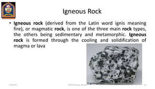
3) The three main types of rocks - igneous, sedimentary, and metamorphic - and their origins and characteristic properties.
4) Important geological structures like strike, dip, folds, faults, joints and unconformities that influence civil engineering design and construction.