The document discusses glacial and postglacial landforms caused by meltwater from glaciers. As glaciers melt, they deposit sediments in characteristic landforms such as moraines, eskers, and kames. Postglacially, melting ice sheets caused sea levels to fluctuate as land rose, leaving raised beaches and terraces. Seasonal meltwater also formed varved clays in lakes.
Comprehensive powerpoint on features of Glacial Erosion.
Introduction to Glaciers and Ice, plucking, abrasion and freeze-thaw, followed by descriptions and photographs of:
Corries
Aretes
Pyramidal Peaks
U-Shaped Valleys
Hanging Valleys
Truncated Spurs
Ribbon Lakes
Comprehensive powerpoint on features of Glacial Erosion.
Introduction to Glaciers and Ice, plucking, abrasion and freeze-thaw, followed by descriptions and photographs of:
Corries
Aretes
Pyramidal Peaks
U-Shaped Valleys
Hanging Valleys
Truncated Spurs
Ribbon Lakes
This topic is all about Glaciation. This includes; the causes of glaciation, the origin of glaciers, formation, primary types, movement, the erosional, transportation and depositional mechanisms. This also includes the common landforms brought by glaciers.
AS Level Physical Geography - Rocks and WeatheringArm Punyathorn
The earth's surface is an ever-changing entity. With the forces of weather and climate and tectonic variability, the rocks and minerals that make up the earth are always changing in size, shape and forms - a fascinating, ancient, never-ending process.
Final project report on grocery store management system..pdfKamal Acharya
In today’s fast-changing business environment, it’s extremely important to be able to respond to client needs in the most effective and timely manner. If your customers wish to see your business online and have instant access to your products or services.
Online Grocery Store is an e-commerce website, which retails various grocery products. This project allows viewing various products available enables registered users to purchase desired products instantly using Paytm, UPI payment processor (Instant Pay) and also can place order by using Cash on Delivery (Pay Later) option. This project provides an easy access to Administrators and Managers to view orders placed using Pay Later and Instant Pay options.
In order to develop an e-commerce website, a number of Technologies must be studied and understood. These include multi-tiered architecture, server and client-side scripting techniques, implementation technologies, programming language (such as PHP, HTML, CSS, JavaScript) and MySQL relational databases. This is a project with the objective to develop a basic website where a consumer is provided with a shopping cart website and also to know about the technologies used to develop such a website.
This document will discuss each of the underlying technologies to create and implement an e- commerce website.
Explore the innovative world of trenchless pipe repair with our comprehensive guide, "The Benefits and Techniques of Trenchless Pipe Repair." This document delves into the modern methods of repairing underground pipes without the need for extensive excavation, highlighting the numerous advantages and the latest techniques used in the industry.
Learn about the cost savings, reduced environmental impact, and minimal disruption associated with trenchless technology. Discover detailed explanations of popular techniques such as pipe bursting, cured-in-place pipe (CIPP) lining, and directional drilling. Understand how these methods can be applied to various types of infrastructure, from residential plumbing to large-scale municipal systems.
Ideal for homeowners, contractors, engineers, and anyone interested in modern plumbing solutions, this guide provides valuable insights into why trenchless pipe repair is becoming the preferred choice for pipe rehabilitation. Stay informed about the latest advancements and best practices in the field.
Saudi Arabia stands as a titan in the global energy landscape, renowned for its abundant oil and gas resources. It's the largest exporter of petroleum and holds some of the world's most significant reserves. Let's delve into the top 10 oil and gas projects shaping Saudi Arabia's energy future in 2024.
Water scarcity is the lack of fresh water resources to meet the standard water demand. There are two type of water scarcity. One is physical. The other is economic water scarcity.
Welcome to WIPAC Monthly the magazine brought to you by the LinkedIn Group Water Industry Process Automation & Control.
In this month's edition, along with this month's industry news to celebrate the 13 years since the group was created we have articles including
A case study of the used of Advanced Process Control at the Wastewater Treatment works at Lleida in Spain
A look back on an article on smart wastewater networks in order to see how the industry has measured up in the interim around the adoption of Digital Transformation in the Water Industry.
Immunizing Image Classifiers Against Localized Adversary Attacksgerogepatton
This paper addresses the vulnerability of deep learning models, particularly convolutional neural networks
(CNN)s, to adversarial attacks and presents a proactive training technique designed to counter them. We
introduce a novel volumization algorithm, which transforms 2D images into 3D volumetric representations.
When combined with 3D convolution and deep curriculum learning optimization (CLO), itsignificantly improves
the immunity of models against localized universal attacks by up to 40%. We evaluate our proposed approach
using contemporary CNN architectures and the modified Canadian Institute for Advanced Research (CIFAR-10
and CIFAR-100) and ImageNet Large Scale Visual Recognition Challenge (ILSVRC12) datasets, showcasing
accuracy improvements over previous techniques. The results indicate that the combination of the volumetric
input and curriculum learning holds significant promise for mitigating adversarial attacks without necessitating
adversary training.
Sachpazis:Terzaghi Bearing Capacity Estimation in simple terms with Calculati...Dr.Costas Sachpazis
Terzaghi's soil bearing capacity theory, developed by Karl Terzaghi, is a fundamental principle in geotechnical engineering used to determine the bearing capacity of shallow foundations. This theory provides a method to calculate the ultimate bearing capacity of soil, which is the maximum load per unit area that the soil can support without undergoing shear failure. The Calculation HTML Code included.
2. INTRODUCTION
Glaciers are solid ice that move extremely
slowly along the land surface. Glacial ice
erodes and shapes the underlying rocks.
Glaciers also deposit sediments in
characteristic landforms. They cover about
10% of the land surface near Earth’s poles
and they are also found in high mountains.
WHAT ARE GLACIERS?
TYPES OF GLACIERS:
Continental glaciers are large ice sheets
that cover relatively flat ground. These
glaciers flow outward from where the
greatest amount of snow and ice
accumulate.
Alpine or valley glaciers flow downhill
through mountains along existing valleys.
3. DEPOSITION FROM
MELT WATERS
As large volumes of melt water
were released from Pleistocene
ice sheets, it carved networks of
deeply incised spillway systems
such as those in Channeled
Scabland of the northwestern
United States and elsewhere in
North America, Europe, Asia, and
Antarctica. In addition to trench-
like spillways, these meltwater
floods sculpted large-scale
streamlined residual hills,
longitudinal grooves, and other
landforms in the glacial
landscape.
Glacial melt water is an
important component of
the glacial system. It
produces a wide variety
of erosional landforms,
especially when released
suddenly from
impoundments under, on
top of, and in front of the
ice.
4. DEPOSITION FROM
MELT WATERS
A moraine is material left
behind by a moving glacier.
This material is usually soil and
rock. Just as rivers carry along
all sorts of debris and silt that
eventually builds up to form
deltas, glaciers transport all
sorts of dirt and boulders that
build up to form moraines.
A glacier deposits its remaining
load of moraine at the ice front.
If this is static, the coarse gravel
and boulders form an irregular
ridge called a terminal moraine.
5. DEPOSITION FROM
MELT WATERS
A series of recessional moraines, of similar
character, may be formed at successive halting
stages as the ice front retreats. Finer fractions of
the moraine are transported by melt waters
issuing from tunnels in the glacier and from
wasting ice at the front of the glacier. The
position of such a tunnel mouth may be marked
as the ice front retreats by an elongated
hummock of cross-bedded sand and gravel.
Meltwater streams begin
in tunnels under the ice.
6. DEPOSITION FROM
MELT WATERS
When the meltwater flows out
of the tunnel it starts to slow
down. The slower moving
meltwater deposits gravel and
sand on an outwash plain.
The rate of flow of the meltwater
stream decreases as it spreads, free
from the confinement of the tunnel
walls, and much of its load is
dropped.
7. DEPOSITION FROM
MELT WATERS
A sinuous ridge called an esker may
form as the tunnel mouth changes
position while the ice retreats, if
there is a steady supply of sand.
Rocks and gravel dumped
in these tunnels form long
thin ridges called eskers.
8. DEPOSITION FROM
MELT WATERS
A more complicated retreat, with
large masses of stagnant ice
present, may produce lines of
hummocks called kames. When a
large block of ice melts, it leaves a
depression in the drift (commonly a
few meters across and one or two
meters deep) called a kettle hole.
Sand and fine gravel may be
carried for kilometers from the ice
front, and be deposited as a flat
spread of well bedded, well sorted
sediments. Other terms, such as
kame terrace and fluvioglacial fan,
are used to describe landforms
produced by spreads of gravel and
sand.
9. DEPOSITION FROM
MELT WATERS
Deposits from melt waters are said to be
fluvioglacial. Fluvioglacial landforms are those
that result from the associated erosion and
deposition of sediments caused by glacial
meltwater. If large enough to be delineated, they
are normally shown on Geological Survey maps
as ‘glacial sand and gravel’, without further
differentiation, although they range in
composition from clean, well bedded, poorly
graded sand, to unstratified mixtures of coarse
gravel, boulders and clay. They also vary widely
in compactness. For example, a deposit that
contained dead ice is less compact than one
laid down in water, and may be recognized by
its steep margins and lack of regular bedding.
10. Late Glacial Event is a landscape with many suitable places for sediment
accumulation to begin, with a wide range of depression sizes, formed by
processes such as scour and erosion of bedrock, or deposition of moraine dams
and of undulating till fields which include features such as kettle holes
(Encyclopedia of Quaternary Science, 2007).
Postglacial means formed or occurring after a glacial period, especially after the
Pleistocene epoch.
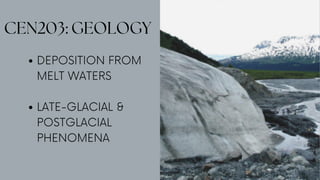
LATE-GLACIAL
& POSTGLACIAL
PHENOMENA
11. At the end of the last glaciation, as
temperatures rose, the ice sheets wasted,
leaving a patchy cover of fluvioglacial
sand and gravel on the glacial till. The
disruption of the preglacial drainage
system, with some rivers choked with drift
and others blocked by stagnant ice or
moraines, produced ponding on an
extensive scale. Many of these small
shallow lakes are now filled with peat or
bedded clays, and others remain to give
northern landscapes a distinctive
character. The layering in some clays
consists of alternating light and dark
bands, each a few millimetres thick.
LATE-GLACIAL
& POSTGLACIAL
PHENOMENA
LATE-GLACIAL
Gouging by ice has produced a rock basin, which subsequently filled
with flat-lying lake clays and peat. Natural ponding has also occurred
behind the morainic mounds of sand and gravel. The lake flat is the
surface expression of this recent sedimentation.
12. The layering in some clays consists of alternating light and dark
bands, each a few millimeters thick. The dark sediment is clay and
the light is silt or fine sand. This varved clay is often formed in lakes
which were fed seasonally by waters from melting glaciers. Spring
floods dumped a mixture of clay and silt in them. The silt settled
quickly but the clay particles stayed in suspension longer. A complete
rhythm of silt and clay constitutes a varve and usually represents the
deposition of a single year. Occasionally in upland valleys the level
of a late-glacial lake is marked by erosion of the valley sides. Wave
action at the shores cuts narrow terraces, which ring the valley.
LATE-GLACIAL
& POSTGLACIAL
PHENOMENA
LATE-GLACIAL
Late-glacial moraines (1, 2, 3) in the Finlay River
watershed, northern British Columbia. (A) Aerial
photograph of Cushing Lake, which is dammed by
moraine 1. (B) Moraines viewed downvalley (west)
from Cushing Lake (from Lakeman et al., 2008).
13. In postglacial times there have been
marked fluctuations of mean sea level
around Britain, partly because the
melted ice added to the volume of the
oceans and partly because, in glaciated
regions where ice sheets were thick,
there was a response of the crust to the
removal of the load of ice. Freed of ice
the plate started to rise in the denser
viscous asthenosphere to attain a new
hydrostatic equilibrium. The process is
referred to as isostatic recovery. It is still
continuing in northern Britain and other
glaciated regions, since the high viscosity
of the material that flows in as the plate
rises makes it a slow process.
LATE-GLACIAL
& POSTGLACIAL
PHENOMENA
POSTGLACIAL
14. The different sea levels, if they have
persisted long enough, have produced
terraces and raised beaches in coastal
areas. These are gently sloping strips,
often backed by sea cliffs, which are
covered by typical beach deposits.
Their mean elevation is usually between
a few and fifty metres. In estuaries, the
deposits of raised beaches are likely to
be bedded clays with lateral changes
to sand or gravel near their shorelines.
Similar terracing and strandlines, which
were formed at times of lower mean
sea level, exist off shore.
LATE-GLACIAL
& POSTGLACIAL
PHENOMENA
POSTGLACIAL
15. A.C.McLean, & C.D.Gribble. (2005). Geology for Civil Engineers: Second
Edition. Taylor & Francis e-Library.
Glasser, N., Kehew, A., & Kozlowski, A. (2013). Meltwater. Retrieved from
ScienceDirect: https://www.sciencedirect.com/topics/earth-
and-planetary-sciences/meltwater
Lumen. (n.d.). Glacial Erosion and Deposition. Retrieved from Lumen
Learning:
https://courses.lumenlearning.com/earthscience/chapter
/glacial-erosion-and-deposition/
National Geographic. (n.d.). National Geographic. Retrieved from
Moraine:
https://www.nationalgeographic.org/encyclopedia/moraine/
One Geology. (n.d.). Meltwater. Retrieved from One Geology:
https://www.onegeology.org/extra/kids/
earthprocesses/meltwater.html
REFERENCES
16. Deposits from meltwaters are said to be...
When a large block of ice melts, it leaves a depression in the drift (commonly a few meters
across and one or two meters deep) called a...
What is the process where the plate starts to rise in the denser viscous asthenosphere to
attain a new hydrostatic equilibrium once it is freed of ice?
It is a sinuous ridge that may form as the tunnel mouth changes position while the ice
retreats, if there is a steady supply of sand.
It is a landscape with many suitable places for sediment accumulation to begin, with a wide
range of depression sizes, formed by processes such as scour and erosion of bedrock, or
deposition of moraine dams and of undulating till fields which include features such as kettle
holes.
It is often formed in lakes which were fed seasonally by waters from melting glaciers.
It means formed or occurring after a glacial period, especially after the Pleistocene epoch.
What is the material left behind by a moving glacier?
1.
2.
3.
4.
5.
6.
7.
8.
9-10. What are the two types of glaciers?
QUIZ
Postglacial Fluvioglacial Isostatic Recovery Moraine
Esker Kettle Hole Late-Glacial Varved Clay
1-8. Choose your answers from the box.
9-10. Enumerate.