Dennis Nona
•Download as PPTX, PDF•
0 likes•1,363 views

Two Brothers is an amazing sculpture by Dennis Nona which is found at KAUST. This presentation tells about the myth that the sculpture is based upon.

More Related Content
What's hot
What's hot (16)
Viewers also liked
Viewers also liked (16)
Similar to Dennis Nona
Similar to Dennis Nona (20)
More from Mary Alice Osborne
More from Mary Alice Osborne (15)
Recently uploaded
Recently uploaded (20)
Dennis Nona
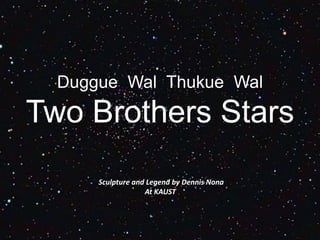
- 1. Duggue Wal Thukue Wal Two Brothers Stars Sculpture and Legend by Dennis Nona At KAUST
- 2. Where do Myths and Legends come from?
- 3. As the sun began to sink lower and lower in the sky and cold winds began to blow, ancient people wondered why different events occurred. Why were there seasons, how was the earth created, and why were animals so many diverse shapes and sizes?
- 4. In the dark nights, they gathered around campfires to tell stories trying to explain these natural occurrences. Their colorful stories became the wonderful, creative myths and legends we hear today.
- 5. There is a Mythical & Mystical Sculpture At KAUST… it is called the 2 brothers.
- 6. Torres Strait This sculpture is based on an ancient myth that comes from the Torres Strait region between Australia and Papua New Guinea
- 7. From a place called Badu Island
- 8. Artist Dennis Nona • Two Brothers was created by Dennis Nona, one of the most famous artists from the Torres Strait. He had an early education in wood- carving which he transformed into a unique artistic style of intricate lino cuts, etchings and sculptures.
- 9. Torres Strait Islander people are described as having one foot on land and one in the sea. Here is one of their hand carved boats
- 10. Canoes were very importance to the people of the Torres Strait. They were used for trading between the islands and trading to the north with Papua New Guinea and to the South with Cape York on the Australian mainland. Canoes were essential for hunting of dugong and turtle which were an important food source. They were also used in battle in the time when warriors were revered and their courage measured by a count of the number of human skulls acquired.
- 11. Here is a Traditional canoe built to hold up to 5 people, but long distance canoes were huge and could hold 50 people
- 12. Here is one of the spectacular war canoes of the Gogodala people in Indonesia.
- 13. Artist Dennis Nona tells ancient stories and myths of his people in one image. He uses delicate clan patterning to indicate each story’s place of origin.
- 14. Like many Torres Strait Islanders Dennis Nona was taught to carve at an early age. Here is the artist carving part of the sculpture 2 Brothers which is seen at KAUST.
- 15. Patterning Artwork by Dennis Nona
- 17. Nagai or the soft wind that Dennis Nona has shown on the right hand of the canoe hull is a totem of his family’s clan.
- 18. Dennis Nona developed “Two Brothers” based on a traditional legend from his home island of Badu. The 7-metre-long cast bronze canoe is supported by 6 paddles, raising it 5 metres above the ground.
- 19. The position of the two stars in the night sky is an indicator of weather conditions which are of vital importance to these seafaring people. When the two stars are seen apart, strong winds and rough conditions can be expected. When they are observed close together, gentle winds and a calm sea will be experienced.
- 20. The patterning and position of two mother-of-pearl stars seen on the sides of the canoe’s hull reflect the strong wind (Sagerr) and soft wind (Nagai). In the legend, these stars are actually 2 brothers who usually get along with each other, like most brothers. When these stars are seen close together the two brother are friends, but when they are seen far apart, the two brothers are fighting, causing bad weather and high seas.
- 21. There are myths and legends all around us…. Look for the ancient myths from your own cultures! We are looking forward to see the creative videos that advisories are making and prizes will be awarded to the 3 best in Middle School and in High School!
Editor's Notes
- As the sun began to sink lower and lower in the sky and cold winds began to blow, ancient people wondered why different events occurred. Why were there seasons, how was the earth created, and why were animals so many diverse shapes and sizes?
- In the dark nights, they gathered around campfires to tell stories trying to explain these natural occurrences. Their colorful stories became the wonderful, creative myths and legends we hear today.
- There is a Mythical & Mystical Sculpture At KAUST… it is called the 2 brothers.
- This sculpture is based on an ancient myth that comes from the Torres Strait region between Australia and Papua New Guinea
- From a place called Badu Island
- Torres Strait Islander people are described as having one foot on land and one in the sea. Here is one of their hand carved boats
- Canoes were very importance to the people of the Torres Strait. They were used for trading between the islands and trading to the north with Papua New Guinea and to the South with Cape York on the Australian mainland. Canoes were essential for hunting of dugong and turtle which were an important food source. They were also used in battle in the time when warriors were revered and their courage measured by a count of the number of human skulls acquired.
- Here is a Traditional canoe built to hold up to 5 people, but long distance canoes were huge and could hold 50 people
- Here is one of the spectacular war canoes of the Gogodala people.
- Artist Dennis Nona tells ancient stories and myths of his people in one image. He uses delicate clan patterning to indicate each story’s place of origin. Dennis Nona: On the islands we have sharks, stingrays, turtles and dugongs. Some of these sea creatures are totems to the Torres Strait Islands. And it's a thing that we're proud of to show people that this is our totem and we decorate them very well in our artwork.
- Like many Torres Strait Islanders Dennis Nona was taught to carve at an early age. Here is the artist carving part of the sculpture 2 Brothers which is seen at KAUST.
- This patterning or mineral provides the artist with a way to convey the many parts of his culture and natural phenomena of his Island world. While appearing to be quite abstract they are in fact depicting things like the fierce currents that swirl around the islands and rip through the Strait from the Pacific to the Indian oceans. The winds, cloud formations, rain, tides, island flora and elements of sacred knowledge that is not explained or revealed to the uninitiated, are all seen in his work.
- Nagai or the soft wind that Dennis Nona has shown on the right hand of the canoe hull is a totem of his family’s clan.
- Dennis Nona developed “Two Brothers” based on a traditional legend from his home island of Badu. The 7-metre-long cast bronze canoe is supported by 6 paddles, raising it 5 metres above the ground.
- The position of the two stars in the night sky is an indicator of weather conditions which are of vital importance to these seafaring people. When the two stars are seen apart, strong winds and rough conditions can be expected. When they are observed close together, gentle winds and a calm sea will be experienced.
- The patterning and position of two mother-of-pearl stars seen on the sides of the canoe’s hull reflect the strong wind (Sagerr) and soft wind (Nagai). In the legend, these stars are actually 2 brothers who usually get along with each other, like most brothers. When these stars are seen close together the two brother are friends, but when they are seen far apart, the two brothers are fighting, causing bad weather and high seas.
- There are myths and legends all around us…. Look for the ancient myths from your own cultures! We are looking forward to see the creative videos that advisories are making and prizes will be awarded to the 3 best in Middle School and in High School!