
Recommended
More Related Content
What's hot
What's hot (20)
Similar to Dannenbaum Engineering - River Update 9-19-2015
Similar to Dannenbaum Engineering - River Update 9-19-2015 (20)
Recently uploaded
Recently uploaded (20)
Dannenbaum Engineering - River Update 9-19-2015
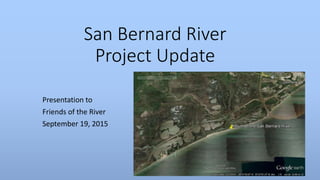
- 1. San Bernard River Project Update Presentation to Friends of the River September 19, 2015
- 2. Scope of work Develop a RESTORE Act grant application to fund an ecosystem restoration project on the San Bernard River • Dredge the historical channel to restore river flow to the Gulf • Evaluate potential structure solutions to avoid future channel siltation/shoaling • Develop a plan to use dredge material beneficially (beach and marsh restoration) • Obtain the necessary permits (Corps, GLO,….) • Work with stakeholders to develop consensus on an actionable plan and secure a RESTORE grant.
- 3. History
- 4. Bathymetry Change River Flow Data
- 5. Modeling Summary • The mouth of the San Bernard River is influenced by the Brazos Delta which continues to evolve. • The littoral drift and associated tidal wave action will continue to move material into the mouth • Current river flow does not sustain a velocity to move sediment away from the river mouth • A one time structural project at the mouth of the river will not be feasible without periodic maintenance • Structural features will have impacts on sediment flow along the littoral drift and could cause additional erosion to shoreline south of the jetty.
- 6. Management Alternatives Team looked at six different management options: • Option A - No Action • Option B - Dredge re-opening, no stabilization; • Option C - Dredge re-opening, stabilization with single jetty on east side; • Option D - Dredge re-opening, stabilization with dual jetties on both sides; • Option E - Dredge re-opening, stabilization with eastern weir jetty and western typical jetty; and, • Option F - Establish a channel to connect to Cedar Lakes to increase tidal prism.
- 7. Channel Configurations 7 channel configurations were investigated: • Rectangular channel with bottom elevation of MLT-10 ft, bottom width of 100 ft, and extending 0 ft into Gulf • Trapezoidal channel with bottom elevation of MLT -8.5 ft, bottom width of 100 ft, and extending 1050 ft into the Gulf • Trapezoidal channel with bottom elevation of MLT -10 ft, bottom width of 130 ft, and extending 1300 ft into the Gulf • Trapezoidal channel with bottom elevation of MLT -8.5 ft, bottom width of 150 ft, and extending 1050 ft into the Gulf • Trapezoidal channel with bottom elevation of MLT -8.5 ft, bottom width of 120 ft, and extending 1050 ft into the Gulf • Trapezoidal channel with bottom elevation of MLT -7 ft, bottom width of 160 ft, and extending 900 ft into the Gulf • Trapezoidal channel with bottom elevation of MLT -5 ft, bottom width of 240 ft, and extending 600 ft into the Gulf
- 8. Alternative Configuration Results Option and Channel config. Configuration Est. Initial dredge volume Est. maint. Interval,chan nel (years) Est. maint. dredge volume, channel Est. time to shoreline advance past East jetty (years) Est. maint. dredge volume, bypass Note A No action, natural maintenance None None None - None Mouth remains closed. No anticipated benefit to circulation or velocity. B4 Dredge re-opening, no stabilization 123,000 cu. yd 2 <123,000 cu. yd per 2 years1 - None Spit growth and uncertain navigability toward end of maintenance cycle. 1Some natural bypassing of westward-moving littoral sediments. C4 Dredge re-opening, long (-8.5ft) jetty stabilization, east side only 123,000 cu. yd 2 <29,000 cu. yd per 2 years 2 or 122 352,000 cu. yd per 2 years, or 2,112,000 cu. yd per 12 years2 Maintenance dredging of channel to remove deposits of eastward moving sediments. (Tidal flushing may lessen this amount). East jetty will initially capture westward sediments; 2If no mechanical bypass dredging, time until jetty impoundment: 10-15 years C7 Dredge re-opening, long (-5ft) jetty stabilization, east side only 94,000 cu. yd 2 14,000 cu. yd per 2 years 2 or 43 <352,000 cu. yd per 2 years, or <704,000 cu. yd per 4 years3 Maintenance dredging of channel to remove deposits of eastward moving sediments. (Tidal flushing may lessen this amount). East jetty will initially capture westward sediments; 3If no mechanical bypass dredging, time until jetty impoundment: 4-5 years. Short jetty anticipated to allow some natural bypassing of westward moving sediments, reducing volume for mechanical bypass dredging.
- 9. Alternatives Option and Channel config. Configuration Est. Initial dredge volume Est. maint. Interval,chan nel (years) Est. maint. dredge volume, channel Est. time to shoreline advance past East jetty (years) Est. maint. dredge volume, bypass Note D4 Dredge re-opening, long jetties (-8.5ft) 123,000 cu. yd 12 limited 2 or 124 352,000 cu. yd per 2 years, or 2,112,000 cu. yd per 12 years4 Extends navigable life between maintenance events; greater effect on littoral sediment movement; East jetty will initially capture westward sediments;4If no mechanical bypass dredging, time until jetty impoundment: 10-15 years D7 Dredge re-opening, short (-5 ft) jetty to promote bypassing 94,000 cu. yd 2 <14,000 cu. yd per 2 years 2 or 45 <352,000 cu. yd per 2 years, or <704,000 cu. yd per 4 years5 Short jetties allow some natural bypassing of westward moving sediments, reducing volume for mechanical bypass dredging. Short jetties may also allow sediment deposits from tidal inflows inside channel – thus requiring channel maintenance. 5If no mechanical bypass dredging, time until jetty impoundment: 4-5 years. DW4 Dredge re-opening, long jetty with east side weir to capture westward sediment 123,000 cu. yd 2 limited 2 352,000 cu. yd per 2 years6 Extends navigable life between maintenance events; lessens effect on littoral sediment movement. 6Deposition of littoral sediments in deposition zone on the inner side of the weir jetty needs to be dredged every two years to free up capacity. CW4 Dredge re-opening, long jetty east side only with weir to capture westward sediment, no west jetty 123,000 cu. yd 2 29,000 cu. yd per 2 years 2 352,000 cu. yd per 2 years6 Extends navigable life between maintenance events; lessens effect on littoral sediment movement. 6Deposition of littoral sediments in deposition zone on the inner side of the weir jetty needs to be dredged every two years to free up capacity.
- 10. Modeling Recommendations Four structural alternatives are selected to be further evaluated by the larger project team: • D4 – Double (east side and west side) jetties extending to -8.5 MLT • D7 – Double (east side and west side) jetties extending to -5 MLT • C4 – Single east side jetty extending to -8.5 MLT • C7 – Single east side jetty extending to -5 feet MLT
- 11. Recommendations
- 12. Potential Dredge Channel Configurations
- 13. Recommended Jetty Alignments We focused our efforts on D4 which has the highest probability of resolving the siltation/shoaling issue.
- 14. Complete Land and Bathometric Surveys
- 15. Courses of Action Constructions costs: Three Structural Jetty and the dredge only option: • COA #1- Rock Jetty • Classic TX Coastal jetty system with a rock subbase and granite stone cover • Cost- $86.2M • COA#2- Hybrid Material Jetty • Jetty with a rock subbase and articulated concrete matt cover • Cost- $60.9M • COA #3- Sheet pile Jetty • Sheet Pile wall system consisting of driven sheets • Cost- $27.8M • COA #4- Dredge Only • Cost- $6.0M
- 16. Dredging • COA #1 • Construction- 600,000 cu yds • Operations and Maintenance - 352,000 cu. yd per 2 years, or 2,112,000 cu. yd per 12 years • Remove sediment behind the Jetty to slow eventual bypass and end of jetty shoaling • COA #2 • Construction- 480,000 cu yds • Operations and Maintenance - 352,000 cu. yd per 2 years, or 2,112,000 cu. yd per 12 years • Remove sediment behind the Jetty to slow eventual bypass • COA #3 • Construction- 450,000 cu yds • Operations and Maintenance -352,000 cu. yd per 2 years, or 2,112,000 cu. yd per 12 years • Remove sediment behind the Jetty to slow eventual bypass • COA #4 (dredging only)- • Open the channel- 400,000 cy yds • Operations and Maintenance (2-3 yrs)- Dredge 125,000 cu yds ($2.5M)
- 17. Conclusions • A structural solution is very expensive • Revenue would need to be budgeted for the short and long term operations and maintenance requirements • The Dannenbaum-Berg/Oliver team is working with USACE on a permit for dredging • The County and Dannenbaum continue to socialize the project with TCEQ and the GLO for RESTORE funding • A grant application will be completed as soon as TCEQ finalizes the process
- 18. Section 7001 Study • Commissioner Payne and Linder have meet with Congressman Weber and USACE to discuss the Corps taking over the future maintenance dredging • USACE has no existing authority….the project in 2009 was a one time exception related to navigational safety • Brazoria County has submitted a request for a USACE funded study under the authority outlined in WRRDA 2014, Section 7001 to review the resiliency of the GIWW and seek potential sources of material to stabilize the waterway banks.
- 19. Questions