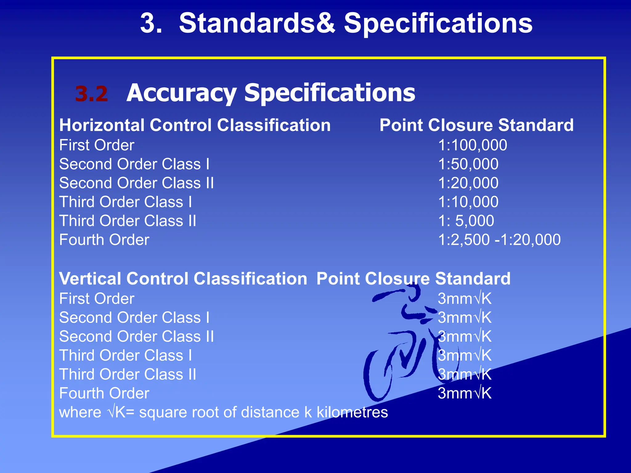
Control and geodetic surveys establish three-dimensional positions of fixed monuments to provide a framework for engineering projects, construction, and mapping. These surveys use conventional surveying techniques with instruments like theodolites and levels as well as GNSS satellite surveying to precisely position control points. The established control points provide horizontal and vertical positions to act as a reference system for subsequent work. Standards and specifications define the required accuracy levels for different types of control surveys based on their intended uses.


![4. Coordinate Systems and Datums
Reference systems can be based on the geoid, ellipsoid, or a plane. The
physical earth’s gravity force can be modeled to create a positioning reference
frame that rotates with the earth. The geoid is such a surface (an equipotential
surface of the earth’s gravity field) that best approximates Mean Sea Level
(MSL)--see Figure 4-1.
The orientation of this surface at a given point on geoid is defined by the
plumbline. The plumbline is oriented tangent to the local gravity vector.
Surveying instruments can be readily oriented with respect to the gravity field
because its physical forces can be sensed with simple mechanical devices. A
mean gravity field can be used as a reference surface to represent the actual
earth’s gravity field. Such a reference surface is developed from an ellipsoid of
revolution that best approximates the geoid.
An ellipsoid of revolution provides a well-defined mathematical surface to
calculate geodetic distances, azimuths, and coordinates. The major semi-axis (a)
and minor semi-axis (b) are the parameters used to determine the ellipsoid size
and shape. The shape of a reference ellipsoid also can be described
by either its flattening (f) or its eccentricity (e).
Flattening: f = ( a - b ) / a
Eccentricity: e = [ sqrt ( a 2 - b 2 ) ] / a
4.1 General](https://image.slidesharecdn.com/controlsurveying-231217083057-d9210f68/75/Control-Surveying-ppt-16-2048.jpg)

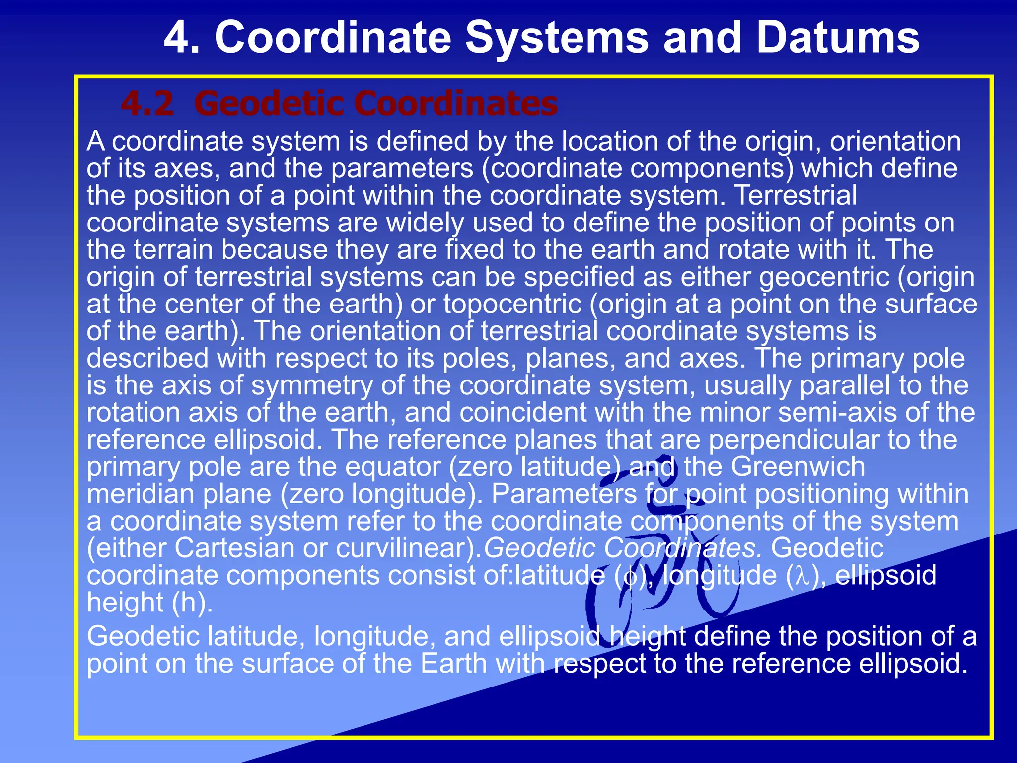
![4. Coordinate Systems and Datums
(1) Geodetic latitude (f). The geodetic latitude of a point is the acute
angular distance between the equatorial plane and the normal
through the point on the ellipsoid measured in the meridian plane
Geodetic latitude is positive north of the equator and negative south
of the equator.
(2) Geodetic longitude (l). The geodetic longitude is the angle
measured counter-clockwise(east), in the equatorial plane, starting
from the prime meridian (Greenwich meridian), to the meridian of
the defined point . To convert easterly to westerly referenced
longitudes, the easterly longitude must be subtracted from 360 deg.
East-West Longitude Conversion:
l (W) = [ 360 - l (E) ]
(3) Ellipsoid Height (h). The ellipsoid height is the linear distance
above the reference ellipsoid measured along the ellipsoidal normal
to the point in question. The ellipsoid height is positive if the
reference ellipsoid is below the topographic surface and negative if
the ellipsoid is above the topographic surface.
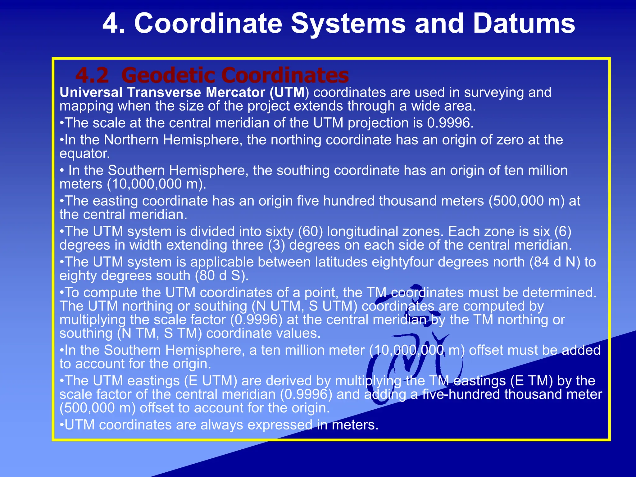
4.2 Geodetic Coordinates](https://image.slidesharecdn.com/controlsurveying-231217083057-d9210f68/75/Control-Surveying-ppt-19-2048.jpg)