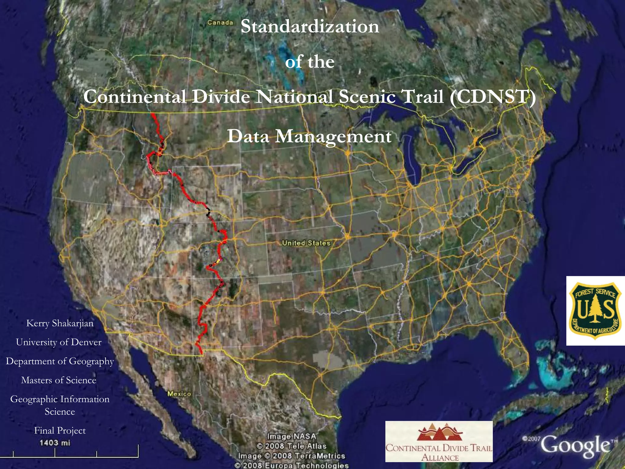
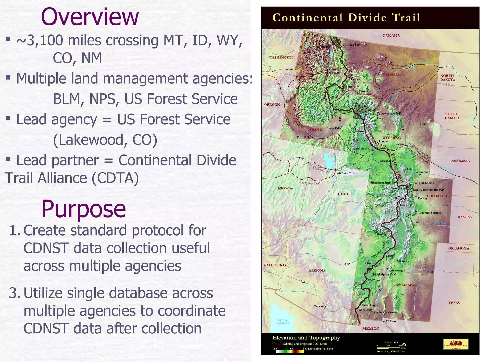
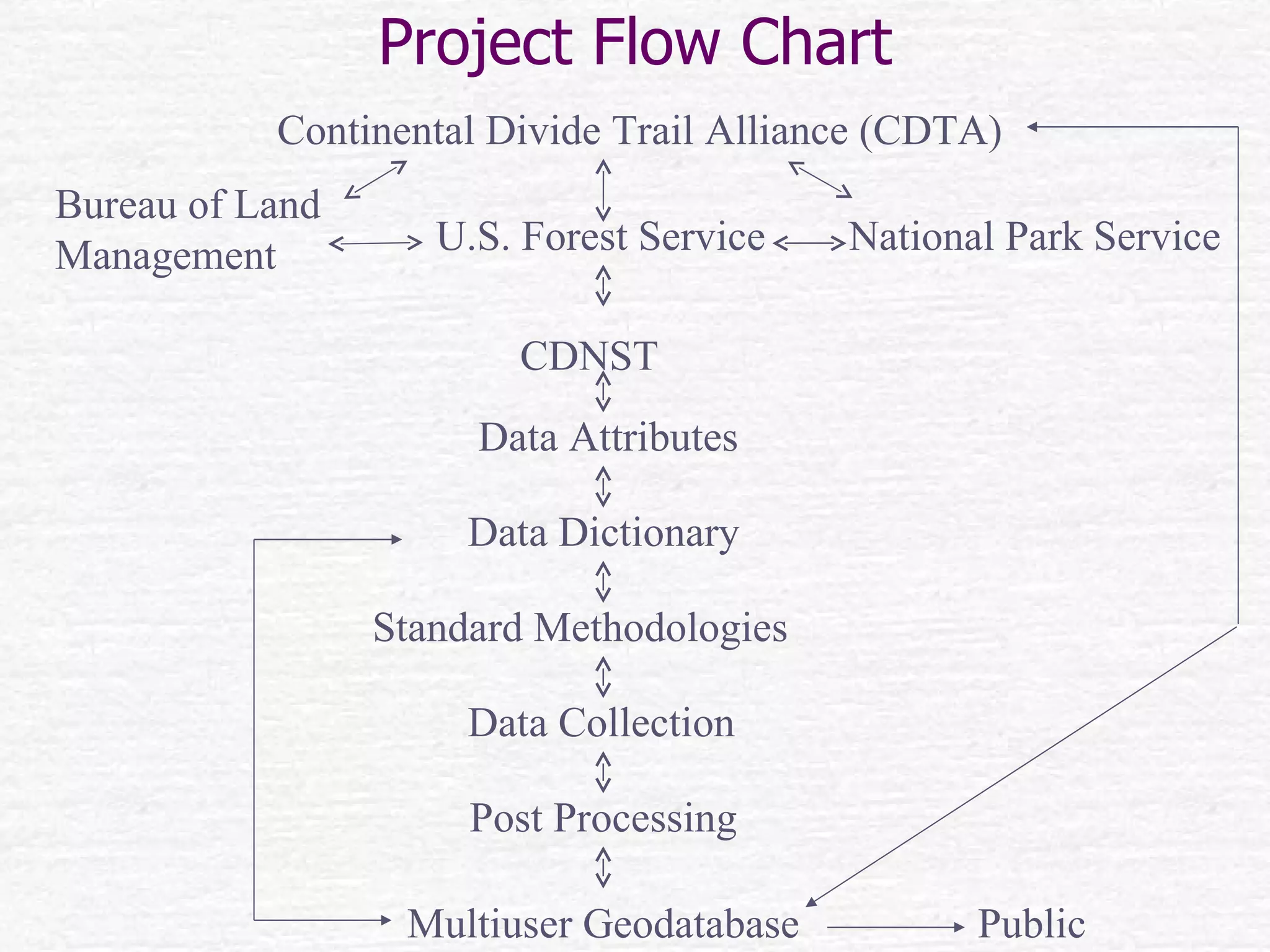
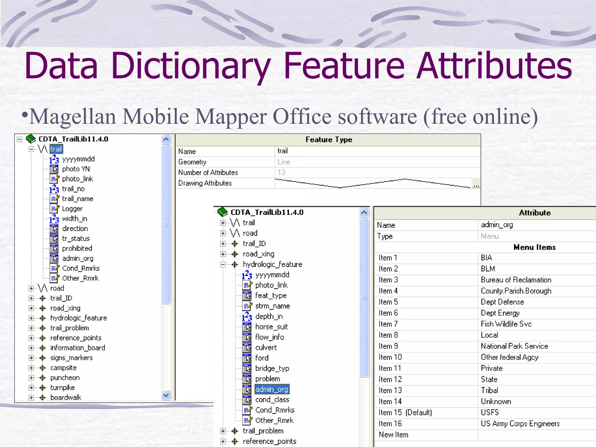
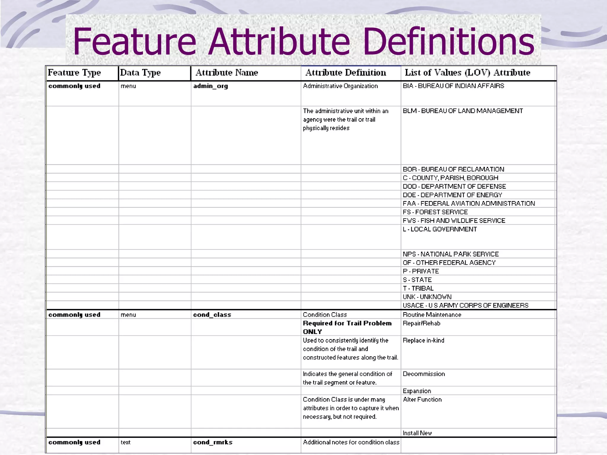
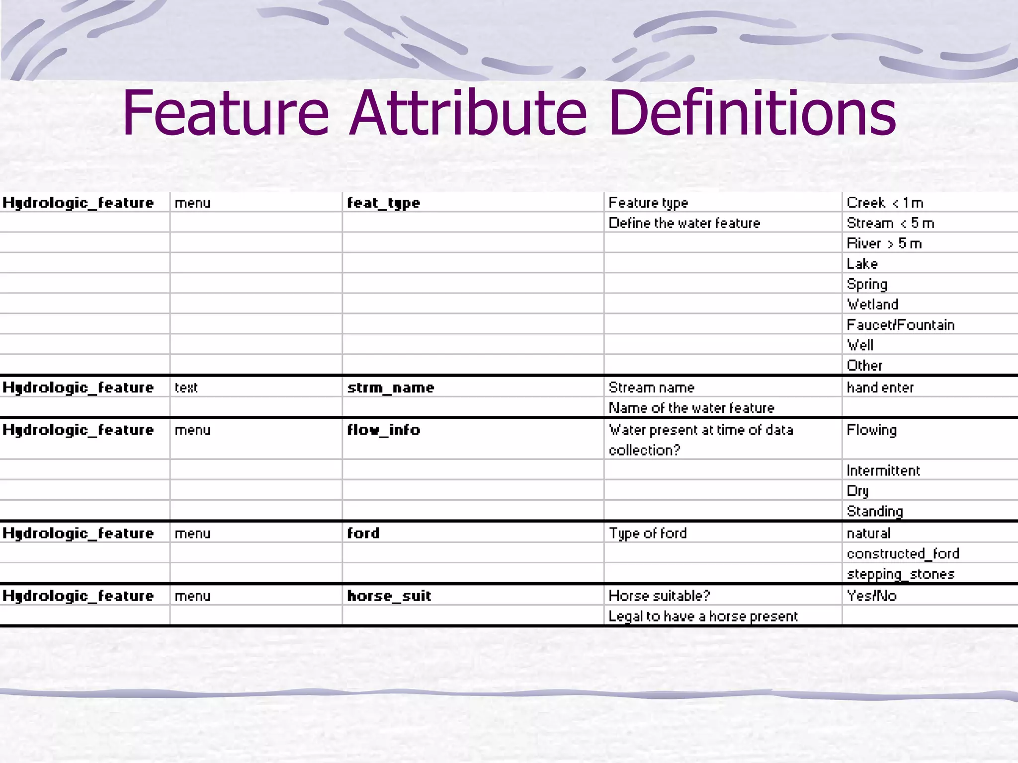
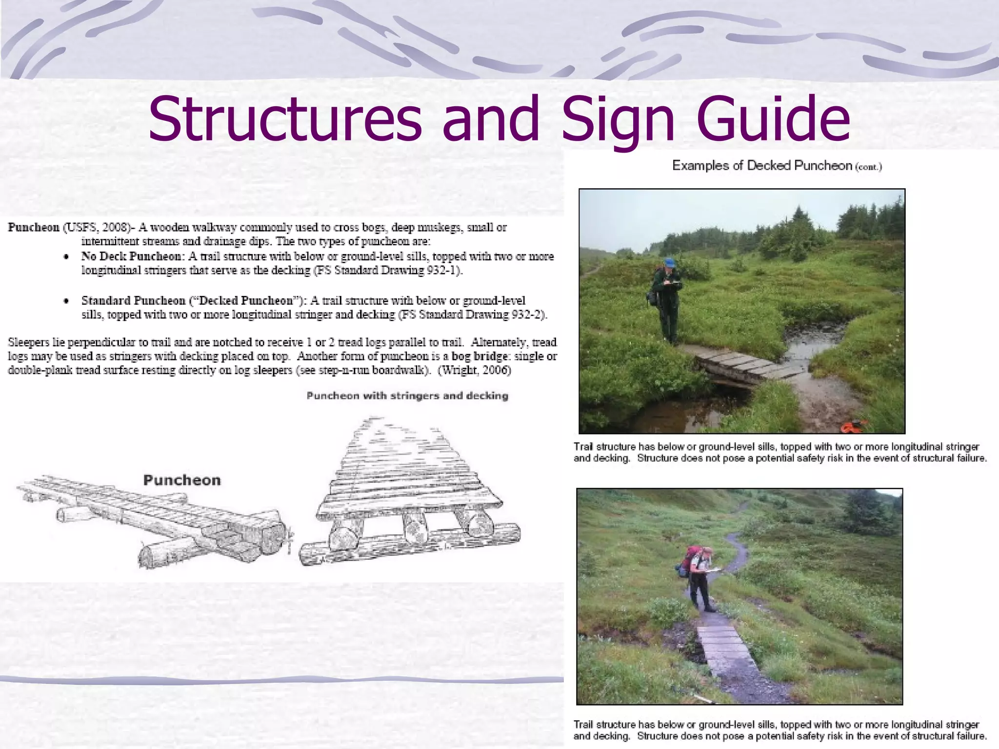
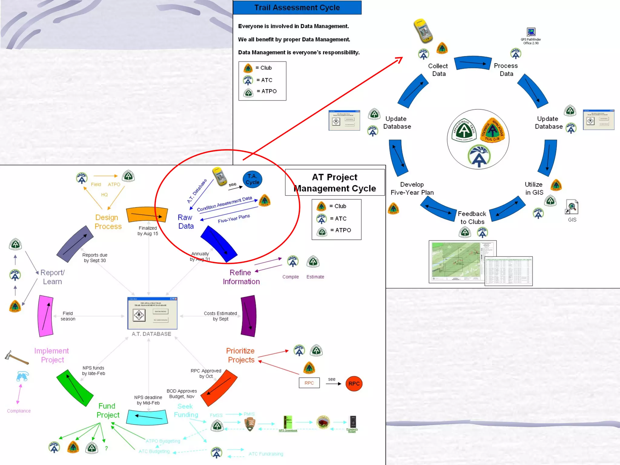
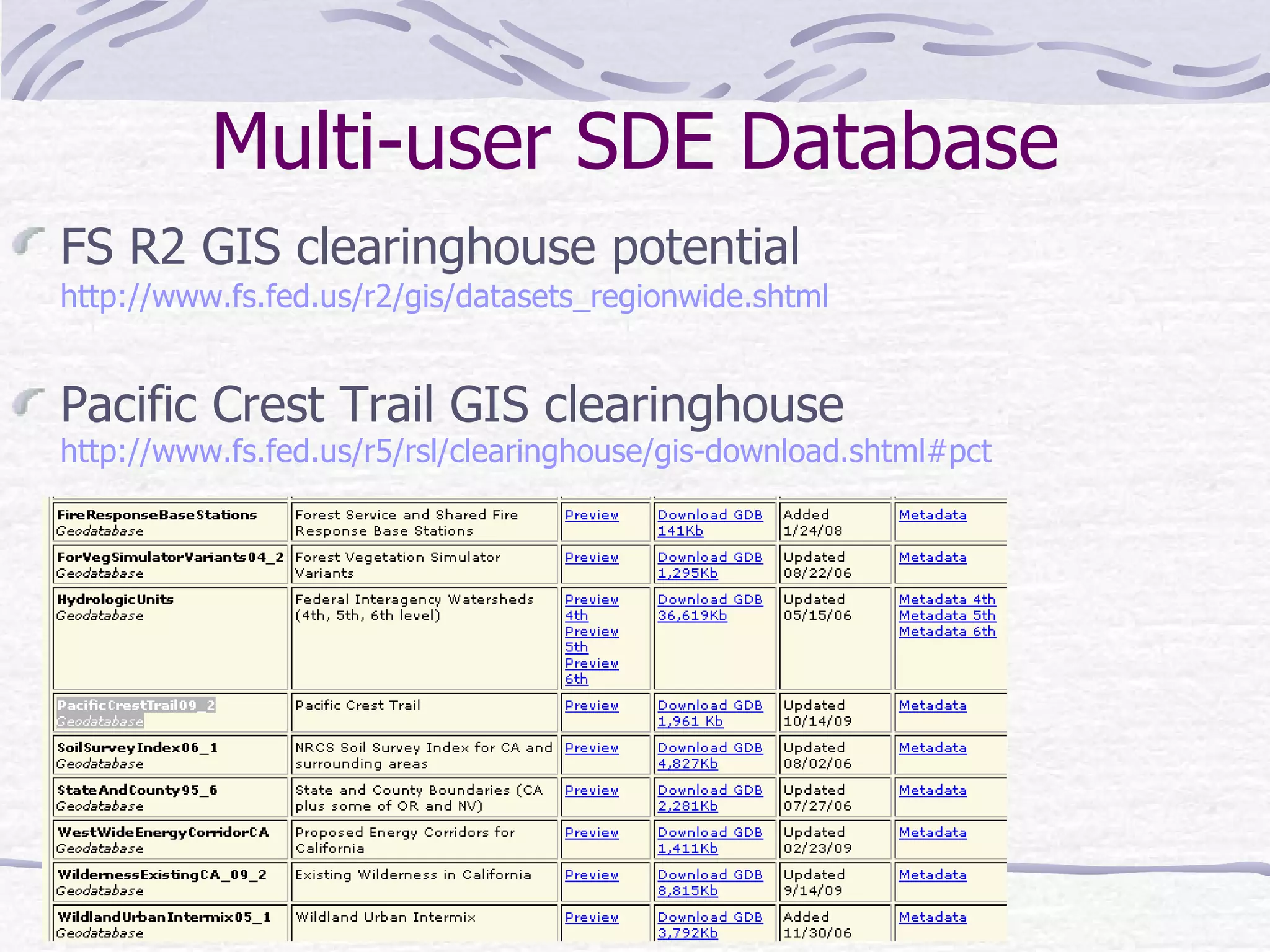
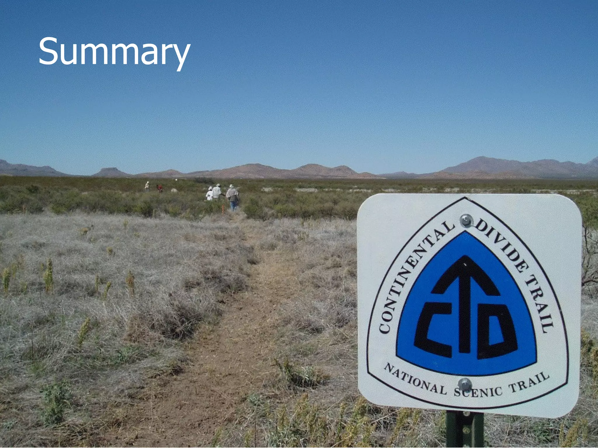
Standardization  of the  Continental Divide National Scenic Trail (CDNST)  Data Management   Kerry Shakarjian University of Denver   Department of Geography Masters of Science  Geographic Information Science Final Project
Overview ~3,100 miles crossing MT, ID, WY,  CO, NM  Multiple land management agencies: BLM, NPS, US Forest Service Lead agency = US Forest Service  (Lakewood, CO) Lead partner = Continental Divide  Trail Alliance (CDTA) Purpose Create standard protocol for CDNST data collection useful across multiple agencies Utilize single database across multiple agencies to coordinate CDNST data after collection
Current Issues Varying trail management policies Different methods/protocols among  agencies Need: Multi-jurisdictional  collaboration GIS attribute coding disagree Agency road definitions differ  Creates potential for different  interpretation Need: One method of coding Variety of sources Inconsistent data collection Need: Systematic data collection Data Consistency!
Standardized Solutions CDNST GPS data dictionary  Consistent: feature attributes (CDNST center line, signs, bridges, etc.) shape (point/line)  data types (menu, numeric, text)  CDNST data managed by CDTA Multi-user ArcGIS geodatabase Spatial Database Engine (SDE) server Single editor-verify data Multiple users-collect/input data
Project Flow Chart CDNST   Bureau of Land Management National Park Service U.S. Forest Service Data Dictionary Standard Methodologies Post Processing Data Attributes Data Collection Continental Divide Trail Alliance (CDTA) Multiuser Geodatabase Public
Methods Determine best technologies for data collection & budget Develop, test and modify data dictionaries for collecting  CDNST data Develop data dictionary feature attribute definitions table Develop Structures and Signs Guide Develop GPS pre-data collection setup standards and field  methods Database storage & multi-user access (agencies)
GPS Criteria Data dictionary capable (standardization) Ease of changing battery and charging of battery  Battery life is  > 8hrs (field time) Carrier phase and post-processing capable  (quality control) $ budget
Field Tools Magellan ProMark 3 professional GPS unit Fully charged, extra batteries, external antennae, current dictionary, enough memory-extra SD cards Digital camera Minimum 6 mega pixels Fully charged, extra SD cards, extra batteries Field notebook w/extra pencils Compass/maps 12’ measuring tape
Data Dictionary Feature Attributes Magellan Mobile Mapper Office software (free online)
Feature Attribute Definitions
Structures and Sign Guide
GPS Setup Pre-field PDOP (Position Dilution of Precision) =12 post process filter by PDOP (keep lowest) 1 second interval  Set camera time to match GPS time write in notebook (syncing photos) 15 min for GPS to gather almanac and satellites
GPS Methods in Field Use field guides Take photos of every feature and vistas Signs are readable in photos! Bridge  and  water (two photos) Notebook: photo #, photo description, vista  description, viewing direction (360 0 ) Slow walking during switchbacks Pause line while collecting feature Trail line is separate from Road line!
2009 Collection Examples Switchback accuracy from GPS pilot project using a Magellan ProMark 3 GPS unit.
After Data Collection Transfer data to MMO from GPS Post process data using CORS  (Continuously Operating Reference Stations) Correct major outliers and attributes mistakes or blanks Export to ArcGIS shapefile format Process photos to stamp lat/long Add shapefile to previously created geodatabase
Photo Stamping
 
 
Multi-user SDE Database FS R2 GIS clearinghouse potential   http://www.fs.fed.us/r2/gis/datasets_regionwide.shtml Pacific Crest Trail GIS clearinghouse http://www.fs.fed.us/r5/rsl/clearinghouse/gis-download.shtml#pct
Summary
Questions?

Continental Divide Trail GPS Mapping Project

  • 1.
    Standardization ofthe Continental Divide National Scenic Trail (CDNST) Data Management Kerry Shakarjian University of Denver Department of Geography Masters of Science Geographic Information Science Final Project
  • 2.
    Overview ~3,100 milescrossing MT, ID, WY, CO, NM Multiple land management agencies: BLM, NPS, US Forest Service Lead agency = US Forest Service (Lakewood, CO) Lead partner = Continental Divide Trail Alliance (CDTA) Purpose Create standard protocol for CDNST data collection useful across multiple agencies Utilize single database across multiple agencies to coordinate CDNST data after collection
  • 3.
    Current Issues Varyingtrail management policies Different methods/protocols among agencies Need: Multi-jurisdictional collaboration GIS attribute coding disagree Agency road definitions differ Creates potential for different interpretation Need: One method of coding Variety of sources Inconsistent data collection Need: Systematic data collection Data Consistency!
  • 4.
    Standardized Solutions CDNSTGPS data dictionary Consistent: feature attributes (CDNST center line, signs, bridges, etc.) shape (point/line) data types (menu, numeric, text) CDNST data managed by CDTA Multi-user ArcGIS geodatabase Spatial Database Engine (SDE) server Single editor-verify data Multiple users-collect/input data
  • 5.
    Project Flow ChartCDNST Bureau of Land Management National Park Service U.S. Forest Service Data Dictionary Standard Methodologies Post Processing Data Attributes Data Collection Continental Divide Trail Alliance (CDTA) Multiuser Geodatabase Public
  • 6.
    Methods Determine besttechnologies for data collection & budget Develop, test and modify data dictionaries for collecting CDNST data Develop data dictionary feature attribute definitions table Develop Structures and Signs Guide Develop GPS pre-data collection setup standards and field methods Database storage & multi-user access (agencies)
  • 7.
    GPS Criteria Datadictionary capable (standardization) Ease of changing battery and charging of battery Battery life is > 8hrs (field time) Carrier phase and post-processing capable (quality control) $ budget
  • 8.
    Field Tools MagellanProMark 3 professional GPS unit Fully charged, extra batteries, external antennae, current dictionary, enough memory-extra SD cards Digital camera Minimum 6 mega pixels Fully charged, extra SD cards, extra batteries Field notebook w/extra pencils Compass/maps 12’ measuring tape
  • 9.
    Data Dictionary FeatureAttributes Magellan Mobile Mapper Office software (free online)
  • 10.
  • 11.
  • 12.
  • 13.
    GPS Setup Pre-fieldPDOP (Position Dilution of Precision) =12 post process filter by PDOP (keep lowest) 1 second interval Set camera time to match GPS time write in notebook (syncing photos) 15 min for GPS to gather almanac and satellites
  • 14.
    GPS Methods inField Use field guides Take photos of every feature and vistas Signs are readable in photos! Bridge and water (two photos) Notebook: photo #, photo description, vista description, viewing direction (360 0 ) Slow walking during switchbacks Pause line while collecting feature Trail line is separate from Road line!
  • 15.
    2009 Collection ExamplesSwitchback accuracy from GPS pilot project using a Magellan ProMark 3 GPS unit.
  • 16.
    After Data CollectionTransfer data to MMO from GPS Post process data using CORS (Continuously Operating Reference Stations) Correct major outliers and attributes mistakes or blanks Export to ArcGIS shapefile format Process photos to stamp lat/long Add shapefile to previously created geodatabase
  • 17.
  • 18.
  • 19.
  • 20.
    Multi-user SDE DatabaseFS R2 GIS clearinghouse potential http://www.fs.fed.us/r2/gis/datasets_regionwide.shtml Pacific Crest Trail GIS clearinghouse http://www.fs.fed.us/r5/rsl/clearinghouse/gis-download.shtml#pct
  • 21.
  • 22.

Editor's Notes

  • #22 Overview: Learn what to collect Learn how to use the GPS Get collected data into GIS Share data with agencies/public