Comprehensive Plan, UDO Annual Review
•
2 likes•1,418 views

This document provides a summary of planning initiatives and projects for College Station in 2016. It discusses updates to the city's Comprehensive Plan including neighborhood, district, corridor, and master plans. It also summarizes amendments to the Unified Development Ordinance and projects in progress, such as updates to the Stormwater Master Plan and Thoroughfare Plan. Major initiatives included adopting new zoning districts based on the Wellborn Community Plan, amending parkland dedication requirements, and allowing mobile food vendor courts.

Recommended
Recommended
More Related Content
What's hot
What's hot (20)
Viewers also liked
Viewers also liked (20)
Similar to Comprehensive Plan, UDO Annual Review
Similar to Comprehensive Plan, UDO Annual Review (20)
More from City of College Station
More from City of College Station (20)
Recently uploaded
Recently uploaded (20)
Comprehensive Plan, UDO Annual Review
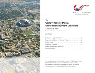
- 1. The Comprehensive Plan & Unified Development Ordinance A Review of 2016 . . . . . . . . . . . . . . . . . . . . . . . . . . . . . . . CONTENTS Evaluation & Appraisal Report . . . . . . . . . . . . . . . . . . . . . . . . . . 2 Neighborhood, District & Corridor Plans . . . . . . . . . . . . . . . . . . 3 Master Plans . . . . . . . . . . . . . . . . . . . . . . . . . . . . . . . . . . . . . . 6 Projects in Progress . . . . . . . . . . . . . . . . . . . . . . . . . . . . . . . . 10 Unified Development Ordinance . . . . . . . . . . . . . . . . . . . . . . . 11 Vision Statement . . . . . . . . . . . . . . . . . . . . . . . . . . . . . . . . . . 12 . . . . . . . . . . . . . . . . . . . . . . . . . . . . . . . This year’s annual review includes an overview of major Comprehensive Plan initiatives. Yearly reviews are performed to ensure that the Comprehensive Plan remains relevant and to identify any changes necessary to accommodate College Station’s future growth.
- 2. 2 Comprehensive Plan Evaluation & Appraisal Report Progress in FY16: • Text amendments to the Comprehensive Plan approved • Future Land Use & Character Map amendments to 3 areas recommended by Sub-Committee • Chapter 8 - Growth Management and Capacity amended based on recommendations by Annexation Task Force • Land use inventory presented and continued by staff • Non-Residential Architectural Standards revisions adopted • Single-Family parking requirements with platting amended WEB WEB Five-Year Comprehensive Plan Evaluation & Appraisal Report September 2014 As called for in the Comprehensive Plan, a five-year evaluation and appraisal report was prepared in 2014 evaluating the existing Plan and assessing its success in achieving the Community’s goals. The purpose was to serve as a “check-up” on the Comprehensive Plan by identifying successes and shortcomings, considering changing conditions, and recommending appropriate modifications. PDF
- 3. 3 MAP MAP MAP Comprehensive Plan Neighborhood, District & Corridor Plans Central College Station Adopted June 2010* Progress in FY16: • Final year of plan implementation • Construction completed along Normand Drive from Rock Prairie Road to Ponderosa Drive . . . . . . . * Received the Long Range Planning Award from CTxAPA in 2010 Eastgate Neighborhood Adopted June 2011 Progress in FY16: • Completed sidewalk on one side of Dominik Dr. from Stallings Dr. to Munson Ave. • Completed Eisenhower St. extension between Lincoln Ave. and Ash St. • Bike lanes and sidewalk on one side with the construction of Eisenhower St. from Lincoln Ave. to Ash St. • Bike route signage on Eisenhower St. from University Dr. to Ash St. • Sidewalk design completed on one side of Eisenhower St. (University Dr. East to Ash St.) and one side of Live Oak St. (Texas Ave. S. to Eisenhower St.) • Nimitz St. rehabilitation under construction Southside Area Neighborhood Adopted September 2012 Progress in FY16: • Completed sidewalk on one side of Wellborn Rd. (Southwest Pkwy to Luther St.) • Completed bicycle and pedestrian improvements at Holleman Dr. and Eleanor St., George Bush Dr. and Dexter Dr., and George Bush Dr. and Timber St. • Preliminary design underway for the Neighborhood Safety Improvements Project in Southside Neighborhood Plan; includes addition of sidewalks on Park Place, Holik St., Glade St. and Anna St. WEB Goals of the Comprehensive Plan Future Land Use and Character | Neighborhood Integrity | Economic Development | Parks Mobility | Municipal Facilities & Community Services | Growth Management Neighborhood, District, and Corridor plans are small area plans that are focused on areas designated for further review in the Comprehensive Plan. These plans are intended to serve as action plans for specific areas that focus on the particular needs and opportunities of the area. WEB WEB WEB WEB
- 4. 4 Goals of the Comprehensive Plan Future Land Use and Character | Neighborhood Integrity | Economic Development | Parks Mobility | Municipal Facilities & Community Services | Growth Management Neighborhood, District, and Corridor plans are small area plans that are focused on areas designated for further review in the Comprehensive Plan. These plans are intended to serve as action plans for specific areas that focus on the particular needs and opportunities of the area. Wellborn Community Plan Adopted April 2013 Progress in FY16: • WE Wellborn Estate, WRS Wellborn Restricted Suburban, and WC Wellborn Commercial zoning districts created and approved. • Greens Prairie Trail under construction between Wellborn Rd. and Royder Rd. • Royder Rd. design ongoing between Greens Prairie Trail and the new CSISD Middle School site South Knoll Area Neighborhood Plan Adopted September 2013 Progress in FY16: • Completed sidewalk on one side of Guadalupe Dr. from Langford St. to Nueces Dr. • Construction underway for sidewalk on one side of Langford St. from Haines Dr. to Guadalupe Dr. • Completed bicycle and pedestrian improvements at Holleman Dr. and Welsh Ave. MAP MAPWEB WEB Comprehensive Plan Neighborhood, District & Corridor Plans WEB WEB
- 5. 5 WEB Comprehensive Plan Neighborhood, District & Corridor Plans Medical District Master Plan Adopted October 2012 Progress in FY16: • Construction underway for Lick Creek Nature Trail • Lakeway Dr. extensions in design and includes portion of Pebble Creek Pkwy • Rock Prairie Rd. reconstruction complete • Rock Prairie Rd. widening from State Hwy 6 to Medical Ave. under construction WEB WEB
- 6. 6 Comprehensive Plan Bicycle, Pedestrian and Greenways Master Plan WEB Bicycle, Pedestrian and Greenways Master Plan Adopted January 2010 (2011 TxAPA Project Plan of the Year) Progress in FY16: • Free bike classes offered • Adopt-A-Greenway Program – 2 new areas adopted (16 total); 286 volunteers; 37.25 volunteer hours; 839 lbs. of trash collected • Buffered bike lanes became a part of street cross-sections in the Thoroughfare Plan. Buffered bike lanes are wider than a standard bike lane and provide greater separation between motor vehicles and bicyclists. • Completed sidewalk on one side of Guadalupe Dr. (Langford St. to Nueces Dr.); one side of Wellborn Rd. (Southwest Pkwy to Luther St.); and one side of Dominik Dr. (Stallings Dr. to Munson Ave.) • Completed bicycle and pedestrian improvements at Holleman Dr. and Eleanor St.; George Bush Dr. and Dexter Dr.; George Bush Dr. and Timber St.; and Holleman Dr. and Welsh Ave. • Construction underway for Lick Creek Greenway Trail and a sidewalk on one side of Langford St. from Haines Dr. to Guadalupe Dr. • Bike lanes added on Dartmouth St. (Holleman Dr. E. to Southwest Pkwy E.) • Bike lanes and sidewalk on one side added with construction of Eisenhower St. (Ash St. to Lincoln Ave.) • Buffered Bike Lanes added on Pebble Creek Parkway from William D. Fitch Parkway to Royal Adelade Drive • Bike route signage added on Eisenhower St. (University Dr. to Ash St.) • Design completed for sidewalk on one side of Cross St. (Dogwood St. to Nagle St.), one side of Eisenhower St. (University Dr. E. to Ash St.), and one side of Live Oak St. from Texas Ave. S. to Eisenhower St. • Preliminary design underway for the Neighborhood Safety Improvements Project in the Southside Neighborhood Plan. This includes the addition of sidewalks on Park Place, Holik St., Glade St. and Anna St. 653 acres of city-owned greenways 183 miles of CS sidewalks 47+ miles of CS bike lanes 13+ miles of CS trails WEB
- 7. 7 Comprehensive Plan Water/Wastewater Master Plans WEB PDF PDF Water System Master Plan Adopted August 2010* Progress in FY16 (private and public): • SHWY 6 Water Line Phase I & II is currently under design • City Wide Water Impact Fees adopted • Cooling tower expansion completed • Sandy Point Pump Station Chemical Feed & Storage System completed • Groundwater Projection Well #9 can Collection line under design . . . . . . . * Water System Master Plan finalization is currently in process Wastewater System Master Plan Adopted June 2011* Progress in FY16 (private and public): • Wastewater Impact Fees adopted • Bee Creek Trunkline PHII design complete • Under design - Eastside sewer service extension, Carters Creek centrifuge and electrical improvements, Lick Creek generator replacement • Lick Creek Wastewater Treatment Plant capacity expansion funded . . . . . . . * Wastewater System Master Plan finalization is currently in process Joint Rehabilitation Projects Older neighborhoods, redevelopment areas Progress in FY16 (private and public): • Eastgate Utility Rehabilitation project under design in the vicinity of Texas Ave., Lincoln St., Walton Ave., and Francis Dr. • Munson Utility and Street Rehabilitation project under construction along Munson St. (Lincoln Ave. to Dominik Dr.) • Phase I & II of Francis Utility and Street Rehabilitation project under design along Francis Street (Glenhaven St. to Munson St.) • Nimitz Utility and Street Rehabilitation project under construction along Nimitz Dr., from Ash St. to Lincoln Ave. • Eisenhower Utility and Street Rehabilitation project complete • Graham Road Utility and Street Rehabilitation project complete WEB
- 8. 8 Comprehensive Plan Parks and Recreation Master Plan WEB Parks and Recreation Master Plan Adopted July 2011 Progress in FY16: • Successfully hosted 68 athletic events including one national, three regional, and five state championships • Hosted 70 special events, including Christmas in the Park at Central Park, and Starlight Music Series (six concerts), Movies in the Park (six movies) and Trick- or-Treat at Wolf Pen Creek Park • Increased total number of park properties to 58, totaling 1,374 acres • Began renovations of playgrounds, surfaces and amenities at 22 parks • Completed a total renovation of the major water slide at Adamson Lagoon • Successfully expanded recreation program activities (250+) • Hosted and expanded the Brazos Valley Senior Games • Began Mayor’s Monarch Pledge campaign to “Save the Monarch Butterflies” • Began design of next phase of Veterans Park (2 synthetic turf athletic fields) • Began Master Plan for the future Southeast Community Park • Completed Master Plan and began design of the Fun-for-All Playground at Central Park • Received “Tree City USA” designation for the 25th consecutive year • Began construction of the Lick Creek Park nature center • Completed planning/design of Lincoln Recreation Center expansion • Continued design planning/process for an expansion of the Ringer Library • Continued process for Community Parkland purchase (111 acres) 250+ park programs offered in CS 58 parks 1,374 acres of parkland WEB
- 9. 9 Comprehensive Plan Economic Development Master Plan WEB Economic Development Master Plan Adopted September 2013 Progress in FY16: • Fully staffed the newly reinstated Economic Development department. Staff members pursing professional IEDC accreditation. • Continued Medical District Master Plan and Spring Creek Technology Park implementation efforts: - Initiation of a working group with area Hospital Administration group - Completion of design of Lakeway and Pebble Creek extensions to provide a connection parallel to Earl Rudder Freeway between Scott & White and St. Joseph’s medical facilities - Worked with majority property toward creation of a Planned Development District zoning - City-initiated rezoning and utility master planning to prepare the initial Spring Creek properties for development. • Executed an ED agreement with ViaSat to locate in the BioCorridor. • Initiated a business attraction marketing strategy, including a video series featuring existing businesses. • Initiated Business Retention and Expansion efforts, including targeted site visits. • Continued discussions regarding community economic development with Texas A&M University, Texas A&M Engineering Experiment Station, and Texas A&M AgriLife Extension Service, Brazos County, and the City of Bryan on partnership opportunities in commercialization and recruitment efforts. • Awarded the bid for the 2017 Americas Competitiveness Exchange (ACE) International Program in cooperation with San Antonio, Austin, New Braunfels, Fredericksburg, and San Marcos. • Initiated creation of synthetic TIRZs in key locations that will provide infrastructure to continue development of infill areas. • Initiated creation of the College Station Business Council, a not-for-profit Economic Development entity. • Initiated a Retail Recruitment program: - Contract with Retail Coach to perform a gap analysis, detailed demographic analysis, and direct recruitment. - Development of specialized website/landing pages for potential retailers. - Direct recruitment of potential retailers including a presence at the state and national International Conference of Shopping Centers (ICSC). • Continued redevelopment efforts along University Drive to maximize property value. • Initiated commercial preservation strategies, including City-initiated rezonings, to preserve commercial development opportunities in key locations. • Continued work with the Research Valley Partnership: - Development of the Strategic Plan - Workforce Strategy Steering Committee PDF WEB
- 10. 10 Comprehensive Plan Projects in Progress WEBStormwater Master Plan Initiated 2011 Progress in FY16: • Engineering firm retained to focus on drainage capacity/flood control projects on the public storm sewer systems and open channels. • Contract with USGS for two stream gauges to collect field measured stream data Thoroughfare Plan Update Completed December 2015 Project Scope: • Update thoroughfares to respond to existing conditions • Update street cross-sections • Simplify thoroughfare classifications and context class • Develop context sensitive design process Additional Progress in FY16: • Initiated the South College Station Mobility consultant contract • Initiated the Barron Road / Capstone realignment design contract and public engagement • Completed the Old Wellborn / Jones-Butler underpass / Luther extension analysis TMDL Implementation Plan Total Maximum Daily Load, Approved August 2012 (TCEQ), I-Plan, Approved September 2012 (EPA) Progress in FY16: • I-Plan update with the Year 4 updates included • MS4 permit renewed and current • Sanitary Sewer Overflow (SSO) initiative is active and being maintained • Outreach efforts including: UBIs, classroom lectures, PSAs, newsletters, and information on the official website at http://brazoscleanwater.org/ • Monitoring is occurring and levels look good • Active participation in the Navasota River TMDL discussions WEB
- 11. 11 Unified Development Ordinance Amendments in Fiscal Year 2016 WEB WEB Single-Family Height Protection Ordinance #2016-3802, adopted Sept. 8, 2016 Revised single-family height protection to include WC district and exemption to non-conforming and agricultural uses, and redevelopment areas. Traffic Impact Analyses for Single-Family Development Ordinance #2016-3796, adopted Aug. 11, 2016 Removed the exemption for single-family residential development from the Traffic Impact Analysis (TIA) requirements and included a requirement that a TIA be provided with preliminary plan applications. Wellborn Zoning Districts Ordinance #2016-3792, adopted July 28, 2016 Created WE, WRS, and WC zoning based on Future Land Use & Character Map and Wellborn Community Plan. Multi-Family Parkland Dedication Amendment Ordinance #2015-3728, adopted Dec. 10, 2015 Revised multi-family parkland dedication and development fees assessed on the number of bedrooms, instead of the number of dwelling units. Northgate Amendments Ordinance #2015-3720, adopted Nov. 23, 2015 Allows the City’s Administrator flexibility regarding tree placement, sidewalk location, and screening requirements in Northgate. Mobile Food Vendor Courts Ordinance #2015-3708, adopted Oct. 8, 2015; Ordinance #2015-3716, amended Nov. 11, 2015 Allowed for short- and long-term siting and operation of multiple mobile food vendors in a court.
- 12. College Station, the proud home of Texas A&M University and the heart of the Research Valley, will remain a vibrant, forward-thinking, knowledge-based community which promotes the highest quality of life for its citizens by: - Ensuring safe, tranquil, clean, and healthy neighborhoods with enduring character; - Increasing and maintaining the mobility of College Station citizens through a well planned and constructed inter-modal transportation system; - Expecting sensitive development and management of the built and natural environment; - Supporting well planned, quality, and sustainable growth; - Valuing and protecting our cultural and historical community resources; - Developing and maintaining quality cost-effective community facilities, infrastructure and services which ensure our City is cohesive and well connected; and, - Pro-actively creating and maintaining economic and educational opportunities for all citizens. College Station will continue to be among the friendliest and most responsive of communities and a demonstrated partner in maintaining and enhancing all that is good and celebrated in the Brazos Valley. It will continue to be a place where Texas and the world come to learn, live, and conduct business!