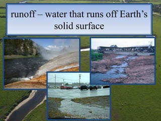
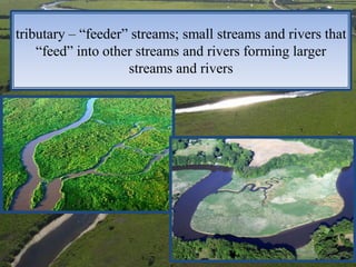
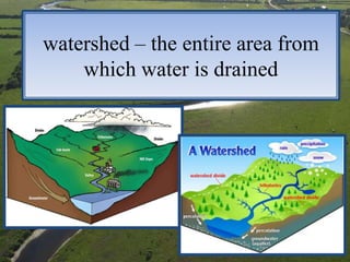
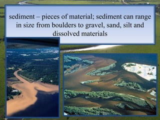
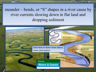
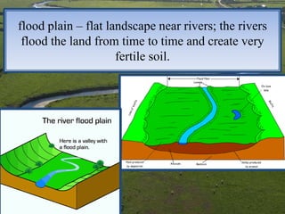
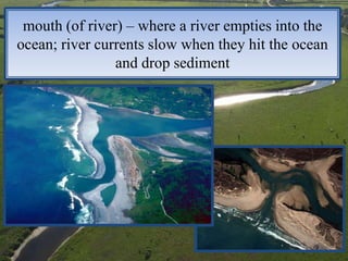
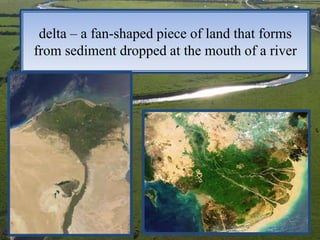
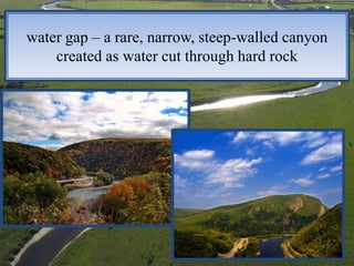
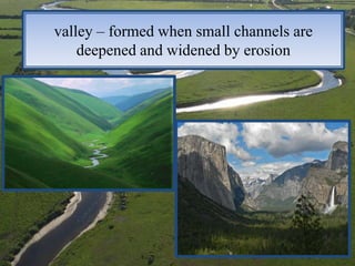
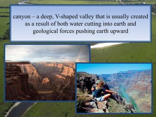
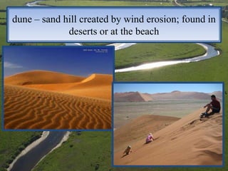
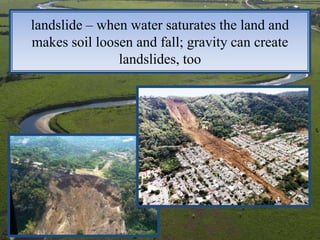
runoff
              tributary
             watershed
              sediment
Chapter 7,    meander
             flood plain
 Lesson 2        delta
Landforms     water gap
               canyon
                valley
                 dune
              landslide
runoff – water that runs off Earth’s
          solid surface
tributary – “feeder” streams; small streams and rivers that
    “feed” into other streams and rivers forming larger
                    streams and rivers
watershed – the entire area from
    which water is drained
sediment – pieces of material; sediment can range
  in size from boulders to gravel, sand, silt and
               dissolved materials
meander – bends, or “S” shapes in a river cause by
  river currents slowing down in flat land and
               dropping sediment


                Click here to learn more about
                rivers and coasts!
flood plain – flat landscape near rivers; the rivers
 flood the land from time to time and create very
                     fertile soil.
mouth (of river) – where a river empties into the
ocean; river currents slow when they hit the ocean
                and drop sediment
delta – a fan-shaped piece of land that forms
from sediment dropped at the mouth of a river
water gap – a rare, narrow, steep-walled canyon
    created as water cut through hard rock
valley – formed when small channels are
    deepened and widened by erosion
canyon – a deep, V-shaped valley that is usually created
    as a result of both water cutting into earth and
       geological forces pushing earth upward
dune – sand hill created by wind erosion; found in
             deserts or at the beach
landslide – when water saturates the land and
makes soil loosen and fall; gravity can create
               landslides, too

Chapter 7, Lesson 2 - Landforms

  • 1.
    runoff tributary watershed sediment Chapter 7, meander flood plain Lesson 2 delta Landforms water gap canyon valley dune landslide
  • 2.
    runoff – waterthat runs off Earth’s solid surface
  • 3.
    tributary – “feeder”streams; small streams and rivers that “feed” into other streams and rivers forming larger streams and rivers
  • 4.
    watershed – theentire area from which water is drained
  • 5.
    sediment – piecesof material; sediment can range in size from boulders to gravel, sand, silt and dissolved materials
  • 6.
    meander – bends,or “S” shapes in a river cause by river currents slowing down in flat land and dropping sediment Click here to learn more about rivers and coasts!
  • 7.
    flood plain –flat landscape near rivers; the rivers flood the land from time to time and create very fertile soil.
  • 8.
    mouth (of river)– where a river empties into the ocean; river currents slow when they hit the ocean and drop sediment
  • 9.
    delta – afan-shaped piece of land that forms from sediment dropped at the mouth of a river
  • 10.
    water gap –a rare, narrow, steep-walled canyon created as water cut through hard rock
  • 11.
    valley – formedwhen small channels are deepened and widened by erosion
  • 12.
    canyon – adeep, V-shaped valley that is usually created as a result of both water cutting into earth and geological forces pushing earth upward
  • 13.
    dune – sandhill created by wind erosion; found in deserts or at the beach
  • 14.
    landslide – whenwater saturates the land and makes soil loosen and fall; gravity can create landslides, too