This document provides information about the city of Chandigarh, India. It discusses Chandigarh's history as a planned city established in the 1950s as a joint capital of Punjab and Haryana. It notes that Chandigarh has experienced rapid population growth and is now a union territory with over 900,000 residents. The document also summarizes Chandigarh's City Development Plan, which aims to guide the city's growth and improve services and infrastructure for residents, with priorities like water, sewage, roads, and solid waste management. Finally, it discusses proposals to enhance Chandigarh's green spaces and public transportation through initiatives like additional buses and bike sharing.
This presentation was given by SPA Bhopal for "Samavesh" - XVl Annual NOSPlan Convention. The Theme of Presentation - "Accessibility in Peri-urban area".
Vijayawada- Organizational setup and Development control regulationsNIT Rourkela
The details of the Organizational and Legislative framework for Housing and the Development control regulations for the city of Vijayawada, Andhra Pradesh.
INTRODUCTION
COORDINATES - 23.22 ON 72.680 E ELEVATION - 265 feet (81 m)*
LOCATED 23 KM NORTH OF AHEMDABAD (FIN CAP. OF GUJARAT)
PLANNED IN 1960S BY, PRAKASH M APTE & H. K. MEWADA,
AFTER PARTITION OF BOMBAY * STATE : AHEMDABAD WAS MADE AS THE CAPTAL OFGUJARAT
AREA TOTAL 177KM2 ELEVATION : 8IM ( 266 FT)
POPULATION (2011)
TOTAL: 206,167 DENSITY : 1,200/KM2
CLIMATE*
TROPICAL WET AND DRY CLIMATE•
SUMMER MAXIMUM - 36 to 42 °C MINIMUM - 19 to 27 C
WINTER MAXIMUM - 29 C MINIMUM - 14°C
MONSOON: THE AVERAGE ANNUAL RAINFALL IS AROUND 803.4 MM
LANGUAGES
GUJARATI, HINDI, AND ENGLISH• 54% GREEN COVER ON ITS LAND AREA
• THE CITY SITS ON THE BANKS OF THE SABARMATI RIVER, IN NORTH-CENTRALEAST GUJARAT
HISTORY
IN 1960, THE INDIAN STATE OF BOMBAY WAS SPLIT INTO TWO STATES, MAHARASHTRA AND GUJARAT LEAVING GUJARAT WITHOUT A CAPITAL CITY.
AT THE TIME AHMEDABAD WAS SELECTED TO BE THE FIRST CAPITAL OF THE NEWLY CREATED STATE.
• IT WAS LATER PROPOSED THAT A NEW CAPITAL CITY BE CONSTRUCTED FOR THE STATE.
• GANDHINAGAR GOT AN IDENTITY OF ITS OWN WHEN THE STATE OF MUMBAI WAS DIVIDED INTO TWO SEPARATE STATES OF GUJARAT AND MAHARASHTRA.
• IN THE BEGINNING, AHMEDABAD - A COMMERCIAL HUB OF GUJARAT WAS CHOSEN AS THE STATE CAPITAL AND IT WAS PROPOSED THAT A NEW CAPITAL SHOULD BE CONSTRUCTED ALONG THE LINE OF OTHER NEW STATE CAPITALS, PARTICULARLY CHANDIGARH
• THEREFORE TWO WELL-KNOWN INDIAN ARCHITECTS, H.K. MEWADA AND PRAKASH M. APTE (WHO WORKED AS BEGINNER FOR THE CHANDIGARH CITY) DESIGNED THE NEW STATE CAPITAL*
NAMED AFTER MAHATMA GANDHI THE FOUNDATION STONE OF THIS CITY WAS LAID ON 1965 AND IN 1971 THE CAPITAL WAS SHIFTED FROM AHMEDABAD TO GANDHINAGAR
PLANNING
• PLANNED AND IMPLEMENTED BETWEEN 1965-1970
• DETERMINATION TO MAKE GANDHINAGAR A PURELY INDIAN ENTERPRISE, PARTLY BECAUSE GUJARAT WAS THE BIRTHPLACE OF GANDHI.
• TO ESTABLISH AND MAINTAIN A SEPARATE IDENTITY FOR THE NEW CITY THE SURROUNDING AREA OF ABOUT 39 VILLAGES WAS BROUGHT UNDER A PERIPHERY CONTROL ACT (AS IN CHANDIGARH)
• THE AREA LATER CONSTITUTED A SEPARATE ADMINISTRATIVE DISTRICT OF GANDHINAGAR.
• THE CITY WAS PLANNED FOR A POPULATION OF 150,000 BUT CAN ACCOMMODATE DOUBLE THAT POPULATION WITH INCREASE IN THE FLOOR SPACE RATIO FROM 1 TO 2 IN THE AREAS RESERVED FOR PRIVATE DEVELOPMENT.
• THE RIVER BEING THE BORDER ON THE EAST, AND THE INDUSTRIAL AREA TO THE NORTH, THE MOST LOGICAL FUTURE PHYSICAL EXPANSION OF THE CITY WAS ENVISAGED TOWARDS THE NORTH-WEST
Self Sustainable Integrated Township : A resource-base planning to improve th...Sahil Singh Kapoor
The objective of this study is to analyze the potential shift towards Integrated Township developmentwith mixed land use, creating employment opportunities close to residential place and requiring minimum land area.
Chennai the fourth largest metropolis in India. Chennai Metropolitan Area (CMA) extends over 1189 sq.km.and comprises of
Chennai Corporation,
16 Municipalities,
20 Town Panchayats and
214 villages covered in 10 Panchayats Unions
It encompasses the Chennai District (176 sq.km.), part of Thiruvallur District (637 sq.km.) and a part of Kancheepuram District (376 sq.km.).
Morphology of historic town : Fatehpur Sikri rinjukurian
Group work done by : Sreelakshmi , Rinju
Fatehpur sikri : Introduction, location, history, architecture, and planning of the sikri and its buildings, plans : old and new , sections and elevations, Sacred complex, Royal Complex, and Imperial complex, Buland darwaza, Jama masjid, tomb of salim chasti, diwan i am, diwan i khas, anup talao, ibadat khana, hujra i anup, naubat khana, mariam-uz-zamani, Aank micholi, birbal's house, panch mahal, nagina masjid, pachisi court, conservation done in Fatehpur Sikri, town planning of Fatehpur Sikri, soil typology, artificial lake, bazaars, enclosure, allocation of sites,etc
Review of Development Plans/ Master Plans of selected cities of India.KARTHICK KRISHNA
This is an academic assignment done for the purpose to draft a master plan/ development plan. This helps us to identify the concept and context of the various plans and its development proposals applicability and replicability.
Urban morphology approaches human settlements as generally unconscious products that
emerge over long periods, through the accrual of successive generations of building activity.
This leaves traces that serve to structure subsequent building activity and provide
opportunities and constraints for city-building processes, such as land subdivision,
infrastructure development, or building construction. Articulating and analysing the logic of
these traces is the central question of urban morphology. Urban morphology is not generally
object-centered, in that it emphasizes the relationships between components of the city. We
will be discussing in detail about the urban morphology of the Chennai metropolitan.
Sustainable Development sector in Vibrant Gujarat SummitVibrant Gujarat
The Government of Gujarat committed to make sure that the dividends of the rapid economic growth reaches the weakest sections of the society. This is reflected in the policies and programs directed towards sustainable human development
Chennai the fourth largest metropolis in India. Chennai Metropolitan Area (CMA) extends over 1189 sq.km.and comprises of
Chennai Corporation,
16 Municipalities,
20 Town Panchayats and
214 villages covered in 10 Panchayats Unions
It encompasses the Chennai District (176 sq.km.), part of Thiruvallur District (637 sq.km.) and a part of Kancheepuram District (376 sq.km.).
Assessment and Future Land Requirements Of Urban areas And Facilities Of Pab...MD Sabbir Hossain Shah
Here is Mohammad Sabbir Hossain Shah, a student at Pabna University of Science and Technology.Literally, this report depicts the process and methods of urban area plan, short description of case study area of Pabna Municipality (population, area, road network, housing, socio-economic condition, employment status, etc), urbanization rate, population projection for 2040 and 2050, economic and employment analysis and projection, threshold analysis for future service facilities, suitable location proposals for waste disposal site, parks and recreation, residential and commercial development, future land requirement for different service facilities within the Pabna Municipality, etc.
Welcome to TechSoup New Member Orientation and Q&A (May 2024).pdfTechSoup
In this webinar you will learn how your organization can access TechSoup's wide variety of product discount and donation programs. From hardware to software, we'll give you a tour of the tools available to help your nonprofit with productivity, collaboration, financial management, donor tracking, security, and more.
Unit 8 - Information and Communication Technology (Paper I).pdfThiyagu K
This slides describes the basic concepts of ICT, basics of Email, Emerging Technology and Digital Initiatives in Education. This presentations aligns with the UGC Paper I syllabus.
2024.06.01 Introducing a competency framework for languag learning materials ...Sandy Millin
http://sandymillin.wordpress.com/iateflwebinar2024
Published classroom materials form the basis of syllabuses, drive teacher professional development, and have a potentially huge influence on learners, teachers and education systems. All teachers also create their own materials, whether a few sentences on a blackboard, a highly-structured fully-realised online course, or anything in between. Despite this, the knowledge and skills needed to create effective language learning materials are rarely part of teacher training, and are mostly learnt by trial and error.
Knowledge and skills frameworks, generally called competency frameworks, for ELT teachers, trainers and managers have existed for a few years now. However, until I created one for my MA dissertation, there wasn’t one drawing together what we need to know and do to be able to effectively produce language learning materials.
This webinar will introduce you to my framework, highlighting the key competencies I identified from my research. It will also show how anybody involved in language teaching (any language, not just English!), teacher training, managing schools or developing language learning materials can benefit from using the framework.
We all have good and bad thoughts from time to time and situation to situation. We are bombarded daily with spiraling thoughts(both negative and positive) creating all-consuming feel , making us difficult to manage with associated suffering. Good thoughts are like our Mob Signal (Positive thought) amidst noise(negative thought) in the atmosphere. Negative thoughts like noise outweigh positive thoughts. These thoughts often create unwanted confusion, trouble, stress and frustration in our mind as well as chaos in our physical world. Negative thoughts are also known as “distorted thinking”.
The Art Pastor's Guide to Sabbath | Steve ThomasonSteve Thomason
What is the purpose of the Sabbath Law in the Torah. It is interesting to compare how the context of the law shifts from Exodus to Deuteronomy. Who gets to rest, and why?
Model Attribute Check Company Auto PropertyCeline George
In Odoo, the multi-company feature allows you to manage multiple companies within a single Odoo database instance. Each company can have its own configurations while still sharing common resources such as products, customers, and suppliers.
Students, digital devices and success - Andreas Schleicher - 27 May 2024..pptxEduSkills OECD
Andreas Schleicher presents at the OECD webinar ‘Digital devices in schools: detrimental distraction or secret to success?’ on 27 May 2024. The presentation was based on findings from PISA 2022 results and the webinar helped launch the PISA in Focus ‘Managing screen time: How to protect and equip students against distraction’ https://www.oecd-ilibrary.org/education/managing-screen-time_7c225af4-en and the OECD Education Policy Perspective ‘Students, digital devices and success’ can be found here - https://oe.cd/il/5yV
The Indian economy is classified into different sectors to simplify the analysis and understanding of economic activities. For Class 10, it's essential to grasp the sectors of the Indian economy, understand their characteristics, and recognize their importance. This guide will provide detailed notes on the Sectors of the Indian Economy Class 10, using specific long-tail keywords to enhance comprehension.
For more information, visit-www.vavaclasses.com
The Roman Empire A Historical Colossus.pdfkaushalkr1407
The Roman Empire, a vast and enduring power, stands as one of history's most remarkable civilizations, leaving an indelible imprint on the world. It emerged from the Roman Republic, transitioning into an imperial powerhouse under the leadership of Augustus Caesar in 27 BCE. This transformation marked the beginning of an era defined by unprecedented territorial expansion, architectural marvels, and profound cultural influence.
The empire's roots lie in the city of Rome, founded, according to legend, by Romulus in 753 BCE. Over centuries, Rome evolved from a small settlement to a formidable republic, characterized by a complex political system with elected officials and checks on power. However, internal strife, class conflicts, and military ambitions paved the way for the end of the Republic. Julius Caesar’s dictatorship and subsequent assassination in 44 BCE created a power vacuum, leading to a civil war. Octavian, later Augustus, emerged victorious, heralding the Roman Empire’s birth.
Under Augustus, the empire experienced the Pax Romana, a 200-year period of relative peace and stability. Augustus reformed the military, established efficient administrative systems, and initiated grand construction projects. The empire's borders expanded, encompassing territories from Britain to Egypt and from Spain to the Euphrates. Roman legions, renowned for their discipline and engineering prowess, secured and maintained these vast territories, building roads, fortifications, and cities that facilitated control and integration.
The Roman Empire’s society was hierarchical, with a rigid class system. At the top were the patricians, wealthy elites who held significant political power. Below them were the plebeians, free citizens with limited political influence, and the vast numbers of slaves who formed the backbone of the economy. The family unit was central, governed by the paterfamilias, the male head who held absolute authority.
Culturally, the Romans were eclectic, absorbing and adapting elements from the civilizations they encountered, particularly the Greeks. Roman art, literature, and philosophy reflected this synthesis, creating a rich cultural tapestry. Latin, the Roman language, became the lingua franca of the Western world, influencing numerous modern languages.
Roman architecture and engineering achievements were monumental. They perfected the arch, vault, and dome, constructing enduring structures like the Colosseum, Pantheon, and aqueducts. These engineering marvels not only showcased Roman ingenuity but also served practical purposes, from public entertainment to water supply.
This is a presentation by Dada Robert in a Your Skill Boost masterclass organised by the Excellence Foundation for South Sudan (EFSS) on Saturday, the 25th and Sunday, the 26th of May 2024.
He discussed the concept of quality improvement, emphasizing its applicability to various aspects of life, including personal, project, and program improvements. He defined quality as doing the right thing at the right time in the right way to achieve the best possible results and discussed the concept of the "gap" between what we know and what we do, and how this gap represents the areas we need to improve. He explained the scientific approach to quality improvement, which involves systematic performance analysis, testing and learning, and implementing change ideas. He also highlighted the importance of client focus and a team approach to quality improvement.
2. It is one of the fastest growing city with a
population decadal growth rate of 40.30%.
The construction of capital city of joint Punjab
was started in early 50s.
The City Chandigarh was declared a Union
Territory in the year 1966 with joint capital of
both the states of Punjab and Haryana.
It is situated in the foot of Shivalik hills.
The area of Union Territory of Chandigarh is
114 sq. km. only with 22 villages falling in the
jurisdiction of Union Territory.
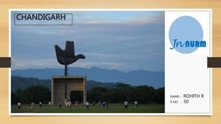
CHANDIGARH
3. • It is one of the greenest city of India with its
green belts / parks/ gardens.
• The quality of life is the consideration of people
in Chandigarh.
• The maintenance of basic urban service is
altogether different than the conventional old
cities.
• It is hub of political and bureaucratic activities of
adjoining States.
CHANDIGARH
4. • Jawaharlal Nehru National Urban Renewal Mission has been
launched by Govt. of India in the year 2005-2006 to carry out
development of selected city.
• To access the funds under JNNURM, the selected city is required to
prepare City Development Plans (CDPs) and implement the
reforms at the state
• The Municipal Corporation of Chandigarh has consolidated the
City Development Plan and the Municipal Action Plans
respectively and strengthened them.
CITY DEVELOPMENT PLAN UNDER JNNURM
5. OBJECTIVES OF CITY DEVELOPMENT PLAN
• The main objective of the CDP is to have a planned
growth of the city in the desired direction and to
project Chandigarh as a Global City, guided by a shared
vision for city’s development.
• The CDP makes basic policy choices and provides a
flexible framework for adapting to real conditions over
time. It emphasizes on issues of priority local concerns
for livability, and the implied requirements in terms of:
1. Upgradation and automation of basic services.
2. Generation of additional water.
3. Extension of more facilities to public
6. OBJECTIVES OF CITY DEVELOPMENT PLAN
The scope of work is to:
• Assess the existing situation with regards to demographic and
economic growth, infrastructure services, municipal finances, etc.
• Identify the gaps in service delivery such as water supply,
sewerage system/treatment, roads, storm water drainage,
transportation and solid waste management.
• Outline the issues faced by the City’s poor
• Prepare a city investment plan with appropriate financing
strategies and an implementation action plan.
7. KEY PRIORITIES
1. Water Supply
2. Sewerage
3. Storm Water Drainage
4. Roads infrastructure.
5. Solid Waste Management
6. Traffic and Transportation
7. Urban Poor
Water supply distribution Chandigarh, Sector 37C
8. • The city of Chandigarh covers an area of 15000 acres
to be developed in three phases.
• Sectors 1 to 30 have been developed in Phase-I and
the remaining sectors from Sector 31 to 47 have been
developed in Phase-II.
• The sectors in Phase-I and II have been fully
developed and the services in all the sectors in Phase-
II have been provided except for part of Sector 43-C
& D.
• The development of southern sectors in 3rd phase is
in progress in which new sectors from 48 to 56 in
Phase III has been taken up.
CITY DEVELOPMENT PLAN UNDER JNNURM
9. • The development in Phase-II sectors had been taken up
simultaneously.
• The planned population of Phase-I and Phase-II was only 5.00 lac
persons.
• According to 2001, census the population of Chandigarh Union
Territory was 9.01 lacs, which clearly indicates the steep rise in the
population in the last decade from 1991 to 2001 having incremental
rate of 4.03% per year.
• According to projected population and current growth rate, the
population of the city would rise to 13.38 lacs in 2011 and 19.85 lacs
in 2021.
CITY DEVELOPMENT PLAN UNDER JNNURM
10. • An approval was also given for installation of ITS (Intelligent Transport System) and a depot.
• The in-principle approval has been given subject to fulfilling of certain conditions like formation of an
SPV(special purpose vehicle).
• Dr Sudhir Krishna, Secretary, Union Ministry of Urban Development, assured that the ministry will finance
the scheme of public biking, which Chandigarh plans to implement, to promote clean transport in the
country.
• The Union Ministry of Urban Development has sanctioned 400 more
buses for Chandigarh under
Jawaharlal Nehru National Urban Renewal Mission (JNNURM).
• The approval was given at a meeting of the Central Sanctioning and
Monitoring Committee (CSMC) on bus funding and ancillary
infrastructure projects under JNNURM.
PROVISION OF MORE BUSES UNDER JNNURM
11. PROPOSALS FOR GREEN AND OPEN SPACES
• Open/Green spaces in the city should be recognized as
inviolable open spaces to prevent them from being diverted to
other land uses.
• Develop an open space system of pedestrian greenways and
nature walking systems which link existing and future open
spaces, parks and forest areas.
• Twelve longitudinal Green Corridors have been proposed
connecting the greens of the city in the North South direction
which will offer diverse experiences as one moves across them .
• Ensure public participation in the development and
maintenance of parks and open spaces/green belts and in
organizing community events.
12. PROPOSALS FOR GREEN AND OPEN SPACES
• Enhancing the qualitative and quantitative green of the city through
sensitive interventions
Garden of conifers,Chandigarh Garden of Springs,Chandigarh