Downloaded 710 times


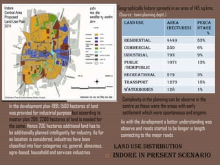


![Bus rapid transit system [brts]
Bus Rapid Transit System is a new form of public public transportation which is
an emerging approach to using buses as an improved high-speed transit system.
Exclusive Lanes. Traffic lanes reserved for the exclusive use of buses help buses
pass congested traffic.
Implementation of BRTS will reduce the cost of public transportation and with
an ability to have fast access to the city will lead in popularizing the public
transport and thus reducing dependability on private vehicles.](https://image.slidesharecdn.com/ithasbecomeoneofthebusiest-120910161441-phpapp02/85/indore-city-18-320.jpg)


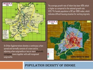
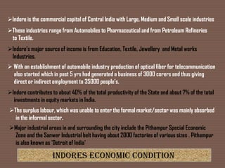
Indore has transformed from a village to a major commercial city through gradual urban development. Its population growth rate of 40% has been higher than the national average. The city expanded north and east due to industrial development. Current land use includes 53% residential, 6% commercial, 9% industrial, and 13% public. Major industries include automobiles, pharmaceuticals, textiles and metals which contribute to the city and state's economy. The large informal sector absorbs surplus labor. Pithampur and Sanwer are major industrial areas with over 2000 factories.