Bhargabi landslide.pdf
•
0 likes•2 views
In this PDF file you know about the landslide and different types of landslides. Cause of landslides and effects of landslides and what's are the prevention of landslides
Report
Share
Report
Share
Download to read offline

Recommended
DM (UNIT-1) (1).pptx
This document outlines the syllabus for a disaster management course. The syllabus covers 5 units: (1) introduction to disasters including definitions, causes and impacts of disasters like earthquakes, floods and droughts; (2) approaches to disaster risk reduction including the disaster cycle and roles of different stakeholders; (3) relationship between disasters and development; (4) disaster risk management in India; and (5) case studies and field works related to different disasters. Key concepts covered include hazards, vulnerability, resilience, and structural vs non-structural disaster risk reduction measures. The syllabus aims to equip students with knowledge on different types of disasters, their impacts and management.
Disaster management landslide
This document discusses landslides and disaster management. It covers types of disasters including natural disasters like landslides, earthquakes, floods, and man-made disasters. Causes of landslides include geological weaknesses, erosion, rainfall, excavation, and earthquakes. The disaster management cycle includes pre-disaster planning, response during the disaster, and post-disaster recovery. Major landslides in India are described and hazard mapping is discussed as a way to reduce landslide risks and prevent loss of life and property.
Landslides
The document discusses landslides, including different types (rotational, translational, lateral spreading, debris flow, rock fall, rock toppling), main causes (gravity, geology, rainfall, earthquakes, forest fires, volcanoes, development, deforestation, drainage), and safety measures. It also describes a specific landslide lake that formed in Pakistan in 2010 due to a large landslide that blocked the Hunza River, causing flooding and secondary landslides. Prevention methods include passive intervention, active prevention, proper land use, and structural and non-structural safety measures.
Landslide.pptx
This document discusses landslides, including what they are, their causes and impacts. It provides the following key points:
- Landslides are the downslope movement of rock, debris and soil under the influence of gravity. They are classified based on movement (falls, slides, flows, creeps) and material (rock falls, debris falls, mud flows).
- Common causes of landslides include heavy rainfall, earthquakes, deforestation, mining, urbanization.
- Impacts of landslides include loss of life, damage to infrastructure and property, impacts on river ecosystems, and changes to landscapes.
- Preventive measures include increasing forest cover, reducing urbanization activities, removing loose material from
10 Geologic Processes and Hazards.pptx
This document discusses various geological hazards caused by earthquakes, volcanic eruptions, and landslides. It identifies the Philippines as highly prone to these hazards due to its location in the Ring of Fire. Specific hazards of each event are outlined such as ground shaking from earthquakes, pyroclastic flows from volcanic eruptions, and human activities that can trigger landslides like deforestation. The document also lists the most at-risk provinces in the Philippines for each hazard and provides safety precautions to follow during hazardous geological events.
Causes of gEOLOGIC hAZARDS.docx
The document discusses the causes of landslides and sinkholes. It identifies several natural causes of landslides including climate, earthquakes, weathering, erosion, volcanic eruptions, and forest fires. It also discusses human causes such as mining and clear cutting. For sinkholes, natural causes include dissolution of sedimentary rocks, while human causes involve underground water pumping. The document provides examples of different types of landslides and sinkholes.
Geological & Environmental impact of Mining
Mining activities have significant negative environmental impacts including air, water, and land pollution. The document discusses how mining releases particulate matter into the air and causes physical destruction of land through open pits and waste dumps. It also contaminates surface and groundwater with heavy metals and acid mine drainage, making water unusable. Specific impacts mentioned include increased dust levels, contamination of streams and lakes, and rendering of land unsuitable for agriculture or habitat. Proper restoration and pollution control methods are needed to mitigate these environmental effects of mining.
Human Impact
This document discusses the impact of human activities on the environment and ecosystems. It begins by establishing that all organisms depend on shared natural resources for survival. It then provides examples of how human activities like agriculture, urban development, and pollution can negatively impact the biosphere. Specifically, issues like global warming, biodiversity loss, deforestation, acid rain, and ozone depletion are examined in more detail. The document stresses the importance of sustainable development and solutions like environmental laws and technologies to curb pollution and its effects on human health and ecosystems.
Landslide and Its Impact on Hilly Region of Bangladesh
This is an assignment on landslide and its impact on hilly region of Bangladesh. This document will help to gather knowledge on this topic.
remociones en masa
This document provides information about landslides including their definition, causes, types, impacts, examples in Bangladesh, risk assessment, and prevention methods. It defines landslides as the downward and outward movement of slope-forming materials like rock, soil, and debris. The key causes are geological factors, morphological factors, physical factors, and human activity. Landslides are classified based on their movement type (falling, sliding, flowing) and material (rock, soil). Their global impacts include loss of life and infrastructure damage. Examples in Bangladesh and a chronology of major landslides are also provided, along with methods to minimize landslide risk and effects.
lessons in Weathering of Grade five.pptx
Mechanical and chemical weathering break rocks down into sediments and soil. Mechanical weathering involves physical breakdown through forces like frost wedging when water freezes in cracks. Chemical weathering changes the rocks' composition through acids. Weathering is important for producing soil but excessive erosion from agents like water and wind can harm the environment if not prevented through measures like planting vegetation.
Major environmental problems and Issues of the world
Here one will come to know indepth knowledge of environmental issue and problems of the world with detail picture
Geography M2 Landslide
This document discusses landslides, including what they are, where they occur, and their causes and impacts. It begins by defining landslides as the rapid movement of soil and rock down slopes. It then explains that landslides are commonly caused by both natural factors like heavy rainfall, earthquakes, and erosion, as well as human activities such as deforestation and construction. The document also outlines some of the damage caused by landslides, and describes methods used to mitigate landslide risks like retaining walls and gabion baskets.
MASS MOVEMENT
Mass wasting refers to the downslope movement of rock and soil due to gravity. It occurs when gravitational forces exceed the frictional or shear strength of the material. The document discusses the key factors that influence mass wasting, including slope steepness, water content, vegetation, and earthquakes. It also describes different types of mass wasting processes such as slides, flows, slumps, creeps, and falls, which are classified based on the material and speed of movement. The document emphasizes that mass wasting is an important geologic hazard, and outlines some methods to lessen its effects, such as removing weight from slopes, using engineering controls, and stabilizing slopes with vegetation.
SOIL DEGRADATION AND CONSERVATION
Soil degradation and erosion are problems that reduce soil quality and fertility. Conservation methods aim to preserve soil for sustainable use. In the USA, the Tennessee Valley Authority addressed severe erosion through dams, reforestation, and encouraging improved farming practices. Similarly, in Tanzania, contour ridging, manure use, fallowing, and resettlement programs have helped curb erosion in areas like Kondoa. Overall, successful soil conservation requires community participation, education, and coordinated efforts across multiple scales.
Principles of Soil Erosion.pptx
This presentation includes definition of Soil Erosion, Causes of Soil Erosion, Types of Soil Erosion, Agents of Soil Erosion, Factors Affecting Soil Erosion, Mechanics of Soil Erosion and
Ill Effects of Soil Erosion
Erosion presentation
Erosion is the process that breaks down large geological formations like mountains into smaller pieces through weathering and transport. It creates beautiful rock formations but can also be destructive. Erosion occurs globally and is exacerbated by human activities like construction of seawalls. It impacts the environment by increasing pollution and sedimentation in waterways, degrading habitats, and reducing the ability of land to hold water. Long-term erosion is unsustainable and poses risks to global food security as it depletes nutrients from soil over generations. Potential solutions include more sustainable agricultural and logging practices, reducing waste, and environmental advocacy efforts.
CAMBRIDGE AS GEOGRAPHY REVISION: ROCKS AND WEATHERING - 3.4 HUMAN IMPACT
A comprehensive presentation of subchapter 3.4 The Human Impact, from the third chapter of Physical Geography, AS Cambridge, Rocks and Weathering.
The role of surveying and mapping in erosion management and control case of o...
1) The document discusses the role of surveying and mapping in managing and controlling erosion, using a case study of erosion sites in Onitsha, Nigeria.
2) Field surveys were conducted using GPS and total stations to collect topographic data on the erosion sites. Remote sensing data was also used.
3) The data was processed using GIS and CAD software to produce maps showing details of the erosion sites and catchment areas, which were used to analyze watersheds and design erosion control structures.
Geology Based natural Disasters in sri Lanka
This document summarizes geology based natural disasters that occur in Sri Lanka. It discusses the main types of natural disasters seen in the country, which include landslides, subsidence, and tsunamis. Landslides are the most common geology based disaster, making up around 30% of the country's land area. The document outlines the different types of landslides that typically happen, including falls, slides, and topples. It also discusses the causes of landslides and methods for mitigating landslide risks. Subsidence and tsunamis are also briefly covered.
Essay On Soil Erosion
The document discusses soil degradation in Africa, explaining that seasonal rainfall patterns, climate change, and poor farming techniques like slash-and-burn agriculture have contributed to soil degradation over time through erosion, loss of nutrients, and desertification. It notes that 91% of Africa's land is susceptible to desertification due to dry conditions and seasonal rains, and that continued soil degradation poses problems for Africa's agriculture and food security.
Natural Disasters .pptx
Natural disasters are caused by natural processes and can result in loss of life and economic damage. There are two main types of disasters: natural disasters such as floods, earthquakes, volcanic eruptions, and tsunamis; and man-made disasters caused by human activities like nuclear explosions and global warming. Common natural disasters include floods, which occur from heavy rain and overflowing rivers; tsunamis, which are large sea waves caused by undersea earthquakes or landslides; wildfires, which burn forests and grasslands due to lightning or human accidents; and earthquakes, which release energy through sudden rock movement underground. Education and preparedness can help reduce impacts, but natural disasters cannot be fully prevented when they occur
HDM-Lec-01.pptx
This document provides an outline for a course on Hazard and Disaster Management taught by Engr. Muhammad Waqas Muneer at the Institute of Southern Punjab in Multan, Pakistan. The course covers introduction to natural and human-induced hazards and disasters, disaster management phases from pre-disaster to post-disaster, infrastructure monitoring and protection strategies, awareness programs, and recommended textbooks. The first lecture introduces key concepts of hazards, vulnerability, risk, and disasters and provides examples of natural hazards that occur in Pakistan.
Avalanches and landslides
Avalanches and landslides are large masses of snow, ice, earth, or rock that slide down mountainsides or cliffs. They are commonly caused by natural events like earthquakes, heavy rain, volcanic eruptions, or forest fires, but can also be triggered by human activities like mining, construction, or deforestation. When they occur, avalanches and landslides can lead to economic losses, damage infrastructure, cause loss of life, impact landscapes and river ecosystems. There are different types of avalanches defined by the type of snow involved and different types of landslides defined by how the earth or rock moves. Prevention methods include early warning systems, monitoring, and controlling human activities that could trigger them.
(Soil erosion (dsm 2202) m. a. mahbub
Course code: 2202
Course Title: Environmental Hazards and Disasters-II (Human-induced)
Course Instructor: Md. Abdullah-Al-Mahbub
Assistant Professor
Dept. of Disaster Management
Begum Rokeya University, Rangpur
Landslides
A landslide is the movement of rock, debris, or earth down a slope, which can be caused by geological, morphological, physical, or anthropogenic factors. Major types of landslides include debris flows, earth flows, debris avalanches, rock falls, and topples. Landslides frequently occur in Chittagong, Chittagong Hill Tracts, and northeastern Sylhet in Bangladesh due to the unstable soil structure. Mitigation approaches include restricting development in prone areas, monitoring systems, and engineering investigations to define hazard levels.
Lanslides tam 2013-04
Landslides refer to the downward sliding of land mass along steep slopes that occurs when part of a natural slope loses its ability to support its own weight. Landslides are caused by both natural factors like heavy rainfall, earthquakes, and deforestation as well as human factors like inappropriate drainage systems and deforestation. Common types of landslides include rock falls and soil creeps. Recent major landslides include those in Uttarakhand, India and Hiroshima, Japan that resulted in thousands of casualties. Mitigation measures involve proper drainage, bioengineering, slope stability techniques, and early detection systems. During a landslide, people should try to get to high ground and avoid debris flows, while after a landslide they
Nat Dis Pp
A natural disaster is an event caused by environmental factors that can cause catastrophic damage and injuries. There are different types of natural disasters including volcanoes, landslides, tornados, avalanches. Recent examples that gained international attention are the 2004 Indian Ocean tsunami and 2005 Hurricane Katrina. Natural disasters can occur with or without warning, so it is important to prepare and understand warning signs. Being prepared can help reduce anxiety, minimize damage and injuries, and allow someone to better respond to the severity of the disaster.
Epcon is One of the World's leading Manufacturing Companies.
Epcon is One of the World's leading Manufacturing Companies. With over 4000 installations worldwide, EPCON has been pioneering new techniques since 1977 that have become industry standards now. Founded in 1977, Epcon has grown from a one-man operation to a global leader in developing and manufacturing innovative air pollution control technology and industrial heating equipment.
Optimizing Post Remediation Groundwater Performance with Enhanced Microbiolog...
Results of geophysics and pneumatic injection pilot tests during 2003 – 2007 yielded significant positive results for injection delivery design and contaminant mass treatment, resulting in permanent shut-down of an existing groundwater Pump & Treat system.
Accessible source areas were subsequently removed (2011) by soil excavation and treated with the placement of Emulsified Vegetable Oil EVO and zero-valent iron ZVI to accelerate treatment of impacted groundwater in overburden and weathered fractured bedrock. Post pilot test and post remediation groundwater monitoring has included analyses of CVOCs, organic fatty acids, dissolved gases and QuantArray® -Chlor to quantify key microorganisms (e.g., Dehalococcoides, Dehalobacter, etc.) and functional genes (e.g., vinyl chloride reductase, methane monooxygenase, etc.) to assess potential for reductive dechlorination and aerobic cometabolism of CVOCs.
In 2022, the first commercial application of MetaArray™ was performed at the site. MetaArray™ utilizes statistical analysis, such as principal component analysis and multivariate analysis to provide evidence that reductive dechlorination is active or even that it is slowing. This creates actionable data allowing users to save money by making important site management decisions earlier.
The results of the MetaArray™ analysis’ support vector machine (SVM) identified groundwater monitoring wells with a 80% confidence that were characterized as either Limited for Reductive Decholorination or had a High Reductive Reduction Dechlorination potential. The results of MetaArray™ will be used to further optimize the site’s post remediation monitoring program for monitored natural attenuation.
More Related Content
Similar to Bhargabi landslide.pdf
Landslide and Its Impact on Hilly Region of Bangladesh
This is an assignment on landslide and its impact on hilly region of Bangladesh. This document will help to gather knowledge on this topic.
remociones en masa
This document provides information about landslides including their definition, causes, types, impacts, examples in Bangladesh, risk assessment, and prevention methods. It defines landslides as the downward and outward movement of slope-forming materials like rock, soil, and debris. The key causes are geological factors, morphological factors, physical factors, and human activity. Landslides are classified based on their movement type (falling, sliding, flowing) and material (rock, soil). Their global impacts include loss of life and infrastructure damage. Examples in Bangladesh and a chronology of major landslides are also provided, along with methods to minimize landslide risk and effects.
lessons in Weathering of Grade five.pptx
Mechanical and chemical weathering break rocks down into sediments and soil. Mechanical weathering involves physical breakdown through forces like frost wedging when water freezes in cracks. Chemical weathering changes the rocks' composition through acids. Weathering is important for producing soil but excessive erosion from agents like water and wind can harm the environment if not prevented through measures like planting vegetation.
Major environmental problems and Issues of the world
Here one will come to know indepth knowledge of environmental issue and problems of the world with detail picture
Geography M2 Landslide
This document discusses landslides, including what they are, where they occur, and their causes and impacts. It begins by defining landslides as the rapid movement of soil and rock down slopes. It then explains that landslides are commonly caused by both natural factors like heavy rainfall, earthquakes, and erosion, as well as human activities such as deforestation and construction. The document also outlines some of the damage caused by landslides, and describes methods used to mitigate landslide risks like retaining walls and gabion baskets.
MASS MOVEMENT
Mass wasting refers to the downslope movement of rock and soil due to gravity. It occurs when gravitational forces exceed the frictional or shear strength of the material. The document discusses the key factors that influence mass wasting, including slope steepness, water content, vegetation, and earthquakes. It also describes different types of mass wasting processes such as slides, flows, slumps, creeps, and falls, which are classified based on the material and speed of movement. The document emphasizes that mass wasting is an important geologic hazard, and outlines some methods to lessen its effects, such as removing weight from slopes, using engineering controls, and stabilizing slopes with vegetation.
SOIL DEGRADATION AND CONSERVATION
Soil degradation and erosion are problems that reduce soil quality and fertility. Conservation methods aim to preserve soil for sustainable use. In the USA, the Tennessee Valley Authority addressed severe erosion through dams, reforestation, and encouraging improved farming practices. Similarly, in Tanzania, contour ridging, manure use, fallowing, and resettlement programs have helped curb erosion in areas like Kondoa. Overall, successful soil conservation requires community participation, education, and coordinated efforts across multiple scales.
Principles of Soil Erosion.pptx
This presentation includes definition of Soil Erosion, Causes of Soil Erosion, Types of Soil Erosion, Agents of Soil Erosion, Factors Affecting Soil Erosion, Mechanics of Soil Erosion and
Ill Effects of Soil Erosion
Erosion presentation
Erosion is the process that breaks down large geological formations like mountains into smaller pieces through weathering and transport. It creates beautiful rock formations but can also be destructive. Erosion occurs globally and is exacerbated by human activities like construction of seawalls. It impacts the environment by increasing pollution and sedimentation in waterways, degrading habitats, and reducing the ability of land to hold water. Long-term erosion is unsustainable and poses risks to global food security as it depletes nutrients from soil over generations. Potential solutions include more sustainable agricultural and logging practices, reducing waste, and environmental advocacy efforts.
CAMBRIDGE AS GEOGRAPHY REVISION: ROCKS AND WEATHERING - 3.4 HUMAN IMPACT
A comprehensive presentation of subchapter 3.4 The Human Impact, from the third chapter of Physical Geography, AS Cambridge, Rocks and Weathering.
The role of surveying and mapping in erosion management and control case of o...
1) The document discusses the role of surveying and mapping in managing and controlling erosion, using a case study of erosion sites in Onitsha, Nigeria.
2) Field surveys were conducted using GPS and total stations to collect topographic data on the erosion sites. Remote sensing data was also used.
3) The data was processed using GIS and CAD software to produce maps showing details of the erosion sites and catchment areas, which were used to analyze watersheds and design erosion control structures.
Geology Based natural Disasters in sri Lanka
This document summarizes geology based natural disasters that occur in Sri Lanka. It discusses the main types of natural disasters seen in the country, which include landslides, subsidence, and tsunamis. Landslides are the most common geology based disaster, making up around 30% of the country's land area. The document outlines the different types of landslides that typically happen, including falls, slides, and topples. It also discusses the causes of landslides and methods for mitigating landslide risks. Subsidence and tsunamis are also briefly covered.
Essay On Soil Erosion
The document discusses soil degradation in Africa, explaining that seasonal rainfall patterns, climate change, and poor farming techniques like slash-and-burn agriculture have contributed to soil degradation over time through erosion, loss of nutrients, and desertification. It notes that 91% of Africa's land is susceptible to desertification due to dry conditions and seasonal rains, and that continued soil degradation poses problems for Africa's agriculture and food security.
Natural Disasters .pptx
Natural disasters are caused by natural processes and can result in loss of life and economic damage. There are two main types of disasters: natural disasters such as floods, earthquakes, volcanic eruptions, and tsunamis; and man-made disasters caused by human activities like nuclear explosions and global warming. Common natural disasters include floods, which occur from heavy rain and overflowing rivers; tsunamis, which are large sea waves caused by undersea earthquakes or landslides; wildfires, which burn forests and grasslands due to lightning or human accidents; and earthquakes, which release energy through sudden rock movement underground. Education and preparedness can help reduce impacts, but natural disasters cannot be fully prevented when they occur
HDM-Lec-01.pptx
This document provides an outline for a course on Hazard and Disaster Management taught by Engr. Muhammad Waqas Muneer at the Institute of Southern Punjab in Multan, Pakistan. The course covers introduction to natural and human-induced hazards and disasters, disaster management phases from pre-disaster to post-disaster, infrastructure monitoring and protection strategies, awareness programs, and recommended textbooks. The first lecture introduces key concepts of hazards, vulnerability, risk, and disasters and provides examples of natural hazards that occur in Pakistan.
Avalanches and landslides
Avalanches and landslides are large masses of snow, ice, earth, or rock that slide down mountainsides or cliffs. They are commonly caused by natural events like earthquakes, heavy rain, volcanic eruptions, or forest fires, but can also be triggered by human activities like mining, construction, or deforestation. When they occur, avalanches and landslides can lead to economic losses, damage infrastructure, cause loss of life, impact landscapes and river ecosystems. There are different types of avalanches defined by the type of snow involved and different types of landslides defined by how the earth or rock moves. Prevention methods include early warning systems, monitoring, and controlling human activities that could trigger them.
(Soil erosion (dsm 2202) m. a. mahbub
Course code: 2202
Course Title: Environmental Hazards and Disasters-II (Human-induced)
Course Instructor: Md. Abdullah-Al-Mahbub
Assistant Professor
Dept. of Disaster Management
Begum Rokeya University, Rangpur
Landslides
A landslide is the movement of rock, debris, or earth down a slope, which can be caused by geological, morphological, physical, or anthropogenic factors. Major types of landslides include debris flows, earth flows, debris avalanches, rock falls, and topples. Landslides frequently occur in Chittagong, Chittagong Hill Tracts, and northeastern Sylhet in Bangladesh due to the unstable soil structure. Mitigation approaches include restricting development in prone areas, monitoring systems, and engineering investigations to define hazard levels.
Lanslides tam 2013-04
Landslides refer to the downward sliding of land mass along steep slopes that occurs when part of a natural slope loses its ability to support its own weight. Landslides are caused by both natural factors like heavy rainfall, earthquakes, and deforestation as well as human factors like inappropriate drainage systems and deforestation. Common types of landslides include rock falls and soil creeps. Recent major landslides include those in Uttarakhand, India and Hiroshima, Japan that resulted in thousands of casualties. Mitigation measures involve proper drainage, bioengineering, slope stability techniques, and early detection systems. During a landslide, people should try to get to high ground and avoid debris flows, while after a landslide they
Nat Dis Pp
A natural disaster is an event caused by environmental factors that can cause catastrophic damage and injuries. There are different types of natural disasters including volcanoes, landslides, tornados, avalanches. Recent examples that gained international attention are the 2004 Indian Ocean tsunami and 2005 Hurricane Katrina. Natural disasters can occur with or without warning, so it is important to prepare and understand warning signs. Being prepared can help reduce anxiety, minimize damage and injuries, and allow someone to better respond to the severity of the disaster.
Similar to Bhargabi landslide.pdf (20)
Landslide and Its Impact on Hilly Region of Bangladesh
Landslide and Its Impact on Hilly Region of Bangladesh
Major environmental problems and Issues of the world
Major environmental problems and Issues of the world
CAMBRIDGE AS GEOGRAPHY REVISION: ROCKS AND WEATHERING - 3.4 HUMAN IMPACT
CAMBRIDGE AS GEOGRAPHY REVISION: ROCKS AND WEATHERING - 3.4 HUMAN IMPACT
The role of surveying and mapping in erosion management and control case of o...
The role of surveying and mapping in erosion management and control case of o...
Recently uploaded
Epcon is One of the World's leading Manufacturing Companies.
Epcon is One of the World's leading Manufacturing Companies. With over 4000 installations worldwide, EPCON has been pioneering new techniques since 1977 that have become industry standards now. Founded in 1977, Epcon has grown from a one-man operation to a global leader in developing and manufacturing innovative air pollution control technology and industrial heating equipment.
Optimizing Post Remediation Groundwater Performance with Enhanced Microbiolog...
Results of geophysics and pneumatic injection pilot tests during 2003 – 2007 yielded significant positive results for injection delivery design and contaminant mass treatment, resulting in permanent shut-down of an existing groundwater Pump & Treat system.
Accessible source areas were subsequently removed (2011) by soil excavation and treated with the placement of Emulsified Vegetable Oil EVO and zero-valent iron ZVI to accelerate treatment of impacted groundwater in overburden and weathered fractured bedrock. Post pilot test and post remediation groundwater monitoring has included analyses of CVOCs, organic fatty acids, dissolved gases and QuantArray® -Chlor to quantify key microorganisms (e.g., Dehalococcoides, Dehalobacter, etc.) and functional genes (e.g., vinyl chloride reductase, methane monooxygenase, etc.) to assess potential for reductive dechlorination and aerobic cometabolism of CVOCs.
In 2022, the first commercial application of MetaArray™ was performed at the site. MetaArray™ utilizes statistical analysis, such as principal component analysis and multivariate analysis to provide evidence that reductive dechlorination is active or even that it is slowing. This creates actionable data allowing users to save money by making important site management decisions earlier.
The results of the MetaArray™ analysis’ support vector machine (SVM) identified groundwater monitoring wells with a 80% confidence that were characterized as either Limited for Reductive Decholorination or had a High Reductive Reduction Dechlorination potential. The results of MetaArray™ will be used to further optimize the site’s post remediation monitoring program for monitored natural attenuation.
Overview of the Global Peatlands Assessment
Presented by Patrick Scheel at GLF Peatlands 2024 - The Global Peatlands Assessment: Mapping, Policy, and Action
ENVIRONMENT~ Renewable Energy Sources and their future prospects.
This presentation is for us to know that how our Environment need Attention for protection of our natural resources which are depleted day by day that's why we need to take time and shift our attention to renewable energy sources instead of non-renewable sources which are better and Eco-friendly for our environment. these renewable energy sources are so helpful for our planet and for every living organism which depends on environment.
Global Peatlands Map and Hotspot Explanation Atlas
Presented by Alexandra Barthelmes at GLF Peatlands 2024 - The Global Peatlands Assessment: Mapping, Policy, and Action
Microbial characterisation and identification, and potability of River Kuywa ...
Microbial characterisation and identification, and potability of River Kuywa ...Open Access Research Paper
Water contamination is one of the major causes of water borne diseases worldwide. In Kenya, approximately 43% of people lack access to potable water due to human contamination. River Kuywa water is currently experiencing contamination due to human activities. Its water is widely used for domestic, agricultural, industrial and recreational purposes. This study aimed at characterizing bacteria and fungi in river Kuywa water. Water samples were randomly collected from four sites of the river: site A (Matisi), site B (Ngwelo), site C (Nzoia water pump) and site D (Chalicha), during the dry season (January-March 2018) and wet season (April-July 2018) and were transported to Maseno University Microbiology and plant pathology laboratory for analysis. The characterization and identification of bacteria and fungi were carried out using standard microbiological techniques. Nine bacterial genera and three fungi were identified from Kuywa river water. Clostridium spp., Staphylococcus spp., Enterobacter spp., Streptococcus spp., E. coli, Klebsiella spp., Shigella spp., Proteus spp. and Salmonella spp. Fungi were Fusarium oxysporum, Aspergillus flavus complex and Penicillium species. Wet season recorded highest bacterial and fungal counts (6.61-7.66 and 3.83-6.75cfu/ml) respectively. The results indicated that the river Kuywa water is polluted and therefore unsafe for human consumption before treatment. It is therefore recommended that the communities to ensure that they boil water especially for drinking.
Wildlife-AnIntroduction.pdf so that you know more about our environment
All about wildlife, if you are fond of animals and wildlife then do follow us for more content like this
Evolving Lifecycles with High Resolution Site Characterization (HRSC) and 3-D...
The incorporation of a 3DCSM and completion of HRSC provided a tool for enhanced, data-driven, decisions to support a change in remediation closure strategies. Currently, an approved pilot study has been obtained to shut-down the remediation systems (ISCO, P&T) and conduct a hydraulic study under non-pumping conditions. A separate micro-biological bench scale treatability study was competed that yielded positive results for an emerging innovative technology. As a result, a field pilot study has commenced with results expected in nine-twelve months. With the results of the hydraulic study, field pilot studies and an updated risk assessment leading site monitoring optimization cost lifecycle savings upwards of $15MM towards an alternatively evolved best available technology remediation closure strategy.
Recycling and Disposal on SWM Raymond Einyu pptx
Increasing urbanization, rural–urban migration, rising standards of living, and rapid development associated with population growth have resulted in increased solid waste generation by industrial, domestic and other activities in Nairobi City. It has been noted in other contexts too that increasing population, changing consumption patterns, economic development, changing income, urbanization and industrialization all contribute to the increased generation of waste.
With the increasing urban population in Kenya, which is estimated to be growing at a rate higher than that of the country’s general population, waste generation and management is already a major challenge. The industrialization and urbanization process in the country, dominated by one major city – Nairobi, which has around four times the population of the next largest urban centre (Mombasa) – has witnessed an exponential increase in the generation of solid waste. It is projected that by 2030, about 50 per cent of the Kenyan population will be urban.
Aim:
A healthy, safe, secure and sustainable solid waste management system fit for a world – class city.
Improve and protect the public health of Nairobi residents and visitors.
Ecological health, diversity and productivity and maximize resource recovery through the participatory approach.
Goals:
Build awareness and capacity for source separation as essential components of sustainable waste management.
Build new environmentally sound infrastructure and systems for safe disposal of residual waste and replacing current dumpsites which should be commissioned.
Current solid waste management situation:
The status.
Solid waste generation rate is at 2240 tones / day
collection efficiently is at about 50%.
Actors i.e. city authorities, CBO’s , private firms and self-disposal
Current SWM Situation in Nairobi City:
Solid waste generation – collection – dumping
Good Practices:
• Separation – recycling – marketing.
• Open dumpsite dandora dump site through public education on source separation of waste, of which the situation can be reversed.
• Nairobi is one of the C40 cities in this respect , various actors in the solid waste management space have adopted a variety of technologies to reduce short lived climate pollutants including source separation , recycling , marketing of the recycled products.
• Through the network, it should expect to benefit from expertise of the different actors in the network in terms of applicable technologies and practices in reducing the short-lived climate pollutants.
Good practices:
Despite the dismal collection of solid waste in Nairobi city, there are practices and activities of informal actors (CBOs, CBO-SACCOs and yard shop operators) and other formal industrial actors on solid waste collection, recycling and waste reduction.
Practices and activities of these actor groups are viewed as innovations with the potential to change the way solid waste is handled.
CHALLENGES:
• Resource Allocation.
Improving the viability of probiotics by encapsulation methods for developmen...
Improving the viability of probiotics by encapsulation methods for developmen...Open Access Research Paper
The popularity of functional foods among scientists and common people has been increasing day by day. Awareness and modernization make the consumer think better regarding food and nutrition. Now a day’s individual knows very well about the relation between food consumption and disease prevalence. Humans have a diversity of microbes in the gut that together form the gut microflora. Probiotics are the health-promoting live microbial cells improve host health through gut and brain connection and fighting against harmful bacteria. Bifidobacterium and Lactobacillus are the two bacterial genera which are considered to be probiotic. These good bacteria are facing challenges of viability. There are so many factors such as sensitivity to heat, pH, acidity, osmotic effect, mechanical shear, chemical components, freezing and storage time as well which affects the viability of probiotics in the dairy food matrix as well as in the gut. Multiple efforts have been done in the past and ongoing in present for these beneficial microbial population stability until their destination in the gut. One of a useful technique known as microencapsulation makes the probiotic effective in the diversified conditions and maintain these microbe’s community to the optimum level for achieving targeted benefits. Dairy products are found to be an ideal vehicle for probiotic incorporation. It has been seen that the encapsulated microbial cells show higher viability than the free cells in different processing and storage conditions as well as against bile salts in the gut. They make the food functional when incorporated, without affecting the product sensory characteristics.
Peatlands of Latin America and the Caribbean
Presented by The Global Peatlands Assessment: Mapping, Policy, and Action at GLF Peatlands 2024 - The Global Peatlands Assessment: Mapping, Policy, and Action
Enhanced action and stakeholder engagement for sustainable peatland management
Enhanced action and stakeholder engagement for sustainable peatland managementGlobal Landscapes Forum (GLF)
Presented by Jan Peters at GLF Peatlands 2024 - The Global Peatlands Assessment: Mapping, Policy, and Action原版制作(Newcastle毕业证书)纽卡斯尔大学毕业证在读证明一模一样
学校原件一模一样【微信:741003700 】《(Newcastle毕业证书)纽卡斯尔大学毕业证》【微信:741003700 】学位证,留信认证(真实可查,永久存档)原件一模一样纸张工艺/offer、雅思、外壳等材料/诚信可靠,可直接看成品样本,帮您解决无法毕业带来的各种难题!外壳,原版制作,诚信可靠,可直接看成品样本。行业标杆!精益求精,诚心合作,真诚制作!多年品质 ,按需精细制作,24小时接单,全套进口原装设备。十五年致力于帮助留学生解决难题,包您满意。
本公司拥有海外各大学样板无数,能完美还原。
1:1完美还原海外各大学毕业材料上的工艺:水印,阴影底纹,钢印LOGO烫金烫银,LOGO烫金烫银复合重叠。文字图案浮雕、激光镭射、紫外荧光、温感、复印防伪等防伪工艺。材料咨询办理、认证咨询办理请加学历顾问Q/微741003700
【主营项目】
一.毕业证【q微741003700】成绩单、使馆认证、教育部认证、雅思托福成绩单、学生卡等!
二.真实使馆公证(即留学回国人员证明,不成功不收费)
三.真实教育部学历学位认证(教育部存档!教育部留服网站永久可查)
四.办理各国各大学文凭(一对一专业服务,可全程监控跟踪进度)
如果您处于以下几种情况:
◇在校期间,因各种原因未能顺利毕业……拿不到官方毕业证【q/微741003700】
◇面对父母的压力,希望尽快拿到;
◇不清楚认证流程以及材料该如何准备;
◇回国时间很长,忘记办理;
◇回国马上就要找工作,办给用人单位看;
◇企事业单位必须要求办理的
◇需要报考公务员、购买免税车、落转户口
◇申请留学生创业基金
留信网认证的作用:
1:该专业认证可证明留学生真实身份
2:同时对留学生所学专业登记给予评定
3:国家专业人才认证中心颁发入库证书
4:这个认证书并且可以归档倒地方
5:凡事获得留信网入网的信息将会逐步更新到个人身份内,将在公安局网内查询个人身份证信息后,同步读取人才网入库信息
6:个人职称评审加20分
7:个人信誉贷款加10分
8:在国家人才网主办的国家网络招聘大会中纳入资料,供国家高端企业选择人才
Climate Change All over the World .pptx
Climate change refers to significant and lasting changes in the average weather patterns over periods ranging from decades to millions of years. It encompasses both global warming driven by human emissions of greenhouse gases and the resulting large-scale shifts in weather patterns. While climate change is a natural phenomenon, human activities, particularly since the Industrial Revolution, have accelerated its pace and intensity
Promoting Multilateral Cooperation for Sustainable Peatland management
Presented by Agus Julianto on GLF Peatlands 2024 - 360 Degree Approach to Improving Capacity of Multiple Stakeholders to Manage Peatland Sustainably
在线办理(lboro毕业证书)拉夫堡大学毕业证学历证书一模一样
学校原件一模一样【微信:741003700 】《(lboro毕业证书)拉夫堡大学毕业证学历证书》【微信:741003700 】学位证,留信认证(真实可查,永久存档)原件一模一样纸张工艺/offer、雅思、外壳等材料/诚信可靠,可直接看成品样本,帮您解决无法毕业带来的各种难题!外壳,原版制作,诚信可靠,可直接看成品样本。行业标杆!精益求精,诚心合作,真诚制作!多年品质 ,按需精细制作,24小时接单,全套进口原装设备。十五年致力于帮助留学生解决难题,包您满意。
本公司拥有海外各大学样板无数,能完美还原。
1:1完美还原海外各大学毕业材料上的工艺:水印,阴影底纹,钢印LOGO烫金烫银,LOGO烫金烫银复合重叠。文字图案浮雕、激光镭射、紫外荧光、温感、复印防伪等防伪工艺。材料咨询办理、认证咨询办理请加学历顾问Q/微741003700
【主营项目】
一.毕业证【q微741003700】成绩单、使馆认证、教育部认证、雅思托福成绩单、学生卡等!
二.真实使馆公证(即留学回国人员证明,不成功不收费)
三.真实教育部学历学位认证(教育部存档!教育部留服网站永久可查)
四.办理各国各大学文凭(一对一专业服务,可全程监控跟踪进度)
如果您处于以下几种情况:
◇在校期间,因各种原因未能顺利毕业……拿不到官方毕业证【q/微741003700】
◇面对父母的压力,希望尽快拿到;
◇不清楚认证流程以及材料该如何准备;
◇回国时间很长,忘记办理;
◇回国马上就要找工作,办给用人单位看;
◇企事业单位必须要求办理的
◇需要报考公务员、购买免税车、落转户口
◇申请留学生创业基金
留信网认证的作用:
1:该专业认证可证明留学生真实身份
2:同时对留学生所学专业登记给予评定
3:国家专业人才认证中心颁发入库证书
4:这个认证书并且可以归档倒地方
5:凡事获得留信网入网的信息将会逐步更新到个人身份内,将在公安局网内查询个人身份证信息后,同步读取人才网入库信息
6:个人职称评审加20分
7:个人信誉贷款加10分
8:在国家人才网主办的国家网络招聘大会中纳入资料,供国家高端企业选择人才
Peatland Management in Indonesia, Science to Policy and Knowledge Education
Peatland Management in Indonesia, Science to Policy and Knowledge EducationGlobal Landscapes Forum (GLF)
Presented by Feri Johana at GLF Peatlands 2024 - 360 Degree Approach to Improving Capacity of Multiple Stakeholders to Manage Peatland SustainablyImproving the Management of Peatlands and the Capacities of Stakeholders in I...
Improving the Management of Peatlands and the Capacities of Stakeholders in I...Global Landscapes Forum (GLF)
Presented by Sonya Dewi at GLF Peatlands 2024 - 360 Degree Approach to Improving Capacity of Multiple Stakeholders to Manage Peatland SustainablyRecently uploaded (20)
Epcon is One of the World's leading Manufacturing Companies.
Epcon is One of the World's leading Manufacturing Companies.
Optimizing Post Remediation Groundwater Performance with Enhanced Microbiolog...
Optimizing Post Remediation Groundwater Performance with Enhanced Microbiolog...
ENVIRONMENT~ Renewable Energy Sources and their future prospects.
ENVIRONMENT~ Renewable Energy Sources and their future prospects.
Global Peatlands Map and Hotspot Explanation Atlas
Global Peatlands Map and Hotspot Explanation Atlas
Microbial characterisation and identification, and potability of River Kuywa ...
Microbial characterisation and identification, and potability of River Kuywa ...
Wildlife-AnIntroduction.pdf so that you know more about our environment
Wildlife-AnIntroduction.pdf so that you know more about our environment
Evolving Lifecycles with High Resolution Site Characterization (HRSC) and 3-D...
Evolving Lifecycles with High Resolution Site Characterization (HRSC) and 3-D...
Improving the viability of probiotics by encapsulation methods for developmen...
Improving the viability of probiotics by encapsulation methods for developmen...
Enhanced action and stakeholder engagement for sustainable peatland management
Enhanced action and stakeholder engagement for sustainable peatland management
world-environment-day-2024-240601103559-14f4c0b4.pptx
world-environment-day-2024-240601103559-14f4c0b4.pptx
Promoting Multilateral Cooperation for Sustainable Peatland management
Promoting Multilateral Cooperation for Sustainable Peatland management
Peatland Management in Indonesia, Science to Policy and Knowledge Education
Peatland Management in Indonesia, Science to Policy and Knowledge Education
Improving the Management of Peatlands and the Capacities of Stakeholders in I...
Improving the Management of Peatlands and the Capacities of Stakeholders in I...
Bhargabi landslide.pdf
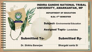
- 1. . . Inicio Fondos Bienvenida Planific. Tareas Pruebas INDIRA GANDHI NATIONAL TRIBAL UNIVERSITY, AMARKANTAK, MP DEPARTMENT OF EDUCATION B.Ed. 4TH SEMESTER Subject- Environmental Education Assigned Topic- Landslides Submitted To- Dr. Shikha Banerjee Submitted By- Bhargabi santa Si
- 2. . . Inicio Fondos Bienvenida Planific. Tareas Pruebas CONTENTS 1. What is landslides 2. Types of Landslides 3. Causes of Landslides 4. Effects of Landslides 5. Prevention of Landslides
- 3. . . . Inicio Fondos Bienvenida Planific. Tareas Pruebas What is Landslides ? A landslide, also known as a landslip, is a geographical phenomenon that includes a wide range of ground movements, such as rock falls, deep failure of slopes and shallow debris flows. Landslides are among the many natural disasters causing massive destructions and loss of lives across the globe. It is one of the natural hazards and it is mostly found in hilly area.
- 5. . . Inicio Fondos Bienvenida Planific. Tareas Pruebas 1) Slipping of one or several units of rock debris with a backward rotation with respect to the slope over which the movement takes place. 2) Rapid rolling or sliding of earth debris without backward rotation of mass is known as debris slide. 3) Nearly the free fall of earth debris from a vertical or overhanging face. 4) Sliding of individual rock masses down bedding, joint or fault surface is rockslide. Over steep slopes, rock sliding is very fast and destructive. 5) Rock fall is free falling of rock blocks over any steep slope keeping itself away from the slope. 1. Slump 2. Debris slide 3. Debris fall 4. Rock slide 5. Rock fall Depending upon the type of movement of materials,
- 6. Inicio Fondos Bienvenida Planific. Tareas Pruebas . . . . . Causes of Landslides Natural causes Human causes 1. Volcanic eruption 2. Earthquakes 3. Erosion 4. Forest fires 5. Climate 1. Mining 2. Clear cutting of forest
- 7. . . Effects of Landslides 1. Affects beauty of landscapes. 2. Loss of life and property. 3. Decimation of infrastructure. 4. Effects on the sources of water. 5. Roadblocks 6. Lead to economic decline
- 8. Inicio Fondos Bienvenida Planific. Tareas Pruebas Prevention of Landslide 1. Improving drainage. 2. Unload the top of the slope. 3. Reducing the angle of the slope. 4. By making a protective wall.