Download to read offline
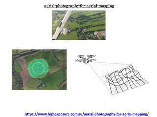
![Aerial survey is a method of collecting geomatics or other imagery by
using airplanes, helicopters, UAVs, balloons or other aerial methods. Typical types of data
collected include aerial photography, Lidar, remote sensing (using various visible and invisible
bands of the electromagnetic spectrum, such as infrared, gamma, or ultraviolet) and also
geophysical data (such as aeromagnetic surveys and gravity. It can also refer to the chart or
map made by analysing a region from the air. Aerial survey should be distinguished
from satellite imagery technologies because of its better resolution, quality
and atmospheric conditions (which can negatively impact and obscure satellite observation).
Today, aerial survey is sometimes recognized as a synonym for aerophotogrammetry, part
of photogrammetry where the camera is placed in the air. Measurements on aerial images
are provided by photogrammetric technologies and methods.[1]
https://www.highexposure.com.au/aerial-photography-for-aerial-mapping/](https://image.slidesharecdn.com/aerial-photography-for-aerial-mapping-190503055251/85/Aerial-photography-for-aerial-mapping-2-320.jpg)
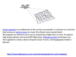


Aerial photography for mapping involves using various aerial techniques to collect geomatics data, offering better resolution and quality than satellite imagery. The process includes autonomous drone flights to capture high-quality images and create detailed 3D models using photogrammetry. This method provides significant cost savings and high-quality data for geographical information systems, planning, and surveying.


