![Marker OptionsFillStylealpha:[Number]color:[Number]gradient:GradientStyleDisplayObjectMatrixGradientStylePointalphas:Array[Number]colors:Array[Number]focalPointRatio:[Number]interpolationMethod:Stringmatrix:Matrixratios:Array[Number]spreadMethod:Stringtype:StringMarkerOptionsTextFormatdraggable:[Boolean] falsefillStyle:FillStyle {color:0xFF766A, alpha:1}gravity:[Number] 0.8hasShadow:[Boolean] trueicon:DisplayObject nulliconAlignment:[Number] nulliconOffset:Point nulllabel:String nulllabelFormat:TextFormat {font:"_sans", size:12, color:Color.BLACK}radius:[Number] 9strokeStyle:StrokeStyle {thickness:2, alpha:1, color:Color.BLACK}tooltip:String nullStrokeStylealpha:[Number]color:[Number]thickness:[Number]](https://image.slidesharecdn.com/maps-adobemax09-091013132454-phpapp01/85/Adobe-MAX-2009-Making-Maps-with-Flash-14-320.jpg)
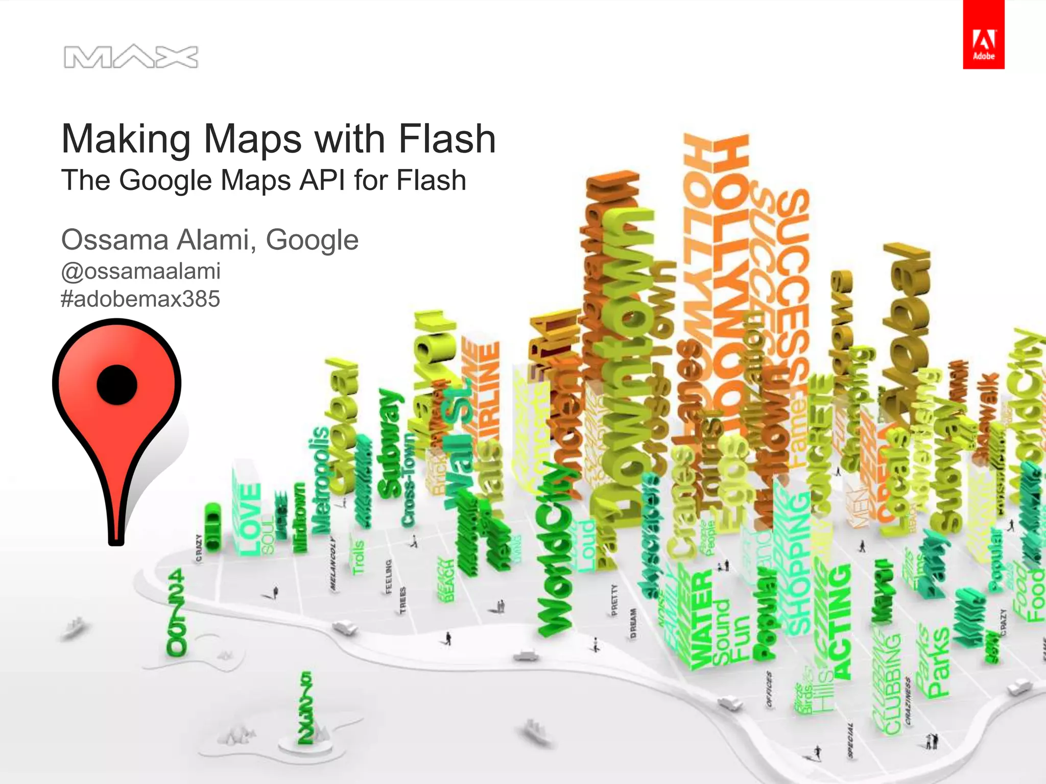
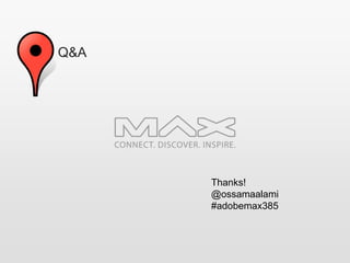
![Maps API for Flash: ServicesGeocoding – Pass in an address and get a LatLngReverse Geocoding – Pass in a LatLng and get and addressDriving & Walking Directionsvargeocoder:ClientGeocoder = newClientGeocoder();geocoder.addEventListener(GeocodingEvent.GEOCODING_SUCCESS, function(e:GeocodingEvent):void {varplacemarks:Array = e.response.placemarks;if(placemarks.length > 0) {addOverlay(new Marker(placemarks[0].point,newMarkerOptions({tooltip:"Google SF"}))); }});geocoder.geocode("345 Spear St., San Francisco, CA"); vardir:Directions = new Directions();dir.addEventListener(DirectionsEvent.DIRECTIONS_SUCCESS,function(event:DirectionsEvent):void {varpolyline:IPolyline = dir.createPolyline();addOverlay(polyline);});dir.load("345 spear st, sf to 1201 S Figueroa St, la");](https://image.slidesharecdn.com/maps-adobemax09-091013132454-phpapp01/85/Adobe-MAX-2009-Making-Maps-with-Flash-17-320.jpg)
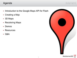
![Recoloring Maps: CodevarR:Number = 0.299; varG:Number = 0.587; varB:Number = 0.114;varmatrix:Array = [//R G B A O - Red, Green, Blue, Alpha, Offset R, G, B, 0, 0, // Red Result R, G, B, 0, 0, // Green Result R, G, B, 0, 0, // Blue Result 0, 0, 0, 1, 0]; // Alpha ResultvarCMF:ColorMatrixFilter = newColorMatrixFilter(matrix);varmapPart:Sprite = Sprite(map).getChildAt(1) as Sprite;varmapArea:Sprite = mapPart.getChildAt(0) as Sprite;mapArea.filters = [CMF]](https://image.slidesharecdn.com/maps-adobemax09-091013132454-phpapp01/85/Adobe-MAX-2009-Making-Maps-with-Flash-29-320.jpg)

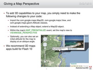
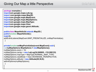
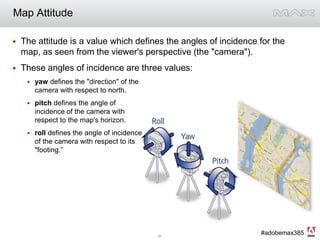
The document introduces the Google Maps API for Flash, detailing its capabilities for creating diverse mapping applications, including support for 3D maps and various features like geocoding and custom markers. It provides examples of ActionScript code for building a map interface, adding markers, and implementing features such as driving directions and map recoloring. Additionally, the document offers resources for further development and customization.


![Getting Started with Apache Spark: Big Data Made Simple [Free Meetup]](https://cdn.slidesharecdn.com/ss_thumbnails/apachesparkgettingstarted-260203175547-8361bcc3-thumbnail.jpg?width=640&height=640&fit=bounds)


