Downloaded 74 times


![Mapstraction: Looking at the code Mapstraction.prototype.setCenterAndZoom = function(point, zoom) { var map = this.maps[this.api]; switch (this.api) { case 'google': case 'openstreetmap': map.setCenter(point.toGoogle(), zoom); break; case 'microsoft': map.SetCenterAndZoom(point.toMicrosoft(),zoom); break; case 'openlayers': map.setCenter(point.toOpenLayers(), zoom); break; case 'multimap': map.goToPosition( new MMLatLon( point.lat, point.lng ), zoom ); break; case 'map24': var newSettings = {}; newSettings.Latitude = point.lat*60; newSettings.Longitude = point.lon*60; ..... A snippet from setCenterAndZoom in the JS:](https://image.slidesharecdn.com/openmapsorcloseenough-1228252652079532-9/85/Open-Maps-Or-Close-Enough-15-320.jpg)

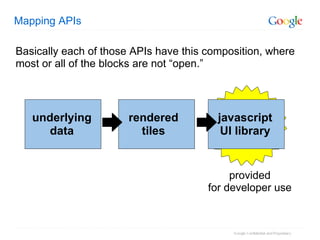
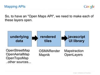
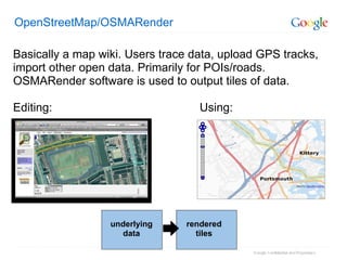
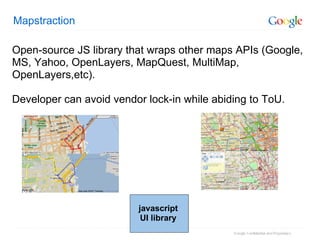
The document discusses various mapping APIs and their components, highlighting both proprietary and open-source options. It emphasizes the need for open layers in mapping systems, detailing tools like OpenStreetMap, Mapstraction, and OpenLayers that facilitate interactive mapping. Additionally, it provides a basic overview of how to integrate and utilize these mapping APIs in web applications.