Application of Residue Theorem to evaluate real integrations.pptx
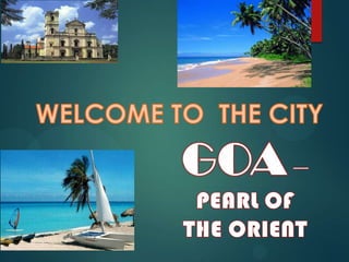
a ppt on hierachy of goa
1.
2. Group members
P.KRISHNA DUTT ABINAV TIWARI
ALOK SINGH
LALITH KUMAWAT
P.KARTHICK KRISHNA
SANKALP SHUKLA
ALOK KUMAR TRIPATI
3. GOA - AT A GLANCE
Smallest state according to area
Fourth smallest as per population
Located in western part of India
Bounded by Karnataka & Maharashtra
Capital - Panaji
Largest city -Vasco da Gama
Important Cities -Margao, Ponda, Mapusa, etc.
Divisions - North Goa district and South Goa district
North Goa Headquarters - Panaji
South Goa Headquarters - Margao
4. Number of divisions of
North Goa - 6
Number of divisions of
South Goa - 5
Richest state of the country,
with a GDP per capita two
and a half times that of
India, as a whole.
On the right is the Political
cum administrative map of
Goa showing the
surrounding states, capital
and other important cities.
5. TRANSPORTATION
Goa has all four kinds of means of transport :
Air - Goa International Airport located at Dabolim, Vasco da
gama.
Rail - Railway lines run by South Western Railway and Konkan
Railway
Road - Four national highways passing through Goa :
NH17 : Pernem - Canacona
NH17A : Mormugao Port - Cortalim
NH17B : Mormugao Port - Ponda
NH4A : Panaji - Belgaum.
6. Water -
Mormugao harbor near
Vasco-da-gama
Panaji port on river
Mandovi
On the left is the transport
map of Goa showing the
National and State
Highways, and other roads.
7. TOURISM
Goa is known as a ‘Tourist
Paradise’.
It is famous for its excellent
beaches, churches and
temples.
The state has few museums
too.
The state has two world
heritage sites: Basilica of Bom
Jesus and the churches and
convents of Old Goa.
Goa also houses some of the
finest and most beautiful
beaches of the world.
8. On the right is the heritage site
map of the state showing
temples, churches, mosques,
caves, forts, museums,
waterfalls, wildlife sanctuaries
and bird sanctuaries.
9. The following table shows us about the changes in
arrivals of tourists from the years 1986-2006.
The respective changes in the no of tourists is also
shown.
10. DRAINAGE
Main rivers - Mandovi, Zuari,
Tiracol, Chaporakushavati,
Talpona and the Sal.
State has some serene lakes,
spread over the entire area of
Goa.
Important and famous lakes -
Mayem lake, Carambolim lake,
Amtonem lake and Anjunem lake
located in North Goa; and
Curtorim lake located in South
Goa.
11. Zuari & Mandovi rivers-
Lifelines of the state.
Mormugao harbor - One of
the best natural harbors
On the left is the drainage
map of Goa showing the
major rivers and lakes.
12. CENSUS MAP
Goa has population of
14.59 lakhs a increase from
fig. of 13.48 lakhs in 2001
census. Total population of
Goa as per 2011 census is
14,58,545 of which male
and female are 7,39,140
and 7,19,405 respectively.
Total population growth in
this decade was 8.23%
while in previous decade it
was 14.89%.
Density of Goa is 394/sq km
which is higher than
national average 382/sq
km.
13. Population growth
rate is less than 10 and
it decreases since the
previous census which
makes it unique.
Urbanization growth
has been rapid in
goa. More than 60% of
the population is
urbanized.
Population growth
rate is negative which
means the population
is greatly decreasing.
Goa has a sex ratio of
973. The ratio is close
to ideal .
14. Contour map
A CONTOUR MAP IS A MAP
ILLUSTRATED WITH CONTOUR LINES,
WHICH SHOWS VALLEYS AND HILLS,
AND THE STEEPNESS OF SLOPES.
A CONTOUR LINE JOINS POINTS OF
EQUAL ELEVATION. CONTOUR
INTERVAL OF A CONTOUR MAP IS THE
DIFFERENCE IN ELEVATION BETWEEN
SUCCESSIVE CONTOUR LINES.
DOTTED LINES ARE OFTEN USED WHEN
THE UNDERLYING BASE MAP CONVEYS
VERY IMPORTANT (OR DIFFICULT TO
READ ) INFORMATION.
BROKEN LINE TYPE ARE USED WHEN
THE LOCATION OF THE CONTOUR LINE
IS INFERRED.
NUMERICAL MARKING IS THE MANNER
OF DENOTING THE ARITHMETICAL
VALUES OF CONTOUR LINES .
THE ORIENTATION OF NUMERICAL TEXT
LABELS IS OFTEN USED TO INDICATE
THE DIRECTION OF THE SLOPE .
15. THE CONTOUR MAP OF GOA GIVES
DETAIL KNOWLEDGE ABOUT ITS
PHYSICAL CHARACTER. IT SHOWS
DENSE CONTOUR LINES ON ONE
SIDE AND VERY FEW CONTOUR
LINES ON OTHER SIDE THIS IS DUE
THE DIFFERENCE IN PHYSICAL
STRUCTURE OF GOA.
THE COASTAL AREA IS ALMOST FLAT
CAUSING VERY FEW CONTOUR
LINES WHEREAS THERE ARE DENSE
CONTOUR LINES ON OTHER SIDE
DUE TO WESTERN GHATS CONSISTS
OF VALLEYS AND HILLS.
16. Land coverage(eco sensitive
zones)
The following map
tells us about the
different distributions
of land cover in the
state of goa.
As we can observe
from the map , the
major components
of land cover are,
settlement areas
and orchard
covered areas.
20. MINING
MINING IS AN INDUSTRY THAT NEEDS TO
BE REVIVED IN THE CONTEXT OF THE
LONG TERM ENVIRONMENT DAMAGE
BEING CAUSED, WITH COMPARATIVELY
LIMITED ECONOMIC BENEFIT OF THE
STATE
THE NEW ALLIGNMENT OF THE NH 4
PRESENTS AN UNPIREDECTED
OPPORTUNITY FOR GOVT. TO TAKE
HOLISTIC VIEW OF THE PROBLEM AND
HEAL THE HUGE DAMAGE TO THE
COMMUNITIES LIVING IN THESE AREAS.
21. North-Goa
North Goa is one of the two
districts that make up the state
of Goa, India.
The district has an area of
1736 km², and is bounded by
Sindhudurg and Kolhapur
districts of Maharashtra state to
the north and east respectively,
by South Goa District to the
south, and by the Arabian Sea
to the west.
22. History- AT A GLANCE
Much of the today's North Goa territories
(Pernem, Bicholim, and Sattari) were under the
Kingdom of Sawantwadi. While Ponda was
sometimes with Sunda Kingdom or Marathas or
Kingdom of Sawantwadi.
Hence these territories were seen as safe
haven for the Hindus who were living under
continuous fear of the Portuguese Inquisition.
23. These territories were conquered by Portuguese
as part of New Conquest in late 18th centuries. These
territories then remain with the Portuguese till 1961
when it was annexed by India.
25. The administrative headquarters of the district is Panaji,
which is also the capital of the state of Goa. The district
forms part of a greater region called the Konkan.
In order to facilitate revenue adminstration, the entire
geographical area of North Goa is sub-divided into
Sub-divisions and Talukas.
The North Goa District is divided into six talukas and four
sub-divisions.
26. Talukas are further subdivided into revenue circles and
circles into revenue sazas.
These sazas consist of compact revenue villages.
Subdivisions :
Panaji, Mapusa, Bicholim & Ponda
Talukas :
Bardez, Bicholim, Pernem, Ponda, Sattari & Tiswadi
32. Goa Beaches
Goa has a long coastline that makes it the ideal state
to have beaches.
The beaches of Goa are the perfect destination for a
relaxing vacation and holiday in India.
Right from lazing around to enjoying water sports
and relishing the exotic sea food of Goa, the beaches
have everything that goes into making your vacation
the perfect one.
44. FROM THE FOLL. DATA , WE
CAN OBSERVE THAT ,THE
HIGHEST LAND USE IS UNDER
RESIDENTIAL SEVTOR
COVERING -34 OF TOTAL
PERCENTAGE OF LAND IN
PANAJI.
THEN IT IS FOLLOWED BY THE
COVERAGE OF NATURAL
RESOURCES.
45.
46.
47.
48.
49.
50.
51.
52.
53.
54. As it is a main area for tourism, there are often
clashes between the locals and the the foreigners
staying in the region
As there are much foreign population, mainly
Africans staying in the region ,there is a culture of
drugs and rave parties. Etc.,
Due to high infrastructure development in the
city,the recreational value of the open spaces is
diminishing.
Also the value of heritage sites are also
diminishing.
As there is rise in population in the city , there is
over congestion in the city as well as the roads.
55. Due to increase in the population of the city,there
is congestion on the roads at the peak hours.
Even though there is improvement in conditions of
the slums in the city, there is a need for
improvement in the facilities.
As there is lack of parking areas in the city,
people tend to park on the edge of the roads ,
creating over congestion on the roads.
Present one way traffic lines and close
intersections are creating the a confusion to new
commers /tourists to roam around the city.
Due to improper system of drainage of rain water
present in the city, in rainy season, there is heavy
siltation and deposition on the roads due to rains
56. References
Wikipedia
Goa.gov.in
City development plan Panjim city ,goa
Regional plan of goa 2021
www.Indiatimes.com
www.MapsofIndia.com
www.Goatourism.in
www.Google.co.in
Army Map Service,U.S (Topography sheet)