Download to read offline
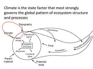
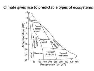
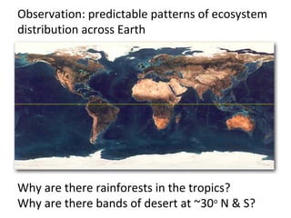
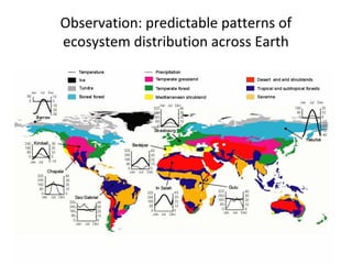
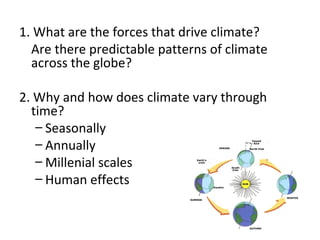
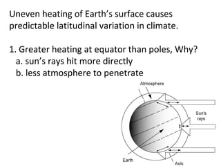
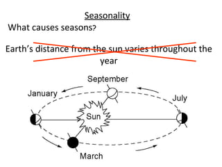
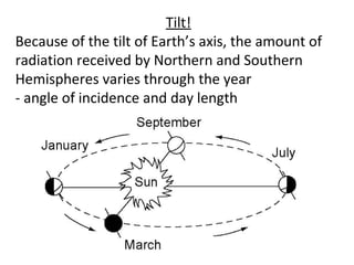
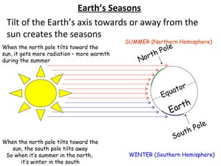
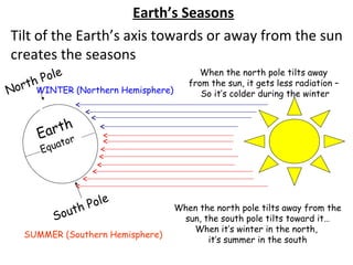
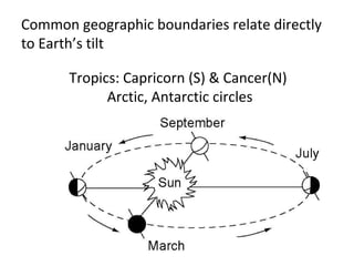
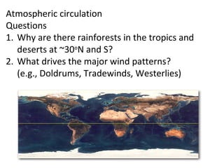
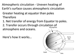
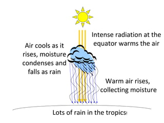
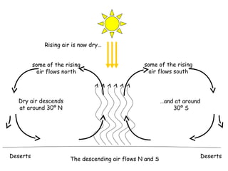
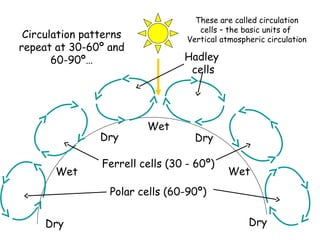
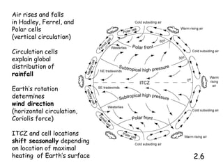
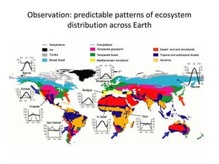
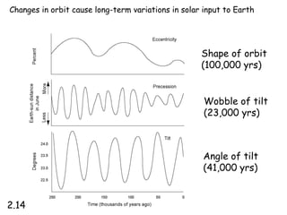
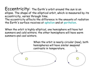
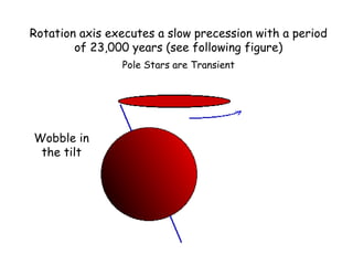
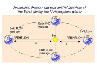
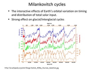
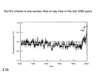

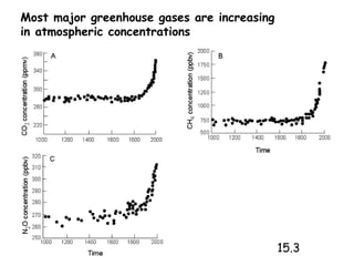
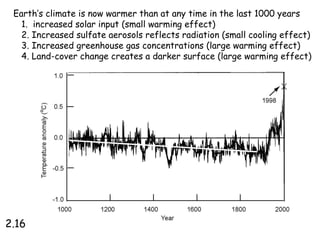
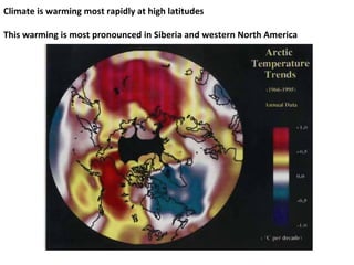
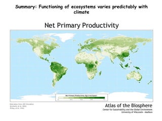
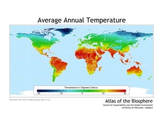
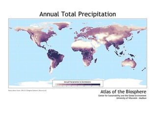
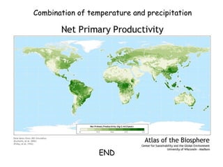


1. Climate strongly influences the distribution of ecosystems globally through temperature and precipitation patterns. 2. Uneven heating of the Earth's surface causes predictable circulation cells in the atmosphere that distribute heat from the equator to the poles. This influences rainfall patterns and gives rise to tropical rainforests and deserts at around 30 degrees north and south. 3. Variations in the Earth's orbit and tilt cause seasonal and millennial changes in climate through differences in solar radiation received in each hemisphere over time. Human activities like increased greenhouse gas emissions are currently warming the climate beyond levels seen in the past 1000 years.


![EVS-1-Global climate [Autosaved].pptx](https://cdn.slidesharecdn.com/ss_thumbnails/evs-1-globalclimateautosaved-230211182852-8012fb9b-thumbnail.jpg?width=640&height=640&fit=bounds)


